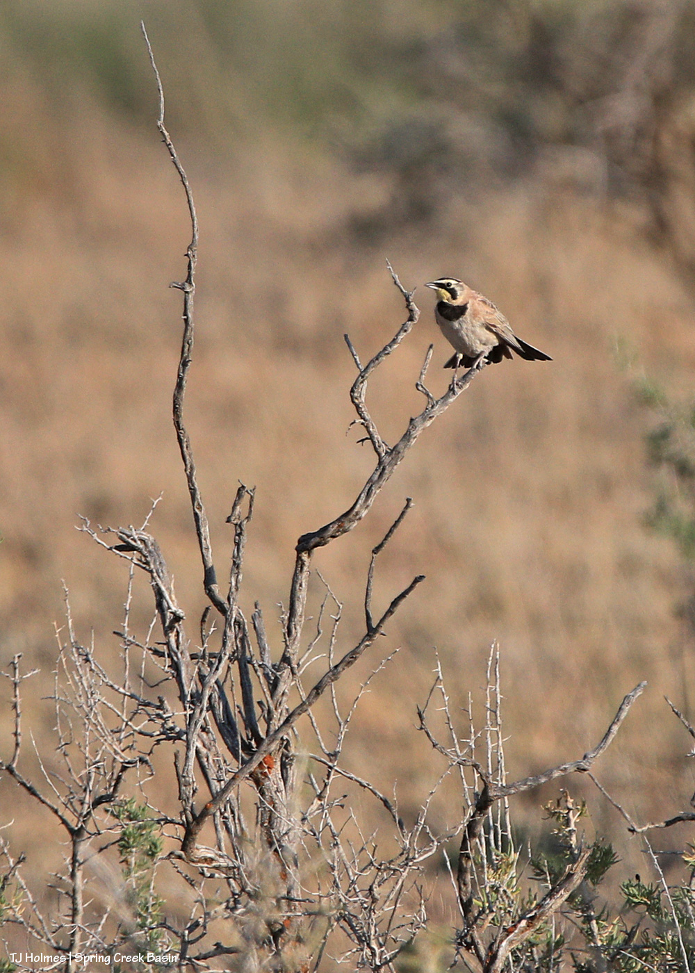
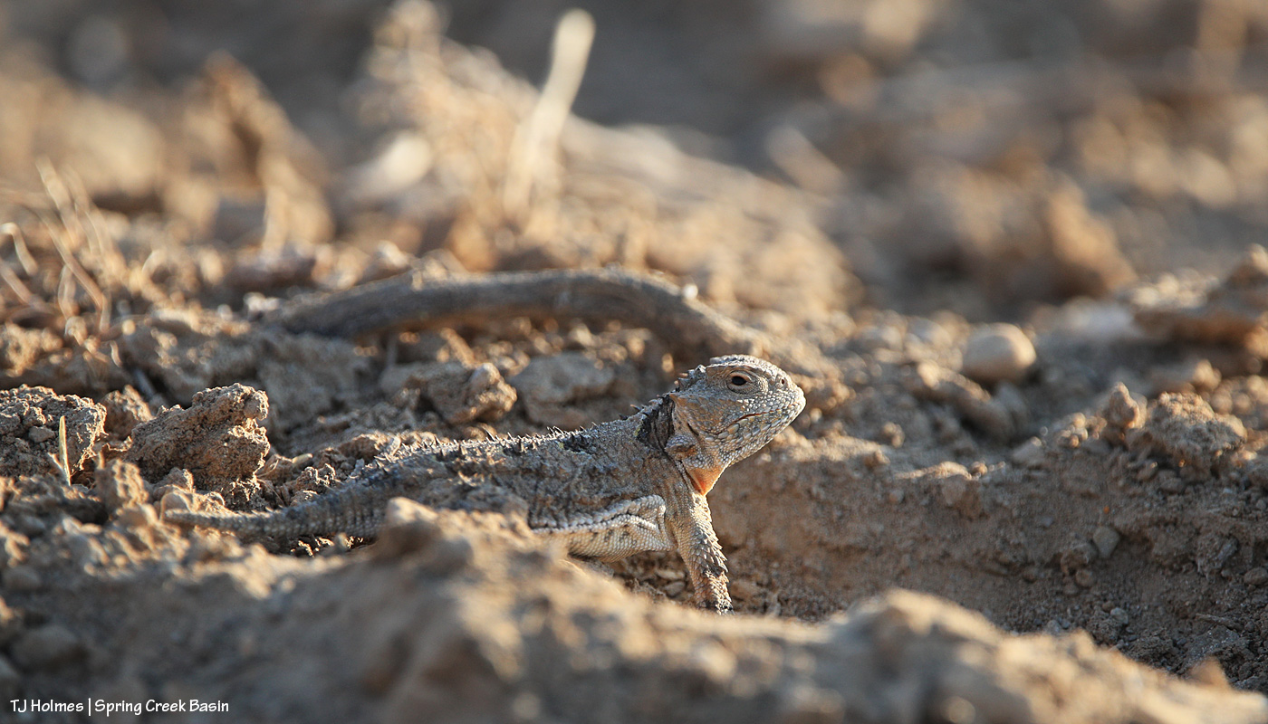
Both of these critters were seen on the evening of summer solstice. Both are named for their “horns.” One has feathers; one has scales. Both are desert beauties.
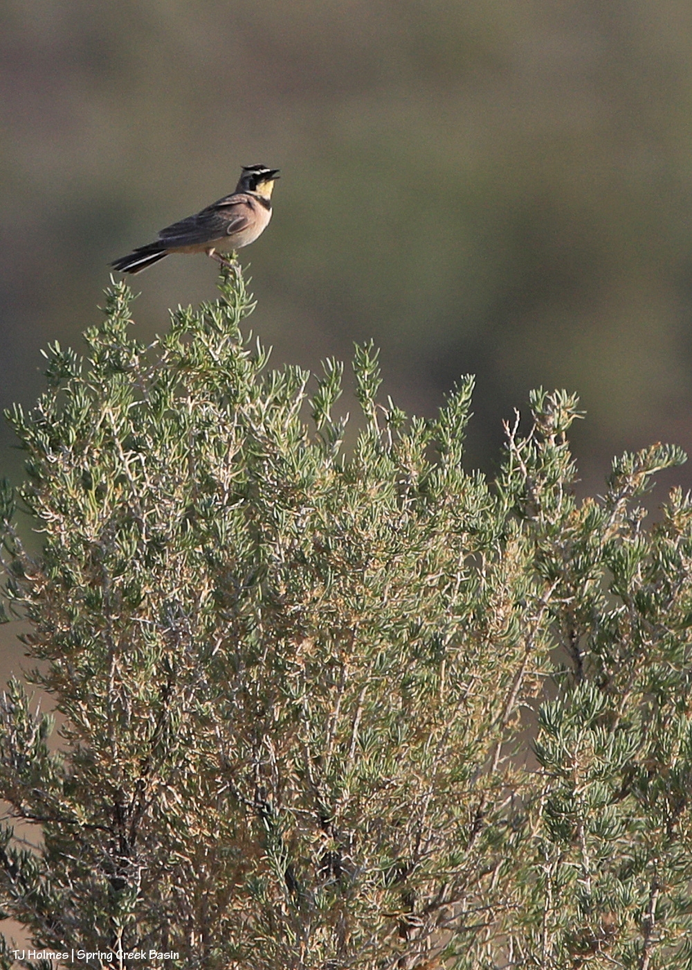
Horned larks are one of the first birds I learned to identify. Lots of them seem to call Spring Creek Basin home. See his little “horn” tufts?
Same lark. Maybe it was the presence of the mustangs behind me that made him feel comfortable enough to land on nearby greasewood to check me out.
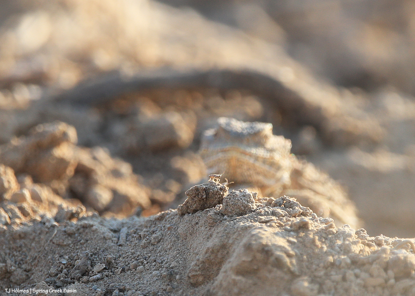
While following those same mustangs away from the road, this little fellow (fellarina?) caught my eye. (Much nicer to see a horned lizard scuttle away underfoot than the longer, more slithery kind!)
I didn’t realize it at first, but it was hunting around an ant hill.
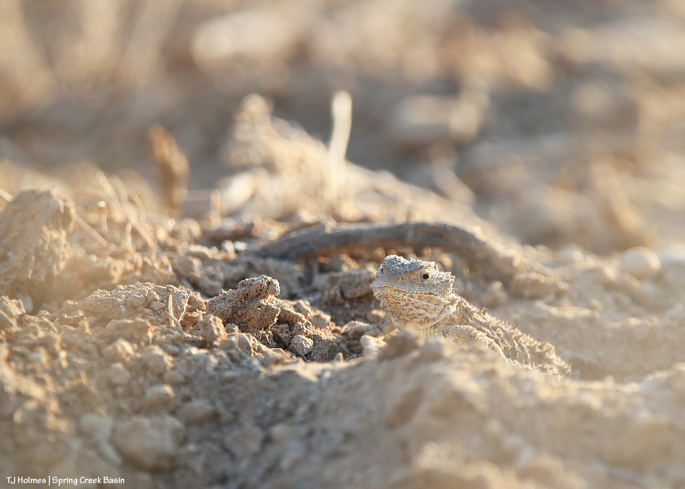
I started to see it darting forward, and that’s what alerted me that it was going after something on the ground, presumably insects. Too bad it’s out of focus, but it helps the story!
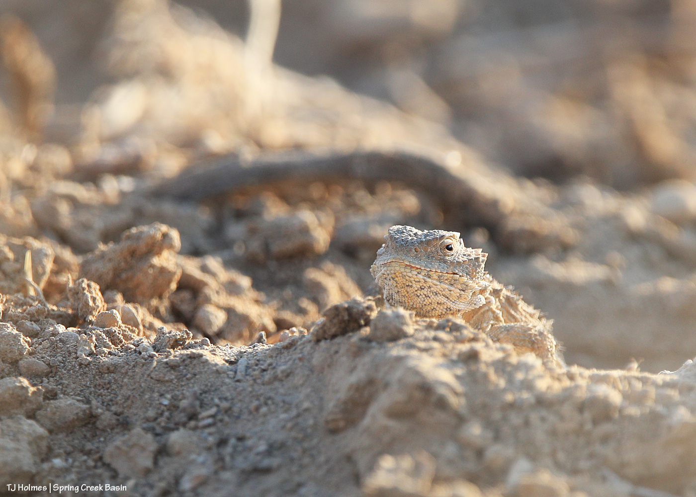
You might think this one is out of focus – I did, too – but look at that little dirt ball in front of the lizard. See the bug? It didn’t last long!
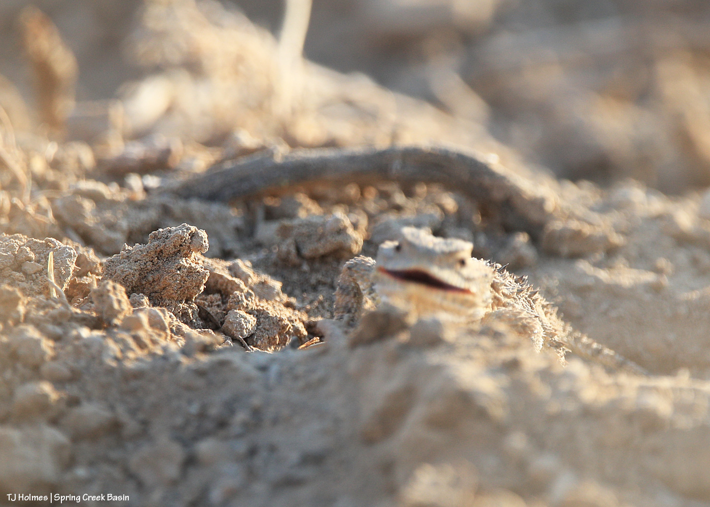
Is it just me, or does that look like a satisfied little lizard? 🙂
Tuesday was a wild and crazy day … and that was just the weather. It was ultimately a successful day, though at least one part left me shaking my head at, well, how life unfolds. And it was a reminder that sometimes the smallest things, and the simplest things, are the most enjoyable of all.
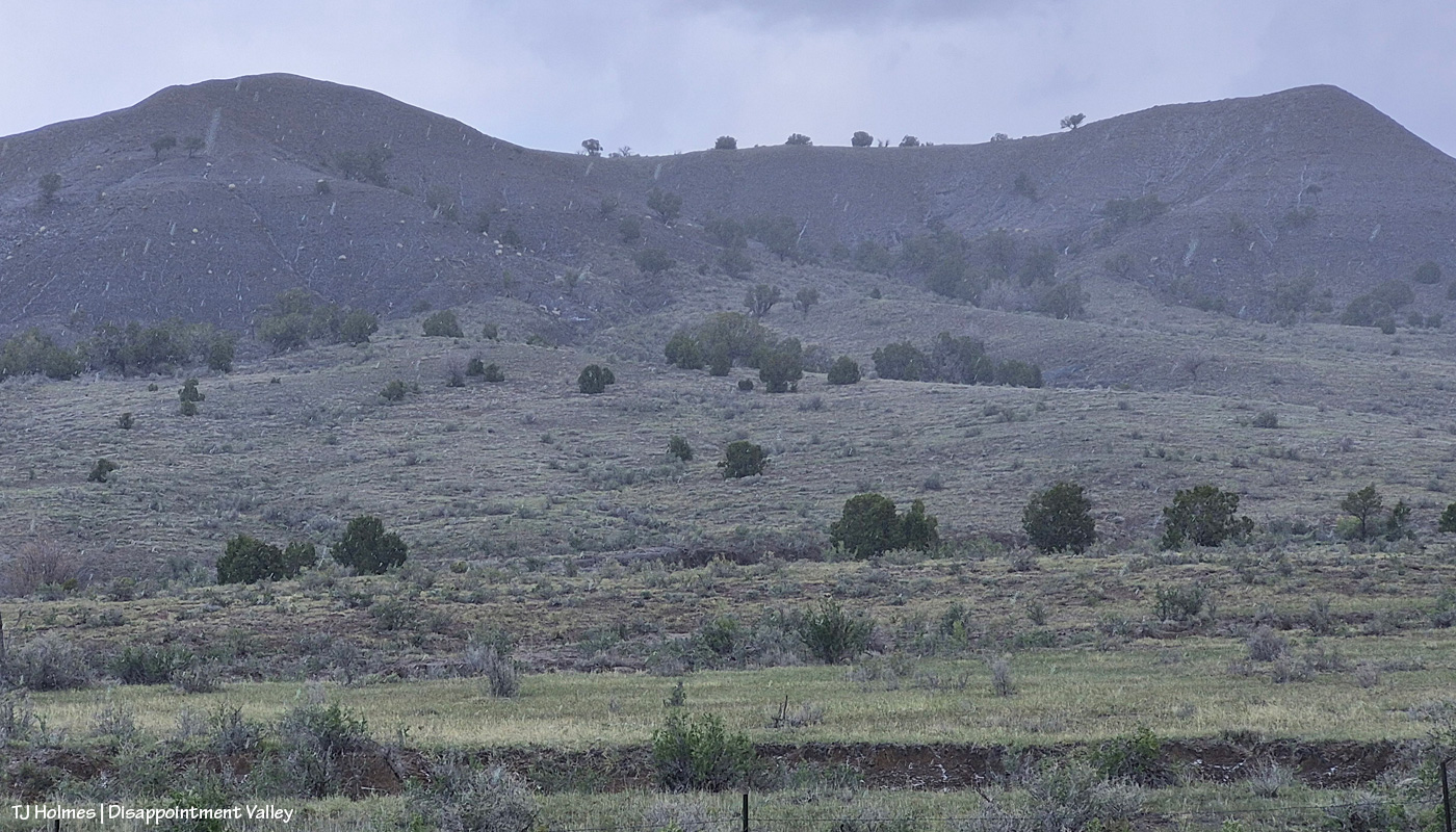
From yesterday’s post, are you wondering what graupel looks like? (Thanks, Valerie, for your comment that led to this post!)
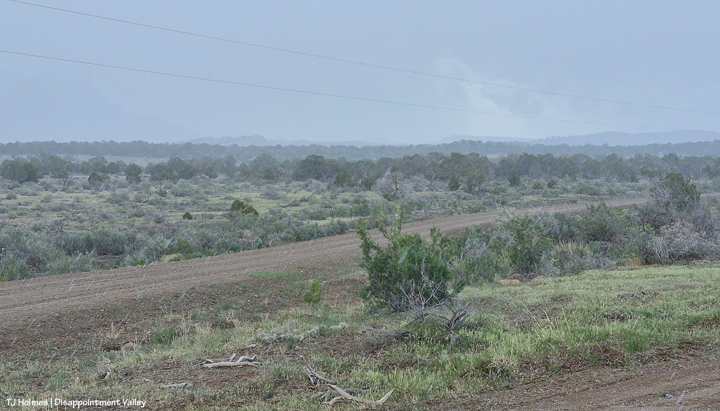
What? I hear you asking. That looks like snow or rain, you’re saying (zoom in to see the streaks). Look on the ground in the lower right corner. I was backed in under a (dead) tree to sit out one wave of it (it wasn’t very hard, and it didn’t last long) at that little side “road” to Disappointment Road, which is across the whole pic. See the little white “balls”?
AI says this: “Graupel, or soft hail, forms when supercooled water droplets freeze onto falling snowflakes, creating soft, small white pellets (2-5 mm) that resemble Dippin’ Dots or Styrofoam. These fragile, slushy particles are often called snow pellets and, unlike hard hail, crumble easily. They occur during wintry mix scenarios, causing sudden, slick conditions, and are identified in aviation reports as ‘GS’.”
I liked this part: Types of Graupel While commonly called graupel, it is sometimes referred to as:
Matsaaruti: A term used in the Nunavik region of Canada to describe wet, soft snow pellets.
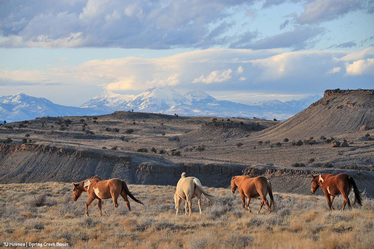
Another pic from the same location as the first pic, looking pretty much straight north at what I call west-of-favorite hill (because it’s, you know, west of what I call favorite hill, which I so-named because once upon a very long time ago, “the pintos” really favored that hill and could very often be found atop it).
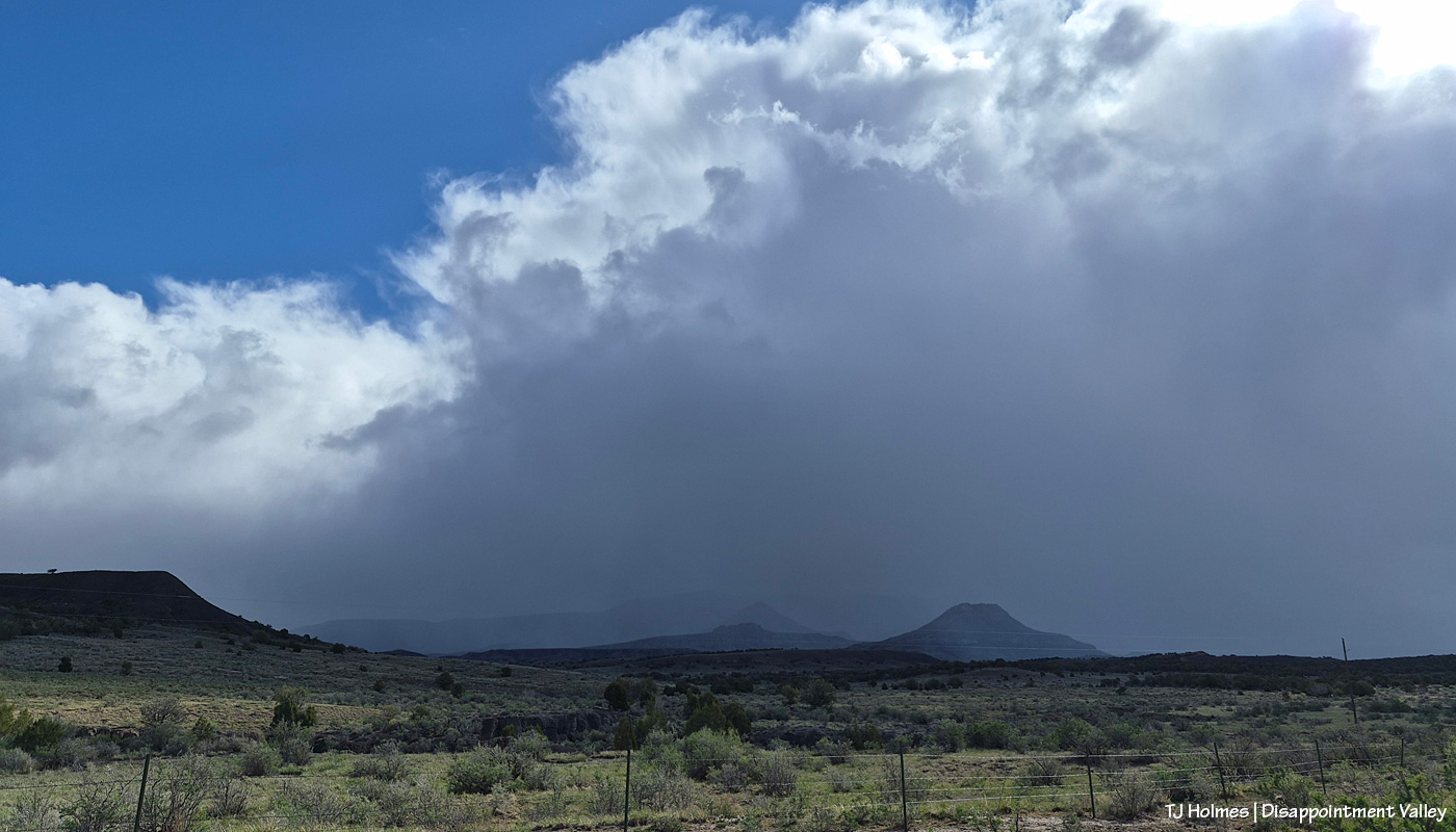
Also from the same spot, looking eastish again as the graupel wave recedes, driven by a strong out-of-the-south wind (I lost track, but at least three, maybe four went over us Tuesday morning). You can see Brumley Point very distinctly, submarine ridge and McKenna Peak to the left it it, and you can’t quite make out Temple Butte. If you slide back up to the first pic, Temple Butte is juuuuuust barely visible at far left, just under the power lines. And yes, the sunshine IS coming back out over the rest of us while the wave pushes north to the east.
With Artemis II and its remarkable human beings on board, their mission, their accomplishments, the images they sent back, from space looking home, in mind … and realizing the absolute tiny-ness of this one itty-bitty part of our great, wide, wild, wonderful, big blue marble … ain’t Earth gorgeous? Now you can see Temple Butte’s promontory emerging from behind Brumley Point (see the graupel/moisture evidence shining below its rimrocks?) and submarine ridge and McKenna Peak. And though you can’t see them in this pic, there were two groups of mustangs out there. Across the road and on the other side of that fence IS Spring Creek Basin.
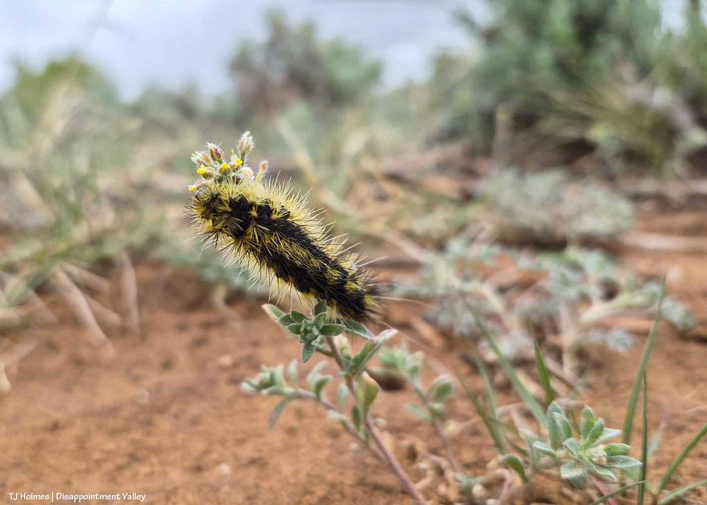
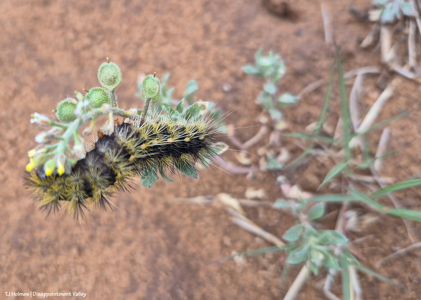
Anybody know what this prickly little caterpillar is called? I’m not sure of the plant it’s on, either.
I tried a lot, but I could NOT get the eye end (far left – is that an eye?) in focus. Of course, I didn’t know that in the field, not having my eyeball glasses on and looking through the glare of my phone screen, but I did try a number of shots with high hopes. One of our BLM range guys recently posted a pic of the same caterpillar, but he’s a plant guy (and an extraordinarily awesome one), not a bug guy, so I’m sure he can tell me the plant, if not the bug (!). If I reach him for an ID before this posts (or even after), I’ll update.
** Update from Ryan, BLM rangeland management specialist and all-around plant guy!:
“Cool that you’re seeing the same caterpillar! [He saw the same kind recently in Canyons of the Ancients National Monument, southwest of Spring Creek Basin.] I’m very curious as to what species of butterfly/moth they will turn into, I’m not good at insect ID but will ask Nate West [BLM wildlife biologist]. The plant that those are on is a mustard species called Alyssum simplex, commonly just called madwort. It’s a pretty prevalent non-native annual that is really common around here, unfortunately. It’s a beautiful picture of the hair-structure on the caterpillar!” Thanks, Ryan!
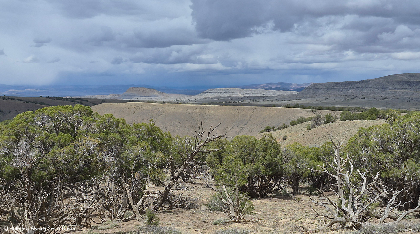
The reason you can’t see Utah’s La Sal Mountains in this pic – way northwest of Spring Creek Basin, from the very far southeastern part of Spring Creek Basin – is because the rain/graupel/snow wasn’t through sending waves over them. 🙂 You CAN see, from right to left, Round Top, Flat Top (looks sloping), Filly Peak and the south-facing rimrocks. Disappointment Road is over to the left somewhere (not far)
From here, we’re looking over not much of the southern part of Spring Creek Basin Herd Management Area (the pic above this one has a perspective to the right of this one) but a lot of the south/southwestern part of Disappointment Valley (most but not all of the pinon-juniper woodlands as far as the eye can see). The near pinon-juniper is within Spring Creek Basin.
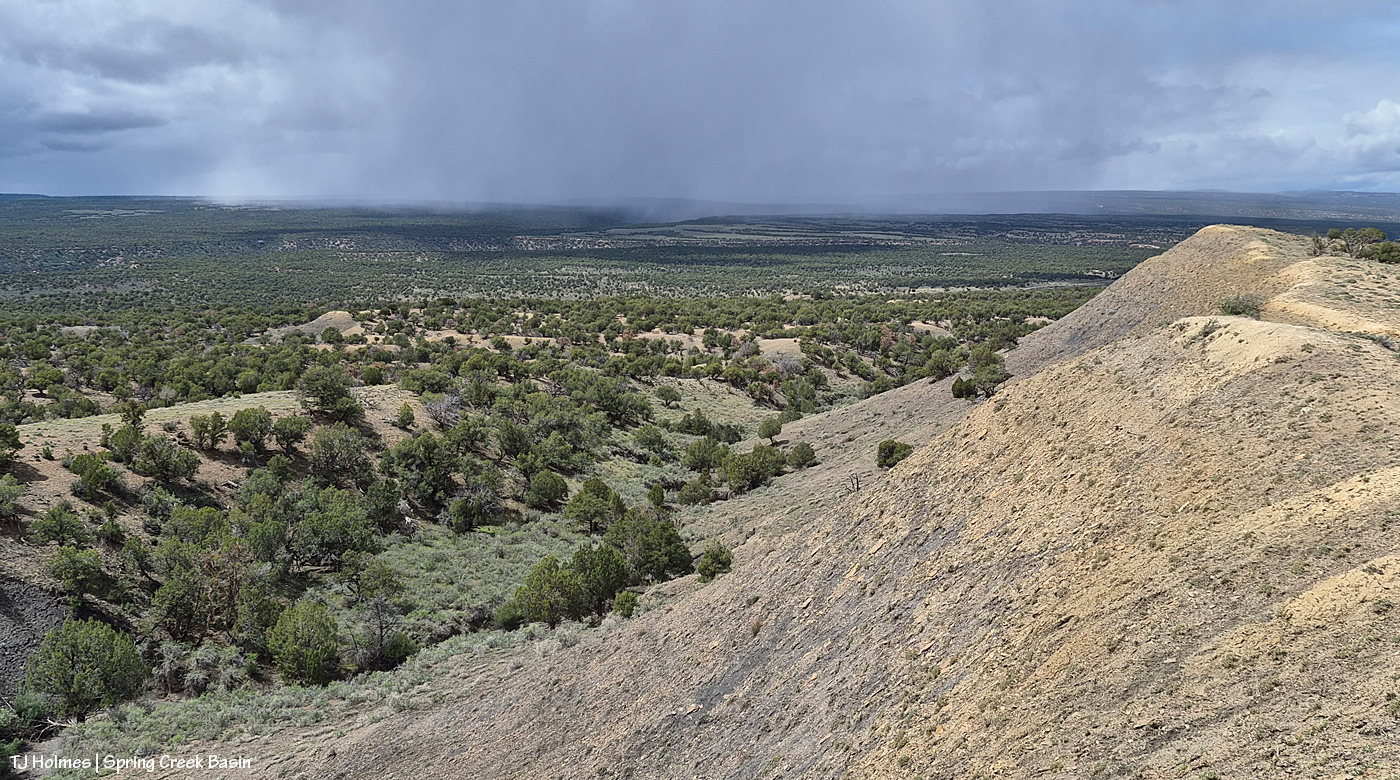
From the same spot now looking back to the south/southeast at another little rain/snow/graupel-fall, toward the Glade and Benchmark Lookout (hi, Rick and Linda! (I think they’re not at the fire lookout tower quite yet)). The near hills and pinon-juniper are all within Spring Creek Basin. The far, thickly treed ridges are partly (middle-ish ground) part of upper Disappointment Valley and partly (farther) part of San Juan National Forest lands beyond Disappointment Valley and its watershed.
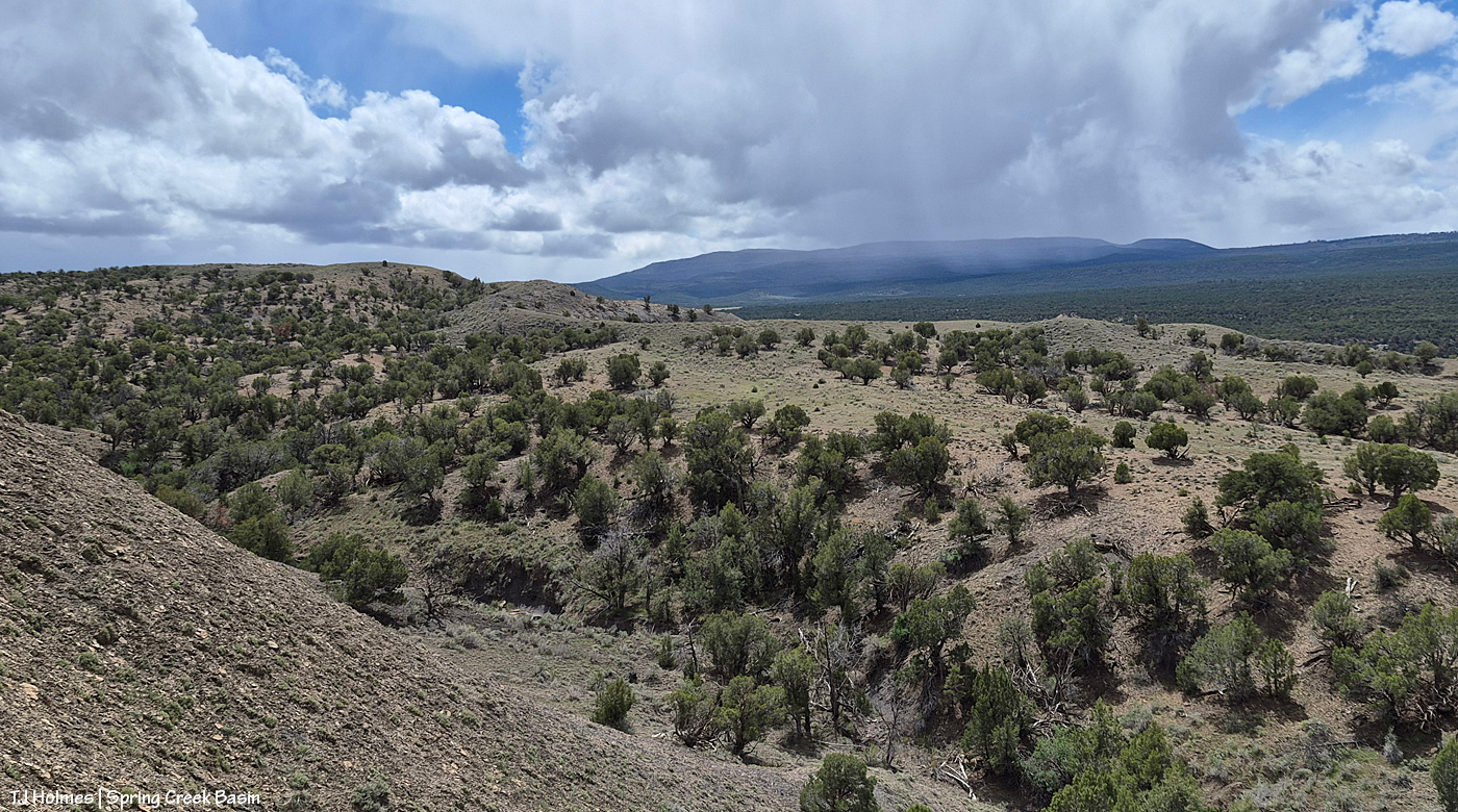
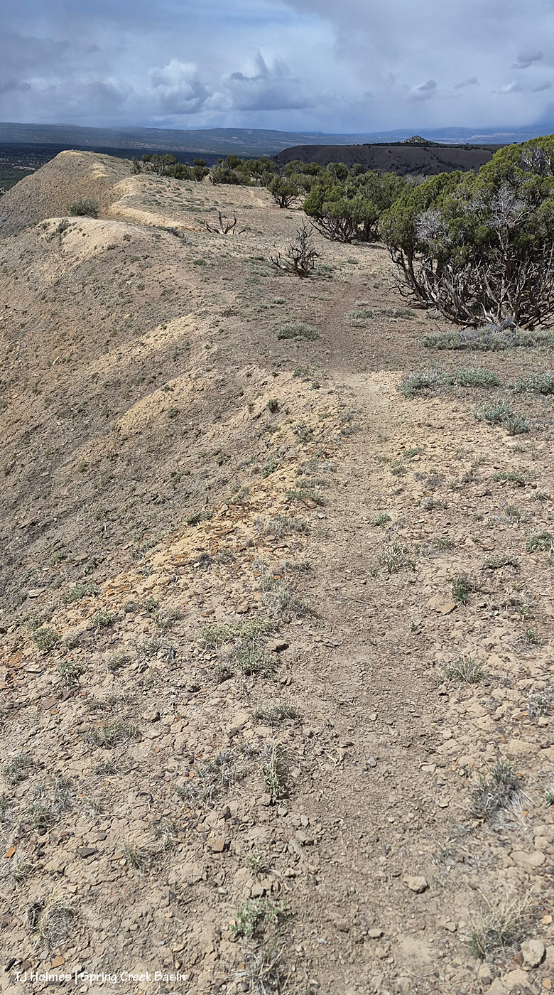
And what the heck was I doing at the high end of a long drop? See the horse trail? 🙂 I was following where the sure-footed have gone before me (and not for the first time).
The above are in order of how I took them … hours apart from first to last.
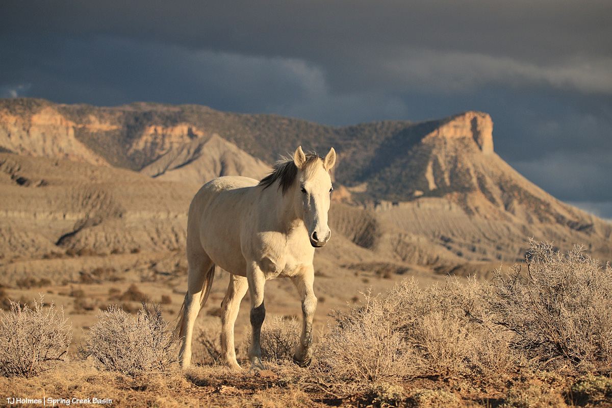
And because you came here for the mustangs …
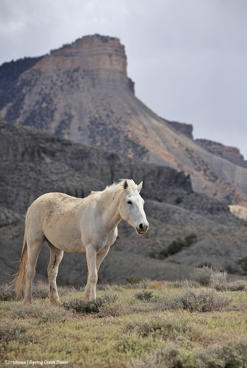
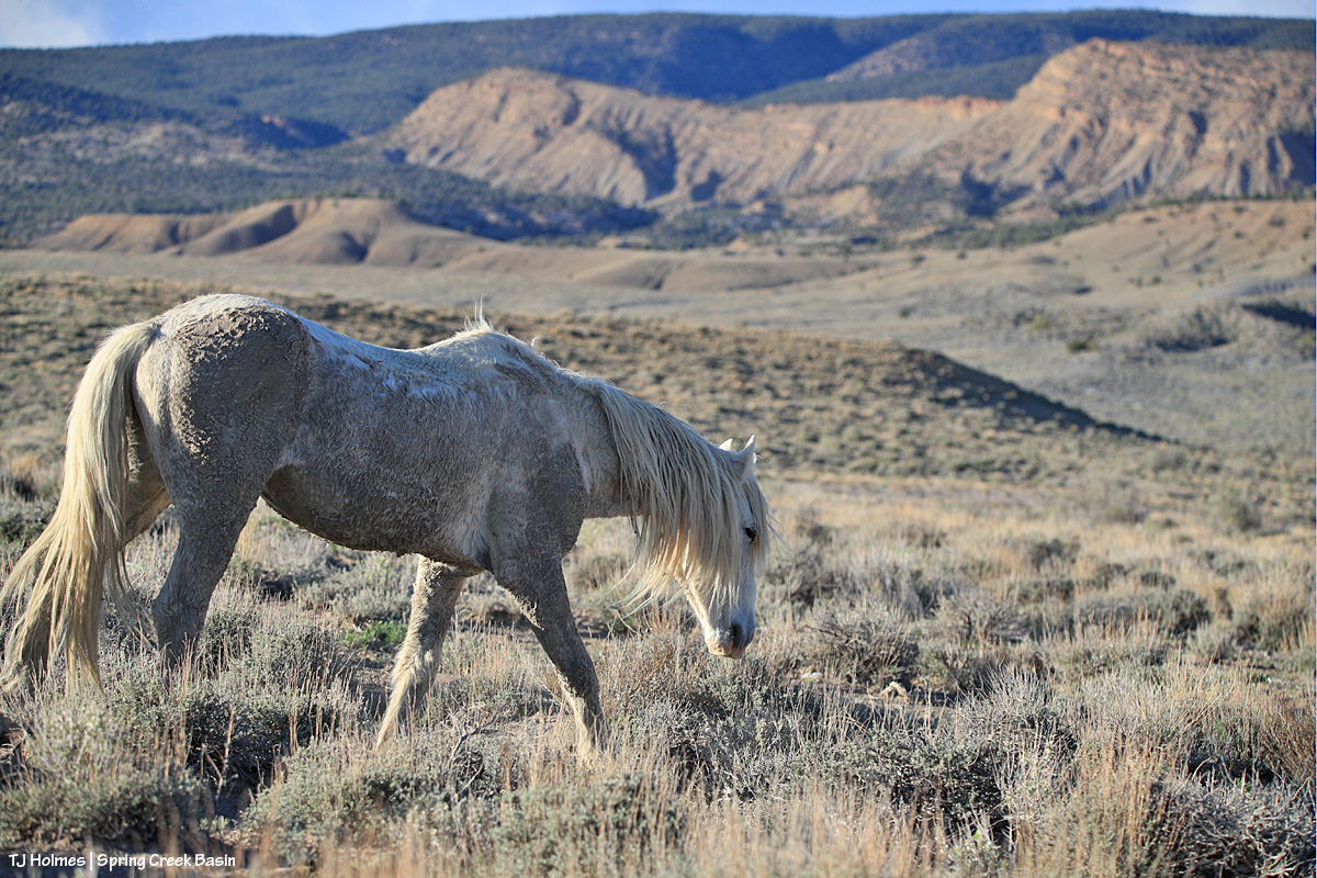
Mysterium, modeling her scruffy-chic look (fashion designers, take note – ha!) below Temple Butte. 🙂 Yes, those are a couple of cuts on the inside of her left hind leg, but she’ll heal quickly, as mustangs do!
Thanks, as always, for coming along for glimpses of this special world. 🙂
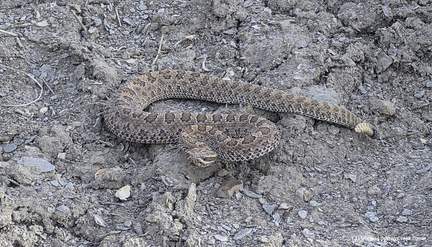
If you don’t like snakes, this post is not for you. Important note: No snake or human was harmed either hiking past or in the taking of these pix. 🙂
I’ve been looking for a particular band for about a week now. They showed up … then they disappeared again. That’s not unusual; even in only-22,000-acre Spring Creek Basin, there are lots of places for the ponies to roam out of sight of human eyes (and given the high ATV/UTV activity lately, including terrible, destructive off-road behavior, much better for them). But I was curious: Were they going south and taking advantage of the pond below/south of Round Top … or were they going deep east and taking advantage of the east-pocket pond? I’d seen water glinting in the RT pond a couple of weeks ago, but because of the very rough road and lack of loop access (because of bad washouts), I don’t often go back as far as the east pocket anymore (which is too bad because it’s one of my favorite areas of the basin).
So curiosity led to a hike up to the tip-top of Round Top. … From the bottom, I always say, “I’ll just go to the ‘bench’ and look from there … and then, if I don’t see anybody, I’ll complete the trek up to the top.” So that’s what I did. … You know I didn’t see anybody from the bench (well, I did see one band, but I knew where to look for them) and had to go all the way up. 🙂 It’s not a bad hike, and it’s really not long, and it does lift you high above the basin and gives TREMENDOUS views, and I love it up there. So I really need to do it more often. (According to my Strava details, it’s only 1.46 miles up and back, with an elevation gain of almost 360 feet, which included my brief stroll around the top to glass.)
I like to go to the different directions at the top – amazingly, it’s not that big – sit and glass. Not only is it fun to look for mustangs, but I like to reminisce about all the hikes I’ve done here, there and (almost) everywhere to find and get to them!
So I’d done my looking, and I’d even done some seeing of various bands that I’d already seen from “ground level.” But I didn’t see the particular band I wanted to see. To be fair, the view to the south is a lot more wide open than to the north/east/northeastish, so I was pretty sure they weren’t south at all.
The hike is enough of an exertion that you want to take your time at the top, and I’ve learned that if I *wait* and don’t get too impatient, something – or somebodies – might reveal itself or themselves.
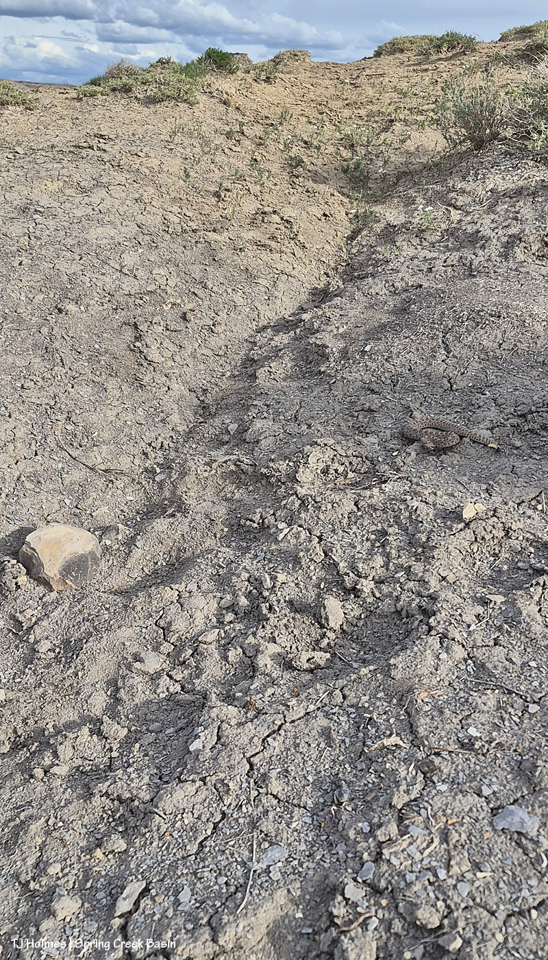
Bingo. 🙂 I had stood up and stepped a few steps when I looked back *one last time*. It’s always that *one last time* when you see what you want to see! Way up in the east pocket. Boom; ponies. So I started the trek back down, half-running, eyes glued to the trail so I didn’t miss my footing. … I was within 40 yards (?) of the end of the trail and end of the road (which is where the trail starts, and this is a horse/deer/elk trail, not a trail-trail) when I heard the soft rattle.
It took a moment for the sound to reach my ears, to reach my brain, for my brain to process it, for me to stop my thoughts-elsewhere forward rush and to look back at the bush (small, a four-wing saltbush, maybe) I’d just passed. Was it entwined around the base? Uh, no. Then I spotted it. (I think I’ve written enough to warn you if you’re at all snake-squeamish??)
Do you see it?
The trail here looks more like a bit of an erosion channel than what most people think of as a *trail*. The pic is looking UP the trail – the trailhead (so to speak) is about 40 yards behind me – and I had come DOWN the trail. The bush isn’t included in this pic, but you can see the faint shadow of it over the rattler. The rock is immediately on the left side of the trail.
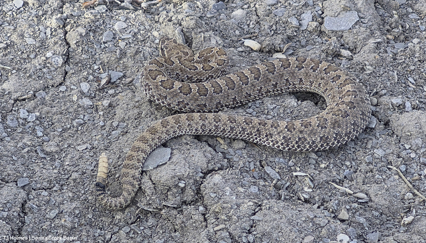
Because I was on a scouting mission to the top of Round Top, I had taken my binocs but not my camera, with its very long, very safe lens. So I took a pic first from “behind” the snake.
It seemed pretty relaxed, so I chanced a front version (you know, you CAN also zoom in with your phone camera!).
Interestingly about our little rattlers out here, you can see by its buttons that it’s not a super young snake. What you really maybe can’t tell from the pix (and no, I wasn’t going to put my hand out for a side-by-side comparison! oh, you silly readers! :)) is that it probably wasn’t more than a foot long. The rock in the first pic is bigger than my two fists held together.
What we have are the midget faded rattlesnakes (“western rattlesnakes”) or faded midget rattlesnakes (the recovering copy editor in me can’t stand non-consistent identifications! Looking at you, CPW). Check out this link to information from Colorado Parks and Wildlife … or this one from the Southeastern Hot Herp Society, written by an undergraduate student at Oklahoma State University. I was particularly interested in this little tidbit from the latter article: “The venom of the Midget Faded Rattlesnake is composed of a much higher neurotoxin than one would assume. … In fact concolor is the most toxic out of the (Western Rattlesnake clade, Crotalus oreganus).”
To paraphrase my dad (who likes bears): DO NOT MOLEST THE MIDGET FADED WESTERN RATTLESNAKES!
Seriously. I love them … from afar. 🙂 And in my experience, they are very (anthropomorphism alert) forgiving of random, idiot humans who nearly step on them in a brainless rush. … Pay attention out there. Every wild being and wild place deserves respect.
And because my day had an extremely happy ending, I’ll end it with this:
What an ending, right? 🙂 (And yes, I did find the ponies, and they’ll grace the blog in future posts.)
Wait, that’s not a mustang, I hear you thinking. 🙂 Correct! That’s a young mule deer, and s/he starts the journey of this particular blog post (which doesn’t include a mustang in sight). S/he was, in fact, inside Spring Creek Basin Herd Management Area, and I was on the road.
But let’s back up a moment.
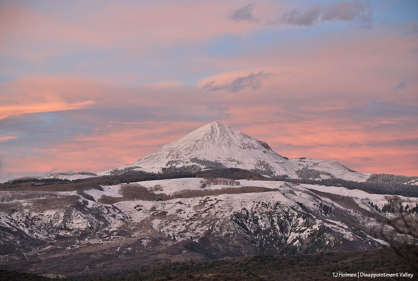
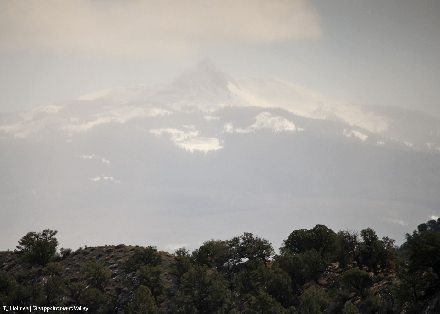
This is where my short trip up-Disappointment-Valley actually started: Seeing snow completely covering nearby Lone Cone from just within the southern part of Spring Creek Basin (not quite as far south/southeast as the mule deer). Except for the very southern area, Lone Cone isn’t visible from most of the basin. (And that promontory in the distance isn’t Temple Butte, which is closer and to my left out of frame.)
Much, most – all?? – of the region got blissful, sweet, rejuvenating rain (at least) on Wednesday. Obviously, higher elevations got some welcome snow. I write a lot about how dry it is in Disappointment Valley and, specifically, Spring Creek Basin. I’ve been writing a lot this “winter” about how dry it has been this past non-winter. It gives me no pleasure and a lot of terror to note that folks are now calling this the “worst [winter] on record,” according to The Colorado Sun. How bad is it?
So consider this post part education, part joy at seeing Lone Cone covered in snow (at least for a little while). The words or phrases in blue (and possibly underlined) indicate links to outside sources. It’s going to be a little bit of a long post, too (sorry to bury the lede!), so grab your brew of choice and come along with me – and also, I should tell you now that this spans back-to-back days, an evening (Thursday) and the following morning (Friday). You’ll see why as we follow the snow. 🙂
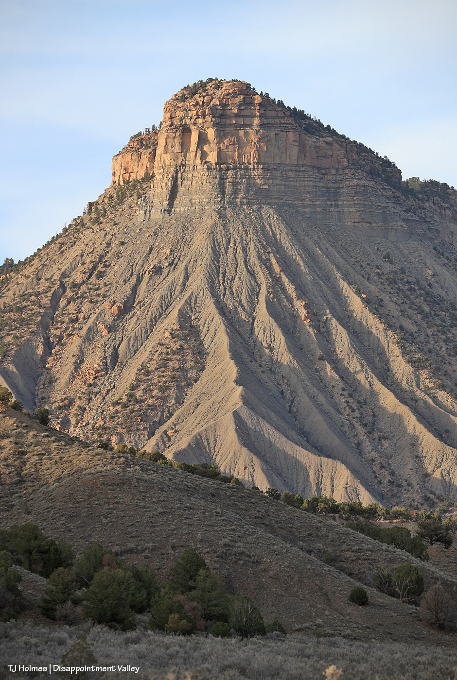
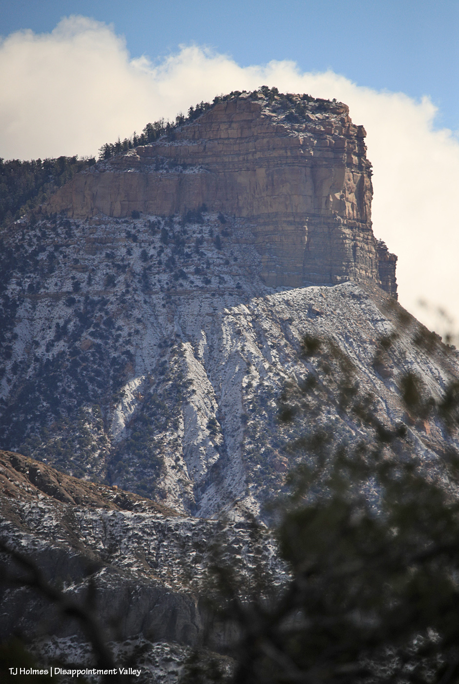
I love Temple Butte. I loved Pati Temple, for whom the butte is named. Previously and for several years, I called it the unnamed promontory, and because it was unnamed, officially, we were able to apply to the U.S. Geological Survey, five years after her passing, to start the process to honor Pati and her dedicated devotion to Spring Creek Basin’s mustangs. Huge thanks to Kat Wilder for coming up with “Temple Butte” as a name, and especially ginormous thanks to Ann Bond (retired from the U.S. Forest Service) for diving deep into the computer work to get that done – undying gratitude! Now it is *officially* Temple Butte, though it’s hard to find maps yet with it marked as such. Our new kiosk at the main western entrance to Spring Creek Basin has a map that shows it (thanks, BLM!!), but when I did a Google search, although I came up with other Temple Butte(s) (!), I found only this reference to ours. It’s a super cool sort of AI rendition of looking at the region as though you’re on top of the butte. Move the view around, and you can see numerous named points of view, including McKenna Peak and Brumley Point. I’ve never been atop either Temple Butte or McKenna Peak, or Brumley Point, though I’ve been way up its sides, but I imagine you can’t help but have noticed that Temple Butte and McKenna Peak (at least) favor heavily in a lot of my images of Spring Creek Basin’s mustangs from all over the basin. 😉
I continued driving up-valley. …
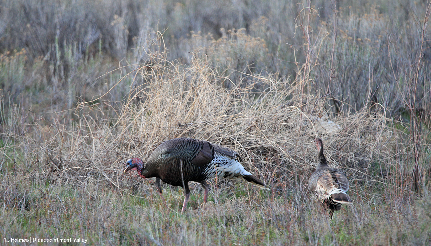
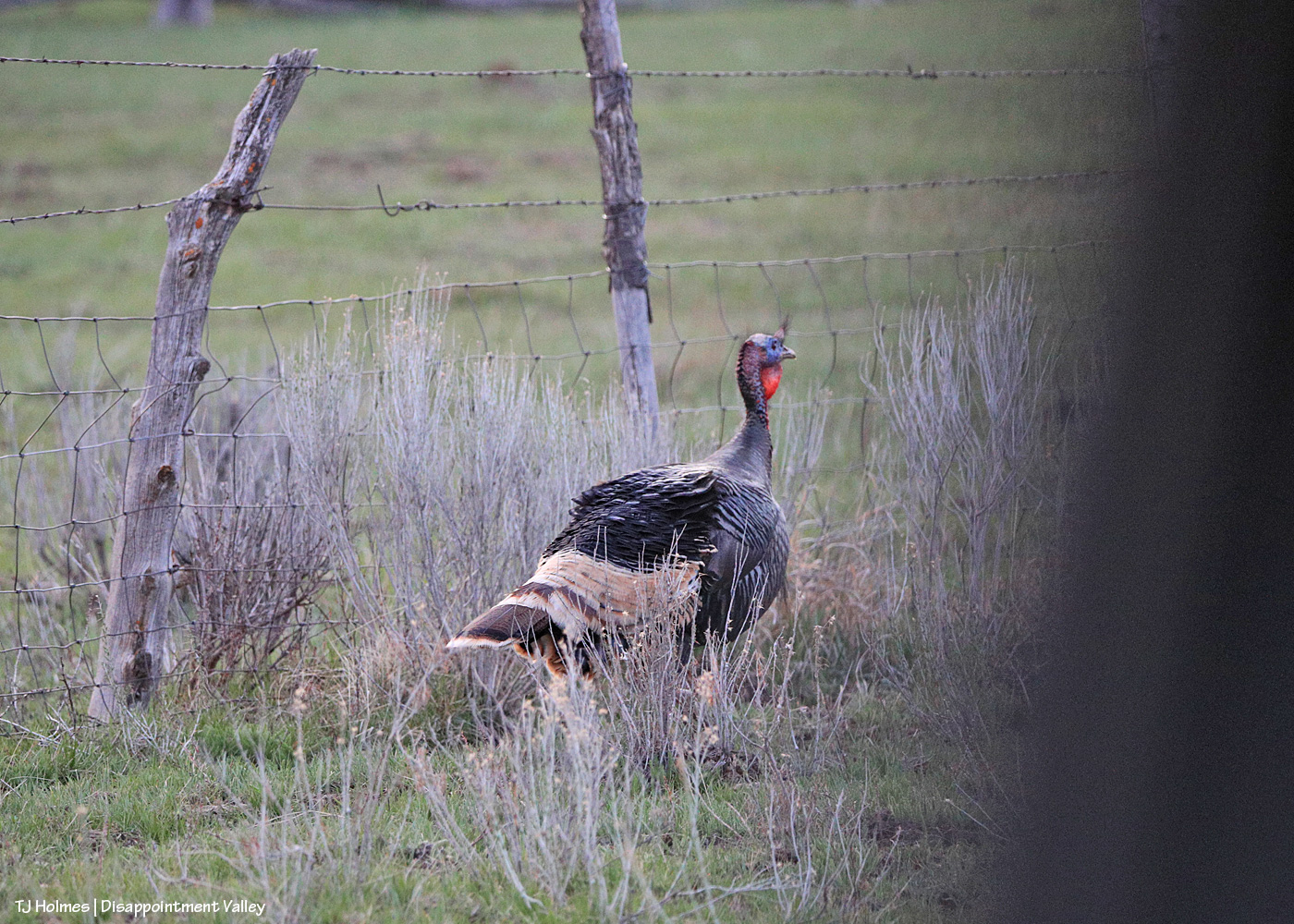
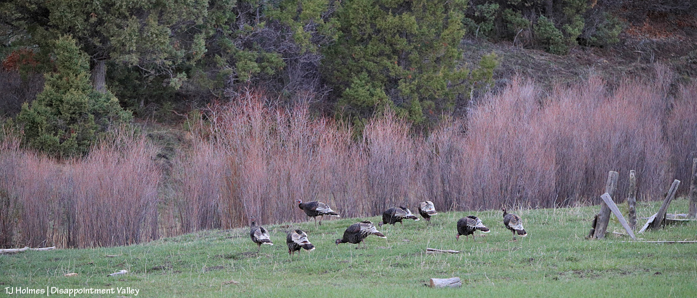
I was so surprised to see this flock of turkeys that I almost didn’t realize at first what I was seeing!
Question: Why are turkeys SO hard to photograph?? Even when I’ve seen them close, my pix of them are almost always blurry. You’d think that with a bird THAT huge, they’d be a cinch. … Yeah, but those tiny heads are, well, tiny! I do love that you can see the color in this tom’s head and some of the greenish iridescence of his gorgeous feathers. There might have been eight to 12 birds in this flock?
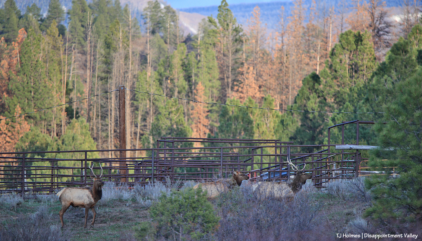
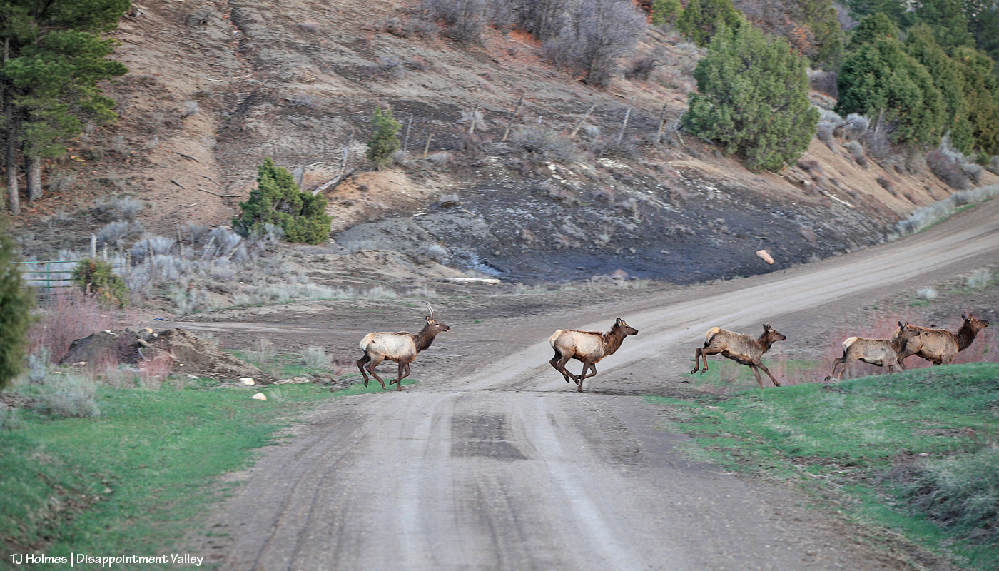
Not much farther, I stopped in the middle of the road and shot over the hood to try to catch these two young bull elk and a cow as they raced across the road and into the trees near some cattle pens belonging to up-valley neighbors. Note the “orange” pines in the background. Not even in Southwest Colorado are we escaping the deaths of ponderosas (and other conifers) across Colorado and the West because of drought and insects.
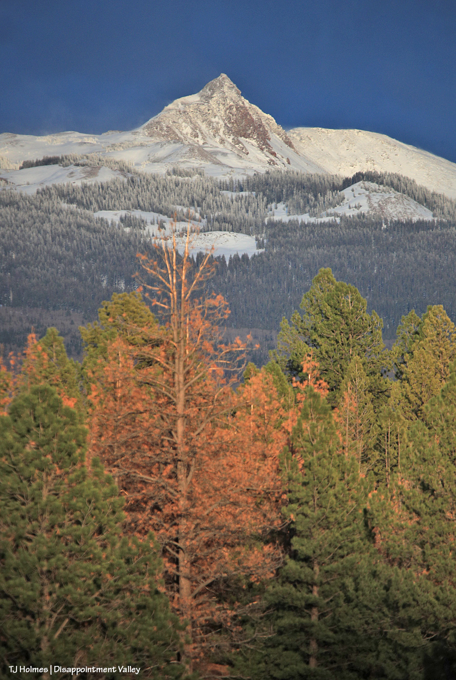
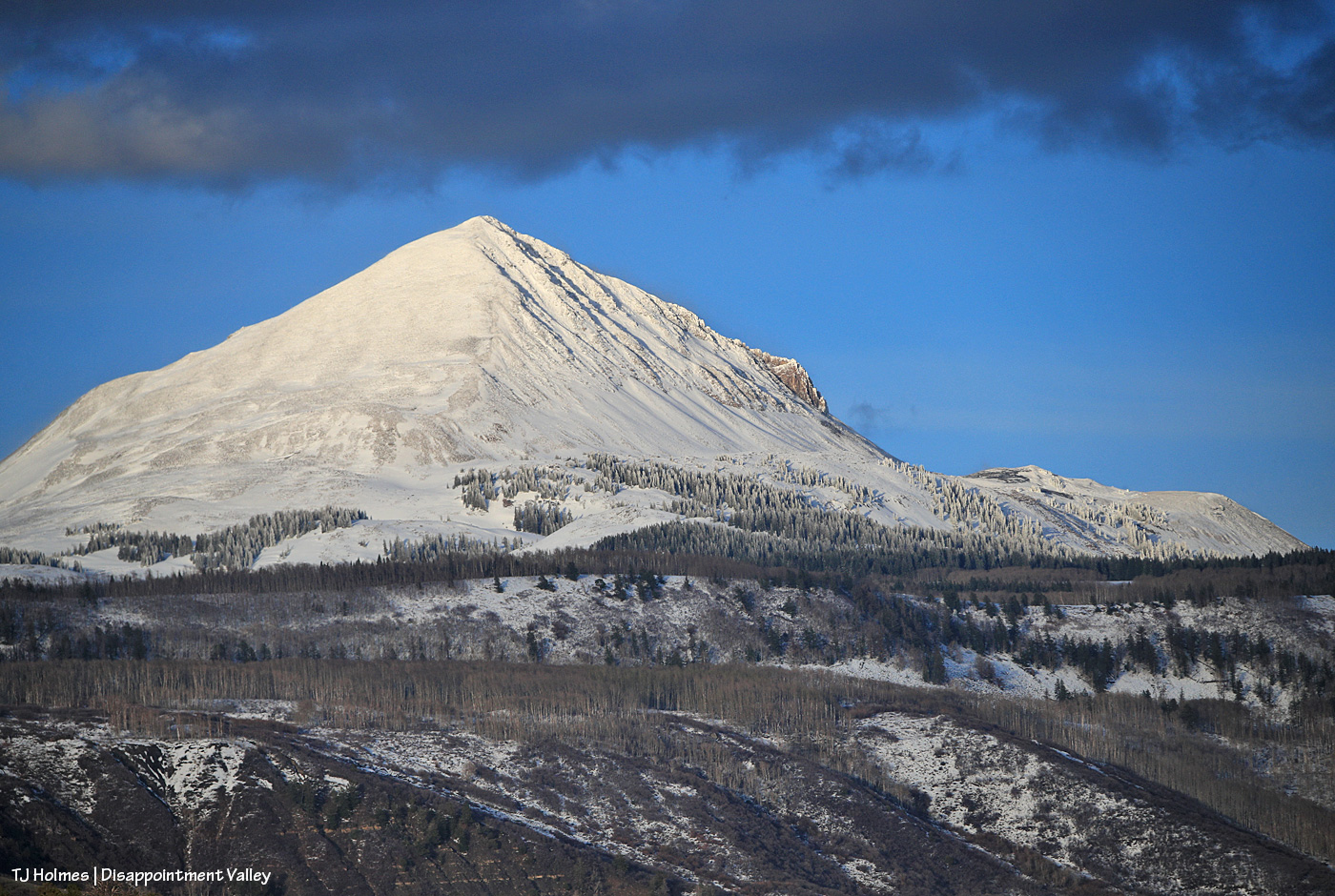
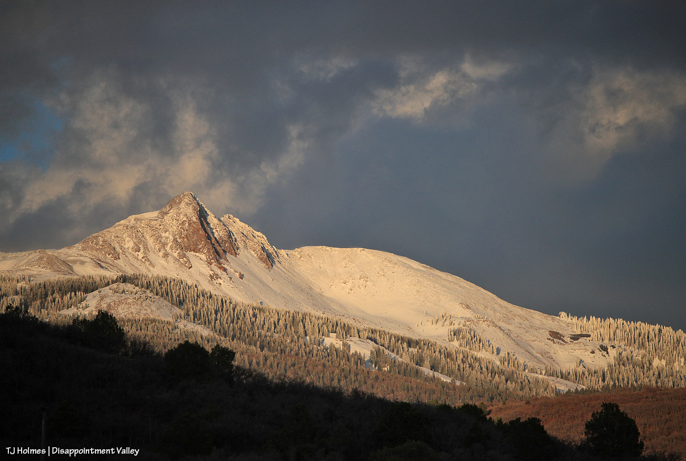
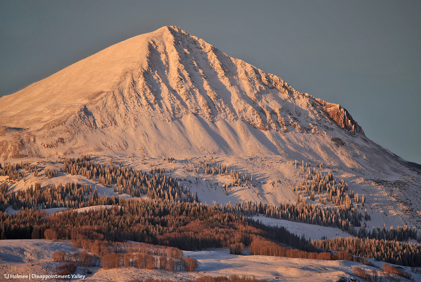
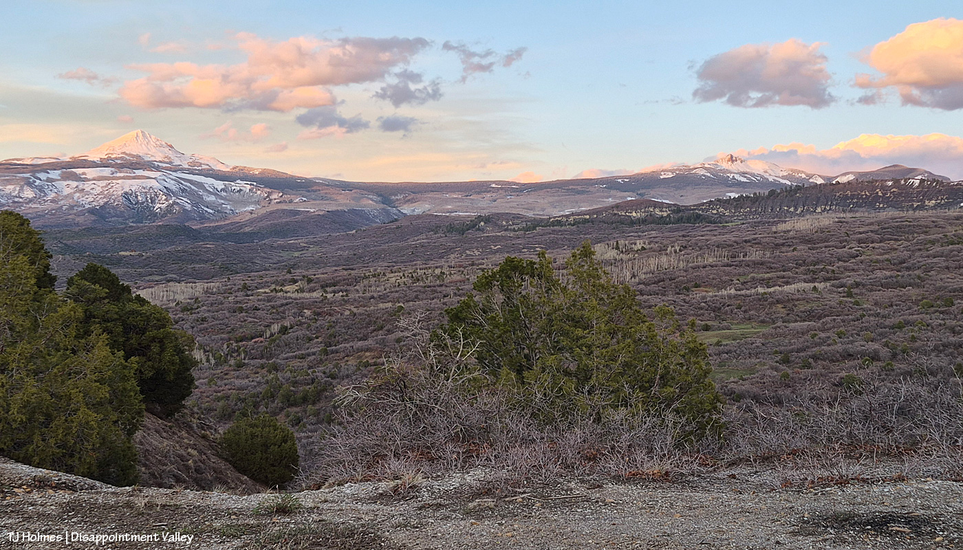
Thankfully, there also are many live ponderosas. At this point, way up-valley, I was starting to get amazing views of Groundhog Mountain. “Groundhog” in this neck of the woods generally refers more to Groundhog Reservoir, where there’s a store and rental cabins and a tiny community of summer cabins. From this view of Groundhog Mountain, those are over yonder on the other side. In the view above – and also of Lone Cone – I was fascinated to see that the trees on the lower shoulders of both mountains were still cloaked in snow. And if you look closely at the above image, you can see that crazy ol’ wind blowing snow from the peak.
Looks pretty wintry, eh? But I think you can tell, even from this distance, that the snow layer is thin. The lower stands of trees are aspen, which are only just beginning to bud and leaf out (depending on elevation; I did see a couple of small pockets of aspen wearing their brand-new bright-green spring leaves).
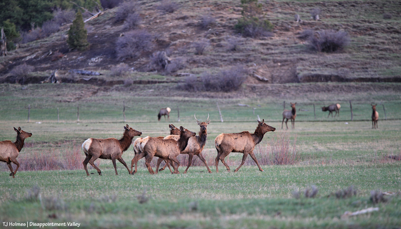
Traffic jam! Disappointment-Valley-style. 🙂 Look at that GREEN. GRASS!
The elk didn’t cross the road to get to the green grass (there was plenty where they’d crossed from) but because the other side of the road features wide-open meadows and more of their friends and family. Almost all I saw in this crowd were cows and youngsters with some young bulls still hanging onto associations with mamas and aunties. There weren’t a huge number of them … fewer than 75, I’d guess.
What a contrast, right? The “ugly” head – but those colors! love! – with the absolutely gorgeous feathers. (The darkness at right is the back of my back truck window.) They’re also hard to photograph because they’re faster than you think they should be. This poor guy and another one were “stuck” on the road side of the fence …
… but they very quickly flapped and flew those big bodies over the fence to rejoin their flock. (I can’t get over how green it is up-valley. This is just several miles above the south end of Spring Creek Basin.)
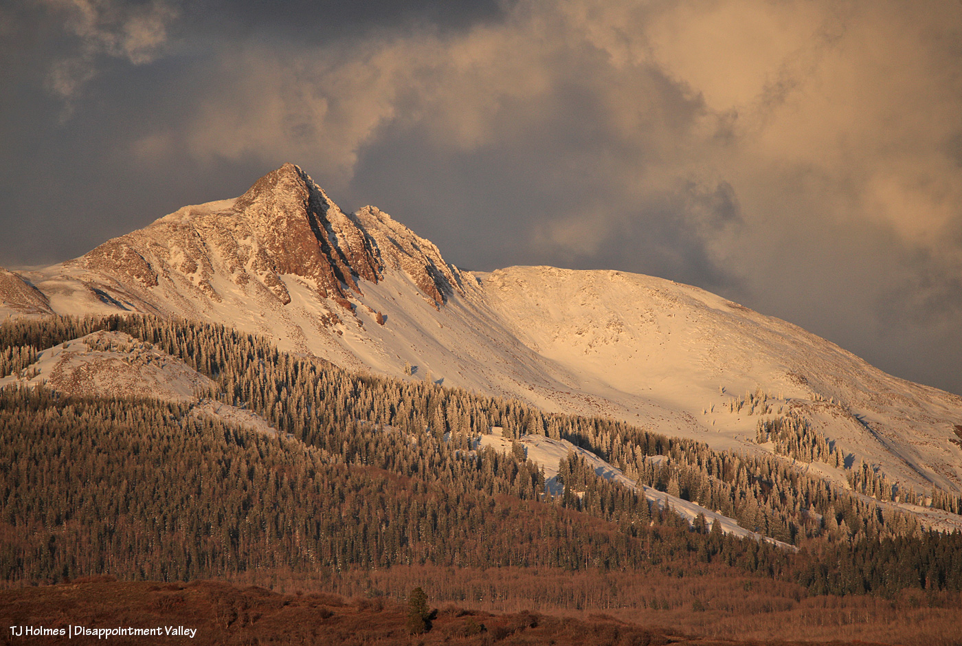
The sun was quickly nearing the western horizon when I took this and the next couple of pix. Great timing, especially with some stormy clouds still swirling above and beyond Groundhog Mountain.
That light! That snow. 🙂 (You can see how not very far down it isn’t there at all.)
It’s still winter somewhere. 🙂 For a little bit longer. Lone Cone snow provides the water that eventually flows down Disappointment Creek, so the more snow, the better. That water doesn’t benefit the mustangs in Spring Creek Basin, but it benefits numerous other species of wildlife from way up high all the way to the canyons of the Dolores River at the far lower end of Disappointment Valley.
Admit it, you didn’t think it could get better. 🙂 When I first was at the upper end of the valley, the clouds were giving Groundhog Mountain the dramatic, bold light and color. This was pretty immediately post-sunset, and the clouds had drifted over to light up the sky above Lone Cone (Groundhog Mountain is farther to the right from this perspective). Um, WOW.
Here we go: A cellphone pic from the “lookout curve” on the switchbacks that lead up and out of Disappointment Valley on the Dolores-Norwood Road (toward Dolores) shows Lone Cone at left and Groundhog Mountain at right at just about last light. I couldn’t have timed that better (the curve was my ultimate destination) if I’d tried (and I did!).
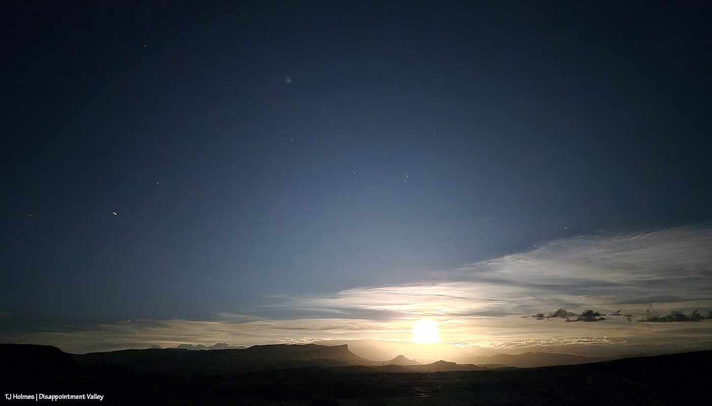
Then it was a down-valley drive as the light faded. Fortunately, though I watched hard, no kamikaze elk or turkeys (or even deer) shared the road with me. I missed full-moonrise this month because of the weather (if you think I’m complaining, please allow me to reiterate my eternal gratitude for the mostly daylong rainfall!!!), and although there were some colorful clouds, they were mostly drifting along the horizons by dark, so I thought maybe I’d get to see the night-after-full-moonrise from farther down-valley. …
This is from my phone (!): Moonrise over Disappointment Valley. WoWoWoWoW!!!
It took a bit for the moon to clear the horizon clouds, but holy wow. You can clearly see Temple Butte and Brumley Point under the glow of the moon. While I’m sure the view of space FROM space (lookin’ at ya’ll, Artemis II astronauts!) is, ahem, otherworldly, I kinda think the above is pretty damn cool (and from my *phone*!). This might be my favorite image from the entire day/night.
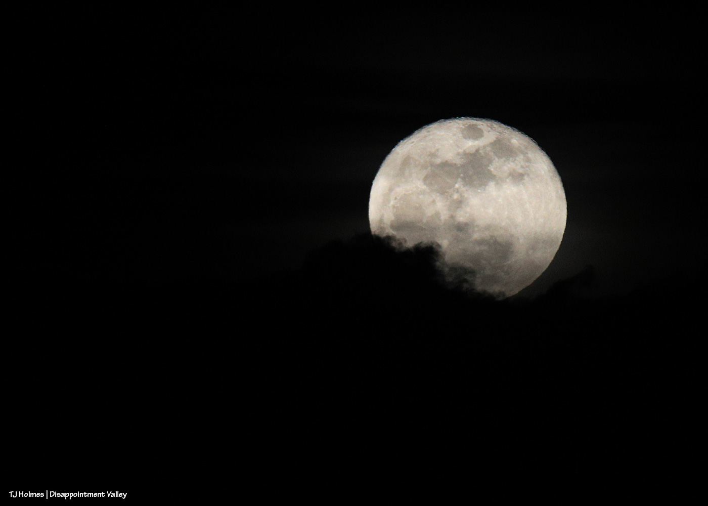
Because I couldn’t resist trying to capture it with my camera, too. 🙂 Those are clouds at lower left as the moon was rising out of the cloud bank.
What a day, right?! And that was literally just about the last three hours of it.
And then the next morning came. … My phone’s weather app’s radar showed spots of snow over Disappointment Valley. Oh, you liar, thought I (because it so usually does lie). … And then I went out into the world.
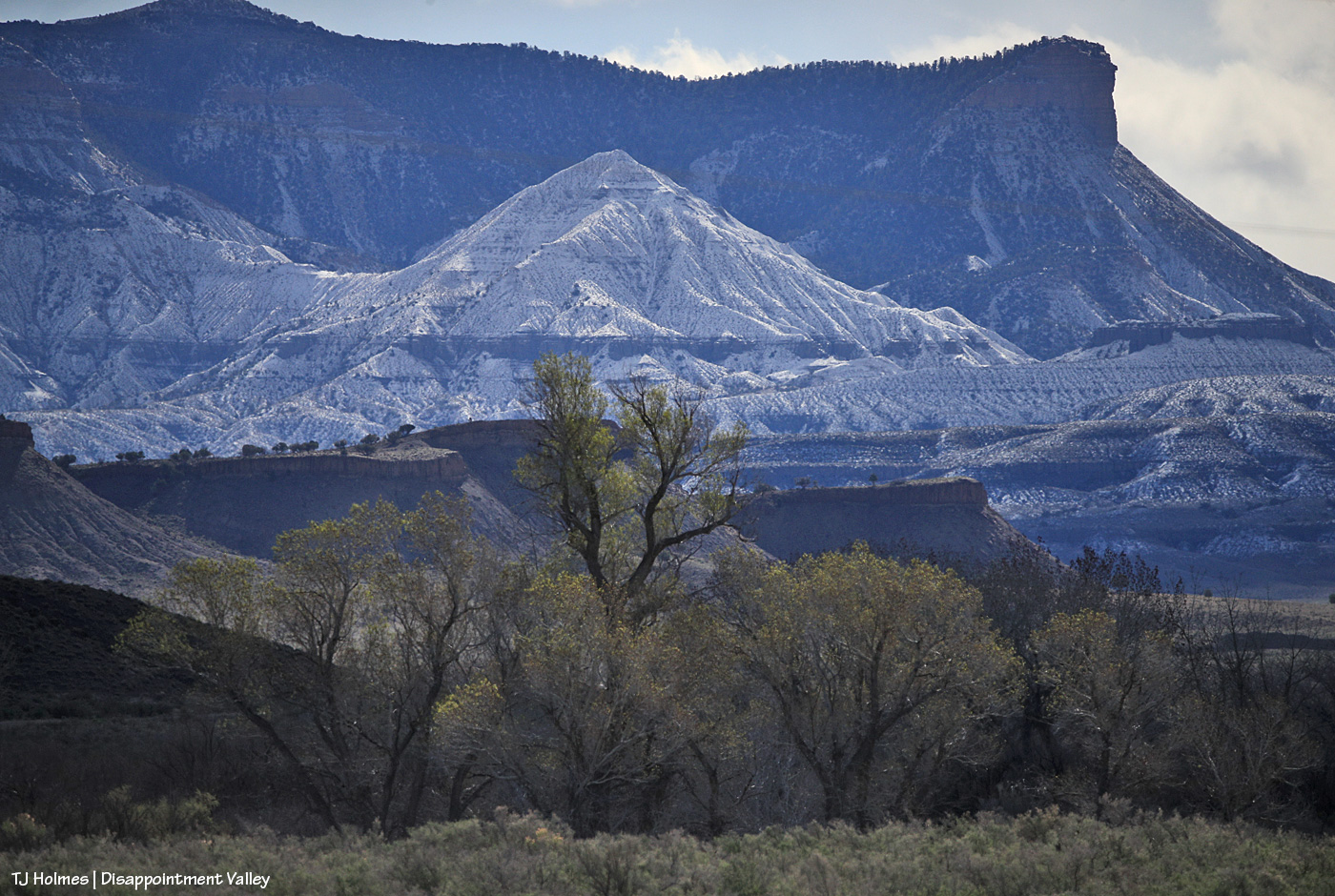
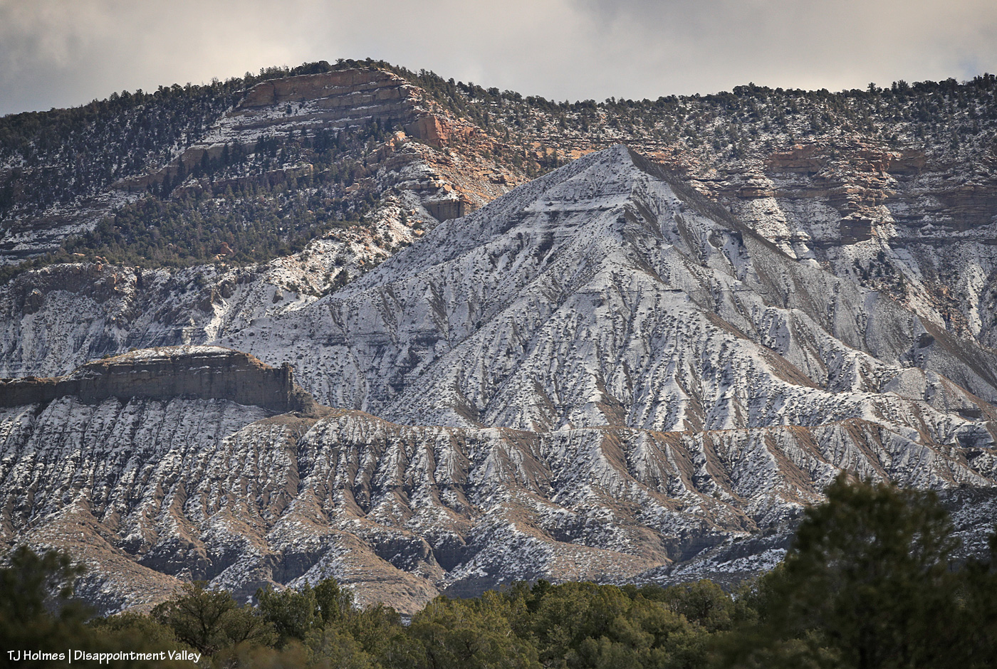
Well, knock me over with a feather! It DID snow … up-valley, not mid- or lower valley (nor did it rain). In the foreground are very newly leafed-out cottonwoods along Disappointment Creek, and in the midground are part of the rimrocks that form the southwestern boundary of Spring Creek Basin. In the background, starting at far right: Flat Top, Round Top and submarine ridge; smack dab in the middle, McKenna Peak; and towering o’er all, Temple Butte.
And from up-valley:
What I call submarine ridge at far left … and McKenna Peak just right of dead center. The very top/back ridge, if you follow it right, ends in Temple Butte.
Voila!
That snow will soak in; it’s not enough to produce runoff. And it was windy again, which further contributes to drying.
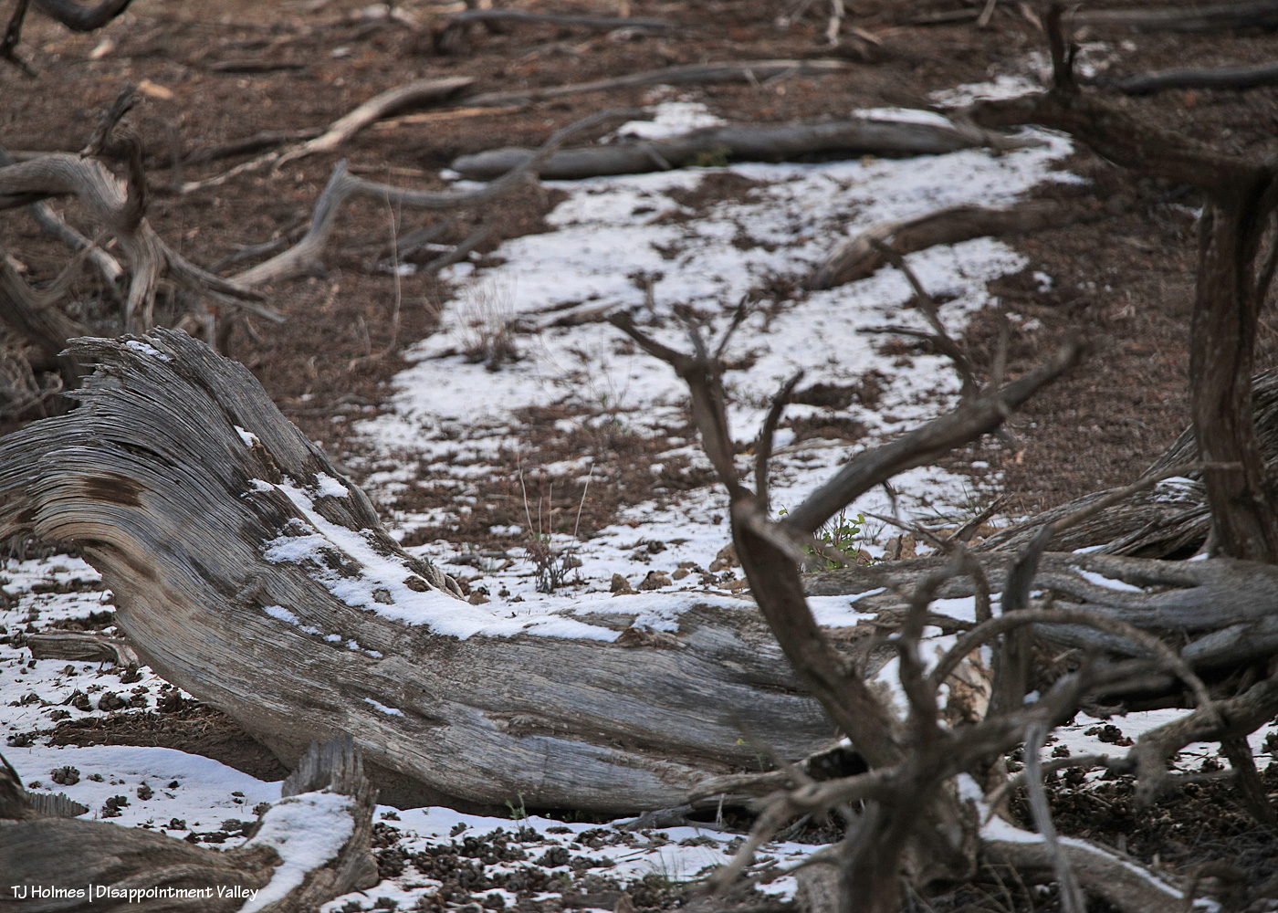
The tiniest bit of a tiny dusting still lingered in shady places under trees (this was just inside the Spring Creek Basin boundary from up-valley along Disappointment Road). Evidence that it HAD, in fact, snowed in the area.
And one last view, of Groundhog Mountain, through a curtain of snow!
It’s a crazy world. 🙂
It’s a crazy BEAUTIFUL world! 🙂
Thanks for coming along. Hope you enjoyed our (temporary) retreat to winter. Snow or rain, we need any and/or all that Mother Nature wishes to bestow.
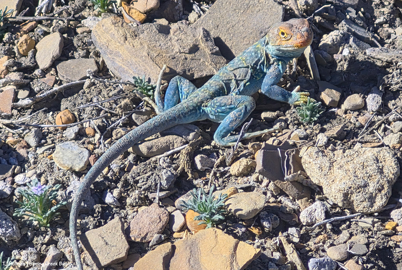
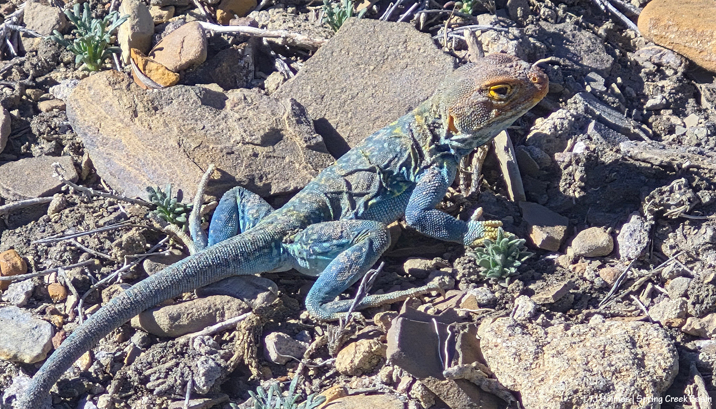
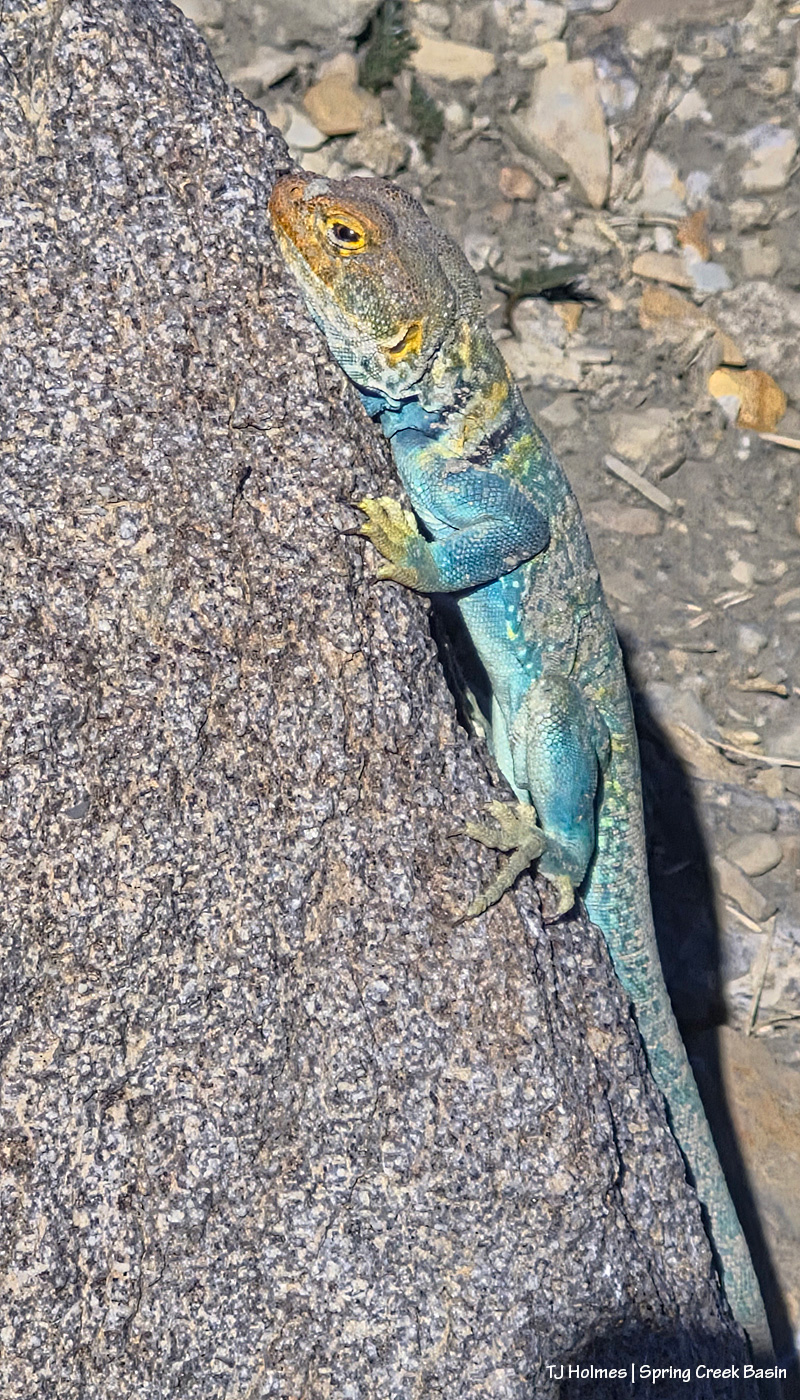
Whaaaaaaaaaaaaaaaat the heck are you doing out in mid-March?!
I don’t know what minimum temperature these little critters need to pop out into the open wide world, but it was at least 74F in Disappointment Valley yesterday.
Not quite 80 … but the weather(wo)man says it’s coming. 😦
I love seeing these lizards – they’re my favorites! – but I never think about seeing them in the middle of March. (Yes, yes, I am starting to watch for the first snakes of the season … !)
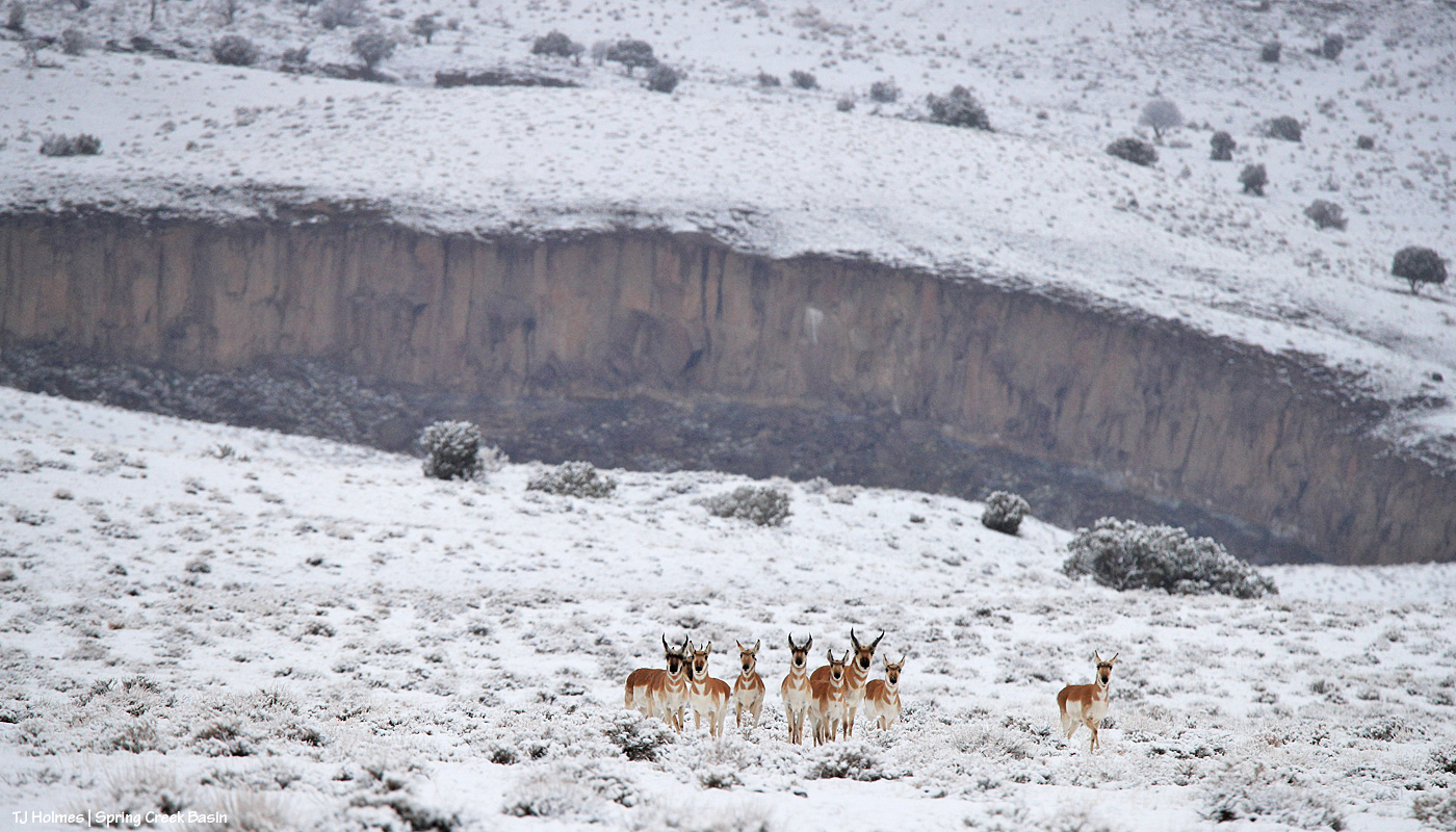
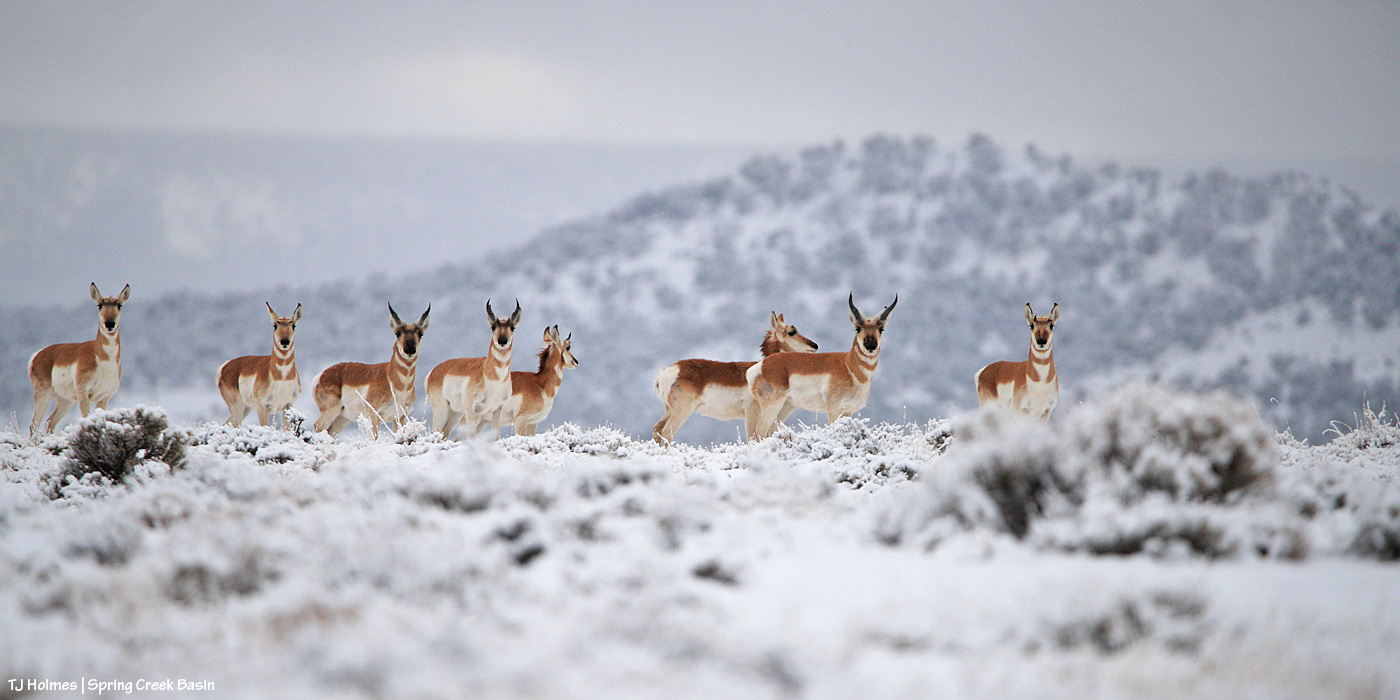
The snow Saturday morning lured me into Spring Creek Basin twice that day. The first time was shortly after sunrise, and while the mustangs were frustratingly far from any accessible areas, the pronghorns were fascinatingly cooperative! While that sort of looks like a giant cave opening behind them, that’s the north rim of Spring Creek canyon (viewed from the southeastish). The pic of Chipeta yesterday was taken much later in the day; compare the melting that had been at work.
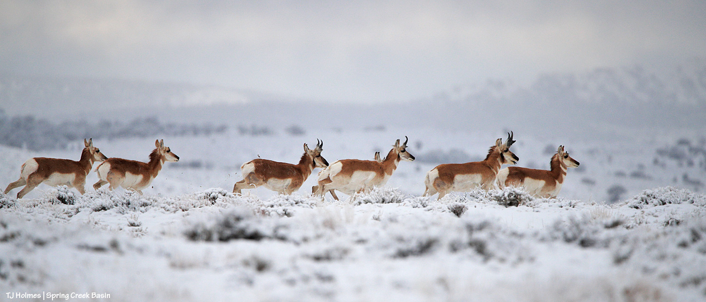
Pronghorns (not actually antelope) are North America’s fastest land mammals. Here, they were just moseying. When they *really* run, they are FAST!
They’re more sprinters than marathon runners … and thankfully for me and my camera, they’re wonderfully curious. 🙂
(Note that the landscape doesn’t look like that AT ALL by this morning (or even by yesterday morning). It was cold (high of 34F?), but in Colorado, sunlight means even more than temperature.)
To remember how I did this post last year, I had to go all the way back to Valentine’s Day to find the post recapping the previous year (2024, then) in images. This year (for 2025), I’m happy to announce that for once, though I procrastinated, it wasn’t THAT long, and it was in plenty of time (OK, one day to spare) to make the Dec. 31 deadline.
Deep breath: This was a hard year. Last winter was rough (read: bad dry), which meant the rest of the year was rough (read: really bad horrible awful dry) in terms of drought. Monsoons didn’t hit their stride over Southwest Colorado, so we didn’t get much rain, either. Federal employees were hard hit, too, and one of our young BLM’ers was illegally fired from the new job he loved.
But we also had some good-news happenings: Thankfully, he was reinstated, and we have a strong range team in Ryan, Anton and Laura. We got some new signs installed, including the replacement of the old, sun-bleached, weather-beaten interpretive sign for the new information “kiosk” that greets visitors upon entering Spring Creek Basin. Fertility control (native PZP) continues to be an extraordinary benefit to our herd in terms of management and keeping roundups and removals at bay.
In wider Colorado mustang news, the BLM short-term holding facility at the Cañon City prison complex closed in November, BLM and Colorado Department of Corrections being unable to reach a contract agreement. That’s not-great news in terms of uncertainty for rounded up and removed Colorado mustangs. Where will they go? In semi-balanced decent news (?), all of the Colorado mustangs that were in holding there (about 100 at the time) were adopted or went to private sanctuary or are currently in foster situations for a planned adoption in March (and that all happened despite federal employees, including BLM’ers, being out of work (or working without pay) because of the government shutdown).
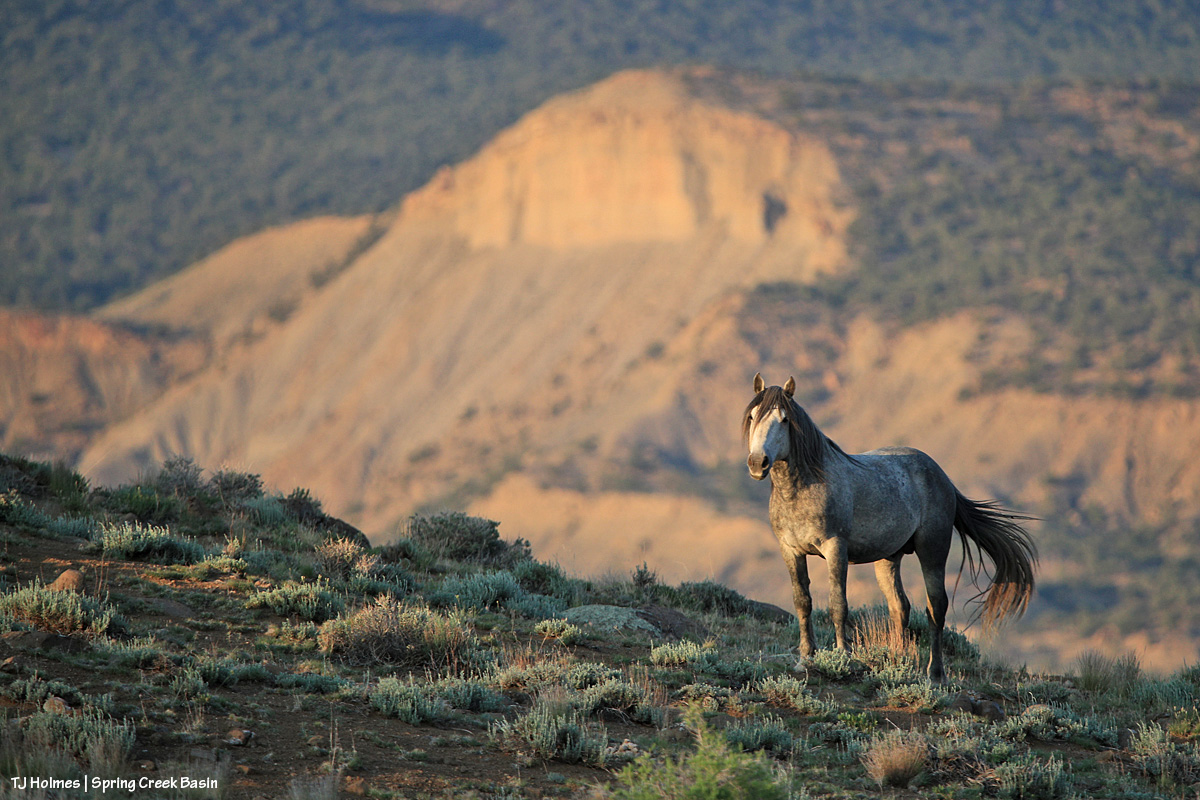
What follows is a pic from each month of the past year and a bit of reminiscence of what was happening when I captured the image of a mustang or mustangs. Many of these pix have been featured previously on the blog; some haven’t. If you make it to the end, there’s a bonus pic … one of my favorite of the past year.
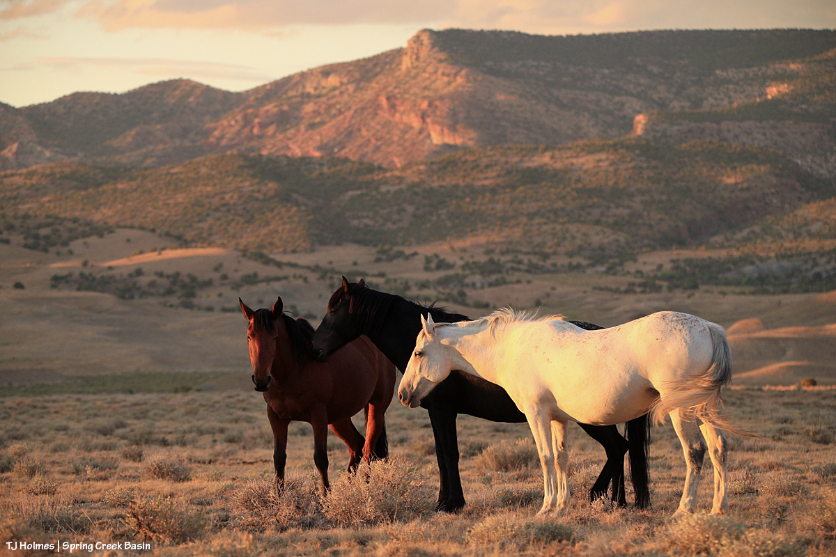
This is one of my very most favorite pix of the entire year. I love it so much, it’s the background image on my computer. I’m aware that I likely post a lot of images of Buckeye’s family; you won’t be surprised to know that they’re among my most favorite mustangs. I considered this image as the *bonus* image … but it was one wildly beautiful day of snow (well, I was out with the horses, watching the snow coming for at least two hours before it finally reached us), and it didn’t match the otherwise very dry *year*. … So it gets the January title.
Did I say that I love Buckeye’s family? You can forgive me for singling them out, right? The three mares weren’t born here, but gosh, they are treasures from our sister herd in Sand Wash Basin, and I’m so grateful that we have them. And yes, that was February. Utah’s La Sal Mountains may not have been the *closest* snow, but we sure didn’t have much.
March is still fuzzy-coat weather with signs of approaching spring, especially in the high desert of Southwest Colorado. Fortunately, we had ponds early in the year. They’d all go dry before some rain this past fall put water back in a couple of them, including the one pictured above with Chipeta. This pond is nicely full currently – and has mustangs taking advantage of its water.
April found Sundance not far from the pond pictured above, and he still had his band at that time. Later in the year, he lost them, and he’s been by himself since then. He has wandered a bit, following vegetation and available water. The stately ol’ guy is still around … I see him now and then, napping in the sunshine or grazing on the side of a ridge.
This wasn’t especially the best pic I took in May, but I love both the perspective and the sort of inside joke that Cassidy Rain always likes to be the farthest away from the two-legged. That day was a pretty warm one, and the band was in an area of basin where I rarely find them. It’s not a place with a lot of trees (in fact, there are very few), but they had found a couple, and were comfortable together in the shade near sunset.
My best boy Storm made a brief appearance in the northern part of the basin in June … one of the first times I’d seen him since he’d lost his band the previous autumn. Bittersweet. I haven’t seen him since about July, when he was at a water source with another band as I was trying to shoot the rising moon.
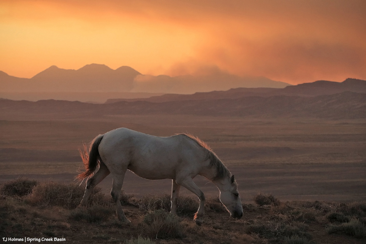
Ah, July, the month the Deer Creek Fire at the base of Utah’s La Sal Mountains sparked. It wasn’t the biggest wildfire of the season, and it wasn’t even the biggest with smoke visible from Spring Creek Basin and Disappointment Valley, but it was uncomfortably close to home. It was a reminder (as if we need any more) that it’s hotter and dryer out there, and we all need to be super aware and careful.
Fortunately, the mustangs live in the moment (while the humans obsess over the wildfire updates), and they still enjoyed peaceful days such as this: Three mares content with their world and each other.
Finally, as summer gave way to fall, Mother Nature cried her best tears and filled some ponds for the mustangs. THAT brought huge relief to us all (if I may speak for my four-legged friends as well as myself). Interestingly, visible at upper left in this image is Benchmark Lookout, a U.S. Forest Service wildfire-watch tower staffed during the critical seasons of the year (which includes September). In this backcountry, we are massively grateful for those who watch for and provide critical information about wildfires, as well as those who work to contain them, allowing them to provide some benefit in some cases while trying to keep property and lives intact.
It might be about now in the list that you’re thinking, “for talking about dry it was, she sure included a lot of pix of ponds.” It’s not because we had so much water; it’s because we’re massively grateful for the water we had.
There’s no water in this image – and it was November, before snow graced the peaks on our northwestern horizon – but the ponies are lined out on their way out to graze after drinking at a little place I call the marsh. This is post-sunset, but wow was it gorgeous under the autumn light. … And it’s not UNgorgeous at blue hour.
You’ve just seen this image of Temple with Temple (yes, the same) Butte and McKenna Peak in the background under a stream of stormy-looking (they didn’t produce a drop over us) clouds. I decided not to choose a pic from the bit of snow we got at the very beginning of December because the above is what we saw the whole rest of the month. The weather has been warm and dry … and that’s awfully nice for getting around and playing outdoors (60s! in Colorado!! in December!!?!) … but if things don’t change in the next few months, I’m going to be singing the same ol’ why-won’t-it-snow song that seems to be stuck on repeat.
And your bonus:
This was an evening in June. Nobody wanted to pose much, and I was going bananas, trying to get somebody – anybody – in front of that background in that subtle, delicious light. Finally, this young stallion obliged. And it seems to sum things up a bit: Hot this year? Yes. Dry? Gosh, yeah. Anxiety-inducing? Pretty much like always … with an extra edge. But! Beautiful, peaceful, a place of escape from the world’s ills (at least the headline type). Kind of a promise that it’s there … out there … and sometimes we don’t have to search all that far for it.
And there you (kinda) have it: 2025 in the rearview. It’s always hard to select just one pic for each month (plus a bonus!), but I hope you enjoyed this little recap.
In best-of-all news, I spent a lot of time (again) with my beloved mustangs in the best place on Earth (in my ever-so-humble opinion). 🙂
And close to that is my gratitude for all of you readers who follow the mustangs and our pictorial journal of peaceful, wild, beautiful life here in Spring Creek Basin. Thank you so much, and I hope you all have a peaceful, wild, beautiful 2026 (with lots more moisture!!!!!!!!!!!!!)!
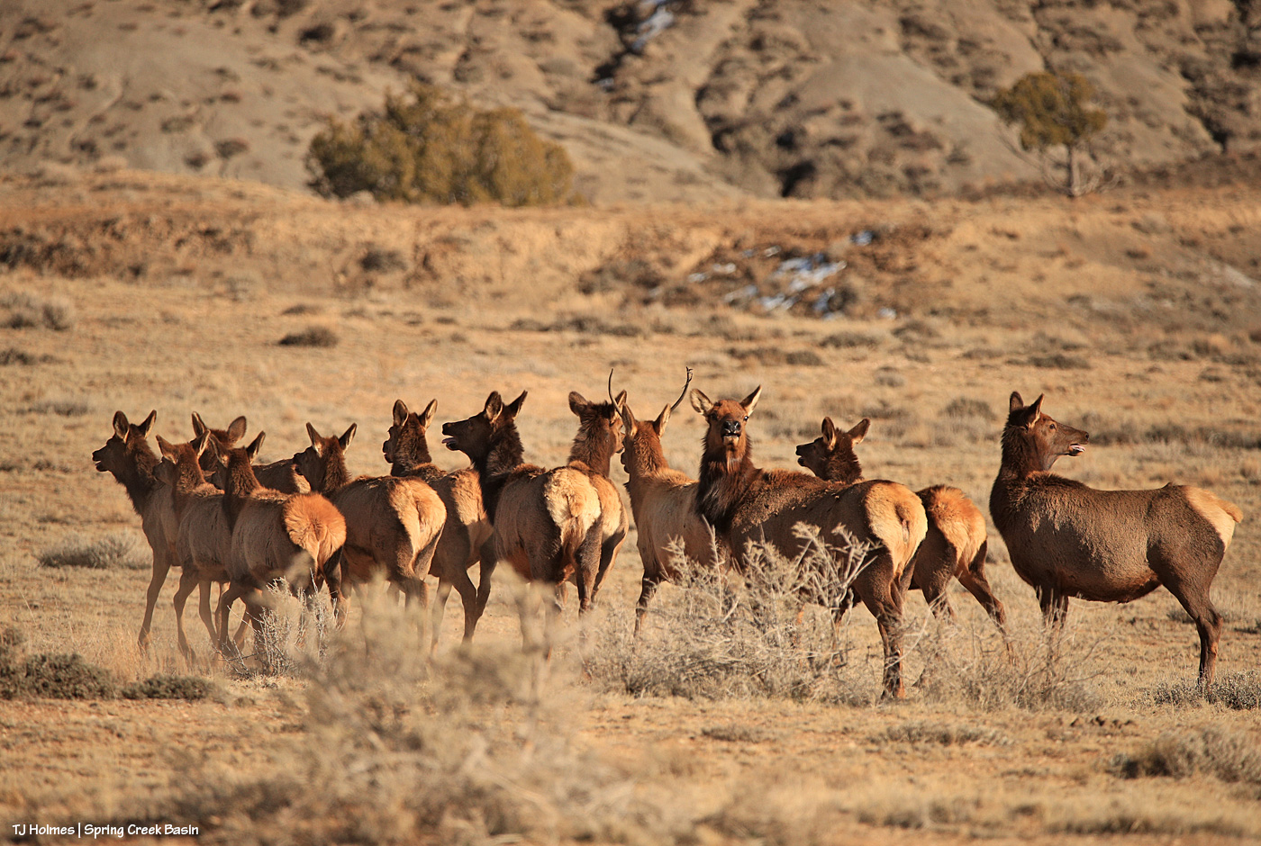
The elk surprised me running around a hill as I toodled up the road. I stopped immediately, but they were not in the mood to also stop, and they kept going. These are probably the first elk I’ve seen since before the main rifle seasons. I’m happy they’re here … though unhappy that I disturbed their peace!
Sunrise in Disappointment Valley highlighting mule deer (I’m so glad to see the bucks back!) in the greasewood and chamisa (rabbitbrush) and willows and cottonwoods along Disappointment Creek, looking toward Spring Creek Basin. It was a drive-by shot, and I couldn’t actually see what I was shooting on my phone’s screen, but the light was so beautiful highlighting the pretty and handsome does and bucks, I literally pointed and pressed the button.
… amid a bigger group! And these weren’t all of them. After the rains, they have plenty of roadside puddles (some of them decently large!) to drink from without ranging too far!
 2-
2- 5
5 mm) that resemble Dippin’ Dots or Styrofoam. These fragile, slushy particles are often called snow pellets and, unlike hard hail, crumble easily. They occur during wintry mix scenarios, causing sudden, slick conditions, and are identified in aviation reports as ‘GS’.”