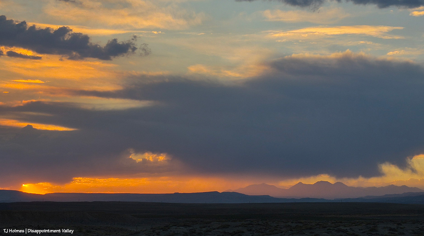
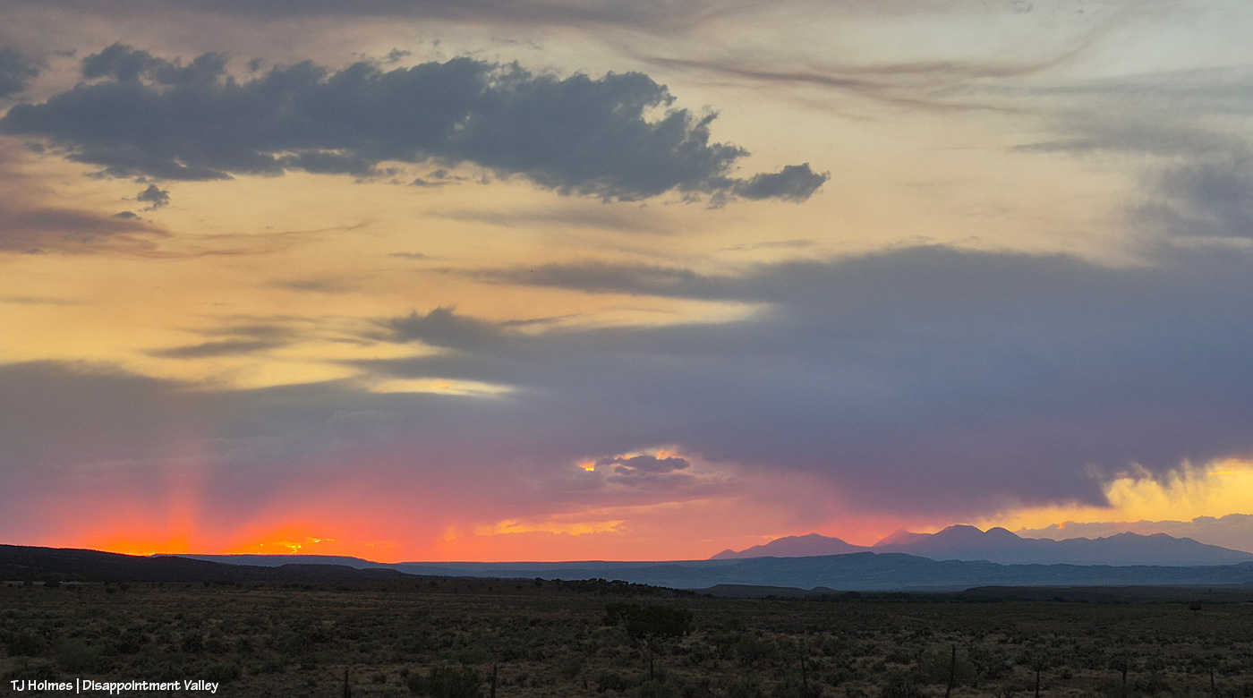
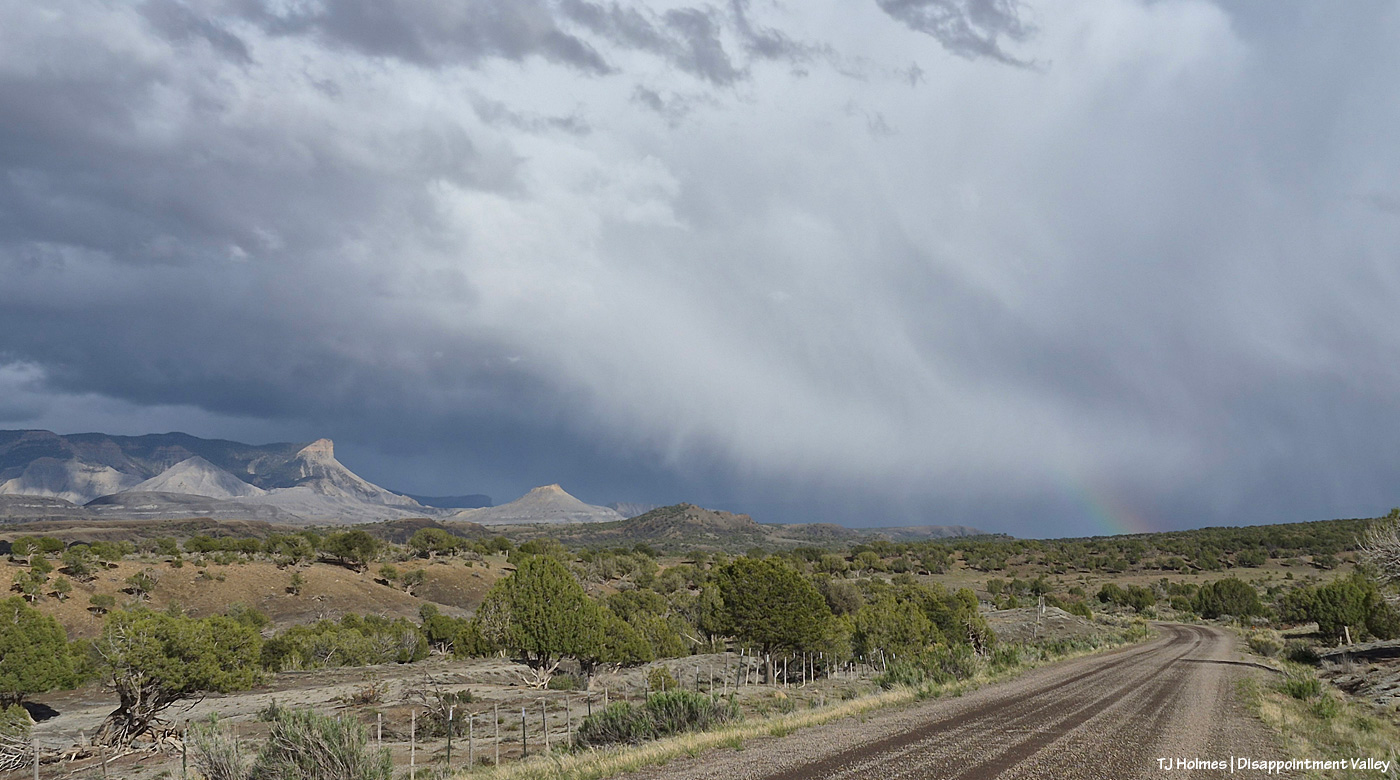
Apologies for the late post this morning; last night’s storms took out my electricity! Very glad of the rain … shown above making its way into Disappointment Valley southeast of southeastern Spring Creek Basin. Seneca really didn’t think she wanted to help show off the view and the rain, but she did an amazing job of it, of course. 🙂
The great thing about the rain is that it wasn’t even in the forecast, so it was a *very* pleasant (understatement) surprise!
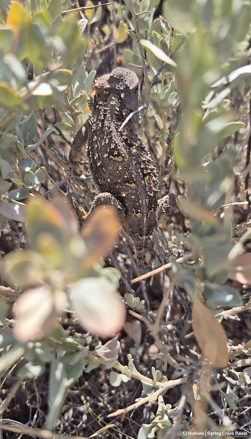
This little fellow or gal scrambled into the middle of a four-wing saltbush (I think? I didn’t stop to ID it at the time). Very shy but maybe one of the bigger horned lizards I’ve seen – and certainly recently. Probably about the size/length of the palm of my hand. I think each individual is different with its coloration/patterns, too. Check out the cool yellowish spots on the dorsal side of this one; they made me think of a butterfly’s markings, so they might be to deter predators?
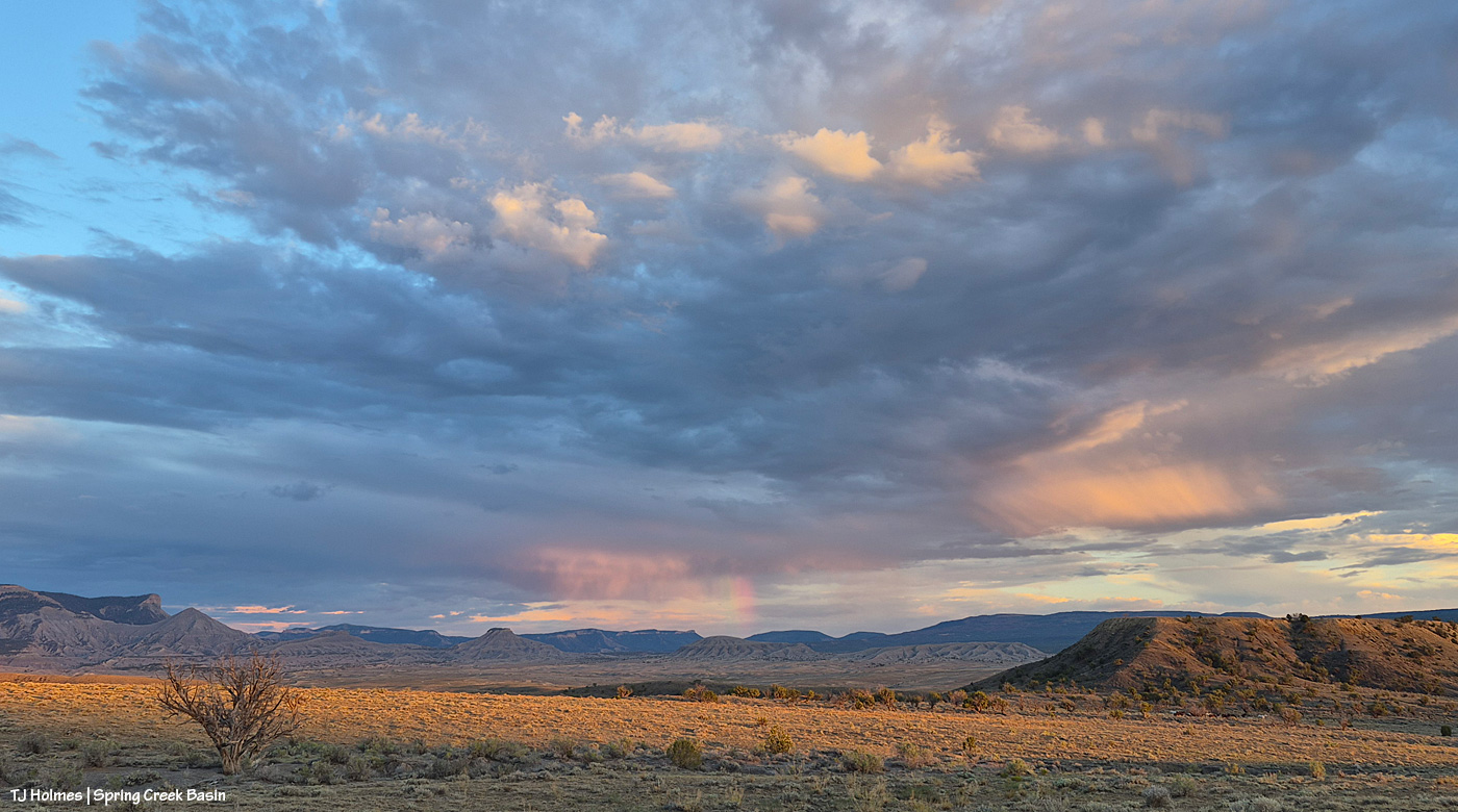
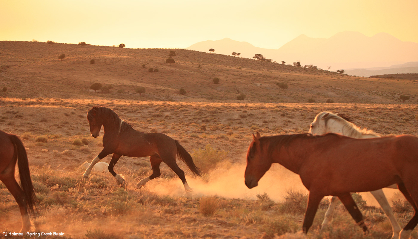
I had just walked back up the hill to the road from visiting with a couple of bands when the sun sank into a low cloud right above the horizon, and I thought (silly me!) that was sunset. … But THEN … the sun found a sliver of a break between cloud and horizon and sent its good-night-world light across Spring Creek Basin. See the partial rainbow at nearly center over Round Top in the low distance? And if you look closely, there’s a band of horses (anOTHER) band of horses) that appeared walking west across the northern base of what I call the east twin butte at lower right.
Note to self: The light’s not done till it’s DONE.
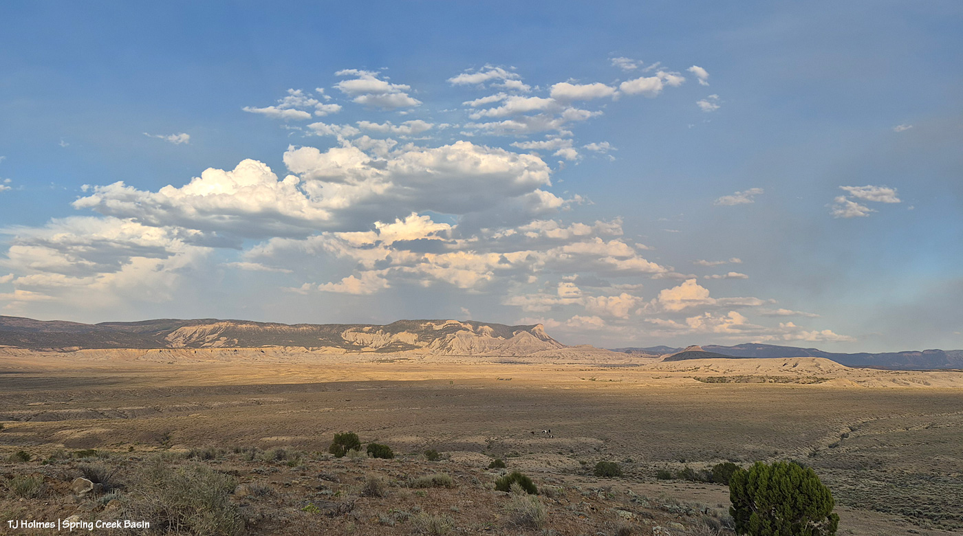
Not much of a theme to the post today … just a couple of glimpses of Spring Creek Basin this past weekend. 🙂
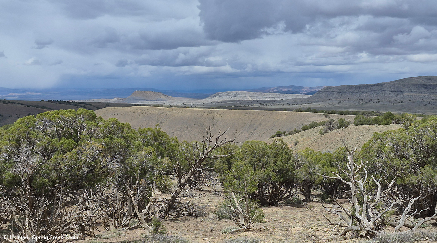
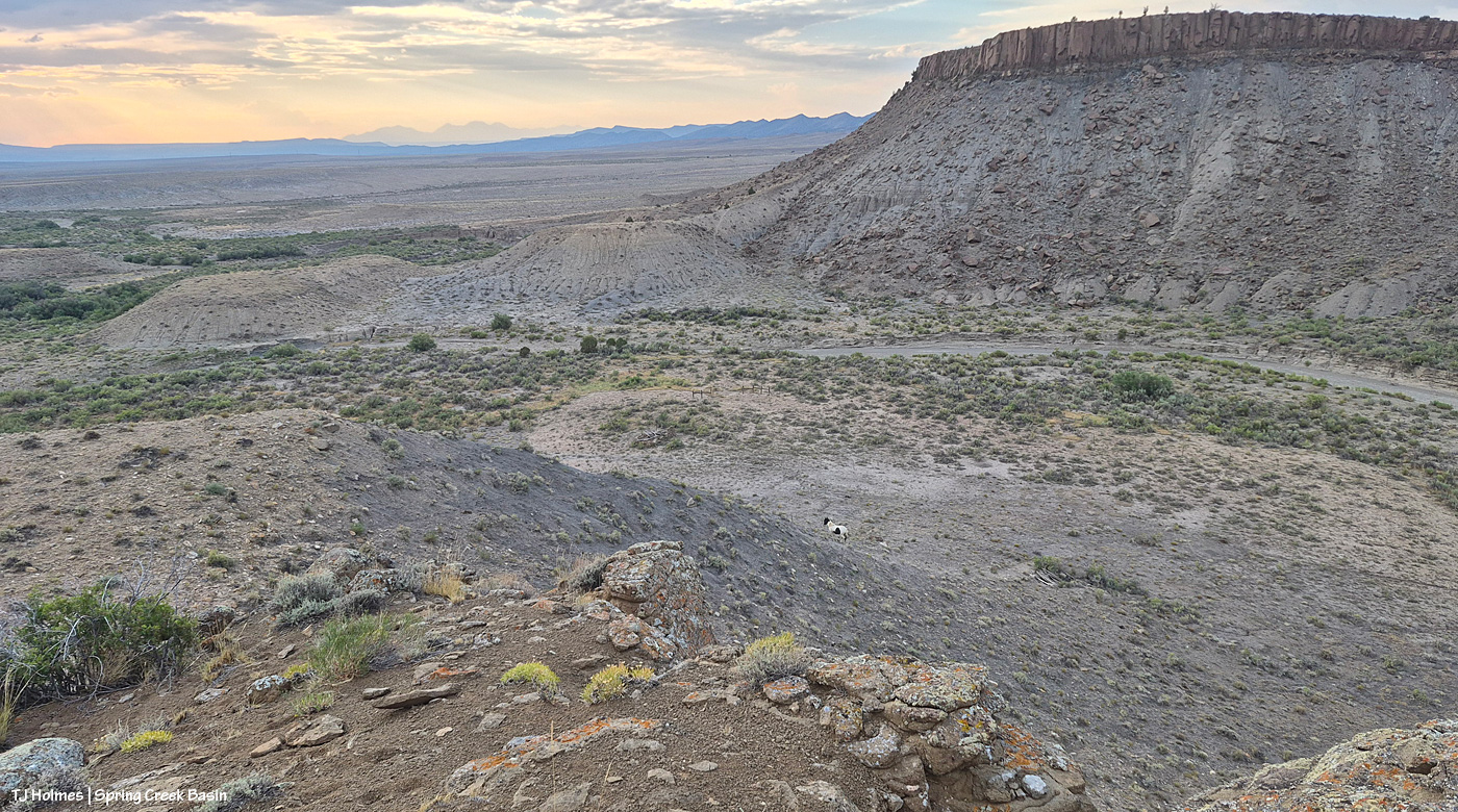
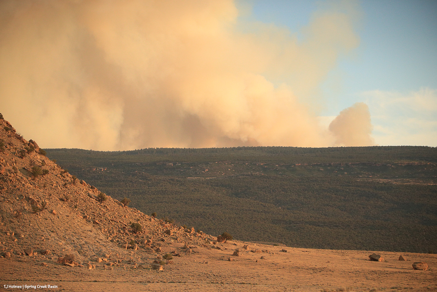
This pic, taken Sunday from between the main/original water catchment and Filly Peak in Spring Creek Basin, is looking southeast toward the Glade and Benchmark Lookout. A few days before, I’d seen the red swaths of retardant across the trees while looking at smoke up there, but I didn’t manage to get a decent pic that showed it. While fire continues to smoke in that area (that’s the Ferris Fire’s northeastern edge), clearly firefighters and aircraft pilots have been hard at work. So hugely grateful! Rick and Linda Freimuth, who staff the tower during the fire season (!!!) hope get the green light to return this week. The mustangs and I (you know they would if they could) will be cheering their return.
Now, some taken yesterday (Monday):
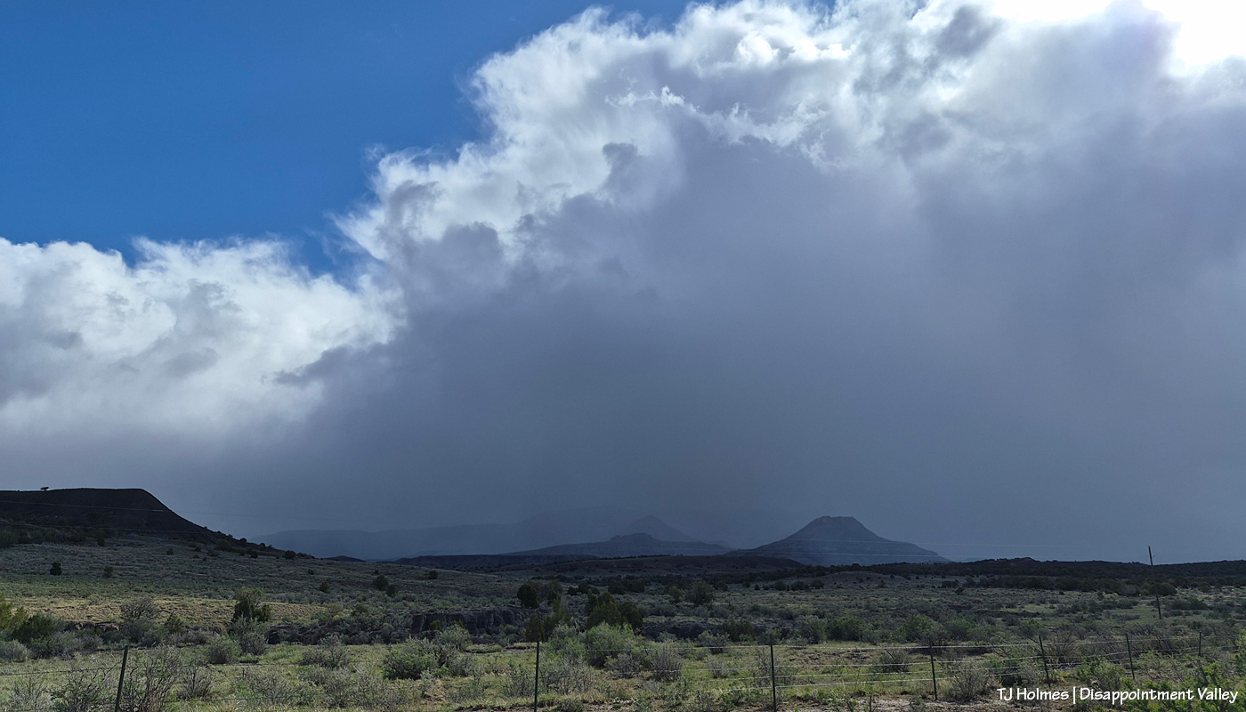
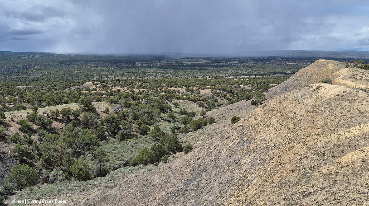
Storm brewing to the east. Spring Creek Basin’s western rimrocks and Filly Peak (lower left) are in sunshine, while Temple Butte, McKenna Peak, Brumley Point and the basin’s eastern ridges are shadowed by rain! Woo-the-heck-hoo!
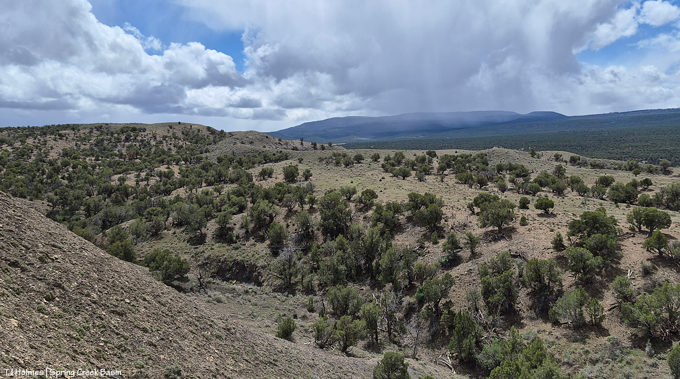
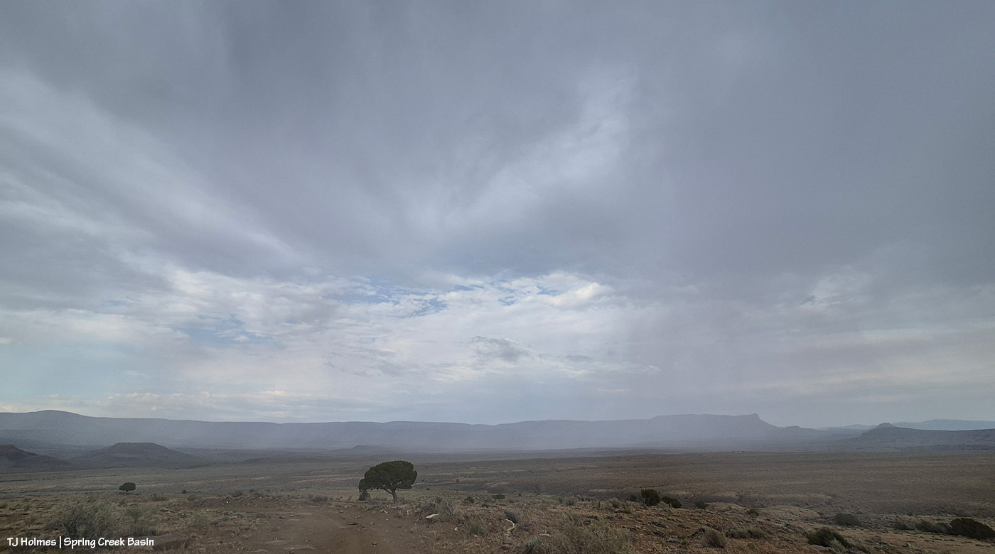
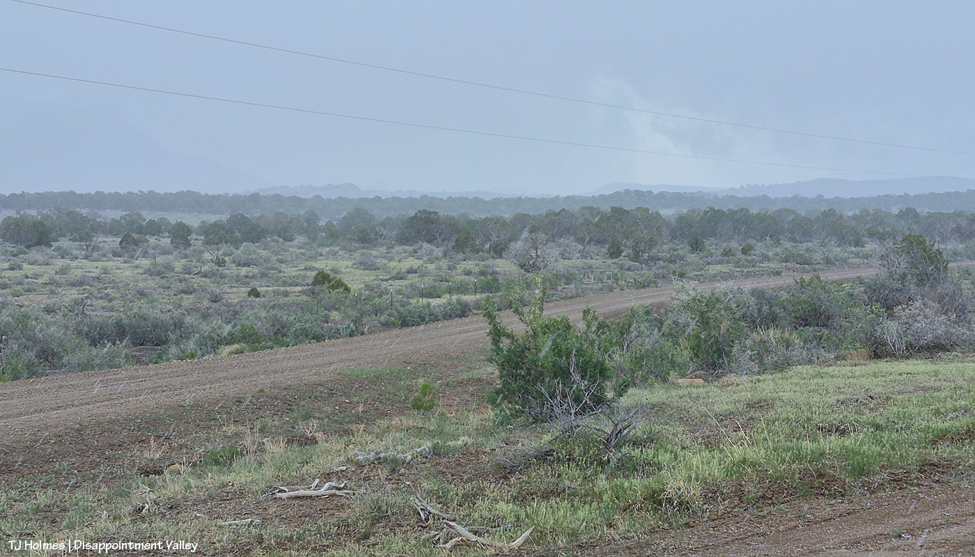
Looking back to the west from the same spot as above. More rain! What looks like white smoke on the horizon at left IS smoke from the Ferris Fire … and I hope it got a good dose of the wet stuff. It wasn’t a high-rain-chance day, but toss the forecast and let ‘er rain!
Methinks the weather wizards were outsmarted by Ma Nature herself. 😉 RAIN, BABY, RAIN! This is from Chrome’s Point in western Spring Creek Basin, looking eastish at a curtain of rain that DID, as I was taking pix, make its way west. Unfortunately, I didn’t get tooooo wet. Ha – I would not have minded!
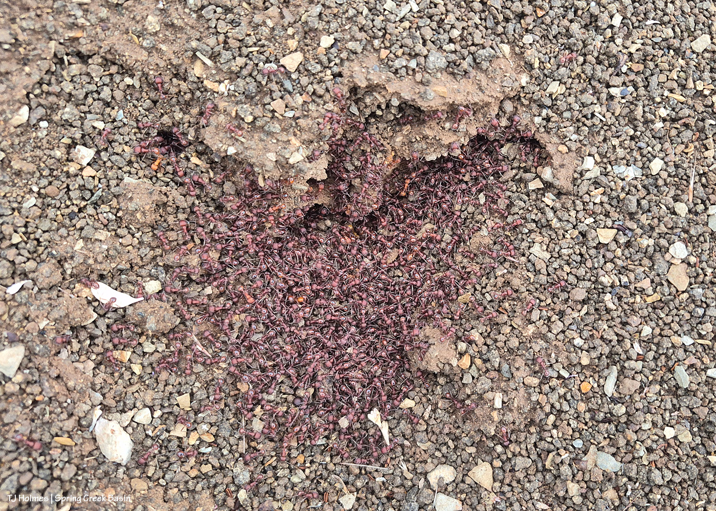
Ants congregating at the entrance to their mound. Apparently, “Ants congregate at their mound entrances after rain primarily to survive flooding. When underground tunnels fill with water, the colony is forced to evacuate. They move the queen, larvae, and food upward to escape the saturation, using the surface or mound entrance as a temporary, elevated sanctuary.” Interestingly, these ants and others I saw doing the same thing in the same relative area happened to be on some of the highest ground in the basin, near the western boundary. I guess that when you’re an ant, everything is at the elevation of ground level (ha ha!).
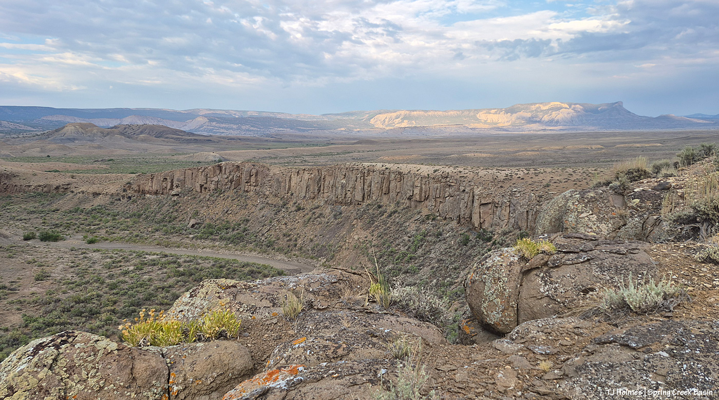
From the south wall of Spring Creek canyon looking eastish after the rain (it didn’t last very long, unfortunately).
Hope you don’t mind this view! It’s pretty spectacular. No, that’s not a road down there in the canyon; that’s Spring Creek arroyo, and just beyond (lower left), it leaves Spring Creek Basin to cross lower-ish Disappointment Valley on its way to join Disappointment Creek (neither of which are carrying water at the moment).
See the pinto pony? This is from the same point as the above two pix, looking generally northwestish across lower Disappointment Valley toward Utah’s La Sal Mountains. There’s a fence across this lower end of the canyon to keep the mustangs within Spring Creek Basin, and there’s a water gap (hanging PVC pipes to move when water DOES flow) across the Spring Creek arroyo. There are a couple of manmade structures down there, one behind McKenna and one kind of in front of him.
As it turned out, though he and his pal and a band were in the vicinity – and the reason I walked out – it was something else entirely that actually took me all the way to the canyon rim. … And that will wait for another post because I got some pix that knocked even my socks off.
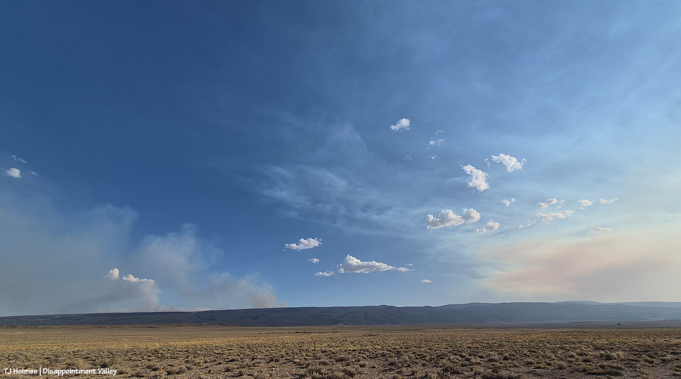
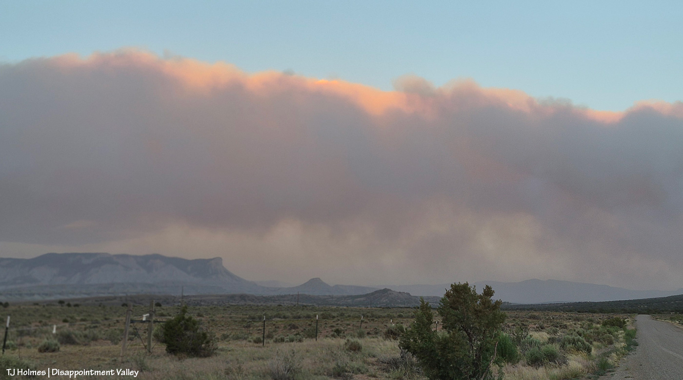
After some reports from different sources of tiny bits of rain here and there (Tuesday day/night, maybe some drips Wednesday), the sky was much more our normal and beloved Colorado-blue than we’ve seen in a run of smoky days. Ferris Fire (60,104 acres as of Wednesday night) smoke at left; Babylon Fire (101,073 acres) smoke at right. Looking mostly south.
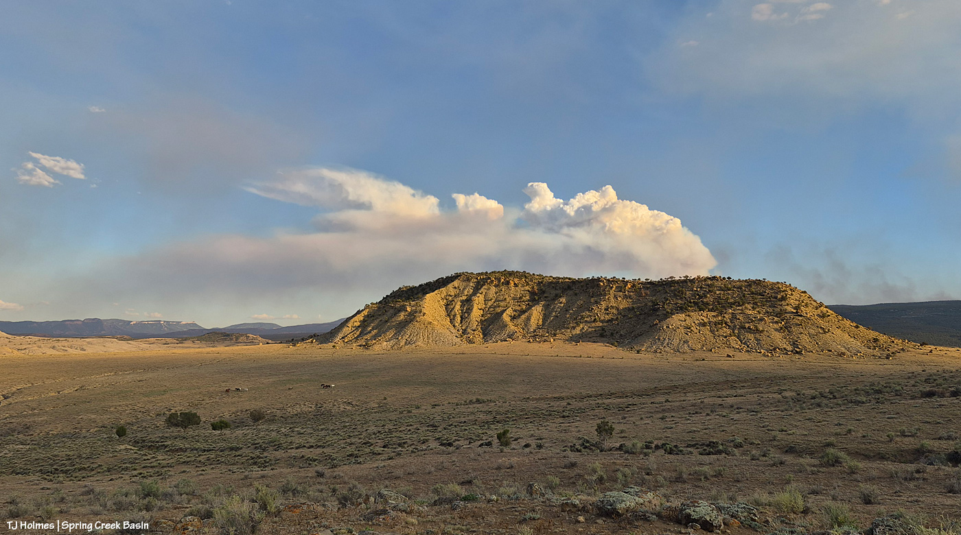
The fire must have gotten into some new, untouched fuels by evening because by 7 p.m. or later, it was really sending up a plume. That’s Filly Peak in the near background, and you can see a bit how perspective matters: Not only is the fire not directly behind it, it’s not *super* closely behind/south of Disappointment Valley’s south ridges. (I did still see a little line of smoke in the Ryman Creek area a bit later.) Mustang ponies in the middle ground, napping.
This and the above pic toward Filly Peak were taken from the same vantage point: Chrome’s Point in Spring Creek Basin’s far western region (not far from the rimrocked western boundary). This one is looking slightly leftish of Filly Peak and southeast/east. The smoke is fairly faint … a MUCH better sight than we’ve had the last many days.
Those are more clouds than smokedrift, though, of course, there’s still smoke there from Utah’s huge Babylon Fire, now more than 101,000 acres. … Mother Nature is trying to stir up the clouds into delivering rain.
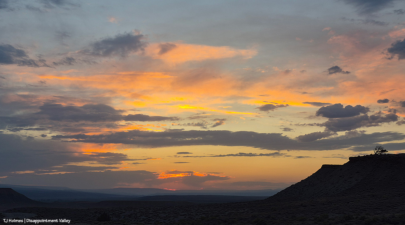
See the pillars of sunset glow at left? I love it when the sun waves goodnight to us like that.
A couple of links to articles I’ve found interesting recently:
“Monsoon rains are on the horizon,” say the weather wizards, err, experts. We can only hope they’re finally going to be proved right. Some super heat is on tap first.
These pix were taken the evening of Friday, July 3:
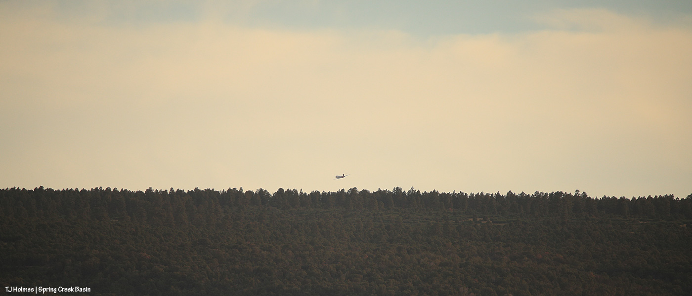
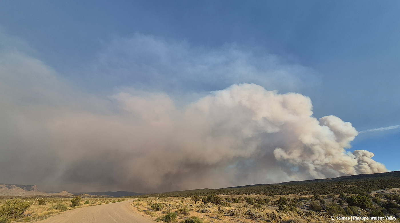
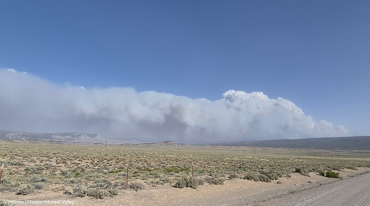
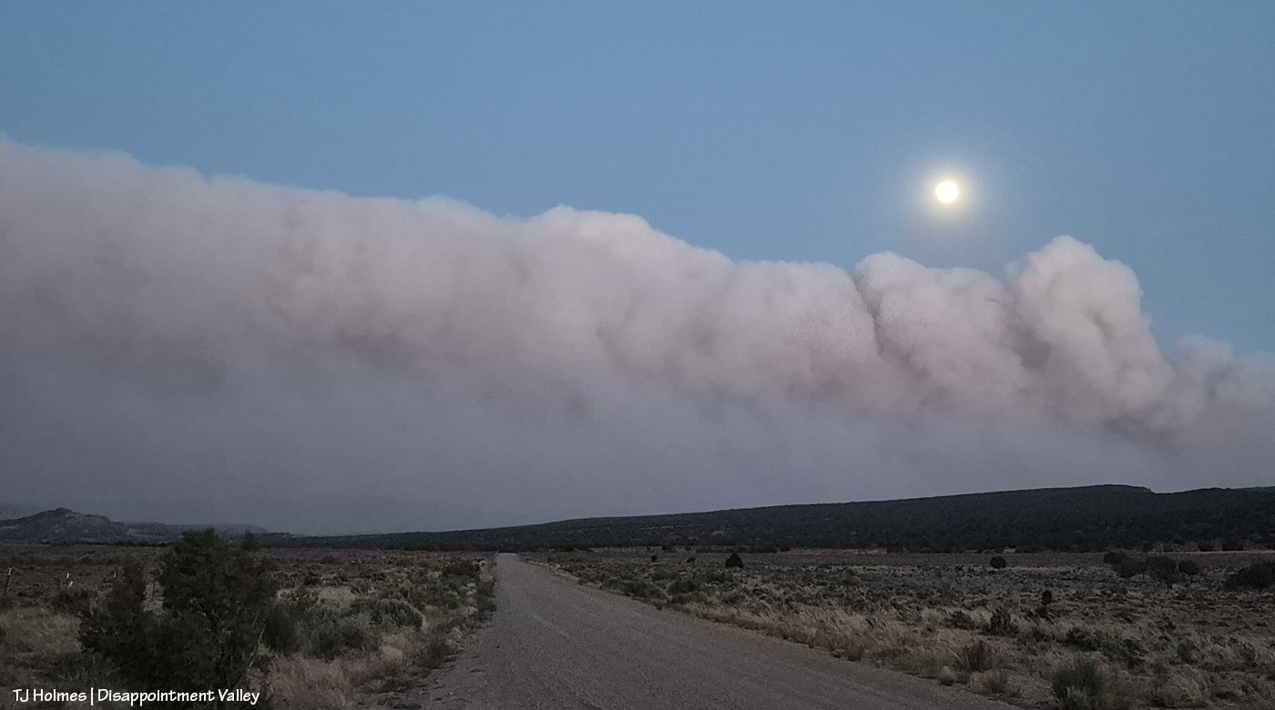
I wasn’t going to go to Spring Creek Basin on Friday. Just watching the smoke from a relatively safe vantage, I *cannot* even begin to fathom the strength and accompanying exhaustion of the firefighters, the law-enforcement rangers, officers, deputies, residents evacuating the Ferris Fire (and others around the region; we’re all in our own communities of what-ifs and fears and plannings). Then, in the evening, the smoke did one of those giant plumes on the west/southwestern side (where it crossed the Dolores River), and my journalist brain kicked in (journalist brain = aka nosy-nellie = aka curiosity-never-hurt-anybody, eh?), and out I went. Above: From Chrome’s Point at the western side of Spring Creek Basin, looking nearly straight south, see the plane above the treed ridge (that’s the south ridgeline of Disappointment Valley at the lower-ish southwestish end/side of the valley)? I regularly use Chrome’s Point to glass a big swath of the big basin that IS Spring Creek Basin, and from there, I heard the drone of a big plane (air tanker), and to my surprise, I actually saw it. It was much higher when I first spotted it, flying from right (west) to left (east) … then it banked to go south, and as you see it above, it’s turning east/southeast again and just about to drop out of sight. Again, there’s a fair (!) amount of distance between the fire and the basin, so there was no way I’d see it drop its load of retardant slurry … but I’m sure you can find impressive videos online of those pilots doing that amazing work.
This was as backed out as my big lens could go to give you a view – and context – of the western end of Filly Peak at left, the straight-south, far southern ridge(s) of Disappointment Valley and Friday evening’s blowup of the west/southwest side of the Ferris Fire, burning south of Disappointment and Spring Creek Basin in northern Montezuma County (where it started) and right up the westish-middle of Dolores County. San Miguel County is the next county north, and that’s where this part (and most of) Spring Creek Basin is located. … Interestingly, though I thought I hadn’t caught the plane in this image, when I was way zoomed in on the computer to clone out (dratted) dust spots, I’m pretty sure I actually spotted it, juuuuuust above the tree line at far right. Again, the pix above are from Friday evening.
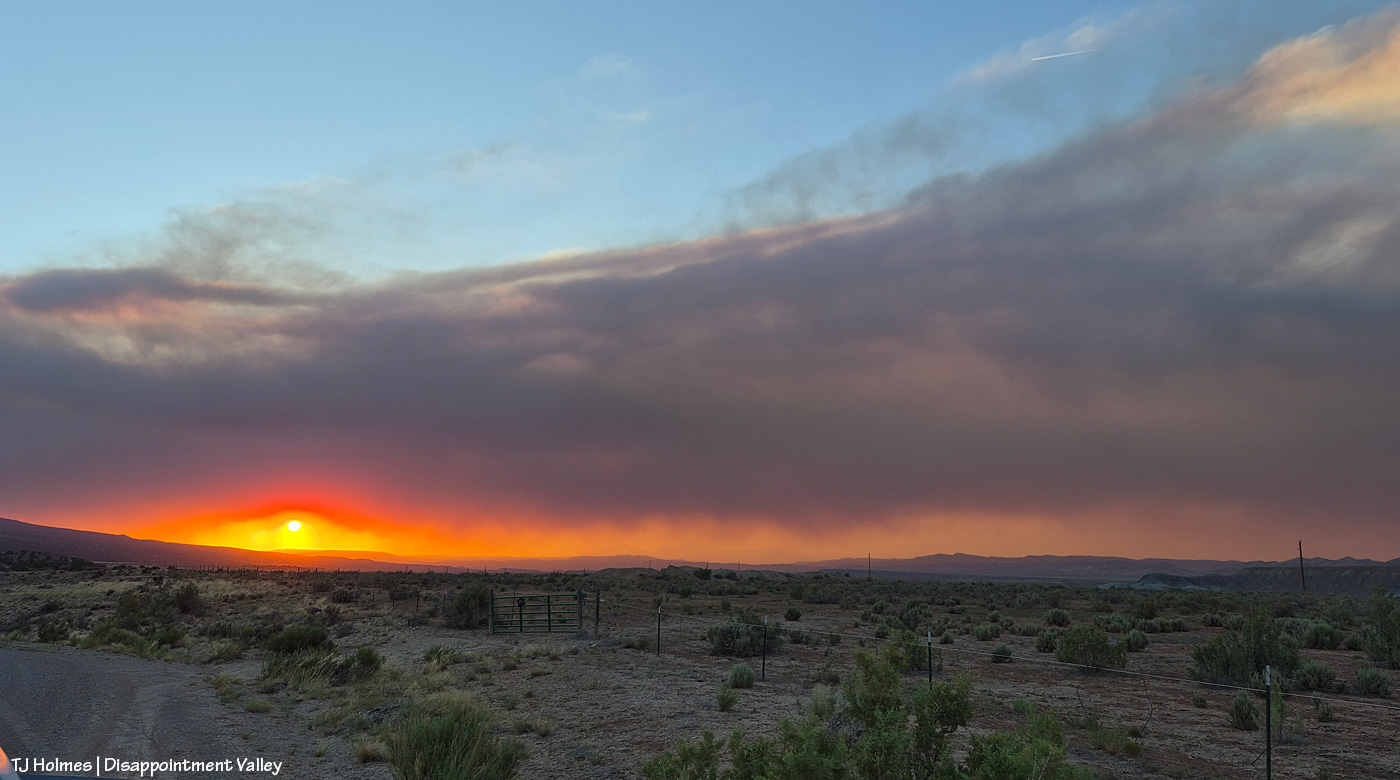
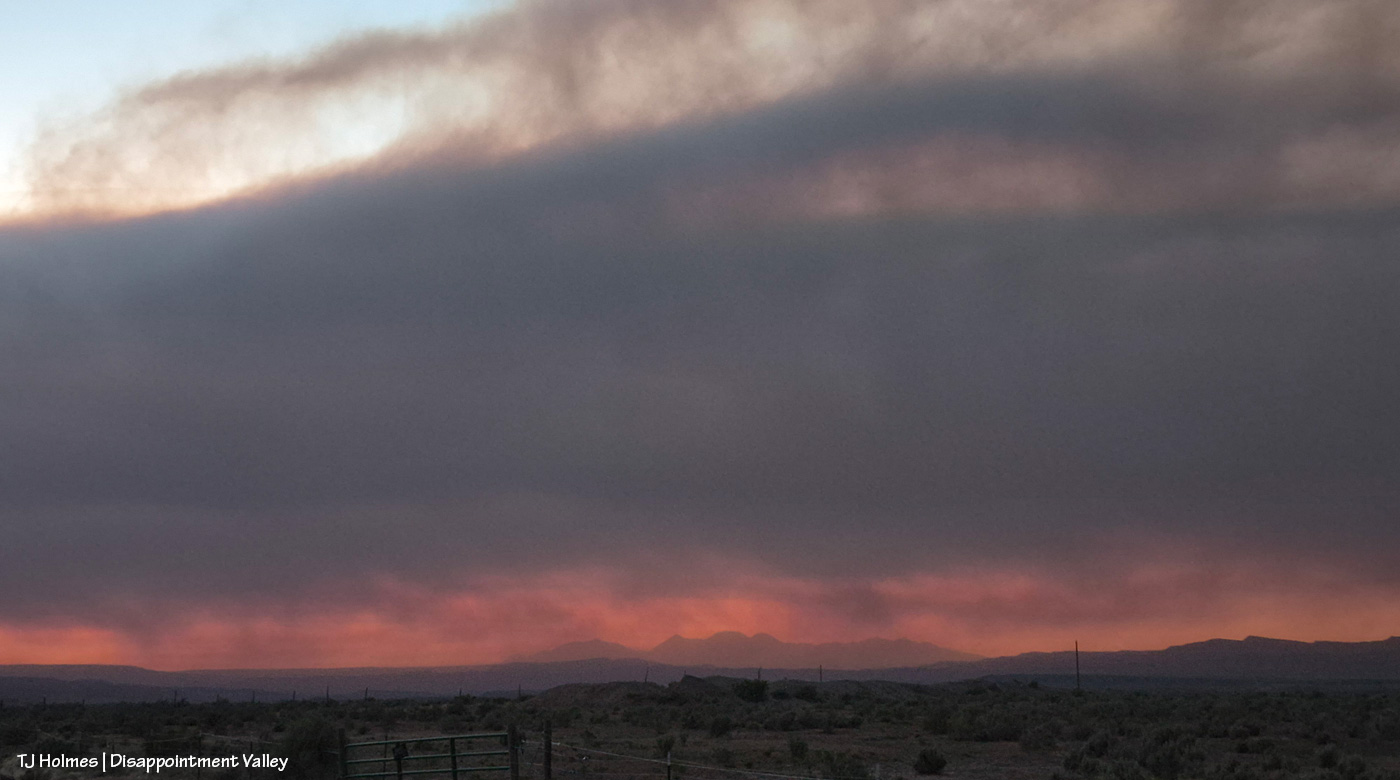
This is a very wide-angle phone shot from Disappointment Road looking south/southeast/eastish, earlier in the evening than I took the pix above from inside the basin. The familiar landmarks of Brumley Point, Temple Butte and McKenna Peak are at far left. That is really not something you want to see – that kind of super-active fire activity! – but flames on the hillside south of your home has to be about a billion times worse (see below).
The Ferris Fire now is up to 41,337 acres, and containment has dropped to 7 percent as the fire has grown (as of Saturday night). A staggering “500 personnel are now working the fire. A Complex Incident Management Team has been ordered to provide additional management and logistical support.” That information is from a 7:30 p.m. July 4 report on Watch Duty (if you live in the West, or know people who do, for goodness sake, download it to your phone if you can; it’s massively informative, and the network they have to report on so many fires is nothing short of amazing).
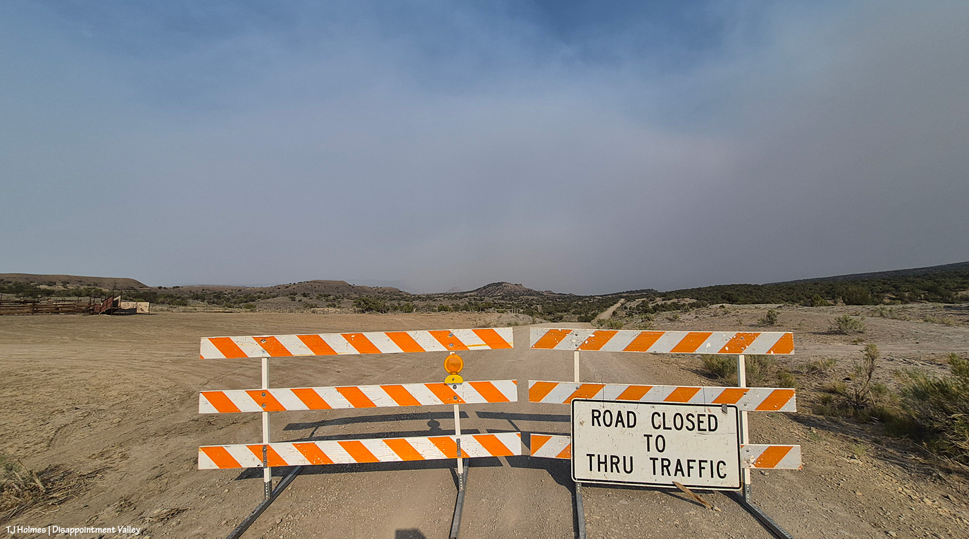
As of Saturday, July 4 (hope you all celebrated Independence Day safely!), maybe Friday (?), Disappointment Road is closed to through traffic. From the west, heading up-valley-southeast, the closure is at the old Perkins corrals; coming down-valley, northwest from the Dolores-Norwood Road, the closure is just above/southeast of Ryman Creek Road. Ryman Creek and Black Snag roads already are closed. In its run north, the fire bypassed Benchmark Lookout (thankfully being aggressively protected by firefighters; if you’re on Instagram, follow @benchmark_rick; Rick and his wife, Linda, staff the tower during fire season … it’s so crazy that they’re not actually there during this fire, but thank goodness they’re safe! they’re helping with supplies at the Salter Y Spike Camp) and started down/north toward Disappointment Valley on Friday night. Up-valley neighbors watched actual flames, as did (at least) San Miguel County deputies, who were stationed up there until around midnight. Smoke is bad enough … seeing flames on the hillside south of your home … I can’t imagine. 😦
Today’s big shoutout goes to San Miguel County Undersheriff Nick Xavier, who, along with deputies Todd Rector, Derek Kibel and Jeremy Platt, and Dolores County deputy Branson Smith, has been keeping me updated about the fire in this neck of the Disappointment Valley piñon-juniper woods. Along with above-and-beyond information-sharing by my BLM range guy Ryan Schroeder (Anton Rambur and Laura Heaton are on the fire), my gratitude is high to all of these folks for keeping calm and keeping eyes and ears on the situation.
From Undersheriff Xavier’s mention of pix he saw, three links to – get this – images of the Ferris Fire with the aurora above flames:
Did I see the northern lights? No, no, I did not. Once again, I slept right through the show. One of these days (err, nights …) … !
And your pony pic from Friday night:
Maiku kicking up dust (we don’t need any more smoke OR dust!) while smoke from the Ferris Fire (coming from the south/left) and Babylon Fire (across our whole western horizon) casts a golden glow over our ponies that isn’t nearly as lovely as simple golden sunset light.
Gratefully, while the Ferris Fire burns 20,560 acres to the southeast and the McCloud Fire and Horse Head Fire burn 113 and 530 acres, respectively, to the southwest (and that smoke is joined from the Snyder Mesa Fire (30,163 acres) to our north/northwest, drifting southish), Spring Creek Basin and lower Disappointment Valley were mostly smoke-free yesterday.
In the pic above, Tenaz and Skywalker, grazing with their band almost at the western boundary of the basin, are highlighted by that drifting smoke to the west. It’s fairly far away, but I haven’t seen Utah’s La Sal Mountains for at least a few days now as the smoke obscures any sight of them.
Now looking east/southeast, that’s the smoke from the Ferris Fire (the Doe Canyon, Far Draw and Ferris fires all have merged and are now being collectively called the Ferris Fire). But see how clear it is between here and there? Not great for folks and critters in that direction … but (again, gratefully), a huge relief for my beloved center-of-the-world Spring Creek Basin.
Huge thanks to sheriff’s deputies from both Dolores and San Miguel counties (Disappointment Valley spans both counties, and Disappointment Road runs from Colorado Highway 141 at the lower north end to the Dolores-Norwood Road at the upper southeast end) who have been diligent in keeping an eye on the fire’s approach: Branson, Todd, Derek, Jeremy and Nick. Also to my BLM folks, especially Ryan and Laura, for keeping an eye on the situation and updating me with information. Anton was on one of the fire crews pulled back Saturday for safety on the Doe Canyon Fire, and he might still be on a fire crew on the merged fire.
This won’t be an easy post to either read or view.
*THE MUSTANGS ARE SAFE*
That’s the important thing (as far as the main topic of this blog, anyway).
Yesterday, Saturday, June 27, at least three wildfires of significance roared to life directly south of Disappointment Valley: Ferris Fire (4,777 acres as of Saturday evening), Far Draw Fire (651 acres) and Doe Canyon Fire (385 acres). There’s also the Horse Head Fire (200 acres) burning to the southwest, in Utah, and the Snyder Fire (28,264 acres) burning north-northwest of here, almost directly west of Grand Junction and just inside Utah.
Red-flag warnings; check.
Wind advisories; check.
Bad air quality; check.
Critical fire weather; check.
Stage 2 fire restrictions in San Miguel and Montrose counties; check (these might extend to other nearby counties, but these are the ones I know about, and most of Spring Creek Basin is in San Miguel County, with the southern/southeastern portion in Dolores County).
Kentucky is flooded, and the West is on fire. Friday night, we had a swift little storm pass through Disappointment Valley – 0.04 inch from four minutes of rain. My guess (guess only; I don’t know yet the cause of these fires) is that they started from lightning strikes. It is one giant tinder box out there. Until the little bit of rain Wednesday, it hadn’t rained here for more than a month.
If images of wildfire smoke bother you (it bothers me), the rest of this post isn’t for you … and the pictures, as usual, don’t convey the bad-ness of the beast. … Again, please know that the mustangs are SAFE. I can’t say what the fires will or will not do, but for now, the horses are OK and not in danger.
I spent most of Saturday in Ridgway with mustang friends, and this is what greeted me and Kat Wilder upon our return to Disappointment Valley. This is from the northern part of the valley, a few miles south of Colorado Highway 141, looking southeast.
Looking west at sunset; this smoke is from the Utah fires.
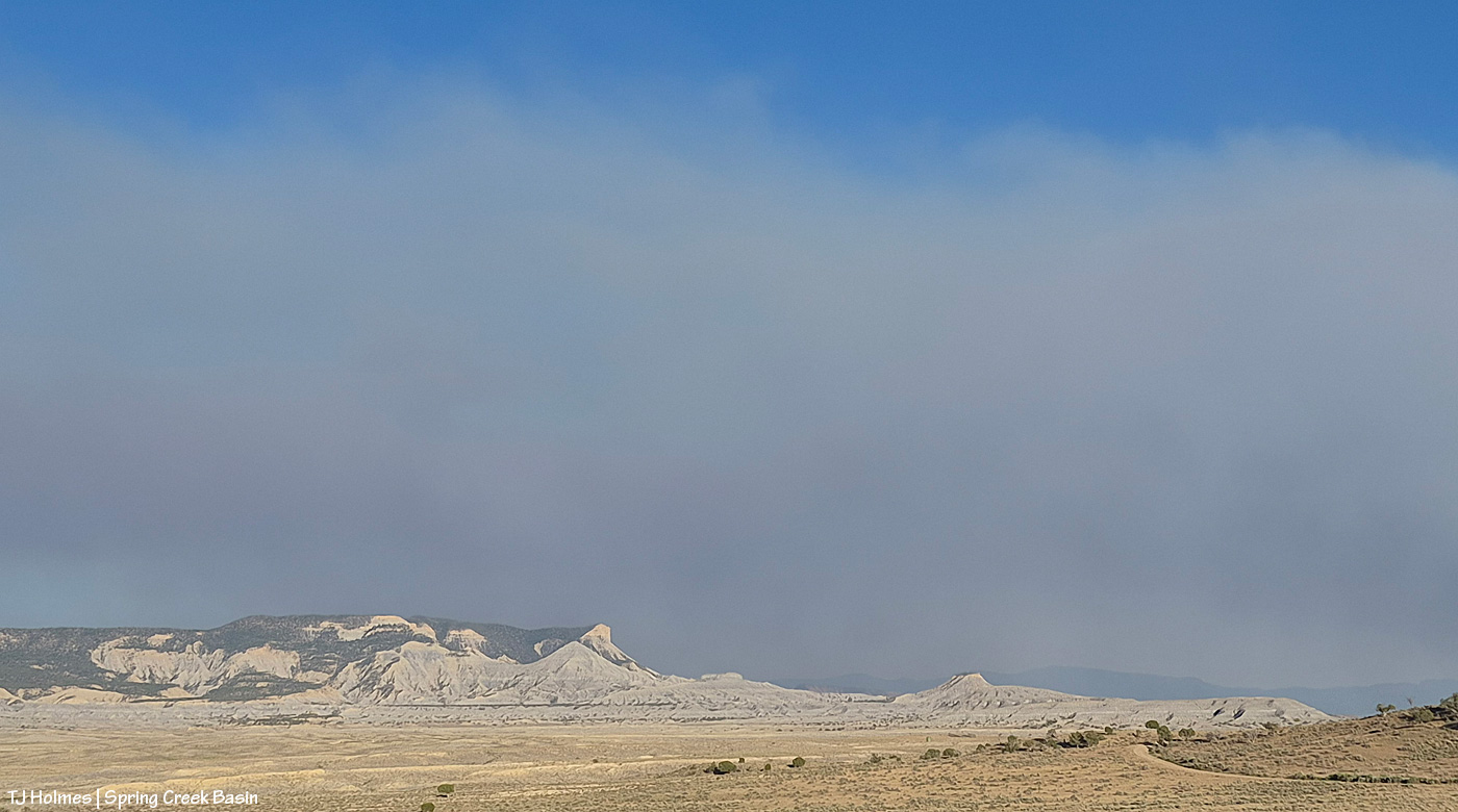
The majority of the smoke seems to be passing east of the eastern side of Spring Creek Basin; McKenna Peak, Temple Butte and Brumley Point are all visible. … The smoke ain’t great up-valley; it smells like you’re in the middle of a campfire (and by the way, campfires and any other kind of fires are strictly verboten (that means forbidden!), not to mention dumb as hell).
What follows is a random selection of cellphone pix from a couple of evenings ago in wild, woolly and very windy Spring Creek Basin.
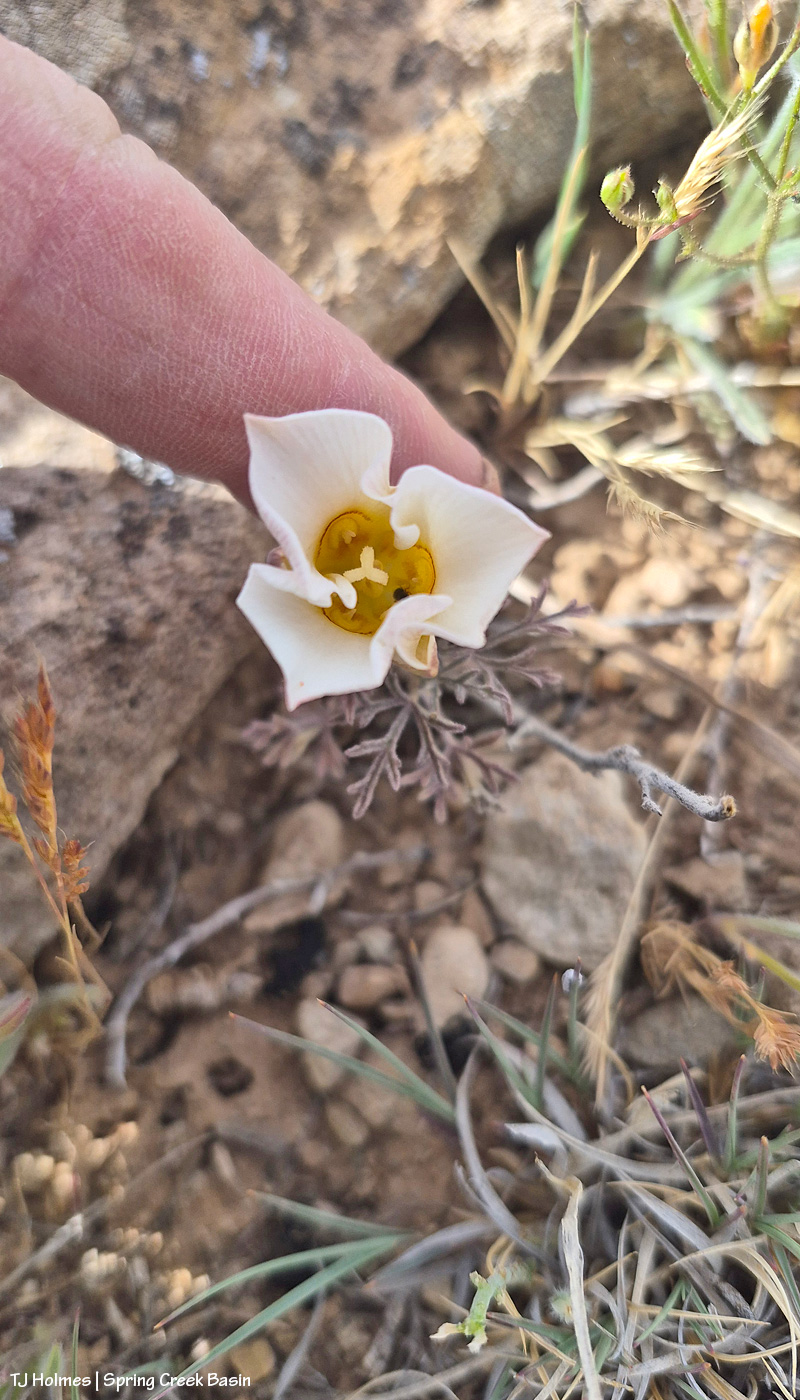
First sego lily of the season! That I’ve seen, anyway. It was SO windy, the flower was whipping around like crazy, so I tried to hold it still for my phone. It’s always a bit of a crap shoot to try to take pix of small things with my phone because I can’t see at all whether the *thing* is in focus or whether it’s the background.
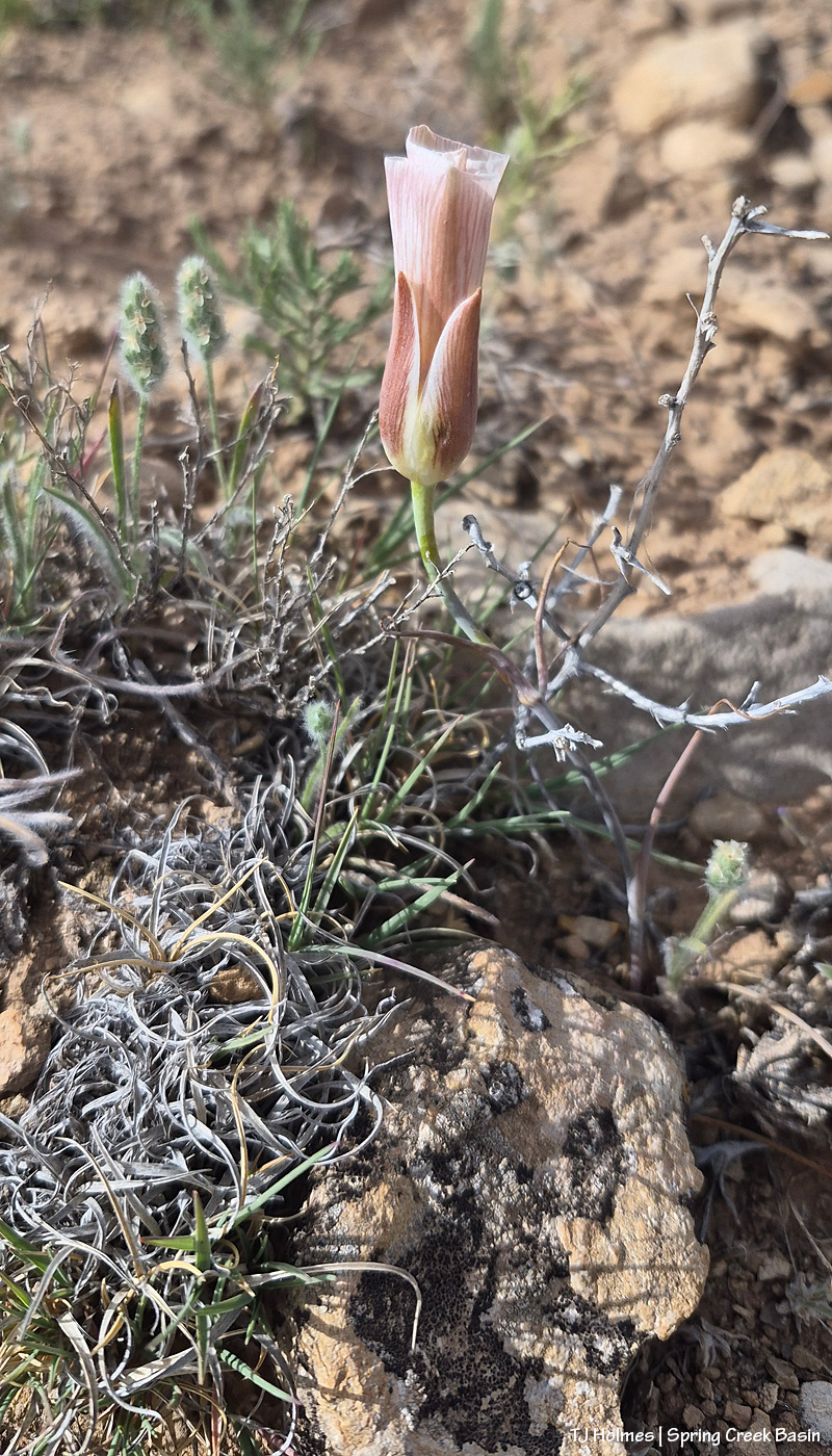
Case in point: I took several pix of this beauty, within a couple of feet of the first one, and only the last one was in focus (that could have been the wind). I adore these lilies – in the desert! These seemed smaller than usual, but I’m glad to see them.
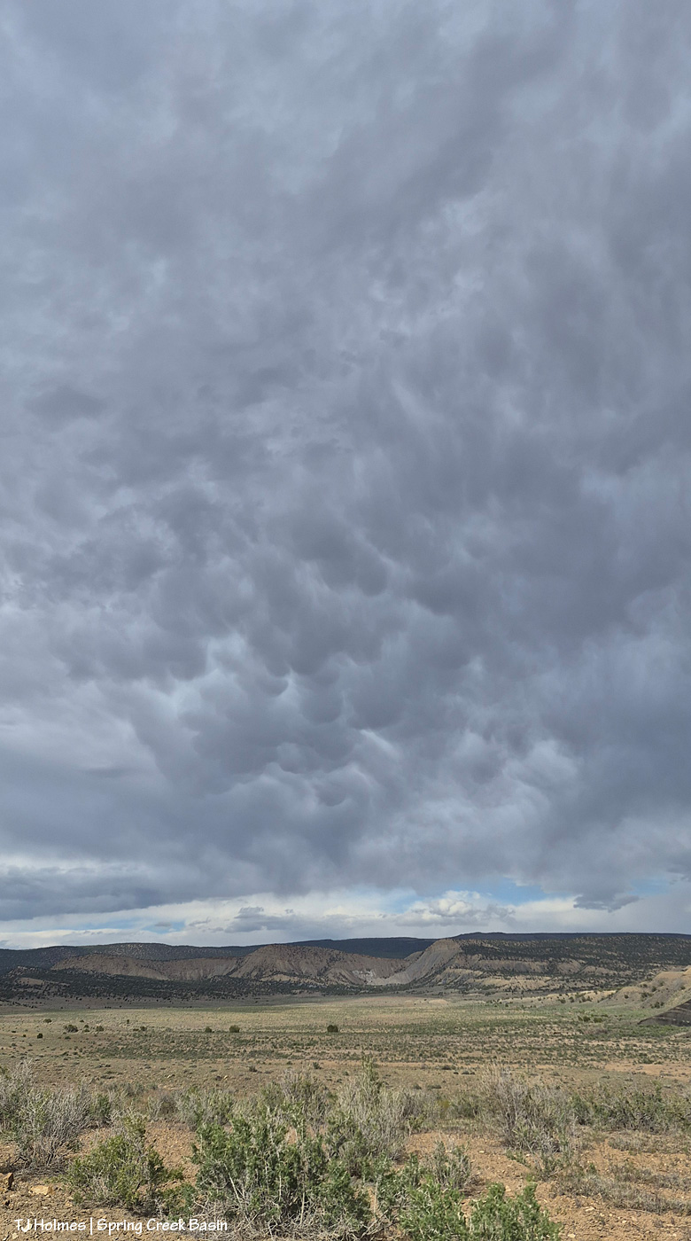
While the pix of the sego lilies seem to suggest that it was sunny, mostly we had these crazy, wildly dramatic clouds looming over the basin. These are mammatus clouds. Looking eastish-northeastish.
Google AI says:
Mammatus clouds are distinct, pouch-like cloud protrusions that hang downward from the base of a larger cloud, usually a towering cumulonimbus. Named after the Latin word for “udder” or “breast”, these stunning formations are fascinating for their unique shape and the rare meteorological process that creates them.
How They Form
Unlike most clouds, which are created by rising air (updrafts), mammatus clouds are formed by sinking air (downdrafts). [1]
The Process: Pockets of cold, dense air saturated with heavy ice crystals and precipitation sink downward from the parent cloud (usually the “anvil” of a thunderstorm).
The Shape: As these dense, cool pockets of air descend into warmer, drier air beneath the cloud, the ice and water begin to evaporate. This evaporation cools the air even more, causing the pockets to sink further, creating the characteristic rounded, bubble-like pouches. [1, 2, 3]
What They Indicate
While their ominous, alien-like appearance might make them look like the beginning of a severe storm or tornado, mammatus clouds are generally a sign that the worst part of the storm has already passed or is off in the distance.
Severe Weather Link: They are most commonly spotted in the vicinity of strong thunderstorms. If you spot them during the summer months, it usually means there are powerful storm cells nearby.
Safe or Not: Mammatus clouds themselves do not produce severe weather and are not dangerous to anyone on the ground. However, pilots are warned to avoid them because the sinking air can cause intense turbulence.
Key Characteristics
Composition: Because they hang high in the atmosphere, they are primarily composed of ice crystals rather than liquid water droplets.
Lifespan: They are relatively short-lived, typically appearing and dissipating within 10 to 30 minutes.
The Best Time to See Them: They are particularly striking at sunset or sunrise, when the low angle of the sun illuminates the underside of the pouches, turning them brilliant shades of gold, orange, pink, or deep blue.
In our case, they appeared around three hours before sunset, so we didn’t get the color, but they’re still pretty amazing to see, even if they also did NOT bring us any rain.
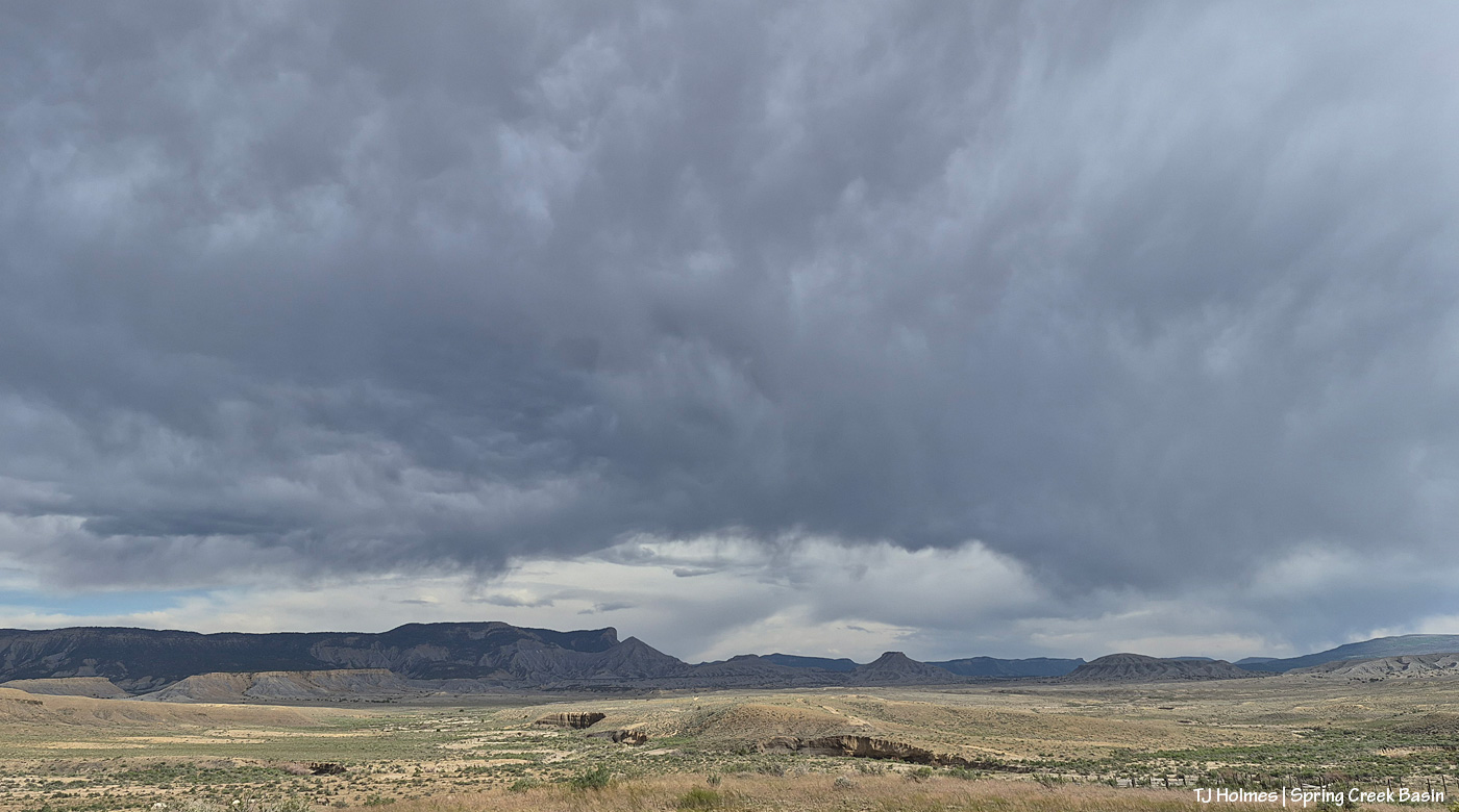
This was taken at about the same time, now looking eastish to southeastish. And quite a bit later, it looked REALLY rainy out beyond our local horizon. So hopefully somebody somewhere got some wet stuff.
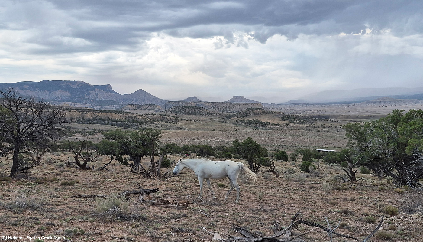
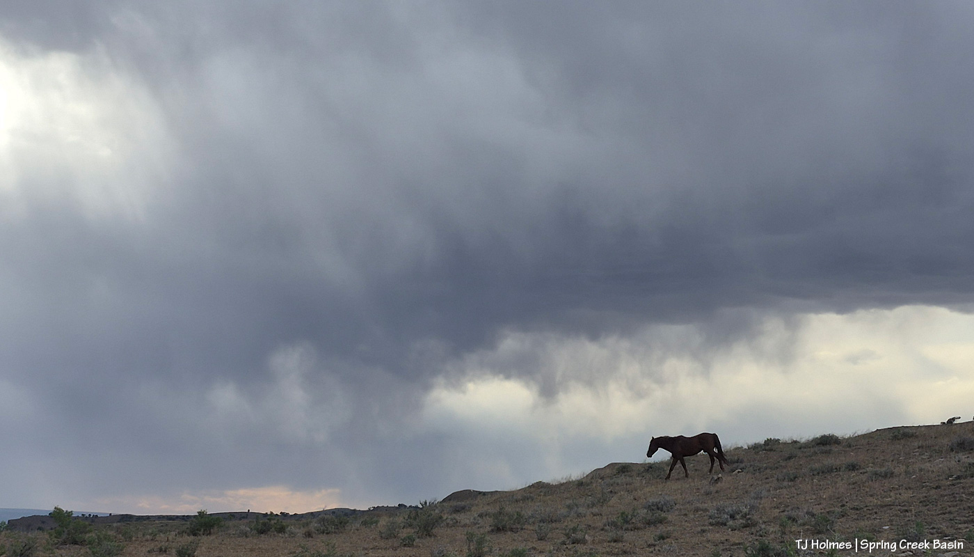
Have to have a pony walking the skyline. 🙂 He was heading to the Spring Creek arroyo (down to the left), and pretty soon, his band followed. Looked like it was raining somewhere out in that direction, too (westish-southwestish).
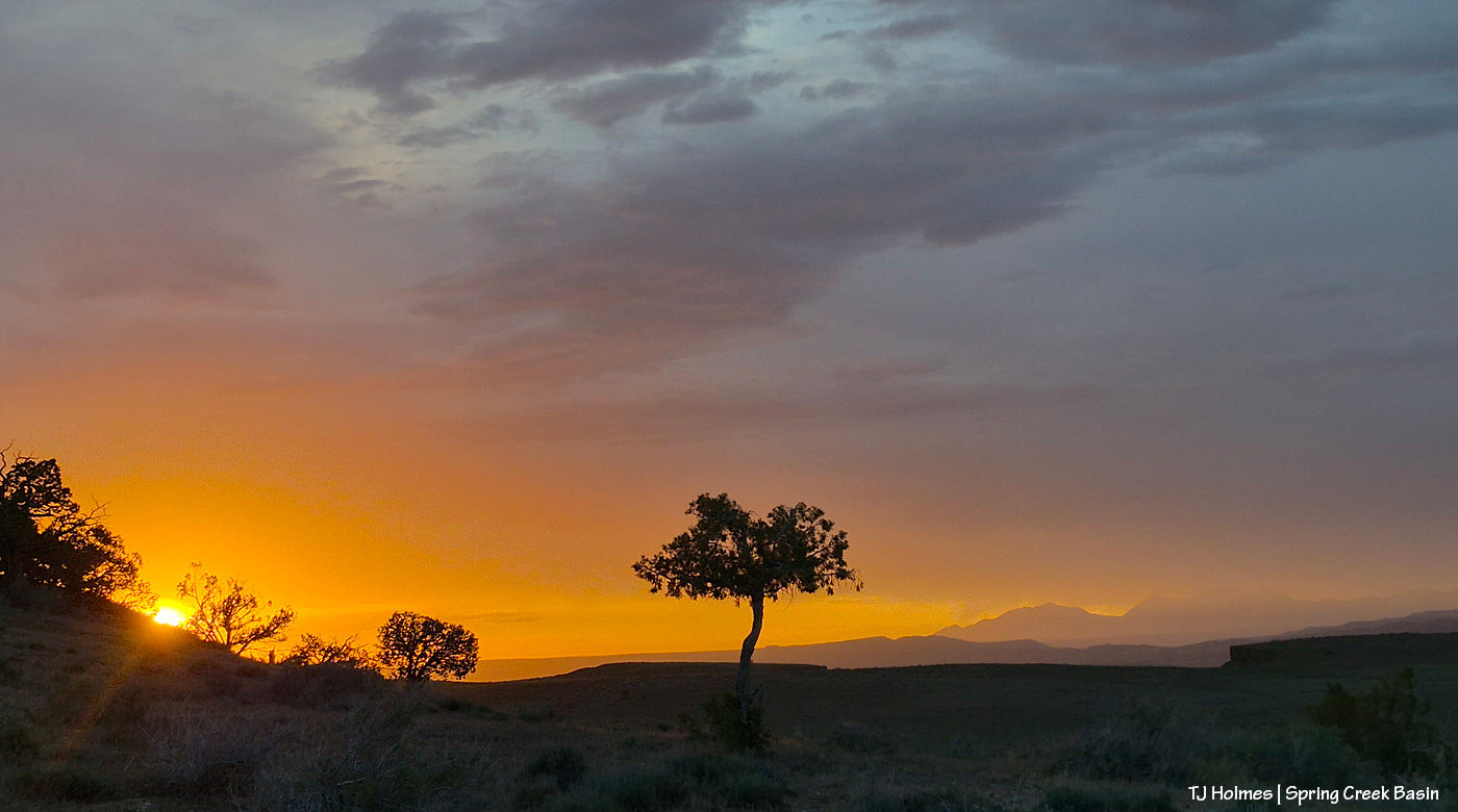
And at the very end of the day (an hour or more later than the last pic), a pretty glorious and somewhat unexpected (and *very* brief) shot of sunset brilliance from the west end of the basin looking westish-northwestish. There were horses immediately behind me, but they were already in the shade of the hill, and that side was already fairly darkrainydusty (? did I mention the howling wind?).
Even under the “worst” conditions, there’s always such beauty. 🙂
Note the slight rainbow at far right, looking pretty much straight southeast up-valley Disappointment. Familiar icons at far left make up Spring Creek Basin’s eastern horizon.
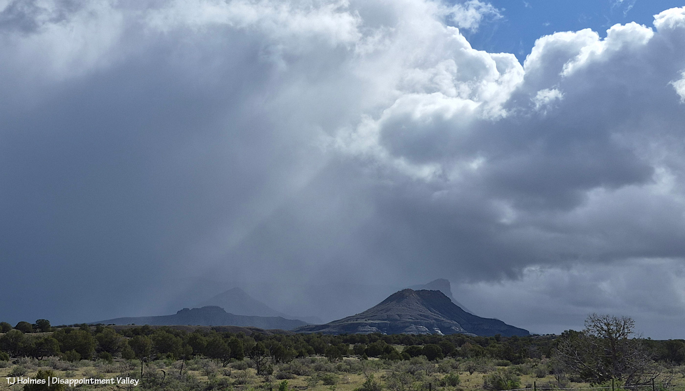
If it looks wet, it was. Give or take (thanks for the *give*, Mz Nature!), Disappointment Valley got half an inch of rain. The great thing was that it kept coming. … The sunshine would break through … then another wave of rain would pass through … then the sunshine would break through … then another wave would pass through.
Tuesday was a wild and crazy day … and that was just the weather. It was ultimately a successful day, though at least one part left me shaking my head at, well, how life unfolds. And it was a reminder that sometimes the smallest things, and the simplest things, are the most enjoyable of all.
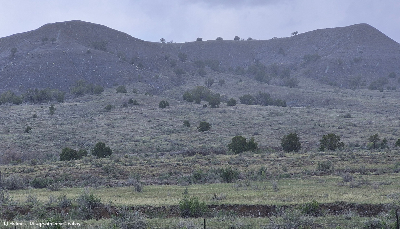
From yesterday’s post, are you wondering what graupel looks like? (Thanks, Valerie, for your comment that led to this post!)
What? I hear you asking. That looks like snow or rain, you’re saying (zoom in to see the streaks). Look on the ground in the lower right corner. I was backed in under a (dead) tree to sit out one wave of it (it wasn’t very hard, and it didn’t last long) at that little side “road” to Disappointment Road, which is across the whole pic. See the little white “balls”?
AI says this: “Graupel, or soft hail, forms when supercooled water droplets freeze onto falling snowflakes, creating soft, small white pellets (2-5 mm) that resemble Dippin’ Dots or Styrofoam. These fragile, slushy particles are often called snow pellets and, unlike hard hail, crumble easily. They occur during wintry mix scenarios, causing sudden, slick conditions, and are identified in aviation reports as ‘GS’.”
I liked this part: Types of Graupel While commonly called graupel, it is sometimes referred to as:
Matsaaruti: A term used in the Nunavik region of Canada to describe wet, soft snow pellets.
Another pic from the same location as the first pic, looking pretty much straight north at what I call west-of-favorite hill (because it’s, you know, west of what I call favorite hill, which I so-named because once upon a very long time ago, “the pintos” really favored that hill and could very often be found atop it).
Also from the same spot, looking eastish again as the graupel wave recedes, driven by a strong out-of-the-south wind (I lost track, but at least three, maybe four went over us Tuesday morning). You can see Brumley Point very distinctly, submarine ridge and McKenna Peak to the left it it, and you can’t quite make out Temple Butte. If you slide back up to the first pic, Temple Butte is juuuuuust barely visible at far left, just under the power lines. And yes, the sunshine IS coming back out over the rest of us while the wave pushes north to the east.
With Artemis II and its remarkable human beings on board, their mission, their accomplishments, the images they sent back, from space looking home, in mind … and realizing the absolute tiny-ness of this one itty-bitty part of our great, wide, wild, wonderful, big blue marble … ain’t Earth gorgeous? Now you can see Temple Butte’s promontory emerging from behind Brumley Point (see the graupel/moisture evidence shining below its rimrocks?) and submarine ridge and McKenna Peak. And though you can’t see them in this pic, there were two groups of mustangs out there. Across the road and on the other side of that fence IS Spring Creek Basin.
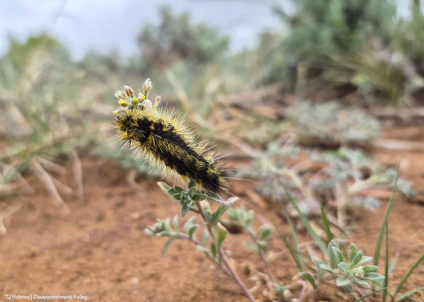
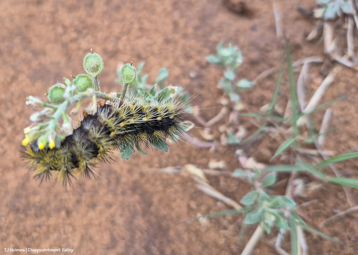
Anybody know what this prickly little caterpillar is called? I’m not sure of the plant it’s on, either.
I tried a lot, but I could NOT get the eye end (far left – is that an eye?) in focus. Of course, I didn’t know that in the field, not having my eyeball glasses on and looking through the glare of my phone screen, but I did try a number of shots with high hopes. One of our BLM range guys recently posted a pic of the same caterpillar, but he’s a plant guy (and an extraordinarily awesome one), not a bug guy, so I’m sure he can tell me the plant, if not the bug (!). If I reach him for an ID before this posts (or even after), I’ll update.
** Update from Ryan, BLM rangeland management specialist and all-around plant guy!:
“Cool that you’re seeing the same caterpillar! [He saw the same kind recently in Canyons of the Ancients National Monument, southwest of Spring Creek Basin.] I’m very curious as to what species of butterfly/moth they will turn into, I’m not good at insect ID but will ask Nate West [BLM wildlife biologist]. The plant that those are on is a mustard species called Alyssum simplex, commonly just called madwort. It’s a pretty prevalent non-native annual that is really common around here, unfortunately. It’s a beautiful picture of the hair-structure on the caterpillar!” Thanks, Ryan!
The reason you can’t see Utah’s La Sal Mountains in this pic – way northwest of Spring Creek Basin, from the very far southeastern part of Spring Creek Basin – is because the rain/graupel/snow wasn’t through sending waves over them. 🙂 You CAN see, from right to left, Round Top, Flat Top (looks sloping), Filly Peak and the south-facing rimrocks. Disappointment Road is over to the left somewhere (not far)
From here, we’re looking over not much of the southern part of Spring Creek Basin Herd Management Area (the pic above this one has a perspective to the right of this one) but a lot of the south/southwestern part of Disappointment Valley (most but not all of the pinon-juniper woodlands as far as the eye can see). The near pinon-juniper is within Spring Creek Basin.
From the same spot now looking back to the south/southeast at another little rain/snow/graupel-fall, toward the Glade and Benchmark Lookout (hi, Rick and Linda! (I think they’re not at the fire lookout tower quite yet)). The near hills and pinon-juniper are all within Spring Creek Basin. The far, thickly treed ridges are partly (middle-ish ground) part of upper Disappointment Valley and partly (farther) part of San Juan National Forest lands beyond Disappointment Valley and its watershed.
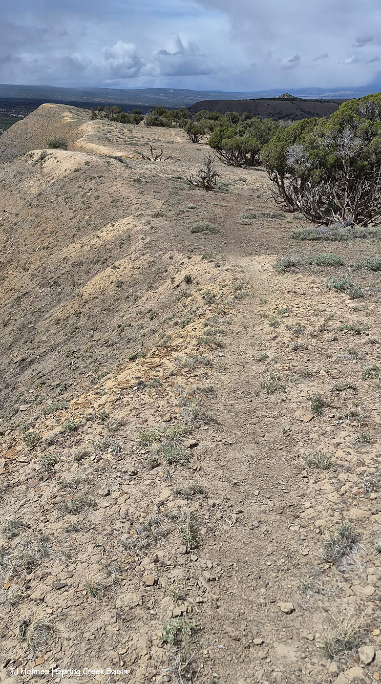
And what the heck was I doing at the high end of a long drop? See the horse trail? 🙂 I was following where the sure-footed have gone before me (and not for the first time).
The above are in order of how I took them … hours apart from first to last.
And because you came here for the mustangs …
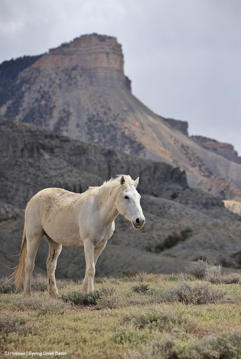
Mysterium, modeling her scruffy-chic look (fashion designers, take note – ha!) below Temple Butte. 🙂 Yes, those are a couple of cuts on the inside of her left hind leg, but she’ll heal quickly, as mustangs do!
Thanks, as always, for coming along for glimpses of this special world. 🙂


 2-
2- 5
5 mm) that resemble Dippin’ Dots or Styrofoam. These fragile, slushy particles are often called snow pellets and, unlike hard hail, crumble easily. They occur during wintry mix scenarios, causing sudden, slick conditions, and are identified in aviation reports as ‘GS’.”