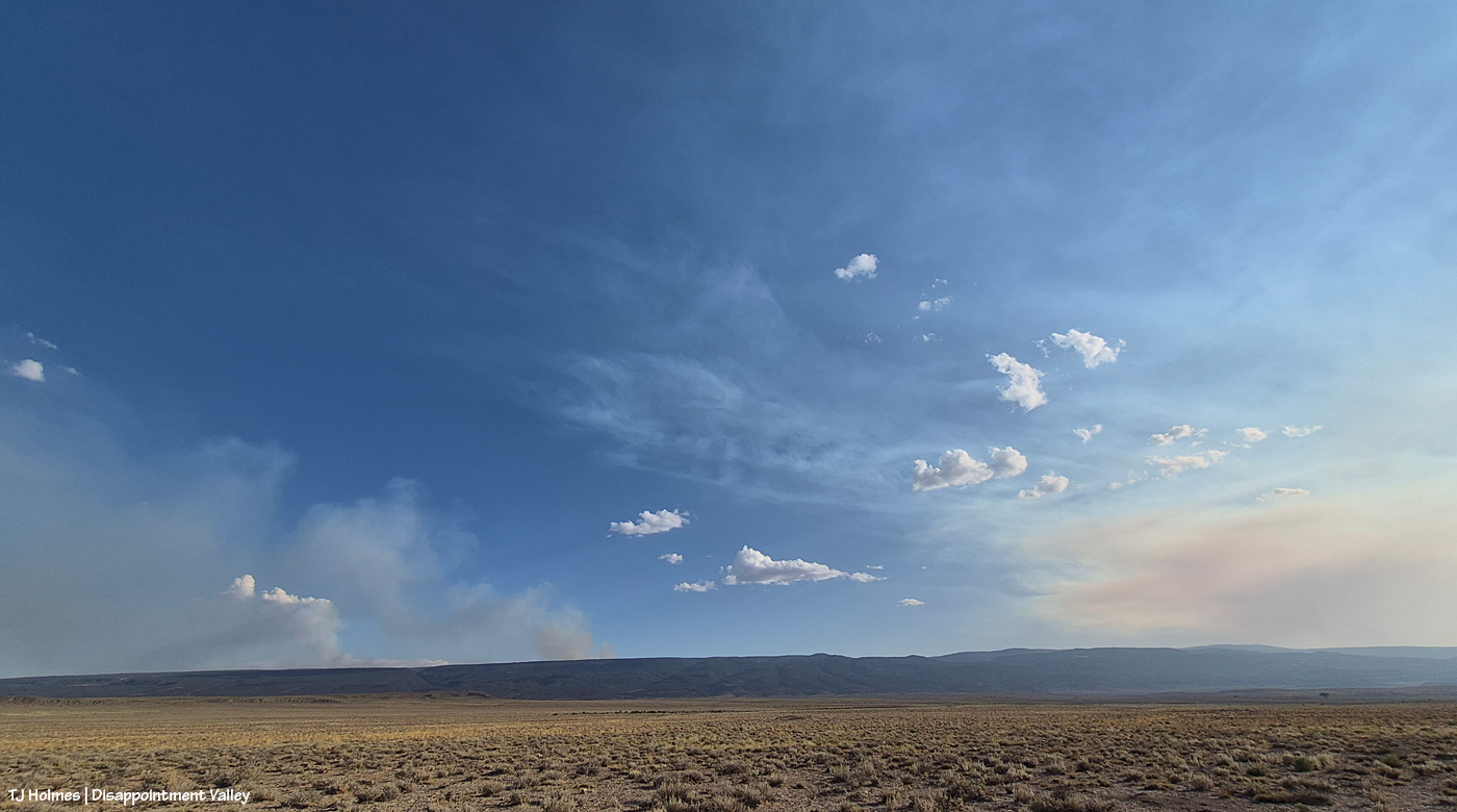
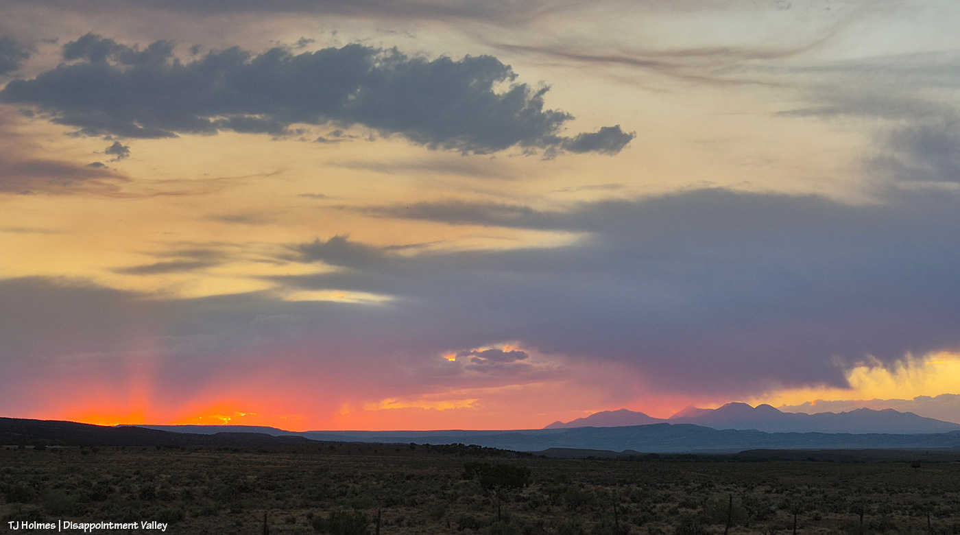
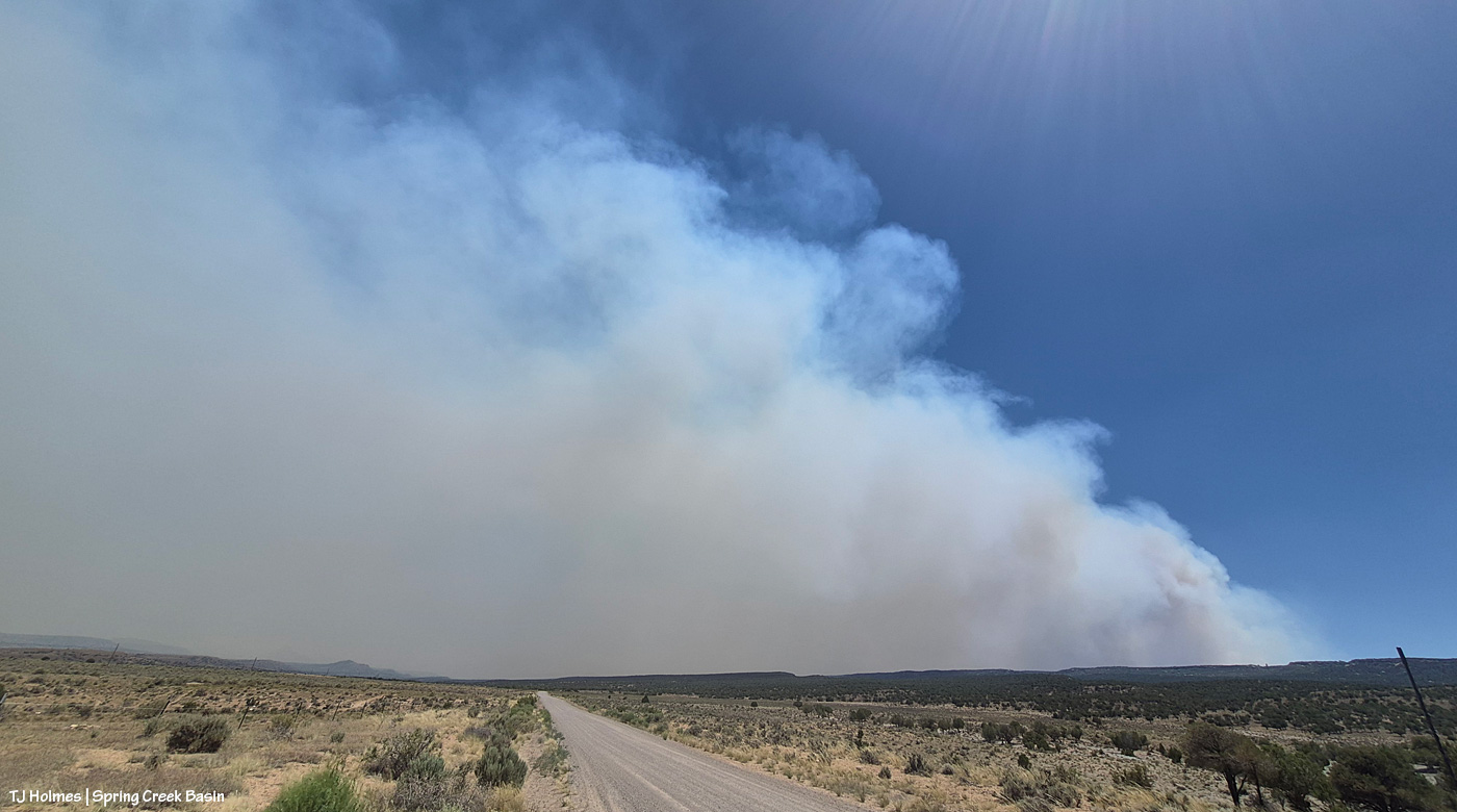
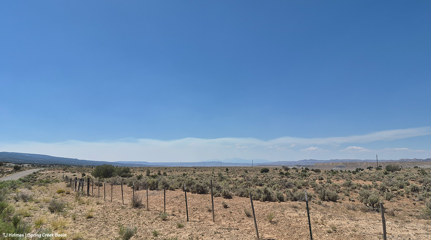
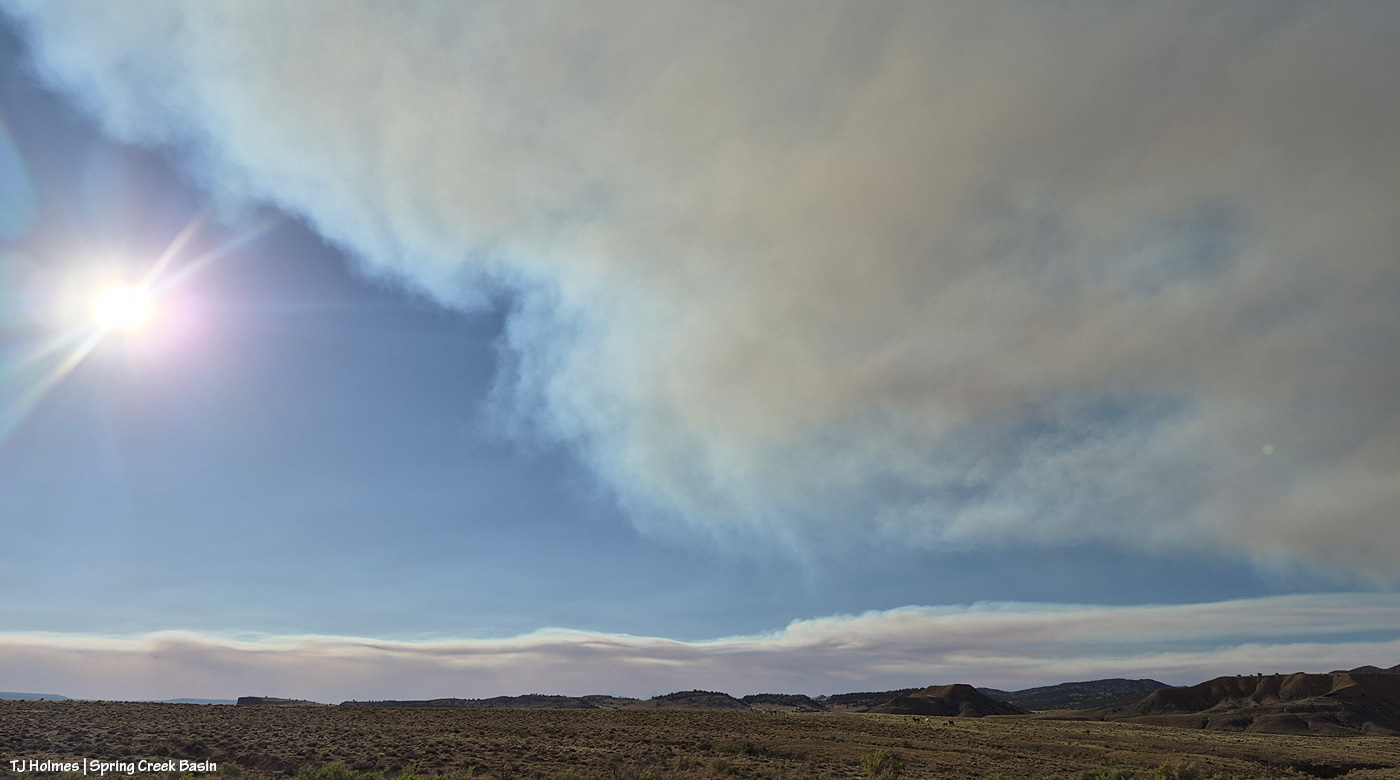
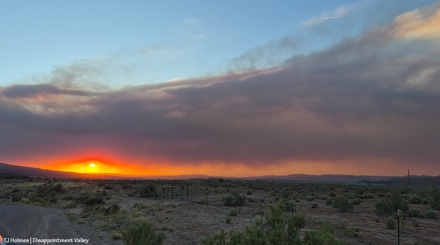
After some reports from different sources of tiny bits of rain here and there (Tuesday day/night, maybe some drips Wednesday), the sky was much more our normal and beloved Colorado-blue than we’ve seen in a run of smoky days. Ferris Fire (60,104 acres as of Wednesday night) smoke at left; Babylon Fire (101,073 acres) smoke at right. Looking mostly south.
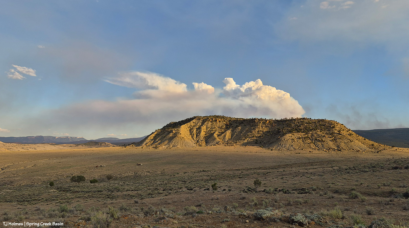
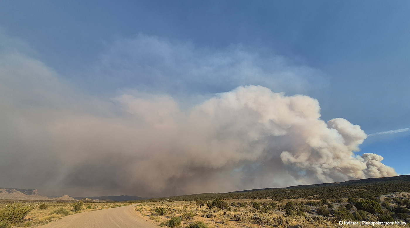
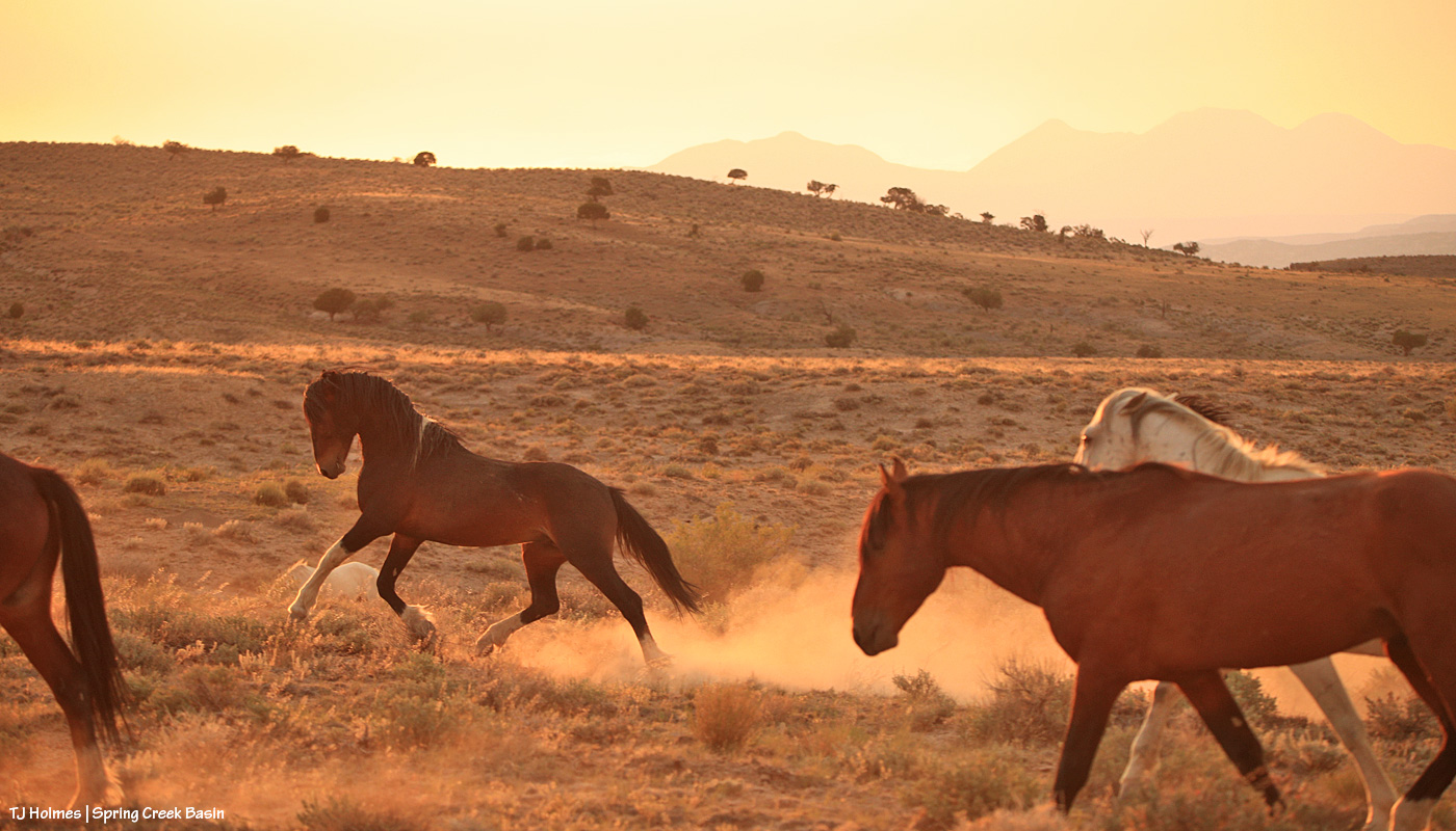
The fire must have gotten into some new, untouched fuels by evening because by 7 p.m. or later, it was really sending up a plume. That’s Filly Peak in the near background, and you can see a bit how perspective matters: Not only is the fire not directly behind it, it’s not *super* closely behind/south of Disappointment Valley’s south ridges. (I did still see a little line of smoke in the Ryman Creek area a bit later.) Mustang ponies in the middle ground, napping.
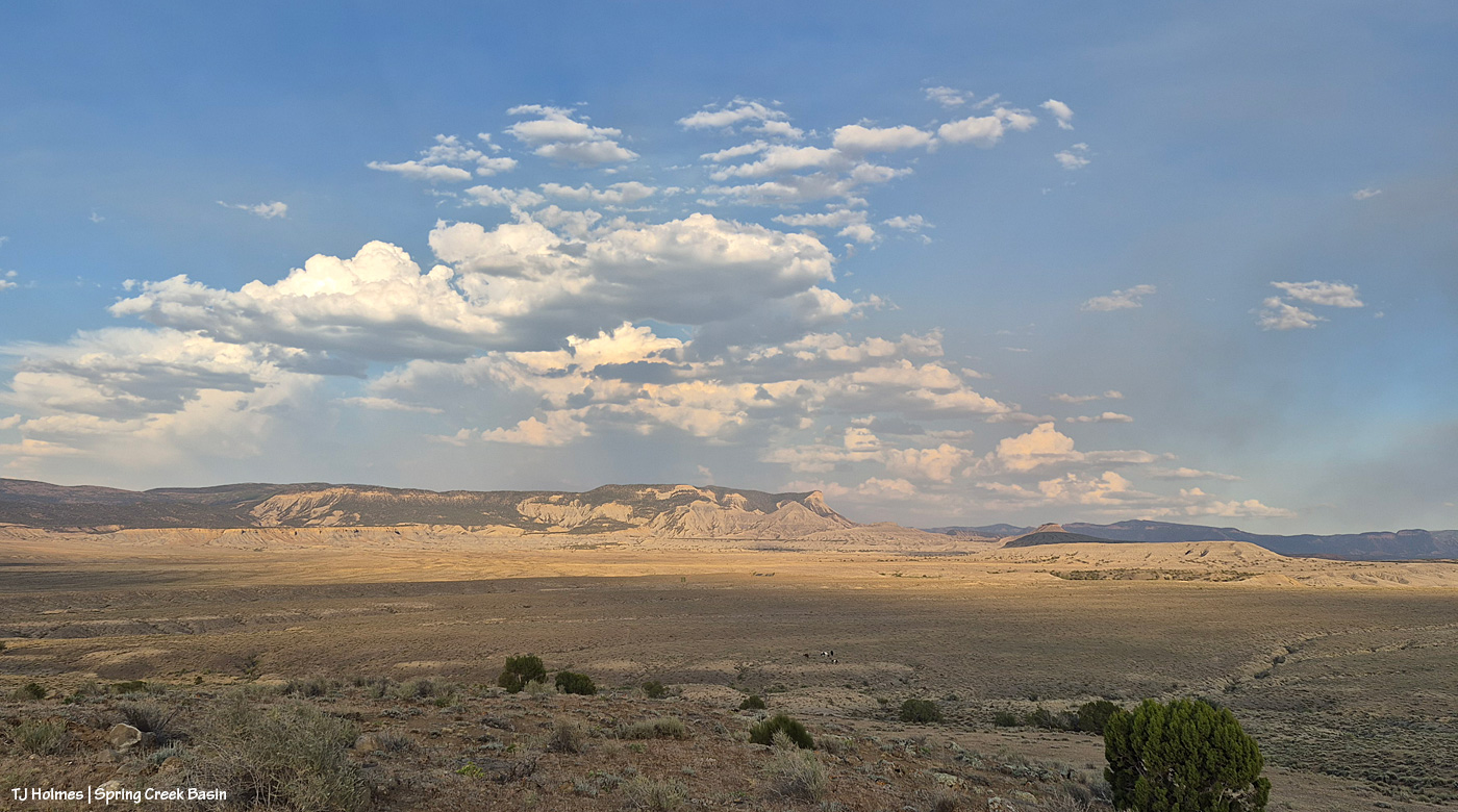
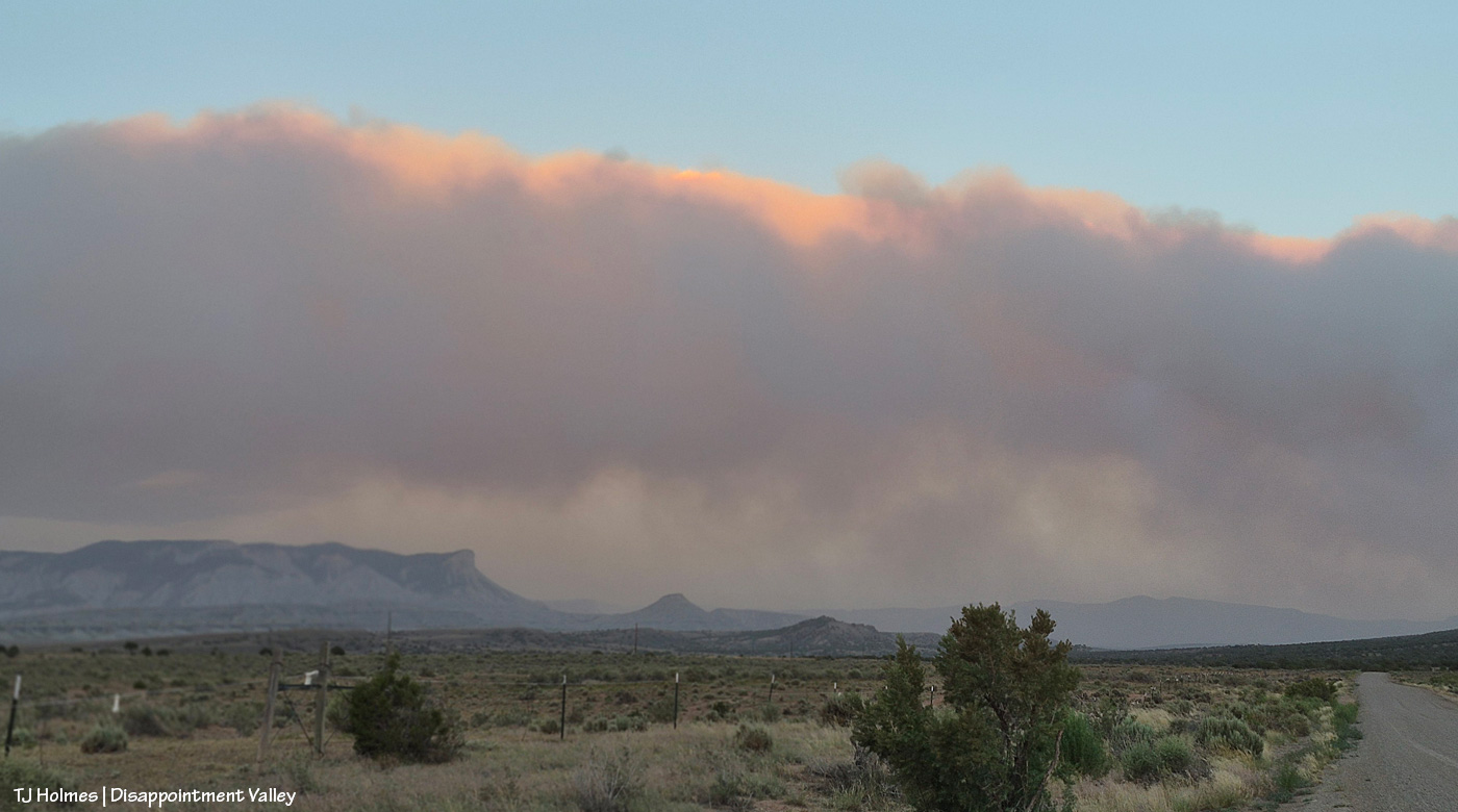
This and the above pic toward Filly Peak were taken from the same vantage point: Chrome’s Point in Spring Creek Basin’s far western region (not far from the rimrocked western boundary). This one is looking slightly leftish of Filly Peak and southeast/east. The smoke is fairly faint … a MUCH better sight than we’ve had the last many days.
Those are more clouds than smokedrift, though, of course, there’s still smoke there from Utah’s huge Babylon Fire, now more than 101,000 acres. … Mother Nature is trying to stir up the clouds into delivering rain.
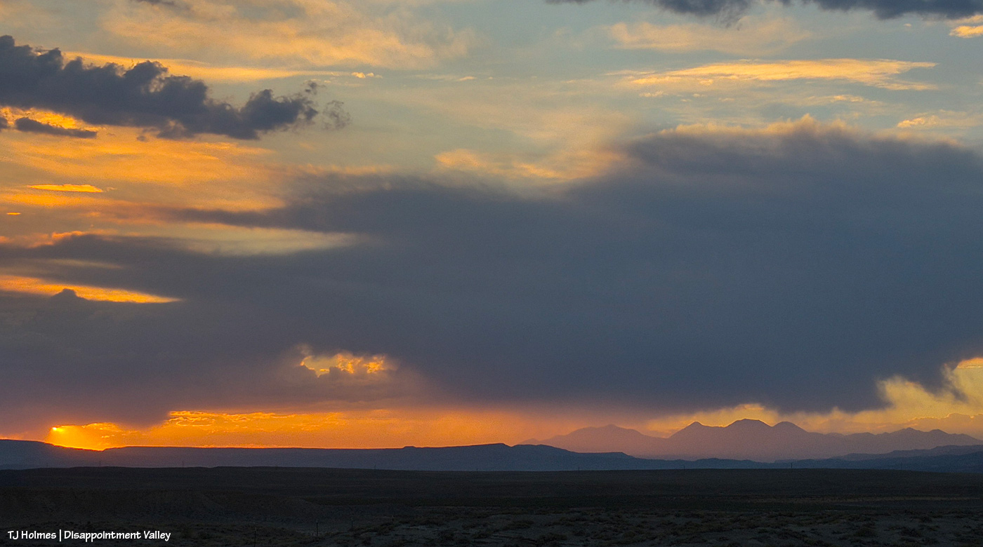
See the pillars of sunset glow at left? I love it when the sun waves goodnight to us like that.
A couple of links to articles I’ve found interesting recently:
“Monsoon rains are on the horizon,” say the weather wizards, err, experts. We can only hope they’re finally going to be proved right. Some super heat is on tap first.
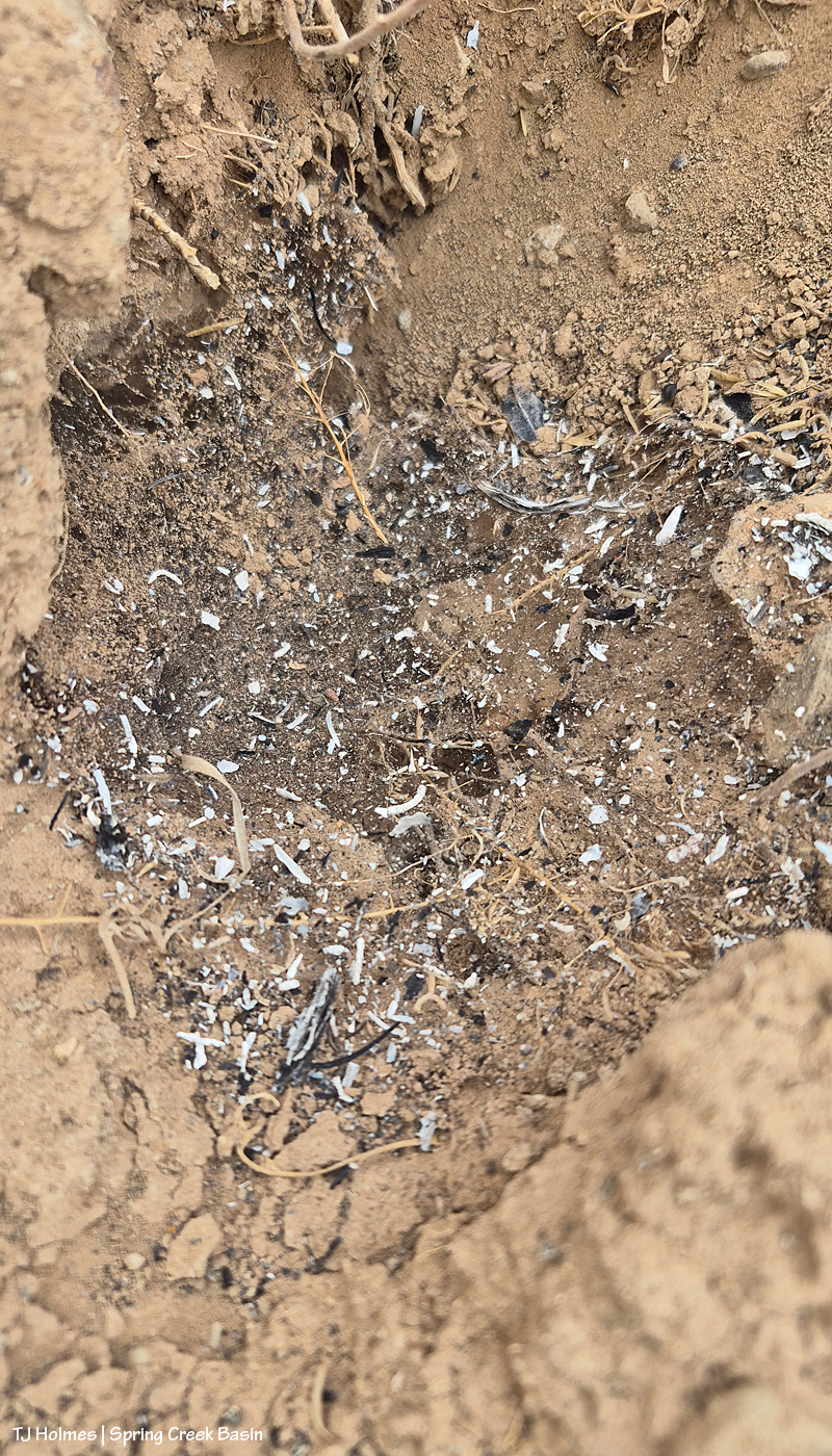
Probably, it’s hard to tell what you’re looking at here: It’s ash on cobweb over an old critter hole.
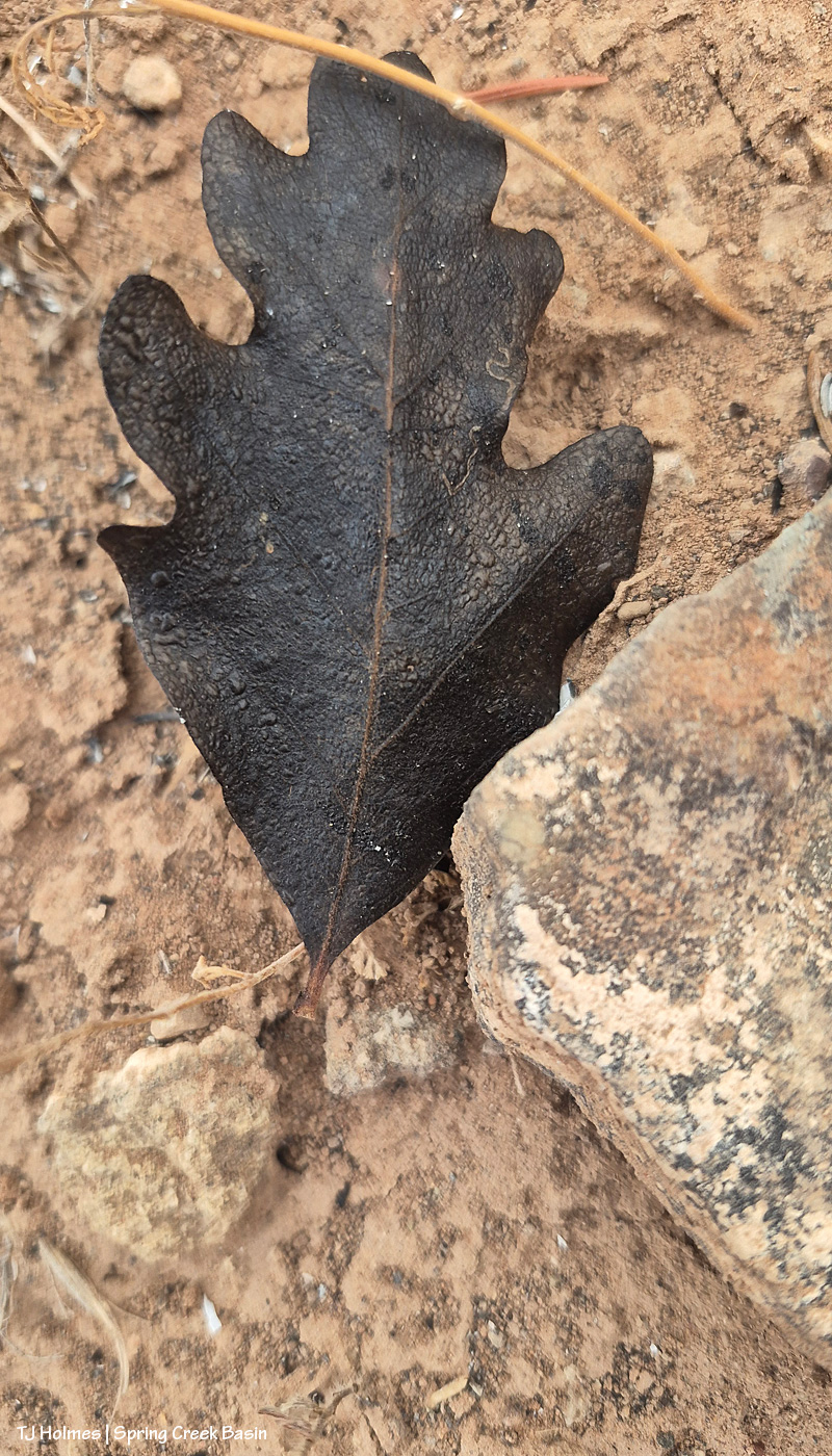
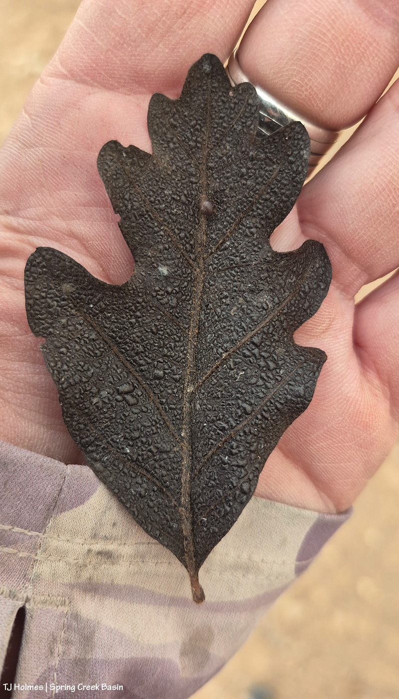
This one is more recognizable: That’s a Gambel or scrub oak leaf (or if some other kind of oak, please let me know). Burned. From the Ferris Fire (I know this because 1) we don’t have scrub oak in Spring Creek Basin (maaaaaaybe in the most upper elevation reaches), and 2) there’s no fire in Spring Creek Basin).
I’m not sure how far south the fire is, as the eagle flies or the oak leaf flutters, from even the southwestern edge of Spring Creek Basin, and I found both of the above things in the sort of almost-northish region of the basin. Kinda wild.
Mariah was not super interested in modeling in the smoke. Can’t blame her.
All above pix taken Monday evening. As of Tuesday morning, the fire was at almost 57,000 acres and still 22% contained.
The little things ARE the big things for us who love them all. Continued prayers and gratitude to all firefighters working on this fire (and all others) in all capacities.
Smoke? Yes, we still have it, sometimes worse than others. Ash? We’ve been getting that, too. On my hikes in Spring Creek Basin, I’ve been seeing these weird black things, and when I reach down to touch them or pick them up – almost thinking it’s a rock or some kind of leaf? – they disintegrate in my fingers. But I haven’t been ready to call those bits of ash – they’ve been maybe about the size of a fingertip? Not large, not tiny. But today, no mistaking it, though it’s much finer and mostly white/grey. Hard to get a pic that shows it.
This is ash on water. Not sure it shows well?
From Watch Duty’s report Sunday night:
“Containment on the Ferris Fire has increased to 21% at 47,780 acres.
“Firefighters continued suppression efforts along all areas of the fire Sunday including significant firing operations in a finger canyon along the western edge of the Dolores River Canyon west of Five Pines Canyon.
“Crews strategically applied fire to widen and improve dozer lines and remove fuel in front of the advancing fire and reduce the potential for even more acres of uncontrolled fire impacting private and public lands.”
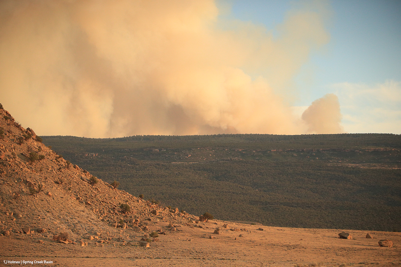
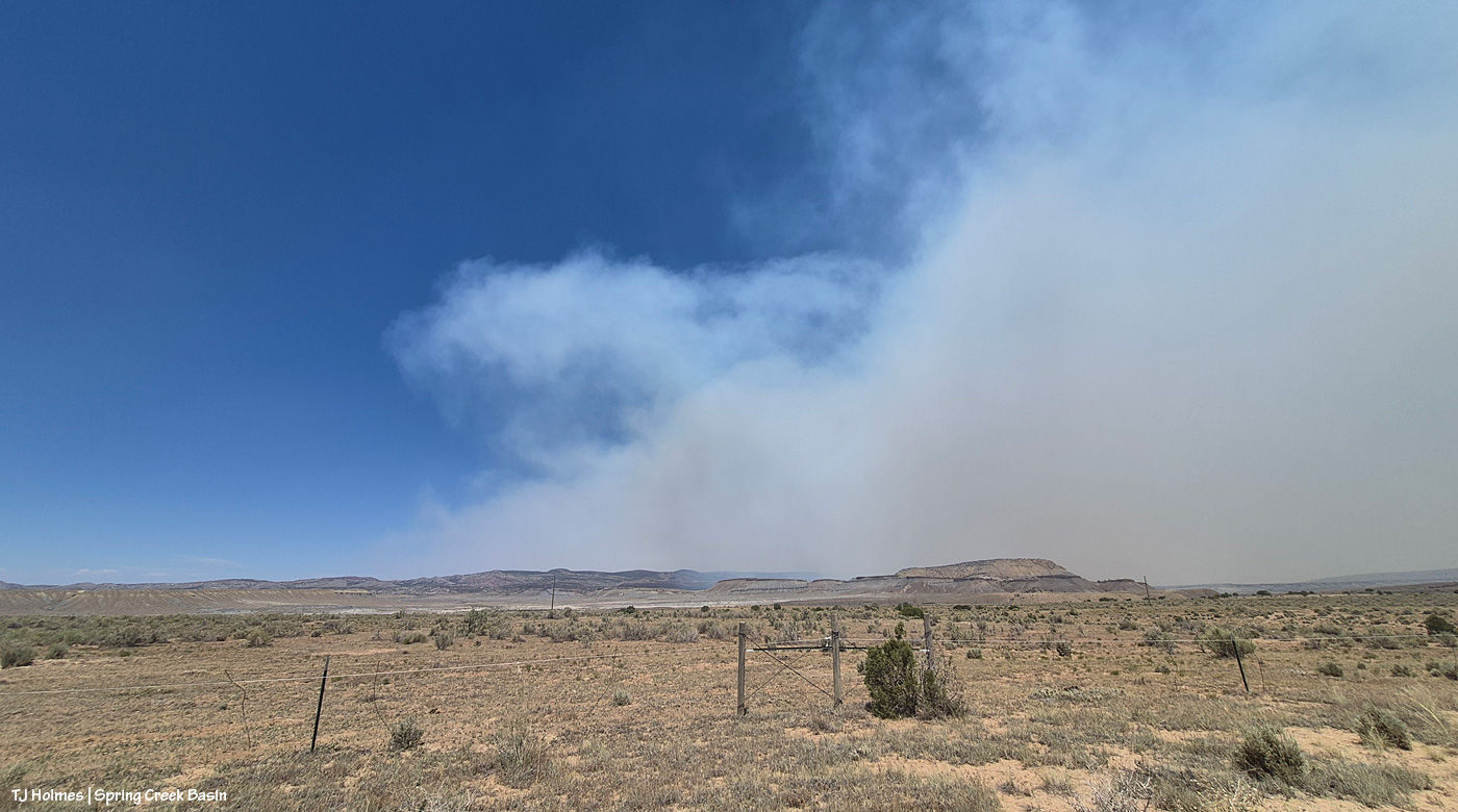
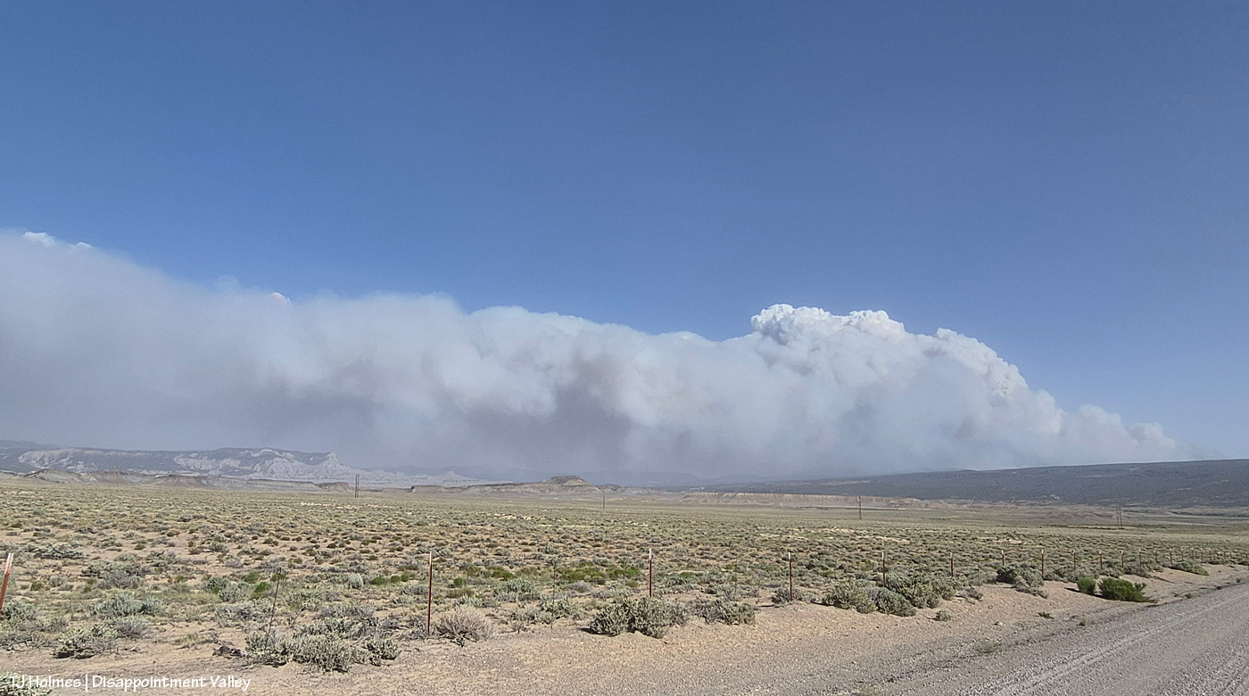
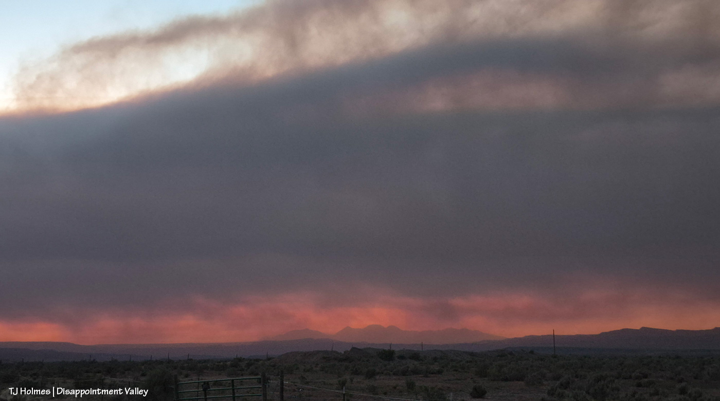
Smoke from the western/southwestern side of the Ferris Fire is at far lower right on the southern horizon of Disappointment Valley, blowing north/northeastish across the southeastern horizon. You can see part of McKenna Peak and Temple Butte at far lower left. The smoke low and to the right, that starts to obscure the farthest lower hills/ridges in the background is from the fire’s northeastern push into Ryman Creek drainage (that area) south of upper Disappointment Valley.
The smoke was not fun this morning and into the afternoon (hello, the ash). Fortunately, it lifted in the lower-mid part of the valley by the time I took the above pic, probably around 7:30 or 8 p.m.
These pix were taken the evening of Friday, July 3:
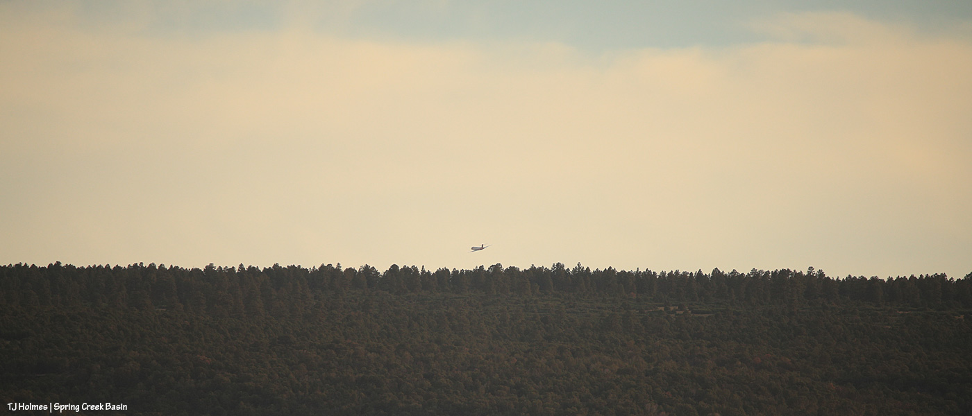
I wasn’t going to go to Spring Creek Basin on Friday. Just watching the smoke from a relatively safe vantage, I *cannot* even begin to fathom the strength and accompanying exhaustion of the firefighters, the law-enforcement rangers, officers, deputies, residents evacuating the Ferris Fire (and others around the region; we’re all in our own communities of what-ifs and fears and plannings). Then, in the evening, the smoke did one of those giant plumes on the west/southwestern side (where it crossed the Dolores River), and my journalist brain kicked in (journalist brain = aka nosy-nellie = aka curiosity-never-hurt-anybody, eh?), and out I went. Above: From Chrome’s Point at the western side of Spring Creek Basin, looking nearly straight south, see the plane above the treed ridge (that’s the south ridgeline of Disappointment Valley at the lower-ish southwestish end/side of the valley)? I regularly use Chrome’s Point to glass a big swath of the big basin that IS Spring Creek Basin, and from there, I heard the drone of a big plane (air tanker), and to my surprise, I actually saw it. It was much higher when I first spotted it, flying from right (west) to left (east) … then it banked to go south, and as you see it above, it’s turning east/southeast again and just about to drop out of sight. Again, there’s a fair (!) amount of distance between the fire and the basin, so there was no way I’d see it drop its load of retardant slurry … but I’m sure you can find impressive videos online of those pilots doing that amazing work.
This was as backed out as my big lens could go to give you a view – and context – of the western end of Filly Peak at left, the straight-south, far southern ridge(s) of Disappointment Valley and Friday evening’s blowup of the west/southwest side of the Ferris Fire, burning south of Disappointment and Spring Creek Basin in northern Montezuma County (where it started) and right up the westish-middle of Dolores County. San Miguel County is the next county north, and that’s where this part (and most of) Spring Creek Basin is located. … Interestingly, though I thought I hadn’t caught the plane in this image, when I was way zoomed in on the computer to clone out (dratted) dust spots, I’m pretty sure I actually spotted it, juuuuuust above the tree line at far right. Again, the pix above are from Friday evening.
This is a very wide-angle phone shot from Disappointment Road looking south/southeast/eastish, earlier in the evening than I took the pix above from inside the basin. The familiar landmarks of Brumley Point, Temple Butte and McKenna Peak are at far left. That is really not something you want to see – that kind of super-active fire activity! – but flames on the hillside south of your home has to be about a billion times worse (see below).
The Ferris Fire now is up to 41,337 acres, and containment has dropped to 7 percent as the fire has grown (as of Saturday night). A staggering “500 personnel are now working the fire. A Complex Incident Management Team has been ordered to provide additional management and logistical support.” That information is from a 7:30 p.m. July 4 report on Watch Duty (if you live in the West, or know people who do, for goodness sake, download it to your phone if you can; it’s massively informative, and the network they have to report on so many fires is nothing short of amazing).
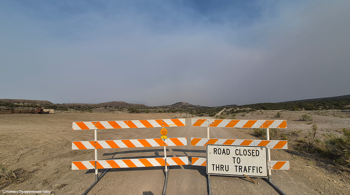
As of Saturday, July 4 (hope you all celebrated Independence Day safely!), maybe Friday (?), Disappointment Road is closed to through traffic. From the west, heading up-valley-southeast, the closure is at the old Perkins corrals; coming down-valley, northwest from the Dolores-Norwood Road, the closure is just above/southeast of Ryman Creek Road. Ryman Creek and Black Snag roads already are closed. In its run north, the fire bypassed Benchmark Lookout (thankfully being aggressively protected by firefighters; if you’re on Instagram, follow @benchmark_rick; Rick and his wife, Linda, staff the tower during fire season … it’s so crazy that they’re not actually there during this fire, but thank goodness they’re safe! they’re helping with supplies at the Salter Y Spike Camp) and started down/north toward Disappointment Valley on Friday night. Up-valley neighbors watched actual flames, as did (at least) San Miguel County deputies, who were stationed up there until around midnight. Smoke is bad enough … seeing flames on the hillside south of your home … I can’t imagine. 😦
Today’s big shoutout goes to San Miguel County Undersheriff Nick Xavier, who, along with deputies Todd Rector, Derek Kibel and Jeremy Platt, and Dolores County deputy Branson Smith, has been keeping me updated about the fire in this neck of the Disappointment Valley piñon-juniper woods. Along with above-and-beyond information-sharing by my BLM range guy Ryan Schroeder (Anton Rambur and Laura Heaton are on the fire), my gratitude is high to all of these folks for keeping calm and keeping eyes and ears on the situation.
From Undersheriff Xavier’s mention of pix he saw, three links to – get this – images of the Ferris Fire with the aurora above flames:
Did I see the northern lights? No, no, I did not. Once again, I slept right through the show. One of these days (err, nights …) … !
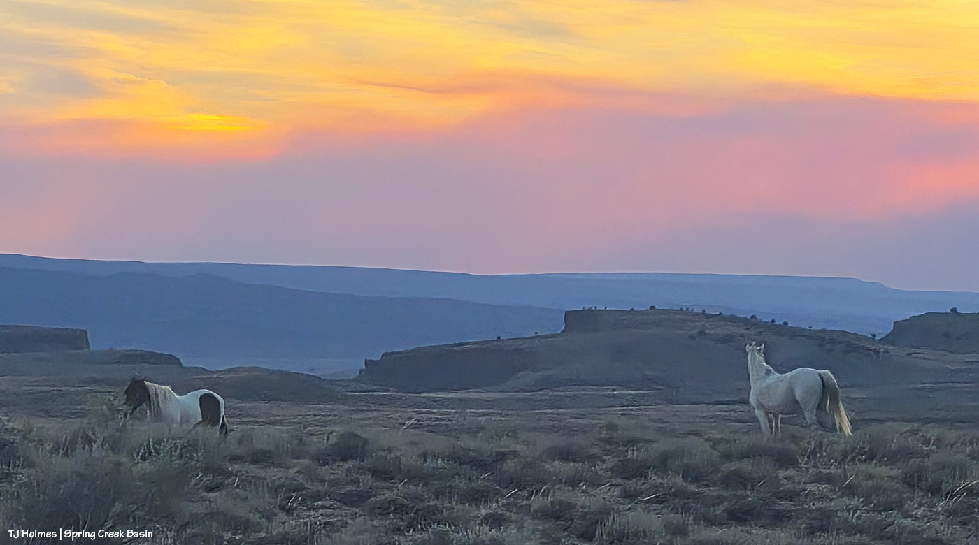
And your pony pic from Friday night:
Maiku kicking up dust (we don’t need any more smoke OR dust!) while smoke from the Ferris Fire (coming from the south/left) and Babylon Fire (across our whole western horizon) casts a golden glow over our ponies that isn’t nearly as lovely as simple golden sunset light.
It should go without saying: Every day, the fire – and the smoke – is different. The Ferris Fire is up to 28,801 acres and 10 percent contained. As Watch Duty says, “That still leaves a lot of uncontained perimeter, but fire crews are still on the line this hour [6:42 p.m.] working to increase that number and there will be personnel working overnight again tonight [Thursday, July 2].”
Yesterday morning, Disappointment Valley was pretty socked in with dense smoke again, but it cleared faster than the day before (which is still relative, as smoke still lingered closer to the ground into early afternoon). Fortunately, it’s lifting by late afternoon and evening.
Yesterday afternoon, it became, as noted, a tale of two skies: smoke across the entire east, from south to north from the Ferris Fire; low smoke across the western horizon from the Babylon Fire in southeastern Utah (81,494 acres!) and clear blue sky above, south/southwest across the west to the north.
These next three pix are the Ferris Fire smoke:
That’s the southern – probably southwestern – edge of the Ferris fire, south of Disappointment Valley (more the upper valley than the lower valley, which is behind me). The smoke is drifting to the left, which is north.
Looking southeast/eastish straight up-valley and up Disappointment Road from southwest of Spring Creek Basin. (I know, it’s weird; up-valley in Disappointment Valley is up/higher elevation, and it’s southeast, which people usually refer to as “down”!) The rimrocks at lower left form the western boundary of Spring Creek Basin, and that’s Filly Peak, within the basin, just above them. On a clear day, you could see Temple Butte and McKenna Peak and Brumley Point from this vantage point.
This is looking east/northeast/north. Even with my phone’s widest angle, I can’t get the entire smoke-drift in one image, south to north, basically. See that blue sky at left in the photo above and to the right in the first pic?
Now let’s turn directly around and look west/northwest, and this was the view: mostly blue sky above the low smoke layer, mingling with some low clouds, from the Babylon Fire, drifting again from south to north across our western horizon. Quite a difference in the two halves of the sky, eh?
Now a couple of evening pix, looking at the changed smoke from the fires:
Seneca and Chipeta, looking west toward Spring Creek canyon, sunset and the Babylon Fire smoke.
Flash’s band, looking south to the sunset-colored smoke from the Ferris Fire.
Yesterday was not the prettiest day under the smoke layers. … In fact, until late afternoon/early evening, it was pretty downright ugly (!). The fire moved toward the Dolores River canyon on its west side, and those delicious new fuels sent up a great deal of smoke. Morning found us super socked in … and it just didn’t lift or drift until much later in the day, which was – you guessed it –another red-flag-warning day. Today, the same.
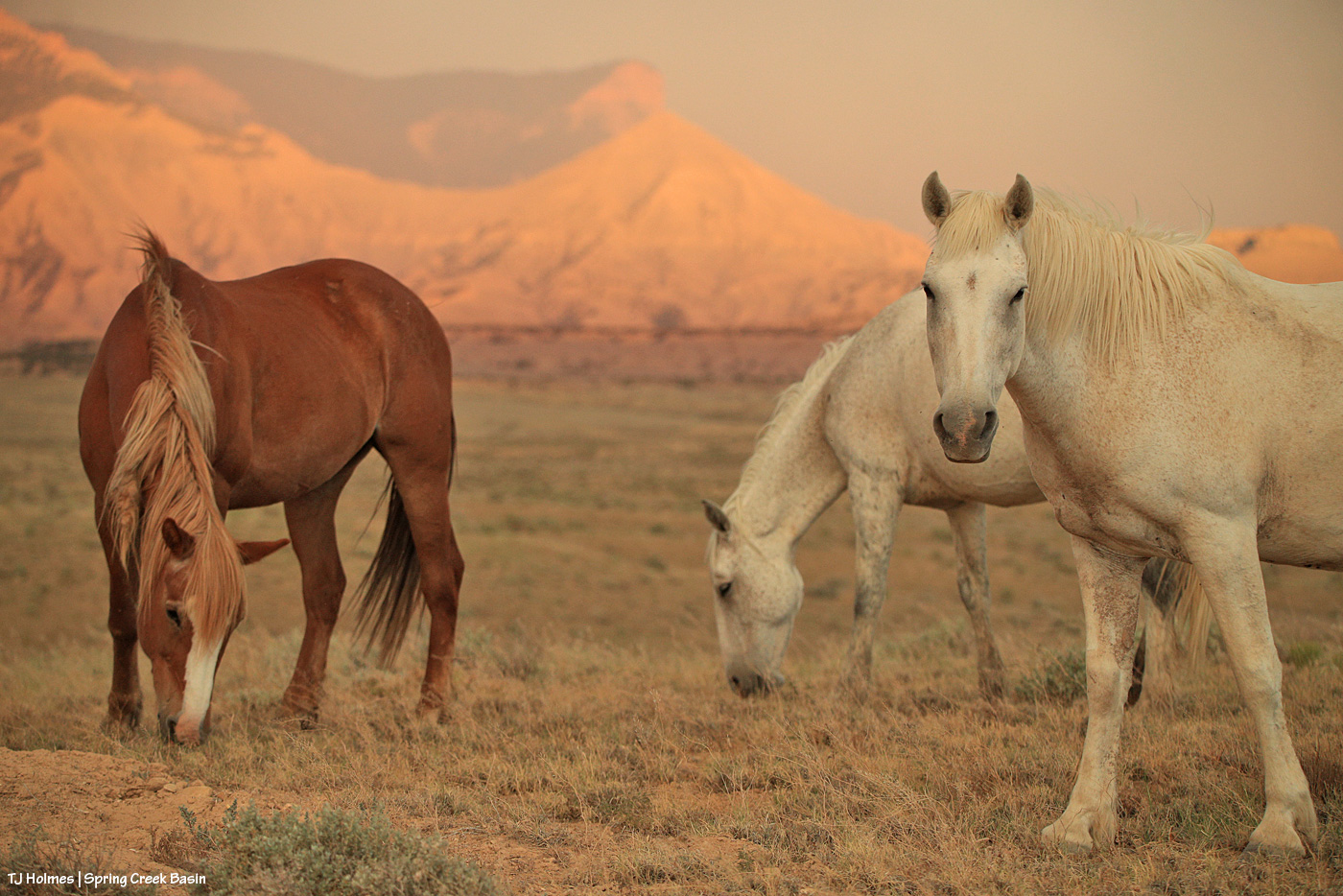
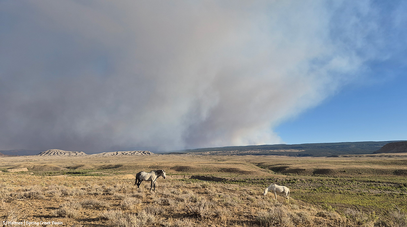
The mustangs continue to fare well through it all. They have forage, they have water, they have each other. When it comes right down to it, they have the important things kinda nailed. Mysterium, Gaia and Maple above.
If you’re using the Watch Duty app, you can find the below information there. I thought the updates Wednesday night for earlier in the day were informative, so I’m going to post them here (and huge thanks to those folks doing the updating?!). There has been a massive amount of work done by firefighting ground crews as well as air attack. It’s humbling to know those folks are out there giving every ounce of their strength to fighting this fire. The Ferris Fire apparently has its own Facebook page, but that’s beyond my knowledge.
Michael Silvester • Senior Manager of Operations & Standards
22 minutes ago • Jul 1 at 9:58 PM
The Ferris Fire is expected to reach the Dolores River Canyon tonight as it backs down Doe Canyon. Fire crews will continue monitor this area closely tonight and will be in close communication with Dolores County out of an abundance of caution.
Tomorrow [today, July 2], a number of engines will staff the west side of the canyon. The Incident Management Team is also coordinating closely with the local fire protection.
Michael Silvester • Senior Manager of Operations & Standards
3 minutes ago • Jul 1 at 9:32 PM
Zone 8 [I believe this is directly west of the fire] is now on “Set” status & the parameters for that zone can be seen above, per the update from Dolores County Office of Emergency Management on Facebook. SET Means Be Ready to Leave & means there’s a wildfire in the area, and conditions could change quickly. It’s time to be alert, stay informed, and be ready to leave at a moment’s notice.
When you’re SET:
– Load your go-kit into your vehicle.
– Park facing out for a quicker departure.
– Follow updates from official fire and emergency channels.
– Review your evacuation routes and know where you’ll go.
– Get pets and livestock ready to leave with you.
Being SET doesn’t mean you need to leave yet.
Total acreage: 25,814 Total personnel: 282
Today [yesterday, July 1], the Arroyo Grande Hotshots continued to dig containment line on the northeast corner of the fire nearest to private lands. An additional dozer and hotshot crew will be in place tomorrow to continue this mission. Favorable weather conditions will allow overnight burnout operations to continue this evening.
Dozer work on the southwest corner of the fire was completed. Firefighters will continue improving and developing containment line in this area.
The west side of the fire, closest to the Dolores River Canyon, continues to present challenges for direct engagement. Additional divisions were added to respond to this expected growth.
Susan Perney • Coverage Reporter
About 4 hours ago • Jul 1 at 5:42 PM
Three Type 1’s and one smaller helicopter are working the various hotspots around the fire. Air tankers have also been dropping retardant to slow the fire’s growth on the southern end where Doe Canyon meets the Dolores River Canyon.
A second interagency Hotshot Crew (IHC) will be arriving later today. Current plans call for them to assist with creating fire line in rugged terrain on the fire’s northeast corner near the lookout. The goal is to prevent the fire from reaching and threatening homes and private property in the Glade Ranch Subdivision and to protect the lookout itself. Despite several large fires in Colorado and surrounding states we are continuing to get more resources to support the crews on the ground and in the air. 280 firefighters and support personnel are now assigned to the fire.
**********
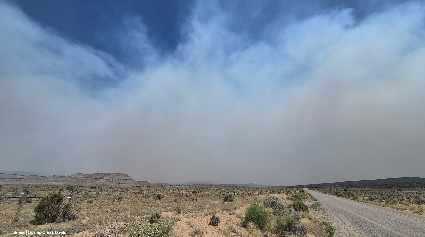
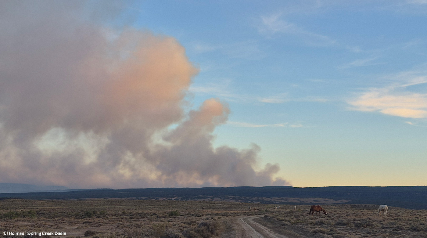
That Montana-shaped smoke is from the Ferris Fire, which has moved north and northwest and is overlapping the western-horizon smoke from Southwest Colorado and Utah fires.
Smoke in the pic is NOT as close as it seems, nor as awful as it looks. I mean, it IS awful where it is, but it is not super close to Spring Creek Basin. I actually debated showing this pic, and I decided to do it, not for drama factor, which I’m aware that it has, but because that was the scene toward sunset looking south/southeast, and I think it helps tell the story. A recovering journalist, still, I am.
We remain incredibly grateful to all the firefighters and folks supporting the crews working on the Ferris Fire *AND* all the other fires burning near and not-so-near. I particularly value my partnership with my local BLM folks, which includes this challenging time, during which they are, as you might guess, super busy. Thanks (again!) to Ryan for taking the time to keep me updated about goings-on; you can’t imagine how grateful I am.
And thank you also to everyone who has messaged me asking about the safety of the mustangs; I appreciate that immensely.
Gratefully, while the Ferris Fire burns 20,560 acres to the southeast and the McCloud Fire and Horse Head Fire burn 113 and 530 acres, respectively, to the southwest (and that smoke is joined from the Snyder Mesa Fire (30,163 acres) to our north/northwest, drifting southish), Spring Creek Basin and lower Disappointment Valley were mostly smoke-free yesterday.
In the pic above, Tenaz and Skywalker, grazing with their band almost at the western boundary of the basin, are highlighted by that drifting smoke to the west. It’s fairly far away, but I haven’t seen Utah’s La Sal Mountains for at least a few days now as the smoke obscures any sight of them.
Now looking east/southeast, that’s the smoke from the Ferris Fire (the Doe Canyon, Far Draw and Ferris fires all have merged and are now being collectively called the Ferris Fire). But see how clear it is between here and there? Not great for folks and critters in that direction … but (again, gratefully), a huge relief for my beloved center-of-the-world Spring Creek Basin.
Huge thanks to sheriff’s deputies from both Dolores and San Miguel counties (Disappointment Valley spans both counties, and Disappointment Road runs from Colorado Highway 141 at the lower north end to the Dolores-Norwood Road at the upper southeast end) who have been diligent in keeping an eye on the fire’s approach: Branson, Todd, Derek, Jeremy and Nick. Also to my BLM folks, especially Ryan and Laura, for keeping an eye on the situation and updating me with information. Anton was on one of the fire crews pulled back Saturday for safety on the Doe Canyon Fire, and he might still be on a fire crew on the merged fire.
This won’t be an easy post to either read or view.
*THE MUSTANGS ARE SAFE*
That’s the important thing (as far as the main topic of this blog, anyway).
Yesterday, Saturday, June 27, at least three wildfires of significance roared to life directly south of Disappointment Valley: Ferris Fire (4,777 acres as of Saturday evening), Far Draw Fire (651 acres) and Doe Canyon Fire (385 acres). There’s also the Horse Head Fire (200 acres) burning to the southwest, in Utah, and the Snyder Fire (28,264 acres) burning north-northwest of here, almost directly west of Grand Junction and just inside Utah.
Red-flag warnings; check.
Wind advisories; check.
Bad air quality; check.
Critical fire weather; check.
Stage 2 fire restrictions in San Miguel and Montrose counties; check (these might extend to other nearby counties, but these are the ones I know about, and most of Spring Creek Basin is in San Miguel County, with the southern/southeastern portion in Dolores County).
Kentucky is flooded, and the West is on fire. Friday night, we had a swift little storm pass through Disappointment Valley – 0.04 inch from four minutes of rain. My guess (guess only; I don’t know yet the cause of these fires) is that they started from lightning strikes. It is one giant tinder box out there. Until the little bit of rain Wednesday, it hadn’t rained here for more than a month.
If images of wildfire smoke bother you (it bothers me), the rest of this post isn’t for you … and the pictures, as usual, don’t convey the bad-ness of the beast. … Again, please know that the mustangs are SAFE. I can’t say what the fires will or will not do, but for now, the horses are OK and not in danger.
I spent most of Saturday in Ridgway with mustang friends, and this is what greeted me and Kat Wilder upon our return to Disappointment Valley. This is from the northern part of the valley, a few miles south of Colorado Highway 141, looking southeast.
Looking west at sunset; this smoke is from the Utah fires.
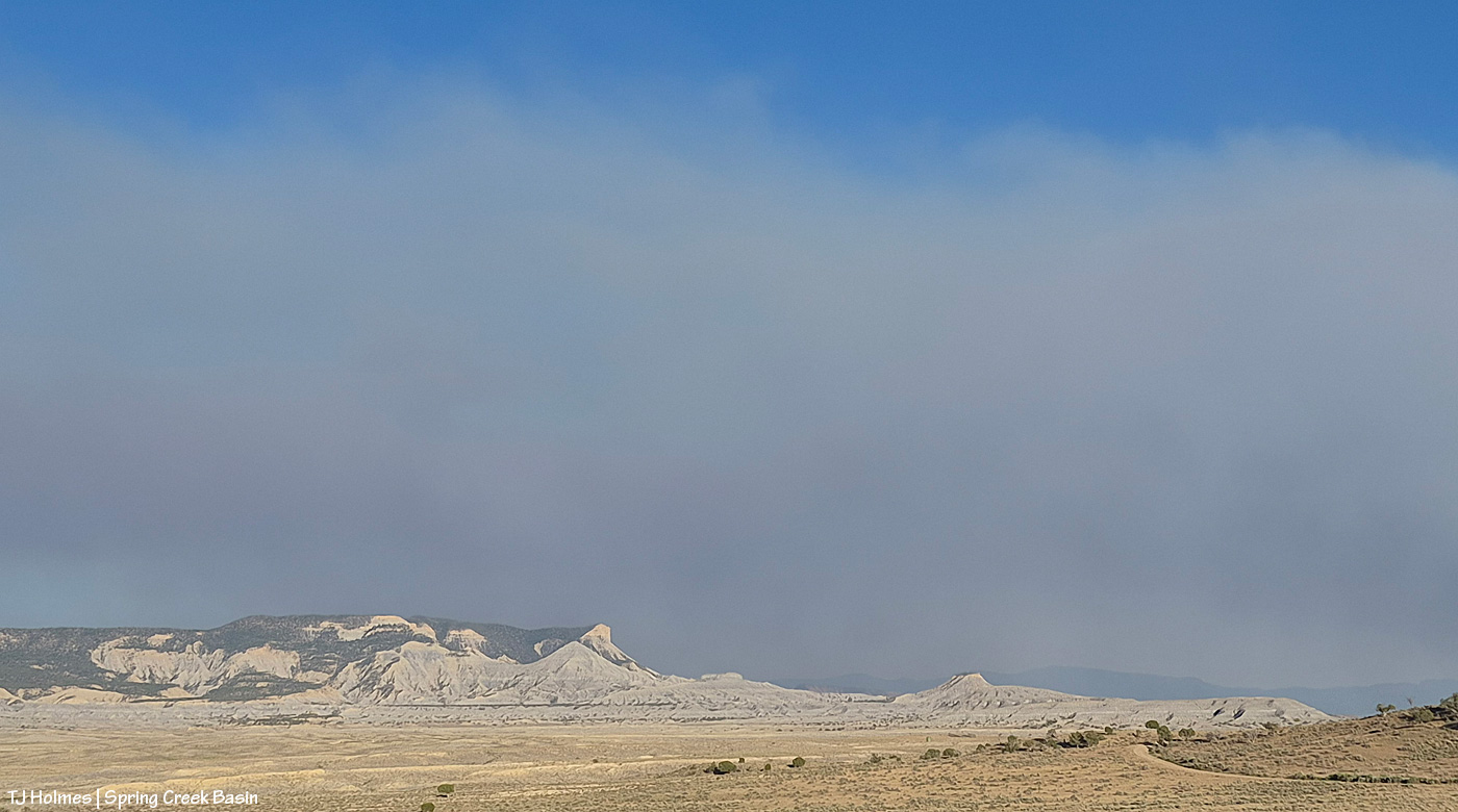
The majority of the smoke seems to be passing east of the eastern side of Spring Creek Basin; McKenna Peak, Temple Butte and Brumley Point are all visible. … The smoke ain’t great up-valley; it smells like you’re in the middle of a campfire (and by the way, campfires and any other kind of fires are strictly verboten (that means forbidden!), not to mention dumb as hell).
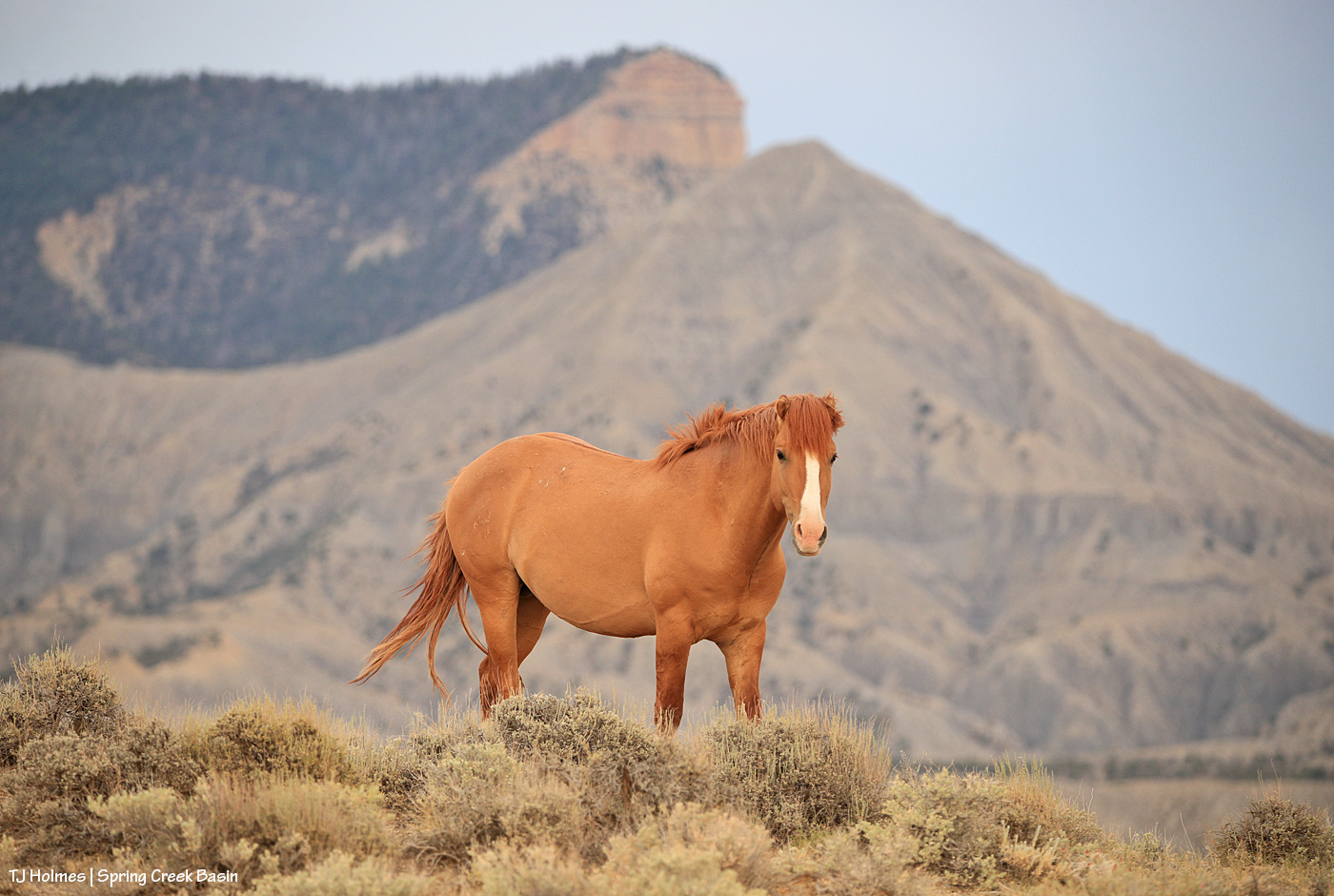
Yes, that’s Odin. No, he’s not pregnant. 🙂 He’s just a stout little bachelor stallion … hanging with one or another of a couple of other bachelors or alone. This was just before a nearby squeal that sent him and his buddy trotting over to investigate.