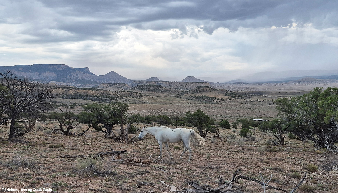
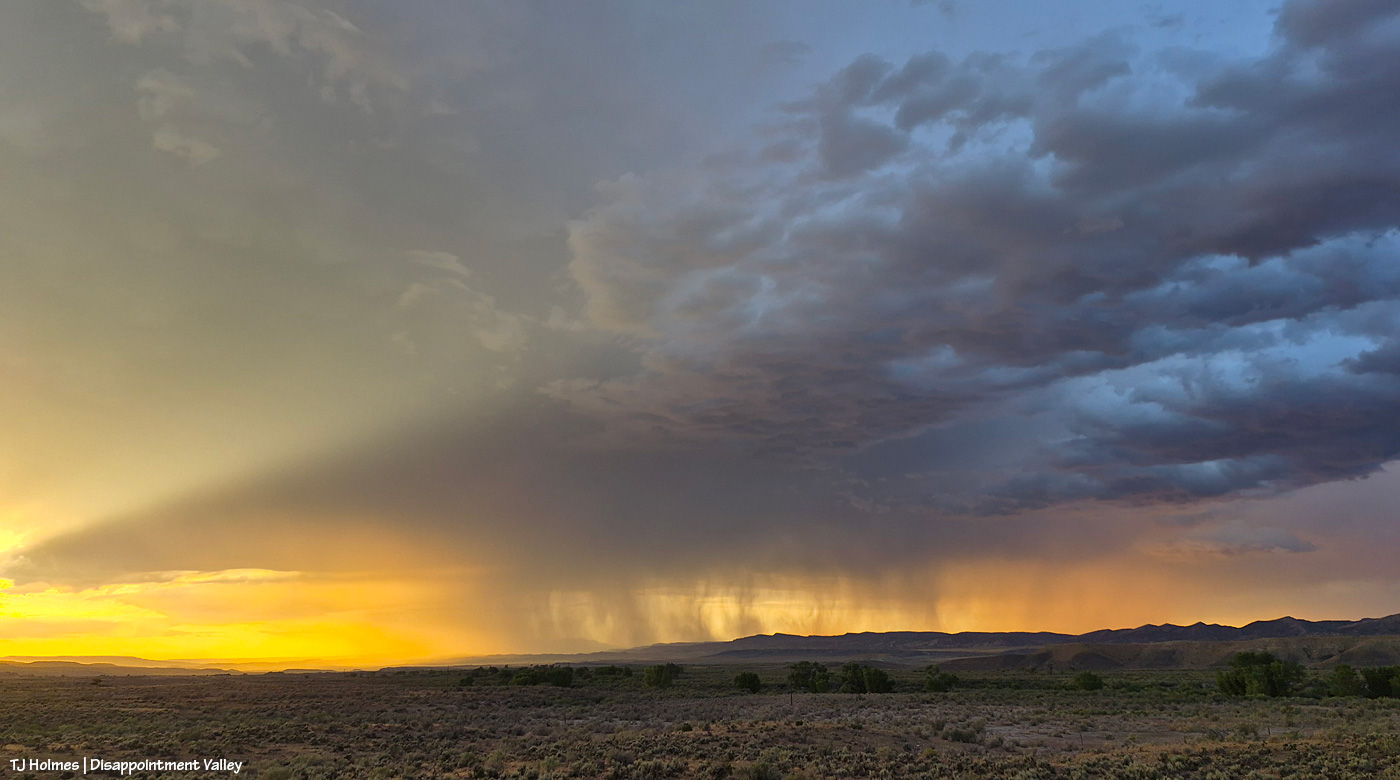
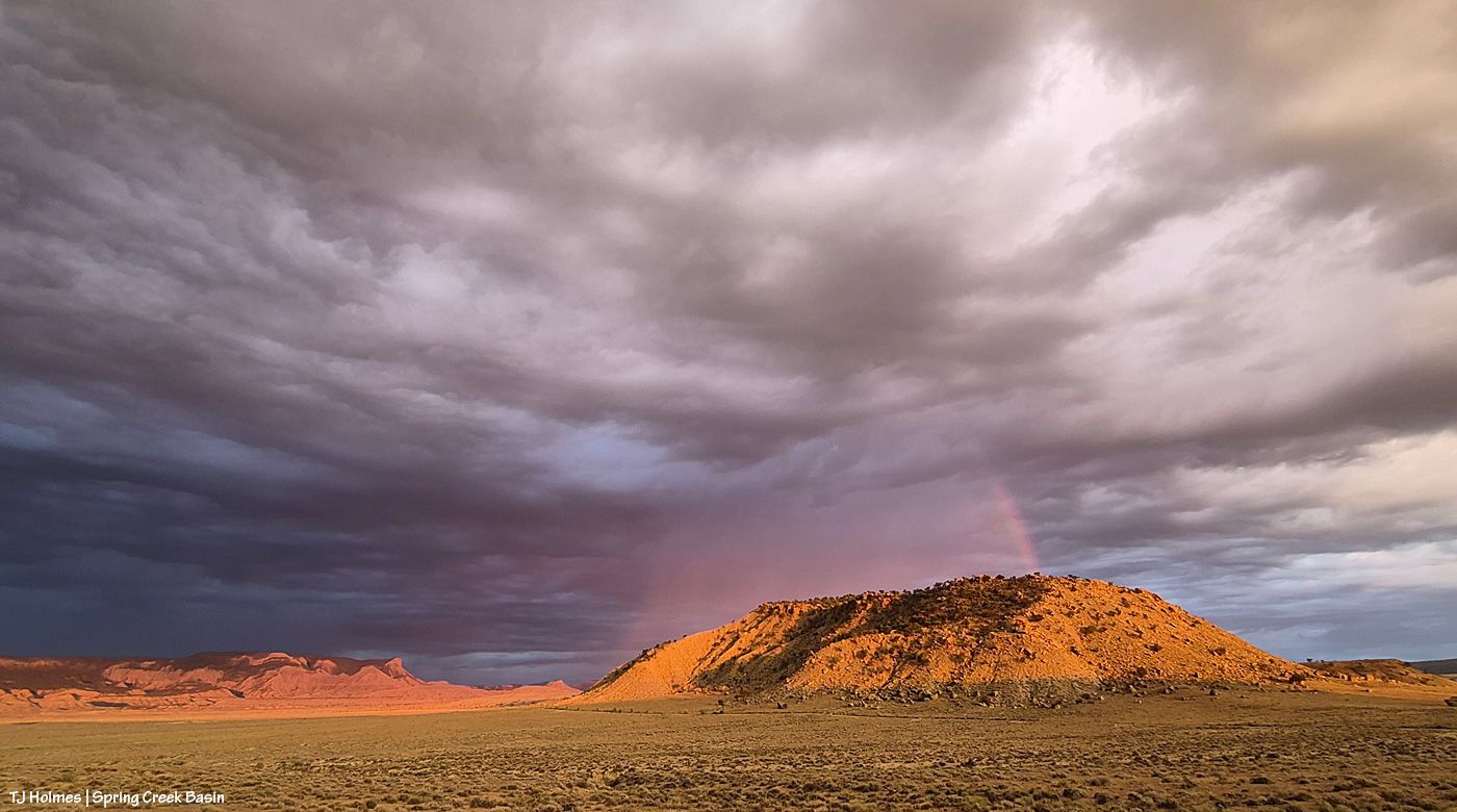
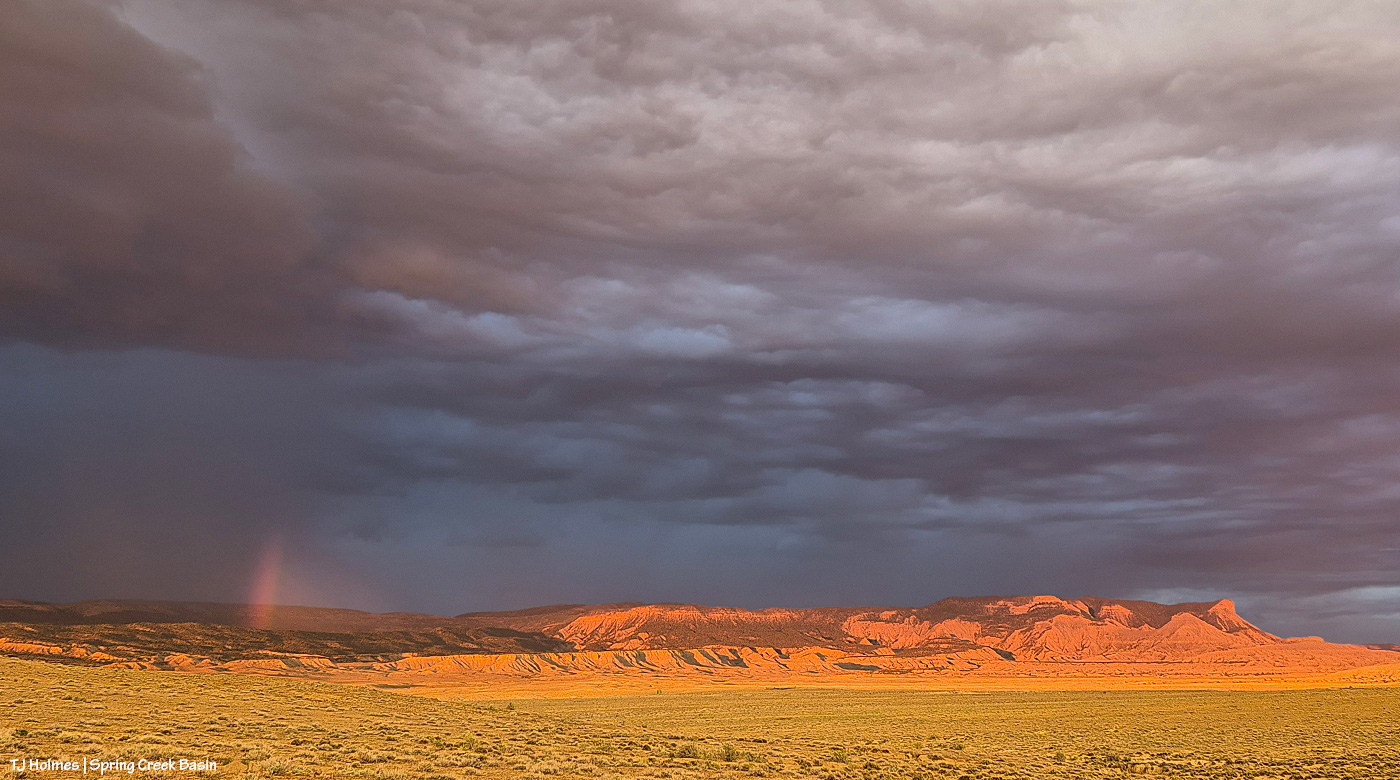
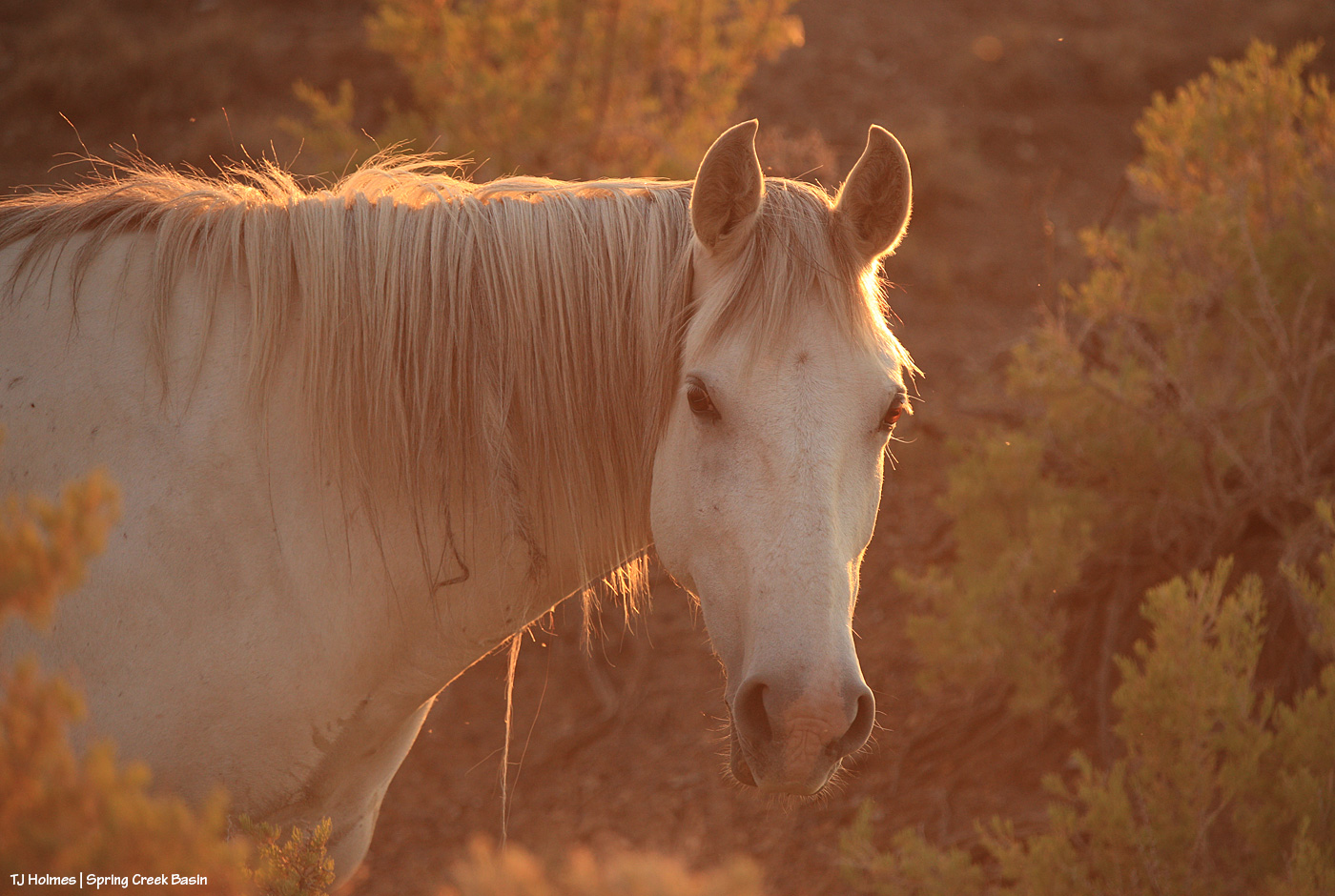
Apologies for the late post this morning; last night’s storms took out my electricity! Very glad of the rain … shown above making its way into Disappointment Valley southeast of southeastern Spring Creek Basin. Seneca really didn’t think she wanted to help show off the view and the rain, but she did an amazing job of it, of course. 🙂
The great thing about the rain is that it wasn’t even in the forecast, so it was a *very* pleasant (understatement) surprise!
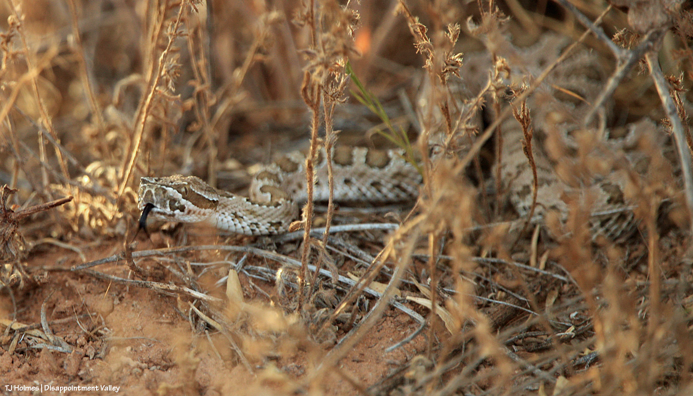
I treat badgers like I treat rattlesnakes: carefully and with respect.
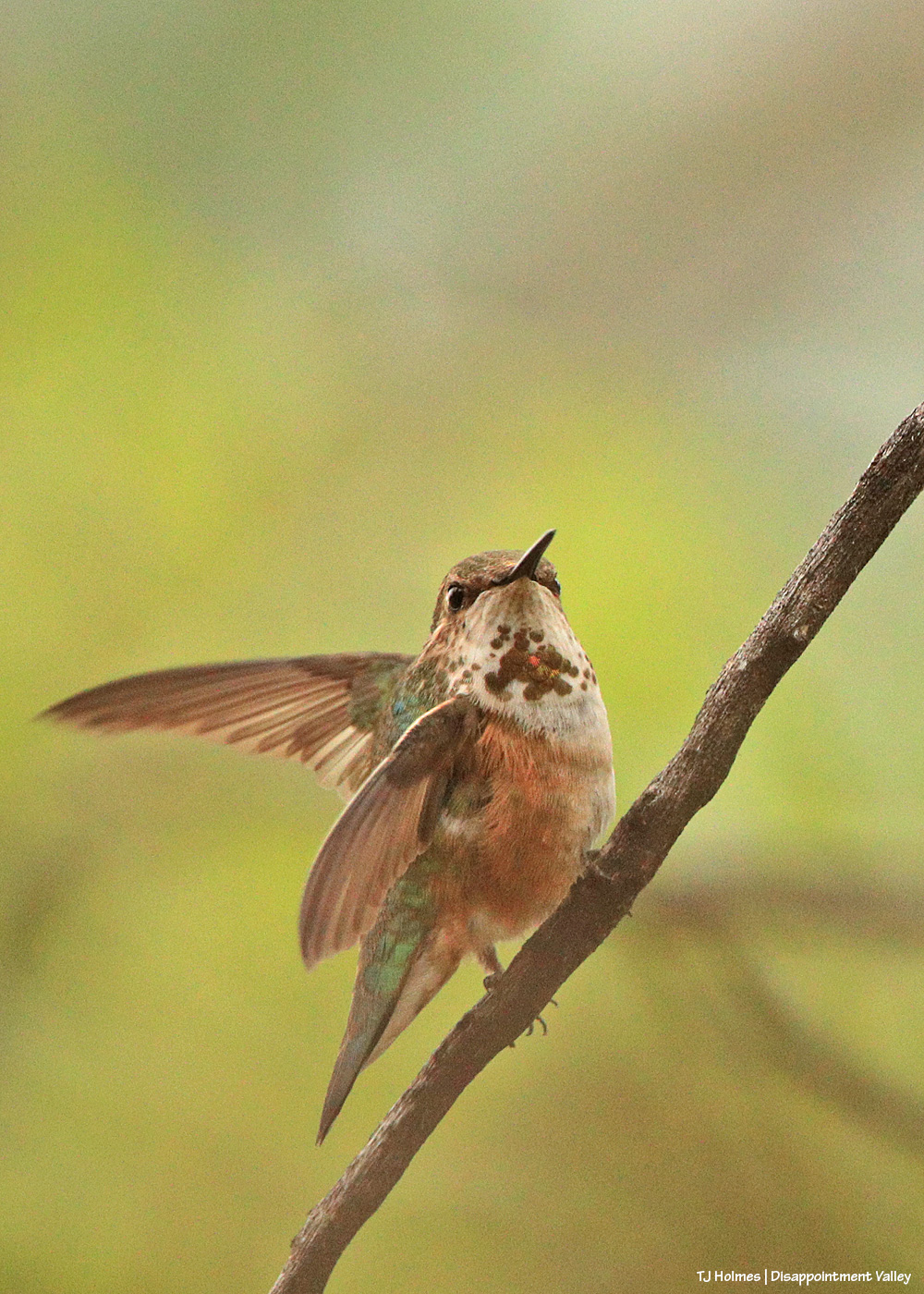
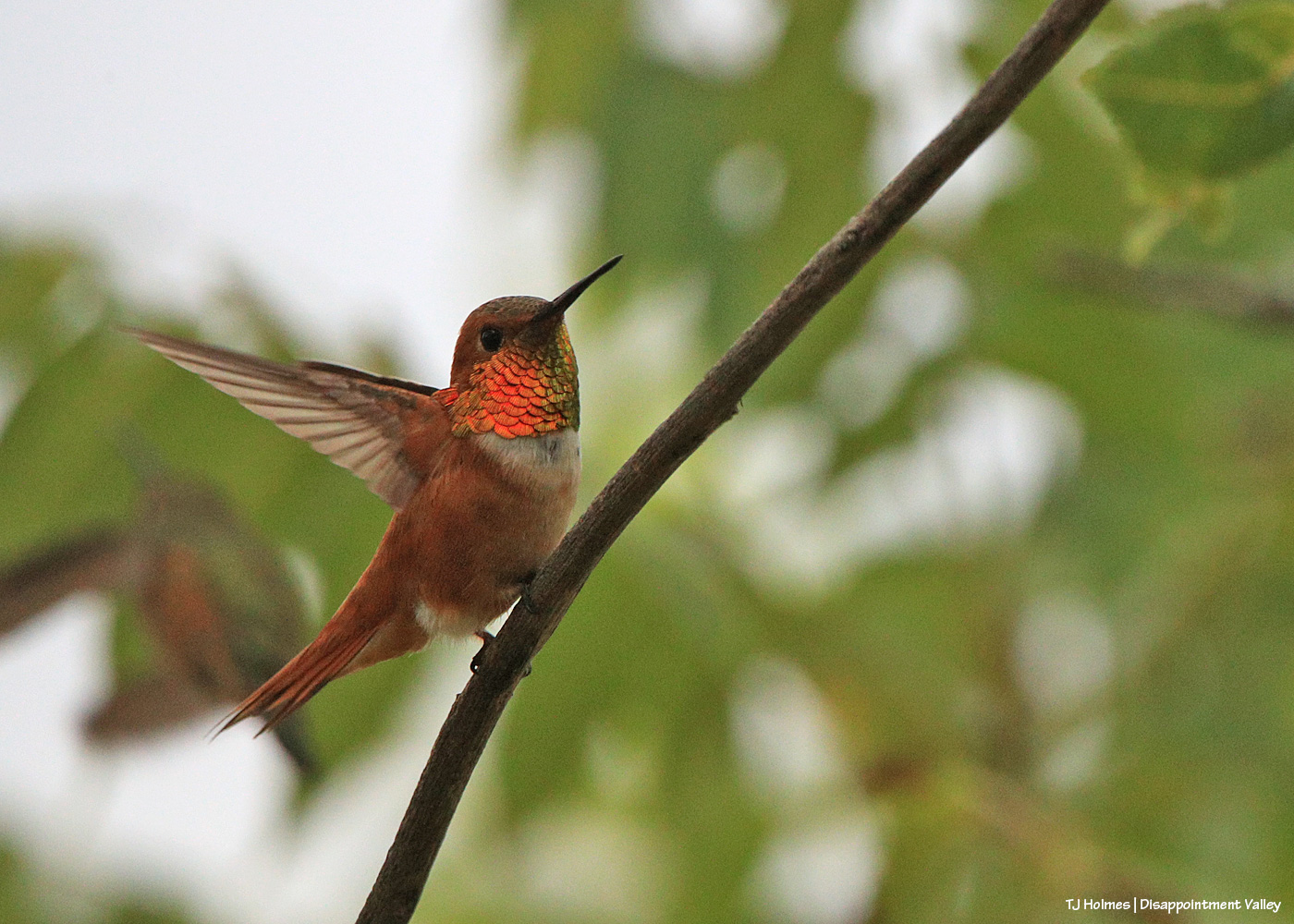
Pretty little ball of energy. Does anyone know what kind of hummingbird this is?
Rufous hummingbird? That orange! When it turned its (his?) head even slightly away, that glittering orange completely disappeared.
Did someone mention rattlesnakes? … Carefully … and with respect. 🙂
Not all from the same day or same areas of Disappointment Valley.
In big news: We’ve had rain! Finally, Mother Nature is shedding some tears of pity over us, and Tuesday night, there was (I think) pretty widespread rain over the valley. Because of intermittent rain throughout the day (!), I didn’t make it into Spring Creek Basin, but I look forward to soon documenting the run of water through Spring Creek. Hallelujah!
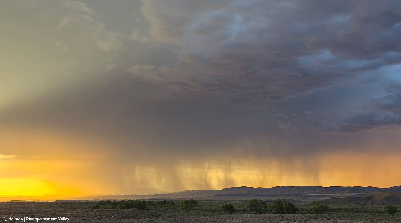
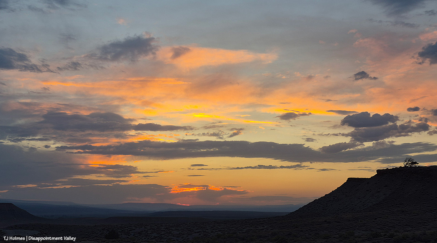
These pix are a poor representation of the ASTOUNDING sunset Monday as rain moved across Disappointment Valley’s western/northwestern horizon at sunset. It was one of the most amazing sunsets I think I’ve ever seen (and I’ve been blessed to see a lot of those).
Rain = literally, the lifeblood of the desert.
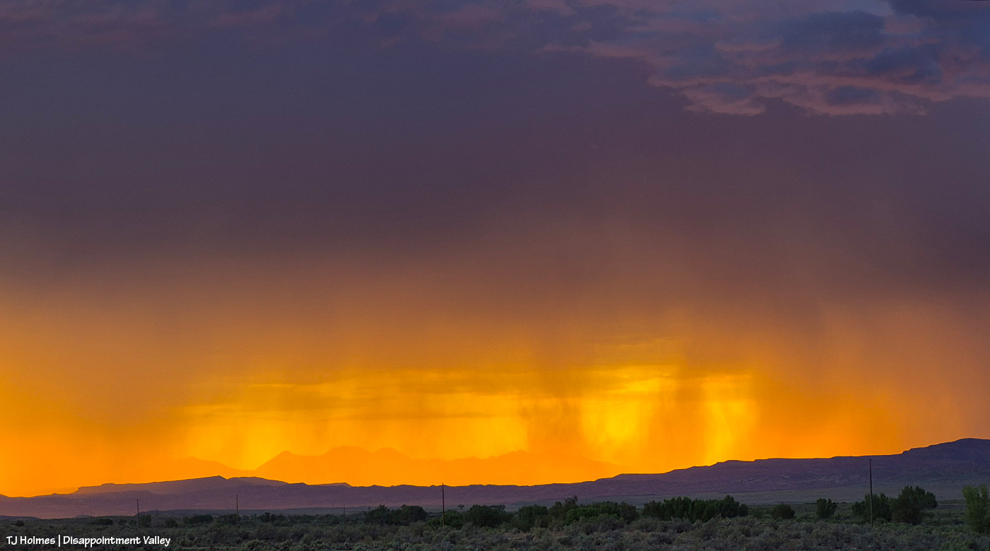
The cottonwoods in the near(ish) foreground line (dry) Disappointment Creek. This is looking northwestish toward neighbor Utah’s La Sal Mountains. You can just barely see one of the shoulders of one of the mountains through the rain. Actual sunset is at far left.
Amazing view a little closer/zoomed. I HOPE that rain was actually finding soil.
Backed out again, and you can see a bit more of the mountains through the curtain of rain.
The LIGHT!!! Kept getting getting better as the sun neared the horizon and even disappeared (from my perspective).
Sheer luck: That downpour is lit up by a lightning strike!
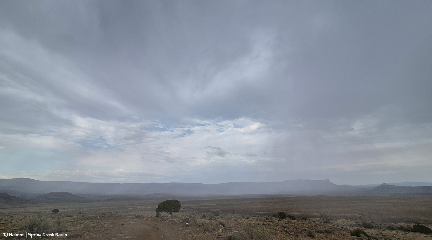
Tuesday afternoon and evening, Disappointment Valley is getting multiple little waves of rain. Super grateful.
There have been multiple road closures because of mudslides in the region (pretty much all of western Colorado). Be careful out there!
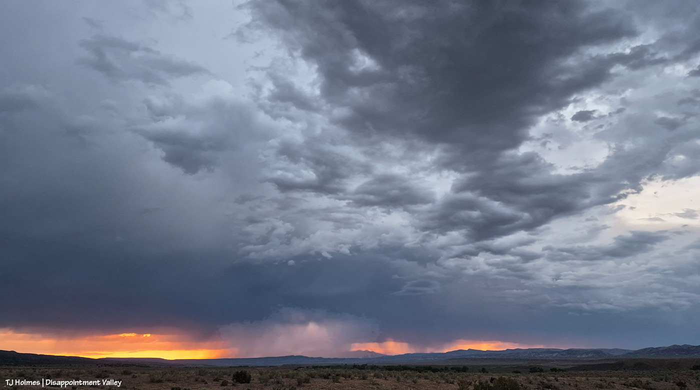
Spectacular sky from incoming storm days later? You betcha.
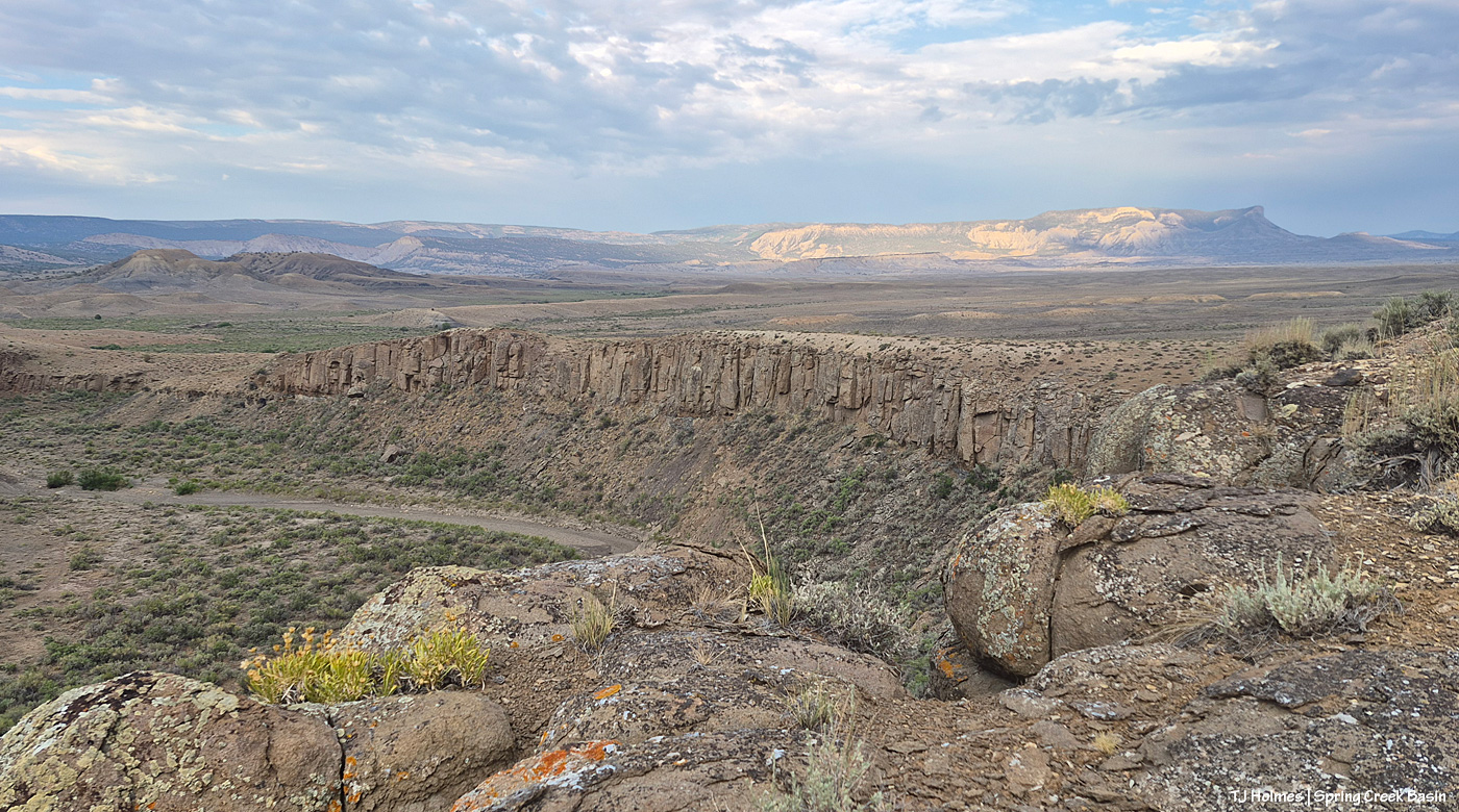
From Spring Creek Basin’s western rimrock boundary looking southeast at the very end of yesterday.
Looking east from the same place. The storm was to the north – our left as we’re looking out over the basin here.
One of the most spectacular jags of lightning I’ve ever seen lit up that northern sky (not close, not nearly far enough away), and I took that as my sign to hit the road, which was still a bit of a hike down to the right. As I headed down the hill, so did the ponies I’d been visiting with. No fools, they (or me!).
As of Thursday afternoon, there are currently NO evacuations active for the 64,881-acre, 59-percent-contained Ferris Fire, though several areas – including in or near Disappointment Valley – are still at “ready” status (that means exactly what it sounds like: Be alert, prepared and ready to move should conditions call for it). Various BLM and U.S. Forest Service closures exist in the region. As far as I know, the middle section of Disappointment Road remains closed, though that could (likely will?) open soon.
Two words: FIREFIGHTERS and RAIN.
From Watch Duty: “Team 7 wishes to thank the communities around the Ferris Fire for their welcome and generosity.”
For the strength, endurance, skill and courage of the firefighters – on the ground, in the air, on the line, acting as support – I am sure the gratitude from our side is massive and total. I’ve done a lot of “thank you, thank you, thank you!” the last couple of weeks. And that includes BLM range guy Ryan Schroeder, San Miguel County Undersheriff Nick Xavier and all of his deputies, including Dolores County Deputy Branson Smith. We ARE community, and yours thanks you all.
That little rain I posted about yesterday over Spring Creek Basin? Apparently quite a lot more fell over the Ferris Fire, and that has helped firefighters reach 43 percent containment on the 64,868-acre fire. Some zones still have active evacuation orders – Zone 16 on the Dolores-San Miguel County line west of Spring Creek Basin; Zone 2 along Ryman Creek southeast of the basin; Zone 10, south along the Dolores River. Up-Disappointment-Valley residents remain at “set” status, as is Glade Ranch (on the east side of the fire, which had been among the first zones evacuated) and Zone 14a and Zone 14b on the very west/northwest side of the fire.
The entire forecast for the foreseeable future contains the potential for thunderstorms. Yay, rain … not so much any accompanying lightning? I got word yesterday afternoon that smoke had been reported up-valley by a firefighting helicopter pilot. Two engines were sent, and though I didn’t hear an outcome report yet, I hope that was squashed before it really got going. It would have been caused by a lightning strike from Monday’s passing storm, and while *I* looked in that area specifically for smoke that evening, I never saw anything. That’s just another lesson in how fires can smolder before they take hold.
The pilot killed fighting the Gold Mountain Fire near Ridgway and Ouray has been identified as Nicholas Dale from British Columbia, Canada. Please hold his family in your prayers. Mentioned in this article and read about from other sources, apparently hundreds of people lined the route as he was carried from Gunnison to Grand Junction on Tuesday.
That’s just some heavy news, and I don’t really have it in me to do much of a post for today.
From my perch Monday evening on the south wall of Spring Creek canyon, looking back (southish) at the mustangs I originally walked out to see. The basin entrance is just below that little hill/butte at mid-back left. Some stormy promise in the background … not much smoke visible … it looked much the same yesterday evening.
Be safe out there. Continue to think RAIN. Include the firefighters – fallen and still fighting – in your prayers.
This pic, taken Sunday from between the main/original water catchment and Filly Peak in Spring Creek Basin, is looking southeast toward the Glade and Benchmark Lookout. A few days before, I’d seen the red swaths of retardant across the trees while looking at smoke up there, but I didn’t manage to get a decent pic that showed it. While fire continues to smoke in that area (that’s the Ferris Fire’s northeastern edge), clearly firefighters and aircraft pilots have been hard at work. So hugely grateful! Rick and Linda Freimuth, who staff the tower during the fire season (!!!) hope get the green light to return this week. The mustangs and I (you know they would if they could) will be cheering their return.
Now, some taken yesterday (Monday):
Storm brewing to the east. Spring Creek Basin’s western rimrocks and Filly Peak (lower left) are in sunshine, while Temple Butte, McKenna Peak, Brumley Point and the basin’s eastern ridges are shadowed by rain! Woo-the-heck-hoo!
Looking back to the west from the same spot as above. More rain! What looks like white smoke on the horizon at left IS smoke from the Ferris Fire … and I hope it got a good dose of the wet stuff. It wasn’t a high-rain-chance day, but toss the forecast and let ‘er rain!
Methinks the weather wizards were outsmarted by Ma Nature herself. 😉 RAIN, BABY, RAIN! This is from Chrome’s Point in western Spring Creek Basin, looking eastish at a curtain of rain that DID, as I was taking pix, make its way west. Unfortunately, I didn’t get tooooo wet. Ha – I would not have minded!
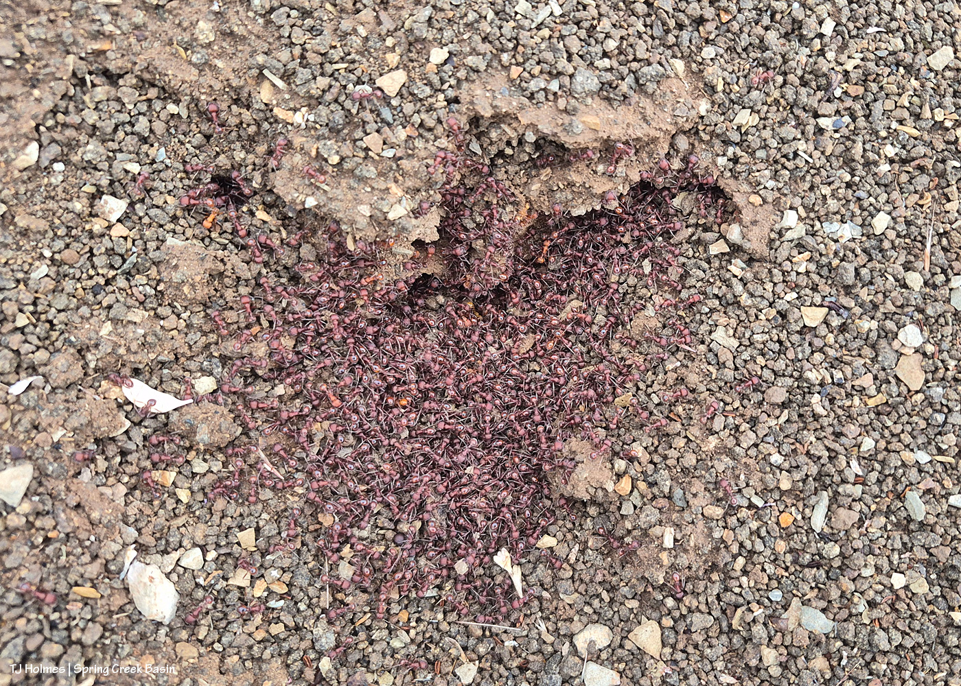
Ants congregating at the entrance to their mound. Apparently, “Ants congregate at their mound entrances after rain primarily to survive flooding. When underground tunnels fill with water, the colony is forced to evacuate. They move the queen, larvae, and food upward to escape the saturation, using the surface or mound entrance as a temporary, elevated sanctuary.” Interestingly, these ants and others I saw doing the same thing in the same relative area happened to be on some of the highest ground in the basin, near the western boundary. I guess that when you’re an ant, everything is at the elevation of ground level (ha ha!).
From the south wall of Spring Creek canyon looking eastish after the rain (it didn’t last very long, unfortunately).
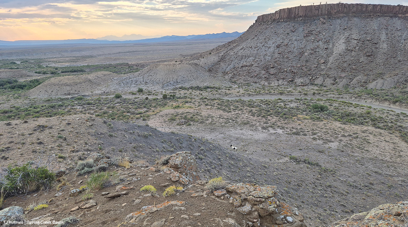
Hope you don’t mind this view! It’s pretty spectacular. No, that’s not a road down there in the canyon; that’s Spring Creek arroyo, and just beyond (lower left), it leaves Spring Creek Basin to cross lower-ish Disappointment Valley on its way to join Disappointment Creek (neither of which are carrying water at the moment).
See the pinto pony? This is from the same point as the above two pix, looking generally northwestish across lower Disappointment Valley toward Utah’s La Sal Mountains. There’s a fence across this lower end of the canyon to keep the mustangs within Spring Creek Basin, and there’s a water gap (hanging PVC pipes to move when water DOES flow) across the Spring Creek arroyo. There are a couple of manmade structures down there, one behind McKenna and one kind of in front of him.
As it turned out, though he and his pal and a band were in the vicinity – and the reason I walked out – it was something else entirely that actually took me all the way to the canyon rim. … And that will wait for another post because I got some pix that knocked even my socks off.
The temp hit at least 98F Sunday before a few-minute rain came through and dropped the temp to 77F in early afternoon! The cooldown was the best (though it did return to 90s); the rain dampened the ground … and as soon as it quit, the ground was dry. That fast.
I learned yesterday from a firefighting source that the Ferris Fire now is the No. 1 priority wildfire in the United States. That’s not based on size (it’s 64,464 acres, 23 percent containment, and there are 1,031 personnel fighting this fire (numbers as of Sunday evening)); it’s based on things like protecting grazing and farmland, homes/private properties, infrastructure (the fire is burning on both sides of the Tri-State Generation and Transmission Association powerline), etc.
I didn’t take many pix of the Ferris Fire from Disappointment Valley on Friday. I did take some from Ridgway of the Gold Mountain Fire, burning about 35,622 acres (with 5 percent containment and 1,006 people working on it).
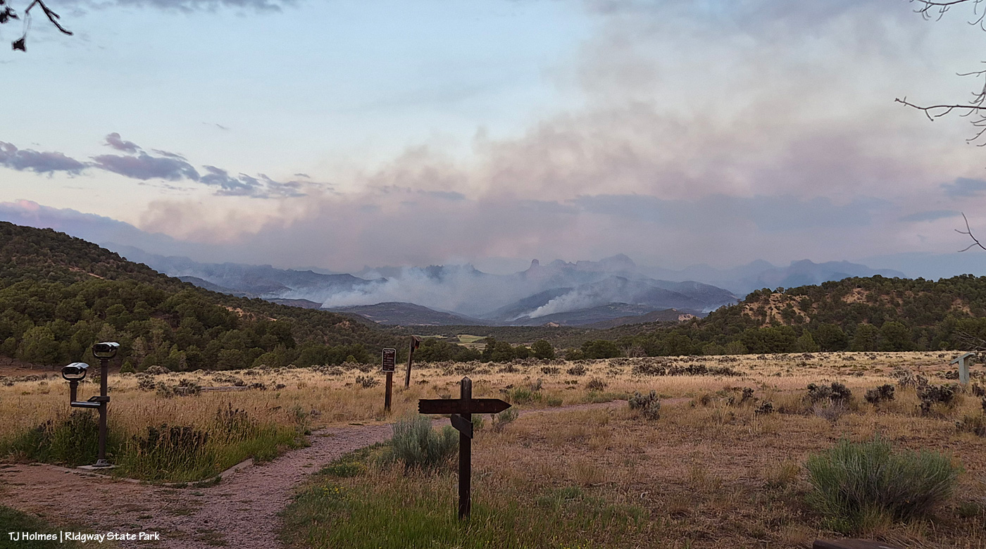
Taken from Ridgway State Park north of Ridgway looking southeastish. The fire is burning on the east side of U.S. Highway 550 between Ouray and Ridgway.
Just to say that there are multiple fires burning in the state, affecting many, many people. Some directly (the loss of homes and businesses is absolutely devastating), some indirectly, and I bet everyone in the state knows someone who is affected, whether by fire or smoke or both. Keep them all in your thoughts.
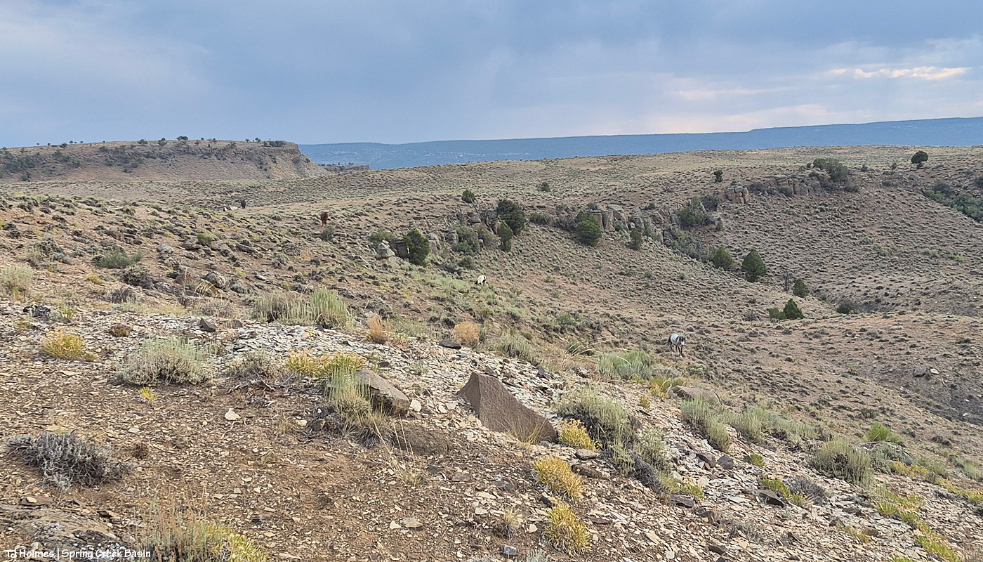
Buckeye and his band made an appearance Friday. They’d disappeared into the folds and ridges and drainages of the far eastern and southeastern regions of Spring Creek Basin, getting water from seeps in those arroyos and grazing places with little to no competition, and I’d been missing them.
A big shout-out to members of my parents’ church: Mooreville Global Methodist Church in Central Texas. My parents have asked them to keep our area and our people and our critters and, especially, our firefighters in their prayers. I’m not a religious person, per se, but I believe in angels, and I believe in the power of prayer. I cried when my mom and dad told me that. 🙂 Thank you, thank you, thank you, all!
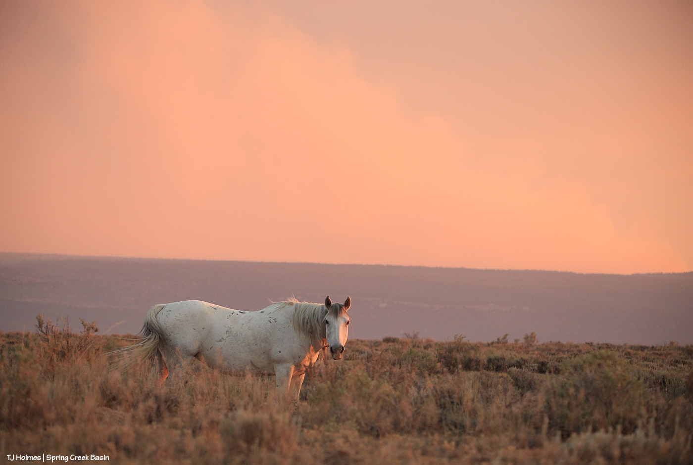
Lovely Mariah in the hazy sunset smokelight. She was grazing in a shallow little arroyo below me … two band members to my right, two more behind her up the other slope. As much as she normally keeps an eye on me, I was lucky to get this one, millisecond look before she returned nonchalantly to her grazing.
I’ve been relieved and jubilant to discover that even during this drought, under smoky conditions, there is actual grass for the mustangs in Spring Creek Basin. And for the most part – a couple of hardworking stallions notwithstanding – the horses are in exceptional condition. As always, I’m thankful for the little/big things … and hopeful for rain to come (without lightning!), which ought to green the place up if we get “enough.”
The morning was clear again; the smoke drifted in again around mid-morning. The temp took its time rising, and it was 97F when I left for an appointment toward late afternoon. The Ferris Fire is at 63,000-plus acres, and nearly 850 people are assigned to fight it. According to Watch Duty, it’s the second largest wildfire currently in Colorado, the largest being the 97,504-acre Aspen Acres Fire southwest of Pueblo that has burned an estimated 850 structures and at least 300 homes. Heartbreaking. To our west, the Babylon Fire in Utah is burning 104,252 acres in the Abajo Mountains, southwest of our familiar La Sal Mountains. Northeast of us, the Gold Mountain Fire burns almost 35,000 acres west of new-start Elk Fire (250 acres).
Rick Freimuth, continuing to work on the Ferris Fire while his and wife Linda’s post at Benchmark Lookout is being defended from the fire, said, “The overhead teams relay that [the community’s gratitude] as well during morning briefings.”
So keep holding those folks in your prayers, and if you can make a donation to firefighters or communities ravaged by wildfires, please do so.
Well, as predicted, the relatively clear sky Thursday returned to smoky by mid-morning yesterday.
Coverage Reporter Traci Clark on Watch Duty noted that “While firefighters continued to improve containment lines along the east and southeastern sides of the Ferris Fire today [Friday], there was an increase in activity in the northwestern area down into Dolores Canyon. Crews responded by dropping retardant and improving dozer lines in the area. The fire has not crossed the westernmost bend of the Dolores River and currently remains within containment lines.”
The fire has consumed 63,271 acres and is 19 percent contained.
Today and tomorrow, the mercury is likely to hit and surpass 100 degrees in many places across Colorado’s Western Slope, and as previously noted, the humidity is nearly nonexistent. Next week, then, while we have decent rain chances … those chances come right alongside thunderstorm activity.
Above: Looking south to Seneca’s band … Filly Peak beyond the horses … Ferris Fire smoke filling the southern horizon beyond (thankfully) Disappointment Valley.
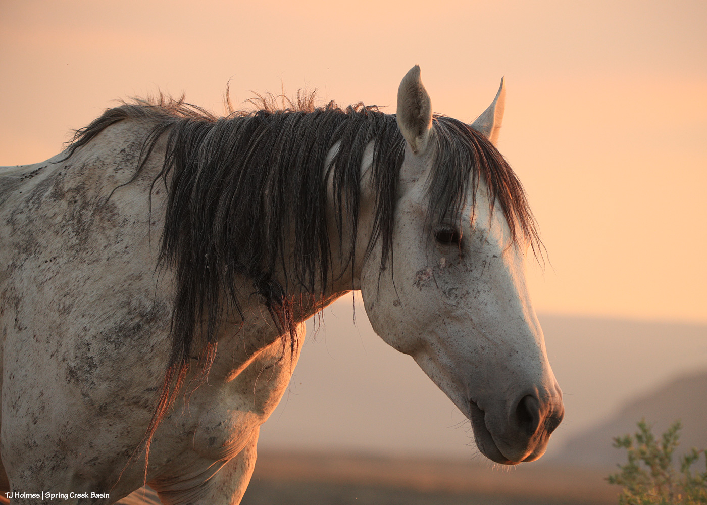
Top: Seneca, carrying on. The mustangs seem to be more bothered by the usual summer flies and gnats than anything else.