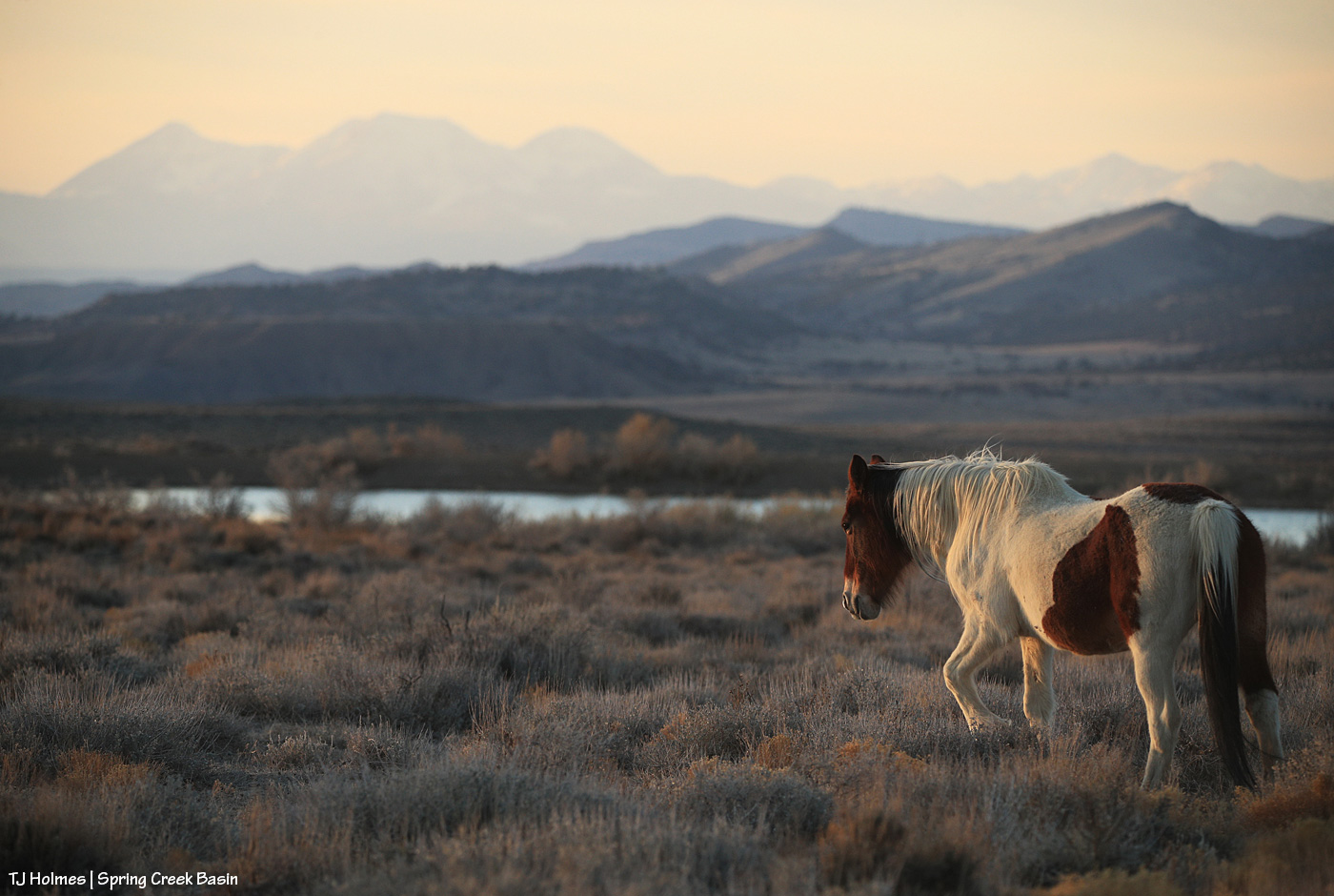
The temp dropped with the moisture Thursday night, and the wind didn’t relent, making the ponies’ still-fuzzy coats much appreciated, I’m sure. 🙂 This pond is one of two in the basin that currently have water, thank goodness.
The temp dropped with the moisture Thursday night, and the wind didn’t relent, making the ponies’ still-fuzzy coats much appreciated, I’m sure. 🙂 This pond is one of two in the basin that currently have water, thank goodness.
I keep saying I’m not a bird photographer (I’m really not!), but birds keep finding their way in front of my viewfinder lately. Who am I to NOT try to photograph them?
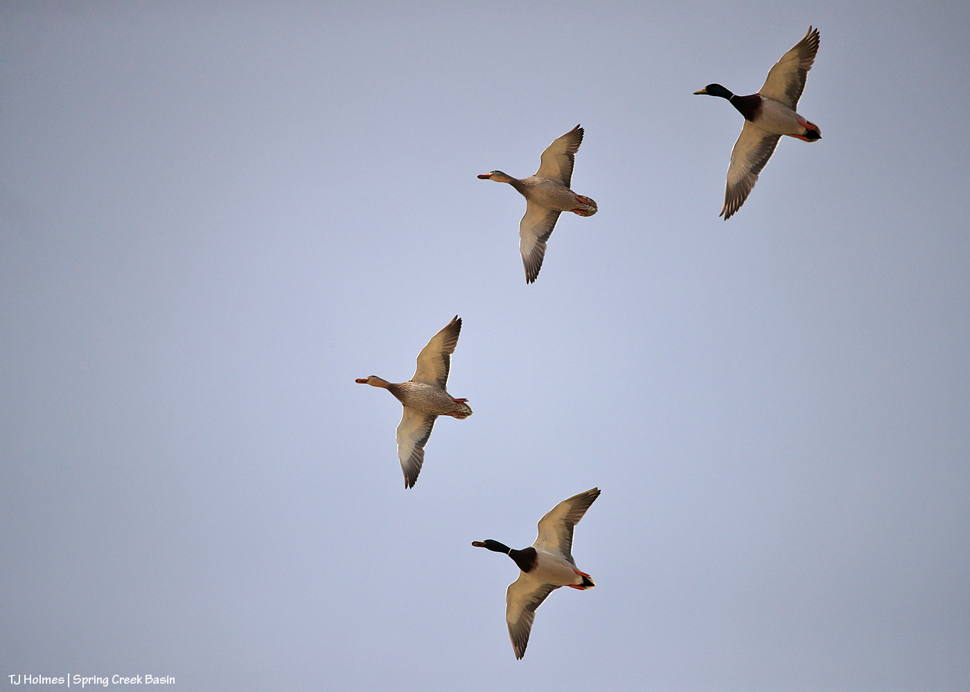
These four mallard ducks (two drakes, two hens) were with another pair on one of two ponds in Spring Creek Basin that currently have water (which is in itself something special, given our dry conditions). They took off when I approached … and circled … then came back to land.

Super bummed that this shot is out of focus, just as one pair of ducks was landing on the water. But I love the position of their wings, and so I say it’s worth sharing.
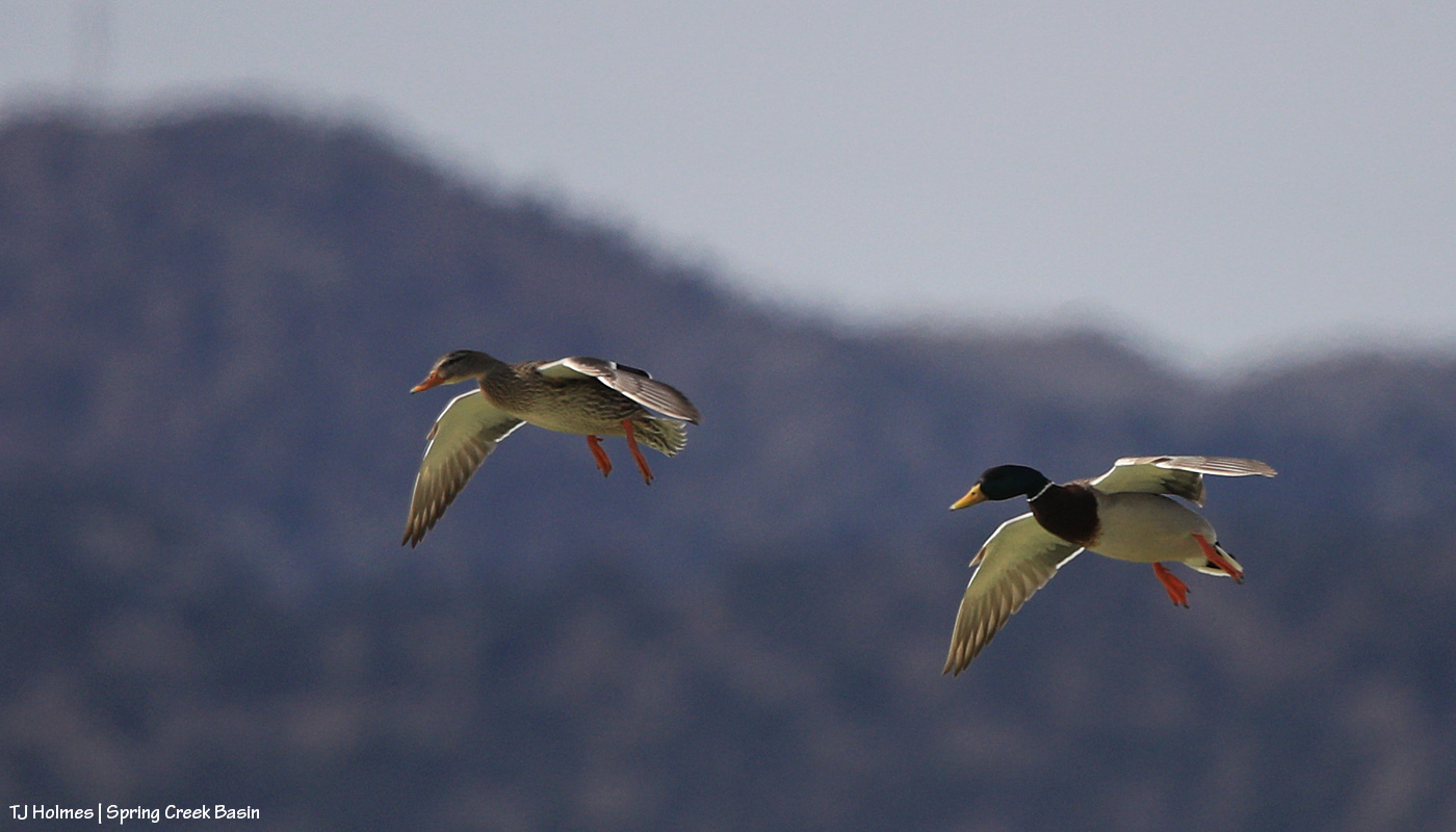
This is another pair – landing flaps are down and ready!

Just about to touch down …
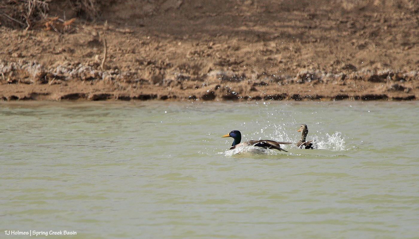
And splash landing! I caught the actual contact with the water, but the drake was blocking the hen, so I liked this image better. Watching them drop right over the pond and into the water is a lesson in flight dynamics, I’m sure! Not quite vertical, but it was a much steeper approach than I expected.
They (not necessarily these specific birds) are visitors every year … and every year, it surprises me that they’ve managed to find these spots of open water in the desert. Love having them. 🙂
Hold onto your paddles, folks, have I got some rainwater for you. 🙂
Brought to you courtesy of Mother Nature –> Southwest Colorado –> Disappointment Valley –> Spring Creek Basin:

A full water-catchment trough is always a good sign. Fortunately, though low (in the tank, uphill behind me), we’ve had enough rain lately to keep this trough full – and there have been a fair number of horses drinking here with the amazing grass around (don’t let the pic fool you; the galleta, in particular, is bonkers this year, along with the alkali sacaton). I may have explained this in the past, but it bears repeating: The triangular sheet of metal over the trough is an evaporation cover, designed to help slow evaporation of precious water in our (usually) dry climate. The shape of the cover is triangular so the horses have plenty of room to drink at the sides of the round trough.

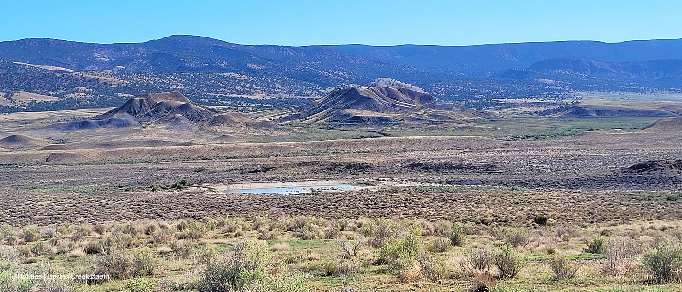
The Flat Top pond looks small in this wide-angle view looking eastish across Spring Creek Basin, but although it has gotten pretty shallow in recent years, it’s a pretty good size.

Good thing I scouted the V-arroyo before I tried to cross it. Those are my tentative footprints in the pillowy, shoe-grabbing – and tire-stopping – mud in the center bottom of the pic. You might not think it’s too bad, but there’s a lot of water in/under that surface mud still, and it is NOT friendly to tires or shoes until it has a chance to seep deeper into the soil and dry out from the bottom up. Along the left side of the pic is the arroyo – we’re looking upstream. The bottom of the arroyo, where I’m standing on relatively firm ground, isn’t very wide (hence my name of the “V”-arroyo), and the road rises to my left – up a little water-carved bank that’s nothing like the wall still in place on the other side of the first Spring Creek crossing.

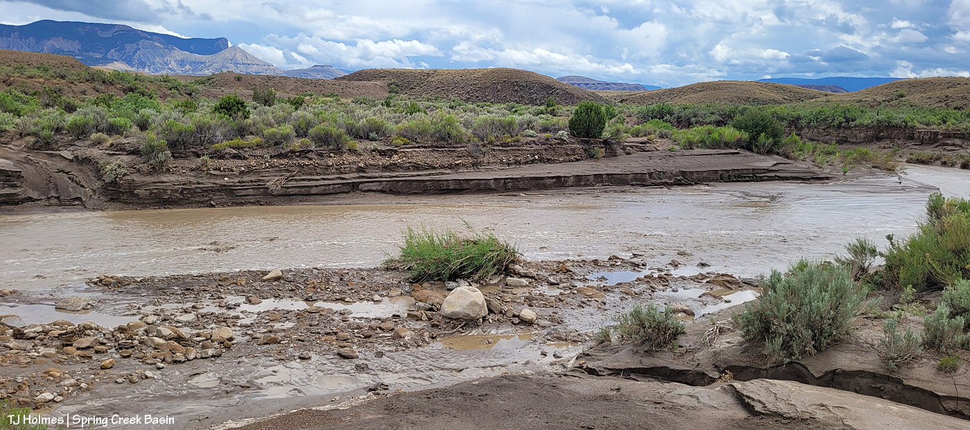
Holy Spring, err, RIVER! I know it’s hard to tell, but this is the first crossing of the usually-dry arroyo that is Spring Creek (when it’s not masquerading as a rainwater-swollen river). Yes, the other side is a road. 🙂 Well, it’s mostly a two-tiered wall; the right side of it is where I dug a channel in the wall the last time the creek ran (back in June) so I could get my ATV across and up and over. It has been widened by crazy people in a truck (I don’t know who … I don’t know anyone that silly/stupid/nutso), but it’s greatly eroded again and is going to need some custom shovel work. (And lowering of the water level. :)) The width here is probably about 25 yards? (Good darting distance.) And this water level is at least 4-5 feet below where it was at its highest/widest mark, behind me, so it’s already running with less volume than at its peak. (WoW!)
I took a lot of pix from here, and I wish I knew how to embed video; I’m still on a super-high from seeing all that water. Bear with me as I show you some upstream and downstream and high-vantage pix. (If you don’t think water in the desert is A BIG DEAL, you don’t live in a desert.)

Looking downstream. Note the two-tiered wall across the creek where the road is (should be). Most of the rocks at left are from previous flooding. But I will tell you, that kind of water can move BIG rocks. I have seen it, and I have moved big (enough) rocks out of the way of crossing in a vehicle or ATV. This is why the powers that be warn people against crossing flooded roads; that water literally grooves arroyos into our salt-desert landscape (milennia ago, this was under a giant ocean!).
Arroyo as defined by Merriam Webster: plural arroyos. 1. : a waterway (as a creek) in a dry region. 2. : an often dry gully or channel carved by water.). … Arroyos are a desert’s proof of water movement – that far bank/wall is much taller than I am. The wall where the road used to be is proof that they’re always changing – with more water.

Looking upstream. Note the water at far right; it was still finding ways to trickle along downstream.

A bit wider view from back up the road a bit. I mean … ?! 🙂 I knew, before ever I got there, that I wouldn’t be able to cross, but I did NOT know how river-esque Spring Creek would be. I love, love, love this place.
Similar view, but this shows the bend in the creek at right. … Try to follow me upstream: See McKenna Peak (the pyramid-shaped pointy peak)? Way back there is the source/start of Spring Creek, which – as you all know, being loyal, wonderful readers of this blog – drains Spring Creek BASIN (along with all its multitude of widely (and narrowly) and wildly variable tributary arroyos). As you may or may not know, the creek doesn’t roll in a straight line from there to here (or beyond/behind/downstream of me). So that bend goes around to the left – upstream of the southernmost *major* drainage/arroyo in the basin – and past another creek/arroyo crossing (below the dugout, if you’ve visited). It comes from the eastish side of the basin – with the northernmost *major* drainage/arroyo entering from the northish to also run back to (really from) the northeast. Are you still with me? There are three *major* drainages in Spring Creek Basin with Spring Creek being the lowest, middle drainage – named as the very-most-major drainage and namesake of the basin it drains.
Water is important here. Knowing how it flows is part of the importance. Back in the very-long-ago day, some other silly people – who apparently didn’t know about arroyos and the highly-erodable quality of the salt-desert soil – tried to dam Spring Creek just below the confluence of the third major arroyo. Thinking they would create a reservoir out of which to irrigate land for farming (what WERE they thinking?), they built a dam and dredged miles of irrigation ditch; the remains of both can still be seen. As the story goes, the first major rain of the (likely monsoon?) season brought water rolling like a river down every tiny arroyo, down to and through the big drainages, blasted a hole in the dam that likely had cost boatloads of blood and sweat and resulted in tears (!) … and they went away *disappointed* (har har). … Mother Nature always wins, folks.
Well, I knew better than to attempt the crossing of Spring Creek Basin’s *river* (without more rain … which we’re getting again as I type … the creek would likely be done flowing within 24 hours … though the water will last in pockets and seeps for a good long while), so despite the big group of a couple of bands of mustangs not far away, I headed out, already on a great big, marvelous high.

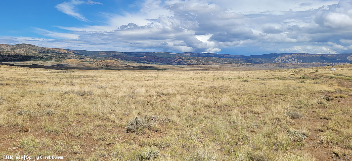
What you’re looking at in the pic above is our crazy-good grass, which amazes me because of the little – but always valuable – rain we’ve gotten this summer (this year, really; it’s been pretty darn dry since *last* year). The galleta grass is particularly bonkers this year, along with the sand dropseed and/or alkali sacaton (very similar in appearance). This is from right inside the basin’s main/western boundary entrance looking eastish.
From here, my next destination was the south rim of Spring Creek canyon, through which water runs out of Spring Creek Basin, out across lower Disappointment Valley and into Disappointment Creek, which delivers water – along with a “healthy” (aka large) dose of salt and sediment (apologies) – to the grand and spectacular Dolores River.

Spring Creek, draining Spring Creek Basin. 🙂 Around the near (left) bend, before the far bend, there’s a fence across the wide-open low ground and a water gap across the creek; that’s the basin’s western boundary. Way yonder, on the horizon, on the far side of the farthest rimrock and even beyond that blue-grey tide of rain, is the south shoulder of eastern Utah’s La Sal Mountains.

Not even my phone’s widest angle is wide enough to take in all the gorgeousity of Spring Creek through its canyon, so here’s another bit of view that takes in more of the upstream canyon area. Spring Creek Basin stretches north (straight ahead of me) and east (to my right) and south (behind me) from this perspective on the canyon’s south rim.

Those layers. The canyon is neither super deep nor particularly long. But it is so gorgeous.

In just the short time I walked out and spent along the rim, the storm to the west was already passing.

Looking upstream across the heart of Spring Creek Basin, where another storm loomed on the northeastern/eastern/southeastern horizon.

And because this is a blog about the wild horses of Spring Creek Basin, there IS a mustang out there, though I’m not sure he’s visible. As far as I know, the young mister is the only one to have crossed the creek (within view, anyway). 🙂
Grow, grass, grow!
Better late than never (this was the last day of specific rain in the forecast). I think we can be said to have gotten some monsoon rains this summer. Despite all the worry leading to this day (yesterday), soooo amazingly grateful. 🙂
* Thanks to Charley Pride for the inspiration behind this post’s title – “(High on a) Mountain of Love.”


I think – I hope – that these pix truly are worth 1,000 (or more!) words … but I’m going to give you a few more anyway. 🙂
This is the east-pocket pond, aptly named as it’s located in Spring Creek Basin’s east pocket. This isn’t the only pond that suddenly has water after Thursday’s tremendous downpour, but it’s the only one of which I have a “before” pic.
“Before” was a little after noon on June 27, a few hours before the four-hour deluge. “After” was about 26 hours later on June 28.
Maybe, if you look closely, you can see a band of greys at far distant left in the pond-now-full pic. Fortunately, the horses have multiple sources of water now. It’s amazing how quickly things change (for the better, in this case!).

Couple of things:
Yes, it really is (still) that dry in Spring Creek Basin and most of the rest of southwestern Colorado. Pooh on the U.S. Drought Monitor for thinking (erroneously in my oh-so-very-humble opinion) that we’re only “moderately dry.”
And: proof that mustangs and mountain goats have a common ancestor (!). 🙂
That’s Sundance (and one of his mares) on a finger of a ridge at the very southeastern end of what we call Knife Edge (which actually is fairly broad on top). This pic, taken with my phone as I hiked out to a series of hills to get up to the ridge that snaked down to where his band was, isn’t even wide enough to show how far to the right I had to go to get to that access area – where I could bypass the rimrocks. The other side of this ridge features a little cove, where a couple of the horses were grazing as I drove up the road to the point where I started hiking, but it’s all rimrock-locked. In other words, the only way TO that point is back up the way they got TO it in the first place.
OK, a third thing: You know I’m going to show you all some scenery from up on that ridge, don’t you? 🙂 (Here’s a crazy thing: As much hiking as I’ve done in Spring Creek Basin during the last 21 (starting to inch up on 22?!) years, I’ve never been up on that particular ridge or on the very top of Knife Edge. … The horses are very good guides at getting me to new places. :))
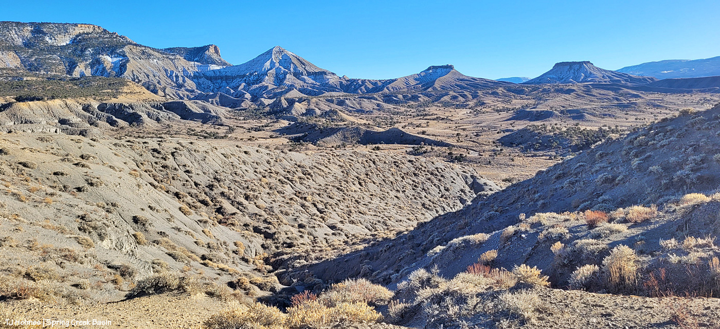
Upon leaving my buggy to start my hike (the big ridge and Sundance’s band are directly to my left), this was the first view that made me reach for my phone (aka easy-to-access camera). I’m just south of an area of Spring Creek Basin that I call the east pocket. Knife Edge is basically to about my 11 o’clock, and the sandy-colored ridges at the right of the image are what I call Valentine Mesa. The mountains are a stone’s throw away (!) in Utah; from the ridge I was later on with the horses, they’re mostly blocked by the bulk of Knife Edge.
I’m up on the ridge that leads to the horses’ location farther down at the fingertip end of it. That big rise of grey Mancos shale and orangier (!) sandstone is Knife Edge. The southern peaks of the mountains are just visible way, way out against the turquoise sky. Spring Creek canyon is visible at far left. That’s the basin’s western boundary; the farthest treed ridges are the southern/southwestern boundary of Disappointment Valley above the Dolores River and its canyons.

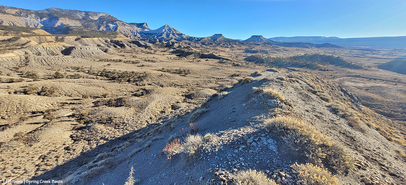
Looking left-ish from the above pic, that’s Spring Creek cutting through Spring Creek Basin in the middle ground. What I call the “weeping wall” is down there, and it provides a pretty constant source of trickling water for the mustangs. At far upper right is the eastern end of Filly Peak in the basin’s western region, and straight out is Flat Top. Round Top is barely visible at left. In about the middle ground – shadowed on its northeastish length – is the ridge I call rollercoaster (though it doesn’t look very rollercoastery from this perspective). … And see the glimmer just above/beyond it? That’s the rollercoaster ridge pond, still decently full of water (semi-frozen, depending on conditions). That’s the pond from the “Reflections” post recently. … And what do McKenna Peak and Temple Butte look like from THIS perspective?
I’m so glad you wondered! 🙂 From a little right of left: Temple Butte, McKenna Peak, what I call submarine ridge (you can see the two “arm” ridges of the actual feature from here) and Brumley Point, on Spring Creek Basin’s southeastern boundary. The Glade is in the far distance, touching the sky. A little closer – middle ground – is Spring Creek and part of the basin’s loop road (rough, and I would not recommend driving a vehicle on this section). The ridge down to the horses starts to the left and runs through the nearer middle of the pic. Sundance was actually partially visible (his back), but I don’t think he shows up very well in this pic.
This pic (left) and the next (right) were taken from the same vantage point, but when I tried to stitch them together into a bit of a panorama in Photoshop, it didn’t work out so well. So, using the ridge in front of me as your guide, you’ll have to use your imagination a bit as you scroll up and down to look left and right (!).
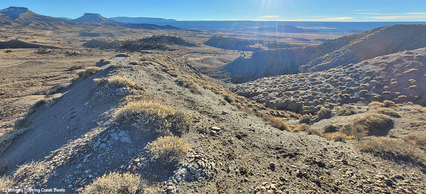
If you can find the ribbon of road, out there in sort of the middle, heading uphill (to the left from this perspective), is where I was when I looked up and horses appeared, much to my wondering eyes! (Magic isn’t just the domain of Santa, folks.) If I’d been going the other way around the loop, downhill, which is my usual direction and preference given some fairly challenging road issues (!), I don’t think I’d have seen them because I’d have had to look back over my shoulder and up. I try to look in that area because I’ve seen Sundance’s band in that relative vicinity before, but see the little “cove” down to the right in the second pic (the one right above)? That’s where a couple of the horses were when I first spotted them from below, and if I’d been in a different place, I wouldn’t – couldn’t – have seen them there from the road.
Another lesson: Perspective often is everything. 🙂
Pretty dry out there. The forecast is starting to show us some glimmers of hope for coming snow. We got kind of skunked over Christmas, but fingers and hooves are crossed that our winter will start picking up in this newest part of the new year.

If this pic of pretty Mysterium up to her knees in the east-pocket pond doesn’t help you feel refreshed and relieved … sit with it a while. … It’ll come. 🙂
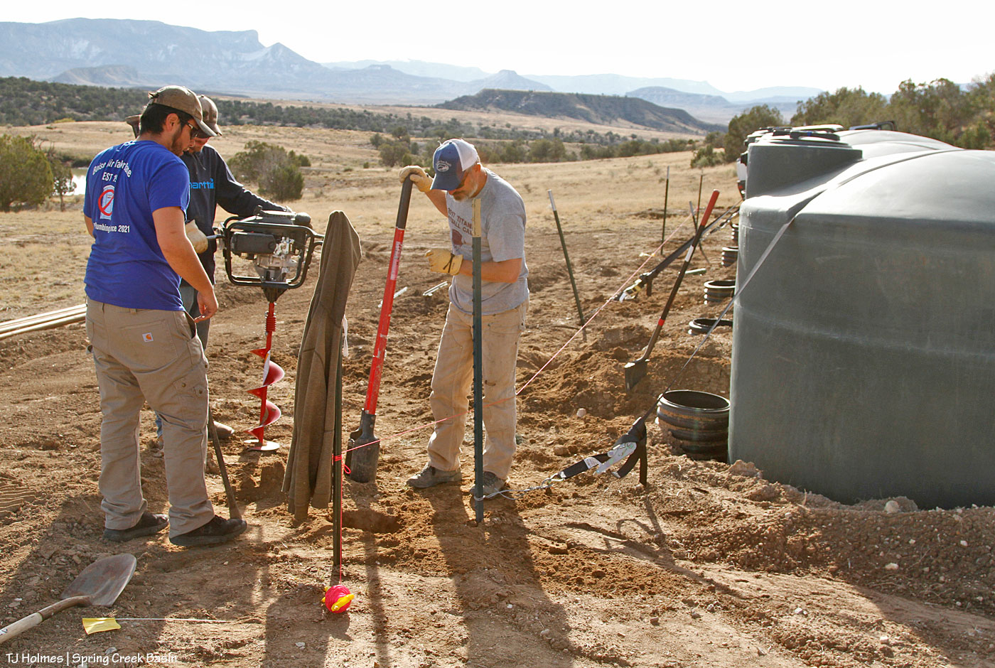
Well, we outlasted the summer heat, the gnats, the dust, the wind, the dust, the gnats, the heat, the dust (you get the picture), and it’s time to finish our second new water-catchment project for our mustangs of Spring Creek Basin!
Last week, after waiting out the drying roads and before the next round of moisture (soaking rain and big, fat flakes of snow that didn’t stick but added to the moisture), Mike Jensen, Garth Nelson and Daniel Chavez – our BLM range heroes! – came out with tools and supplies, and we got started on phase 2 to get the catchment finalized to take advantage of hoped-for winter snow.
If you need a quick refresher about our work to install the tanks and piping and trough, click on June 2022 over on the right under Archives, then scroll down to find the posts about that work.

It all starts with the first post (pipe) hole! Well, it really all starts with running a string (see the pink line across the tanks?) to dig the holes so the line of steel pipes – to support the roof structure – will be in a straight line. Garth (left) and Daniel are on the gas-powered augur (what a difference that makes to digging holes! especially as many as this project requires), and Mike supervises. He would later do the lion’s share of work with the post-hole digger (far left) and tamp bar when the augur wasn’t quite enough to break through the calcium layer of soil.

Moving right along. You can see by their bodies that Garth and Daniel are putting their weight and strength over the augur to dig deep into the soil.
This was the last hole across the front line of the tanks.
Have you noticed the black straps over the tops of the tanks? As you might remember, we had another good monsoon year (heck, we HAD monsoons again this year after *not* for a few years). After the tanks were in the ground (in June) – piped together at the bottom, the dirt covered back over – at least one of those big rains poured off the hill behind and above the tanks and ran across the not-so-settled dirt around them … and sort of UPROOTED at least two of the tanks – and broke at least one pipe connection! The BLM guys had to come back and fix that little issue (no pix of that because the designated photographer/documenter (that’s me) was on vacation in Wyoming at the time). The straps over the tanks – snugged to T-posts driven into the ground – were to hold them in place in case of another gully washer – which seems to have worked.

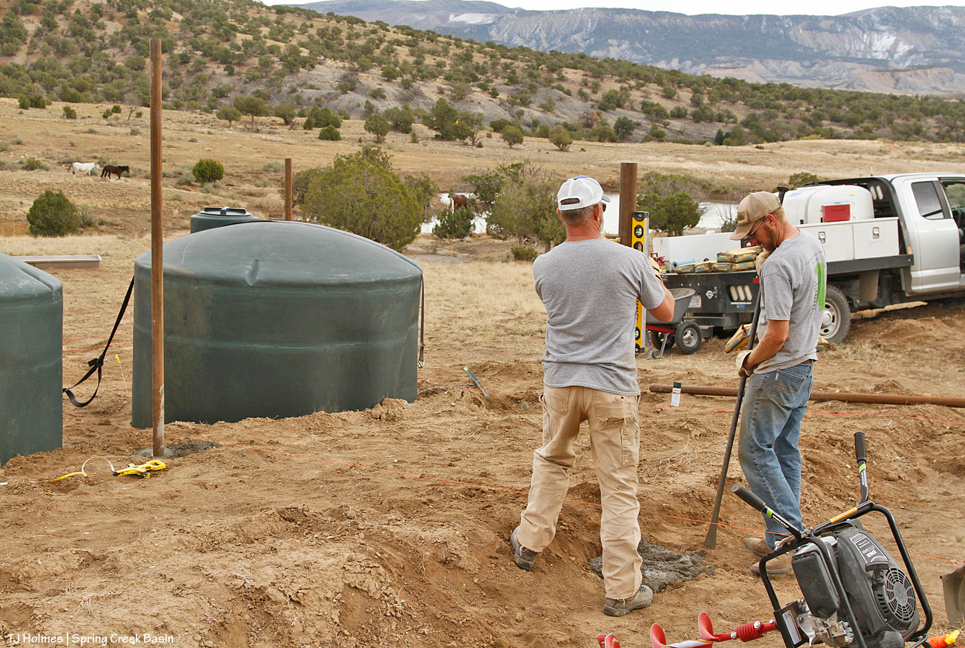
Mike checks the level of the pipe while Daniel finagles the concrete to straighten the tilt.
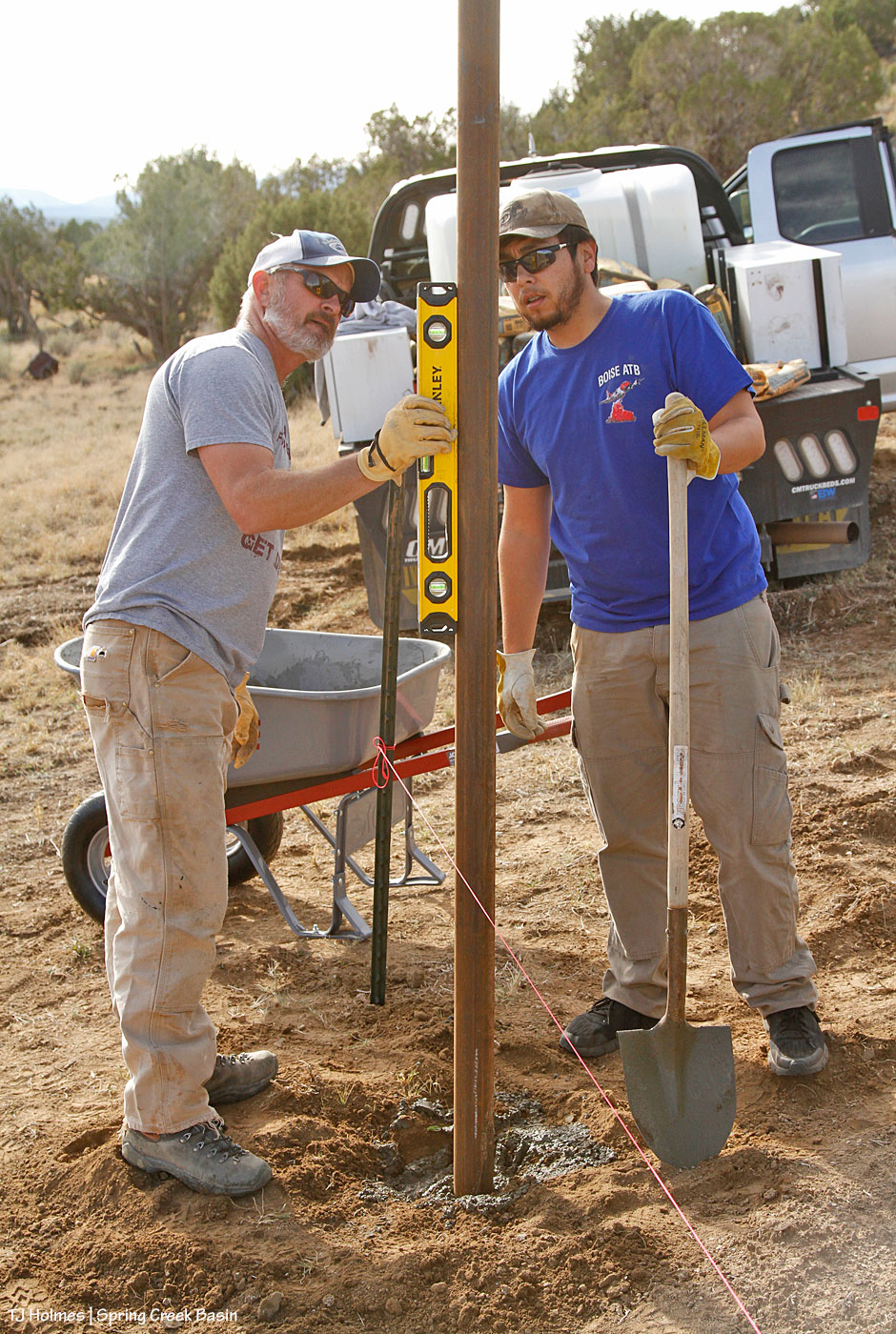
Right on the money! These pipes will be holding an immense weight to support the propanel roof sheets, so the guys filled all the holes with concrete to ensure the longevity of the pipes in our erosion-prone soil.

While Mike and Daniel were mixing and pouring the concrete, Garth was cutting the pipes into sections to place in the holes that the guys had dug with the augur. I went back and forth, lending a hand wherever needed and taking pix of the work (because all good work should be documented!).

The guys work together to shovel the concrete into one of the holes to stabilize one of the pipes.

Getting close to end end of hole-auguring on the back side (uphill side) of the tanks. Of note: The white on the far ridges, including McKenna Peak and Temple Butte, IS, in fact, snow. That seems at odds with the guys wearing T-shirts, but it was warmish until the wind picked up. And did I note that it wasn’t HOT, and there were no gnats and no dust?

Here, you can see the pipes that we’ve already placed – and concreted in place – that will serve as supports for the roof.

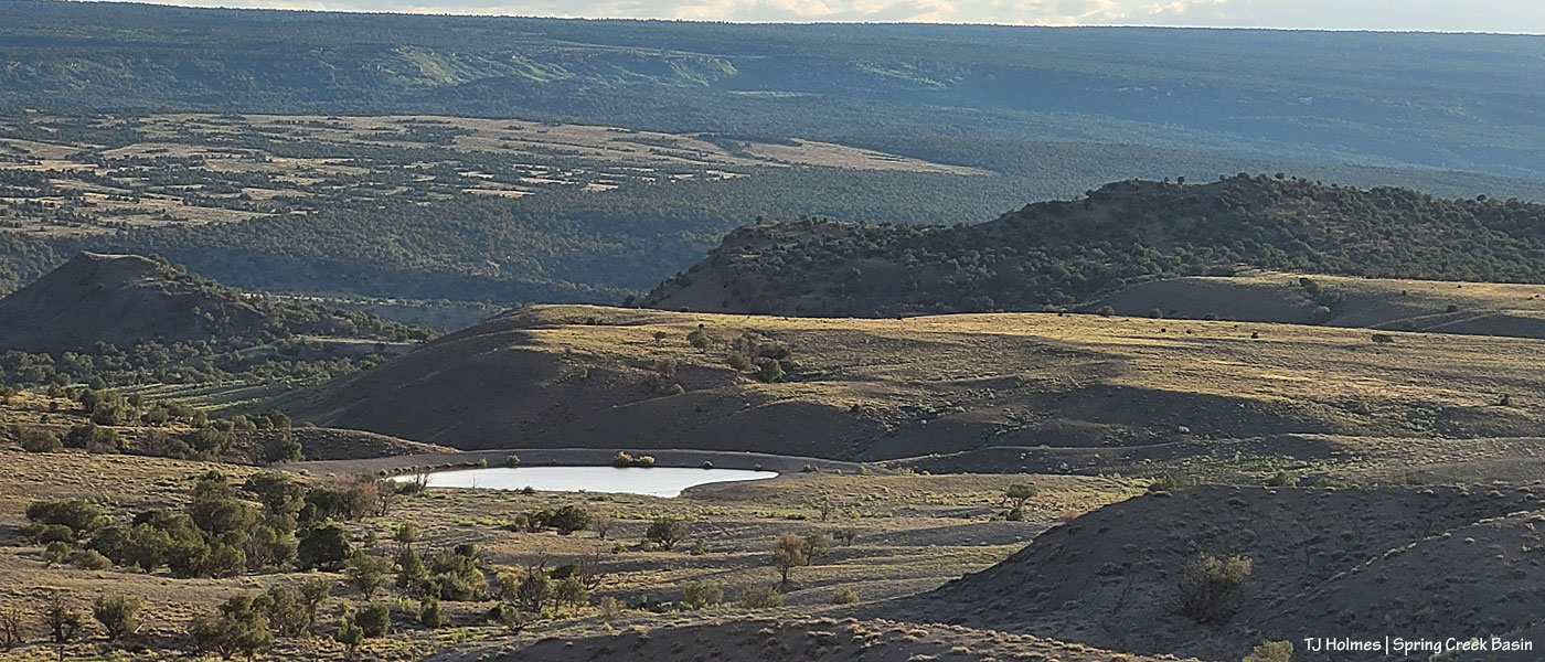
And then, as we were getting close to placing the last pipes, THIS happened: A couple of bands came down the hill from the northwest bowls (little “swales” in the northwestern part of Spring Creek Basin, above Spring Creek canyon) to drink at the pond in this area that I call the northwest valley. Why are we building a water catchment in an area that has a pond, you ask? Because, other than this year (of course), that pond only rarely has water in it, which meant that this area – usually dry – is a really GOOD location for a water catchment. And it has proved to be a good location – this year – for showing us that the horses will use this area – and graze it – when there’s water there to drink!

The guys used a couple of methods to ensure straightness of the posts (not just the straightness of each individual pipe but all of them related to all the others in lines up and across), including the string line (pink, tied to the short bit of rebar between Mike and Garth); measuring distance with a tape measure between the posts pictured, as well as those to the left, out of sight; and Daniel, shown here employing the eyeball method – sighting along the three pipes.

Mike and Garth level the pipe while the horses decide there’s not much to worry about and go on to the pond.

Peace on both sides, horse and human.
More of the same. I so loved that the horses, after their initial shock at seeing us at their watering hole, pretty quickly decided that we weren’t doing anything upsetting at all.

And the last pipe is in place!
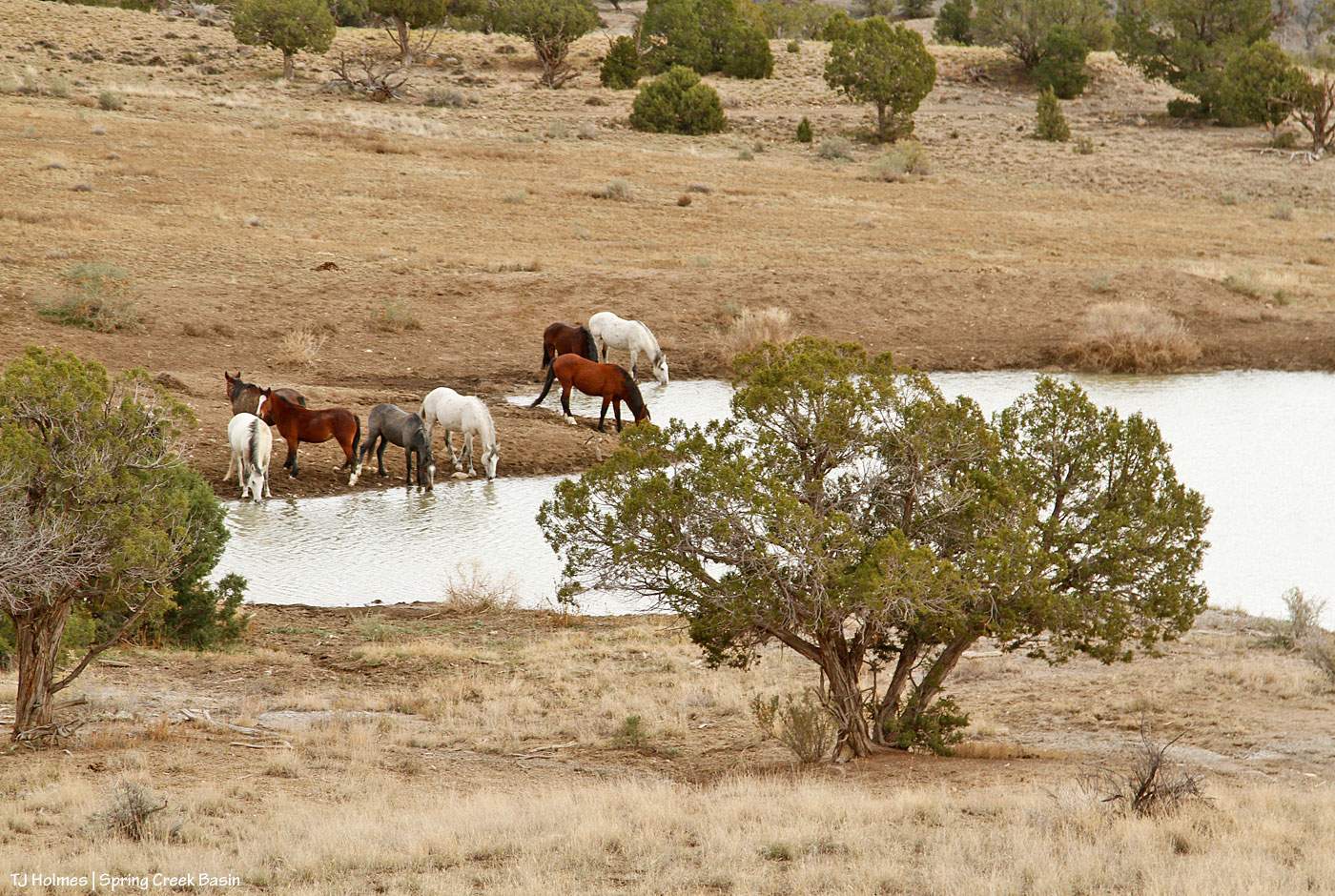
It’s a good-size pond, and when it holds water, it holds a fair quantity!
Shortly after this, we were done with all the pipe placement and started cleaning up tools and supplies. The horses drank and wandered off to graze in the little valley. Even when the guys rumbled out in their trucks, the horses weren’t bothered. I stayed to take some pix. Before I left, two trucks with sightseers (importantly, not hunters (the end of today marks the end of the second rifle season … two more to go …)) drove up into the northwest valley. The horses had drifted and were grazing right along the road, but the visitors moved super slowly and respectfully, and the horses gave them a marvelous view for pictures right through their passenger-side windows!
We’ll continue work on the roof structure over the tanks as weather allows. Another moisture-bearing system is headed our way by Tuesday night. 🙂
A visual selection of newly full ponds in Spring Creek Basin:

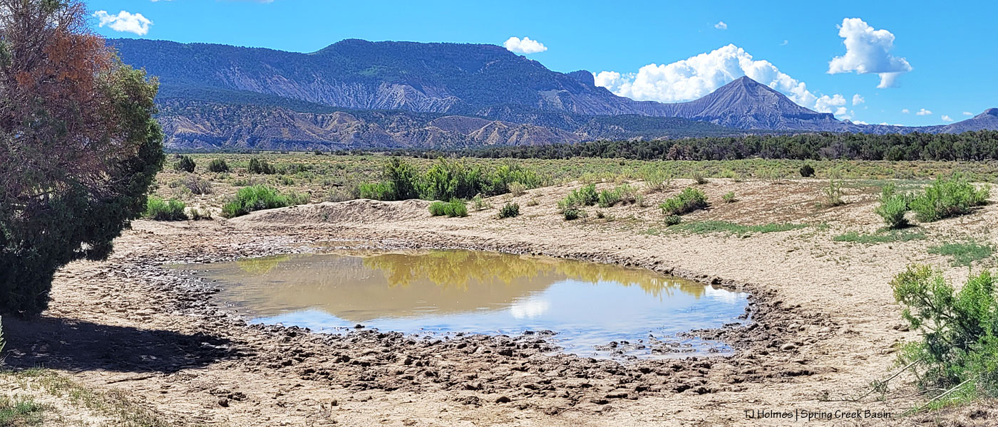
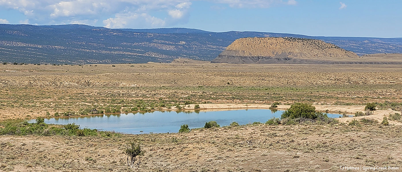
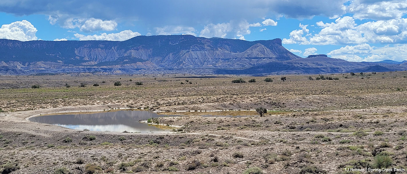
Courtesy of Mother Nature! We’re grateful. 🙂
In Spring Creek Basin, with much love and gratitude, we received a most precious gift this past Saturday: Three young mares named Rowan, Aiyanna and Dundee.
Yesterday on the blog: a quick teaser with an equally short explanation of why we periodically introduce mares to Spring Creek Basin for the genetic benefit of our necessarily small herd. Today: a much longer, illustrated tale of our very quick (and not-so-short) journey from the southwestern corner of Colorado to just south of the Wyoming border and back again (heavy on the back-again and release).
Last Thursday, Mike Jensen, our excellent Spring Creek Basin herd manager, called with a request. He was about to go on annual leave with his family, and asked, “Can you drive to Sand Wash Basin to collect three young mares to introduce to Spring Creek Basin?”
CAN I!!!!????????????????!!!!!!
I think I would have left that minute had practicalities and a *little* preparation not been necessary. 🙂
By 9:30 the next morning, long-time advocate and friend Tif Rodriguez and I were speeding (as fast as you can safely go with an empty trailer) north.
At 5:30 Saturday morning, we met BLM Colorado’s on-range wild horse and burro specialist Ben Smith and another BLM employee in the dark parking lot of a Craig hotel, then followed west and north and into Sand Wash Basin as the sun rose.
By 11ish, we were back on the road heading south, now going MUCH slower with three precious bodies in the trailer. Tif and I joked that we needed “Precious Cargo: MUSTANGS” signs on the trailer to alert the drivers who stacked up behind us on the curvy roads. … But not a joke! We had three lovely Sand Wash Basin mustang mares in that trailer, and it was our responsibility and great honor to deliver them safely to Spring Creek Basin!
Shortly before 7 p.m., I backed the trailer down a faint doubletrack above a full pond, and with Tif primed to video the mares’ first steps to the rest of their lives, Kat quietly opened the trailer door.

… And then we waited. …

Dundee, at the back, was the first to see the open trailer door as the gateway to freedom.


And she was the first to make the leap to freedom!

Isn’t she lovely? She reminds me strongly of Kootenai, one of our 2008 introductees.

She looked back at her friends on the trailer and seemed to say, “C’mon out! The grass is EXCELLENT!”

But while there was immediate interest in what Dundee was doing out there, there’s also no denying that these girls were exhausted. They weren’t in a hurry to leave the safety of the trailer.

With the sun continuing its relentless march toward the western horizon, however, we wanted the girls to find food (in abundance) and water (right down the hill within sight of the trailer) with as much light left in the day as possible. So Tif stepped gently onto the runner at the front of the trailer, which gave the younger girls the encouragement they needed to take a closer look at their new home.

Two more flying leaps, and all three girls were on Spring Creek Basin soil!

Aren’t they divine?
Tif and I had discussed various scenarios that might happen upon their release from the trailer. The one thing I was sure of? That they would NOT go immediately to the water that was the humans’ No. 1 priority for them upon exit from the trailer after a seven-plus-hour road trip. Because you can show mustangs the water, but mustangs are mustangs, after all. And mustangs have their own priorities:

And that was to immediately start eating the green, green grasses of their new home! We made a very conscious decision to deliver them just uphill of a lovely, nice pond … with an abundance of galleta, grama, sand dropseed (native grasses) and greasewood, four-wing saltbush and tender Russian thistle (although it becomes tumbleweed later, at this stage of its green growth, the horses eat it with relish) also right there. (All the images of the girls off the trailer, except the very last one, were taken of them within 50 yards of it.)

Our iconic McKenna Peak (the pyramid-shaped hill) and Temple Butte in the background. We hope they come to love their new horizon (it’s all a little closer than the wide-open and far-away horizons of their Sand Wash Basin homeland) as much as we do.


By great good fortune, monsoon rains fell this summer throughout our region for the first time in many long years, and Spring Creek Basin grew her very best to welcome these lovely ladies to the rest of their wild lives.
Some additional random images from the basin that evening:

Rain and virga falling across our northwestern horizon, the rimrocks of Spring Creek canyon in the foreground and La Sal Mountains of Utah in the background.

Glorious sunset beyond our western horizon (in that direction lies the (main) entrance to Spring Creek Basin).

The pond below the mares’ release site.

This was yesterday’s blog-post pic, and it’s appropriate to end today’s blog post here (almost), with an image of Spring Creek Basin’s newest beauties. Light was fading, and our day was at an end, very happily and peacefully.
Rowan, Aiyanna and Dundee were face- and knee-deep in grass and vegetation, water was nearby (our main water catchment was a short distance to the east, in addition to the pond they initially ignored), a couple of our bands were within sight, and all was well within our small and magical world.

Dear Sand Wash Basin, thank you for the gift of three radiant and unique and utterly amazing mustang mares who now join our grateful family.
With love from Spring Creek Basin.
So we had a bit of this:
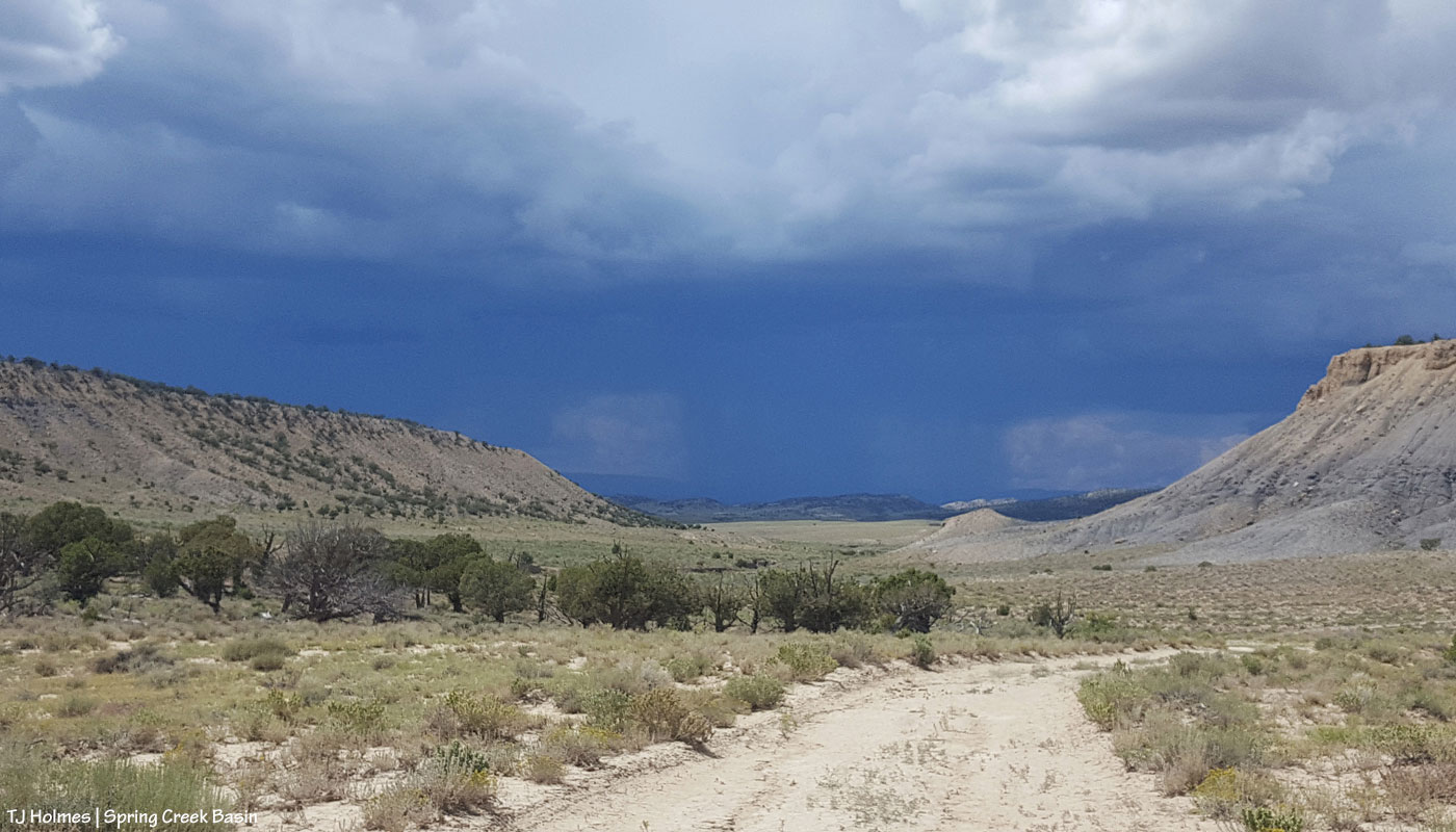
And, because of skies like that the last couple of days from the east and southeast (the above pic is looking west), all our ponds now look like this:

!!!!!!!!!!!!!!!!!!!!!!!!!!!!!!!!!!!!!!!!!!!!!!!!!!!!!!!!!!!!!!!!!!!!!!!!!!!!!!!!!!!!!!!!!!!!!!!!!!!!!!!!!!!!!!!!!!!!!!!!!!!!!!!!!!!!!!!!!!!!!!!!!!!!!!!!!!!!!!!!!!!!!!!!!!!!!!!!!!!!!!!!
🙂
Are we happy? Are you kidding?!
We are about a gazillion kinds of grateful. 🙂
Every time I rolled up to a pond and saw the reflection that meant water, I yelled, screamed and cried with joy. Nobody heard me but the wind … and Ma Nature. She knows our gratitude.
