Well, yesterday was pretty quiet, weather-wise. Nice and sunny with fluffy, pretty clouds in a sharp blue sky. I made it down-valley to check on Disappointment Creek where it crosses under Disappointment Road on its way farther west, and I also watched happily as Spring Creek ran with muddy water in its broad arroyo a bit farther north.
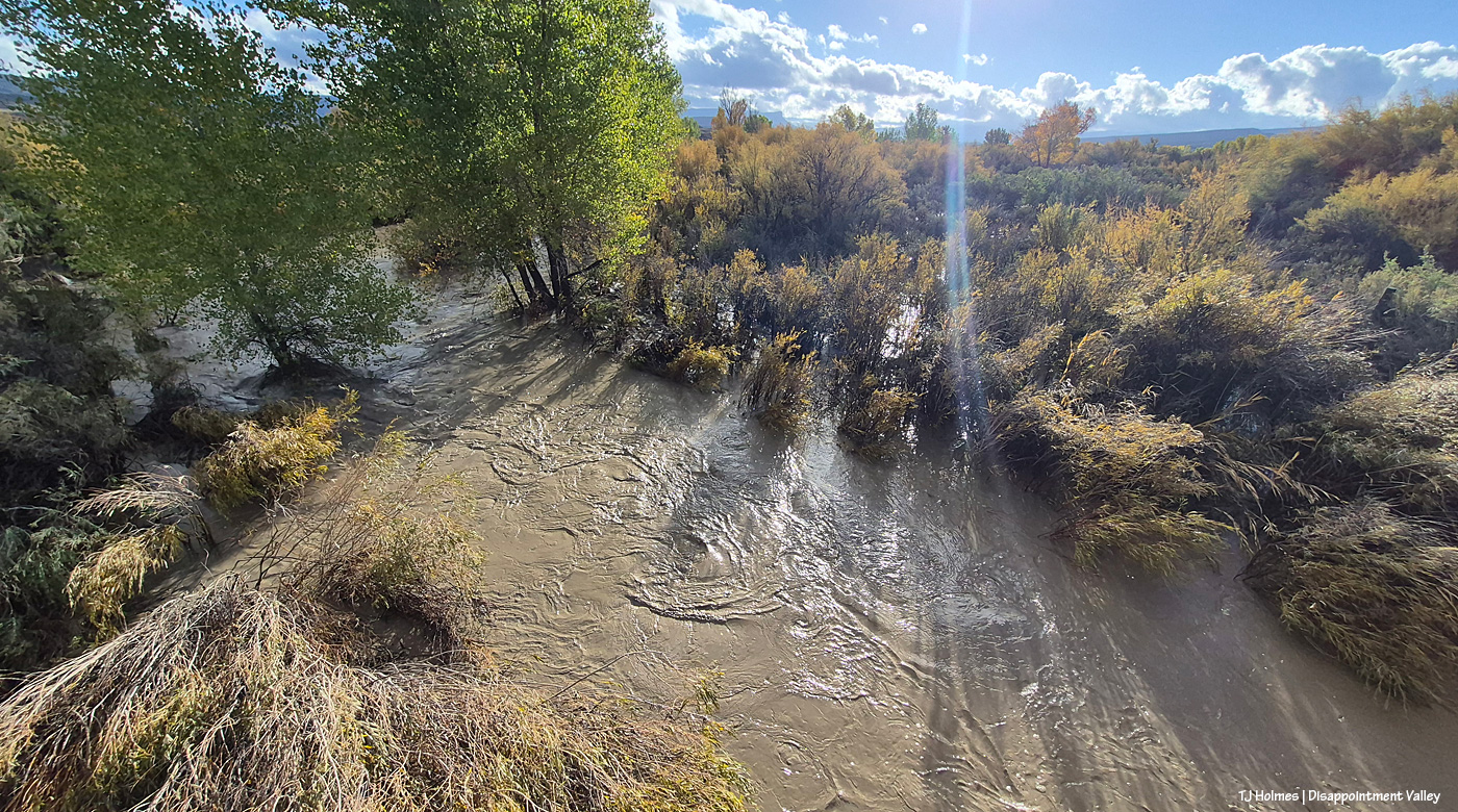
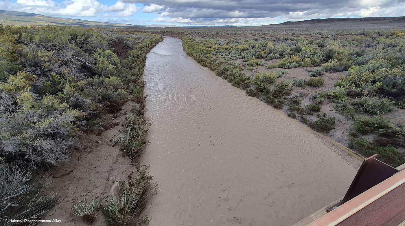
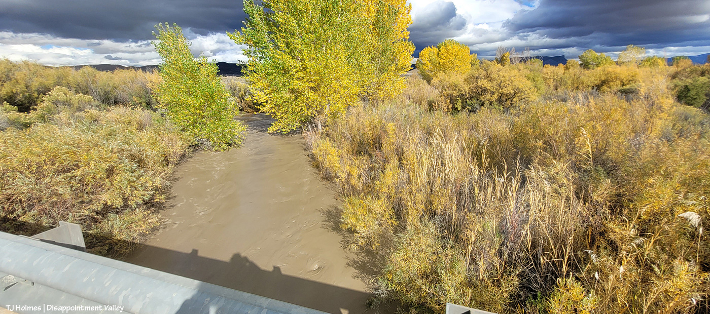
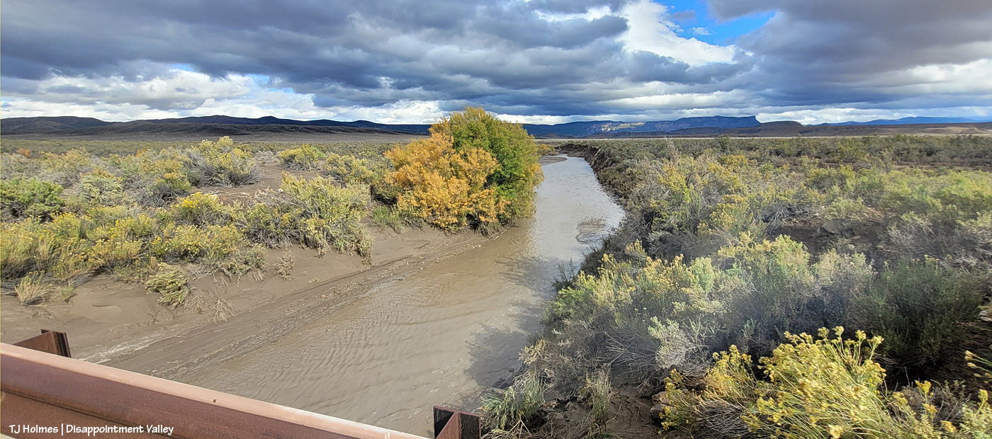
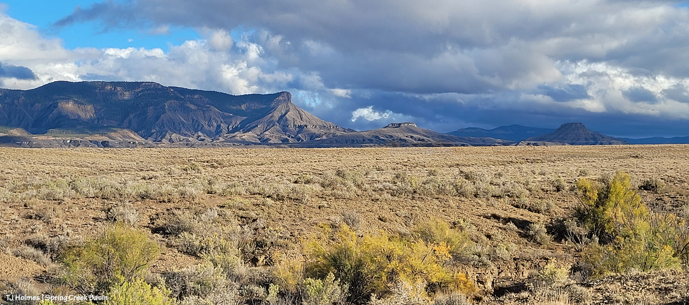
This is a view of the still very swollen Disappointment Creek from what’s known locally as the Daddy Williams bridge (nope, I don’t know who Daddy Williams was). Looking upstream as the water flows toward me. Temple Butte is at just about center WAY back east.
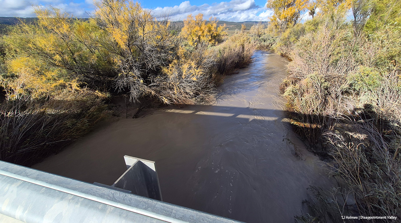
And from the west side of the bridge as the water swirls and flows away toward the Dolores River.
Then farther north, past Road K20E to Spring Creek Basin – muddy and still puddled with rain water! – to check on Spring Creek. Oh, the anticipation! Would it still be running??
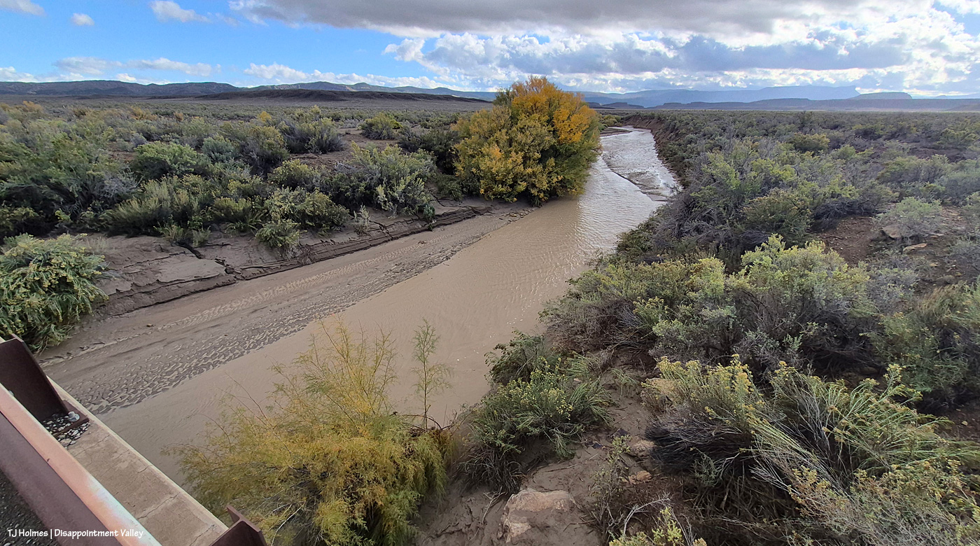
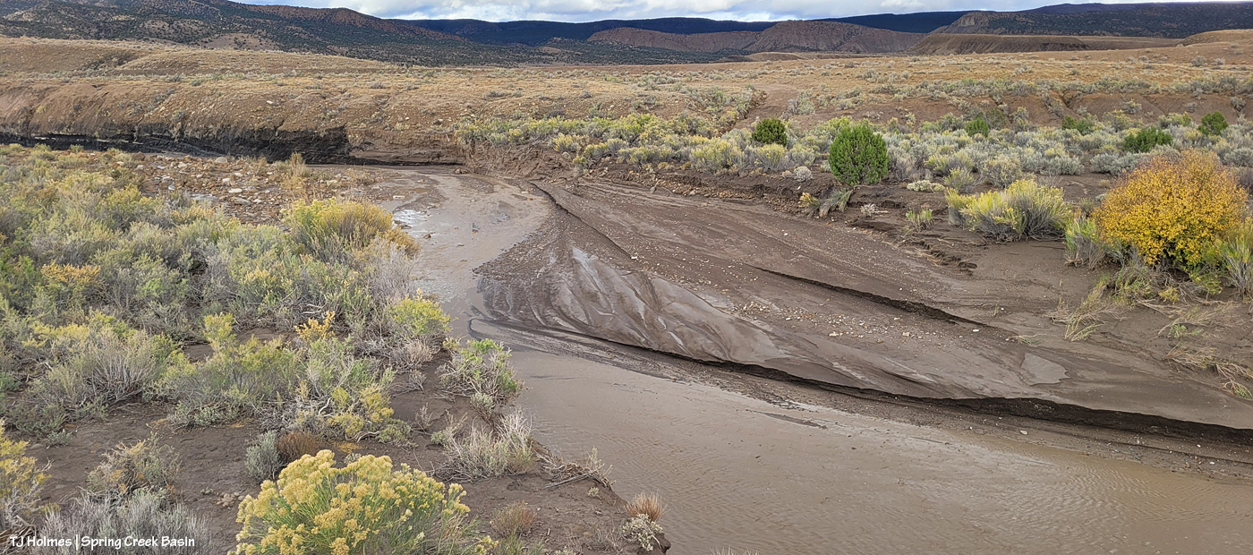
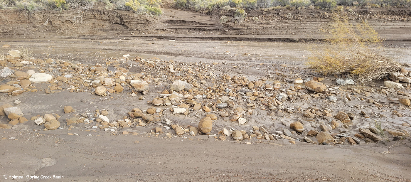
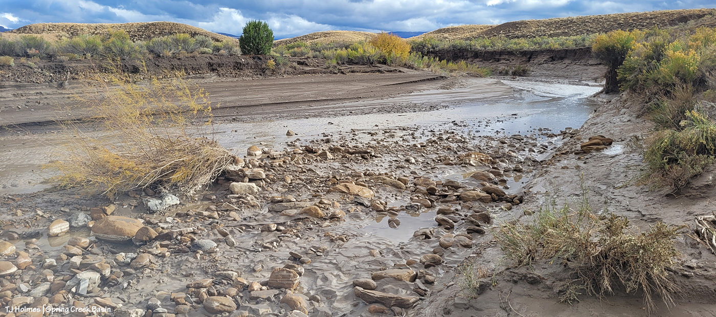
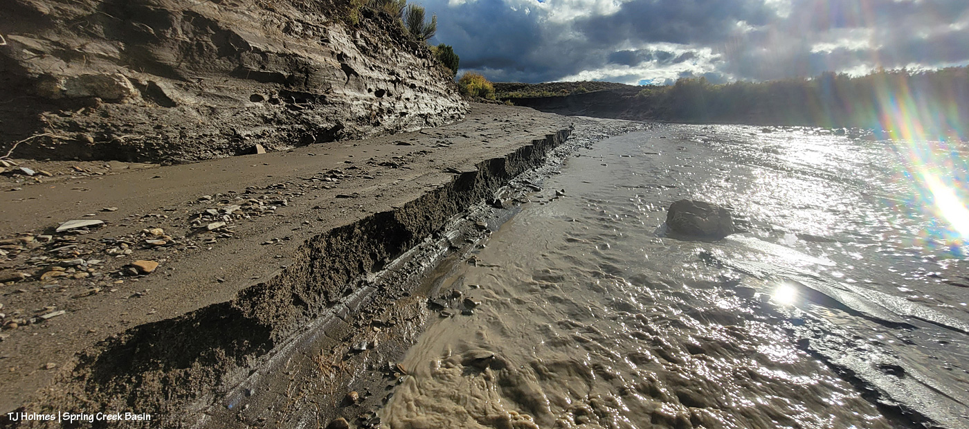
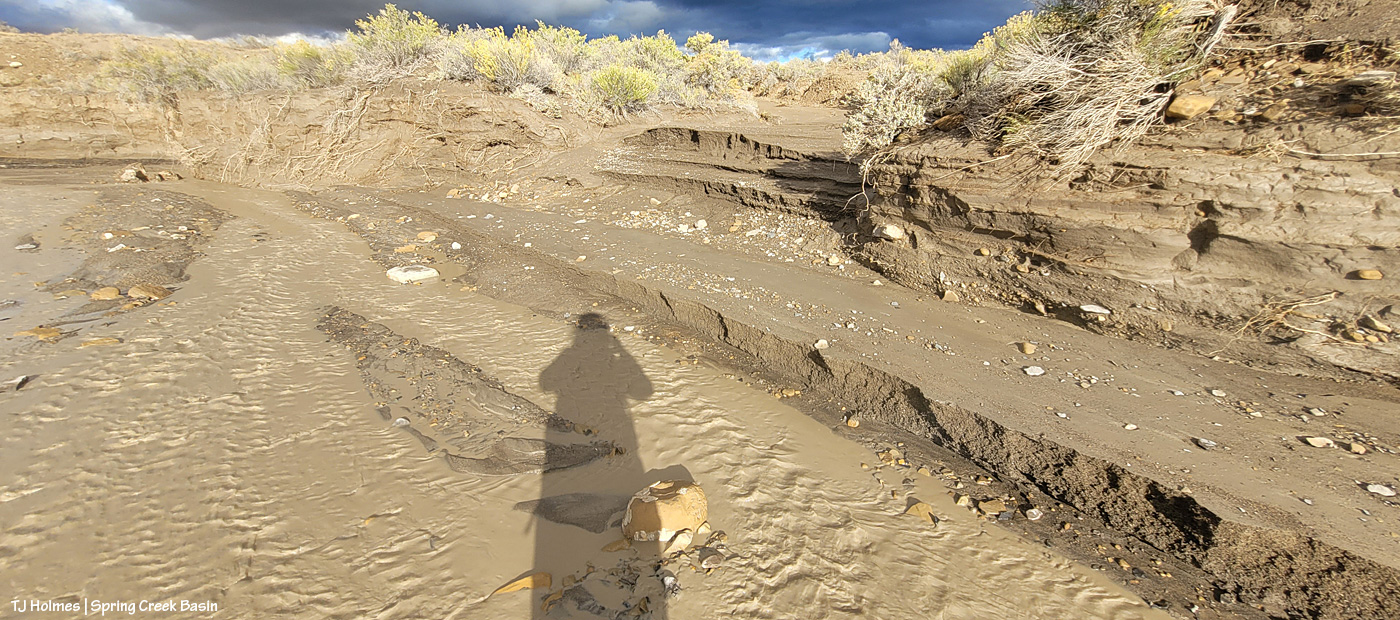
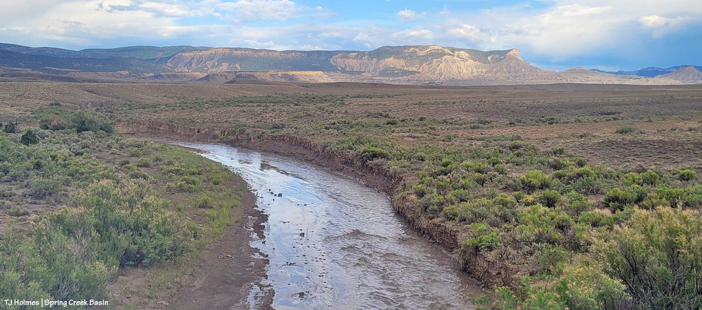
Spring Creek is much broader than Disappointment Creek at pretty close to the same elevation. You can see on the other side of the creek how high the water had risen along the creek bank and how much it had receded. By step-measurement, that was about 15 feet. Spring Creek Basin, the arroyos of which gather all this water into the lowest, main arroyo – Spring Creek – is visible in the distance to the east.
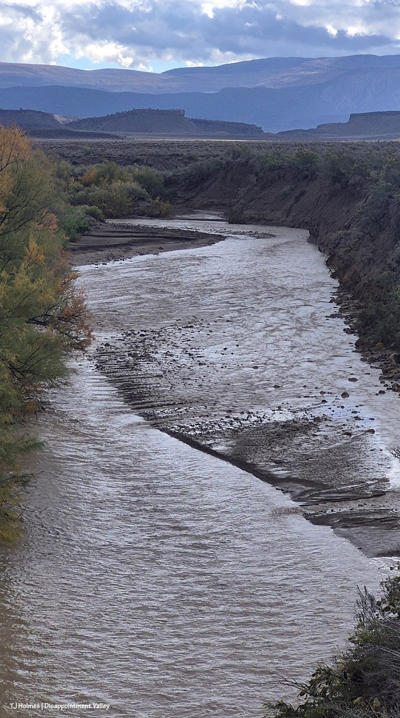
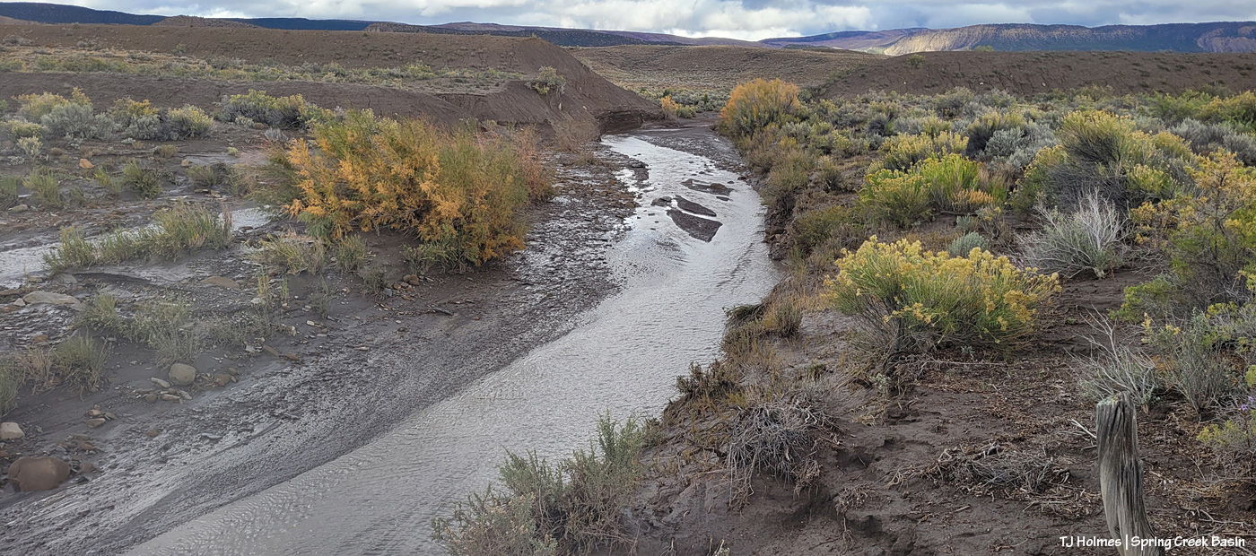
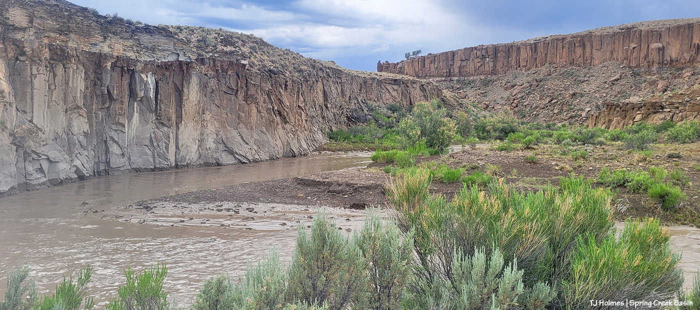
Spring Creek flowing out of Spring Creek Basin, through Spring Creek canyon, visible just right of center in the low background.
Looking nice and lovely and broad – and pretty shallow by this time – on the west side of this bridge, Spring Creek flows on west to join Disappointment Creek.
The rain should return today. Oh, and the total for the two full days between 8 a.m. Wednesday and 8 a.m. Friday: 2.74 amazing inches. Absolutely outstanding!
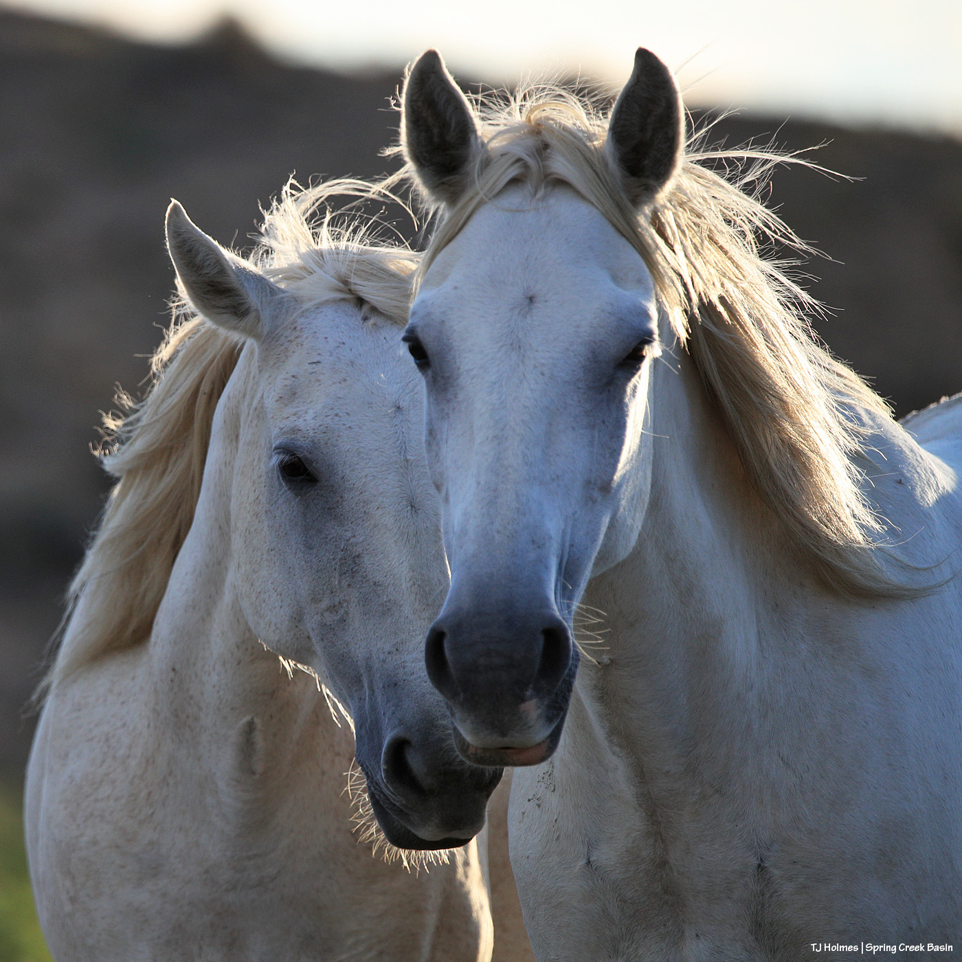
Tenaz was feasting on greasewood during the band’s unhurried mosey toward water, so he was a little late to the drinks party in Spring Creek, but he made it. He’s looking up on the bank as some horses have already had a tasty slurp and have cleared the way.
Above is the same featured day as the last few pix – the day the clouds cleared after five days of glorious rain. For the next couple of days, we had the same bluebird sky you can see in the pic above … and now we’ve returned to clouds in anticipation of the next wave of rainy days!
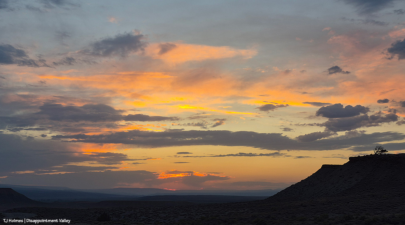
Last night as you read this (earlier tonight as I’m typing), I can’t even put into words the crazy-awesome spectacularity of the storm sky, especially at sunset. There were at least four partial rainbows (a couple of them were very faint), and it rained so hard across upper Disappointment Valley that by the time I got out of the basin and up-valley a fair distance, alongside the basin, Disappointment Creek (which does NOT run through Spring Creek Basin) was rollin’ like a RIVER!
I already had the above pic of Tenaz ready to go, and I just don’t have time for all the processing of pix from today (yesterday as you’re reading), but hopefully by tomorrow’s post (as you’re reading), I’ll have some pix that won’t begin to do justice to the outstandingness of Mother Nature when she lets rip.
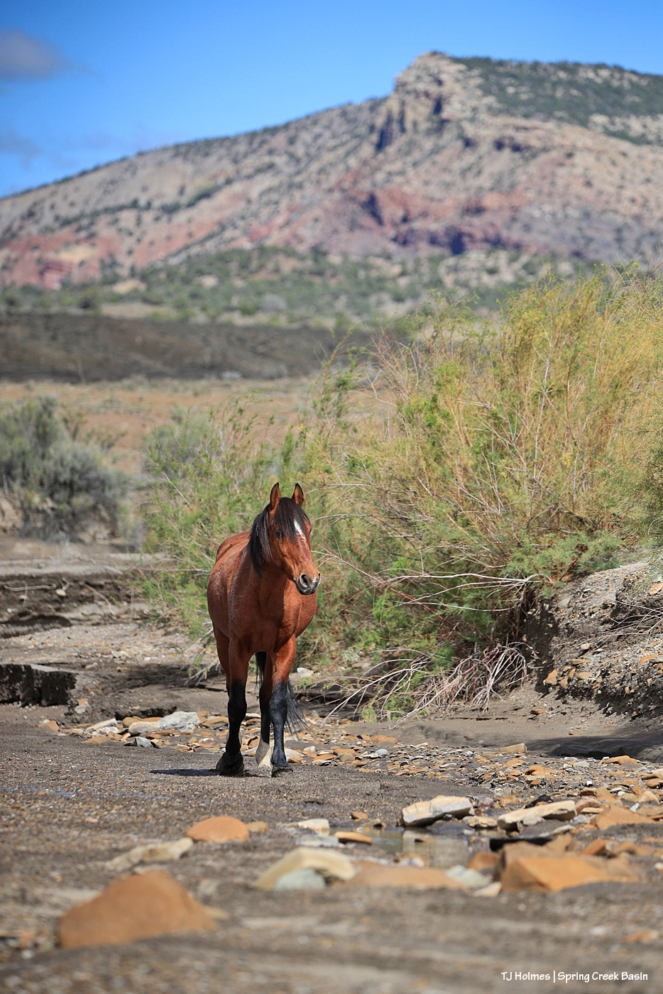
This is another one from the day of clearing after the amazing five-day run of rain last week, and this is Temple in Spring Creek, just upstream of the canyon. Water most definitely had run through the arroyo (probably multiple times during the frequent rains over Spring Creek Basin), and there were big puddles in places (along with a lot of very deep, pillowy mud). This little stream in the arroyo was fresh, trickling water, which the horses definitely seemed to appreciate.
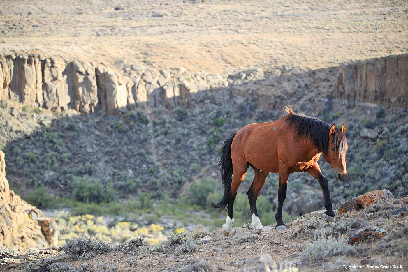
Tenaz (and the other bands) were well up on the north side of Spring Creek canyon – near the highest point that looks west out over lower Disappointment Valley from above the rimrocks that form Spring Creek Basin’s dramatic western boundary – when I hiked up to them the other evening.
Below Tenaz is the eastern end of the canyon and Spring Creek (there’s actually water down there from where water running underground hits bedrock and is forced up in a decent-distance running seep). Behind Tenaz is the north-facing south rim of the canyon (the main western entrance to Spring Creek Basin is on south a short distance). To my right – ahead of him – the top of the canyon slopes upward to where it abruptly ends at the sheer vertical rim of rock that forms the basin’s natural western boundary. In some places, it’s natural, and in others, there are fences to keep the mustangs within the basin’s borders.
We came up (they were already there when I entered the basin and saw them) from an “easier” slope that comes up directly from the Spring Creek arroyo to the leftish/behind Tenaz.
Between one thing and another (including some more sprinkles and thunder/lightning risks after the big rain Tuesday night), it took me three days to get out to Spring Creek Basin to check on the state of things. Only parts of the arroyos – Spring Creek above – were still damp, and this isn’t even close to as rearranged as I’ve seen Spring Creek and this crossing after a big rain over Spring Creek Basin. I’ve been turning the valve to one trough on and off manually because part of the float is broken, and I hope to report soon that we’ve fixed that. Fortunately, there’s plenty of water in the tanks to fill the trough pretty quickly (good pressure).
This pic, taken Sunday from between the main/original water catchment and Filly Peak in Spring Creek Basin, is looking southeast toward the Glade and Benchmark Lookout. A few days before, I’d seen the red swaths of retardant across the trees while looking at smoke up there, but I didn’t manage to get a decent pic that showed it. While fire continues to smoke in that area (that’s the Ferris Fire’s northeastern edge), clearly firefighters and aircraft pilots have been hard at work. So hugely grateful! Rick and Linda Freimuth, who staff the tower during the fire season (!!!) hope get the green light to return this week. The mustangs and I (you know they would if they could) will be cheering their return.
Now, some taken yesterday (Monday):
Storm brewing to the east. Spring Creek Basin’s western rimrocks and Filly Peak (lower left) are in sunshine, while Temple Butte, McKenna Peak, Brumley Point and the basin’s eastern ridges are shadowed by rain! Woo-the-heck-hoo!
Looking back to the west from the same spot as above. More rain! What looks like white smoke on the horizon at left IS smoke from the Ferris Fire … and I hope it got a good dose of the wet stuff. It wasn’t a high-rain-chance day, but toss the forecast and let ‘er rain!
Methinks the weather wizards were outsmarted by Ma Nature herself. 😉 RAIN, BABY, RAIN! This is from Chrome’s Point in western Spring Creek Basin, looking eastish at a curtain of rain that DID, as I was taking pix, make its way west. Unfortunately, I didn’t get tooooo wet. Ha – I would not have minded!
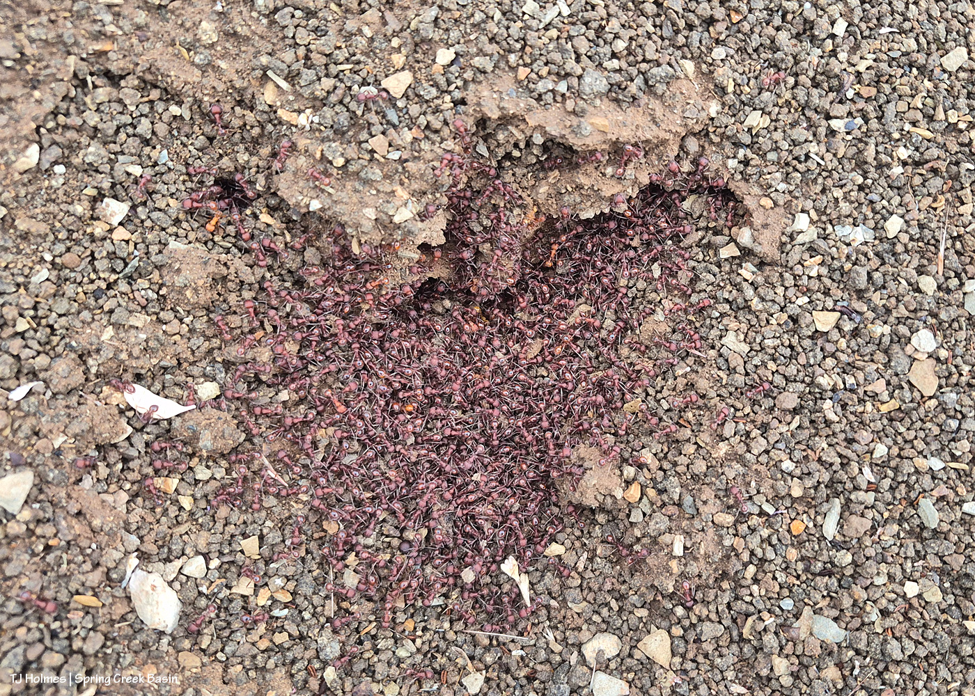
Ants congregating at the entrance to their mound. Apparently, “Ants congregate at their mound entrances after rain primarily to survive flooding. When underground tunnels fill with water, the colony is forced to evacuate. They move the queen, larvae, and food upward to escape the saturation, using the surface or mound entrance as a temporary, elevated sanctuary.” Interestingly, these ants and others I saw doing the same thing in the same relative area happened to be on some of the highest ground in the basin, near the western boundary. I guess that when you’re an ant, everything is at the elevation of ground level (ha ha!).
From the south wall of Spring Creek canyon looking eastish after the rain (it didn’t last very long, unfortunately).
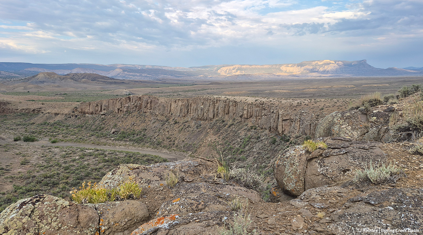
Hope you don’t mind this view! It’s pretty spectacular. No, that’s not a road down there in the canyon; that’s Spring Creek arroyo, and just beyond (lower left), it leaves Spring Creek Basin to cross lower-ish Disappointment Valley on its way to join Disappointment Creek (neither of which are carrying water at the moment).
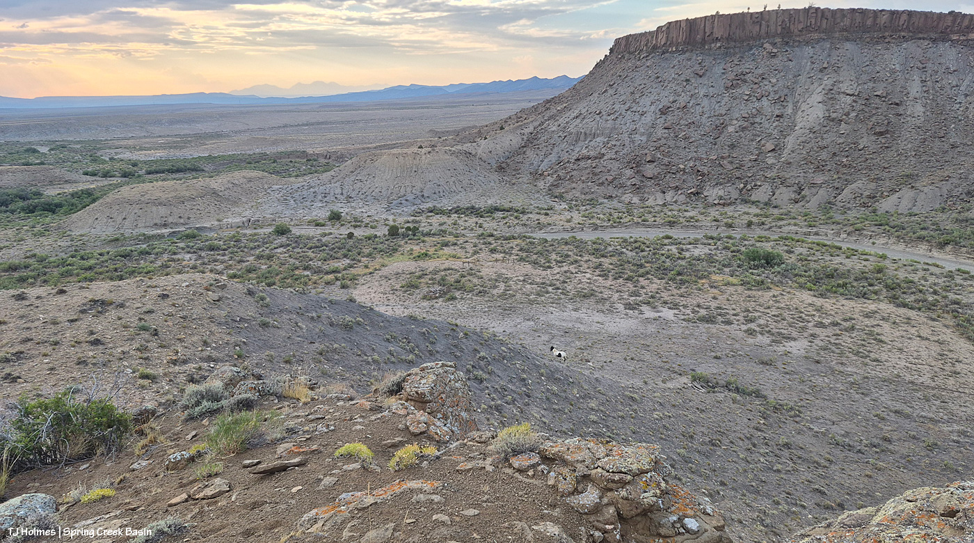
See the pinto pony? This is from the same point as the above two pix, looking generally northwestish across lower Disappointment Valley toward Utah’s La Sal Mountains. There’s a fence across this lower end of the canyon to keep the mustangs within Spring Creek Basin, and there’s a water gap (hanging PVC pipes to move when water DOES flow) across the Spring Creek arroyo. There are a couple of manmade structures down there, one behind McKenna and one kind of in front of him.
As it turned out, though he and his pal and a band were in the vicinity – and the reason I walked out – it was something else entirely that actually took me all the way to the canyon rim. … And that will wait for another post because I got some pix that knocked even my socks off.
At least one part of Disappointment Valley got 1.35 inches of rain over about 16 hours yesterday (it started around dark Friday and ended mid-morning Saturday). Every minor ditch and arroyo to every creek bed (Disappointment, Spring and Dawson creeks) ran with water. … LOTS of water. None had been running previously; all had been dry.
While a lot of water ran off and away, there must have been a fair bit of soaking in; the rain was all fairly light and decidedly steady. The ground and the road into and in Spring Creek Basin are all SOGGY.
Come along on this virtual tour with me – yesterday late afternoon – to see what I saw:
It’s hard to tell either how wide or how deep the water is here in Disappointment Creek several miles up-valley from the turn to Spring Creek Basin off Disappointment Road, but given that it was previously dry, I *hope* you can see that it’s running like a milk-chocolate river. This is looking upstream.
Another view, from several miles downstream of the above image; this is just 50 or 75 yards south of the road to Spring Creek Basin. The creek channel is much narrower here; I hope you can tell how high and wide the water is?
Now we’re looking upstream at Spring Creek water flowing downstream (toward us) from Spring Creek Basin, a few miles east (Temple Butte is visible against the horizon). (I’m still on Disappointment Road, a mile or so north of the above Disappointment Creek pic.)
And, from the other side of the bridge, Spring Creek flowing downstream toward its confluence with Disappointment Creek (marked by the line of barely visible golden cottonwoods in the middle distance).
I know it’s hard to tell width and depth again; the creek arroyo here isn’t terribly deep, but it’s three or four times as wide at this point as in the second pic of Disappointment Creek above. These creeks carried a LOT of water yesterday.
Then I went looking for the condition of the Spring Creek arroyo in Spring Creek Basin (in case this isn’t obvious, Spring Creek and its tributary arroyos drain Spring Creek Basin – when it rains – and the main Spring Creek arroyo carries all that gathered water west across Disappointment Valley to join the also-muddy water of Disappointment Creek, and together, they carry the watershed’s drainage to the Dolores River).
I thought you all might like to see a bit different view of Spring Creek, and I had to walk the last half-mile or so because the road was still too mucky even for my faithful little buggy, so this is just upstream and around the curve from the first crossing, where I usually take pix of rolling Spring Creek after a good rain. If you’ve ever gone into the basin with me, you’ve heard the story about Custer dam (and I even wrote a bit about it earlier this year). This image doesn’t show it well because of the background, but if you look on the left and right sides of the image above the water, you might see that the ground is abnormally straight/flat? Those sides are what remain of Custer dam (marked on maps). The brief story is that around 1900 (?), someone(s) put an enormous amount of work (and likely money) into building a dam to contain water from Spring Creek (the lowest/central arroyo in Spring Creek Basin) and the north and south *major* arroyos that feed into it (and a whole lotta other arroyos feed into all of them). The people also built at least a few miles of irrigation ditch. The story goes that the first major storm after the dam was built burst the dam. As you can (maybe?) see in the pic above, Mother Nature prevailed. (Who could possibly think this country is farmable?!)
Now I’m standing atop the south side of the dam looking downstream and westish. Just around the bend to the right is where the road crosses (when the arroyo is dry). It’s a weird perspective, and though I thought this would be a great perspective, it proved difficult to actually show. The road tops the area at the far (north) end of the dam, which is more to the right than “straight” across, but it’s only … 150 yards away, maybe? Or maybe it’s that from the far side part of the dam.
Now I’m down at the bend that you can see in the above pic, still looking downstream at the road crossing. You see it, right? Where all the rocks are at the left side of the pic. The road crosses the rocks, the arroyo and up the other side to the right.
Sorry, how about now? 🙂 Straight across. This should look familiar. … Well, except for the increase in rocks and the far side, which looks a bit like a wall. …
Looking upstream, there’s the curve where I was standing a couple of pix ago, looking to where I’m now standing.
The water, I should mention, had greatly receded at this point. This is probably some five, six miles (??) upstream from the first Spring Creek pix I showed toward the top of this post. I found evidence that the water reached probably at least another 20 yards up the road where I approached, from, say, the middle of the arroyo. It would have looked most definitely like Spring RIVER at its highest/deepest point. Spring Creek runs ONLY when we have a major rain event. … And when all that water from all that rain is done, so is the “creek.”
I’m gonna need my shovel. Again. 🙂
Are you tired? We’ve been walking around, in the super-mucky mud, in calf-high mud (or muck) boots. And we still have to hoof it back to the buggy. I was whupped.
But you can never, ever, ever beat that view. 🙂 Especially rain-dampened and -darkened. 🙂
I can’t wait to get farther in and take a gander at ponds. SURELY the mustangs have multiple water sources now. What an amazing deluge of rain. Much needed.
A hard, brief storm passed through Disappointment Valley and Spring Creek Basin (and the whole local area) Saturday, so you know what that means:
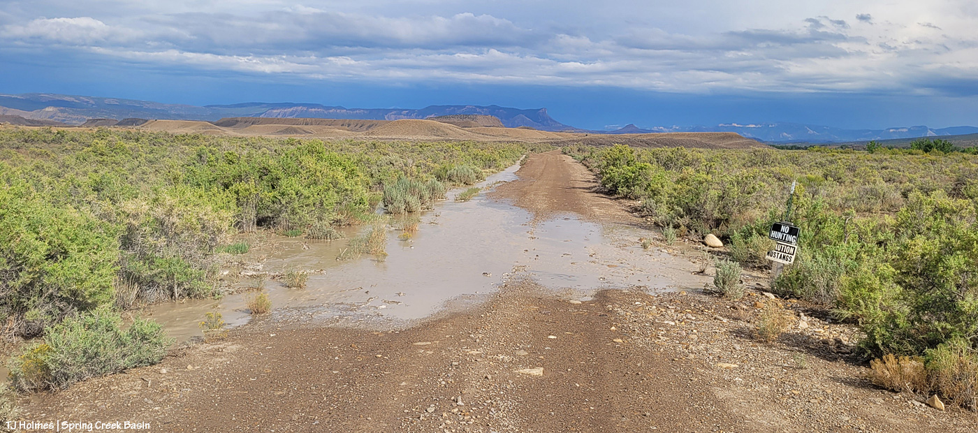
It’s hard to tell in this still image, but that water is moving. It’s flowing toward me along the ditch at left from just another 100 or so yards up the road (this is Road K20E, just east of Road 19Q). In some places, it had already stopped running, but the ditches were still soggy. There was more evidence of it having washed across the road farther along toward the basin (you can see the familiar horizon with the rimrocks, Filly Peak, McKenna Peak, Temple Butte, submarine ridge and Brumley Point rain-darkened (!) in the distance as the storm recedes to the east and southeast.
And of course, I knew what I’d find within Spring Creek Basin:
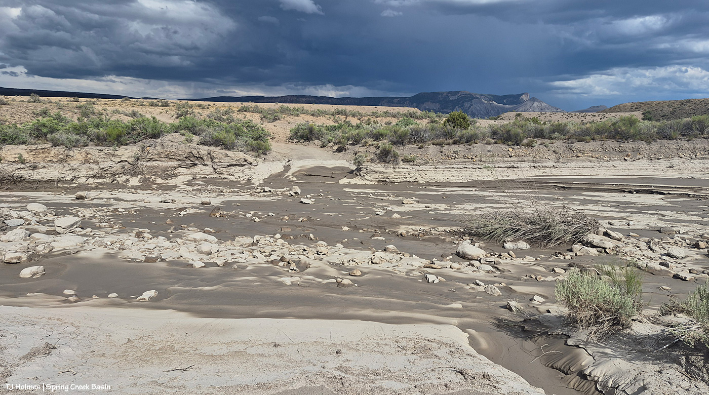
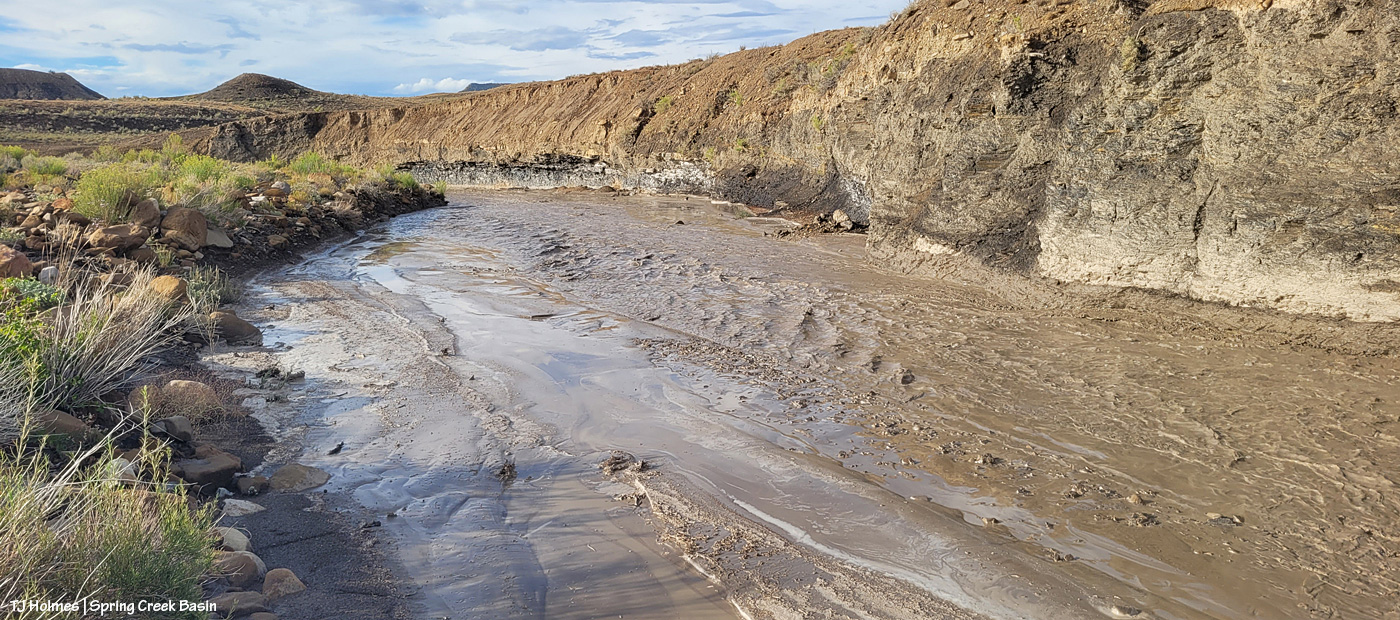
We had a number of these last year. This year, not so much. … ALWAYS fabulous to see water running across the first (as you come to it) Spring Creek crossing. It was already receding when I reached it in late afternoon, but the water (very muddy) was happily gurgling along.
From downstream a bit from the crossing (you can see it at just-left-of-top-center) looking upstream. There’s a rocky “beach” to the right that’s at least as wide as the creek bed itself, and it doesn’t look as though that flooded this time.
And from the same spot as above, now looking downstream. There’s a big curve straight ahead, and around that a bit is a seep that has water fairly consistently where the horses like to drink.
At most, floods like these last maybe 24 hours. This one probably – maybe – lasted 12? The rain came down pretty hard, but it didn’t last very long. And the rain, as hard as it was, didn’t penetrate very deep into the soil; an inch – maybe? We need a day(s)long rain that just sooooooooooooooaaaaaaaaaaaaaaaks in deeply. That’s what the fragile, drought-stressed vegetation needs.
All the mustangs I saw were on the north side of the creek, and I didn’t cross it. 🙂 Can’t wait to see the evidence elsewhere in the basin when I *can* get across the muddy arroyo!
Skywalker might be considered Tenaz’s lieutenant, though I don’t think he would mind my translation that it’s not a title he likes or plans to use for long (!). Tenaz has two young mares, and Skywalker does keep Tenaz on his toes. They’re part of a bigger group of horses that’s basically two separate bands – one mostly happy family. 🙂
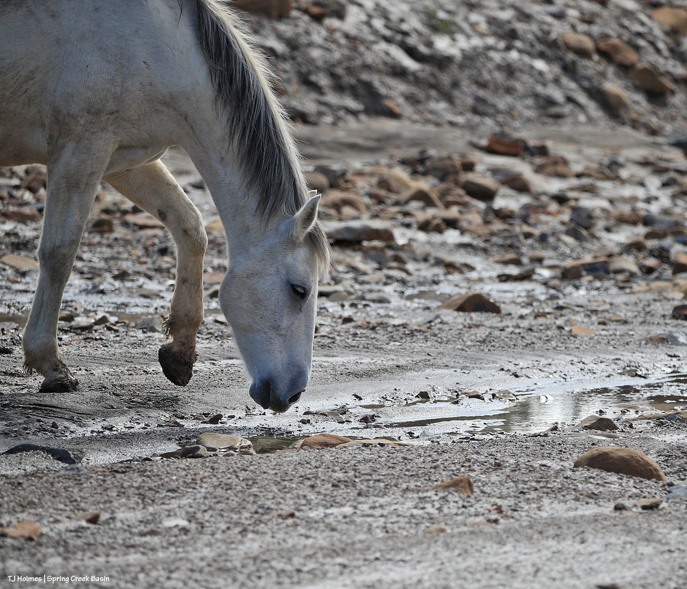
Above, the mares have gone ahead (to the right), and they’re waiting for their turn at the water cooler … err, pools of water that gather in the creek bed just above/upstream of Spring Creek canyon. A couple of other bands beat them to it, so they were politely waiting their turn.
The arroyo actually comes from beyond/above where Skywalker and Tenaz are standing, passes by us on the left, makes a big curve behind me as I’m facing them, runs a short distance, then makes another big curve to enter the canyon. Another few curves later, it empties below the rimrock cliff band that forms the basin’s western boundary into lower, wide-open Disappointment Valley on its way to join Disappointment Creek (which also is dry but for pockets of water) … and on to the Dolores River.
The mustangs definitely rely on these seeps in Spring Creek and its tributary arroyos as the summer gets drier and drier before the hoped-and-prayed-for monsoon rains. The forecast is showing an uptick of chances next week, and we’re crossing fingers, toes and hooves (!) that some rain actually pans out for us from those chances!
We interrupt your regularly scheduled mustangs for an important news update:
WE GOT RAIN!!!!!!!
When you don’t get rain for weeks and weeks, even a little rain is newsworthy. When Mother Nature unleashes a direct hit over Spring Creek Basin, well, that’s major news, that is!
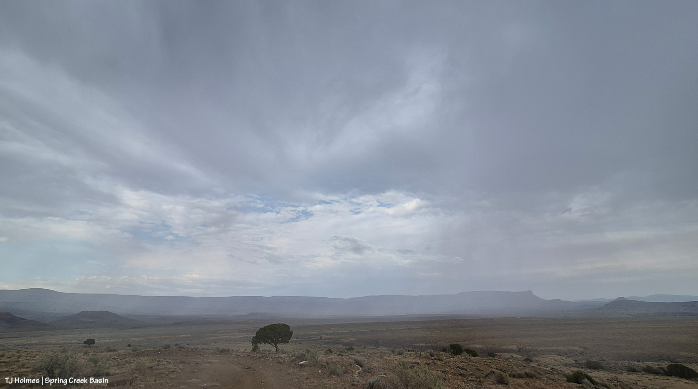
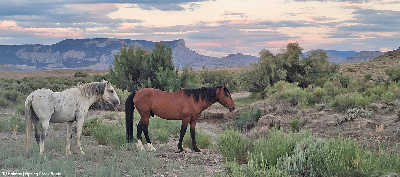
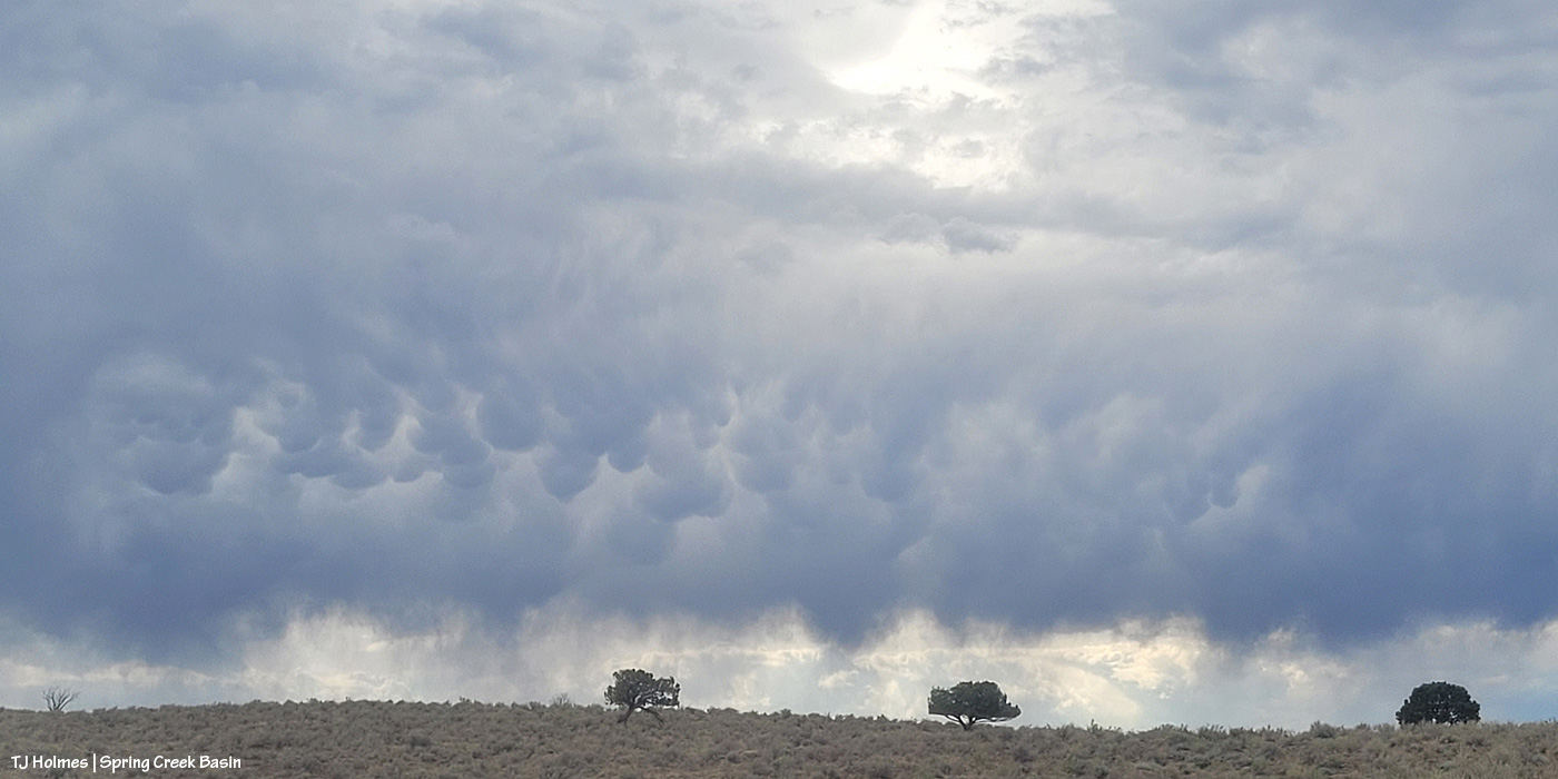
This crazy sky (please tell me the name of those clouds if you know? mammatus or something similar? I read an article about them recently, but I can’t remember the name) was AFTER the rain. Upon entering Spring Creek Basin, I had seen some silver slivers in the distance that had me very excited … but first I saw this sky, and then I saw mustangs, so I had to stop (I ran out of time and patience to choose and process any mustang pix, but they’ll be coming; nothing super exciting as they weren’t super cooperative with that sky above them, chasing the rain-fresh grass!).
Then … THIS:
SPRING CREEK!!!!!
Can you tell that straight across (left side of the pic) is the road? At far right is the curve just after the water passes through the old breached dam (I did a post about it a little while ago). The water is flowing from right to left – and it was loud and muddy and glorious. 🙂 You can see how high it was when it first ran; already it was feet lower by the time I got out there.
Many (most? all?) of the rocks in the foreground are from previous floods. That, my friends, is the power of water in the desert.
Then I rolled around back downstream to just upstream of Spring Creek canyon, through which Spring Creek runs on its way out of Spring Creek Basin. All of the basin’s arroyos feed into the big arroyo that is Spring Creek. This is looking eastish toward that iconic horizon. The canyon is right behind me:
The water flows from right to left, around the curve on downstream, through the short stretch of zigzagging canyon and on across Disappointment Valley to join Disappointment Creek, which ALSO was flowing with rainwater (the flow of the creek ended around solstice weekend), and eventually to the Dolores River way out there where the sky is particularly (and still) dark with rain.
Mammatus (also called mamma [1] or mammatocumulus, meaning “mammary cloud”) is a cellular pattern of pouches hanging underneath the base of a cloud.
People also ask
What does it mean when you see mammatus clouds?
AI Overview
Mammatus clouds, with their distinctive pouch-like or udder-like appearance, often signal the presence of severe weather, particularly thunderstorms, though they can also appear after the storm has passed. While they don’t directly cause storms, they are a visual indicator of unstable atmospheric conditions and can be associated with heavy rain, hail, lightning, or even snow in winter.
Here’s a more detailed explanation:
Formation: Mammatus clouds form when sinking air creates pouch-like structures hanging from the base of other clouds, most commonly the anvil of a cumulonimbus cloud (thunderstorm cloud).
Significance:
They are often seen before, during, or after a thunderstorm, indicating the turbulent and unstable air within the storm system.
Severity:
While not a direct sign of severe weather, their presence suggests the possibility of other dangerous weather conditions like lightning, hail, or strong winds.
Pilot Caution:
Pilots are often advised to avoid cumulonimbus clouds with mammatus formations due to the potential for turbulence.
Not Always Dangerous:
It’s important to note that mammatus clouds don’t always guarantee severe weather. They can also appear after a storm has weakened or dissipated.
Visual Cue:
Despite their potential association with storms, mammatus clouds are known for their striking appearance and are often photographed by weather enthusiasts and meteorologists. –> including this photographer! 🙂