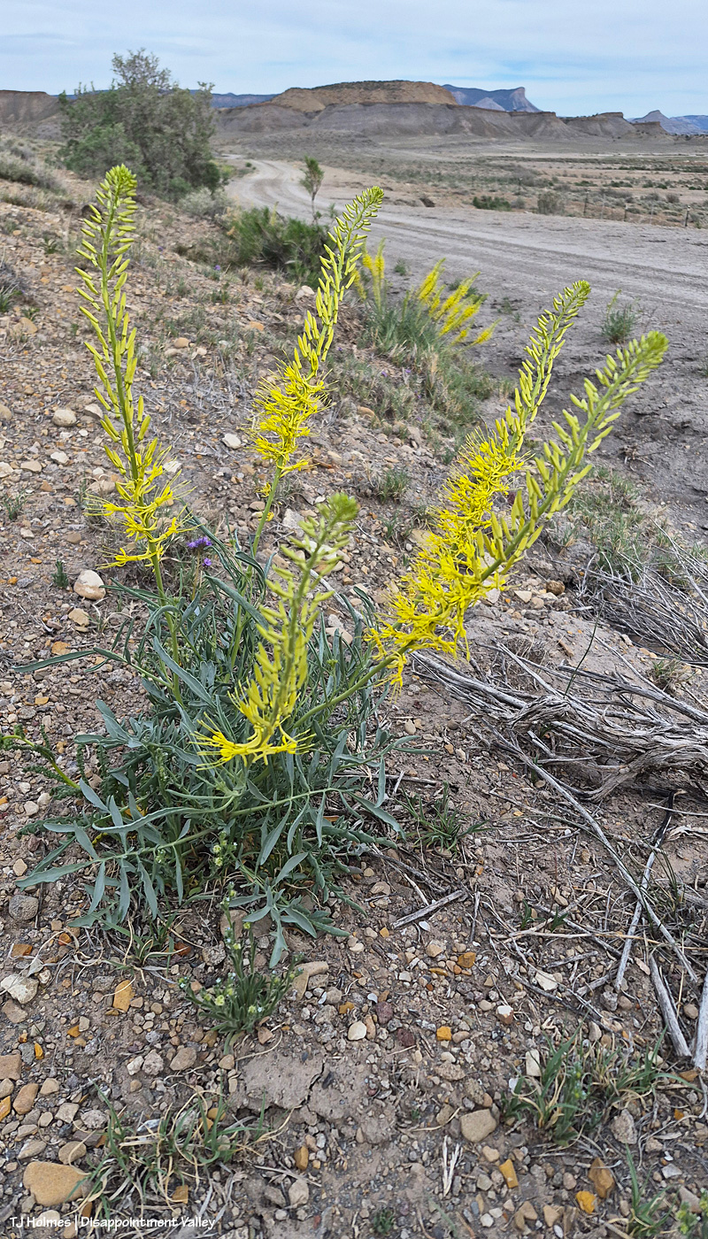
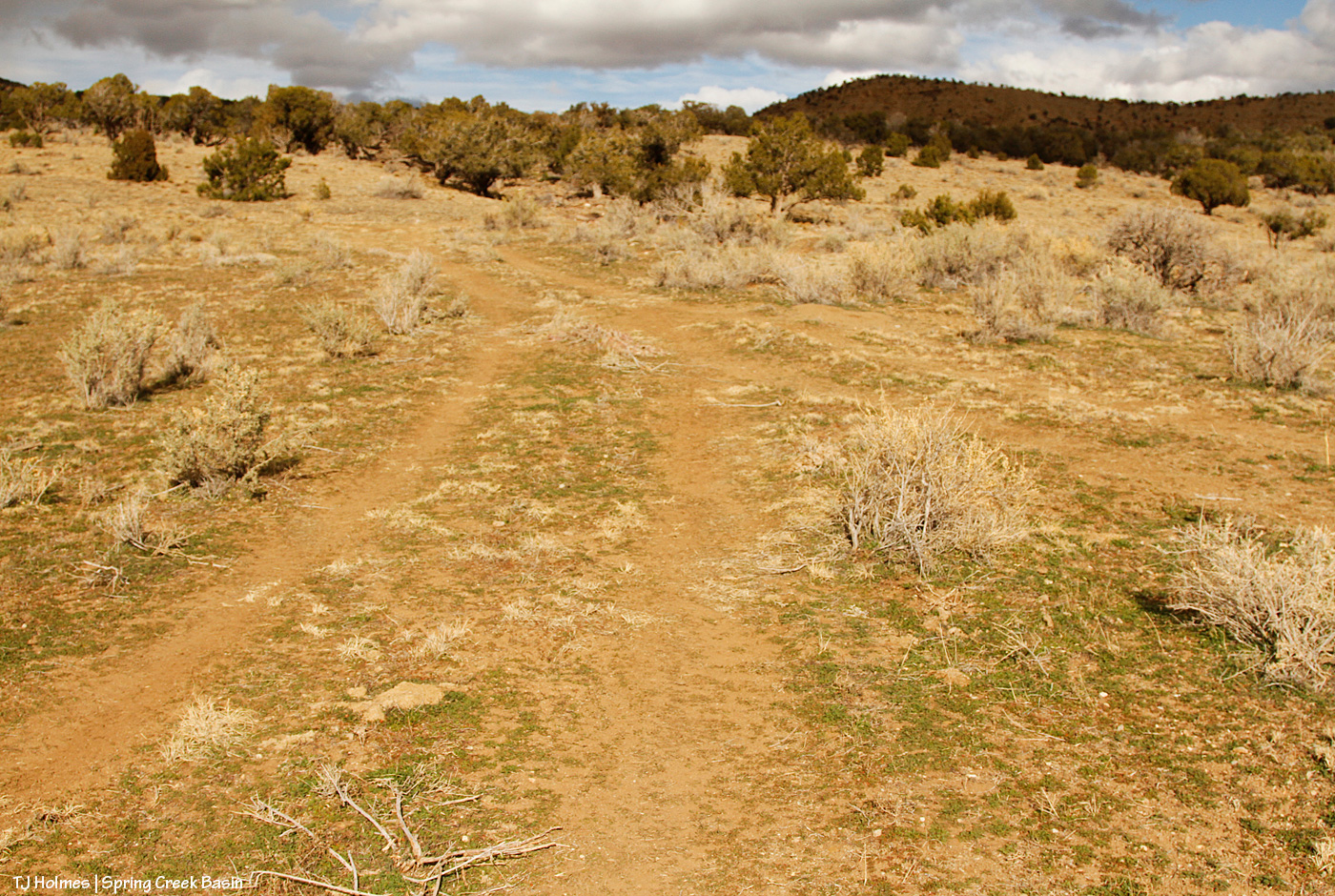
Heading TO Spring Creek Basin, I found the prince’s plume plants in full, crazy bloom. Why is this crazy, I hear you asking? Because they don’t usually bloom until May. IN Spring Creek Basin, the prince’s plumes I saw were a little behind these along Road K20E toward the basin, which makes sense as the basin is a bit higher elevation than along this road.
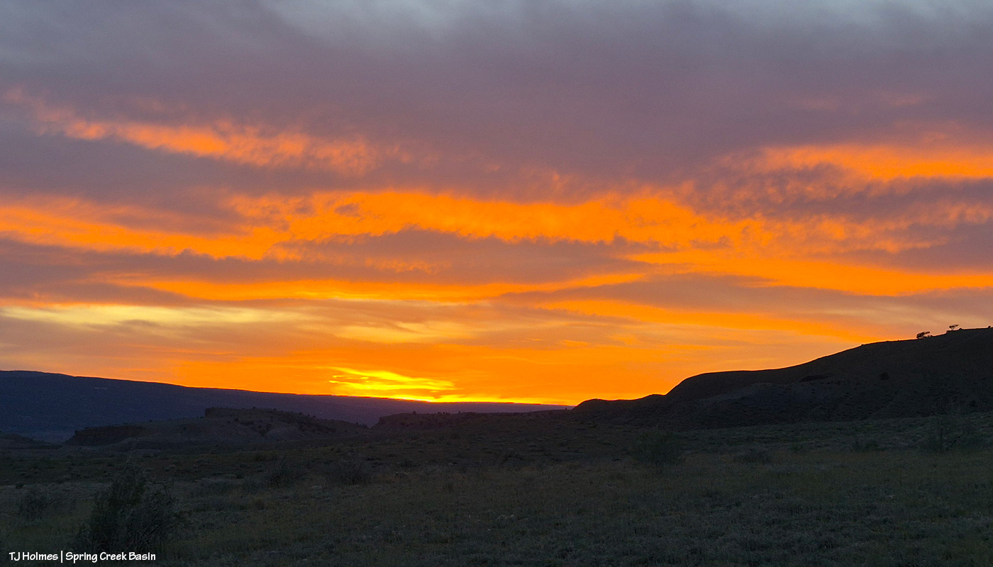
Heading OUT of Spring Creek Basin, the grey sky exploded with color at and post-sunset! Wowza. The weather wizards are giving us a whopping NINETY PERCENT chance of rain Wednesday. Do you know what Wednesday is? Wednesday is April 1, otherwise known as April Fools’ Day. Call me a fool a million times over, and please, please, PLEASE, let it RAINRAINRAIN!!!
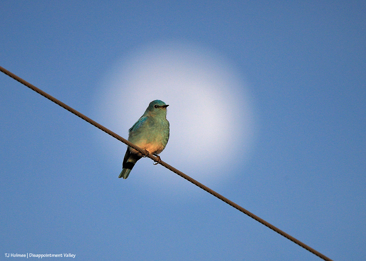
Merlin (the app) tells me this is, in fact, a mountain bluebird. I know it looks green. Pretty sure it’s not the camera/lens/white balance/color cast because it looked green in person!
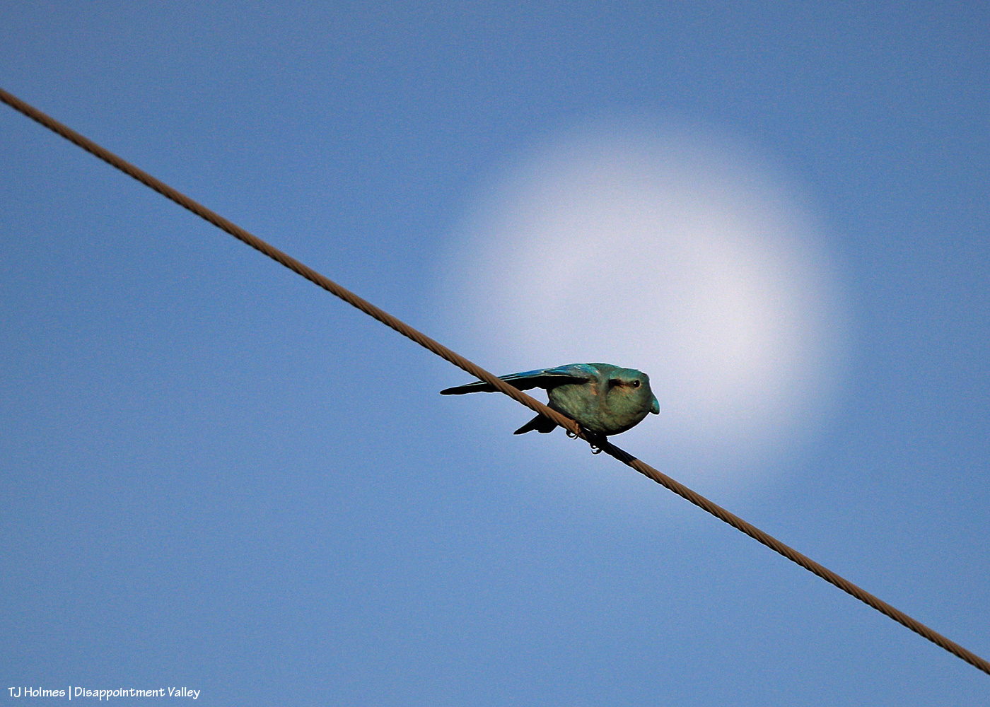
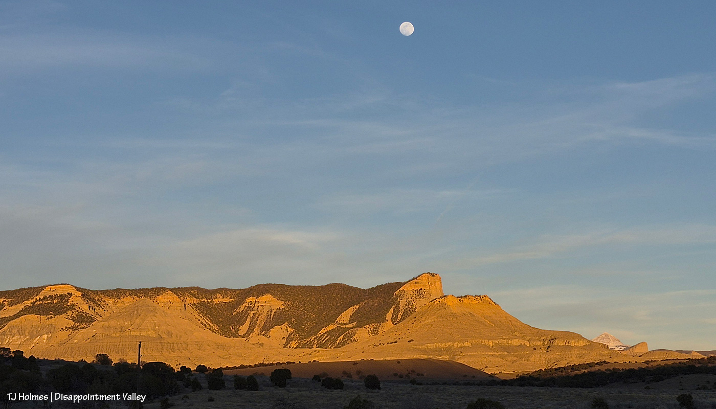
That big white disc behind it is the MOON!
I got kinda skunked again trying to photograph it rising because of thin clouds that were just enough to block/blend the moon as it rose behind the eastern(ish) ridges. When I got back to my buggy from a fairly long walk into Spring Creek Basin looking for the *right* place to stand and shoot (spoiler: I didn’t actually find it), this beautiful fellow flew in to check me out from the utility wire right above me and the road. How sweet! How did it know I needed a pick-me-up? 🙂 These bright blue flashes of gorgeousity are everywhere right now. … I’m not sure whether they’re early … or right on time. The temp hit 68 insane degrees yesterday.
He gave me enough time to unpack my camera from my bag, fiddle faddle around and change some settings from moon-shooting … and of course, he posed like the gorgeous creature he is (see top pic) … before he flew off. I got this pic (above), and then everything else was a green blur (pretty sure that’s a superhero character: “The Green Blur”).
Yesterday was another day when the temperature hit at least 65F. I wish those clouds had given us moisture, like the several-days-ago-forecast hinted was possible, but all the atmosphere delivered was more wind.
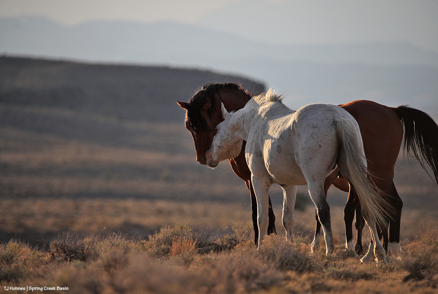
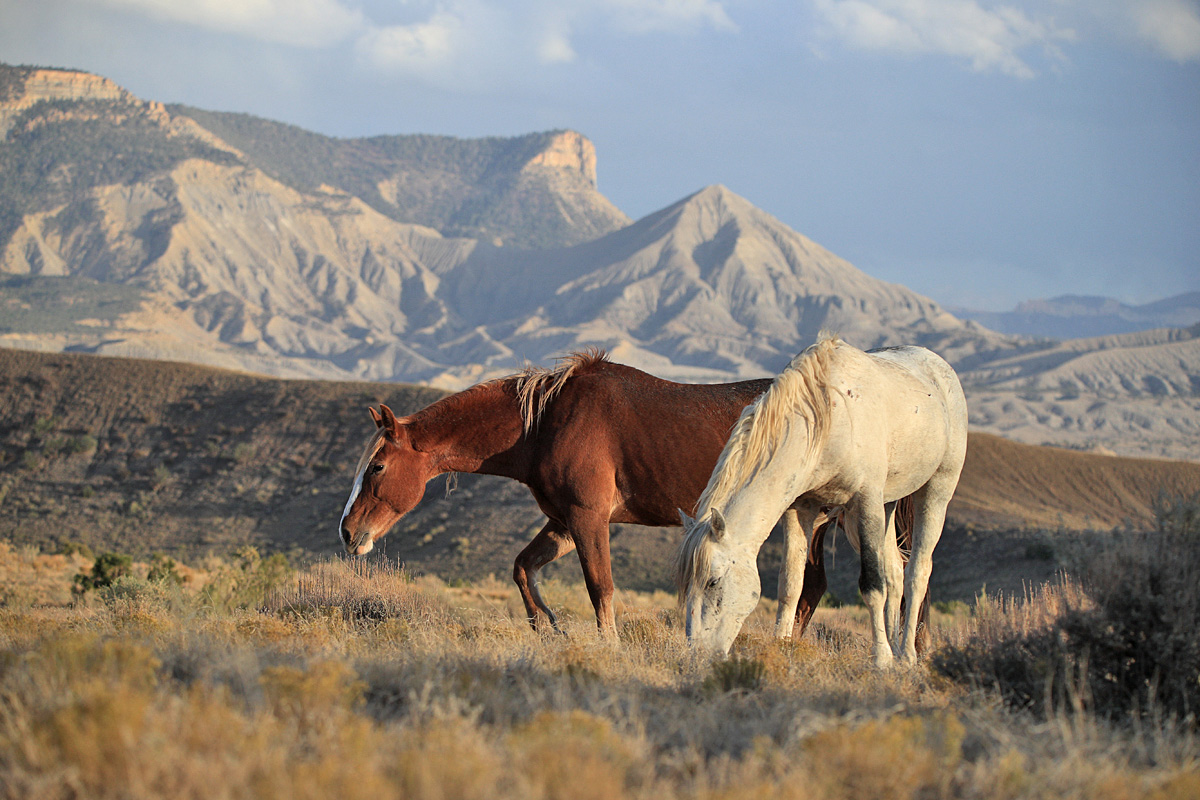
Fortunately, Alegre and her band are finding water (look at that mud!). I think it’s a pond that’s no longer (easily) accessible because of washouts across the road.
How good are *my* BLM folks? THIS GREAT *arms spread wide*!
Allow me to highlight:
Days before the end of the shutdown, toward the end of third rifle season, when I was feeling very tired and hard done by at the sheer volume of humanity in a usually very quiet, very peaceful place, one of our law-enforcement rangers, Matt Abraham, came into Disappointment Valley to check on Spring Creek Basin. Um, wow! But that’s who these guys are and have been since I started volunteering 18 years ago (I’ve known at least five).
The day (?) the shutdown ended, herd manager Anton Rambur was out in Disappointment Valley to check on things. The muddy road prevented him from accessing Spring Creek Basin, but that this was one of his priorities at his return to work … ???!!! He wanted to know what was happening and what I needed.
Later that afternoon, I got a call from the other range specialist, Ryan Schroeder, asking – again – what HE could do for ME and the MUSTANGS/BASIN.
Upon returning to the computer, I had an email from range tech Laura Heaton asking what SHE could do for us!
Like, um, I don’t even have words to express my crazy-level appreciation and gratitude for these excellent human beings!
One of my mentions to all three of them was that it would be great to have (more) signs to deter the illegal route-making in the basin – as reader Sue calls them, “rogue roads.” I had one very particular place in mind (and have for the two years people have been driving around a particular washout … only to get stymied within half a mile by a washout they CAN’T cross …). …
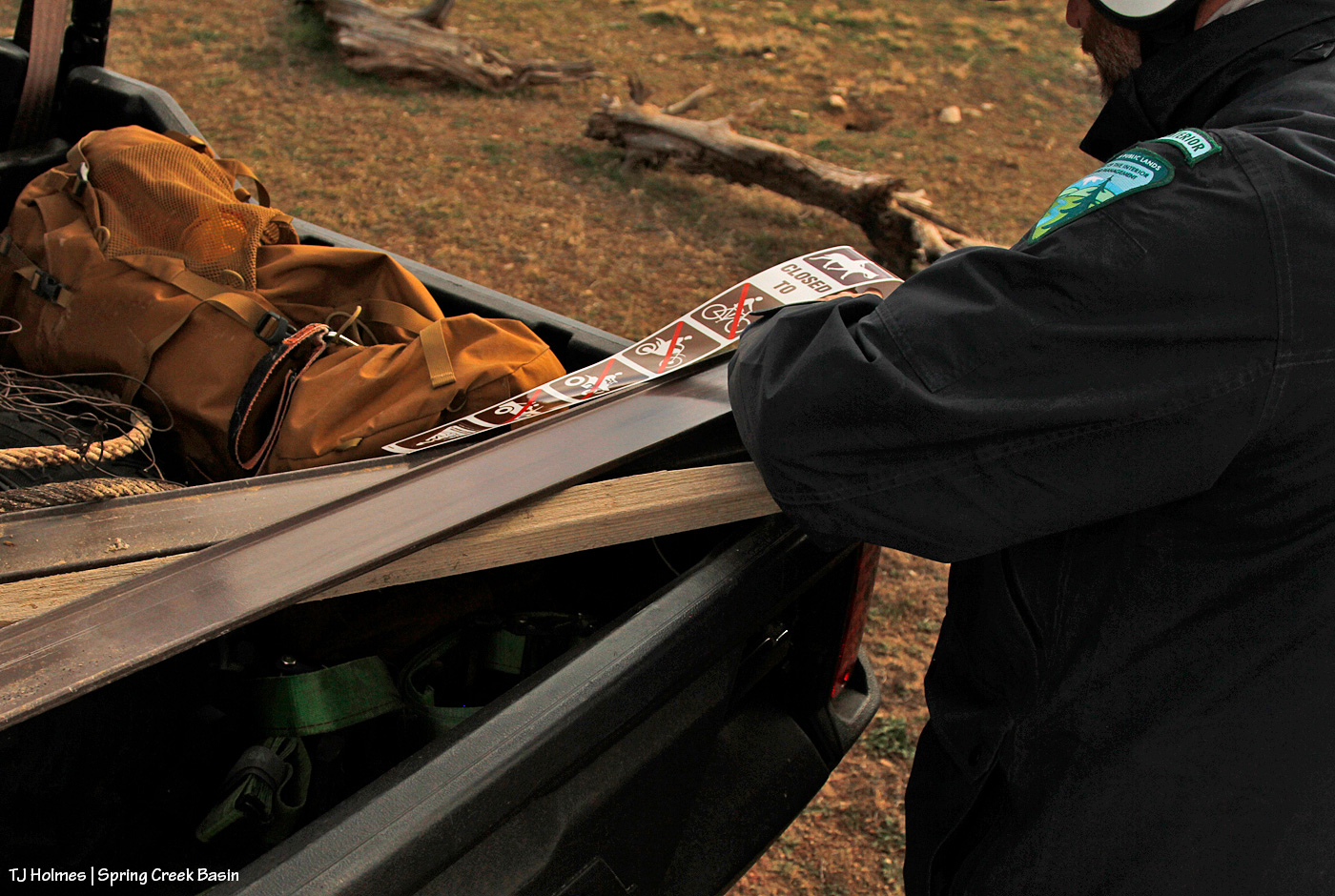
The following day, I had a message from BLM park ranger Jon Whitehead asking for details about what signs we need! And Wednesday, he and Ryan brought promised signs and stickers to Spring Creek Basin to erect in areas to hopefully stop already-done resource damage and continue to prevent it in places where the signs, with their sun-faded stickers, have worked for nearly or more than 18 years.
Please follow along in pix:
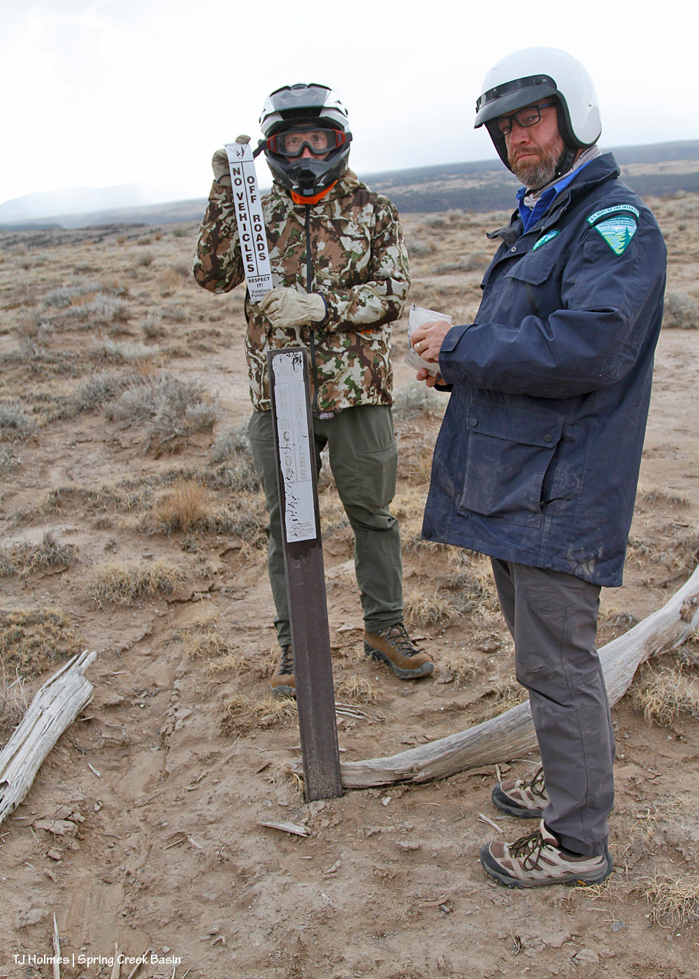
We have to start at the start: That’s Jon driving and Ryan riding shotgun (unfortunately, both Anton and Laura had duties elsewhere that day) at Road 19Q (behind them – and look! it’s being graded! thanks, Denny from San Miguel County!) and Road K20E to Spring Creek Basin. (Also note the water at right; that’s from Sunday’s rain.) Safety first!
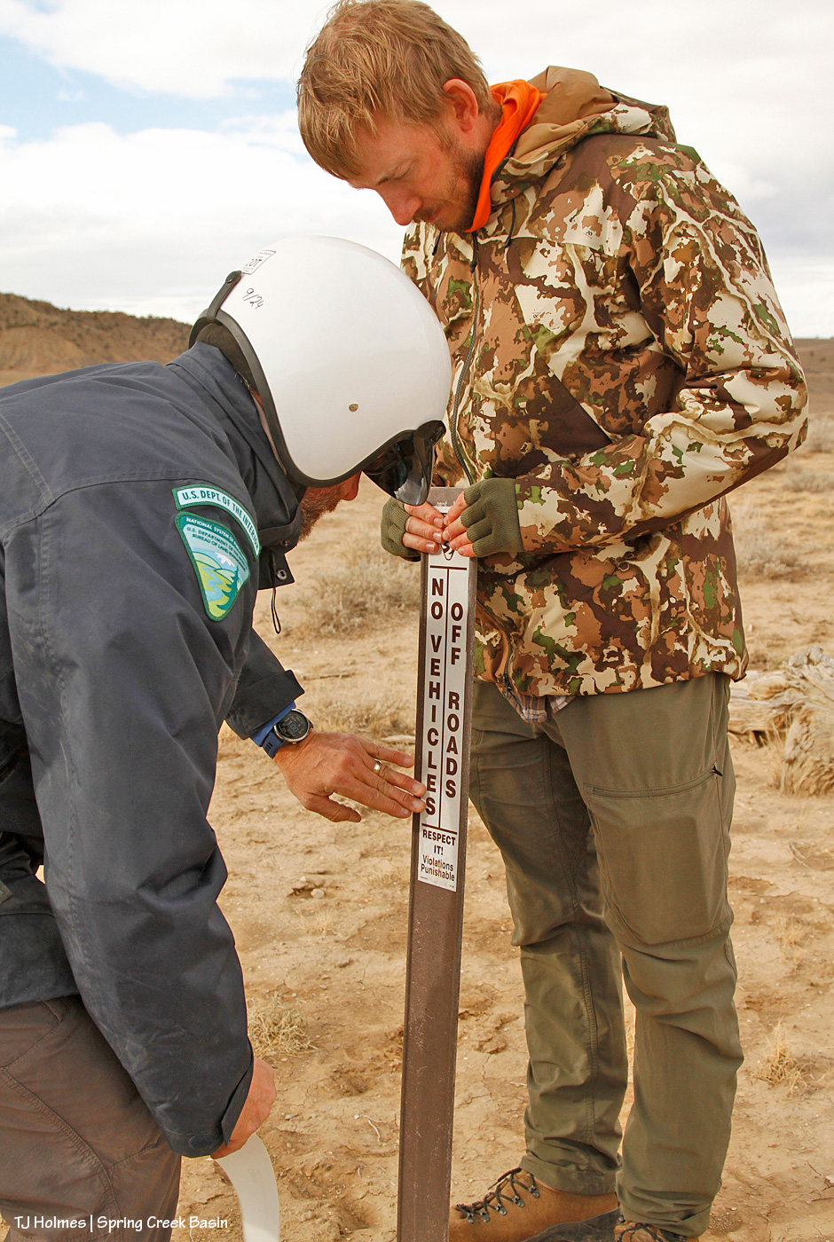
The *serious* BLM faces as they’re about to prep an existing carsonite sign for a new sticker. …
They couldn’t maintain those stoic faces for more than a couple of seconds. 🙂 We shouldn’t have so much fun “working” … should we?? 😉 Note the snow over the Glade in the background! We got a drizzle later, but we agreed that was likely snow at higher elevation.
Wonder what “carsonite” is? Apparently, it’s a brand, which means that I should be capitalizing it, but I think I’m going to leave it because we refer to it somewhat generically. It’s like fiberglass, and as Jon will tell you, don’t (try not to) touch it with your bare hands/fingers.
And on goes the new sticker over the old, faded one!
This is a place on a curve in the road, and the edge of this level of ground is less than 50 yards away. … But it had been just too tempting for people to DRIVE over there to look over the edge as opposed to leaving their vehicles or buggies at the road, getting off their butts and WALKING over to look over the edge. So that’s why we had placed the sign there years ago – and why I’d “reinforced” the message with the old branches you see on the ground. There are any number of places in the basin where I have seen tire tracks that lead from the road to the edge of a ridge or place where the ground falls off, including this last driving (aka “hunting”) season. It makes me craaaaaaaaaaaaaazy.
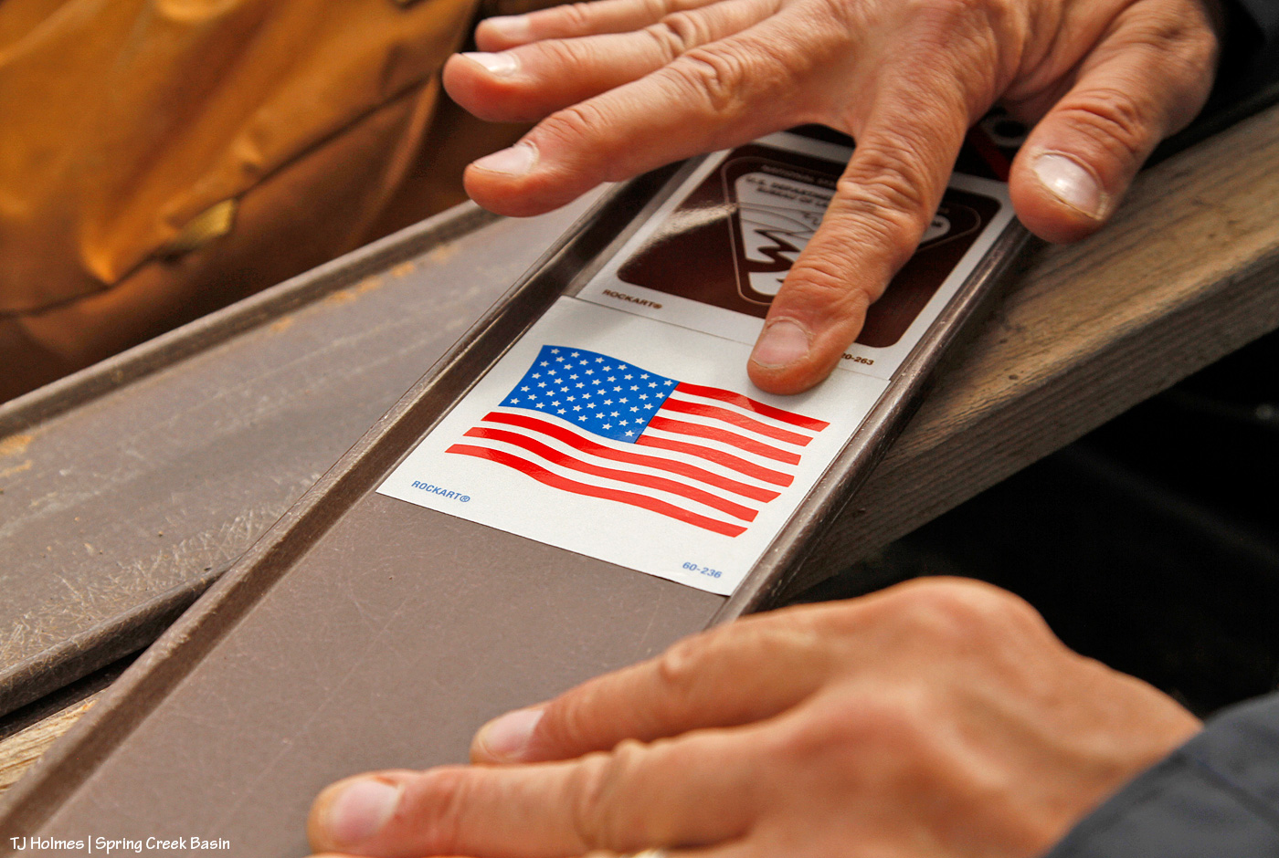
No less important in terms of the sign stickers and their meanings: the American flag. These are America’s public lands! Respect them, no matter how you use them!
On to our next location, a reminder to not handle these signs with bare hands: splinters! This is the location of an old “Y,” driven in by people too lazy to use the actual road (up the hill) to get to the main road, which comes out not even 75 yards away. Interestingly, this is the site of one of my very first volunteer projects for BLM in Spring Creek Basin; shout out to Kathe Hayes, retired long-time volunteer coordinator for San Juan Mountains Association, who spent countless hours shepherding excellent projects in the basin (including the much-loved alternative spring break program with University of Missouri students). You might have heard that Colorado gets 300 days of sunshine every year. In Disappointment Valley, we take pride in the fact that we likely get about *600* days a year of sunshine (har har). Remember the faded information board that led to the installation (with our most-excellent BLM folks!) of the new kiosk earlier this year? Yeah. You laugh, but we know how much sunshine we get! These signs were due for updated and easier-to-read stickers.
This image really illustrates why it’s so important to protect the resources of Spring Creek Basin, specifically, and many of the West’s drought-fragile landscapes in general: We closed this route 17-18 years ago? It STILL bears the traces of the drivers who ignored that fragility and made a new route because they were too lazy to use the established road – a “designated route,” as BLM calls them.
Every illegal “Y” has its other end, so here are the guys adhering a new sticker to the carsonite sign at the top of the hill. The actual road is right behind Jon.
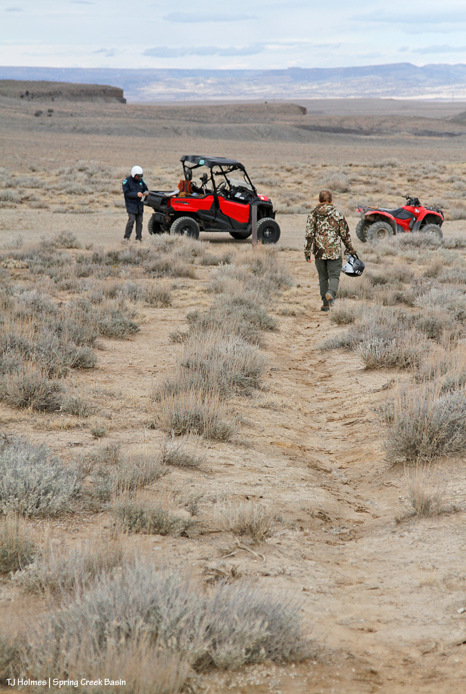
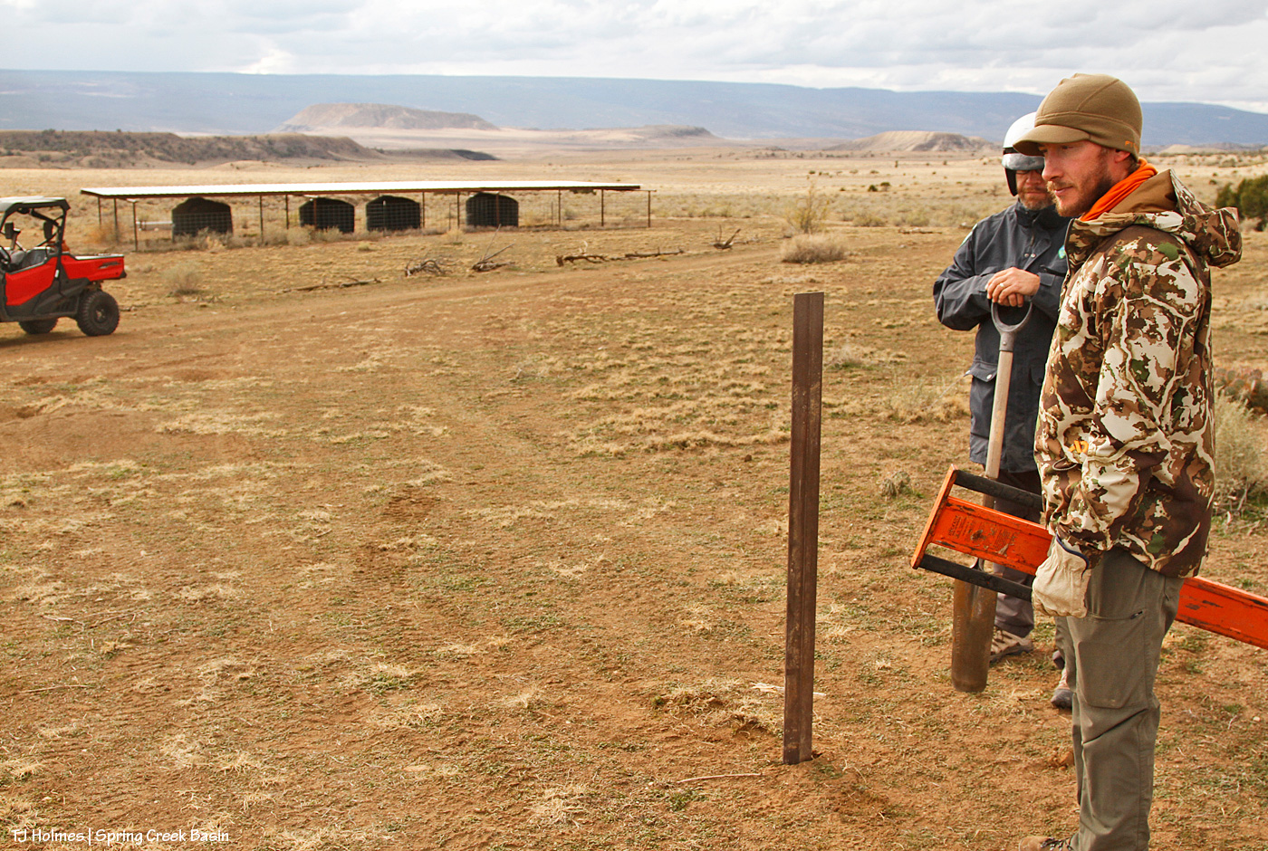
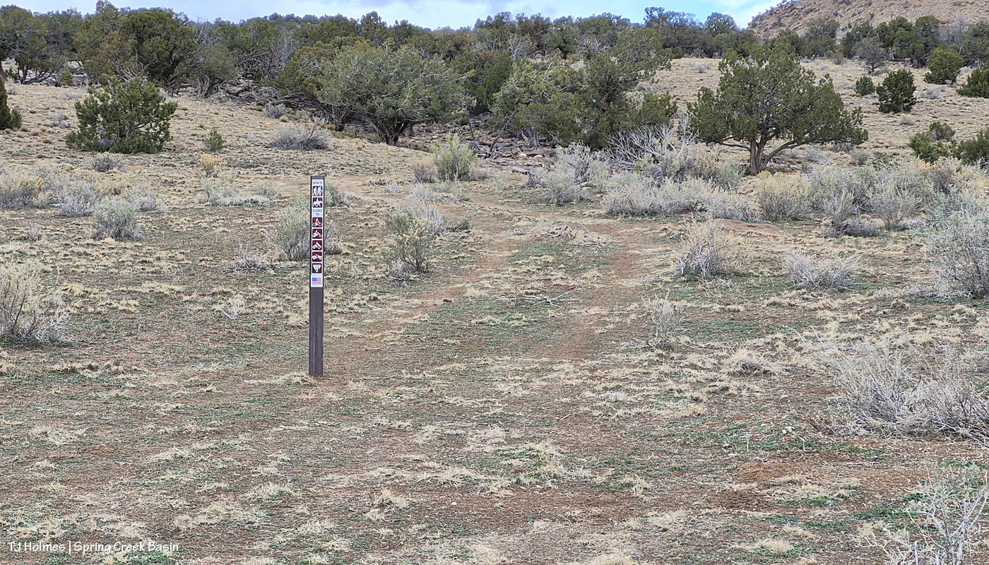
On to our next location! This was the first installation of the day of a new sign, and we put it at the dugout intersection, which marks the start (or end, or both!) of “the loop,” which is no longer completable (is that a word?!) by vehicle or even most UTVs/ATVs because of washouts (which was the main impetus behind the day and the signs, as you’ll see later). Note the rusty old cable; a bonus to attaching the new stickers to the signs at either end of the old “Y” was that I spotted both old wire clumps and this length of old cable, starting to erode out of the soil, where it had been for … decades? At least nearly 18 years.
This sign, at an intersection, reminds travelers to stay on designated routes. Jon lamented this need, as there are no fewer than THREE big signs from just south of the highway to just before to just inside Spring Creek Basin’s western boundary (and main entrance) that warn that exact message (along with similar signs all along Disappointment Road). … I think of them as just another pretty-please reminder.
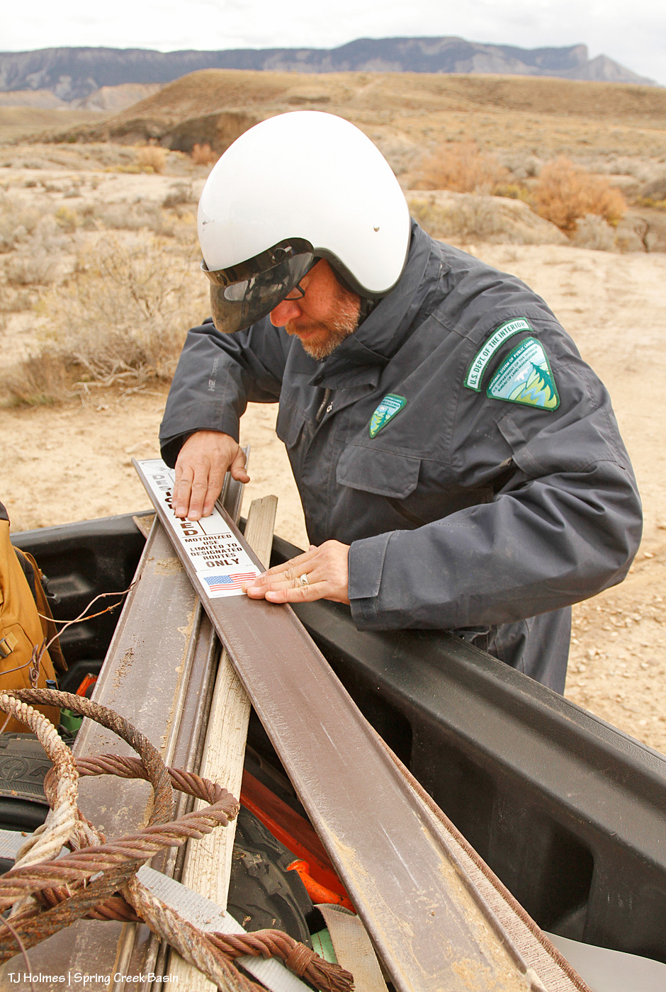
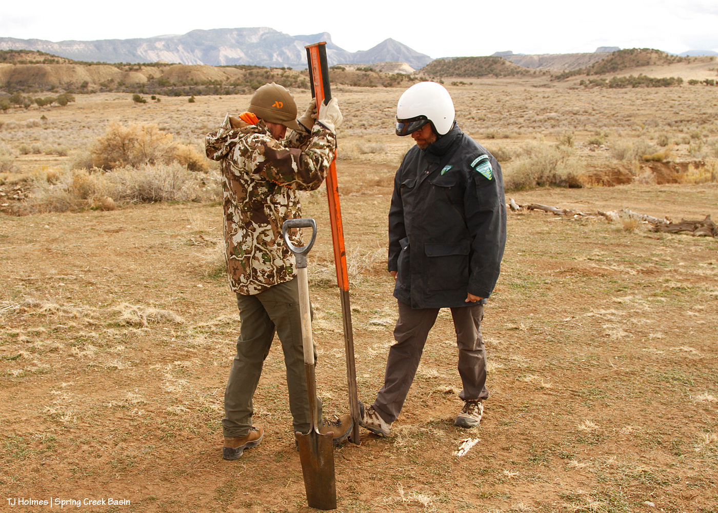
Wonder how the heck one of those narrow, flimsy signs is installed, aka pounded into the ground?
It requires a specialized “pounder.” First, you need the “tile spade” pictured at right, to create a “slit” in the ground and test for out-of-sight rocks (and with our recent rain, the damp ground was very accommodating!) to ensure you *don’t* hit rock. As Jon said, if you pound that flimsy, floppy carsonite sign and it hits rock, the whole thing is wrecked. Then the pounder does the rest. I’ve wielded my fair (or more than fair?!) share of T-post pounders, where you have to hold the post steady or have an unflinching friend do it so it doesn’t twist. Note the men’s toe-to-toe technique on either side of the base of the carsonite; that was to prevent it buckling as it entered the ground.
Now we’re getting to the new water catchments and where I really, really wanted the signs. This one, pictured, was the second one built by Mike Jensen, Garth Nelson, Daniel Chavez and me (the first one included Jim Cisco), in 2022. People really can’t help themselves (!) from driving where they shouldn’t, including over not only fragile ground that doesn’t recover quickly (see above) but also the very limited vegetation on which the mustangs AND deer AND elk AND pronghorn graze and browse. You can see by the wood scattered around that I’ve tried to block it using natural means; people just drive across the ground from somewhere else (at least three other places that I’ve tried to block at this location). And not only directly to the water trough and tanks but to the pond (which, thankfully, is holding water!). … Like, WHY??? I get the curiosity; but have some respect and WALK.
And now we’ve reached the last stop, and, to/for me, the most important.
The 2021 water catchment is behind Jon, not 50 yards away. See the wood on the ground behind him? Over the last two years, I’ve dragged a number of old branches and trunks down from the trees up the hill to line the edge of the road to prevent lookie-loos from lazily driving down to and around the water trough, downhill from the roofed catchment tanks. It has mostly worked, though I’ve had to add more as people, too lazy to even move the blocks, find a “hole” and think that’s OK to drive past/through/around. (And we still found old tracks that indicate people are still doing it. Sigh.)
But in 2024, when we had big, flooding rains in early summer, the road, directly ahead of the UTV in the pic, washed out, leaving a gaping chasm where the road had been (you can see the line of it in the pic). That, effectively, ended the road right there. … Until hunting season, which was wet last year, and people repeatedly drove around the washout to continue, driving-in a rogue and illegal route and damaging resources – again, the vegetation upon which the wildlife depend. I literally cried. And put up more blockade branches and trunks on that side … which people continued to ignore and drove either over or past.
When we arrived at the location, which I hadn’t visited at all this past hunting season as my heart just couldn’t take it, sure enough, people had left my last blockade intact … and just created yet another new route to get around the washout – which is even worse now and even washed away their “shorter shortcut” (which I’d also attempted repeatedly to block).
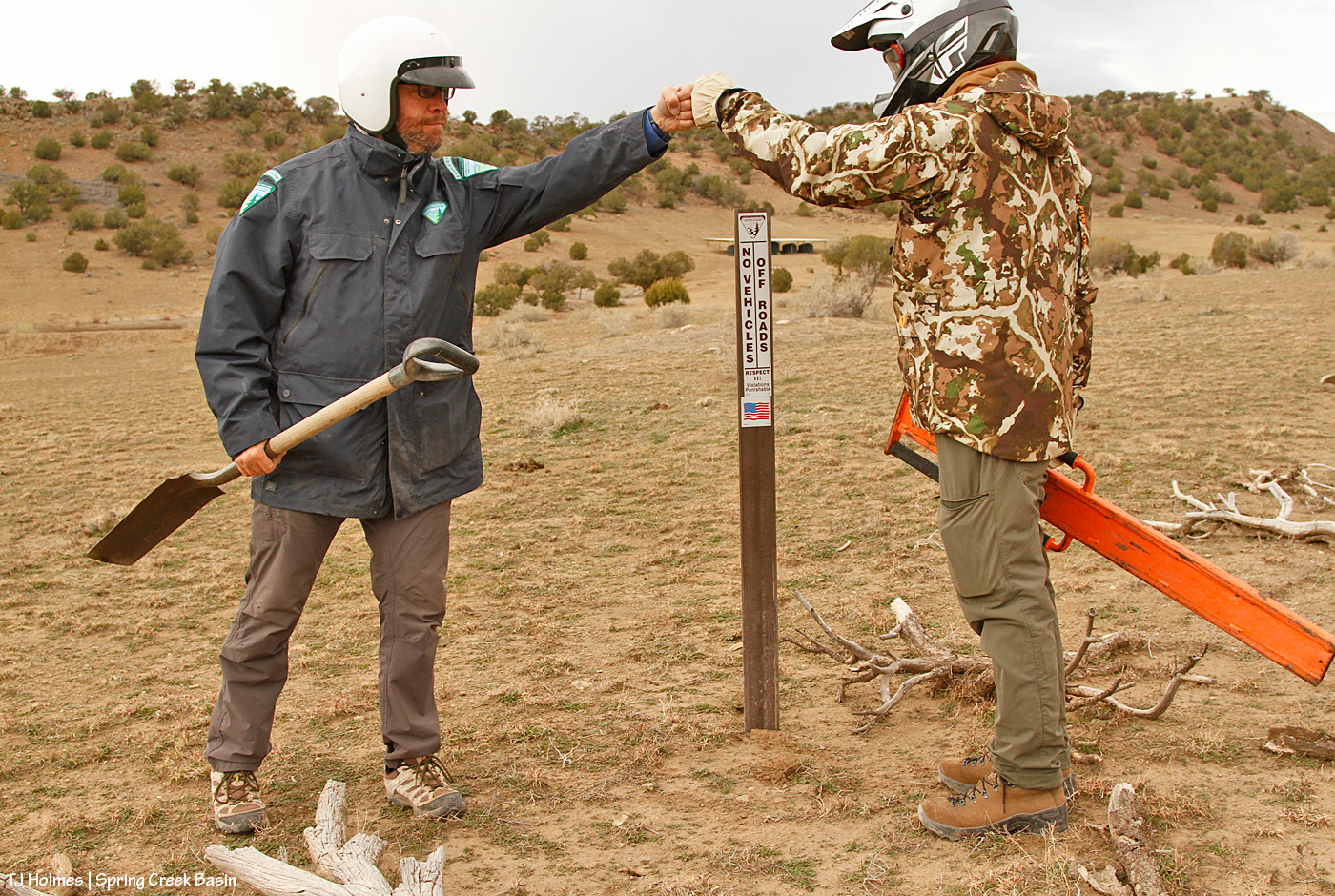
But I didn’t cry at the destruction this time because I had guys with me who were about to justify my upsettedness at the lazy-ness of man (to be fair, most of them have been men), and we were about to proclaim in more certain terms than dead-pinon/juniper trunks/branches and big rocks that YOU SHALL NOT PASS! (I do love a fellow LOTR fan! Thanks, Ryan!)
The sticker going on the carsonite for the sign you saw in yesterday’s post.
Along with:
I really kinda love this pic. Those are hands that belong to someone who cares deeply about our public lands, their value and their sacredness. And though they’re the hands of only one, *I* know, and I tell you with all sincerity, that hands just like that belong to every person at Tres Rios Field Office (at least).
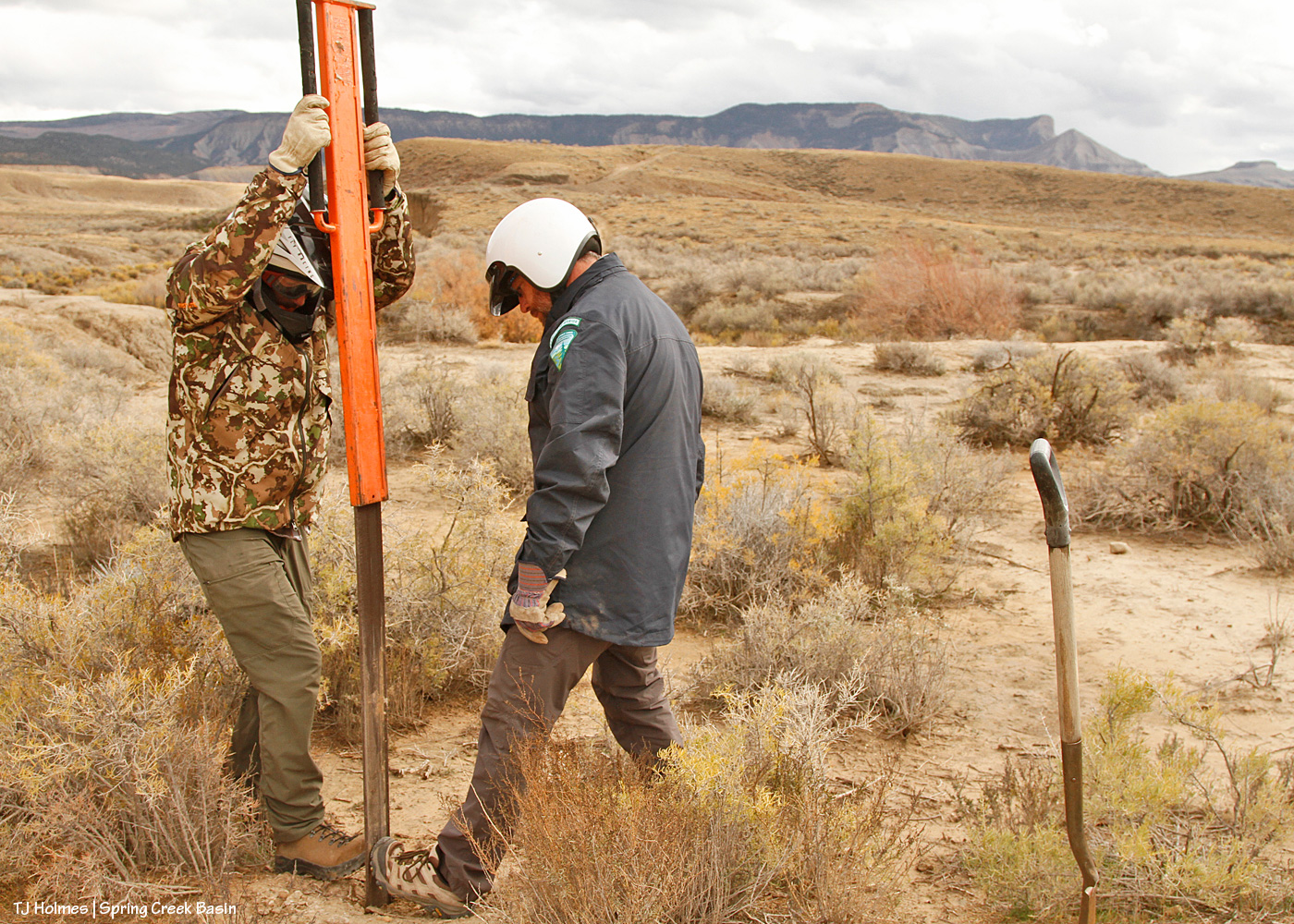
Sign inserted into pounder; check. Note the tire marks Jon and Ryan are standing on. The road is immediately behind Jon.
Pounding commencing; check. At right, you can see my blockade – untouched because the drivers just shifted to driving where Jon and Ryan are installing the sign – and above that, the washout. It starts at the left (literally) and runs right/south/downhill to join a bigger arroyo/drainage downhill of the catchment.
Now looking back to the road (on which the UTV is parked), my blockade along the road to try to protect the water catchment. The silver trough is just visible to the left of the leftmost tank. Yes, it’s THAT close to the road. NO need to drive down there when it’s so easily walkable to get a better/closer look! The tire tracks on the rogue route are really distinct in this image.
For a better look at the rogue route and the resource damage caused (after only two years):
The track at right is where people first started driving off the road to get around the washout. Directly ahead is where they shifted so as to ignore the blockade that plainly (!?) was meant to deter people from driving illegally over our precious and drought-limited grasses and other vegetation (cacti and four-wing saltbush are among the most destroyed).
From where they crossed the “head” of the washout, over bedrock, to return to the actual road, which is semi-visible along where this illegal route makes its last curve.
Why ELSE is this rogue route so infuriating (as if destruction of resources and the vegetation the mustangs and other wildlife depend on weren’t enough)? Within a short distance (less than a quarter-mile?) is another, bigger drainage and semi-washout (that has been hunter-filled with rocks to make it crossable). But just another quarter-or-less-mile past THAT is a washout that isn’t crossable except by walking, riding a bike or a horse or a motorbike or perhaps jigging a relatively small ATV around – and that was the last time I saw it. With the more recent rains, it’s possible that even jigging isn’t possible anymore. Either way, it’s a risky or not-possible-to-cross washout, so why destroy resources just to continue driving another half-mile??? ARGH! It has made me craaaaaaaaaaaaazy!
While out in wildcat valley a few days ago, during third rifle season, I sat with a band and literally watched a truck drive up to the washout, see the washout, back up and drive around the washout to continue on … to the washout they couldn’t pass. … Then return. Following the tracks made by others. I know these people are *just* trying to access public lands, and I am not inherently anti-hunting (though I am very against the *driving* culture that seems to be “the way to do it” out here). I believe *respect* is key, and animals are trying to survive on this fragile landscape. Please, please respect the land AND the wildlife!
I am keen to say that I’ve noticed that other signs such as those we put up Wednesday have been very much honored in the basin regarding non-designated and please-don’t-drive-on routes. I hope these signs also are honored, and I hope it indicates to visitors that we have land managers here who give a damn about the land and the herd and the way our natural resources are treated.
No joke: THIS happened over Jon and Ryan as we were leaving. 🙂 AND I found an old horseshoe while we were installing another sign (I didn’t think to take a pic, but it was a much better find than the rusty old wire and rusty old cable). If those aren’t *signs* that Mother Nature herself is happy with our work, I sure don’t know what are.
Absolute heartfelt gratitude to all who made this happen, including and hugely Jon and Ryan! This was a very long post about seemingly very little things, but those little signs have the potential to signal big impacts for the preservation of Spring Creek Basin and its vegetation resources for generations to come of mustangs (as well as deer, elk and pronghorns, and no, I do NOT apologize for hammering this point!), not to mention all those living their best lives right now. 🙂
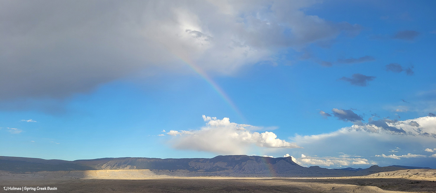
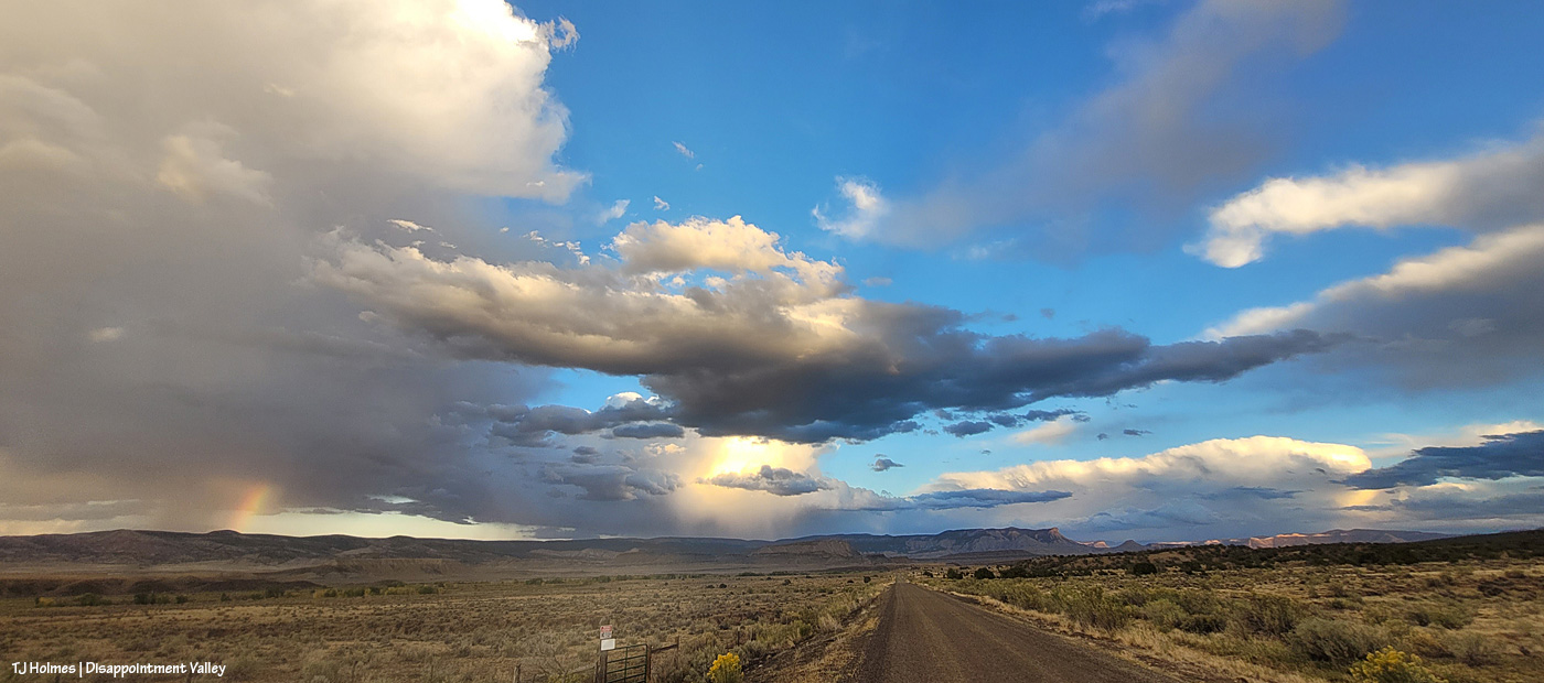
We rarely get morning rainbows; we rarely get morning rain (and even more rarely with sunshine).
Along with a lot of rain the last few days (about 2.56″), we’ve had a lot of sunshine.
This IS Colorado, after all!
Yeah, so THIS happened yesterday morning!
The cottonwoods along Disappointment Creek are starting to glow gold. And yes, it was sprinkling through the sunshine, which brought the magic. (The above pix are looking west; sun rising behind me above the rain clouds.)
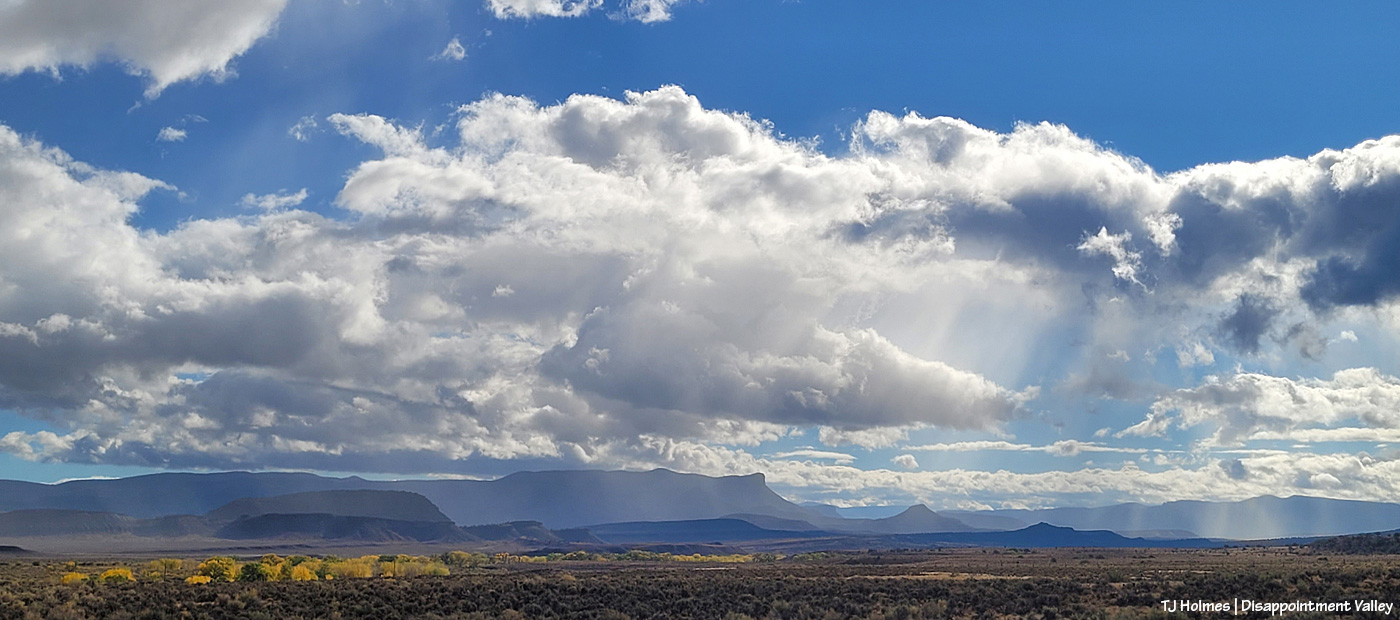
Wonder what it looked like back to the east? Here ya go! A lot different, eh? The sun was rising to upper right. This is Disappointment Road/Road 19Q looking toward Spring Creek Basin (not the road TO the basin).
Now I’m at 19Q looking west up Road K20W (not to be confused with K20E(ast) to Spring Creek Basin).
The sign struck me as funny under the rainbow. I mean, really, do you need a destination when the treasure is right in front of you??
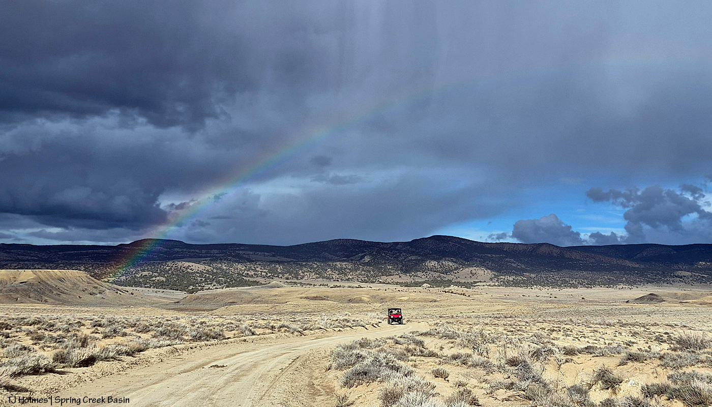
Here we are at Road K20E looking eastish/southeastish toward Spring Creek Basin as the storm was passing to the north. (Sorry about the crazy glare-arrow; my phone’s camera lens is cracked.) Don’t make the mistake of driving this road for at least a few days! The cottonwoods at right line Disappointment Creek, which, yep, was running!
The rainbow (at least the main one) lasted somewhat longer than 30 minutes?!
It.
Was.
EXCEPTIONAL!
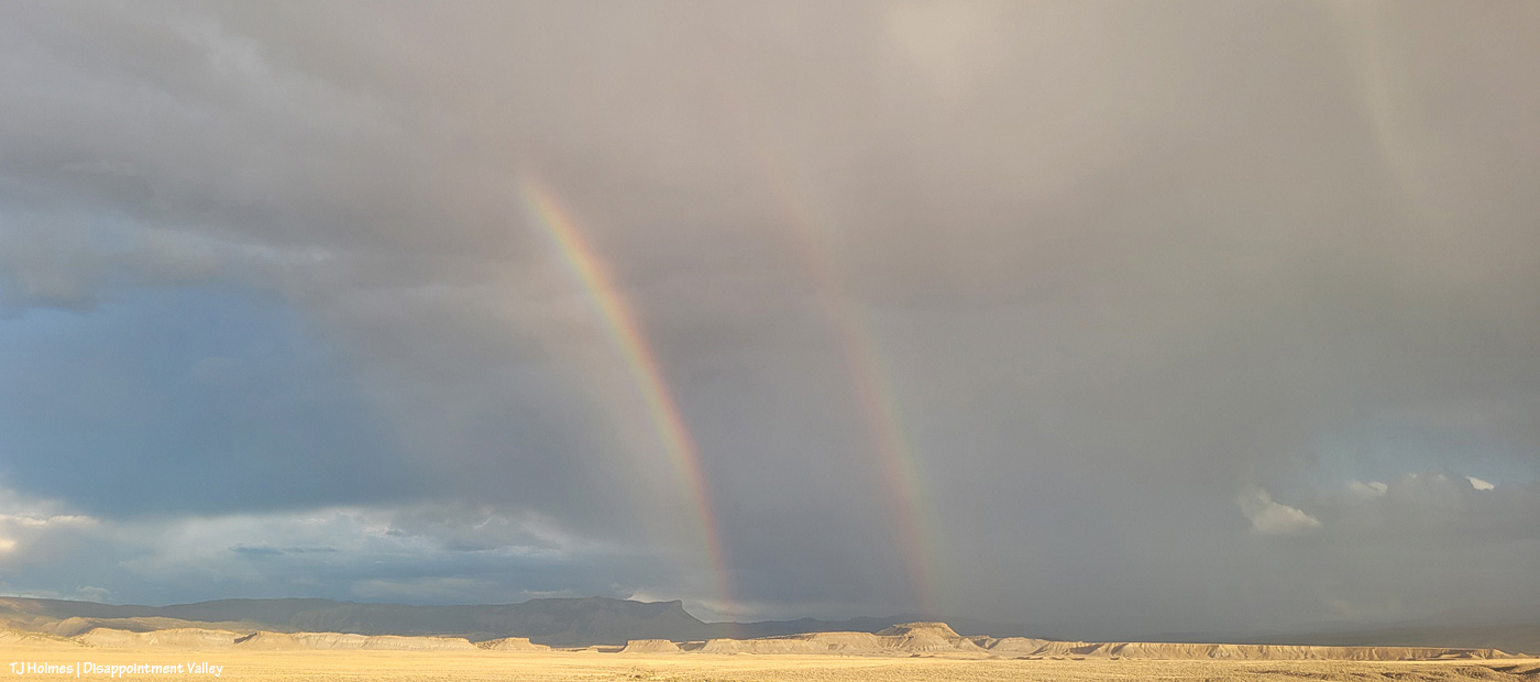
And when it finally faded, little curtains of rain were still moving south to north across the eastern(ish) part of the valley.
A person can never have too much magic in their lives. 🙂
Don’t hate me for making up spectacular words to match the gorgeousity of the magic scenery, painted by Mother Nature. … Anyone would (and should) do it. 🙂
(And yes, I did get semi-soaked!)
“It won’t rain.”
The rain came from behind-ish me (southish), and though it lasted (at a guess) less than five minutes, it soaked my right pant leg and right shoulder/arm and left water dripping down my leg inside my pants (!). These two pix (above) are looking north as the rain has mostly passed over me and is continuing north.
From the same spot as the first two pix, looking now eastish, I watched the moon rise over Temple Butte (promontory) and McKenna Peak (pyramid).
The moon was still barely visible when the light hit the passing rain and formed the prism, but while trying to decide between my phone and big camera, I think I missed it before it rose into the clouds (argh!).
With more dark clouds rising from the south and mustangs mostly far and scattered across the northern part of the basin, I decided to return another day. … (Note: It’s not a good idea to go into the basin if it’s going to rain. The road can get spectacularly bad when really, really, super wet.)
Wellllllll (a friend and a new friend will understand that heavily accented word 🙂 ) … when your gut tells you to turn around and make for the place where the rainbow will align with the pot of gold you know to be there (if you know, you know), be like Leroy Jethro Gibbs, and pay attention to your gut!
I stood in the sunshine along Disappointment Road while the second wave of rain passed from south to north across Spring Creek Basin (the rimrocks are Spring Creek Basin’s western boundary; the basin stretches away to the east in the northeasternish part of Disappointment Valley).
And the spectacularity JUST. GOT. BETTER.
End to end under the powerlines.
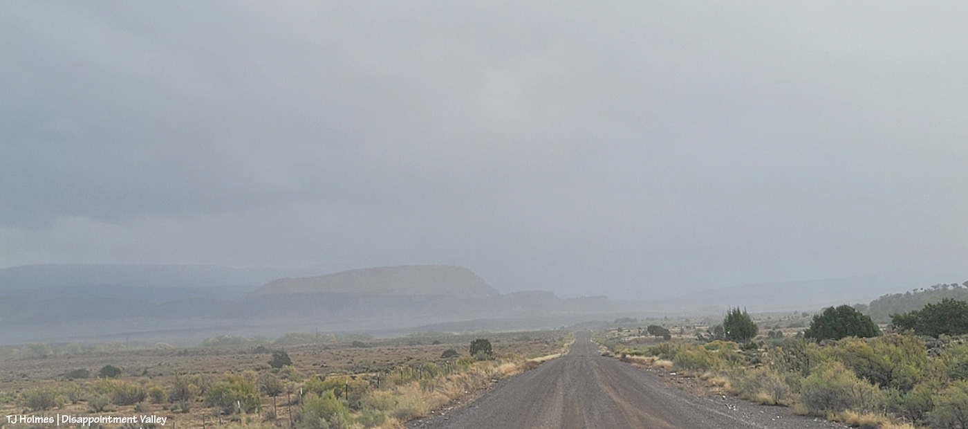
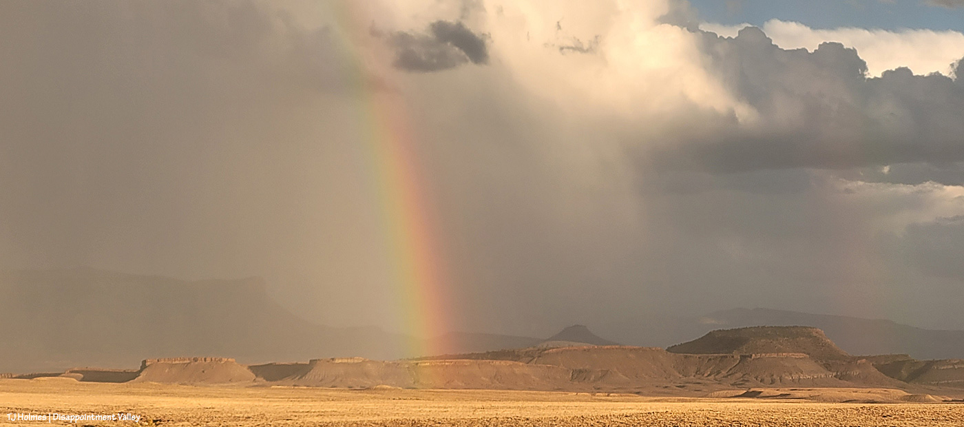
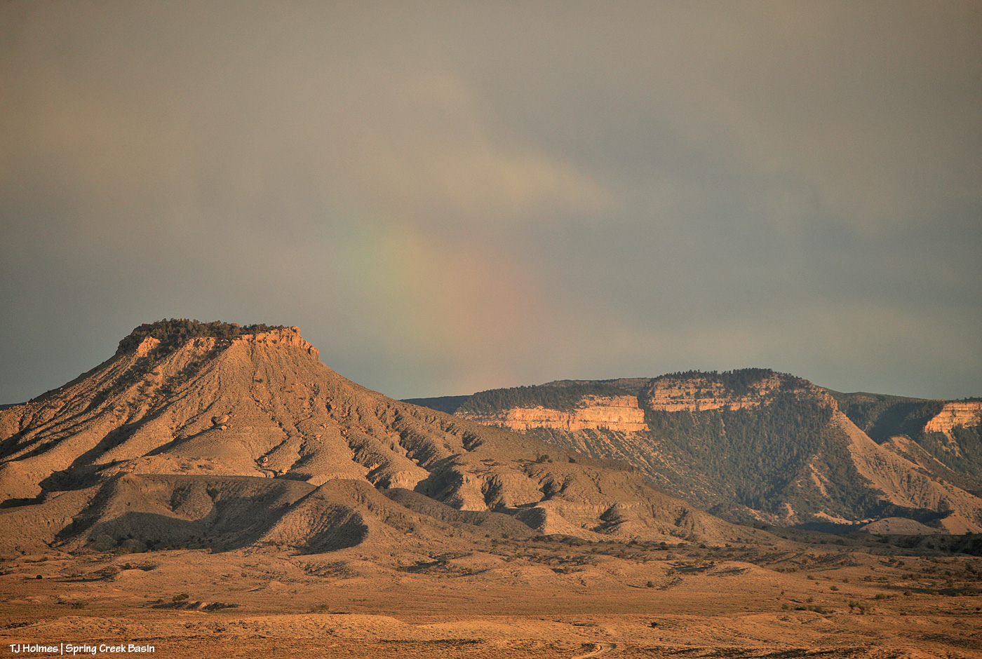
Temple Butte is visible again as the storm moves north.
This is NOT part of the original/above rainbows; it was a newly formed prism as the rain continued to pass and clear and the sun found space beneath the clouds above the western horizon. This stretch of Disappointment Road goes straight east.
After dark, we got yet another little wave of the good rain stuff. *Sigh of contentment*.
Maybe more overnight and in the morning. (Fingers and toes all crossed!)
I mean … RIGHT?! 🙂 Magic, folks. Pure magic. No artificial ingredients added. 🙂
It’s not my intention to ignore all the ills of the world on this blog, just to make it a place of peace and beauty.
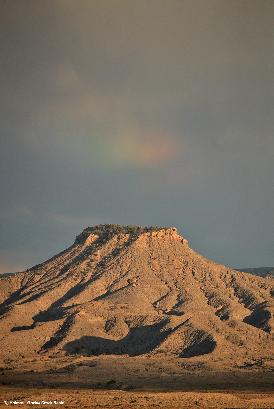
Two nights ago, clouds stymied my moonrise photography attempts, but Mother Nature put on a show, nonetheless. You can’t really call that a rainbow – a light prism? – over Brumley Point, but it was a much better sight than the image I took the day before that looked like Brumley, which looks enough like an old volcano, was actually erupting.
This was the second time it happened (and I was in a bit different location). Neither occurrence lasted more than a minute or two?
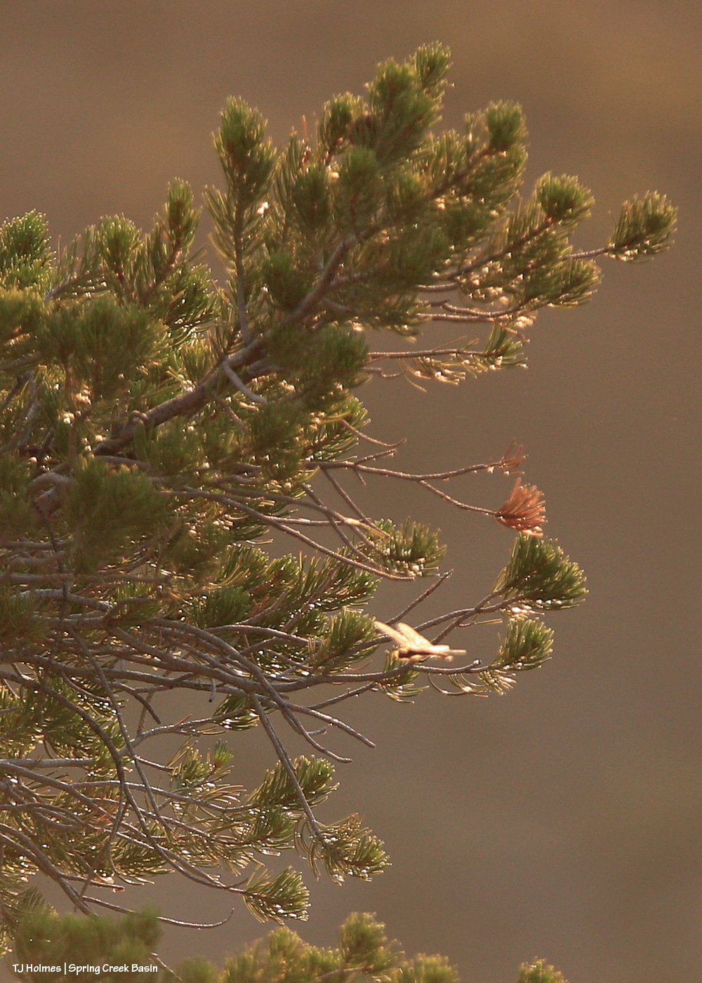
Do dragonflies bring you joy? It’s way out of focus here near the in-focus pinon tree – in my defense, I was pretty far away, and it was zipping faster than I could follow, let alone focus – but that little beam of zooming light (seeing it backlit against a far mesa is what caught my attention in the first place) brought ME joy! I realized that it was snatching flying insects out of the air, which I cheered wholeheartedly. The gnats are largely gone, but we have (still) big flies and (now) these weird little things that are bigger than gnats and almost as exasperating.
The moon did rise above the clouds eventually, of course. No matter the conditions here on Earth, it’s always, comfortingly, there – somewhere out there.
Most importantly, to paraphrase Mad-Eye Moody (apologies to non-Harry Potter fans): Stay vigilant!
Note: Images are from Tuesday, Aug. 5. Yes, I’m in Spring Creek Basin for the below (cell-phone) images, and yes, the fire is fairly close as the eagle soars (the next county south, which is Dolores County; the basin is mostly in San Miguel County but does extend south into northern Dolores County). However, the horses are not in danger; there’s actually a lotta country between there and and the basin.
If you’ve visited Spring Creek Basin, you’ll recognize this cattle guard at the intersection of Road 19Q (Disappointment Road) and Road K20E. What you most likely and very fortunately have NOT seen as you head east toward Spring Creek Basin is a giant, nuclear-cloud-looking smoke plume. 😦 That’s the newly started Stoner Mesa Fire. (This is the Durango Herald link; you may hit a paywall, or you may get a free read of three articles (?).)
I won’t lie; I nearly had a heart attack when I saw that plume. Back in 2002, I was working at the aforementioned Durango Herald, and when I drove to work each afternoon (copy editor/page designer shift of 3 p.m. to midnight), the nuclear-plume of smoke from the Missionary Ridge Fire greeted me with heart-stopping awesomeness (and not in a good way) every time I topped Hesperus Hill to descend toward Durango.
This is from the area we call Chrome’s Point in western Spring Creek Basin, looking east-southeast. Yes, those dark-and-white spots at far left, left of the main/original water catchment aprons (looks like a tennis court) and tank are mustangs. Thankfully, they seemed completely and totally oblivious. The air was hot and smoky: Dragon Bravo Fire, Sharp Canyon Fire, Turner Gulch Fire (smoke still visible from it, too), Waters Canyon Fire … and who knows what other fires contributing to our air dis-quality (!?)) – more hazy than seems apparent from these images.
Moonrise over McKenna Peak and Temple Butte from farther north in the basin. Most of the smoke was blocked by the eastern horizon of ridges from this perspective.
Sunset through smoke. Pretty … but it is violently, dangerously dry out there.
This is a hot, bad, dry (and very-bad-dry) summer, folks. Please be mindful of anything that could spark a flame, stay safe, and support your firefighters … local, regional, state and national. And rain dances are *ALWAYS* appreciated. 🙂
(I went with my phone pix for this post, but I may have some from my big camera in coming days. … May …)
There are no mustangs in this post (crazy, I know, with a title like that), but mustangs were SEEN.
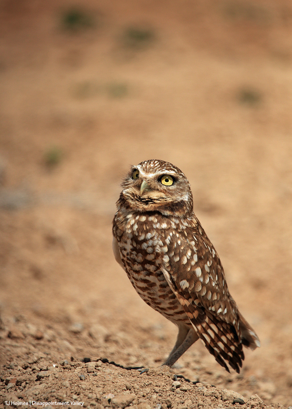
This, my friends and fans of wild things and wild places, is a burrowing owl. Possibly one of THE – I’m gonna say (type) it – *cutest* birds on the planet. You know how I adore kestrels. … I see them all the time. But burrowing owls?!?!?!?! This might be the third I’ve ever seen in Disappointment Valley.
Huge shout-out to friend Mary, who not only was driving but spotted this marvelous beauty along the road. She casually asked if I’d seen the owl – she thought it was an owl? – and obliged my horizon-gazing self by backing up to where – sure enough – this burrowing owl was standing on a burrow (possibly/likely previously the home of a prairie dog family) right alongside the road. The owl him/herself (?) obliged us by being its beautiful, gorgeous, adorable self so we could take a minute or two’s worth of photos before driving on to not disturb its … burrow guarding? We never saw another bird, and this one seemed pretty comfortable.
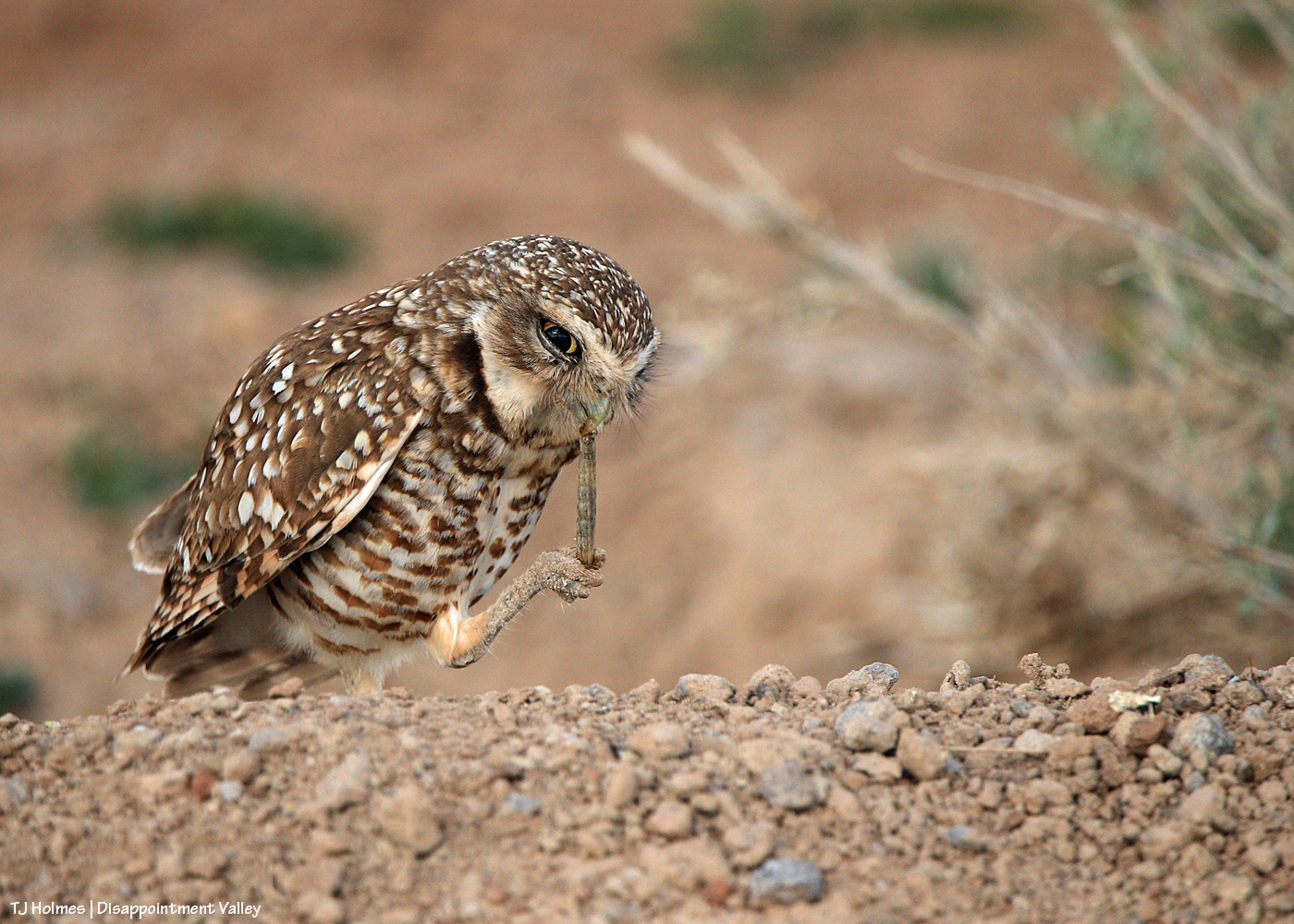
Who needs opposable thumbs when one has feet/talons perfectly capable of gripping dinner? (I think this might be a carpenterworm? Though it’s much earlier than I’ve ever seen them. Eat all you want, friend owl!)
Like … WOWOWOWOWOWOWOW! 🙂
And as if that weren’t enough, this was the end-of-day, sunset-lit, alien-mothership/stormcell cloud (one or the other … right?!) visible over upper Disappointment Valley just beyond (?) Spring Creek Basin:
Because … our planet Earth really is that gorgeous. 🙂
Notes: Owl pix taken with a 600mm lens from inside a vehicle. Crazy storm-cloud pic (and yes, the rest of the sky was basically blue and nearly clear) taken with my phone because a long-mustang-owl lens just could not capture the entirety of the above scene. Very last light of day. I sized the image and gave it a touch of sharpening, but otherwise, that is straight out of the camera, err, phone.
It really was a WOW kinda day. 🙂 “*Grateful*” doesn’t even begin to describe how I feel about this glorious little part of our great, wide, wild, wonderful world.
Better late than never, and when I finally got my act together, I thought Valentine’s Day would be the best day for this rundown.
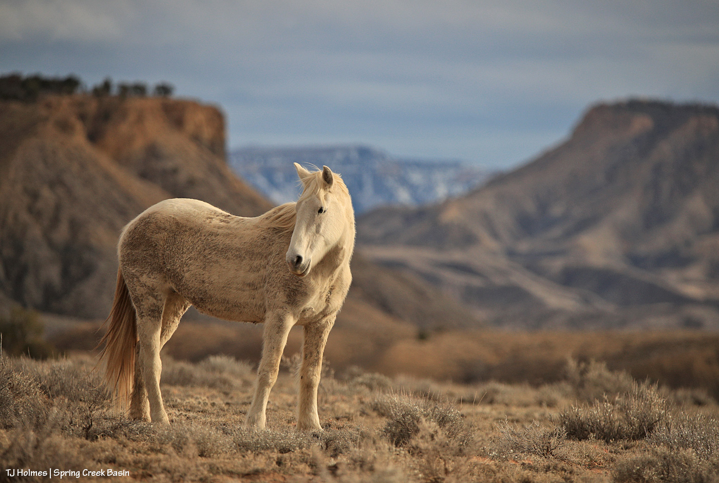
As usual, these are 12 (and a bonus) images from the last year that came from each month. This year, I think, most of these photos have been on the blog previously. A little reminiscence of the events surrounding each image will follow the photos. Sometimes it’s those emotions and memories that make a particular image special for the photographer, and these are no exception to that. Just being out with the mustangs, in Spring Creek Basin, no matter the weather, is the very best part of what is impossible to share.
Enjoy … and please consider this is my love letter to Spring Creek Basin and its mustangs from 2024. 🙂
January last year was at least somewhat snowy (this year was very much NOT snowy). Skywalker had been a bachelor with a couple of bands until sometime last year, and here he is with some horses from one of those bands. Completing the composition is part of the Spring Creek canyon rimrocks in the near background and Utah’s La Sal Mountains in the far background. (I wish they were that snowy this year.)
This was a magical February visit with Mariah and her band. The low-angle sunshine made each snowflake a visible bit of earthly magic, and when she looked back at somebody – shazam. Magic captured.
Couldn’t pass up this snowy March day in the basin with Temple! Clearly, she had been enjoying the moisture and excuse to roll in the mud. I love the sunshine on her and the falling snow blurring the background.
I had so many opportunities with the mustangs in April, but this image of Hollywood was just *the one*. You all know exactly what I mean. (To update, I haven’t seen him again since the image I posted earlier this winter. It doesn’t mean anything other than I haven’t seen him. …)
When Spring Creek is running with rainwater, that is a time not to miss photographing it because it doesn’t happen often and water doesn’t run in the arroyo bed for very long. When Skywalker moseyed to the edge of the creek in May, just upstream of the canyon, the scene came alive with story: mustang drinking from an ephemeral stream in the desert.
In June, I was lucky to catch Sundance’s band near Odin’s band … and luckier still to see Sundance and Odin having a friendly little chat! Elder stallion and growing young stallion; what a moment. I’d love to know what wisdom Sundance was imparting to young Odin.
Terra’s stallion adores her. And I mean *adores* her. They travel with another band, but Venture has eyes only for Terra. This image is from July, when it’s hot and dry and the horses just like to doze.
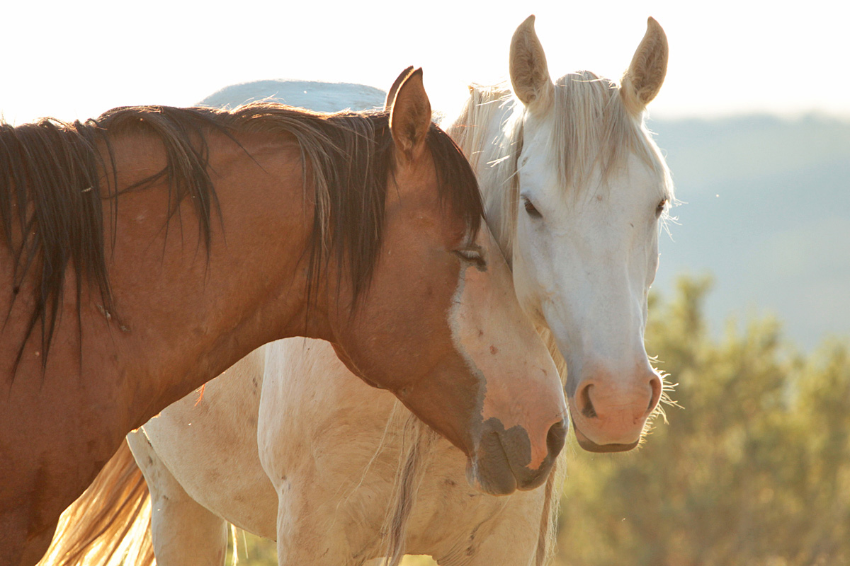
Personally, this is one of my favorite images of the year because those are two of my favorite stallions: Storm and Buckeye. With their bands grazing nearby on this warm August evening, the boys greeted each other quietly and respectfully before returning to their mares.
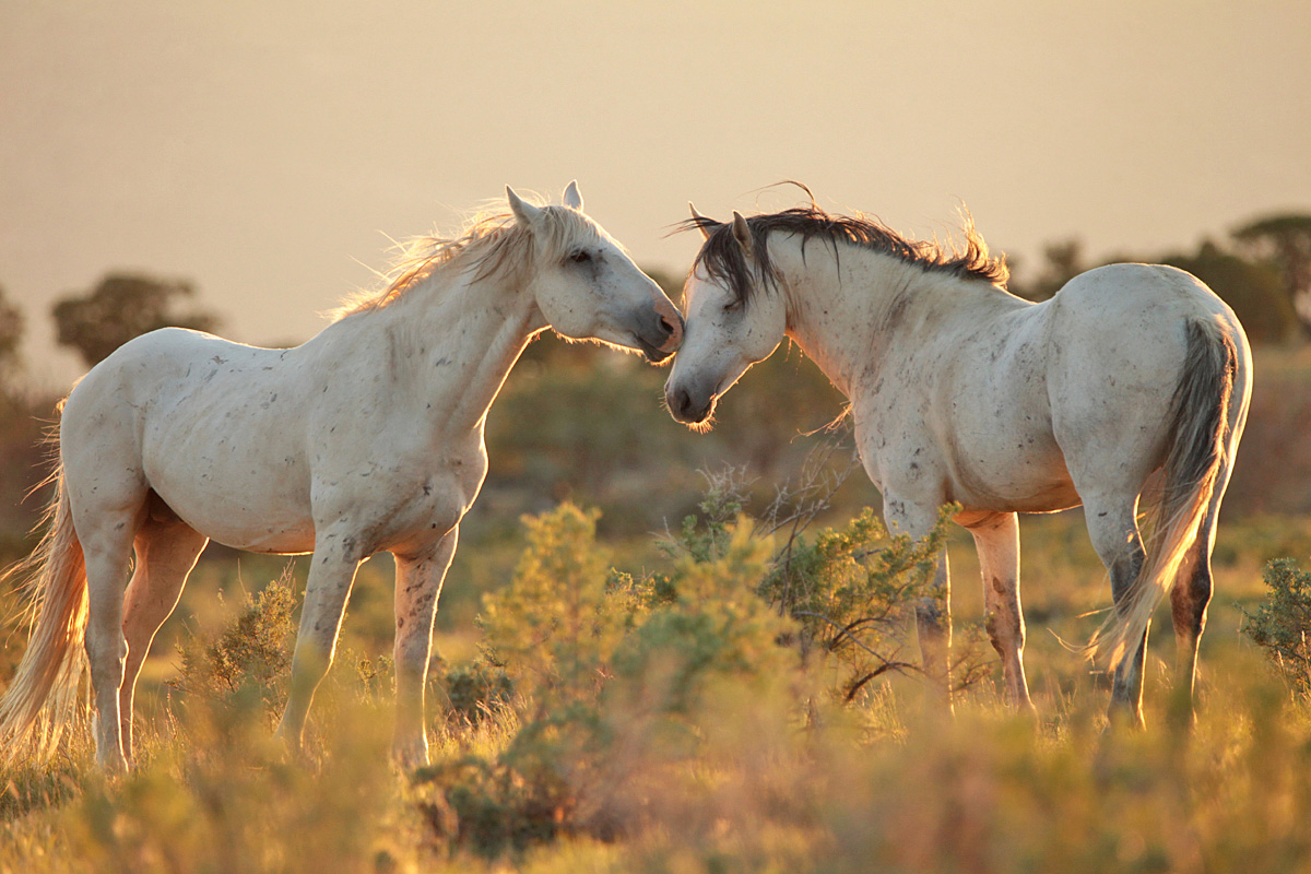
Here’s your Valentine’s Day image, taken last September. 🙂 Buckeye and Rowan, especially, seem to have a special fondness for each other.
After Storm lost his band in October, the mares went through a couple of younger stallions that couldn’t seem to keep them. Flash ended up with Gaia … then also with Mysterium. And finally, as you know now, he gathered all of Storm’s girls (which, I think, probably was due more to them wanting to be together and evading the youngster that had them than to any particular skill Flash had at stealing them!). (I’ve seen Storm just once since he lost the band, way deep in the southeastern part of the basin.)
Last November, we had some great snow, and we were so optimistic for the winter to come! … And that was pretty much it. Here it is February, and we’re desperate for moisture of any kind while we watch the dirt turn to dust, to powder. But in November, Terra was a gorgeous girl in the sunlit snow, and life was good.
We had more lovely light in December – as seen glowing around lovely Winona – but not a heckuva lot of snow.
And as usual, a bonus:
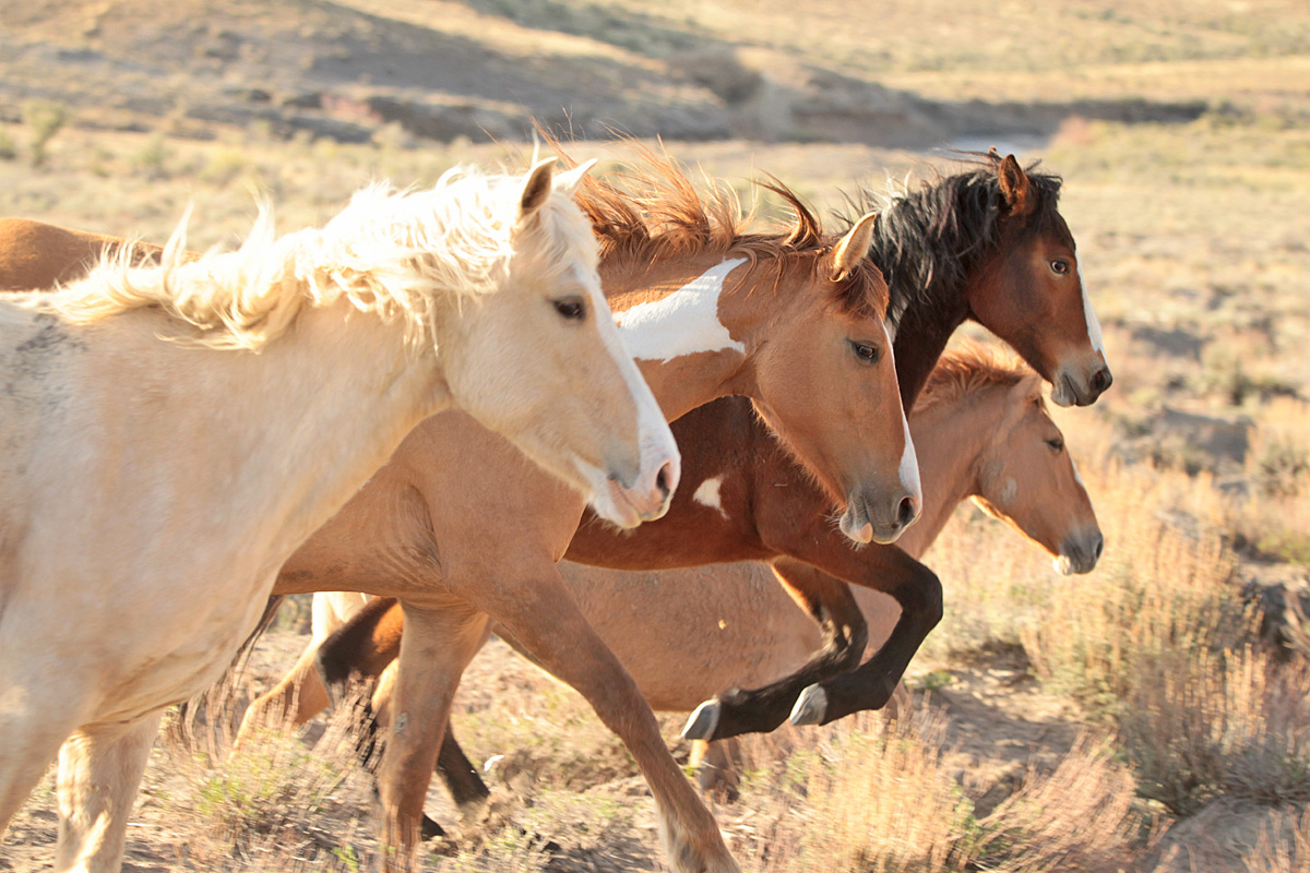
Buckeye’s girls. 🙂 I don’t remember what caused them to run right past me, but I was stoked to capture this image of them nearly in a row, especially just as Bia was leaping a bit of sage or saltbush!
Thanks for following along, happy Valentine’s Day to you and your loved ones, and if we can have a bit of a love(ly) wish … more snow, please! 🙂
*** Update Friday morning: Disappointment Valley is getting RAIN! Not snow, RAIN. In February. In Colorado. Well, you know we’re in desperate need of moisture, so I’ll take it. (But 38F is hard on the wildlife under rain.)