Note: Images are from Tuesday, Aug. 5. Yes, I’m in Spring Creek Basin for the below (cell-phone) images, and yes, the fire is fairly close as the eagle soars (the next county south, which is Dolores County; the basin is mostly in San Miguel County but does extend south into northern Dolores County). However, the horses are not in danger; there’s actually a lotta country between there and and the basin.
If you’ve visited Spring Creek Basin, you’ll recognize this cattle guard at the intersection of Road 19Q (Disappointment Road) and Road K20E. What you most likely and very fortunately have NOT seen as you head east toward Spring Creek Basin is a giant, nuclear-cloud-looking smoke plume. 😦 That’s the newly started Stoner Mesa Fire. (This is the Durango Herald link; you may hit a paywall, or you may get a free read of three articles (?).)
I won’t lie; I nearly had a heart attack when I saw that plume. Back in 2002, I was working at the aforementioned Durango Herald, and when I drove to work each afternoon (copy editor/page designer shift of 3 p.m. to midnight), the nuclear-plume of smoke from the Missionary Ridge Fire greeted me with heart-stopping awesomeness (and not in a good way) every time I topped Hesperus Hill to descend toward Durango.
This is from the area we call Chrome’s Point in western Spring Creek Basin, looking east-southeast. Yes, those dark-and-white spots at far left, left of the main/original water catchment aprons (looks like a tennis court) and tank are mustangs. Thankfully, they seemed completely and totally oblivious. The air was hot and smoky: Dragon Bravo Fire, Sharp Canyon Fire, Turner Gulch Fire (smoke still visible from it, too), Waters Canyon Fire … and who knows what other fires contributing to our air dis-quality (!?)) – more hazy than seems apparent from these images.
Moonrise over McKenna Peak and Temple Butte from farther north in the basin. Most of the smoke was blocked by the eastern horizon of ridges from this perspective.
Sunset through smoke. Pretty … but it is violently, dangerously dry out there.
This is a hot, bad, dry (and very-bad-dry) summer, folks. Please be mindful of anything that could spark a flame, stay safe, and support your firefighters … local, regional, state and national. And rain dances are *ALWAYS* appreciated. 🙂
(I went with my phone pix for this post, but I may have some from my big camera in coming days. … May …)
Spotlit by heaven’s sunshine is Temple Butte. You’re not used to seeing it from this vantage point, are you?
That’s because when I took this image, I was way up high among the ridges that form the southern boundary of Disappointment Valley, and I’m looking uppish-valley (!). Snow was still blowing through the region, and the sunlight was finding different and varied windows through the clouds … and
IT
WAS
SPECTACULAR!
Every time I’m up there, I’m reminded anew how absolutely gorgeous is this part of the world. Spring Creek Basin is back to the leftish, and with the clouds and sunlight and waves of snow … it was more painting than reality. But it WAS reality, and by gosh, it was gorgeous.
(I even saw a band of mustangs from up there, but they were very far away and nearly impossible to see other than through binoculars. I think I did take a pic with them in it, but they’re not in this pic.)
Yes, it really is (still) that dry in Spring Creek Basin and most of the rest of southwestern Colorado. Pooh on the U.S. Drought Monitor for thinking (erroneously in my oh-so-very-humble opinion) that we’re only “moderately dry.”
And: proof that mustangs and mountain goats have a common ancestor (!). 🙂
That’s Sundance (and one of his mares) on a finger of a ridge at the very southeastern end of what we call Knife Edge (which actually is fairly broad on top). This pic, taken with my phone as I hiked out to a series of hills to get up to the ridge that snaked down to where his band was, isn’t even wide enough to show how far to the right I had to go to get to that access area – where I could bypass the rimrocks. The other side of this ridge features a little cove, where a couple of the horses were grazing as I drove up the road to the point where I started hiking, but it’s all rimrock-locked. In other words, the only way TO that point is back up the way they got TO it in the first place.
OK, a third thing: You know I’m going to show you all some scenery from up on that ridge, don’t you? 🙂 (Here’s a crazy thing: As much hiking as I’ve done in Spring Creek Basin during the last 21 (starting to inch up on 22?!) years, I’ve never been up on that particular ridge or on the very top of Knife Edge. … The horses are very good guides at getting me to new places. :))
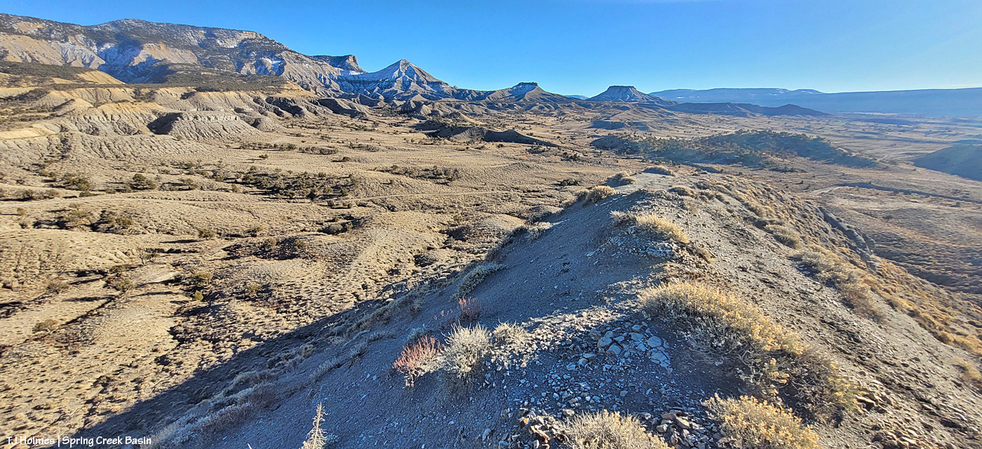
Upon leaving my buggy to start my hike (the big ridge and Sundance’s band are directly to my left), this was the first view that made me reach for my phone (aka easy-to-access camera). I’m just south of an area of Spring Creek Basin that I call the east pocket. Knife Edge is basically to about my 11 o’clock, and the sandy-colored ridges at the right of the image are what I call Valentine Mesa. The mountains are a stone’s throw away (!) in Utah; from the ridge I was later on with the horses, they’re mostly blocked by the bulk of Knife Edge.
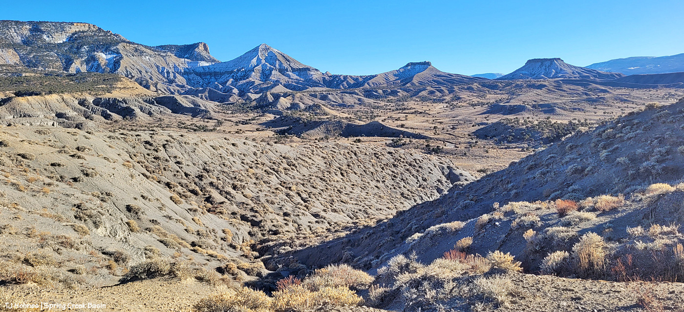
I’m up on the ridge that leads to the horses’ location farther down at the fingertip end of it. That big rise of grey Mancos shale and orangier (!) sandstone is Knife Edge. The southern peaks of the mountains are just visible way, way out against the turquoise sky. Spring Creek canyon is visible at far left. That’s the basin’s western boundary; the farthest treed ridges are the southern/southwestern boundary of Disappointment Valley above the Dolores River and its canyons.
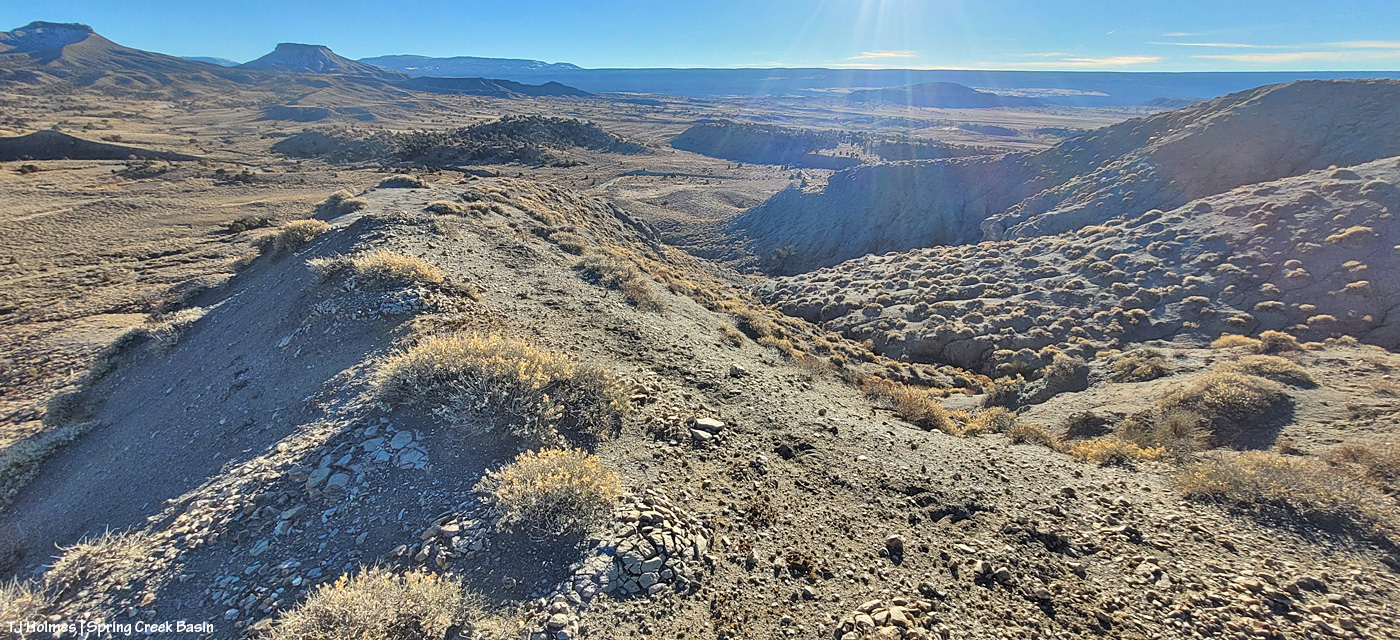
Looking left-ish from the above pic, that’s Spring Creek cutting through Spring Creek Basin in the middle ground. What I call the “weeping wall” is down there, and it provides a pretty constant source of trickling water for the mustangs. At far upper right is the eastern end of Filly Peak in the basin’s western region, and straight out is Flat Top. Round Top is barely visible at left. In about the middle ground – shadowed on its northeastish length – is the ridge I call rollercoaster (though it doesn’t look very rollercoastery from this perspective). … And see the glimmer just above/beyond it? That’s the rollercoaster ridge pond, still decently full of water (semi-frozen, depending on conditions). That’s the pond from the “Reflections” post recently. … And what do McKenna Peak and Temple Butte look like from THIS perspective?
I’m so glad you wondered! 🙂 From a little right of left: Temple Butte, McKenna Peak, what I call submarine ridge (you can see the two “arm” ridges of the actual feature from here) and Brumley Point, on Spring Creek Basin’s southeastern boundary. The Glade is in the far distance, touching the sky. A little closer – middle ground – is Spring Creek and part of the basin’s loop road (rough, and I would not recommend driving a vehicle on this section). The ridge down to the horses starts to the left and runs through the nearer middle of the pic. Sundance was actually partially visible (his back), but I don’t think he shows up very well in this pic.
This pic (left) and the next (right) were taken from the same vantage point, but when I tried to stitch them together into a bit of a panorama in Photoshop, it didn’t work out so well. So, using the ridge in front of me as your guide, you’ll have to use your imagination a bit as you scroll up and down to look left and right (!).
If you can find the ribbon of road, out there in sort of the middle, heading uphill (to the left from this perspective), is where I was when I looked up and horses appeared, much to my wondering eyes! (Magic isn’t just the domain of Santa, folks.) If I’d been going the other way around the loop, downhill, which is my usual direction and preference given some fairly challenging road issues (!), I don’t think I’d have seen them because I’d have had to look back over my shoulder and up. I try to look in that area because I’ve seen Sundance’s band in that relative vicinity before, but see the little “cove” down to the right in the second pic (the one right above)? That’s where a couple of the horses were when I first spotted them from below, and if I’d been in a different place, I wouldn’t – couldn’t – have seen them there from the road.
Another lesson: Perspective often is everything. 🙂
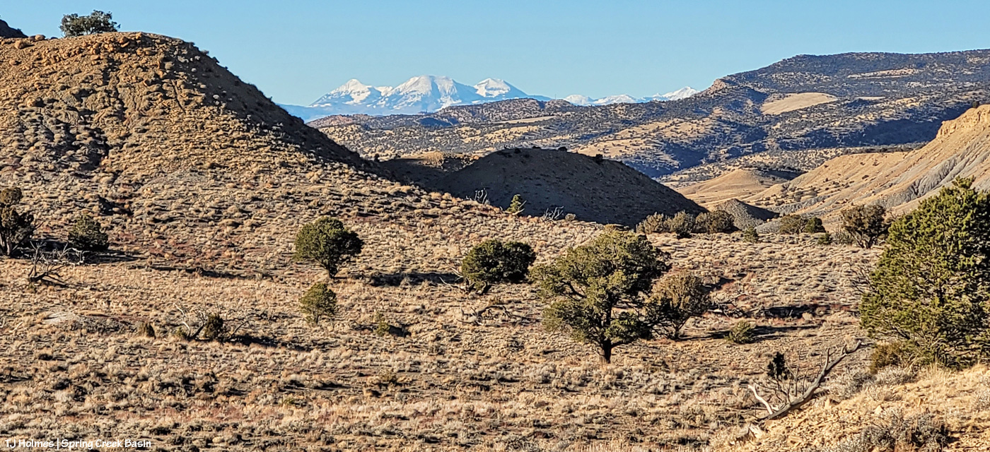
Pretty dry out there. The forecast is starting to show us some glimmers of hope for coming snow. We got kind of skunked over Christmas, but fingers and hooves are crossed that our winter will start picking up in this newest part of the new year.
We have had a pretty amazing surge of rain this fall – contrary to the forecasts for a dryer-than-usual fall. Or maybe that was for Colorado in general, which doesn’t seem to remember sometimes that our southwestern corner IS, in fact, still within the Centennial State’s borders. (And although we’re still dry – we *are* high desert, after all – other parts of Colorado are in (much) more severe drought than we are now. The U.S. Drought Monitor has reduced us to “abnormally dry.”)
Lower Disappointment Valley (as the elevation changes – and it changes rather dramatically from upper to very lower – rainfall amounts vary wildly) has gotten at least 1.84 inches of rain just in October. … Are you paying attention? That’s just the last few days! To put that in perspective, we got just 2 inches of liquid moisture between last Dec. 1 and this April 1 (that’s liquid from snow). Wowza.
We’re kinda dancin’ a bit ’round here. 🙂
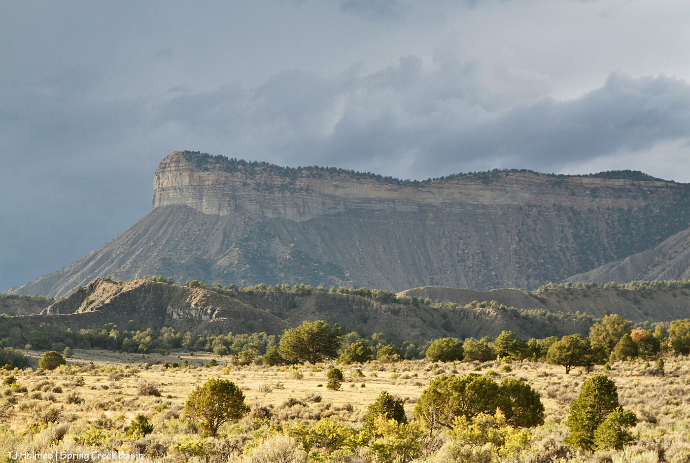
The pix in this post are of Temple Butte … different perspectives than normally seen from the interior of Spring Creek Basin. The top pic was taken from southeast of the southernmost basin boundary (Spring Creek Basin is basically on the *other* side of it from that perspective), and the one above was taken from below the last/southern/southeasternmost drainage in the basin – both from Disappointment Road.
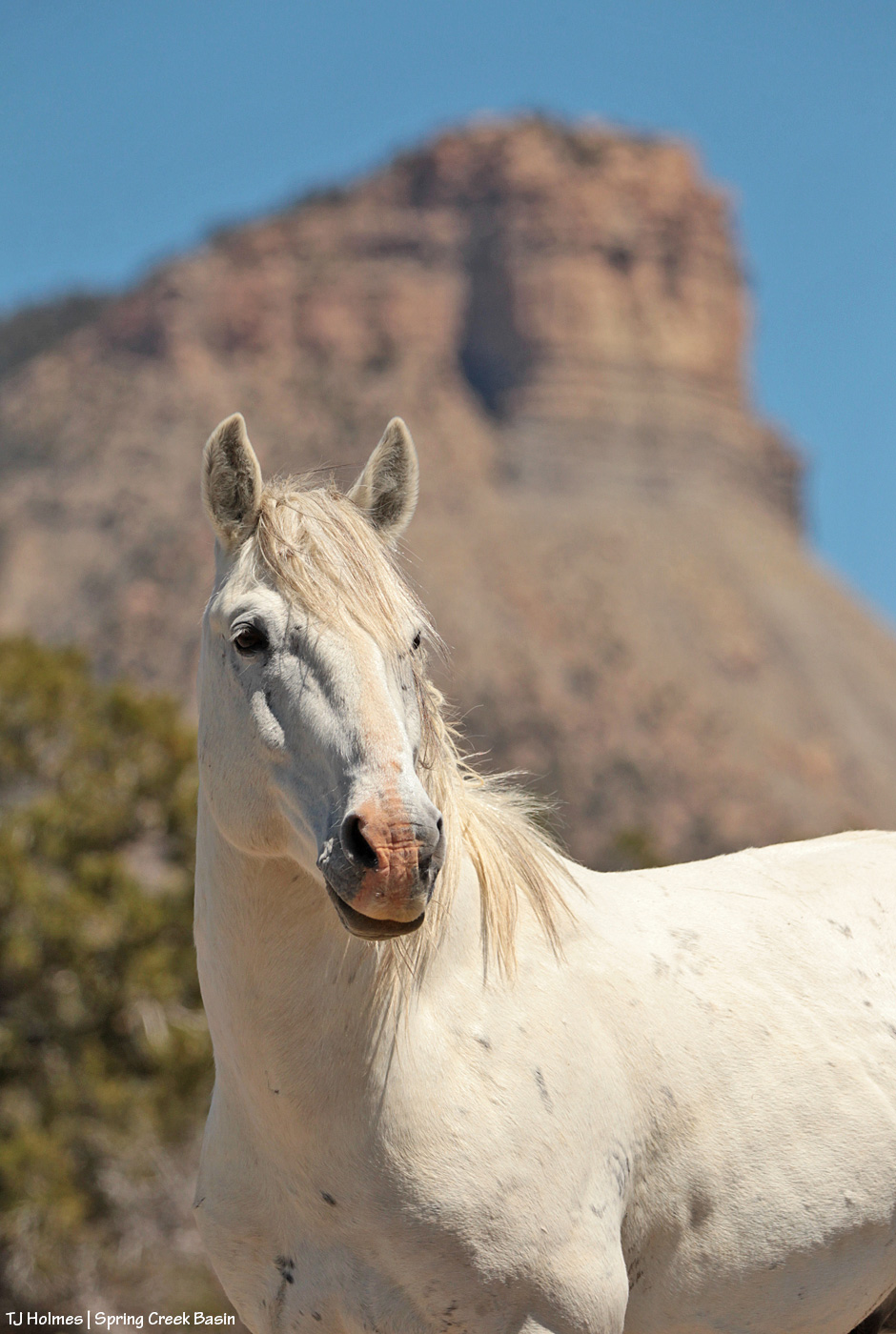
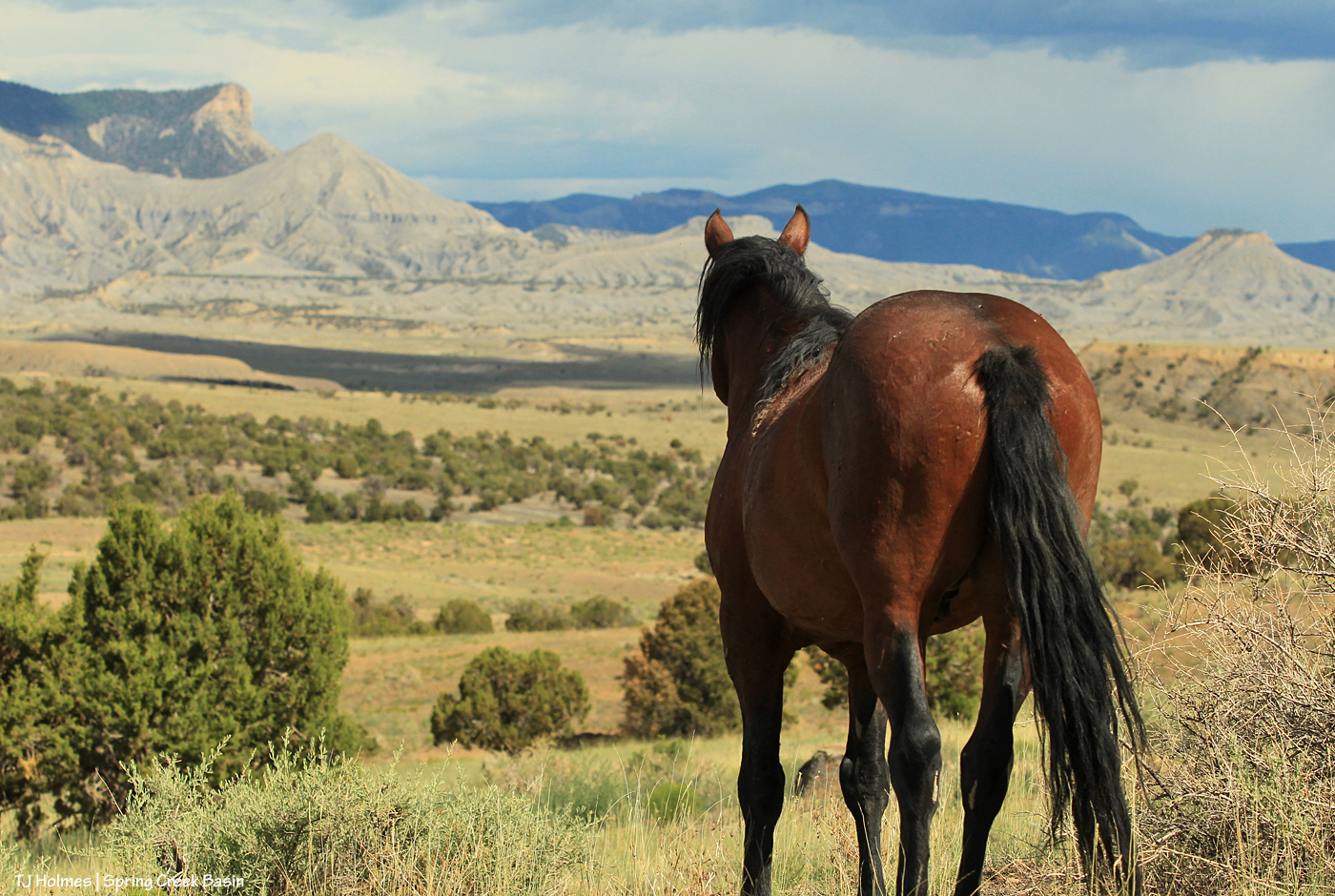
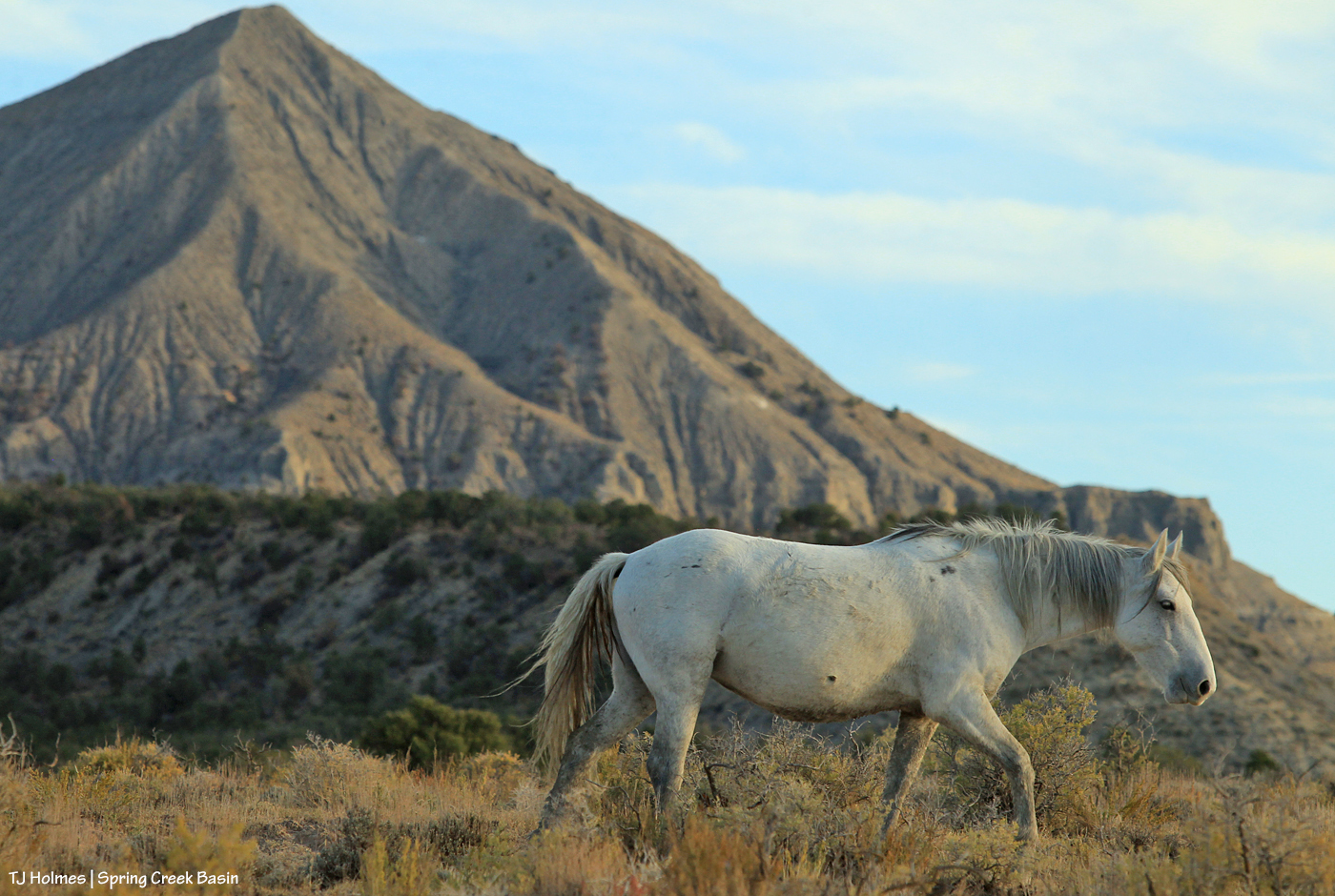
Just about everything is shown in this one pic – just about everything I love: Mustang (and there are more in the yonder) and that horizon that always lets me know I’m home after any amount of time away.
As always, I wonder what the horse sees/thinks as he looks out on that view, those places he knows intimately as a true, wild resident of that vast, wild land.
Lexi and Mason from SMA brought five interested – and interesting – people to see this area that’s in the same county as Telluride (San Miguel) … and a world away climate- and geology- and geography-wise.
Disclaimer: The pic above of Juniper walking past McKenna Peak was NOT taken during our hike. 🙂
We didn’t see any of our fabulous mustangs during our hike in the far southeastern part of the basin, but we did see a couple of tarantulas and lots of cool fossils (including a couple of faint but awesome nautilus impressions!). I got to talk about my favorite subject ever (I bet none of you can guess what that is … ;)), and Lexi talked to us about McKenna Peak and the CORE Act – the Colorado Recreation and Economy Act.
From the website:
“The CORE Act is the most significant and broadly-supported effort to protect Colorado’s most cherished lands, waters, and forests in a generation. The legislation would protect roughly 400,000 acres of public lands in Colorado, ensuring that future generations can always enjoy our state’s mountains, rivers and wildlife.”
McKenna Peak Wilderness Study Area is proposed for inclusion in the San Juan Mountains area. This link shows the locations of the areas; scroll down to read a little more about McKenna Peak and see where it’s located. The entire WSA isn’t included, just the part in San Miguel County. As with anything else, politics plays a part. Our San Miguel County commissioners are fully supportive of this inclusion, just as they were of the naming of Temple Butte, which is in San Miguel County.
Regular readers know the shape of both McKenna Peak and Temple Butte as icons of our Spring Creek Basin horizon. Given our location and lack of specific trails, I don’t think we’ll be overrun with visitors. But how cool would it be to see the status of even part of this amazing landscape go from wilderness study area to full wilderness area? It’s protected from motorized/mechanized-vehicle use currently, which enables it to feel secluded and protected to the wild horses and other lives that know its wildness (even us humans).
Being able to share it with another few like-minded humans gave me great enjoyment. To see their wonder and appreciation of this landscape I love … well, to be perfectly honest, it made me happy. 🙂
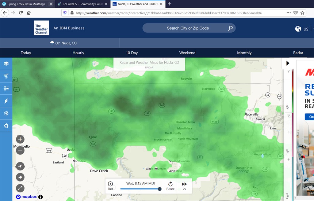
That looks lovely, right?! That’s nearly all of San Miguel County – McKenna Peak is outside the basin’s eastern boundary – under wonderful green, which in radar terms, of course, means RAIN.
Except that it wasn’t actually raining when I took this screenshot (around quarter after 8 a.m.). The heavens had leaked a little a little while earlier, but someone fixed (!) the leak. (Note to someone: We’re really OK with that kind of leak … and it could rip right open … really!)
We are so hopeful, and we need it BADLY – GOODLY? … We need the goodness of it in a really bad way ’cause it’s really kinda bad dry out there.