I don’t know about ya’ll, but I’m pretty sure that I only just got used to 2025 being, well, 2025. And I’m also pretty sure that I feel pretty much the same just about every year as one year winds down and another one gets ready to kick off.
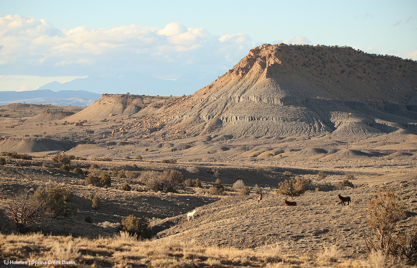
Fortunately, the only thing that changes is the light on the land and where the wild ponies might be found on the next adventure. (OK, so that’s not really true, but wouldn’t it be nice?) Pic above from Christmas Day, which already feels about 365 days ago (!).
Thanks for following these amazing mustangs. We’re all grateful for your interest! 🙂
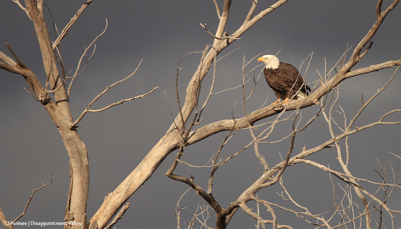
The cottonwood tree is almost as cool as the bald eagle. And that light! It was momentary, which makes the mistake harder to bear.
While shooting, I knew there were little branches in front of the eagle, but I didn’t realize until I saw the images on the computer that one branch literally goes right across the eagle’s eye. Sigh.
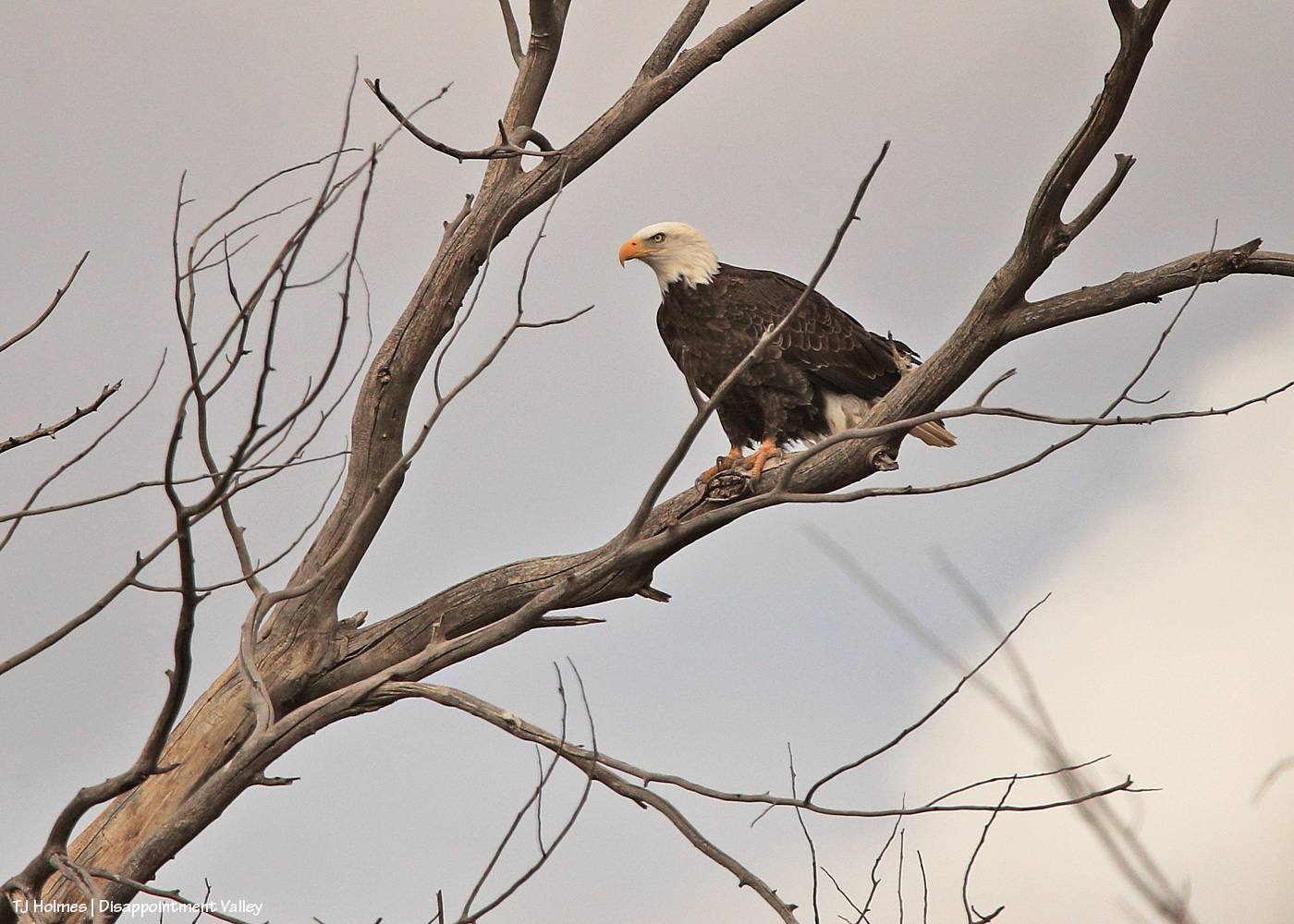
Here we go; a little better when the eagle ducked a bit to at least allow a shot of his/her (?) eye not directly crossed by a branch.
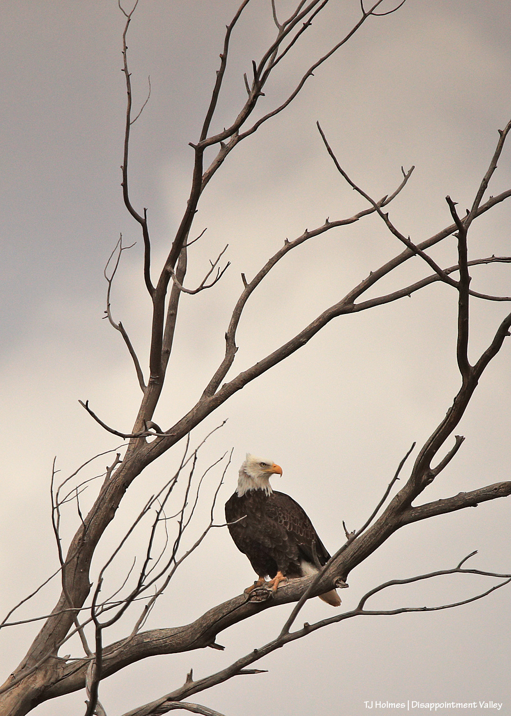
The eagle stayed “sticky” as I drove a little closer, using my vehicle as a “hide” to try not to spook the eagle (and all of these are taken with a 600mm lens and cropped).
I’m happy to say that s/he was comfortable enough with my presence in the rolling hide that s/he never flew away while I was there. I drove on and left it to its day doing eagle things.
Pretty cool sighting for the (windy) day after Christmas!
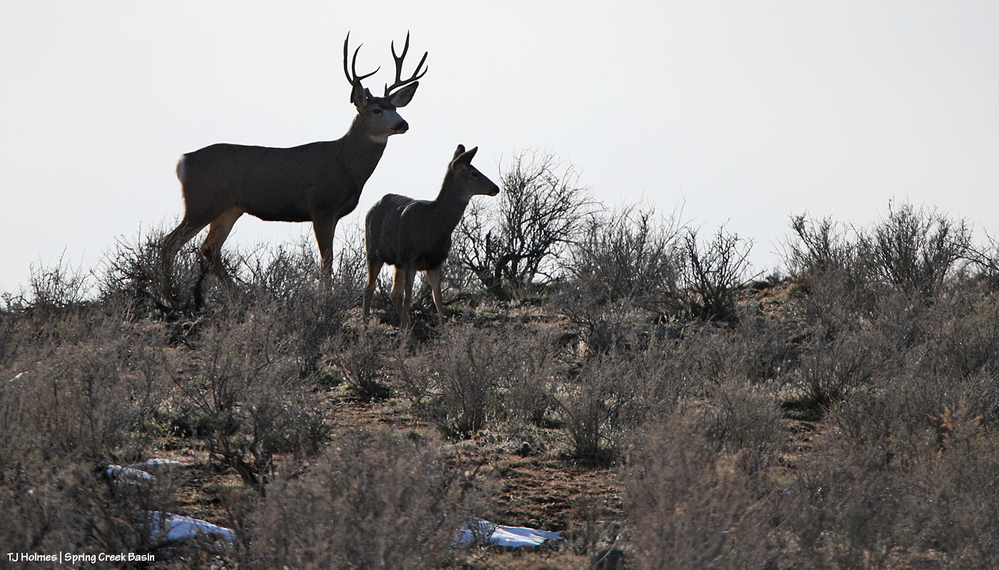
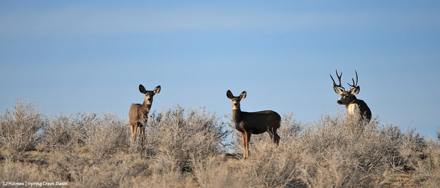
Sunrise in Disappointment Valley highlighting mule deer (I’m so glad to see the bucks back!) in the greasewood and chamisa (rabbitbrush) and willows and cottonwoods along Disappointment Creek, looking toward Spring Creek Basin. It was a drive-by shot, and I couldn’t actually see what I was shooting on my phone’s screen, but the light was so beautiful highlighting the pretty and handsome does and bucks, I literally pointed and pressed the button.
During the hunting seasons (basically starting the first of September and running across or nearly to (and in some cases past) Thanksgiving in Colorado), the wild antlered critters make scarce. I don’t know the numbers, but the traffic and human population of Disappointment Valley increases wildly (sorry) during that time – and not in a good way for the peace of most of us. And when the peace returns, so do the regular sightings.
One little girl is a little more bold than her sisters and aunties. 🙂
*Collective sigh of relief*
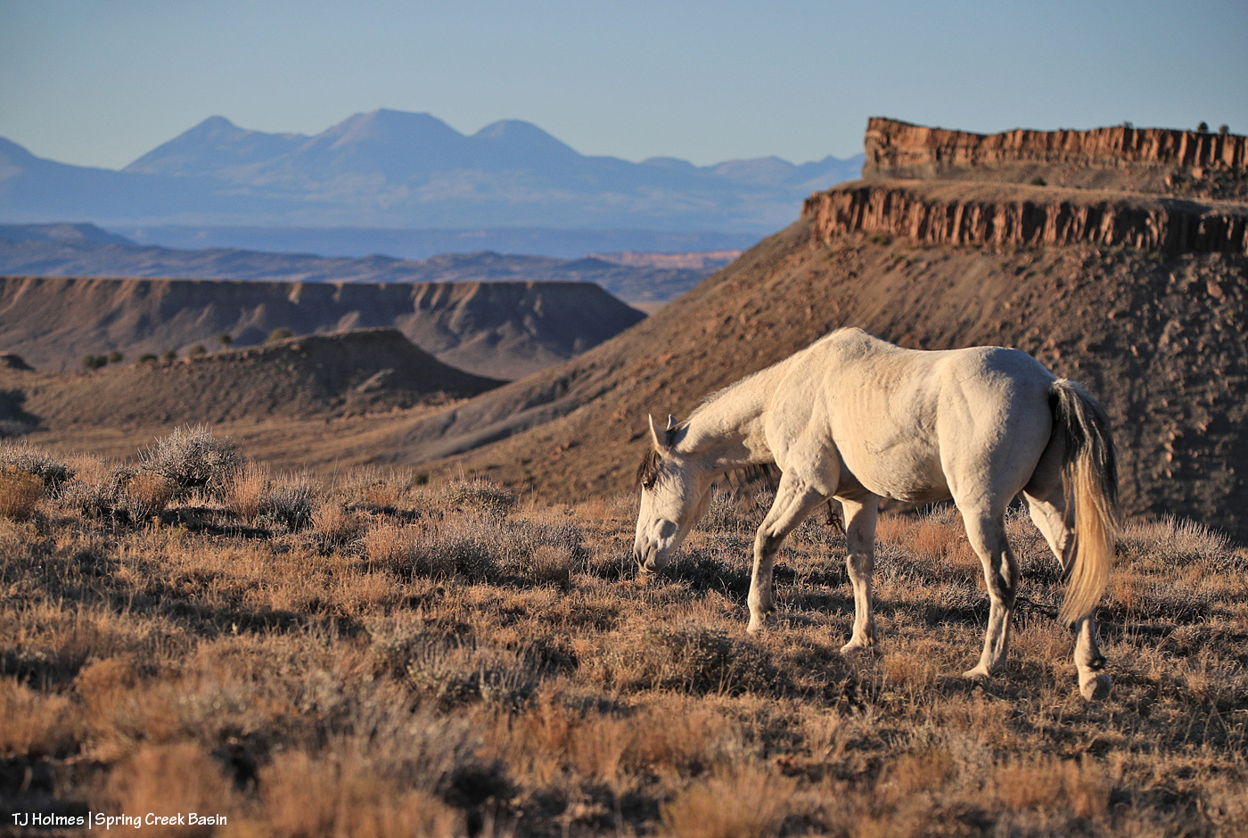
These are the first pix I’ve taken since returning to the basin since the snow has (mostly) melted. The roads range from completely dry in sections to stretches of snow-bordered bogginess. Ponies are foraging mostly far from roads, which is perfectly good and fine. Signs are holding up well!
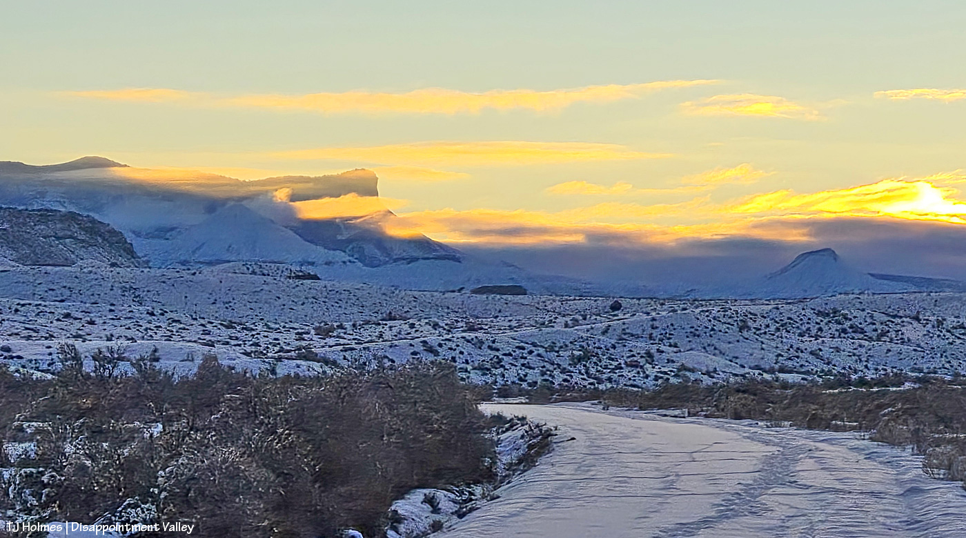
Looking east along Road K20E toward Spring Creek Basin at sunrise. Some of that clearing-storm cloudbank lingered well into the afternoon … even as the rest of the sky cleared to deepest Colorado blue. Deer (maybe elk, too?) and rabbits have been out and about.
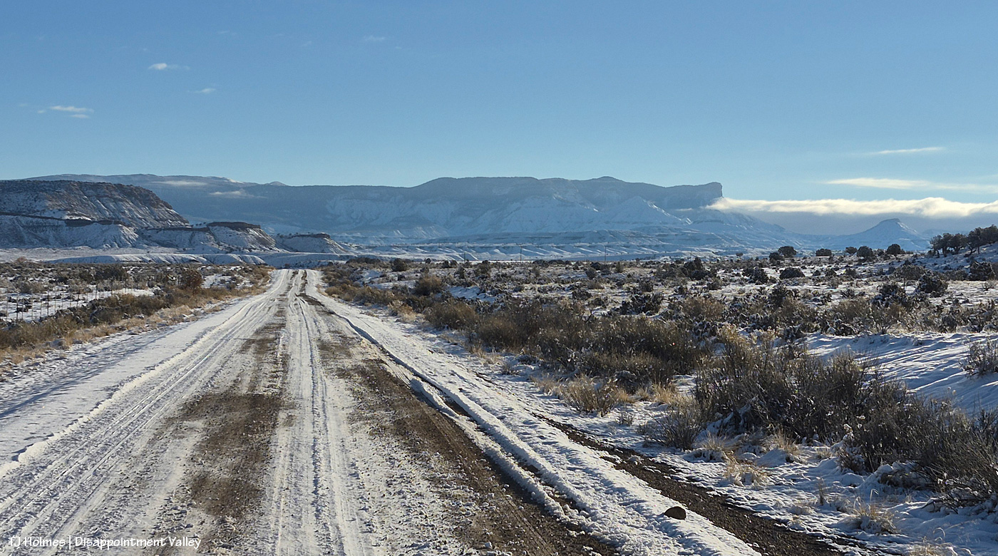
Now looking east up Road 19Q toward the basin. This pic, in particular, seems deceptive regarding the amount of snow. The melting really got under way in the afternoon, but that is/was some great snow! Three inches or so? Not bad for our first (and second?) coverings of the season.
And I hiked through a fair bit of it to find some wild ponies. 🙂
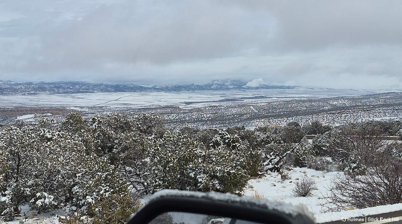
Getting home was less than straightforward (all on the northern New Mexico and southwestern Colorado side of the trip, not the Texas side, where it’s still summer-going-on-autumn-going-on-summer!), but there’s nothing like that view spread out from the top of the Slick Rock switchbacks heading down to the Dolores River canyon country and on out to Disappointment Valley. … Add snow to the view? Magical!
The road was clear by the time I got to this point (following a snowplow scraping the edge of the road clear of wet snow). If you visit Spring Creek Basin from the south, via Dove Creek, this is your view from the switchbacks heading down to Slick Rock (minus, probably, the snow and heavy cloud cover!).
Looking top down to, out and across broad lower Disappointment Valley! That line at leftish is Colorado Highway 141 across the valley. The rimrocks that form Spring Creek Basin’s western border are just visible at far-way-away, under-the-clouds right side.
I had such a wonderful time in Texas with my family (minus my brother, who was hard at work between Wisconsin and Illinois)! I’m sending a *massive*, incredibly grateful shoutout to my friend Kim A., who came to Colorado from Pennsylvania (!!!!!) so I could be with my mom and dad (and all of their critters and some long-long-time family friends) for Thanksgiving. 🙂
There seems to be at least 3 inches of the white stuff coating the entire region, so tomorrow’s post might also be late until I can get out and acquire some pix of snowy mustangs!
It’s been a crazy few days, and I’m almost over the rivers and past the mountains and down the plains and into the woods of home for Thanksgiving week.
It has been an incredibly busy fall season already. Third rifle season descends on Disappointment Valley (and every other bit of public land in Colorado) today. Apologies to good, ethical hunters, but it is THE WORST week of my year. So partly to set the tone for a hopefully OK week (and a safe one), and partly because I mostly forgot these images (!), let’s start it with some golden eagles.
The above image was taken more than a week ago (on my mom’s birthday, actually!), as you can see by the phase of the moon (wow, has it been BRIGHT!). But see that little speck right of center? That’s an eagle, and THAT is what I spotted that made me stop and scramble to get my camera out of its pack.
Two of the three eagles I saw were flying (cavorting?!) together above Spring Creek Basin’s western rimrocks. I like to think they came flying overhead to see what the crazy two-legged was doing, and I was glad to see them so close in all their majesty.