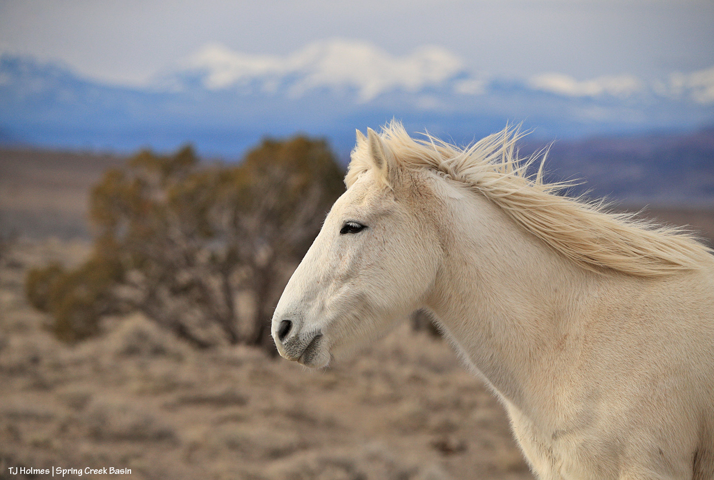
Question: Is Mysterium posing, or is she alert to something?
Hint: She does love her naps, when it might look like she’s “posing,” but she really doesn’t do posing. 🙂
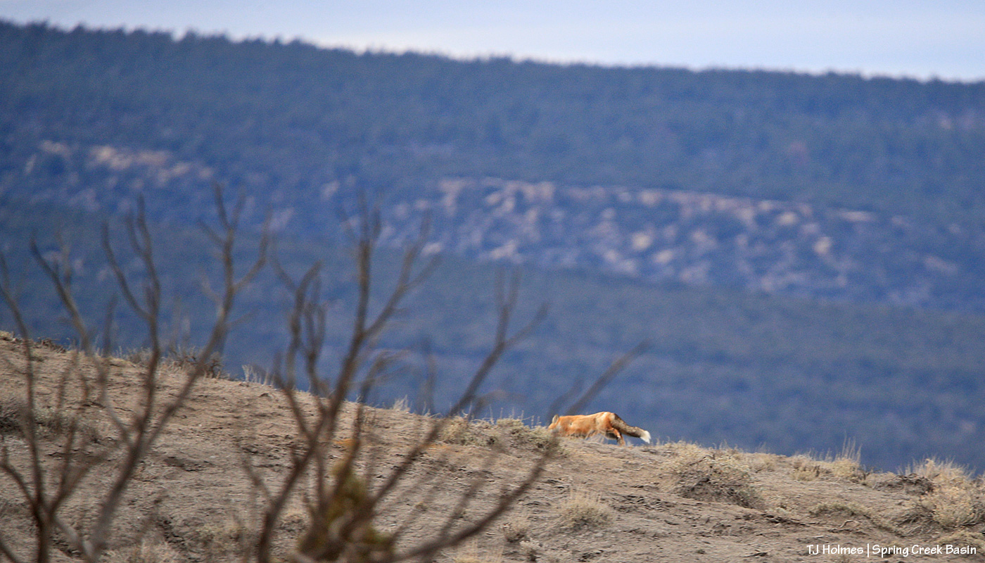
Whaaaaaaaaaaaaaaaaaaaaaaaat?!?!?!!!!
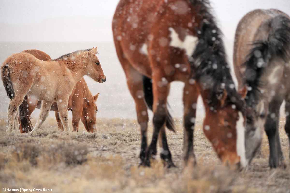
I was sitting on the ground, lens trained on some horses, when I heard them spook and looked up to see that something had caught their attention. THEY didn’t go far at all (more a spook-in-place kind of thing), and then I saw a flash of moving-red … FOX! Wow. It must have been in one of the little/shallow curvy arroyos nearby, and I’m not sure what spooked IT. I must have walked semi-past it earlier to go uphill of where the horses were (note the view beyond Mysterium!).
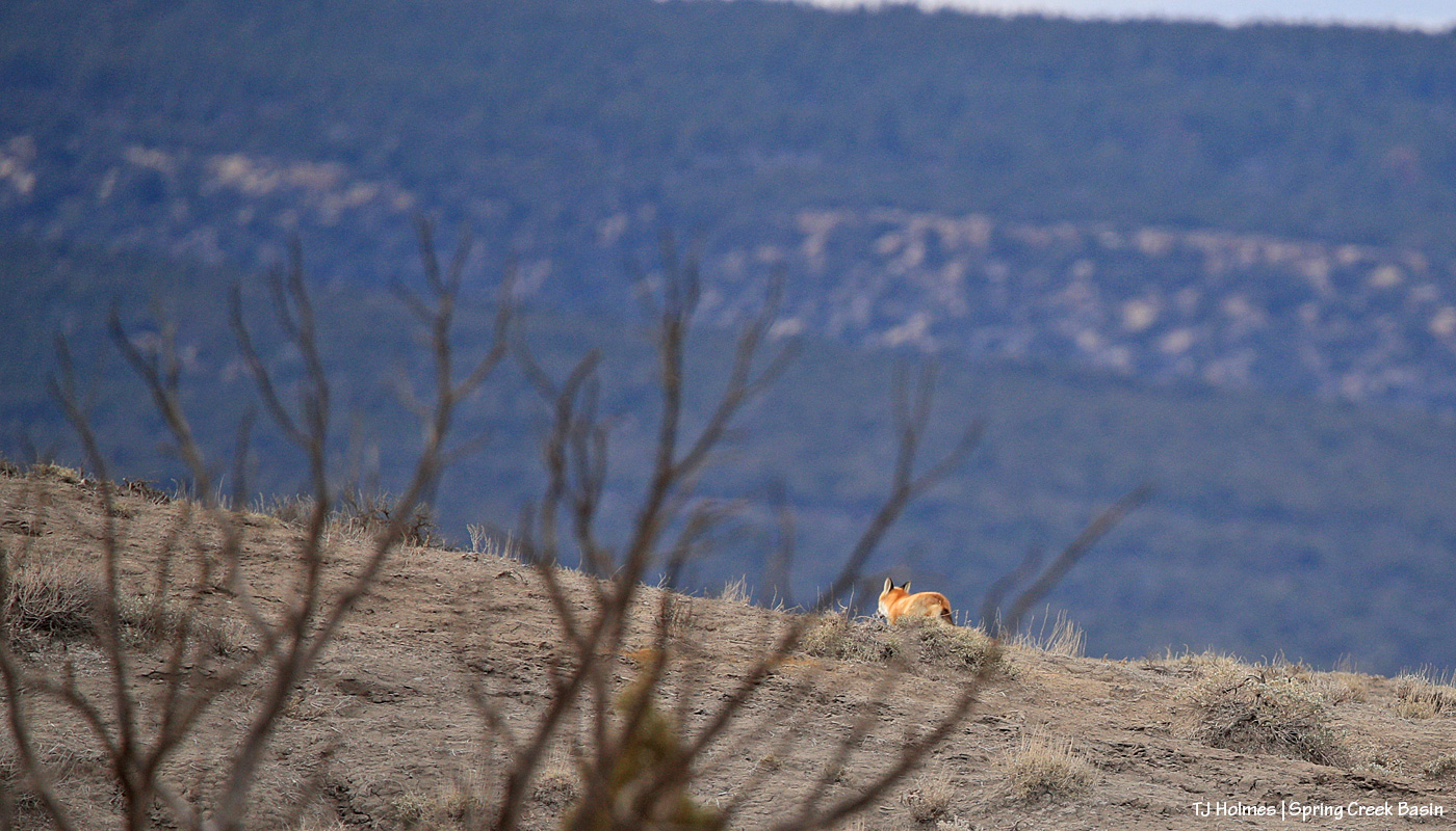
Unfortunately, there was a tree between us, and then it disappeared into one of the drainage folds … and when I caught sight of it next, it was nearly over the ridge. I wish it had stopped to give us a quick look, but nope.
Wowowowowow! I think the mustangs were just as thrilled (OK, interested) as I was. I doubt they see many flashy red foxes around. (We weren’t super far from where I found the fox last year, but we weren’t close, either. I don’t know what kind of territory a fox covers?)
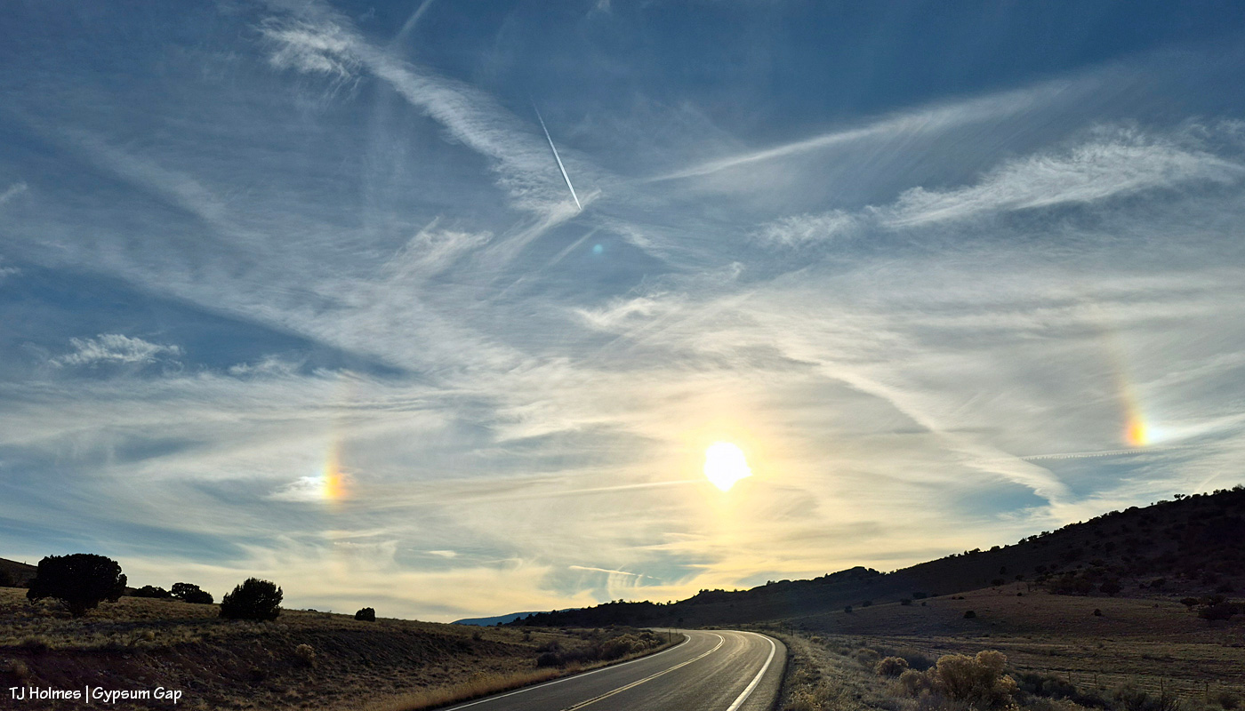
We (all the “we” people under the same sky I was under) had fantastic, long-lasting sun dogs yesterday! (Sun dogs … sundogs … which do you prefer? I’ve probably gone back and forth.) Sometimes both sides were super bright and prismatic, and other times, only one side was bright, and the other side was dim – and then they would swap.
What ARE sun dogs?
According to Google AI:
“Sundogs (or parhelia) are bright, colorful spots of light appearing on either side of the sun, caused by sunlight refracting through hexagonal ice crystals in high-altitude clouds, common in cold weather. They look like “phantom suns” or rainbow-like patches, often red closest to the sun, and usually signal approaching rain or storms, despite being associated with cold, clear conditions.”
The Almanac says that seeing sun dogs often means that “rain is on the way” and to “look out for foul or wet weather!” We in Colorado would challenge the word “foul” because we’ll all be rejoicing greatly if we get any kind of wet weather! We do have “PM rain/snow showers” in Thursday’s forecast, along with very cold temps for several days afterward. The temp yesterday hit 60F again, so that’ll be a big change.
If you’re wondering about why sun dogs are called sun dogs, the Almanac has an answer for that, too:
“According to Greek mythology, Zeus walked his dogs across the sky, and those “false suns” in the sky on either side of the sun’s disk were his two dogs.”
It’s fun to imagine that the ancient Greeks also liked to walk their dogs to enjoy nature and get some exercise. 🙂
Bundle up, and THINK SNOW!
(I should mention that the above pic was taken from the edge of Big Gypsum Valley, above Gypsum Gap, which, from that direction, is the gateway to Disappointment Valley.)
To remember how I did this post last year, I had to go all the way back to Valentine’s Day to find the post recapping the previous year (2024, then) in images. This year (for 2025), I’m happy to announce that for once, though I procrastinated, it wasn’t THAT long, and it was in plenty of time (OK, one day to spare) to make the Dec. 31 deadline.
Deep breath: This was a hard year. Last winter was rough (read: bad dry), which meant the rest of the year was rough (read: really bad horrible awful dry) in terms of drought. Monsoons didn’t hit their stride over Southwest Colorado, so we didn’t get much rain, either. Federal employees were hard hit, too, and one of our young BLM’ers was illegally fired from the new job he loved.
But we also had some good-news happenings: Thankfully, he was reinstated, and we have a strong range team in Ryan, Anton and Laura. We got some new signs installed, including the replacement of the old, sun-bleached, weather-beaten interpretive sign for the new information “kiosk” that greets visitors upon entering Spring Creek Basin. Fertility control (native PZP) continues to be an extraordinary benefit to our herd in terms of management and keeping roundups and removals at bay.
In wider Colorado mustang news, the BLM short-term holding facility at the Cañon City prison complex closed in November, BLM and Colorado Department of Corrections being unable to reach a contract agreement. That’s not-great news in terms of uncertainty for rounded up and removed Colorado mustangs. Where will they go? In semi-balanced decent news (?), all of the Colorado mustangs that were in holding there (about 100 at the time) were adopted or went to private sanctuary or are currently in foster situations for a planned adoption in March (and that all happened despite federal employees, including BLM’ers, being out of work (or working without pay) because of the government shutdown).
What follows is a pic from each month of the past year and a bit of reminiscence of what was happening when I captured the image of a mustang or mustangs. Many of these pix have been featured previously on the blog; some haven’t. If you make it to the end, there’s a bonus pic … one of my favorite of the past year.
This is one of my very most favorite pix of the entire year. I love it so much, it’s the background image on my computer. I’m aware that I likely post a lot of images of Buckeye’s family; you won’t be surprised to know that they’re among my most favorite mustangs. I considered this image as the *bonus* image … but it was one wildly beautiful day of snow (well, I was out with the horses, watching the snow coming for at least two hours before it finally reached us), and it didn’t match the otherwise very dry *year*. … So it gets the January title.
Did I say that I love Buckeye’s family? You can forgive me for singling them out, right? The three mares weren’t born here, but gosh, they are treasures from our sister herd in Sand Wash Basin, and I’m so grateful that we have them. And yes, that was February. Utah’s La Sal Mountains may not have been the *closest* snow, but we sure didn’t have much.
March is still fuzzy-coat weather with signs of approaching spring, especially in the high desert of Southwest Colorado. Fortunately, we had ponds early in the year. They’d all go dry before some rain this past fall put water back in a couple of them, including the one pictured above with Chipeta. This pond is nicely full currently – and has mustangs taking advantage of its water.
April found Sundance not far from the pond pictured above, and he still had his band at that time. Later in the year, he lost them, and he’s been by himself since then. He has wandered a bit, following vegetation and available water. The stately ol’ guy is still around … I see him now and then, napping in the sunshine or grazing on the side of a ridge.
This wasn’t especially the best pic I took in May, but I love both the perspective and the sort of inside joke that Cassidy Rain always likes to be the farthest away from the two-legged. That day was a pretty warm one, and the band was in an area of basin where I rarely find them. It’s not a place with a lot of trees (in fact, there are very few), but they had found a couple, and were comfortable together in the shade near sunset.
My best boy Storm made a brief appearance in the northern part of the basin in June … one of the first times I’d seen him since he’d lost his band the previous autumn. Bittersweet. I haven’t seen him since about July, when he was at a water source with another band as I was trying to shoot the rising moon.
Ah, July, the month the Deer Creek Fire at the base of Utah’s La Sal Mountains sparked. It wasn’t the biggest wildfire of the season, and it wasn’t even the biggest with smoke visible from Spring Creek Basin and Disappointment Valley, but it was uncomfortably close to home. It was a reminder (as if we need any more) that it’s hotter and dryer out there, and we all need to be super aware and careful.
Fortunately, the mustangs live in the moment (while the humans obsess over the wildfire updates), and they still enjoyed peaceful days such as this: Three mares content with their world and each other.
Finally, as summer gave way to fall, Mother Nature cried her best tears and filled some ponds for the mustangs. THAT brought huge relief to us all (if I may speak for my four-legged friends as well as myself). Interestingly, visible at upper left in this image is Benchmark Lookout, a U.S. Forest Service wildfire-watch tower staffed during the critical seasons of the year (which includes September). In this backcountry, we are massively grateful for those who watch for and provide critical information about wildfires, as well as those who work to contain them, allowing them to provide some benefit in some cases while trying to keep property and lives intact.
It might be about now in the list that you’re thinking, “for talking about dry it was, she sure included a lot of pix of ponds.” It’s not because we had so much water; it’s because we’re massively grateful for the water we had.
There’s no water in this image – and it was November, before snow graced the peaks on our northwestern horizon – but the ponies are lined out on their way out to graze after drinking at a little place I call the marsh. This is post-sunset, but wow was it gorgeous under the autumn light. … And it’s not UNgorgeous at blue hour.
You’ve just seen this image of Temple with Temple (yes, the same) Butte and McKenna Peak in the background under a stream of stormy-looking (they didn’t produce a drop over us) clouds. I decided not to choose a pic from the bit of snow we got at the very beginning of December because the above is what we saw the whole rest of the month. The weather has been warm and dry … and that’s awfully nice for getting around and playing outdoors (60s! in Colorado!! in December!!?!) … but if things don’t change in the next few months, I’m going to be singing the same ol’ why-won’t-it-snow song that seems to be stuck on repeat.
And your bonus:
This was an evening in June. Nobody wanted to pose much, and I was going bananas, trying to get somebody – anybody – in front of that background in that subtle, delicious light. Finally, this young stallion obliged. And it seems to sum things up a bit: Hot this year? Yes. Dry? Gosh, yeah. Anxiety-inducing? Pretty much like always … with an extra edge. But! Beautiful, peaceful, a place of escape from the world’s ills (at least the headline type). Kind of a promise that it’s there … out there … and sometimes we don’t have to search all that far for it.
And there you (kinda) have it: 2025 in the rearview. It’s always hard to select just one pic for each month (plus a bonus!), but I hope you enjoyed this little recap.
In best-of-all news, I spent a lot of time (again) with my beloved mustangs in the best place on Earth (in my ever-so-humble opinion). 🙂
And close to that is my gratitude for all of you readers who follow the mustangs and our pictorial journal of peaceful, wild, beautiful life here in Spring Creek Basin. Thank you so much, and I hope you all have a peaceful, wild, beautiful 2026 (with lots more moisture!!!!!!!!!!!!!)!
I don’t know about ya’ll, but I’m pretty sure that I only just got used to 2025 being, well, 2025. And I’m also pretty sure that I feel pretty much the same just about every year as one year winds down and another one gets ready to kick off.
Fortunately, the only thing that changes is the light on the land and where the wild ponies might be found on the next adventure. (OK, so that’s not really true, but wouldn’t it be nice?) Pic above from Christmas Day, which already feels about 365 days ago (!).
Thanks for following these amazing mustangs. We’re all grateful for your interest! 🙂
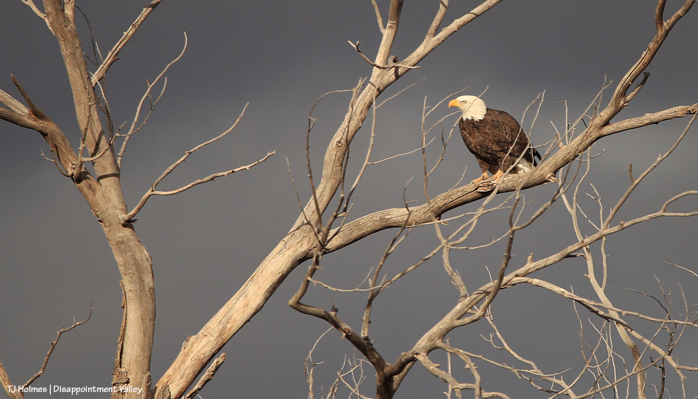
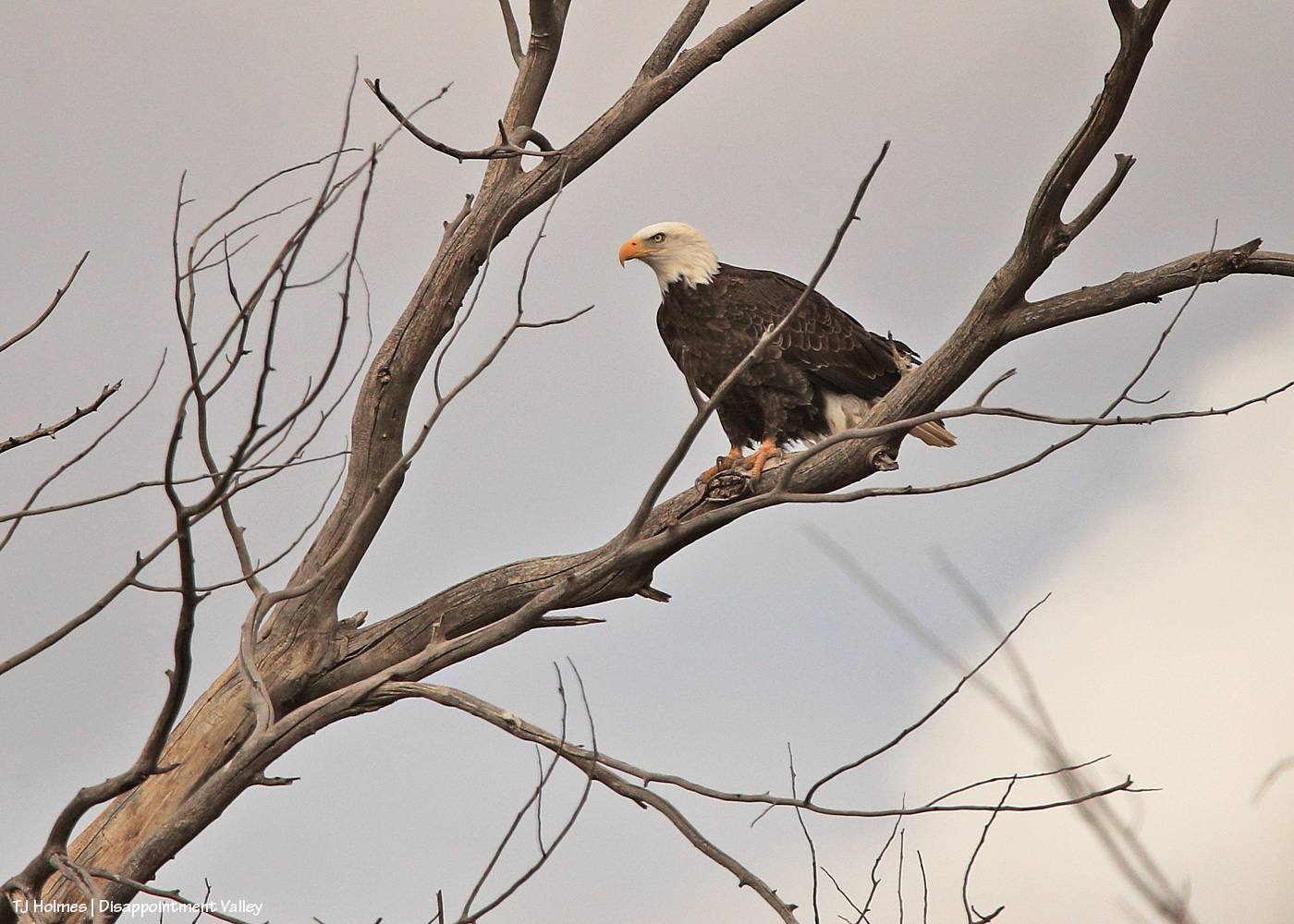
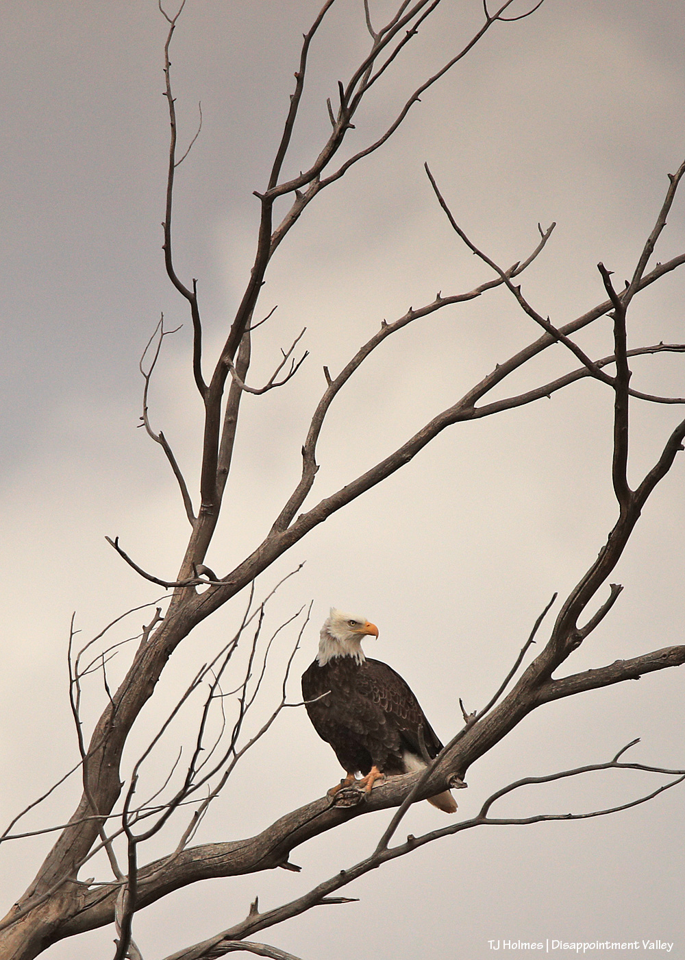
The cottonwood tree is almost as cool as the bald eagle. And that light! It was momentary, which makes the mistake harder to bear.
While shooting, I knew there were little branches in front of the eagle, but I didn’t realize until I saw the images on the computer that one branch literally goes right across the eagle’s eye. Sigh.
Here we go; a little better when the eagle ducked a bit to at least allow a shot of his/her (?) eye not directly crossed by a branch.
The eagle stayed “sticky” as I drove a little closer, using my vehicle as a “hide” to try not to spook the eagle (and all of these are taken with a 600mm lens and cropped).
I’m happy to say that s/he was comfortable enough with my presence in the rolling hide that s/he never flew away while I was there. I drove on and left it to its day doing eagle things.
Pretty cool sighting for the (windy) day after Christmas!
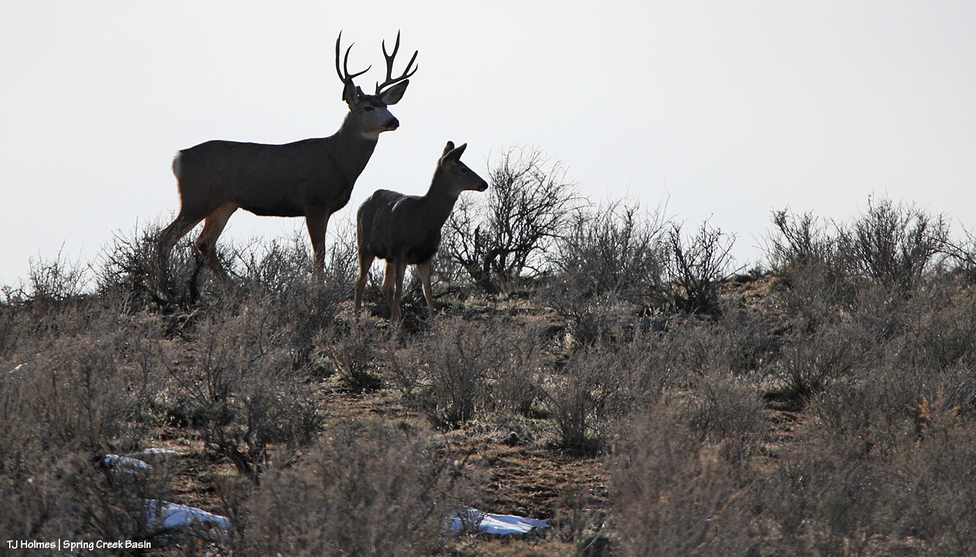
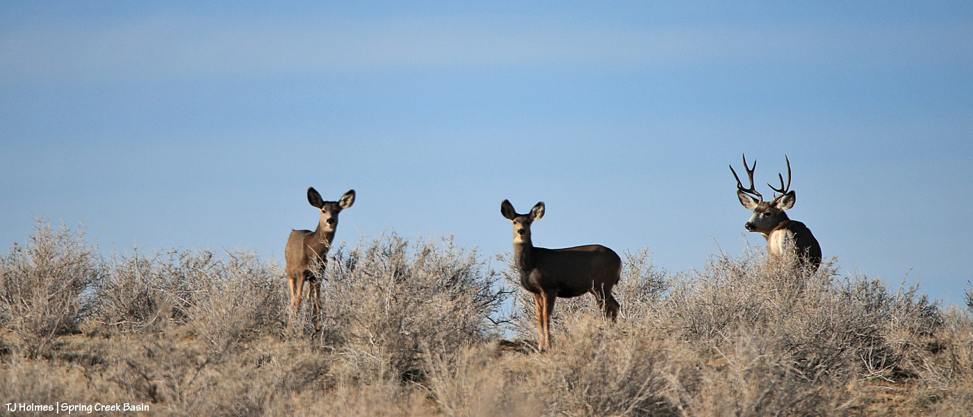
Sunrise in Disappointment Valley highlighting mule deer (I’m so glad to see the bucks back!) in the greasewood and chamisa (rabbitbrush) and willows and cottonwoods along Disappointment Creek, looking toward Spring Creek Basin. It was a drive-by shot, and I couldn’t actually see what I was shooting on my phone’s screen, but the light was so beautiful highlighting the pretty and handsome does and bucks, I literally pointed and pressed the button.
During the hunting seasons (basically starting the first of September and running across or nearly to (and in some cases past) Thanksgiving in Colorado), the wild antlered critters make scarce. I don’t know the numbers, but the traffic and human population of Disappointment Valley increases wildly (sorry) during that time – and not in a good way for the peace of most of us. And when the peace returns, so do the regular sightings.
One little girl is a little more bold than her sisters and aunties. 🙂
*Collective sigh of relief*
These are the first pix I’ve taken since returning to the basin since the snow has (mostly) melted. The roads range from completely dry in sections to stretches of snow-bordered bogginess. Ponies are foraging mostly far from roads, which is perfectly good and fine. Signs are holding up well!
Today is the 10th anniversary of the passing of Dr. Jay Kirkpatrick, beloved fertility-control advocate (and so much more) for wild horses and burros (many species of wildlife, actually). I remember that when I got the news in an email from a friend, though it was December, I thought it was some kind of cruel April Fool’s joke.
I met Dr. Jay in August 2010, when I showed up at the Science and Conservation Center in Billings, Montana, for a PZP training course. I also remember that it took me a long time to work up the courage to follow the advice of a couple of friends and contact him; he was a rock star to me. Legendary. Untouchable. Unapproachable!
Except that neither of those last two words was true.
I finally worked up the gumption to email him … and sign up for training – BEFORE we got approval to implement a PZP program in Spring Creek Basin. I tentatively approached the lab, on the grounds of ZooMontana, the day before the class officially started, to see what I was getting myself into. When Jay appeared, I didn’t ask for an autograph (!), I asked if I could give him a hug. I still remember that, while he laughed, he indulged me. … Wow, I miss him.
Jay was one of the friendliest, most down-to-earth people I’ve ever met, all the more amazing because he was also one of the very most obviously crazy-intelligent people I’ve ever met (to this day). He had this way of making everyone welcome and like you were IN ON IT with him, even as he explained his “why wouldn’t you do it this way” philosophy surrounding better management … some of which you might never quite have thought of but was so wonderfully simple – and, according to his same philosophy, attainable.
Dr. Jay was one of the best, most inspiring, most humble, most committed and dedicated people I’ve ever known, and I feel so blessed to have known him, even briefly. He trained me not only to mix and dart with PZP, the *why* behind doing it, the keeping of records (back at a time when it was particularly challenging for us in Spring Creek Basin) but also the importance of having optimism and a plan … and persevering.
I got to know him for five years, and he encouraged me through the sometimes rocky start of Spring Creek Basin’s PZP program. Even now, 14 years and only one roundup later (in 2011, when we started our PZP program), I think of him quite a lot. He’s one of the three (at least) angels watching over Spring Creek Basin, and I hope he’s proud of what we’ve accomplished here.
Friends Celeste Carlisle and Kayla Grams, along with Melissa Esser (whom I haven’t yet met but already greatly respect) visited Rocky Mountain National Park during their trip to Colorado for the Pathways 2025 Human Dimensions of Wildlife conference. Celeste wrote this blog post for Return to Freedom.
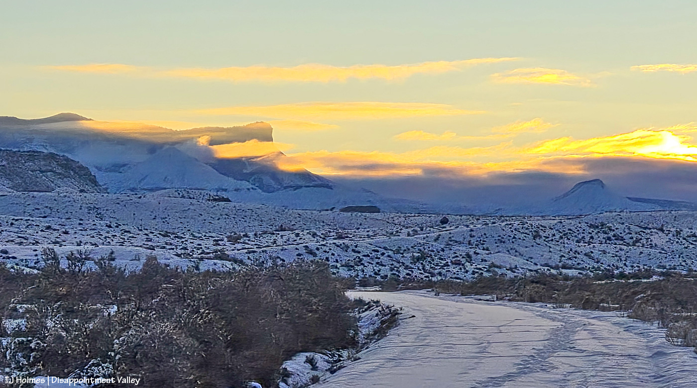
Looking east along Road K20E toward Spring Creek Basin at sunrise. Some of that clearing-storm cloudbank lingered well into the afternoon … even as the rest of the sky cleared to deepest Colorado blue. Deer (maybe elk, too?) and rabbits have been out and about.
Now looking east up Road 19Q toward the basin. This pic, in particular, seems deceptive regarding the amount of snow. The melting really got under way in the afternoon, but that is/was some great snow! Three inches or so? Not bad for our first (and second?) coverings of the season.
And I hiked through a fair bit of it to find some wild ponies. 🙂
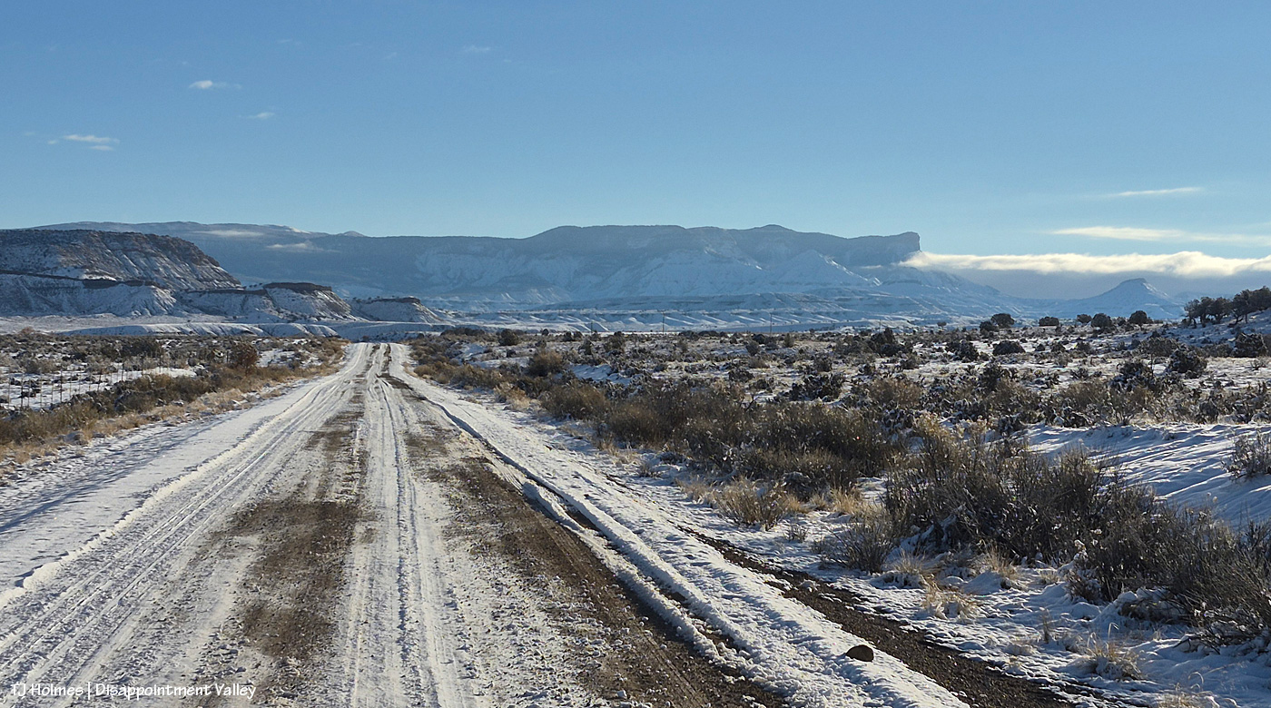
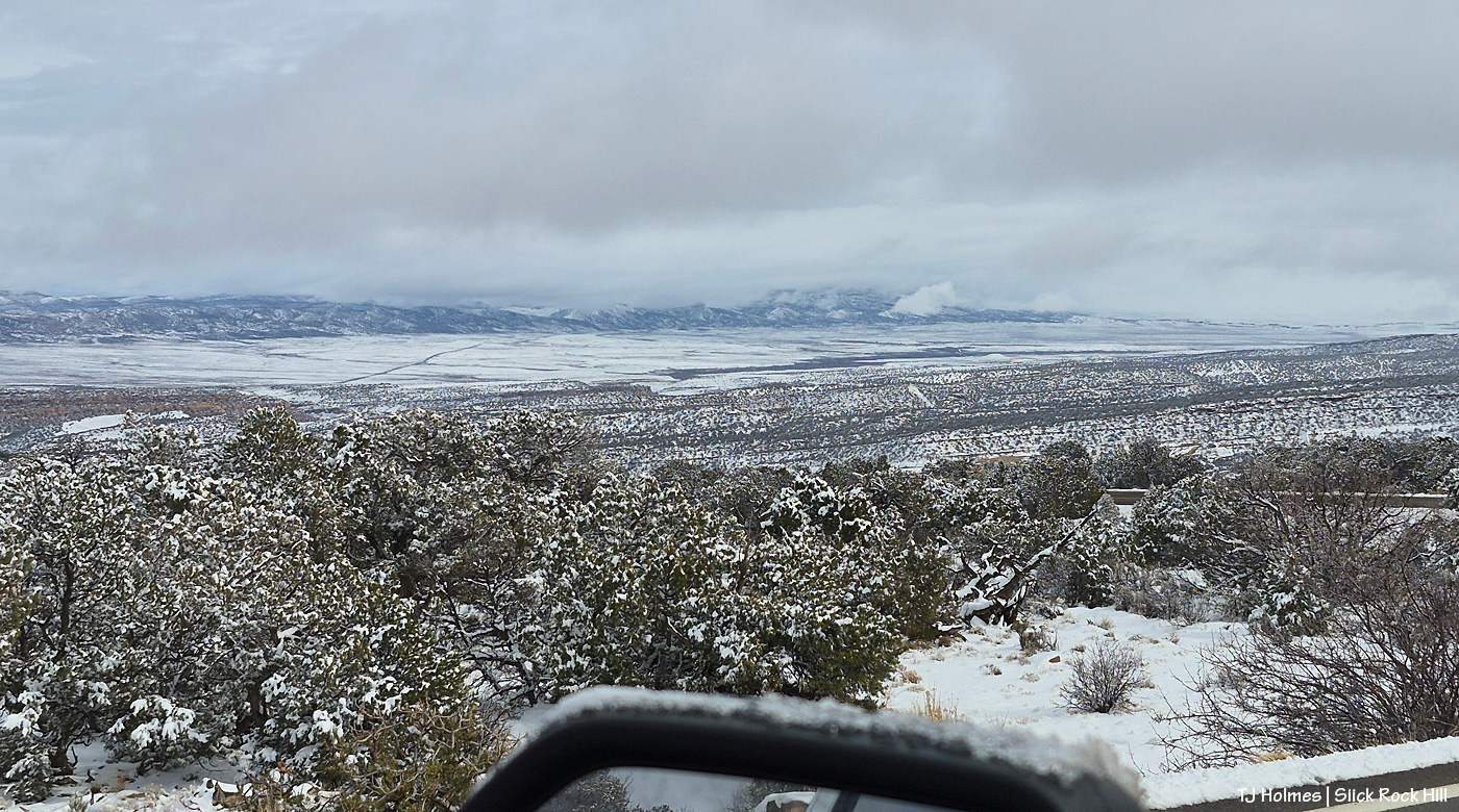
Getting home was less than straightforward (all on the northern New Mexico and southwestern Colorado side of the trip, not the Texas side, where it’s still summer-going-on-autumn-going-on-summer!), but there’s nothing like that view spread out from the top of the Slick Rock switchbacks heading down to the Dolores River canyon country and on out to Disappointment Valley. … Add snow to the view? Magical!
The road was clear by the time I got to this point (following a snowplow scraping the edge of the road clear of wet snow). If you visit Spring Creek Basin from the south, via Dove Creek, this is your view from the switchbacks heading down to Slick Rock (minus, probably, the snow and heavy cloud cover!).
Looking top down to, out and across broad lower Disappointment Valley! That line at leftish is Colorado Highway 141 across the valley. The rimrocks that form Spring Creek Basin’s western border are just visible at far-way-away, under-the-clouds right side.
I had such a wonderful time in Texas with my family (minus my brother, who was hard at work between Wisconsin and Illinois)! I’m sending a *massive*, incredibly grateful shoutout to my friend Kim A., who came to Colorado from Pennsylvania (!!!!!) so I could be with my mom and dad (and all of their critters and some long-long-time family friends) for Thanksgiving. 🙂
There seems to be at least 3 inches of the white stuff coating the entire region, so tomorrow’s post might also be late until I can get out and acquire some pix of snowy mustangs!