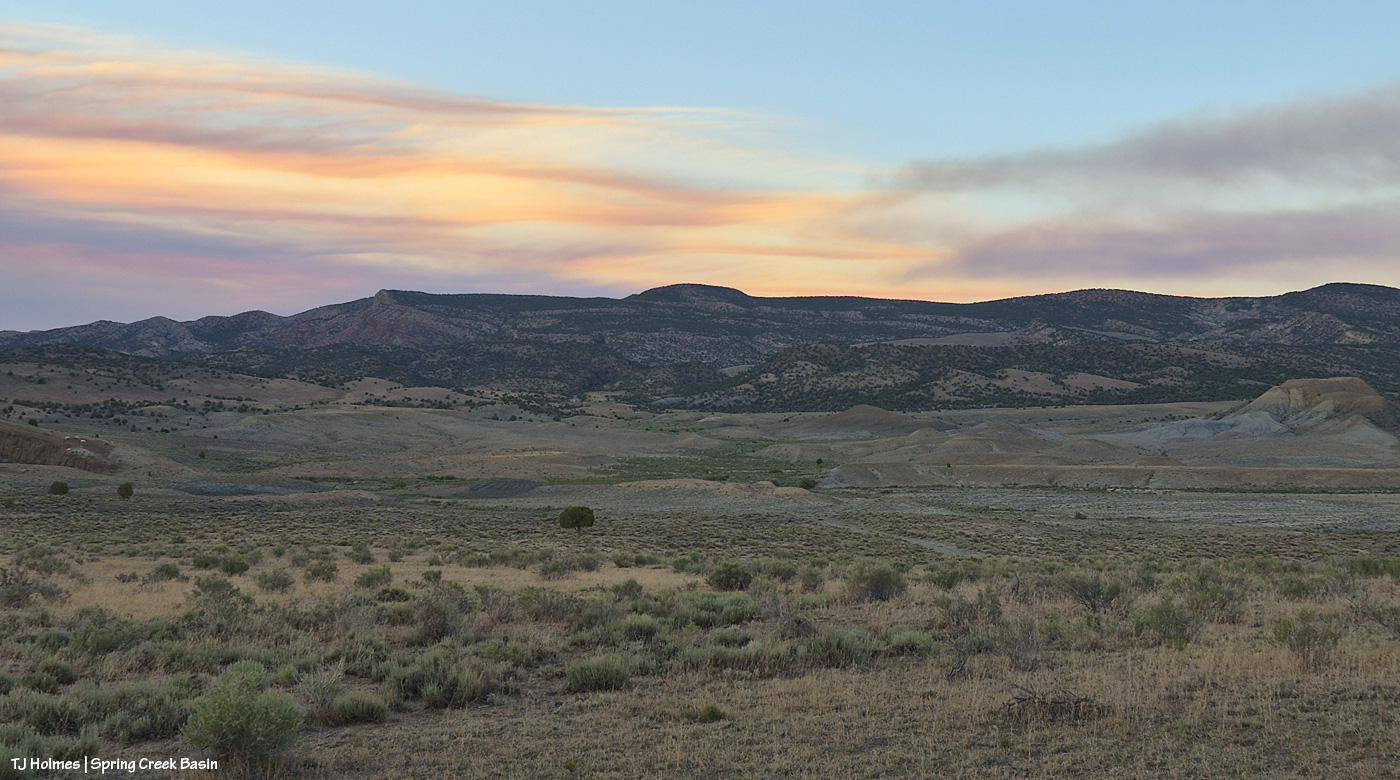
Yesterday was not the prettiest day under the smoke layers. … In fact, until late afternoon/early evening, it was pretty downright ugly (!). The fire moved toward the Dolores River canyon on its west side, and those delicious new fuels sent up a great deal of smoke. Morning found us super socked in … and it just didn’t lift or drift until much later in the day, which was – you guessed it –another red-flag-warning day. Today, the same.
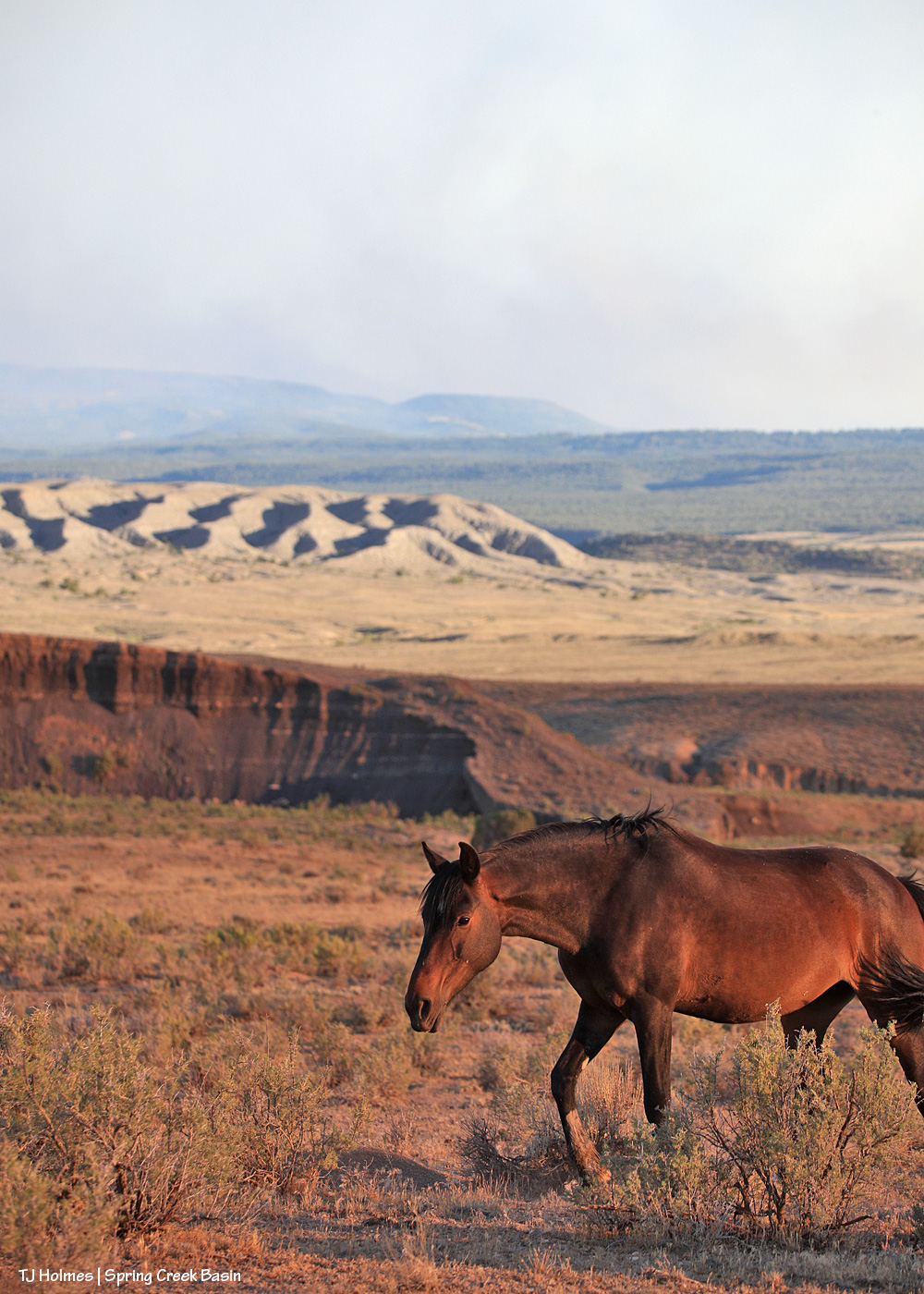
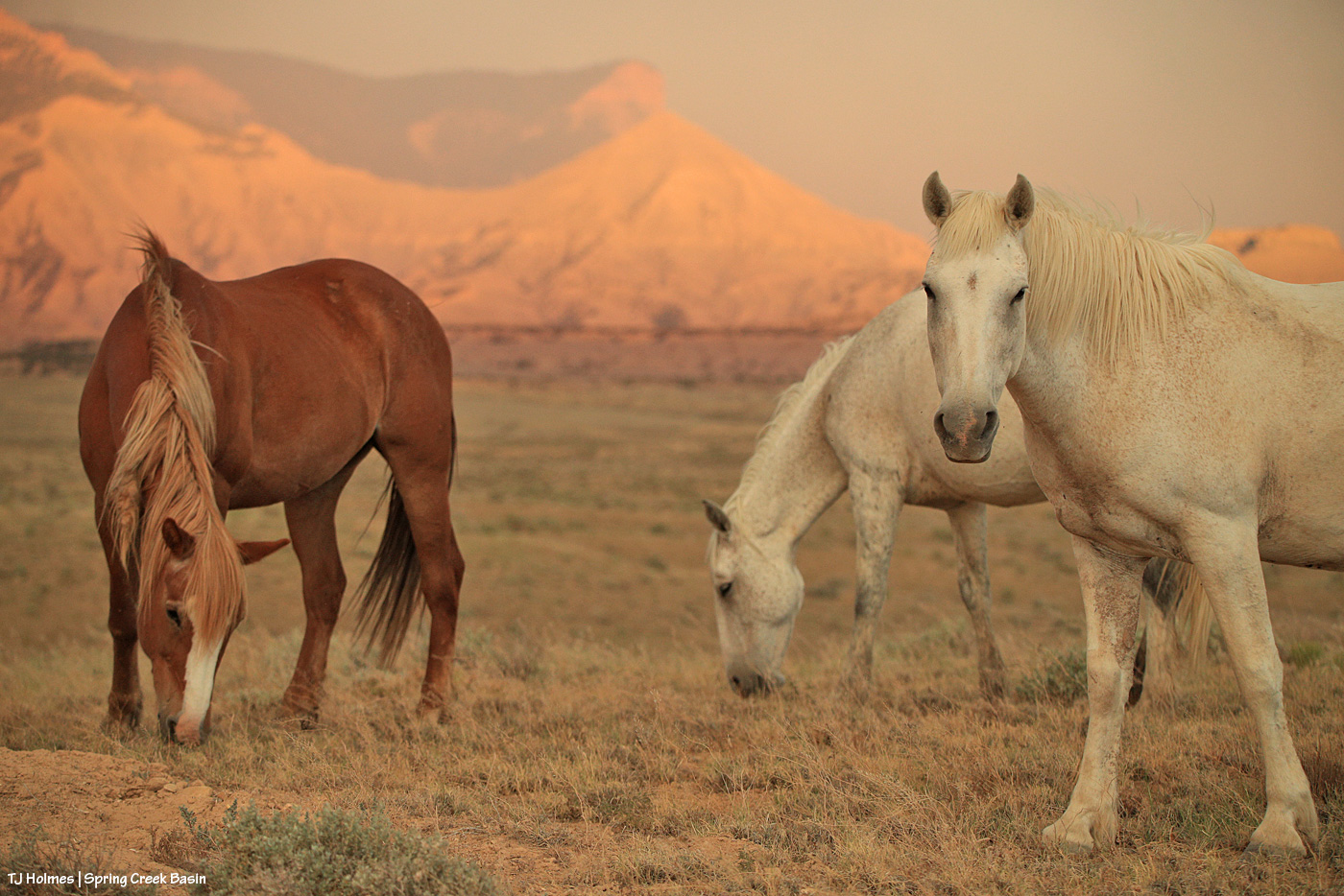
The mustangs continue to fare well through it all. They have forage, they have water, they have each other. When it comes right down to it, they have the important things kinda nailed. Mysterium, Gaia and Maple above.
If you’re using the Watch Duty app, you can find the below information there. I thought the updates Wednesday night for earlier in the day were informative, so I’m going to post them here (and huge thanks to those folks doing the updating?!). There has been a massive amount of work done by firefighting ground crews as well as air attack. It’s humbling to know those folks are out there giving every ounce of their strength to fighting this fire. The Ferris Fire apparently has its own Facebook page, but that’s beyond my knowledge.
Michael Silvester • Senior Manager of Operations & Standards
22 minutes ago • Jul 1 at 9:58 PM
The Ferris Fire is expected to reach the Dolores River Canyon tonight as it backs down Doe Canyon. Fire crews will continue monitor this area closely tonight and will be in close communication with Dolores County out of an abundance of caution.
Tomorrow [today, July 2], a number of engines will staff the west side of the canyon. The Incident Management Team is also coordinating closely with the local fire protection.
Michael Silvester • Senior Manager of Operations & Standards
3 minutes ago • Jul 1 at 9:32 PM
Zone 8 [I believe this is directly west of the fire] is now on “Set” status & the parameters for that zone can be seen above, per the update from Dolores County Office of Emergency Management on Facebook. SET Means Be Ready to Leave & means there’s a wildfire in the area, and conditions could change quickly. It’s time to be alert, stay informed, and be ready to leave at a moment’s notice.
When you’re SET:
– Load your go-kit into your vehicle.
– Park facing out for a quicker departure.
– Follow updates from official fire and emergency channels.
– Review your evacuation routes and know where you’ll go.
– Get pets and livestock ready to leave with you.
Being SET doesn’t mean you need to leave yet.
Total acreage: 25,814 Total personnel: 282
Today [yesterday, July 1], the Arroyo Grande Hotshots continued to dig containment line on the northeast corner of the fire nearest to private lands. An additional dozer and hotshot crew will be in place tomorrow to continue this mission. Favorable weather conditions will allow overnight burnout operations to continue this evening.
Dozer work on the southwest corner of the fire was completed. Firefighters will continue improving and developing containment line in this area.
The west side of the fire, closest to the Dolores River Canyon, continues to present challenges for direct engagement. Additional divisions were added to respond to this expected growth.
Susan Perney • Coverage Reporter
About 4 hours ago • Jul 1 at 5:42 PM
Three Type 1’s and one smaller helicopter are working the various hotspots around the fire. Air tankers have also been dropping retardant to slow the fire’s growth on the southern end where Doe Canyon meets the Dolores River Canyon.
A second interagency Hotshot Crew (IHC) will be arriving later today. Current plans call for them to assist with creating fire line in rugged terrain on the fire’s northeast corner near the lookout. The goal is to prevent the fire from reaching and threatening homes and private property in the Glade Ranch Subdivision and to protect the lookout itself. Despite several large fires in Colorado and surrounding states we are continuing to get more resources to support the crews on the ground and in the air. 280 firefighters and support personnel are now assigned to the fire.
**********
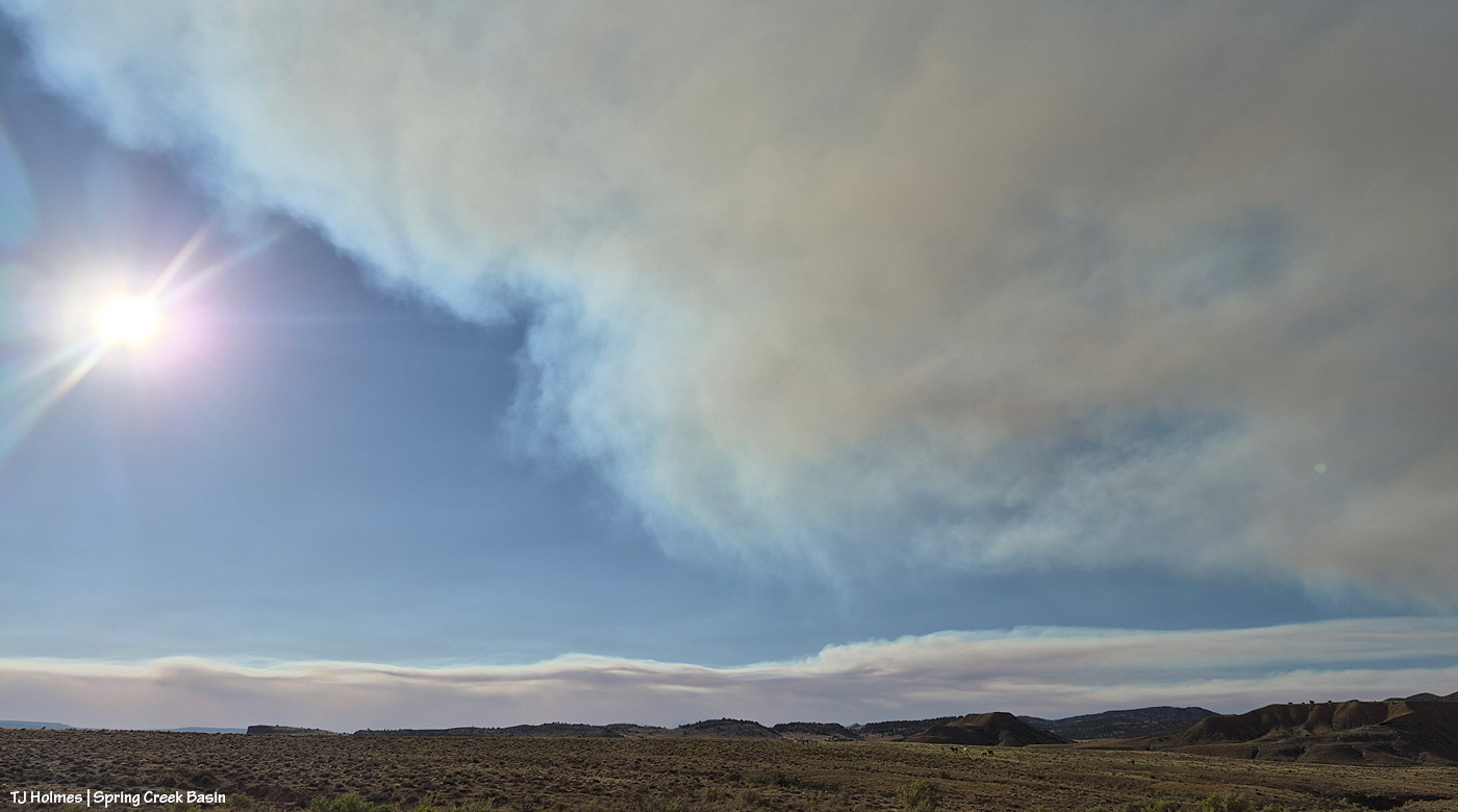
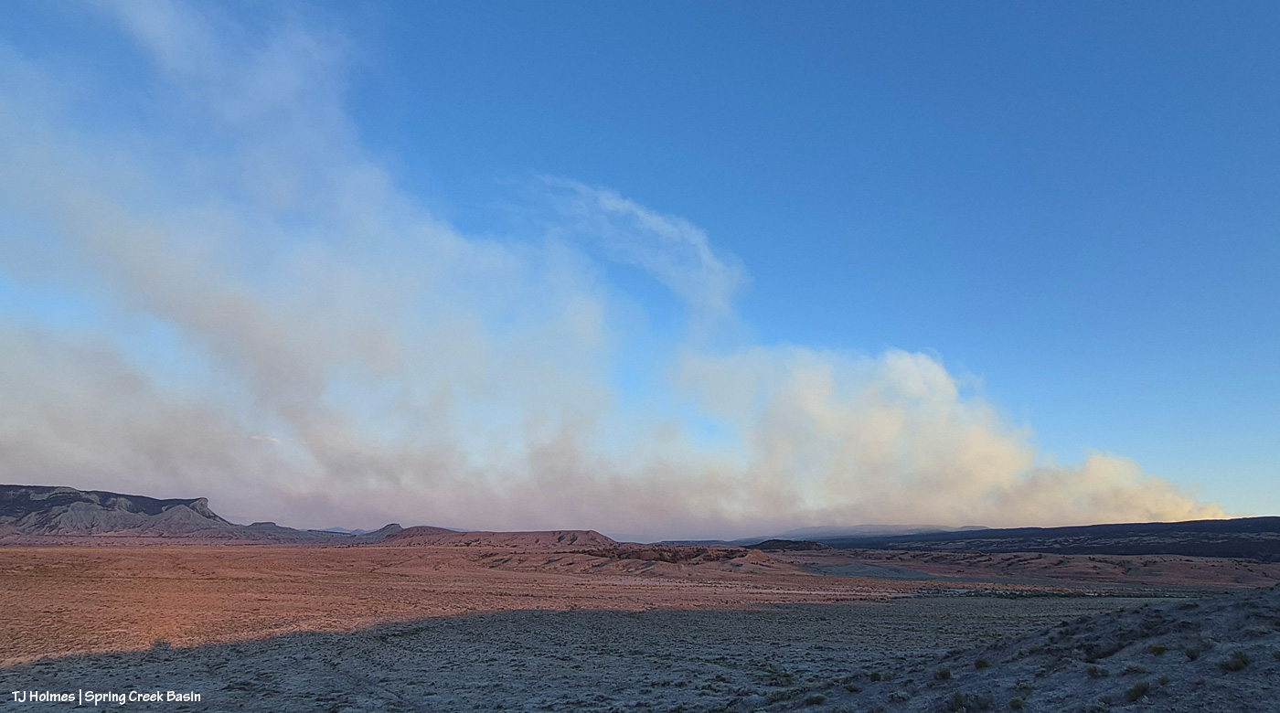
That Montana-shaped smoke is from the Ferris Fire, which has moved north and northwest and is overlapping the western-horizon smoke from Southwest Colorado and Utah fires.
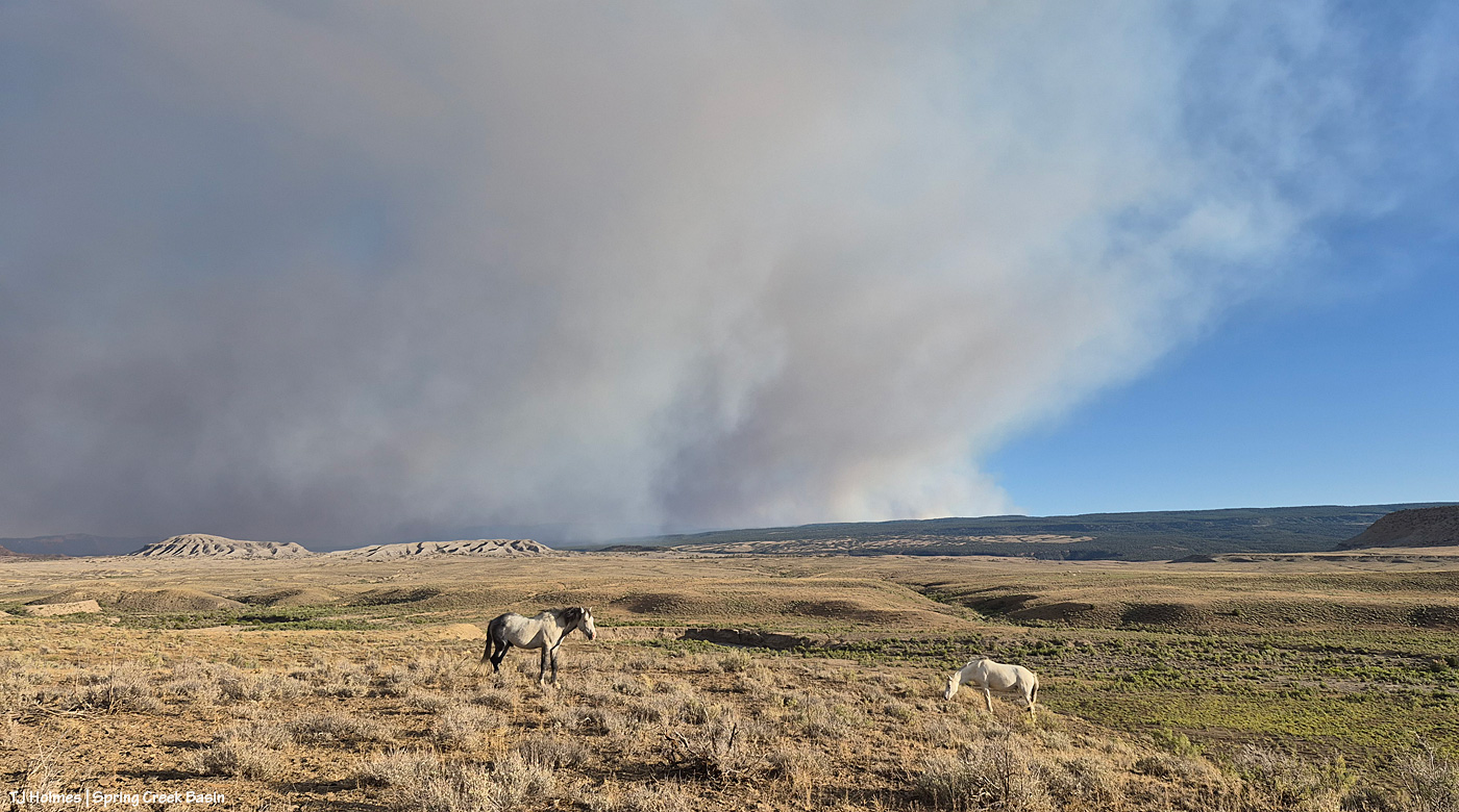
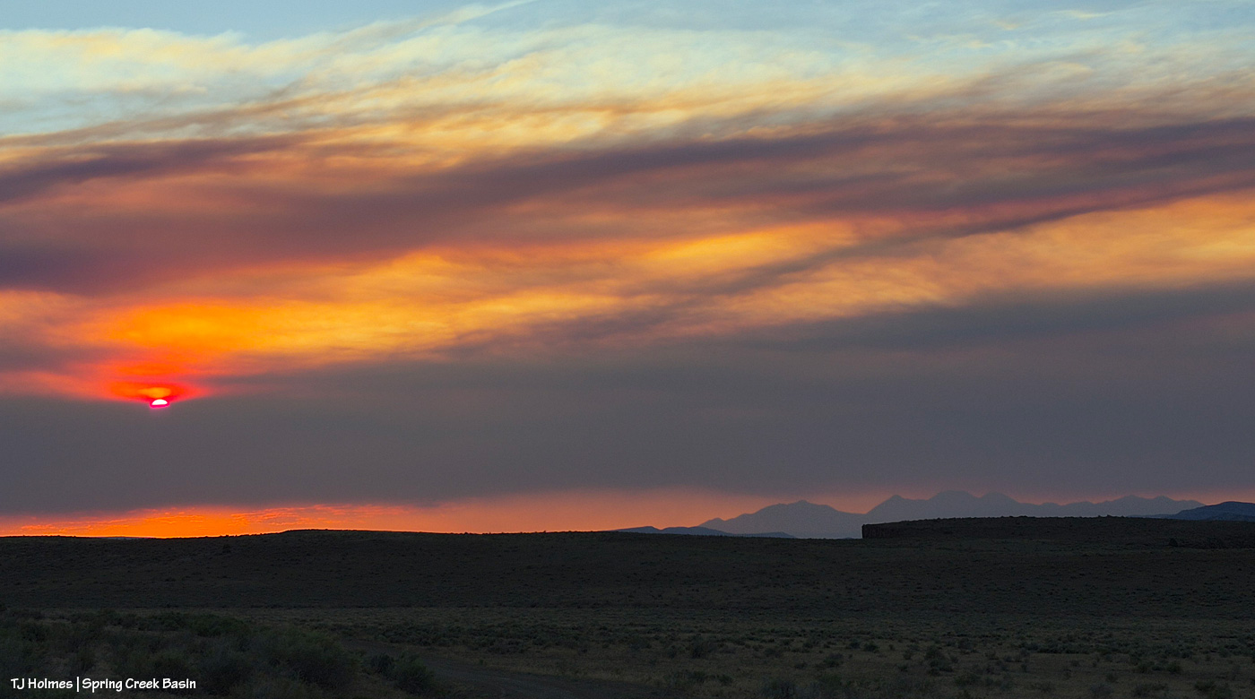
Smoke in the pic is NOT as close as it seems, nor as awful as it looks. I mean, it IS awful where it is, but it is not super close to Spring Creek Basin. I actually debated showing this pic, and I decided to do it, not for drama factor, which I’m aware that it has, but because that was the scene toward sunset looking south/southeast, and I think it helps tell the story. A recovering journalist, still, I am.
We remain incredibly grateful to all the firefighters and folks supporting the crews working on the Ferris Fire *AND* all the other fires burning near and not-so-near. I particularly value my partnership with my local BLM folks, which includes this challenging time, during which they are, as you might guess, super busy. Thanks (again!) to Ryan for taking the time to keep me updated about goings-on; you can’t imagine how grateful I am.
And thank you also to everyone who has messaged me asking about the safety of the mustangs; I appreciate that immensely.
They’re OK. We’re OK. 🙂