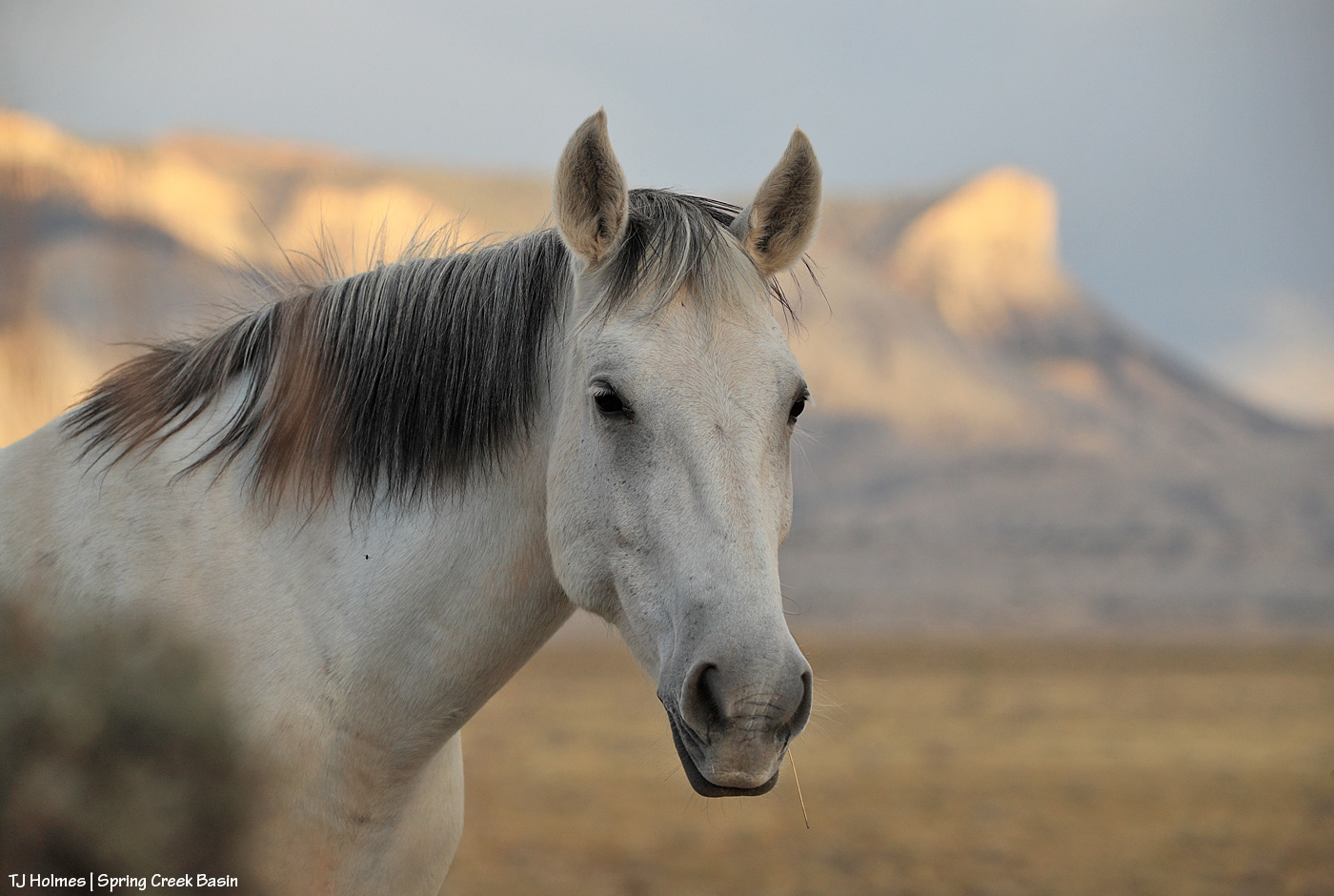
Young Master Flash is looking a little scarred and beat up, but he otherwise looks good and ready for winter. He still has some remnants of his pinto pattern, but otherwise, he’s pretty grey, grey, grey. 🙂
Young Master Flash is looking a little scarred and beat up, but he otherwise looks good and ready for winter. He still has some remnants of his pinto pattern, but otherwise, he’s pretty grey, grey, grey. 🙂

A little grazing, a little late-afternoon rambling by daughter Maia and mama Alegre. I can’t think of a better setting for an evening mosey.
******
In fabulous news, we got a nice little drenching in Disappointment Valley yesterday. I kept thinking I’d head out, but then another wave of sprinkles would come through. So envision it wet and gloomy (is it really gloomy when it’s grey and you need it so, so very much?) while you enjoy pix of dry ground and mustangs. And if I can get out in the mud, you might see some of those pix later.

Autumn-gold-and-tall grasses (galleta, grama, alkali sacaton), long, deep shadows. Must be fall. 🙂

If there’s anything that says fall in the West – that’s NOT glowing aspen – it’s glowing cottonwood trees. We have at least two varieties here in Southwest Colorado (I think – please correct me if I need correcting!): narrowleaf and Fremont. Don’t ask me which is pictured, but here’s what Google’s AI-generated (!) search has to say about the differences between the species:
Here are some ways narrowleaf cottonwood and Fremont cottonwood compare:
Leaves
Fremont cottonwood leaves are shiny, triangular to heart-shaped, and light green with white veins. Narrowleaf cottonwood leaves are narrow (3/4–1 1/2 in wide) by 2–6 in long, with a round base and a very pointed tip.
Fruit
Fremont cottonwood fruit is light brown and egg-shaped, and it bursts into three to four sections to release its seeds.
Habitat
Fremont cottonwoods grow in wet areas within arid climates, while narrowleaf cottonwoods grow along streambanks in dry mountains, desert shrublands, and prairie grasslands.
Uses
Fremont cottonwoods are used for streambank protection, wildlife food and shelter, shade for livestock and recreation facilities, ornamental plantings, and windbreaks.
I don’t know how tall the above-pictured cottonwood is, but it’s tall – especially when you realize it’s rooted in that little arroyo (standing in the bottom, it was easy to climb into and out of, but it was still deeper than I am tall):

There aren’t a lot of cottonwoods in Spring Creek Basin, probably mostly because there aren’t a lot of consistent sources of water. I know of several (well, a few of the several?) that have died in the 17 years I’ve been intimately acquainted with the basin. Drought. 😦
The above pix are from my phone. The below are from my camera:

That pic would be splendidly *perfect* if there were a mustang *right there*! 🙂 One year, I’ll catch them at just the right time and place (and hopefully this wise old tree will continue that long).

Temple Butte through a perfect little window of leaves.
Cottonwoods line the entire length of Disappointment Creek, which runs (clear to its confluence with the Dolores River) with water from February-ish to late July in a good year (into August in a *really* good year, which this was not, water-wise), and which is entirely outside Spring Creek Basin.
Hopefully ALL the trees and shrubs and grasses and ponds and seeps and catchments and horses, pronghorns, elk and deer and other critters throughout our parched region will reap the benefits of the forecast rain … today through Sunday! Fingers and hooves crossed!

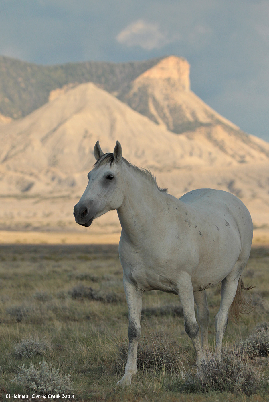
Lovely, very muddy Seneca was intent on her grazing, but I couldn’t let that gorgeous view go undocumented, so I hit the shutter anyway. And viewers do get a dynamic tail swish in lieu of anything else exciting on this very gorgeous autumn evening. 🙂
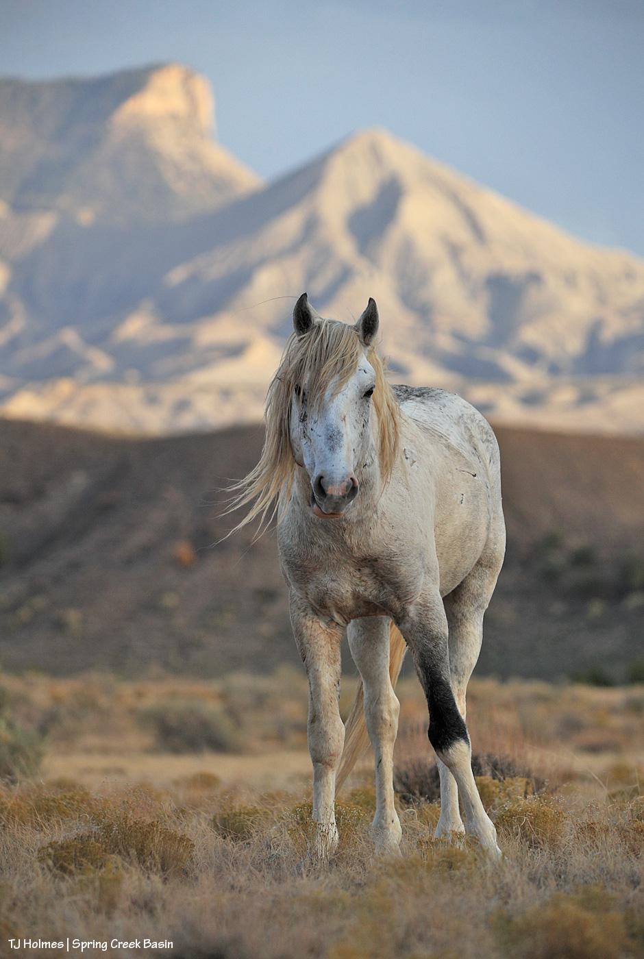
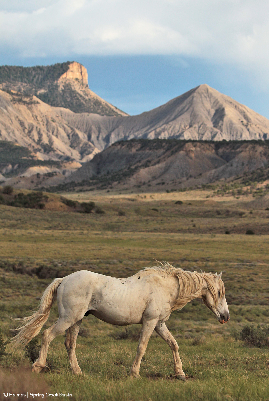
Classic, beautiful Temple. Classic Spring Creek Basin background.
The moment when Temple noticed Corazon’s band in the distance.
This moment lasted about 2.7 seconds … and then she returned to her peaceful grazing.
I was waiting to get her, the background horizon, the stormy sky in a *moment* … and that’s all I needed.

From above Disappointment Road looking up-valley – Spring Creek Basin from about mid-ground at left to background. The magic treasure under the rainbow.
We got sprinkles but nothing spectacular in the rain department … unless, of course, you count the rainbow glowing ahead of the rain. 🙂
**** Update: Around 5 a.m., we got a *spectacular* thunder-and-lightning storm that brought the rain in toad-gagging torrents. Every arroyo and creek in the valley is surely rolling and roiling. Catchments hopefully have gotten much-needed infusions by the gallon.
Wowza!!!!

From Chrome’s Point in Spring Creek Basin, I watched the moon rise last night.

There’s a lot going on with our lunar neighbor this month, according to NASA. According to that linked article’s headline, “the next full moon (Tuesday) is a partial lunar eclipse; a supermoon, the corn moon, and the harvest moon.” That’s a hard-working moon!

It’s been rising over our horizons for generations untold. Still so amazing and mysterious and beautiful.

Be still my so-in-love heart.
I have been in complete love with Storm (sorry human men; you really don’t stand a chance) since the moment I saw him, bright-copper-penny red with a huge blaze, hind stockings and still-tipped ears, standing with his mama Alpha, dried blood still reddening her hind legs, sweet, divine look on her face as she stood calmly with her spunky baby boy.
That was back in the days when I had to drive two hours to get to the basin and was camping in my Jeep. I have watched him grow up and into a marvelous band stallion, watching over his own mares and spunky foals.
As much as I love them ALL, Storm is my boy. He makes my heart big enough to love them all, and that’s pretty amazing.

If you don’t realize from Sundance’s march that he means business, please allow me to translate from the original and ancient mustang: Sundance means business.
Remember the young guy wandering around wreaking havoc among bands a few nights/posts ago? This (above situation) was soon after I arrived on the scene, so I don’t know the exact extent of his havoc (I do know that I had seen his usual-pal way west on my way into the basin and had wondered where this young fellow was …). But although he was a fair distance from his family, that was too close for Sundance, who decided to have a little meeting with the youngster.
Soon after Sundance’s encounter, Storm reinforced the message, after which the young stallion went off to look for other targets – which he found in the form a big group of a couple of bands heading this way from an evening drink at a nearby pond. THEY ended up fleeing across a deep arroyo, up over a little table-top end of a ridge, down and through another deep arroyo and up another ridge.
Meanwhile, young master headed back to his original targets – or nearby – as seen in the pix of the evening of majesty a few nights ago.
“Never give up”: motto of young stallions everywhere. 🙂
(And oh my GOSH, I adore the image of Sundance framed by Temple Butte and McKenna Peak! Classics, all!)
