
A raven flies in front of Temple Butte, seen dimly through rain or snow yesterday.
We got spits and not much else of the “showers” promised by the forecast. … Here’s hoping today’s snow forecast is at least partially accurate.
A raven flies in front of Temple Butte, seen dimly through rain or snow yesterday.
We got spits and not much else of the “showers” promised by the forecast. … Here’s hoping today’s snow forecast is at least partially accurate.
Red sky at night, sailors’ delight.
Red in the morning, sailors take warning.
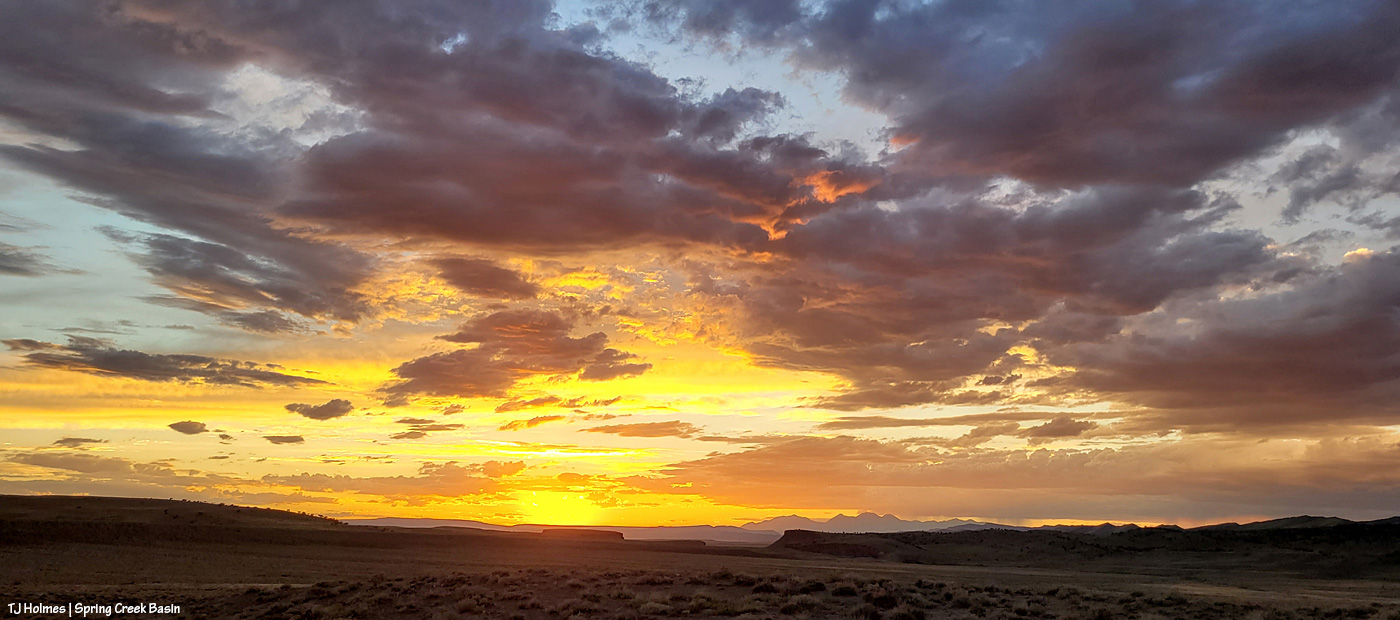
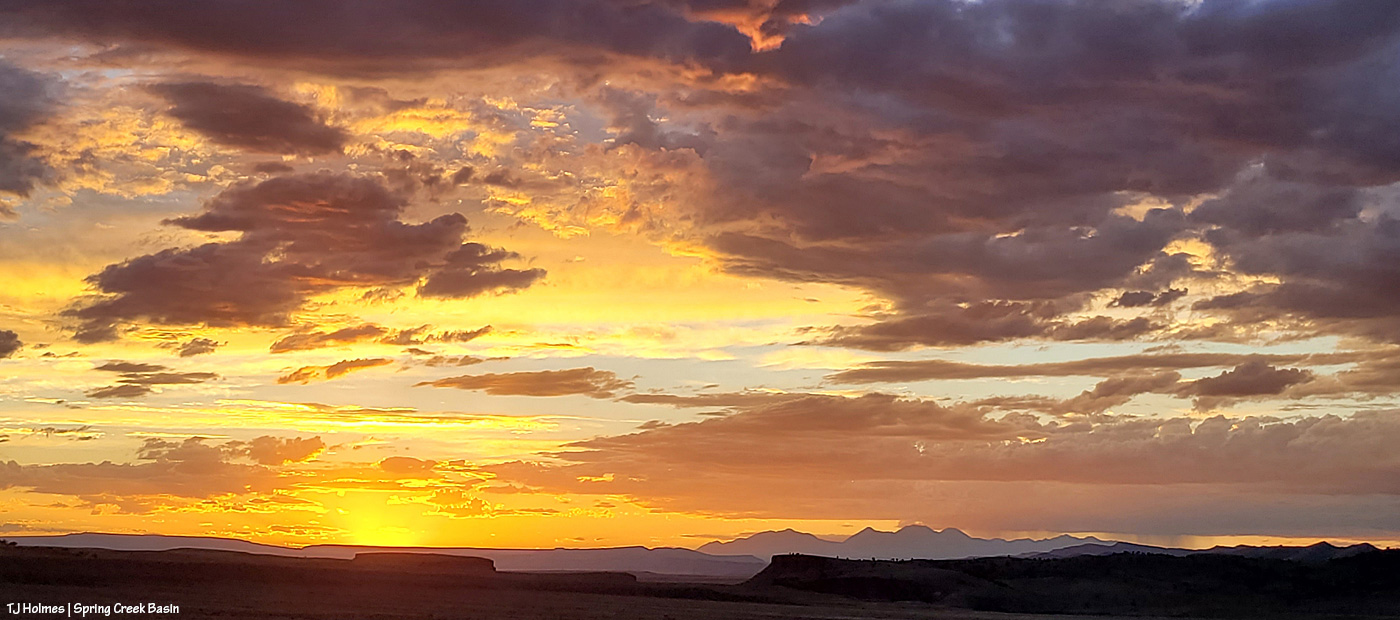
The following pix are from sunset the night of Oct. 28 (I couldn’t think of anything spookier for today’s post!).
Morning the 29th was grey and dark – and raining from the heavens! – and I was fully delighted by both the light show … and then with all of the RAIN (0.86 inch total)!
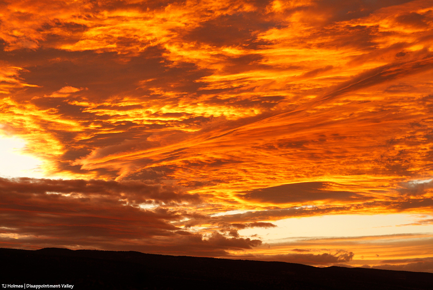
Am I right, or am I right?! The above is nearly straight out of my camera – I sized it and applied some sharpening. That’s looking west.
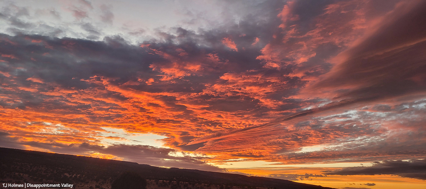
This is the spookiest part of the post (!). Looking east toward/across/beyond Spring Creek Basin. Again, the only thing I did was size it and apply some sharpening.

And a bit closer as the color was absolutely exploding.
The above are from my camera; the below – for wider views – from my phone (again, nothing but sizing and sharpening):
And:
I don’t know about sailors (any folks on actual waves are half a continent away), but *I* was the very best kind of astounded!
And very grateful for the rain overnight and the next morning. 🙂
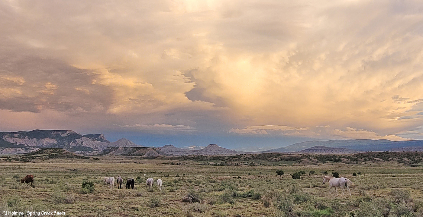
Buckeye stands between his band – some up, some down – on a high ridge in western Spring Creek Basin with a background of rain across the southern ridges of Disappointment Valley.

La Sals beyond Disappointment Valley/Creek cottonwoods.
We had rain in the valley – to the tune of almost 0.80 inch total (way, way more than we got in all of September). To say I’m “grateful” is a vast, vast understatement. 🙂
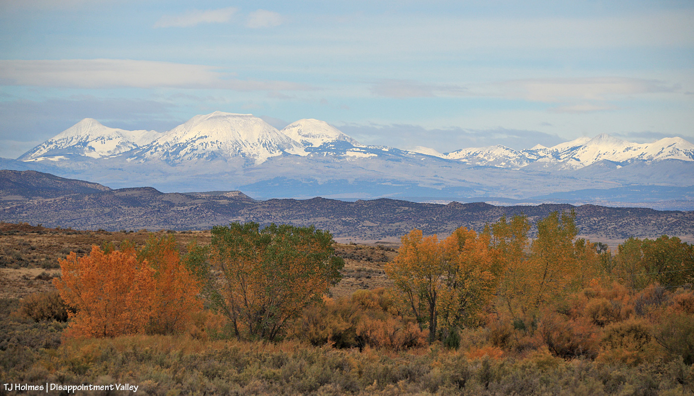
Now THAT looks like autumn. 🙂

By the time I was out with Mariah and her band on Saturday, the snow was noticeably melting, and clouds were lowering over the peaks. Sunday had more rain and super sogginess, and if I could have seen the mountains for the heavy clouds, I bet they’d have shown pristine white caps again.
Yes, major-super gratitude. 🙂

From above Disappointment Road looking up-valley – Spring Creek Basin from about mid-ground at left to background. The magic treasure under the rainbow.
We got sprinkles but nothing spectacular in the rain department … unless, of course, you count the rainbow glowing ahead of the rain. 🙂
**** Update: Around 5 a.m., we got a *spectacular* thunder-and-lightning storm that brought the rain in toad-gagging torrents. Every arroyo and creek in the valley is surely rolling and roiling. Catchments hopefully have gotten much-needed infusions by the gallon.
Wowza!!!!
Prepare ye for brilliance.
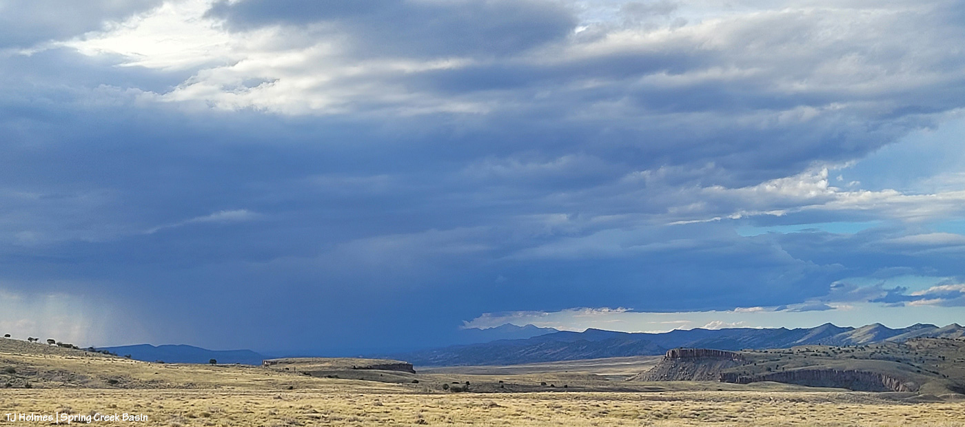
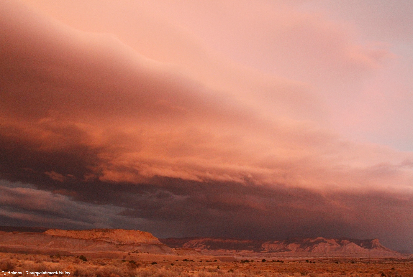
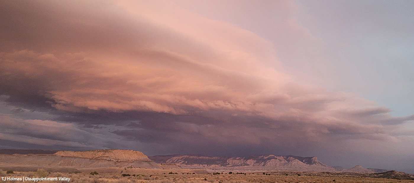
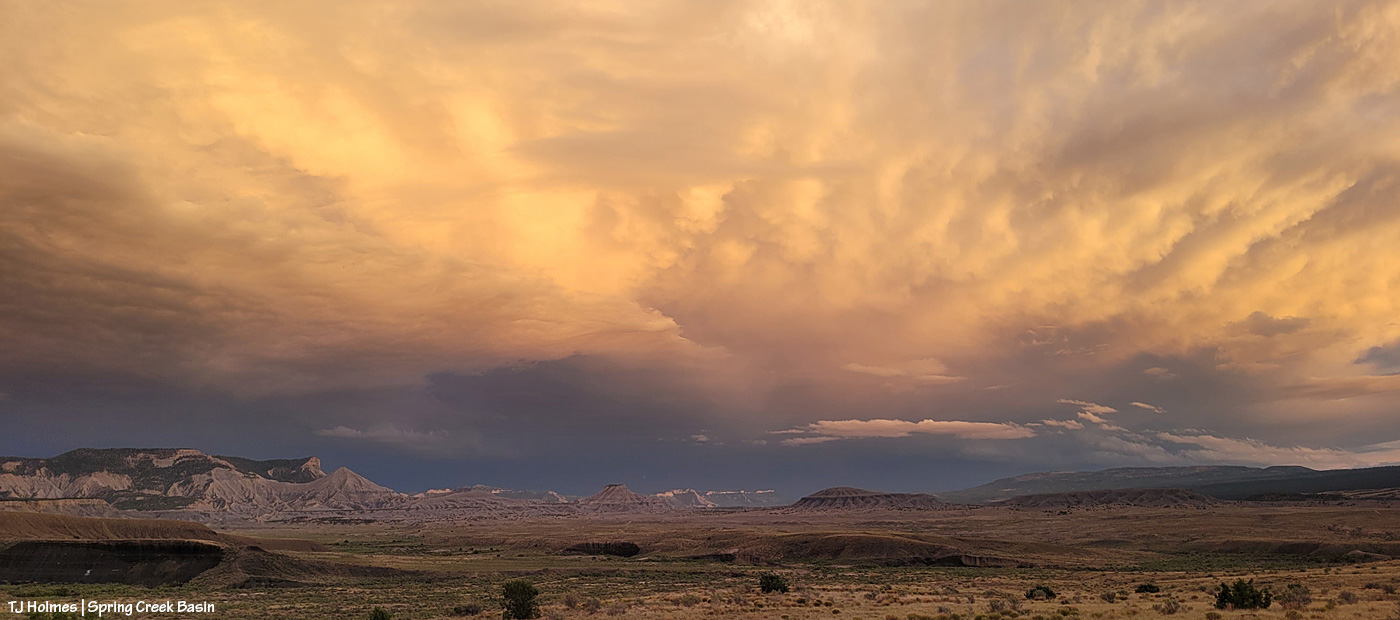
When I went into the basin Saturday evening, this was the view to the northwest beyond Spring Creek Basin, its namesake canyon and lower Disappointment Valley. You can just see eastern Utah’s northern La Sal Mountains at the right edge of the vast curtain of storm-rain.
This pic, with its sage-covered foreground, semi-jagged horizon and gorgeous-glorious sky with angel rays above an isolated downpour of distant rain, illustrates *The West* to me.

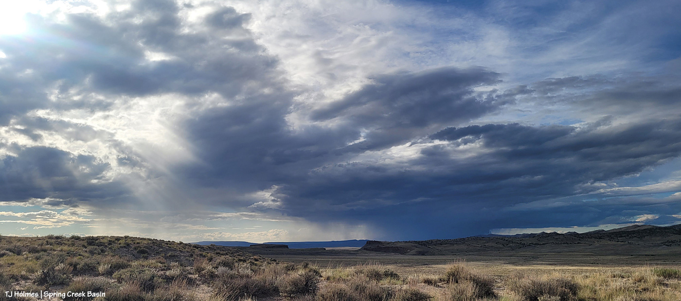
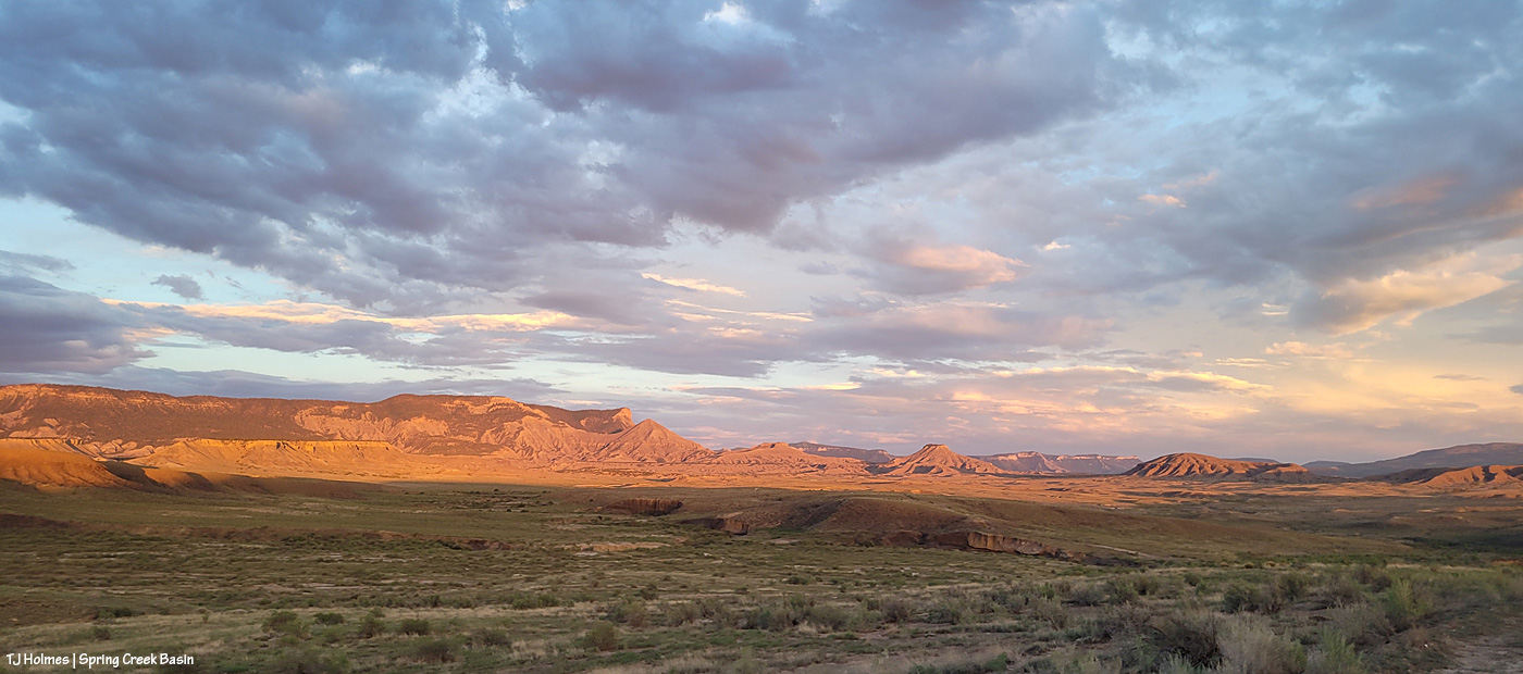
Fast forward a couple of hours, and this was developing above our southeastern horizon: end of Valentine Mesa, Temple Butte, McKenna Peak, the crowns of submarine ridge and Brumley Point over Knife Edge, The Glade in the far distance (hi, Rick!) beyond Round Top and Flat Top.

At the same time as above, this was the view to the west. I thought we were going to get last light through that window to the right of the sun, but the clouds had other ideas.
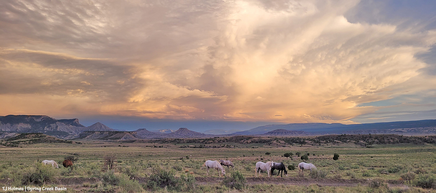
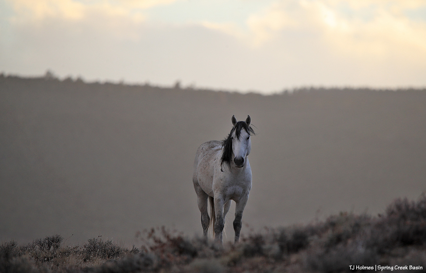
While my very long lens is perfect for capturing pix of the mustangs, not even my wide-angle lens (if I’d had it along) is wide enough for this amazing view of Storm’s band under the, uh, storm clouds (he WAS born under a storm!).

The light on those clouds – and the very far ridges (bottom center between submarine ridge and Brumley Point) – with that narrow band of dark, dark blue (that’s rain away off yonder) … WOW. And just right of very bottom center is a young wild pony who recently left his family and is usually with a calm elder-ish bachelor but this evening was having fun (between peaceful-grazing energy-restoration periods) creating havoc among a few other widespread bands.
Storm at right heading back to his band after leaving a deposit on a stud pile on the road (where I am … really needing to leave as dark approaches but unwilling to leave the gorgeousity).
Other than sharpening, this pic is exactly as it came out of my phone’s most-excellent camera (how DID we survive without cameras in our phones that we can take to the wildest places on Earth?! I won’t be without my camera-cameras … but I do love my phone’s camera for the wide, wild shots). Nerd info: The other pix also had some shadow-lightening applied (with sharpening) to better see the horses in the foreground, but that’s it. WHO NEEDS AI when you have this kind of light happening right in front of you????
It’s straight-up magic, folks. Ma Nature is kind of a genius. 🙂 All I do is point and click. And share. 🙂
We didn’t get rain out of either of those storms … but we got *divine* and very fabulous rain Sunday morning!
(Thanks to Harry Potter for this post’s title/quote!)
Hold onto your paddles, folks, have I got some rainwater for you. 🙂
Brought to you courtesy of Mother Nature –> Southwest Colorado –> Disappointment Valley –> Spring Creek Basin:

A full water-catchment trough is always a good sign. Fortunately, though low (in the tank, uphill behind me), we’ve had enough rain lately to keep this trough full – and there have been a fair number of horses drinking here with the amazing grass around (don’t let the pic fool you; the galleta, in particular, is bonkers this year, along with the alkali sacaton). I may have explained this in the past, but it bears repeating: The triangular sheet of metal over the trough is an evaporation cover, designed to help slow evaporation of precious water in our (usually) dry climate. The shape of the cover is triangular so the horses have plenty of room to drink at the sides of the round trough.

The Flat Top pond looks small in this wide-angle view looking eastish across Spring Creek Basin, but although it has gotten pretty shallow in recent years, it’s a pretty good size.

Good thing I scouted the V-arroyo before I tried to cross it. Those are my tentative footprints in the pillowy, shoe-grabbing – and tire-stopping – mud in the center bottom of the pic. You might not think it’s too bad, but there’s a lot of water in/under that surface mud still, and it is NOT friendly to tires or shoes until it has a chance to seep deeper into the soil and dry out from the bottom up. Along the left side of the pic is the arroyo – we’re looking upstream. The bottom of the arroyo, where I’m standing on relatively firm ground, isn’t very wide (hence my name of the “V”-arroyo), and the road rises to my left – up a little water-carved bank that’s nothing like the wall still in place on the other side of the first Spring Creek crossing.

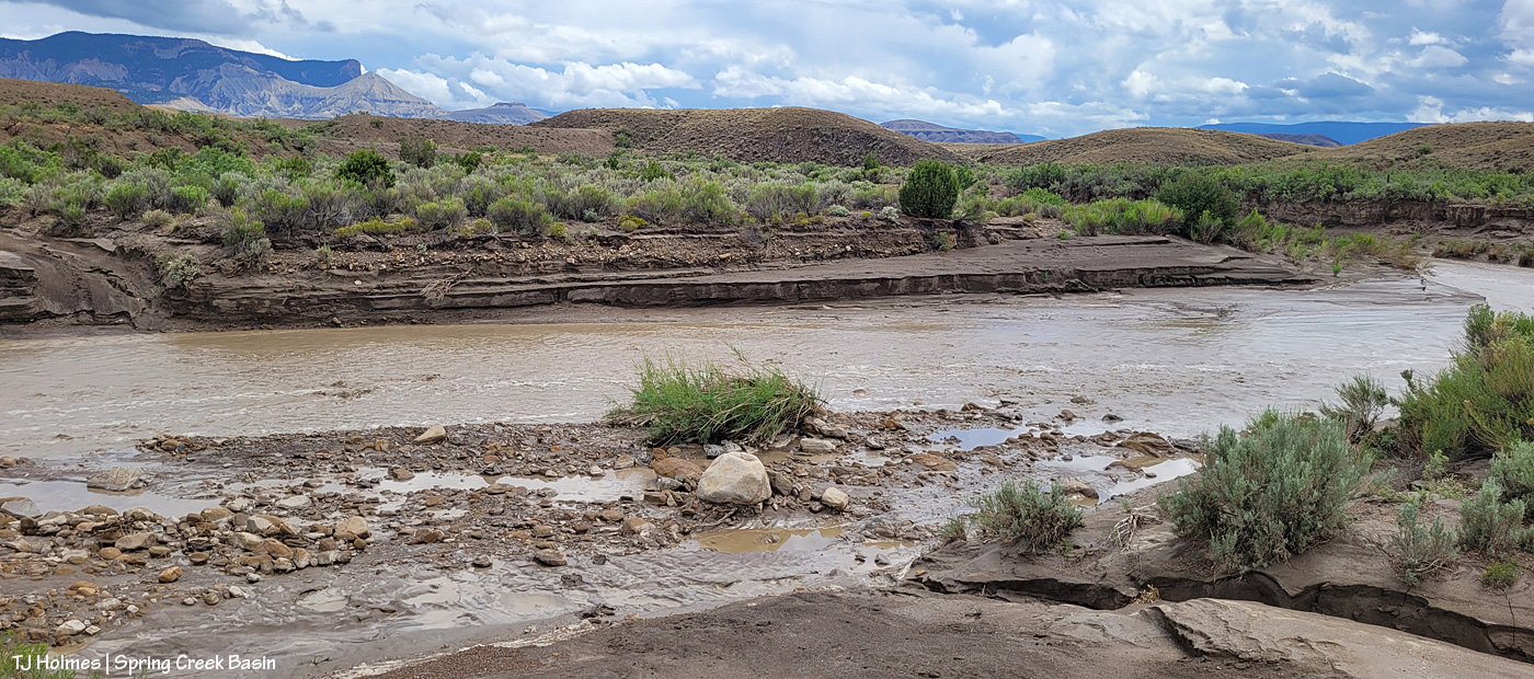
Holy Spring, err, RIVER! I know it’s hard to tell, but this is the first crossing of the usually-dry arroyo that is Spring Creek (when it’s not masquerading as a rainwater-swollen river). Yes, the other side is a road. 🙂 Well, it’s mostly a two-tiered wall; the right side of it is where I dug a channel in the wall the last time the creek ran (back in June) so I could get my ATV across and up and over. It has been widened by crazy people in a truck (I don’t know who … I don’t know anyone that silly/stupid/nutso), but it’s greatly eroded again and is going to need some custom shovel work. (And lowering of the water level. :)) The width here is probably about 25 yards? (Good darting distance.) And this water level is at least 4-5 feet below where it was at its highest/widest mark, behind me, so it’s already running with less volume than at its peak. (WoW!)
I took a lot of pix from here, and I wish I knew how to embed video; I’m still on a super-high from seeing all that water. Bear with me as I show you some upstream and downstream and high-vantage pix. (If you don’t think water in the desert is A BIG DEAL, you don’t live in a desert.)

Looking downstream. Note the two-tiered wall across the creek where the road is (should be). Most of the rocks at left are from previous flooding. But I will tell you, that kind of water can move BIG rocks. I have seen it, and I have moved big (enough) rocks out of the way of crossing in a vehicle or ATV. This is why the powers that be warn people against crossing flooded roads; that water literally grooves arroyos into our salt-desert landscape (milennia ago, this was under a giant ocean!).
Arroyo as defined by Merriam Webster: plural arroyos. 1. : a waterway (as a creek) in a dry region. 2. : an often dry gully or channel carved by water.). … Arroyos are a desert’s proof of water movement – that far bank/wall is much taller than I am. The wall where the road used to be is proof that they’re always changing – with more water.

Looking upstream. Note the water at far right; it was still finding ways to trickle along downstream.

A bit wider view from back up the road a bit. I mean … ?! 🙂 I knew, before ever I got there, that I wouldn’t be able to cross, but I did NOT know how river-esque Spring Creek would be. I love, love, love this place.
Similar view, but this shows the bend in the creek at right. … Try to follow me upstream: See McKenna Peak (the pyramid-shaped pointy peak)? Way back there is the source/start of Spring Creek, which – as you all know, being loyal, wonderful readers of this blog – drains Spring Creek BASIN (along with all its multitude of widely (and narrowly) and wildly variable tributary arroyos). As you may or may not know, the creek doesn’t roll in a straight line from there to here (or beyond/behind/downstream of me). So that bend goes around to the left – upstream of the southernmost *major* drainage/arroyo in the basin – and past another creek/arroyo crossing (below the dugout, if you’ve visited). It comes from the eastish side of the basin – with the northernmost *major* drainage/arroyo entering from the northish to also run back to (really from) the northeast. Are you still with me? There are three *major* drainages in Spring Creek Basin with Spring Creek being the lowest, middle drainage – named as the very-most-major drainage and namesake of the basin it drains.
Water is important here. Knowing how it flows is part of the importance. Back in the very-long-ago day, some other silly people – who apparently didn’t know about arroyos and the highly-erodable quality of the salt-desert soil – tried to dam Spring Creek just below the confluence of the third major arroyo. Thinking they would create a reservoir out of which to irrigate land for farming (what WERE they thinking?), they built a dam and dredged miles of irrigation ditch; the remains of both can still be seen. As the story goes, the first major rain of the (likely monsoon?) season brought water rolling like a river down every tiny arroyo, down to and through the big drainages, blasted a hole in the dam that likely had cost boatloads of blood and sweat and resulted in tears (!) … and they went away *disappointed* (har har). … Mother Nature always wins, folks.
Well, I knew better than to attempt the crossing of Spring Creek Basin’s *river* (without more rain … which we’re getting again as I type … the creek would likely be done flowing within 24 hours … though the water will last in pockets and seeps for a good long while), so despite the big group of a couple of bands of mustangs not far away, I headed out, already on a great big, marvelous high.

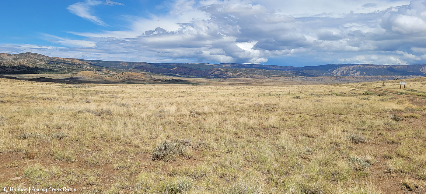
What you’re looking at in the pic above is our crazy-good grass, which amazes me because of the little – but always valuable – rain we’ve gotten this summer (this year, really; it’s been pretty darn dry since *last* year). The galleta grass is particularly bonkers this year, along with the sand dropseed and/or alkali sacaton (very similar in appearance). This is from right inside the basin’s main/western boundary entrance looking eastish.
From here, my next destination was the south rim of Spring Creek canyon, through which water runs out of Spring Creek Basin, out across lower Disappointment Valley and into Disappointment Creek, which delivers water – along with a “healthy” (aka large) dose of salt and sediment (apologies) – to the grand and spectacular Dolores River.

Spring Creek, draining Spring Creek Basin. 🙂 Around the near (left) bend, before the far bend, there’s a fence across the wide-open low ground and a water gap across the creek; that’s the basin’s western boundary. Way yonder, on the horizon, on the far side of the farthest rimrock and even beyond that blue-grey tide of rain, is the south shoulder of eastern Utah’s La Sal Mountains.

Not even my phone’s widest angle is wide enough to take in all the gorgeousity of Spring Creek through its canyon, so here’s another bit of view that takes in more of the upstream canyon area. Spring Creek Basin stretches north (straight ahead of me) and east (to my right) and south (behind me) from this perspective on the canyon’s south rim.

Those layers. The canyon is neither super deep nor particularly long. But it is so gorgeous.

In just the short time I walked out and spent along the rim, the storm to the west was already passing.

Looking upstream across the heart of Spring Creek Basin, where another storm loomed on the northeastern/eastern/southeastern horizon.

And because this is a blog about the wild horses of Spring Creek Basin, there IS a mustang out there, though I’m not sure he’s visible. As far as I know, the young mister is the only one to have crossed the creek (within view, anyway). 🙂
Grow, grass, grow!
Better late than never (this was the last day of specific rain in the forecast). I think we can be said to have gotten some monsoon rains this summer. Despite all the worry leading to this day (yesterday), soooo amazingly grateful. 🙂
* Thanks to Charley Pride for the inspiration behind this post’s title – “(High on a) Mountain of Love.”

I mean, wow, right? Does anyone doubt this latest proof of magic in Disappointment Valley (or on planet Earth?)? 🙂 That was absolutely as wide as my cell-phone camera could go; the rainbow was (seemed to be) right above me.
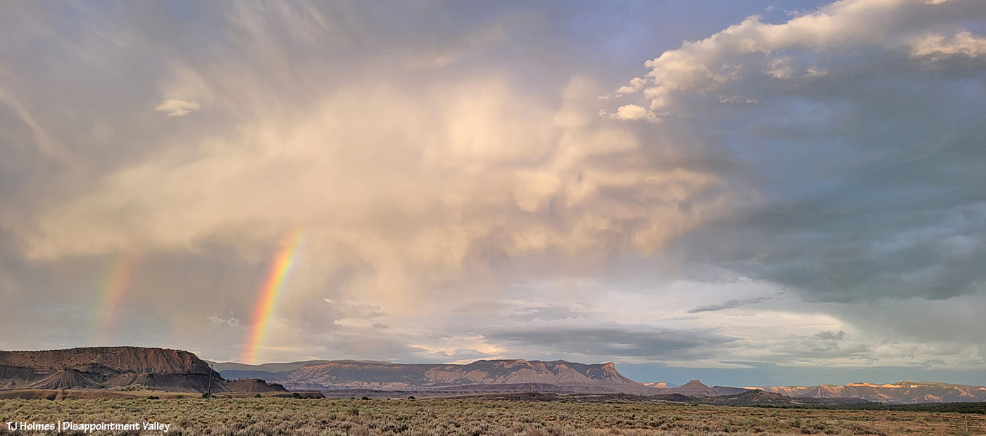
As usual, the rain forming the prism of the rainbows fell in the atmosphere, but not much actually made it to Earth.

And after sunset, this was the storm to the southeast. Only in a video clip was I able to catch the lightning bolts. Time between first and third photo: about an hour and 15 minutes. (And that rain didn’t make it to my location, either. I’m not greedy, but it’s still annoying to have rain *that close*! :))
A recent selection of post-rain images:

The water trough at the main/original water catchment is full again. The tank has about 3 feet of water. It has been mostly dry with a poor winter and without much rain.
Post-rain grass growth! If you live east of the Rockies and in places where it, you know, rains, this might look sparse. … To us, it looks lush and divine! And I will tell you, the mustangs are going after it with gusto!

Do you see the pillar of light? The clouds were heavy the last part of the day (and they and the breeze dropped the mercury comfortably), but then, at THE very end of the day, the sun found a window, and it lit up the basin.
Did you think I was exaggerating? 🙂 As usual, the pic doesn’t do justice to the colors of reality.
I couldn’t decide between the really long, wide view or the slightly zoomed-in view, so you get both. 🙂
Just another glorious day in Spring Creek Basin. I promise, pix of ponies are on the way.
P.S. Happy July. 🙂


I think – I hope – that these pix truly are worth 1,000 (or more!) words … but I’m going to give you a few more anyway. 🙂
This is the east-pocket pond, aptly named as it’s located in Spring Creek Basin’s east pocket. This isn’t the only pond that suddenly has water after Thursday’s tremendous downpour, but it’s the only one of which I have a “before” pic.
“Before” was a little after noon on June 27, a few hours before the four-hour deluge. “After” was about 26 hours later on June 28.
Maybe, if you look closely, you can see a band of greys at far distant left in the pond-now-full pic. Fortunately, the horses have multiple sources of water now. It’s amazing how quickly things change (for the better, in this case!).
