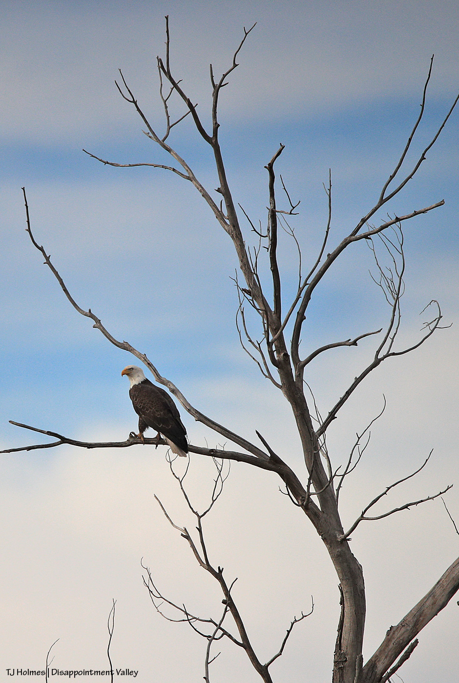
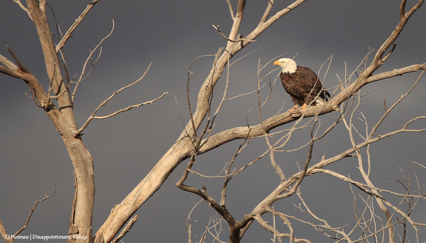
I saw TWO bald eagles that day (about a week ago now), as well as two golden eagles or juvenile bald eagles; I didn’t have my binoculars then, and I couldn’t tell from a distance. When I went back much later with my big gun (as opposed to my wimpy phone), one bald eagle was in that tree, which seems to be the favorite tree (and why not, with that perfect stick, err, branch?).
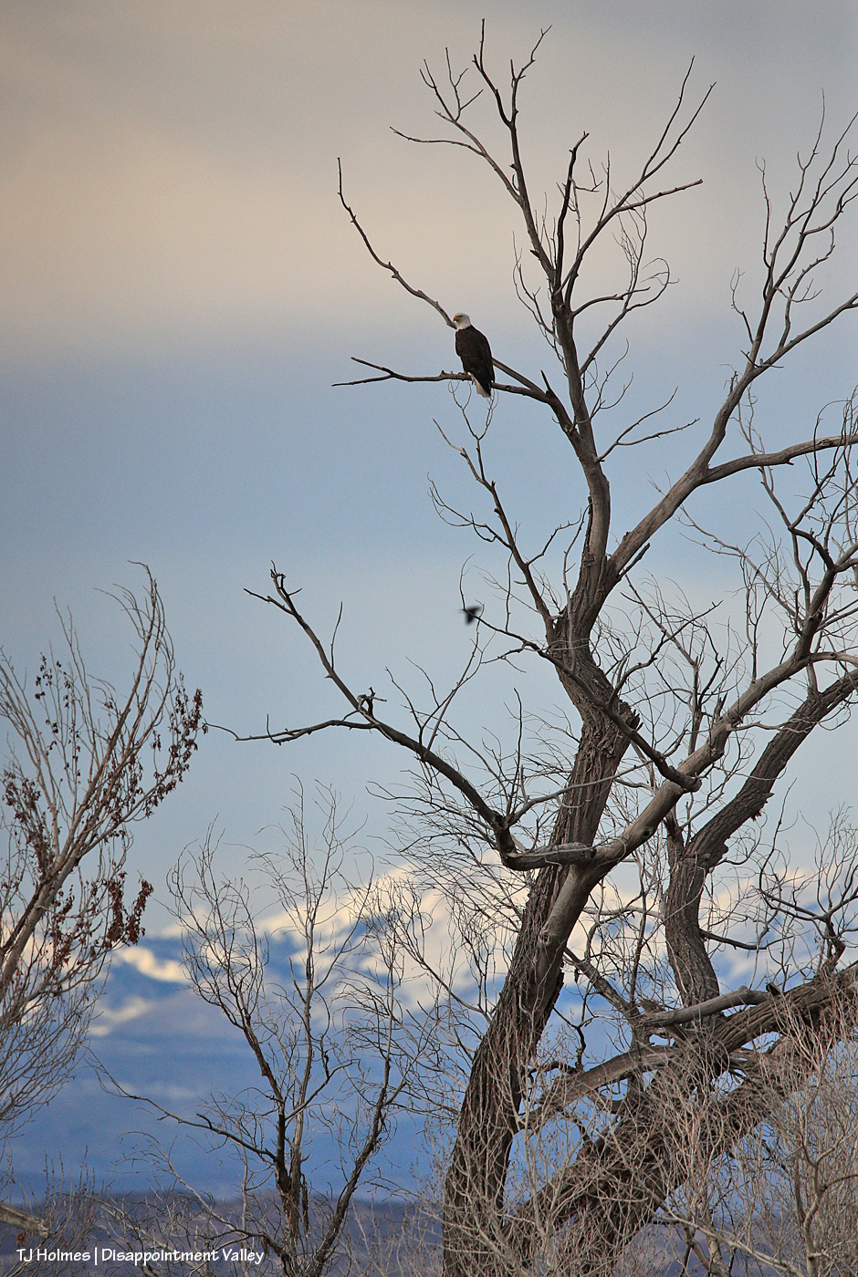
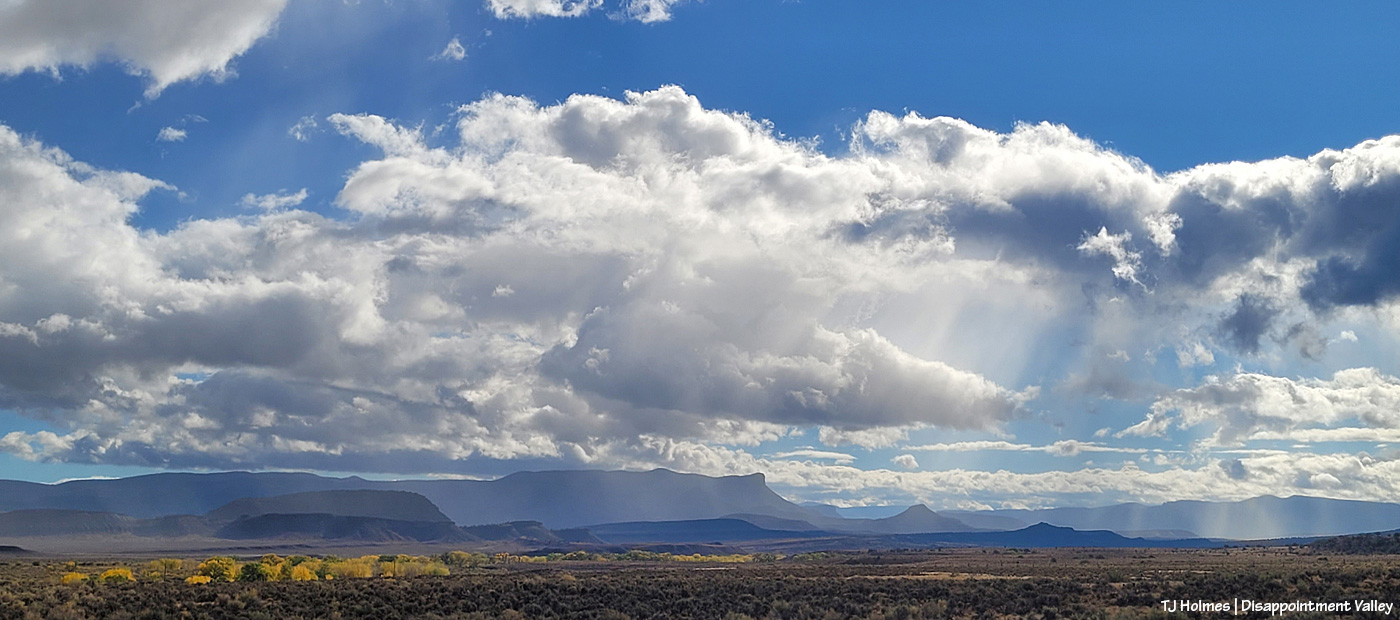
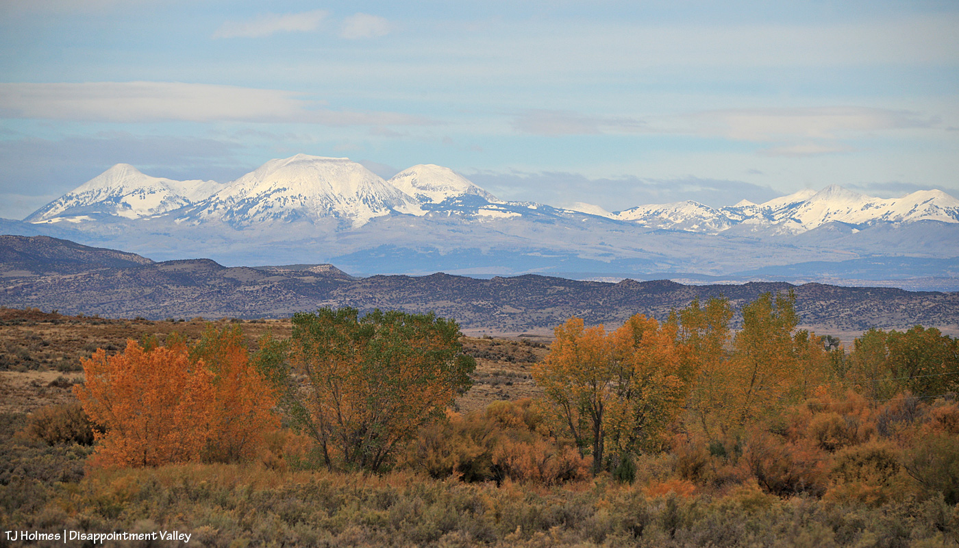
Non-moisture-bearing clouds were overhead, but in the distance, a bit of sunlight was shining on Utah’s La Sal Mountains. Bit of a messy cottonwood foreground, but you get the idea. 🙂 (Who spotted the raven doing a photobomb flyby in the middle background?)
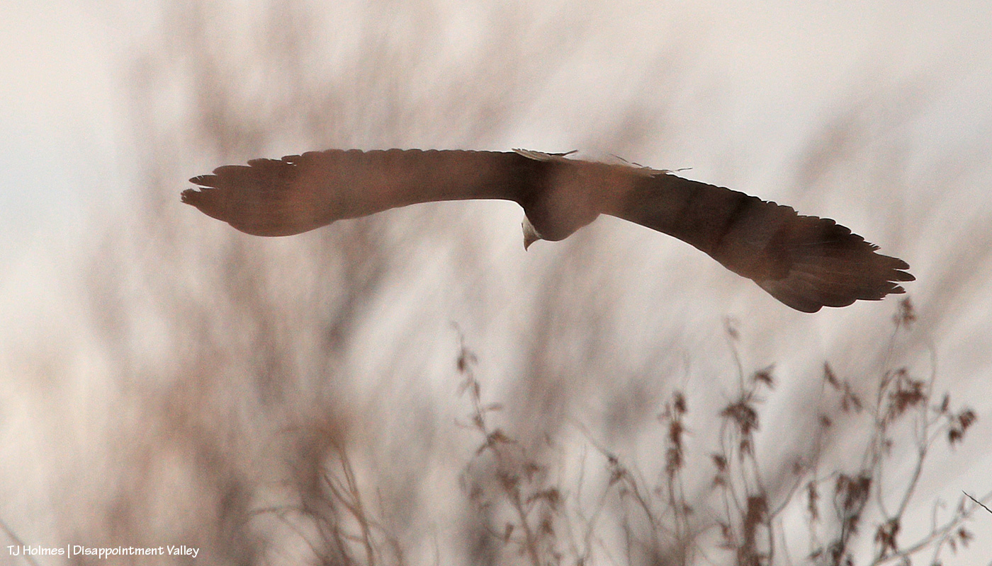
This is a strange image, I know, but I was zoomed in as I initially scrolled through the pix on the computer (culling out-of-focus ones), and when this pic came up, it was cropped like that, and I liked it. 🙂 To each, their own, eh?
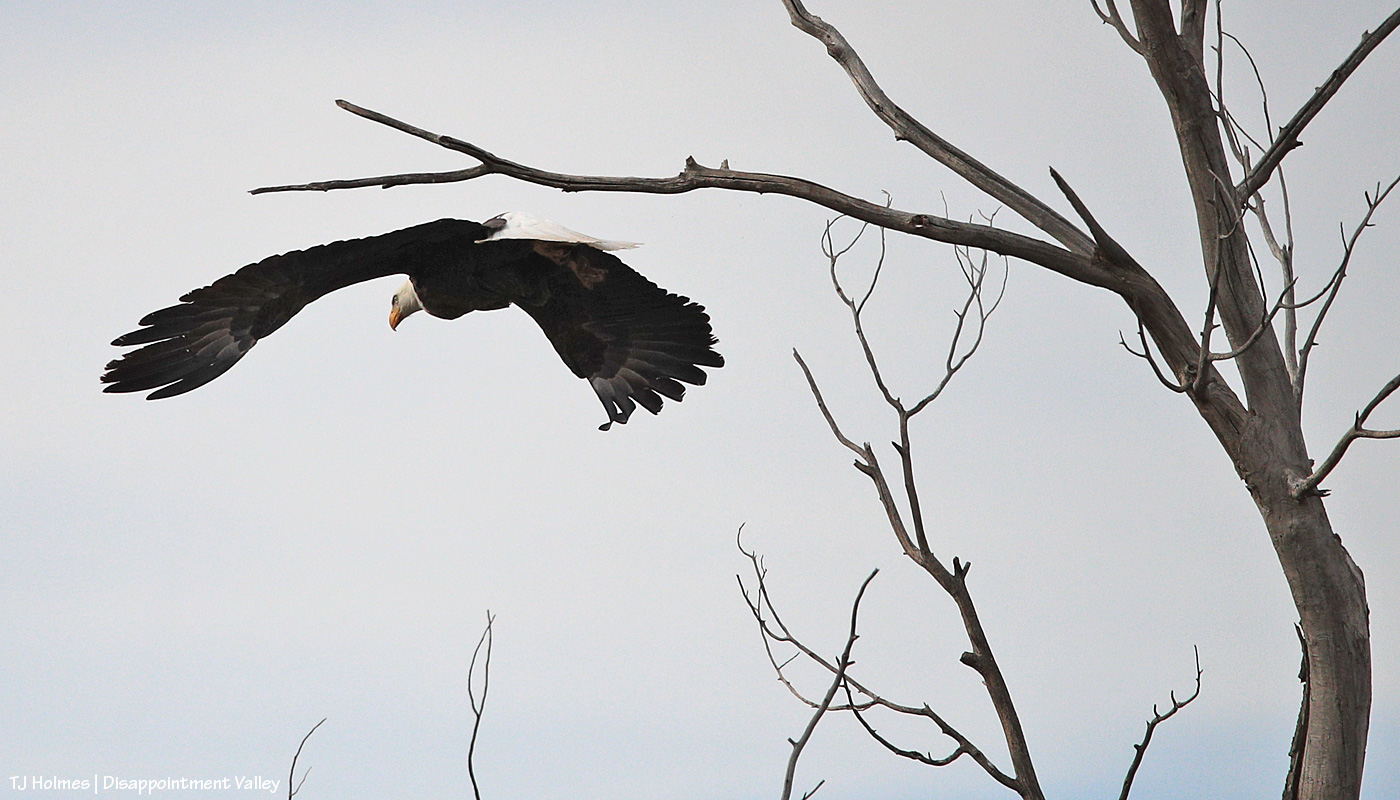
A more typical eagle-launch image. Too bad s/he flew away from me, but it was warm-ish, critters were out, and eagle had other fish to fry (not in dry Disappointment Creek, though) and things to do!
Wow, do I love seeing them. 🙂
(The title is a reference to a phrase I sometimes see about “bird-on-a-stick” pix: portrait shots of birds perched on branches. As a non-bird photographer, I figure I haven’t yet gotten bored with shooting birds or raptors of any kind on sticks or branches of any kind!)
The cottonwood tree is almost as cool as the bald eagle. And that light! It was momentary, which makes the mistake harder to bear.
While shooting, I knew there were little branches in front of the eagle, but I didn’t realize until I saw the images on the computer that one branch literally goes right across the eagle’s eye. Sigh.
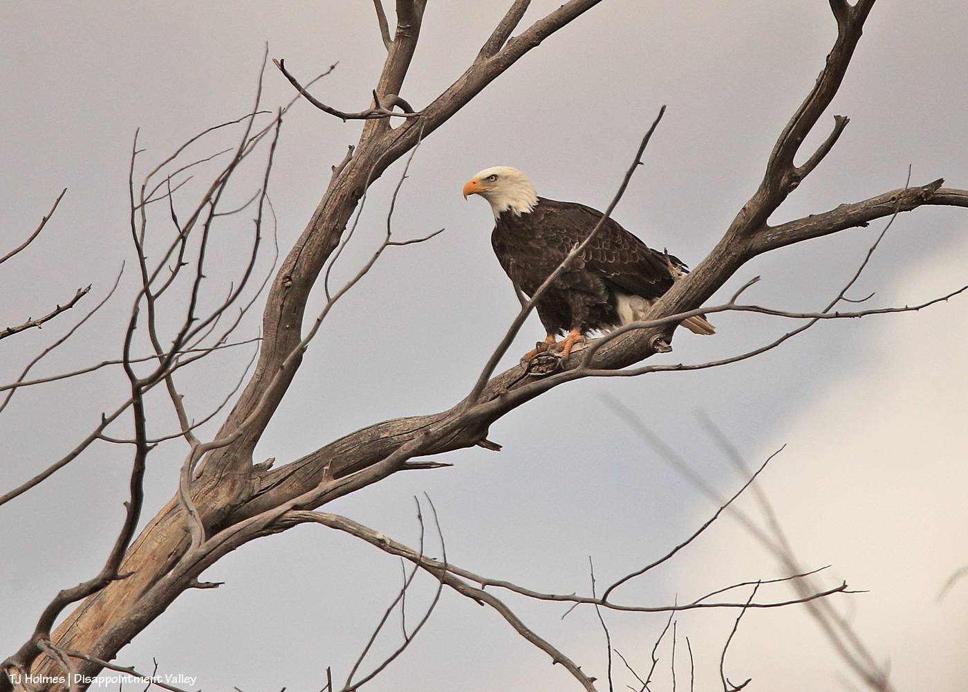
Here we go; a little better when the eagle ducked a bit to at least allow a shot of his/her (?) eye not directly crossed by a branch.
The eagle stayed “sticky” as I drove a little closer, using my vehicle as a “hide” to try not to spook the eagle (and all of these are taken with a 600mm lens and cropped).
I’m happy to say that s/he was comfortable enough with my presence in the rolling hide that s/he never flew away while I was there. I drove on and left it to its day doing eagle things.
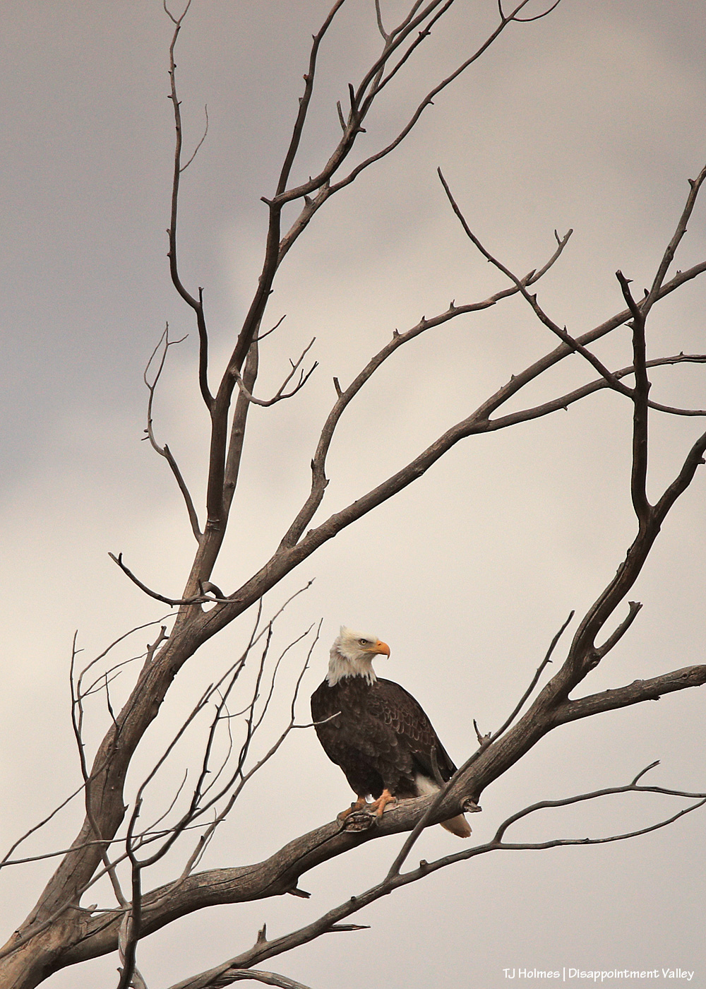
Pretty cool sighting for the (windy) day after Christmas!
Sunrise in Disappointment Valley highlighting mule deer (I’m so glad to see the bucks back!) in the greasewood and chamisa (rabbitbrush) and willows and cottonwoods along Disappointment Creek, looking toward Spring Creek Basin. It was a drive-by shot, and I couldn’t actually see what I was shooting on my phone’s screen, but the light was so beautiful highlighting the pretty and handsome does and bucks, I literally pointed and pressed the button.
Top to bottom: Temple. Madison. Temple photobombing Madison. 🙂
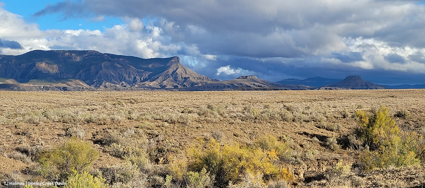
Mustangs in Spring Creek Basin, which is part of Disappointment Valley but does NOT include Disappointment Creek, along which you can see the glowing cottonwoods snaking across the distant landscape, headed west.
(Disappointment Creek currently is as dry (well, muddy, as I type this during intermittent rain waves) as Spring Creek … maybe with a few more puddles along its considerably longer length. But it generally runs from … February? Ish? Into July if we’re lucky. That’s enough water to (mostly) support the cottonwoods along most of its length. Spring Creek runs only when there’s a major rain event. We have a couple of cottonwood trees in Spring Creek Basin (I think I can count them on one hand and have fingers left over), but they’re in higher drainages that may not get more flow (?) but might get more rainfall. The cottonwoods seen in the distance in the above images are along Disappointment Creek outside/west of Spring Creek Basin.)
We rarely get morning rainbows; we rarely get morning rain (and even more rarely with sunshine).
Along with a lot of rain the last few days (about 2.56″), we’ve had a lot of sunshine.
This IS Colorado, after all!
Yeah, so THIS happened yesterday morning!
The cottonwoods along Disappointment Creek are starting to glow gold. And yes, it was sprinkling through the sunshine, which brought the magic. (The above pix are looking west; sun rising behind me above the rain clouds.)
Wonder what it looked like back to the east? Here ya go! A lot different, eh? The sun was rising to upper right. This is Disappointment Road/Road 19Q looking toward Spring Creek Basin (not the road TO the basin).
Now I’m at 19Q looking west up Road K20W (not to be confused with K20E(ast) to Spring Creek Basin).
The sign struck me as funny under the rainbow. I mean, really, do you need a destination when the treasure is right in front of you??
Here we are at Road K20E looking eastish/southeastish toward Spring Creek Basin as the storm was passing to the north. (Sorry about the crazy glare-arrow; my phone’s camera lens is cracked.) Don’t make the mistake of driving this road for at least a few days! The cottonwoods at right line Disappointment Creek, which, yep, was running!
The rainbow (at least the main one) lasted somewhat longer than 30 minutes?!
It.
Was.
EXCEPTIONAL!
And when it finally faded, little curtains of rain were still moving south to north across the eastern(ish) part of the valley.
A person can never have too much magic in their lives. 🙂
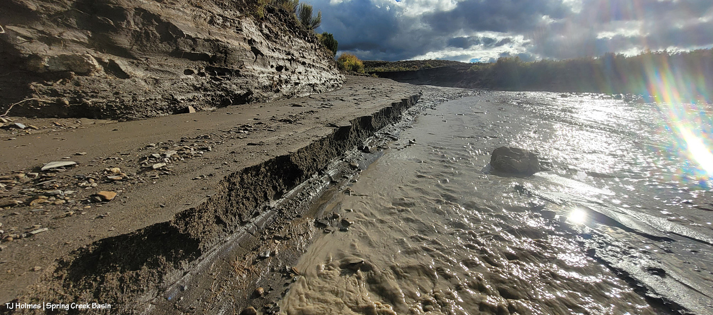
At least one part of Disappointment Valley got 1.35 inches of rain over about 16 hours yesterday (it started around dark Friday and ended mid-morning Saturday). Every minor ditch and arroyo to every creek bed (Disappointment, Spring and Dawson creeks) ran with water. … LOTS of water. None had been running previously; all had been dry.
While a lot of water ran off and away, there must have been a fair bit of soaking in; the rain was all fairly light and decidedly steady. The ground and the road into and in Spring Creek Basin are all SOGGY.
Come along on this virtual tour with me – yesterday late afternoon – to see what I saw:
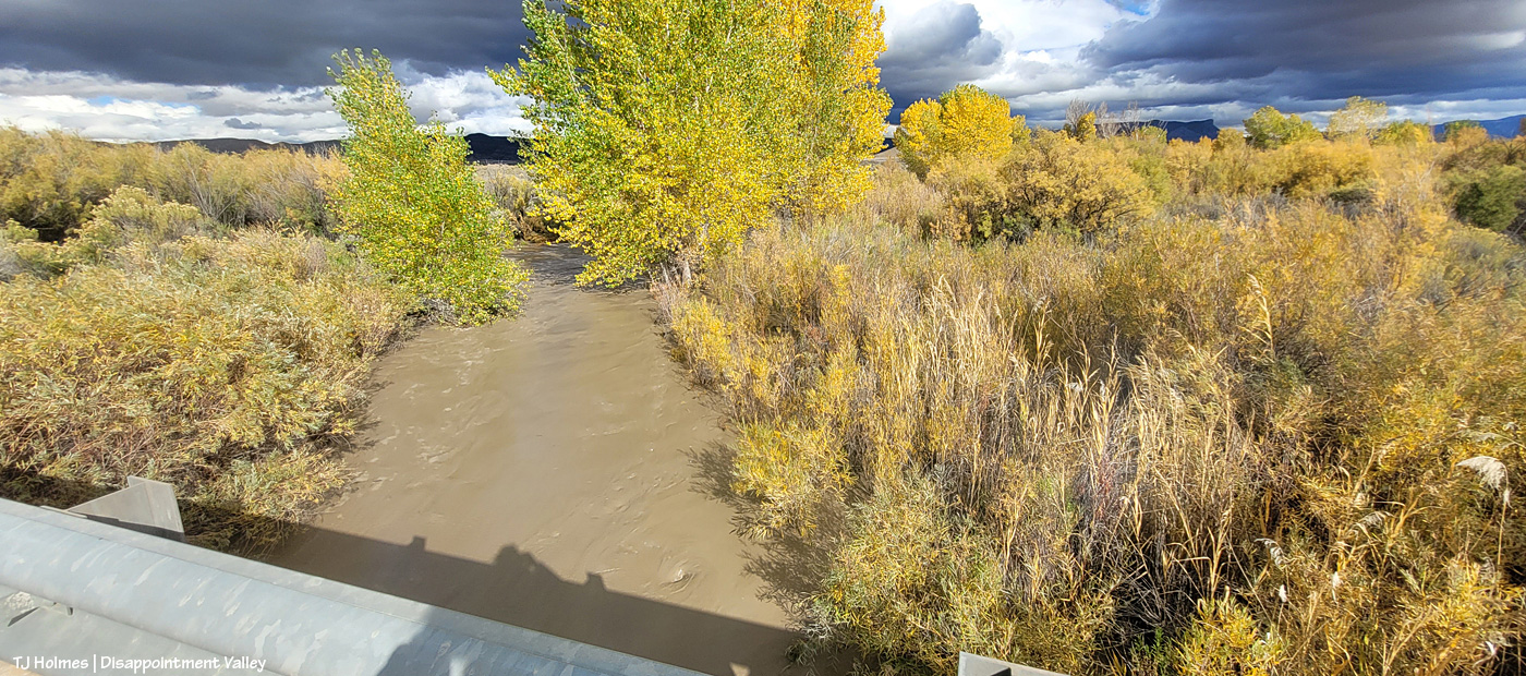
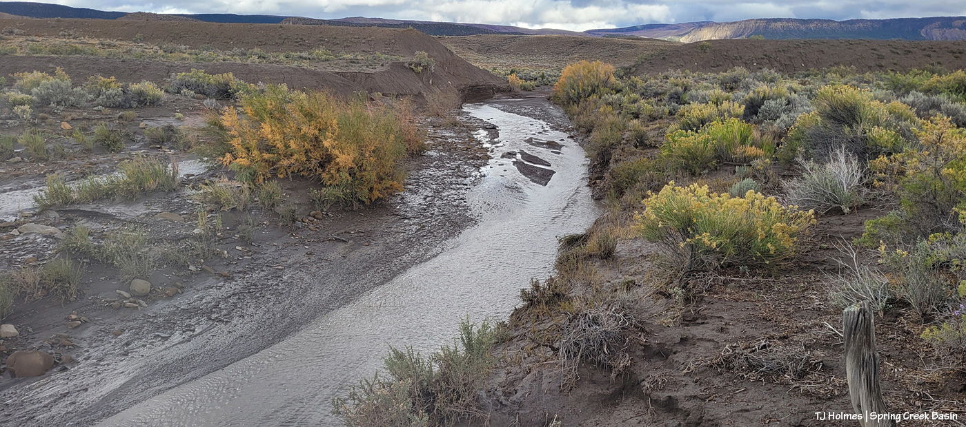
It’s hard to tell either how wide or how deep the water is here in Disappointment Creek several miles up-valley from the turn to Spring Creek Basin off Disappointment Road, but given that it was previously dry, I *hope* you can see that it’s running like a milk-chocolate river. This is looking upstream.
Another view, from several miles downstream of the above image; this is just 50 or 75 yards south of the road to Spring Creek Basin. The creek channel is much narrower here; I hope you can tell how high and wide the water is?
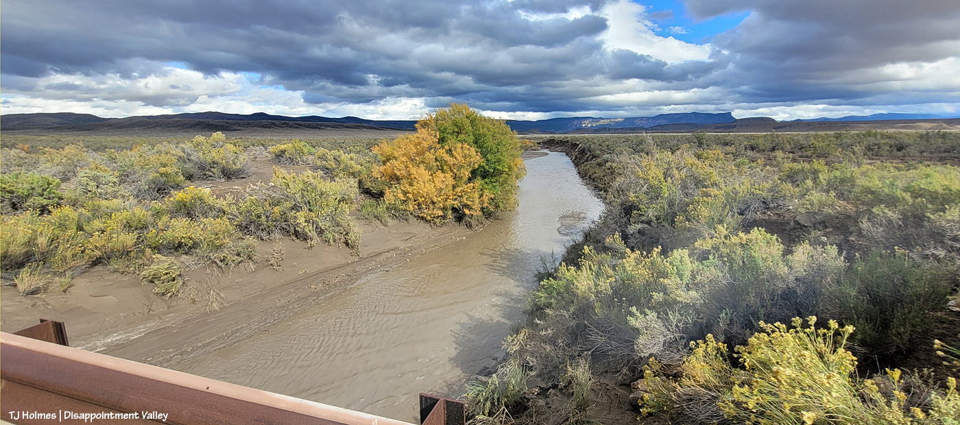
Now we’re looking upstream at Spring Creek water flowing downstream (toward us) from Spring Creek Basin, a few miles east (Temple Butte is visible against the horizon). (I’m still on Disappointment Road, a mile or so north of the above Disappointment Creek pic.)
And, from the other side of the bridge, Spring Creek flowing downstream toward its confluence with Disappointment Creek (marked by the line of barely visible golden cottonwoods in the middle distance).
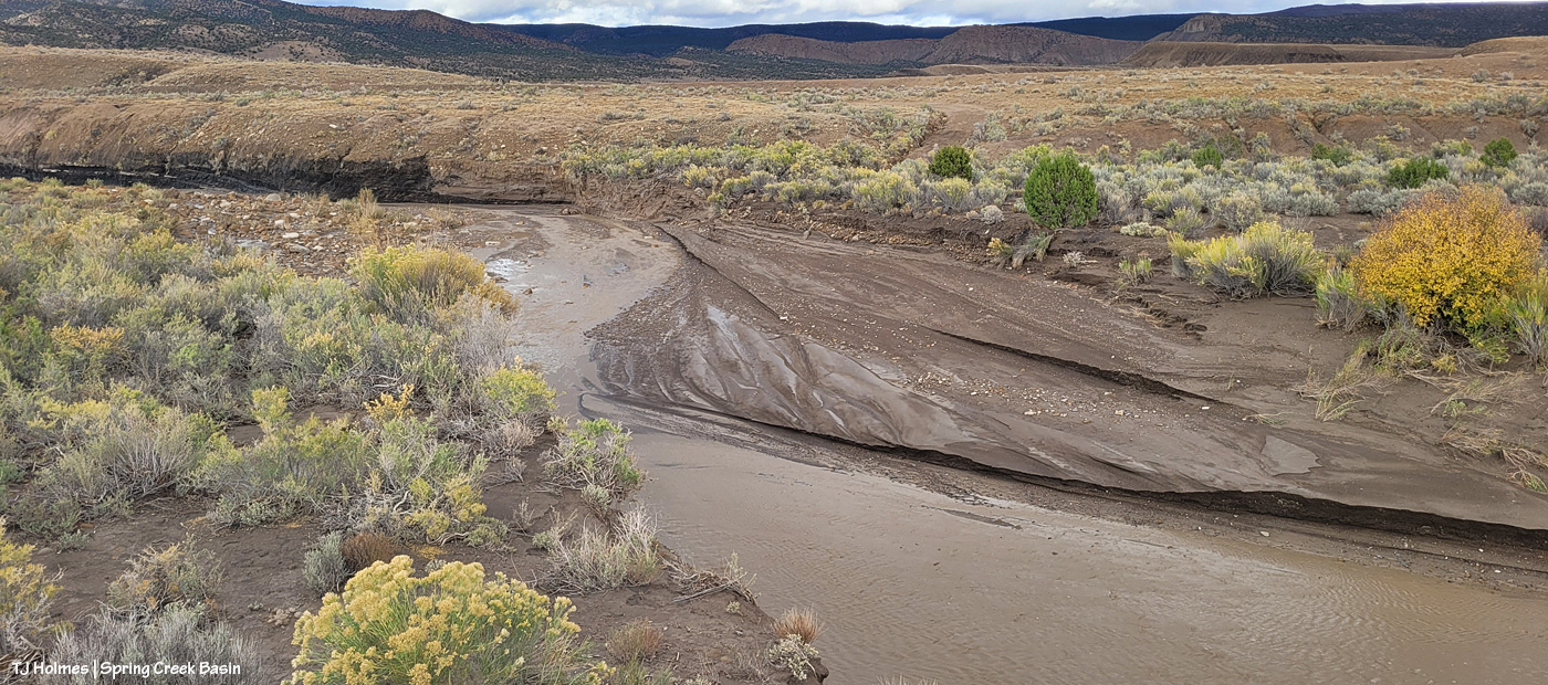
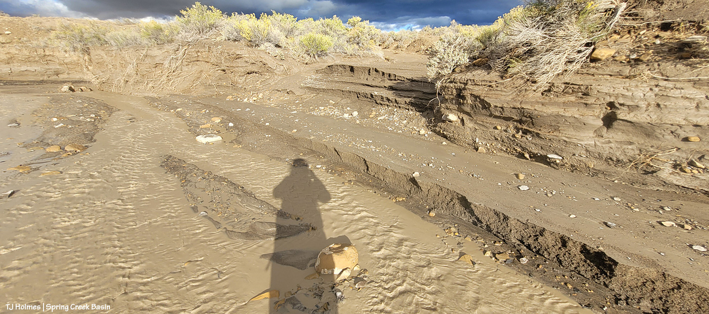
I know it’s hard to tell width and depth again; the creek arroyo here isn’t terribly deep, but it’s three or four times as wide at this point as in the second pic of Disappointment Creek above. These creeks carried a LOT of water yesterday.
Then I went looking for the condition of the Spring Creek arroyo in Spring Creek Basin (in case this isn’t obvious, Spring Creek and its tributary arroyos drain Spring Creek Basin – when it rains – and the main Spring Creek arroyo carries all that gathered water west across Disappointment Valley to join the also-muddy water of Disappointment Creek, and together, they carry the watershed’s drainage to the Dolores River).
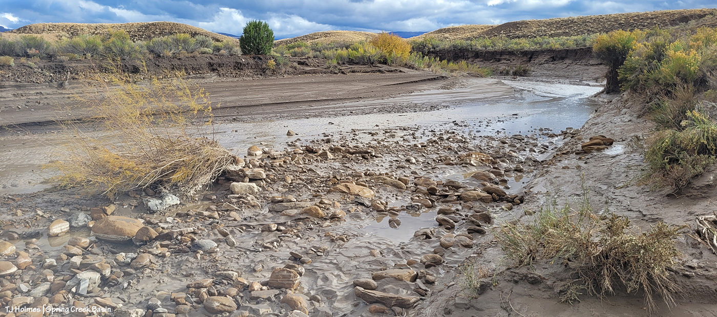
I thought you all might like to see a bit different view of Spring Creek, and I had to walk the last half-mile or so because the road was still too mucky even for my faithful little buggy, so this is just upstream and around the curve from the first crossing, where I usually take pix of rolling Spring Creek after a good rain. If you’ve ever gone into the basin with me, you’ve heard the story about Custer dam (and I even wrote a bit about it earlier this year). This image doesn’t show it well because of the background, but if you look on the left and right sides of the image above the water, you might see that the ground is abnormally straight/flat? Those sides are what remain of Custer dam (marked on maps). The brief story is that around 1900 (?), someone(s) put an enormous amount of work (and likely money) into building a dam to contain water from Spring Creek (the lowest/central arroyo in Spring Creek Basin) and the north and south *major* arroyos that feed into it (and a whole lotta other arroyos feed into all of them). The people also built at least a few miles of irrigation ditch. The story goes that the first major storm after the dam was built burst the dam. As you can (maybe?) see in the pic above, Mother Nature prevailed. (Who could possibly think this country is farmable?!)
Now I’m standing atop the south side of the dam looking downstream and westish. Just around the bend to the right is where the road crosses (when the arroyo is dry). It’s a weird perspective, and though I thought this would be a great perspective, it proved difficult to actually show. The road tops the area at the far (north) end of the dam, which is more to the right than “straight” across, but it’s only … 150 yards away, maybe? Or maybe it’s that from the far side part of the dam.
Now I’m down at the bend that you can see in the above pic, still looking downstream at the road crossing. You see it, right? Where all the rocks are at the left side of the pic. The road crosses the rocks, the arroyo and up the other side to the right.
Sorry, how about now? 🙂 Straight across. This should look familiar. … Well, except for the increase in rocks and the far side, which looks a bit like a wall. …
Looking upstream, there’s the curve where I was standing a couple of pix ago, looking to where I’m now standing.
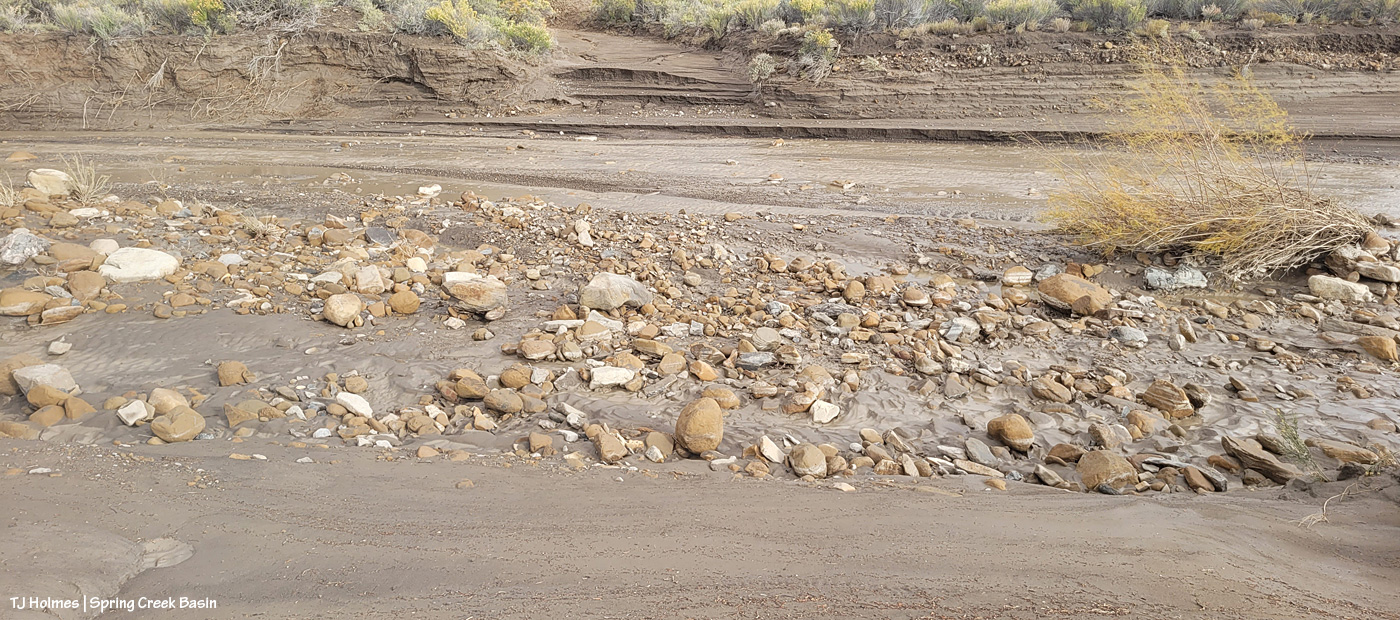
The water, I should mention, had greatly receded at this point. This is probably some five, six miles (??) upstream from the first Spring Creek pix I showed toward the top of this post. I found evidence that the water reached probably at least another 20 yards up the road where I approached, from, say, the middle of the arroyo. It would have looked most definitely like Spring RIVER at its highest/deepest point. Spring Creek runs ONLY when we have a major rain event. … And when all that water from all that rain is done, so is the “creek.”
I’m gonna need my shovel. Again. 🙂
Are you tired? We’ve been walking around, in the super-mucky mud, in calf-high mud (or muck) boots. And we still have to hoof it back to the buggy. I was whupped.
But you can never, ever, ever beat that view. 🙂 Especially rain-dampened and -darkened. 🙂
I can’t wait to get farther in and take a gander at ponds. SURELY the mustangs have multiple water sources now. What an amazing deluge of rain. Much needed.
A young bull elk and a cow elk check me out from right above Disappointment Creek, which still is not running yet this year. They still look awfully fuzzy don’t they? The temp was at least 67F in the valley yesterday. Spring is here.
Switching gears – and hair for feathers – this morning, please enjoy this juvenile bald eagle that was hanging out in some cottonwood trees near (dry) Disappointment Creek.
S/he looks like s/he dipped her/his head in some of the seeps that are producing mud-water currently, but based on this illustration, I believe s/he’s a juvenile, about 4 years old.
There were no other birds around – eagles or otherwise. I was incredibly happy that the eagle was “sticky” and allowed me a few minutes to photograph him/her from my truck.
We don’t have a lot of bald eagles in Disappointment Valley anymore, though I’ve been seeing them all winter between Disappointment and Dry Creek Basin (on the way to Naturita and/or Norwood). (And I’ve kicked myself a million times for not having my camera those times … though it’s harder to stop in the middle of the highway than on lonely Disappointment Road!) A generation or so ago, there must have been many, as evidenced by the title of “Where Eagles Winter: History and Legend of the Disappointment Country” by Wilma Crisp Bankston, the late mother of an up-valley resident (whose brother and sister also still own land nearby).
While we have golden eagles year ’round in the Disappointment Country, bald eagles are mostly winter visitors. It’s always a treat to see any of these magnificent birds.
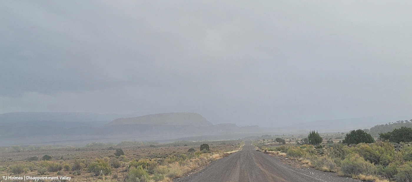
The cold front announced its arrival in Disappointment Valley yesterday morning with wind and dramatic skies. Utah’s La Sal Mountains were blocked from sight by a snow squall in/over western Disappointment Valley most of the afternoon.
I drove into Spring Creek Basin briefly, just in time to see a little snow squall rolling from north to south across the eastern ridges of the basin. In contrast to the other day, when the snow blazed a trail across the basin, yesterday, the snow was all around but never atop us.
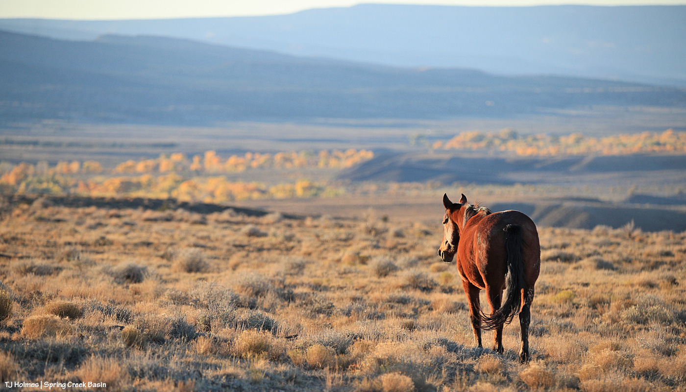
Horses were visible in the distance, but I decided that this would be more of a scenery day.
On my way out of the basin, I happened upon the group of about 15 pronghorns that have been hanging around together lately. By the time I saw them, stopped, got the camera out of my pack and aimed, at least half of them had dropped off their little ridge.
Away out yonder in those breaks and canyons is the Dolores River.
From back on the Disappointment Road, another isolated little squall was dropping snow along Horse Park, a narrow little valley between Spring Creek Basin and beyond. You can recognize part of the far ridge as the same one in the background of the Maiku pic a couple of posts ago. The rimrocks at the bottom, semi-foreground are the western boundary of Spring Creek Basin.
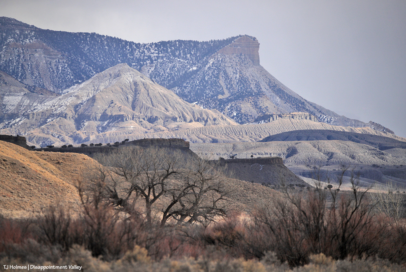
And just a little south of the previous pic, the squall was still moving south over Temple Butte. In the near foreground are cottonwoods and tamarisk along Disappointment Creek.
This is yet farther south (from my vantage point, I’m looking sort of southeast-ish). While I was trying to get the snow over the very far (and much higher elevation) ridges, a golden eagle was flying over the scene. See it above the cottonwood at left?
We’ll close with another, tighter view across Disappointment Creek and Spring Creek Basin. You can see the basin’s western rimrocks, Flat Top, Round Top, submarine ridge, McKenna Peak and Temple Butte – snow beyond.
Gosh, I love this place. 🙂
Wherever you are, I hope you’re warm these next few days!
La Sals beyond Disappointment Valley/Creek cottonwoods.
We had rain in the valley – to the tune of almost 0.80 inch total (way, way more than we got in all of September). To say I’m “grateful” is a vast, vast understatement. 🙂
Now THAT looks like autumn. 🙂
By the time I was out with Mariah and her band on Saturday, the snow was noticeably melting, and clouds were lowering over the peaks. Sunday had more rain and super sogginess, and if I could have seen the mountains for the heavy clouds, I bet they’d have shown pristine white caps again.