How good are *my* BLM folks? THIS GREAT *arms spread wide*!
Allow me to highlight:
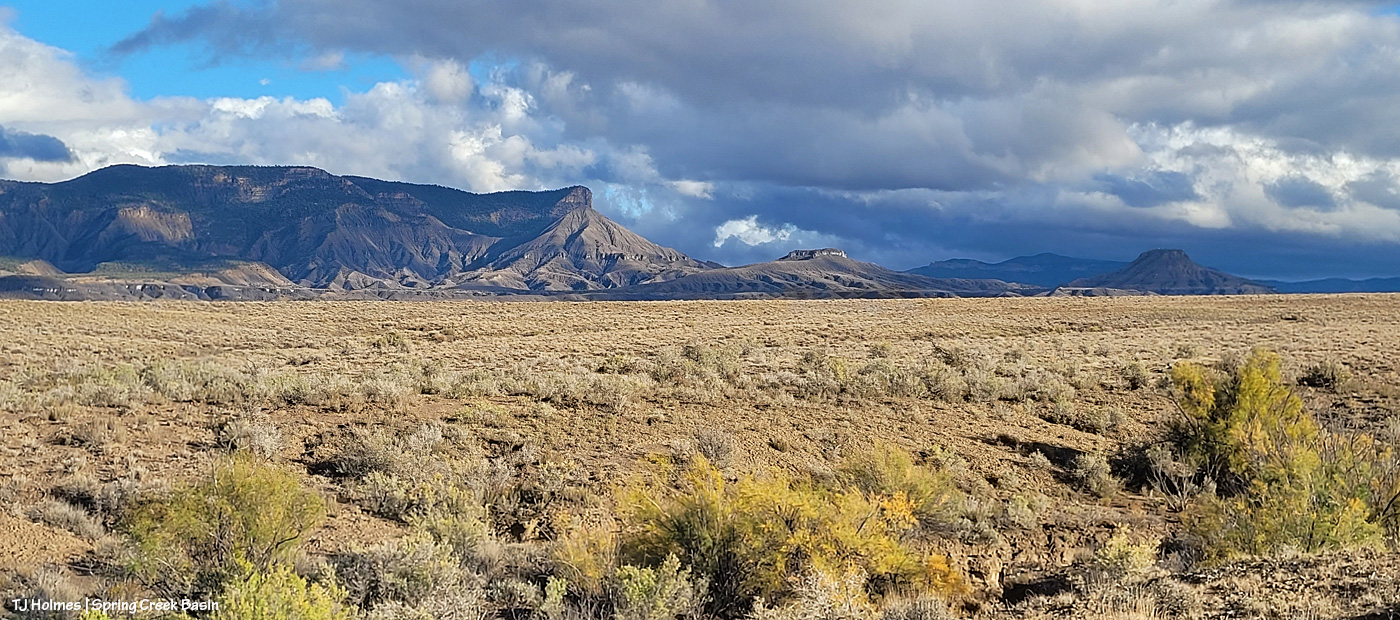
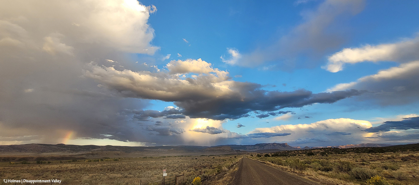
Days before the end of the shutdown, toward the end of third rifle season, when I was feeling very tired and hard done by at the sheer volume of humanity in a usually very quiet, very peaceful place, one of our law-enforcement rangers, Matt Abraham, came into Disappointment Valley to check on Spring Creek Basin. Um, wow! But that’s who these guys are and have been since I started volunteering 18 years ago (I’ve known at least five).
The day (?) the shutdown ended, herd manager Anton Rambur was out in Disappointment Valley to check on things. The muddy road prevented him from accessing Spring Creek Basin, but that this was one of his priorities at his return to work … ???!!! He wanted to know what was happening and what I needed.
Later that afternoon, I got a call from the other range specialist, Ryan Schroeder, asking – again – what HE could do for ME and the MUSTANGS/BASIN.
Upon returning to the computer, I had an email from range tech Laura Heaton asking what SHE could do for us!
Like, um, I don’t even have words to express my crazy-level appreciation and gratitude for these excellent human beings!
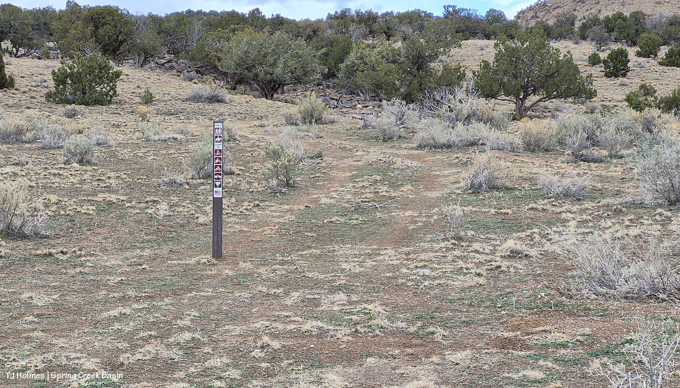
One of my mentions to all three of them was that it would be great to have (more) signs to deter the illegal route-making in the basin – as reader Sue calls them, “rogue roads.” I had one very particular place in mind (and have for the two years people have been driving around a particular washout … only to get stymied within half a mile by a washout they CAN’T cross …). …
The following day, I had a message from BLM park ranger Jon Whitehead asking for details about what signs we need! And Wednesday, he and Ryan brought promised signs and stickers to Spring Creek Basin to erect in areas to hopefully stop already-done resource damage and continue to prevent it in places where the signs, with their sun-faded stickers, have worked for nearly or more than 18 years.
Please follow along in pix:

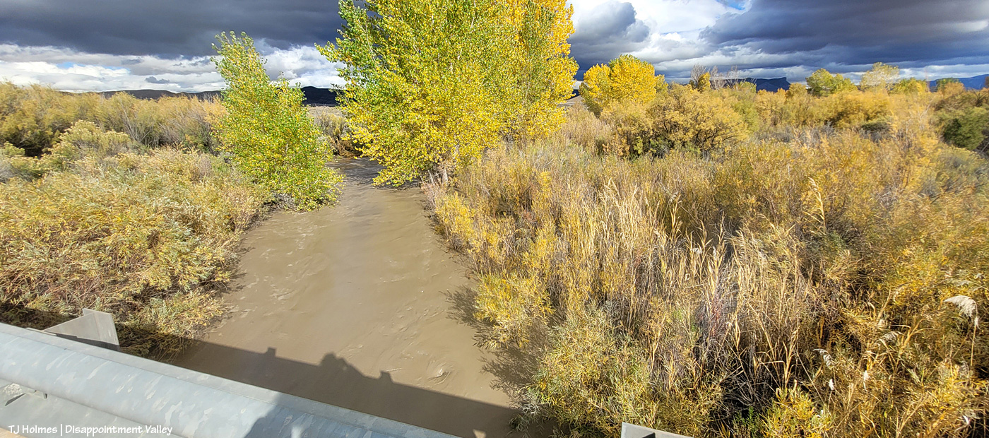
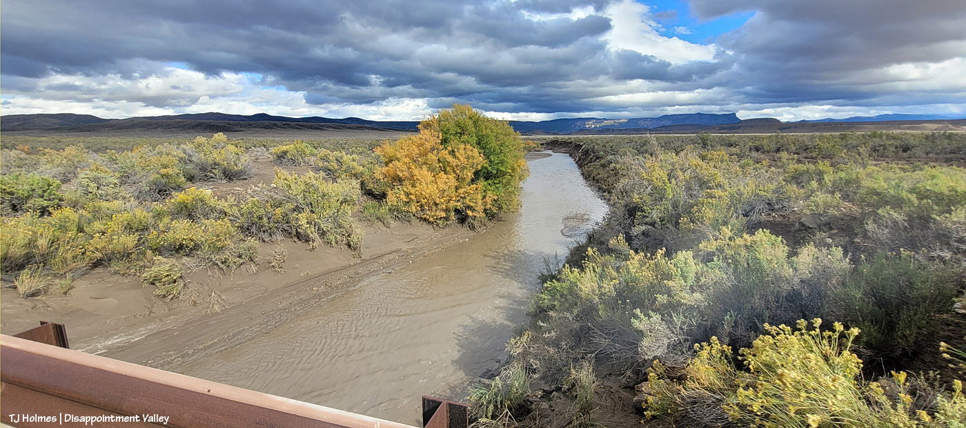
We have to start at the start: That’s Jon driving and Ryan riding shotgun (unfortunately, both Anton and Laura had duties elsewhere that day) at Road 19Q (behind them – and look! it’s being graded! thanks, Denny from San Miguel County!) and Road K20E to Spring Creek Basin. (Also note the water at right; that’s from Sunday’s rain.) Safety first!
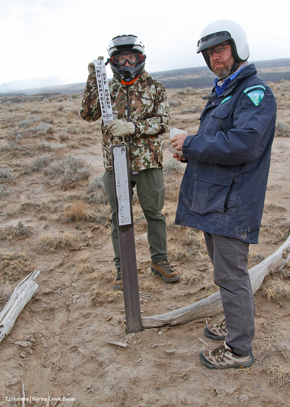
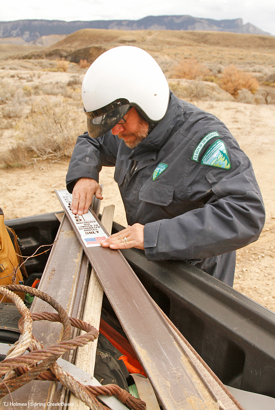
The *serious* BLM faces as they’re about to prep an existing carsonite sign for a new sticker. …

They couldn’t maintain those stoic faces for more than a couple of seconds. 🙂 We shouldn’t have so much fun “working” … should we?? 😉 Note the snow over the Glade in the background! We got a drizzle later, but we agreed that was likely snow at higher elevation.
Wonder what “carsonite” is? Apparently, it’s a brand, which means that I should be capitalizing it, but I think I’m going to leave it because we refer to it somewhat generically. It’s like fiberglass, and as Jon will tell you, don’t (try not to) touch it with your bare hands/fingers.

And on goes the new sticker over the old, faded one!
This is a place on a curve in the road, and the edge of this level of ground is less than 50 yards away. … But it had been just too tempting for people to DRIVE over there to look over the edge as opposed to leaving their vehicles or buggies at the road, getting off their butts and WALKING over to look over the edge. So that’s why we had placed the sign there years ago – and why I’d “reinforced” the message with the old branches you see on the ground. There are any number of places in the basin where I have seen tire tracks that lead from the road to the edge of a ridge or place where the ground falls off, including this last driving (aka “hunting”) season. It makes me craaaaaaaaaaaaaazy.

No less important in terms of the sign stickers and their meanings: the American flag. These are America’s public lands! Respect them, no matter how you use them!

On to our next location, a reminder to not handle these signs with bare hands: splinters! This is the location of an old “Y,” driven in by people too lazy to use the actual road (up the hill) to get to the main road, which comes out not even 75 yards away. Interestingly, this is the site of one of my very first volunteer projects for BLM in Spring Creek Basin; shout out to Kathe Hayes, retired long-time volunteer coordinator for San Juan Mountains Association, who spent countless hours shepherding excellent projects in the basin (including the much-loved alternative spring break program with University of Missouri students). You might have heard that Colorado gets 300 days of sunshine every year. In Disappointment Valley, we take pride in the fact that we likely get about *600* days a year of sunshine (har har). Remember the faded information board that led to the installation (with our most-excellent BLM folks!) of the new kiosk earlier this year? Yeah. You laugh, but we know how much sunshine we get! These signs were due for updated and easier-to-read stickers.
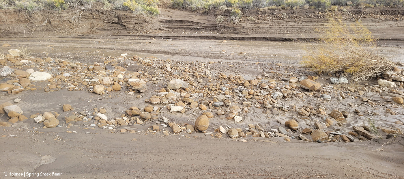
This image really illustrates why it’s so important to protect the resources of Spring Creek Basin, specifically, and many of the West’s drought-fragile landscapes in general: We closed this route 17-18 years ago? It STILL bears the traces of the drivers who ignored that fragility and made a new route because they were too lazy to use the established road – a “designated route,” as BLM calls them.
Every illegal “Y” has its other end, so here are the guys adhering a new sticker to the carsonite sign at the top of the hill. The actual road is right behind Jon.
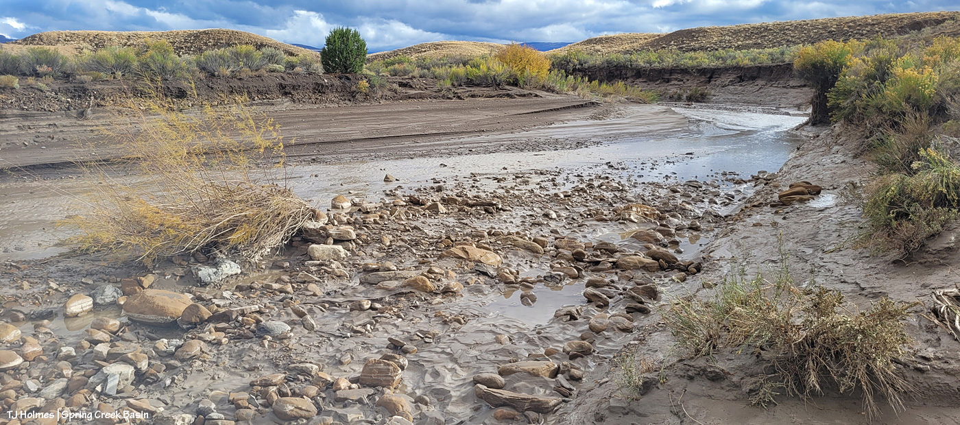
On to our next location! This was the first installation of the day of a new sign, and we put it at the dugout intersection, which marks the start (or end, or both!) of “the loop,” which is no longer completable (is that a word?!) by vehicle or even most UTVs/ATVs because of washouts (which was the main impetus behind the day and the signs, as you’ll see later). Note the rusty old cable; a bonus to attaching the new stickers to the signs at either end of the old “Y” was that I spotted both old wire clumps and this length of old cable, starting to erode out of the soil, where it had been for … decades? At least nearly 18 years.
This sign, at an intersection, reminds travelers to stay on designated routes. Jon lamented this need, as there are no fewer than THREE big signs from just south of the highway to just before to just inside Spring Creek Basin’s western boundary (and main entrance) that warn that exact message (along with similar signs all along Disappointment Road). … I think of them as just another pretty-please reminder.

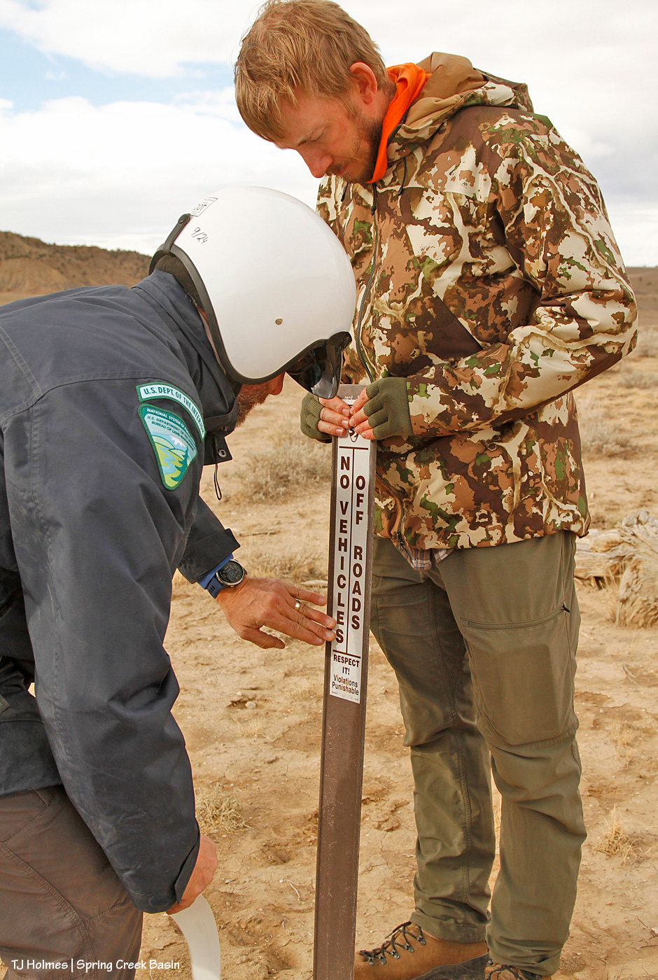
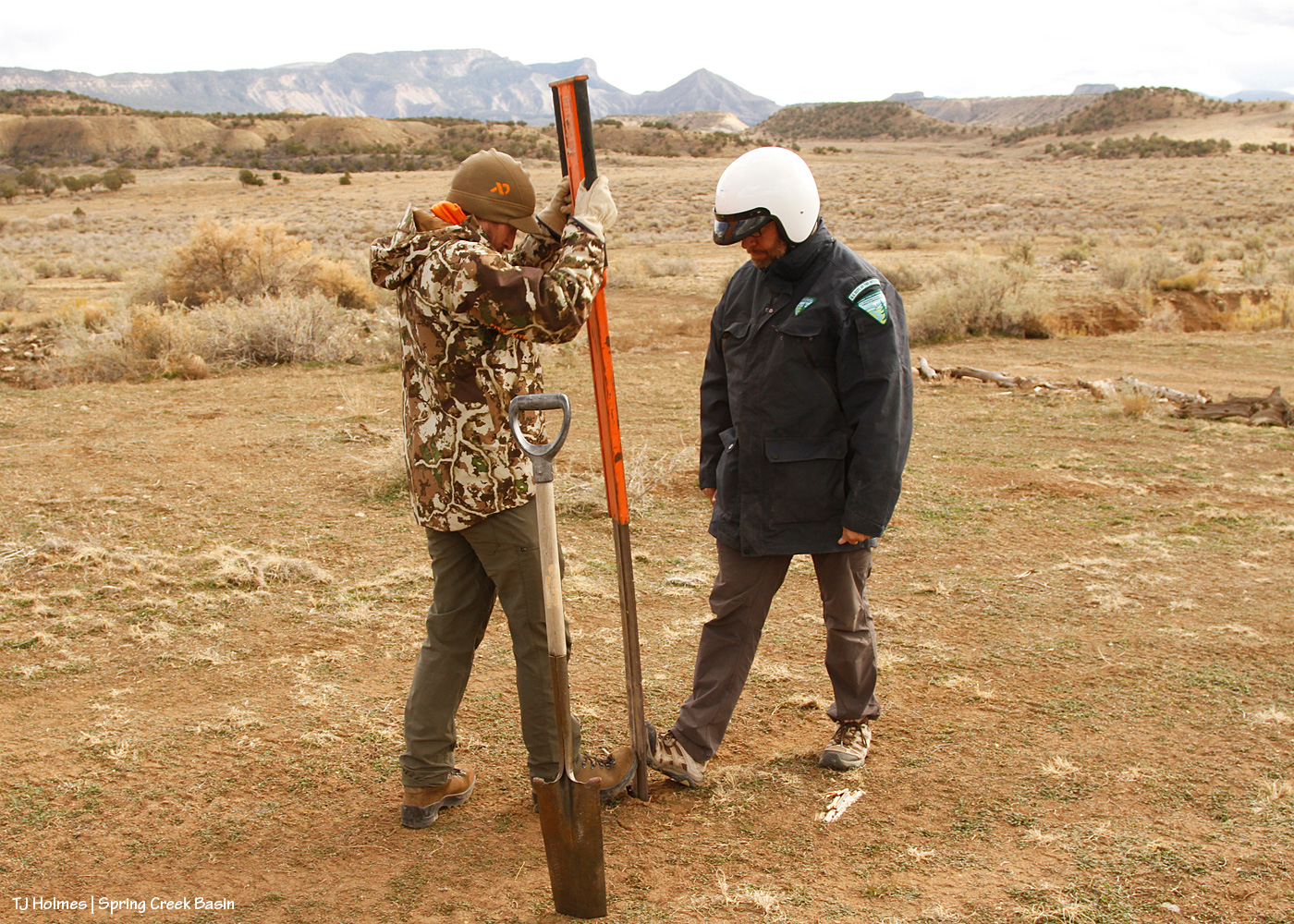
Wonder how the heck one of those narrow, flimsy signs is installed, aka pounded into the ground?
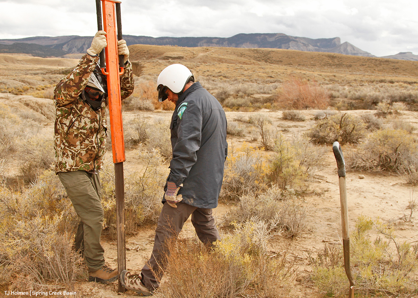
It requires a specialized “pounder.” First, you need the “tile spade” pictured at right, to create a “slit” in the ground and test for out-of-sight rocks (and with our recent rain, the damp ground was very accommodating!) to ensure you *don’t* hit rock. As Jon said, if you pound that flimsy, floppy carsonite sign and it hits rock, the whole thing is wrecked. Then the pounder does the rest. I’ve wielded my fair (or more than fair?!) share of T-post pounders, where you have to hold the post steady or have an unflinching friend do it so it doesn’t twist. Note the men’s toe-to-toe technique on either side of the base of the carsonite; that was to prevent it buckling as it entered the ground.
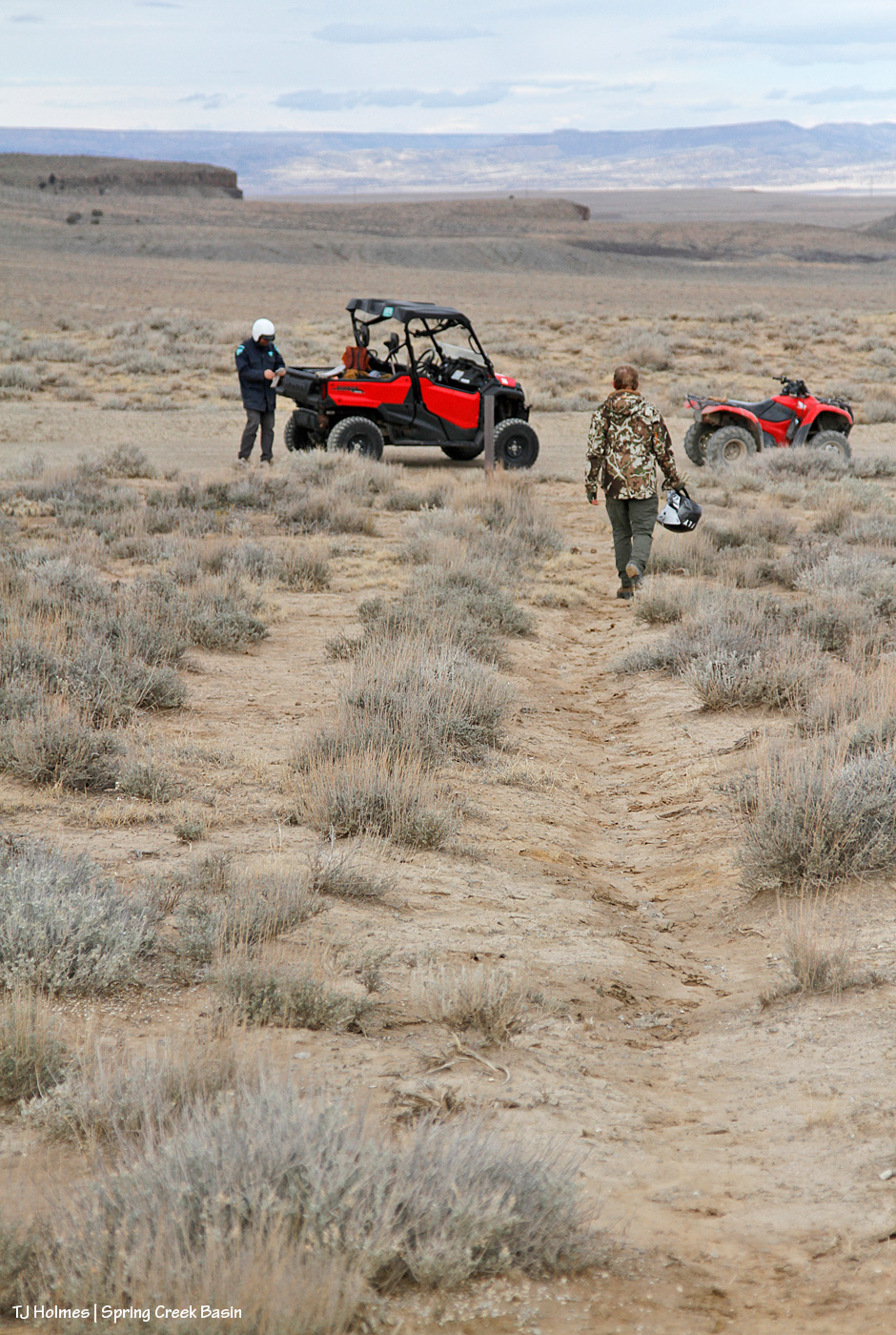
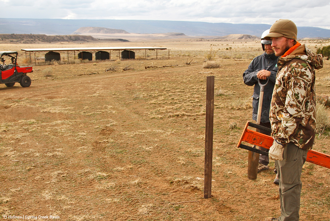
Now we’re getting to the new water catchments and where I really, really wanted the signs. This one, pictured, was the second one built by Mike Jensen, Garth Nelson, Daniel Chavez and me (the first one included Jim Cisco), in 2022. People really can’t help themselves (!) from driving where they shouldn’t, including over not only fragile ground that doesn’t recover quickly (see above) but also the very limited vegetation on which the mustangs AND deer AND elk AND pronghorn graze and browse. You can see by the wood scattered around that I’ve tried to block it using natural means; people just drive across the ground from somewhere else (at least three other places that I’ve tried to block at this location). And not only directly to the water trough and tanks but to the pond (which, thankfully, is holding water!). … Like, WHY??? I get the curiosity; but have some respect and WALK.

And now we’ve reached the last stop, and, to/for me, the most important.
The 2021 water catchment is behind Jon, not 50 yards away. See the wood on the ground behind him? Over the last two years, I’ve dragged a number of old branches and trunks down from the trees up the hill to line the edge of the road to prevent lookie-loos from lazily driving down to and around the water trough, downhill from the roofed catchment tanks. It has mostly worked, though I’ve had to add more as people, too lazy to even move the blocks, find a “hole” and think that’s OK to drive past/through/around. (And we still found old tracks that indicate people are still doing it. Sigh.)
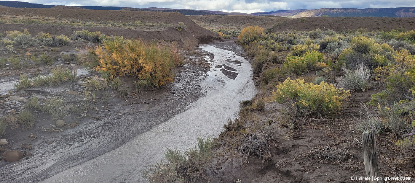
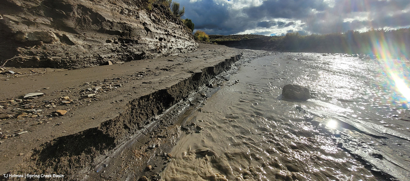
But in 2024, when we had big, flooding rains in early summer, the road, directly ahead of the UTV in the pic, washed out, leaving a gaping chasm where the road had been (you can see the line of it in the pic). That, effectively, ended the road right there. … Until hunting season, which was wet last year, and people repeatedly drove around the washout to continue, driving-in a rogue and illegal route and damaging resources – again, the vegetation upon which the wildlife depend. I literally cried. And put up more blockade branches and trunks on that side … which people continued to ignore and drove either over or past.
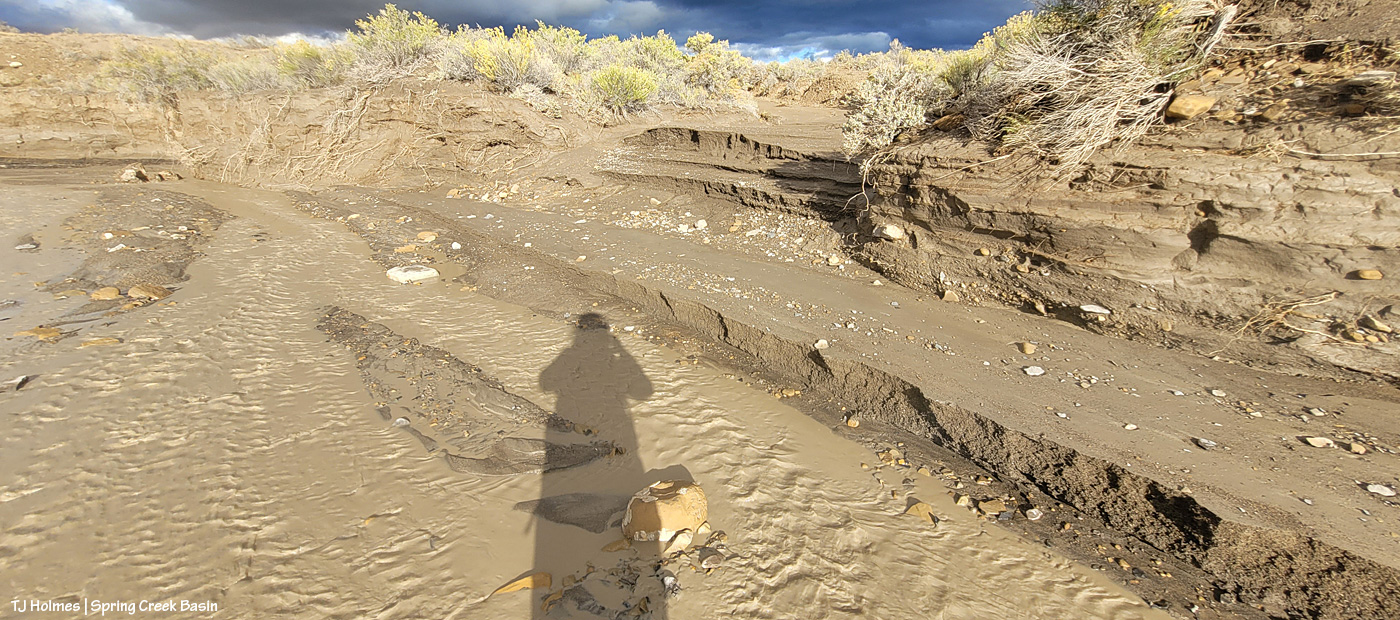
When we arrived at the location, which I hadn’t visited at all this past hunting season as my heart just couldn’t take it, sure enough, people had left my last blockade intact … and just created yet another new route to get around the washout – which is even worse now and even washed away their “shorter shortcut” (which I’d also attempted repeatedly to block).
But I didn’t cry at the destruction this time because I had guys with me who were about to justify my upsettedness at the lazy-ness of man (to be fair, most of them have been men), and we were about to proclaim in more certain terms than dead-pinon/juniper trunks/branches and big rocks that YOU SHALL NOT PASS! (I do love a fellow LOTR fan! Thanks, Ryan!)
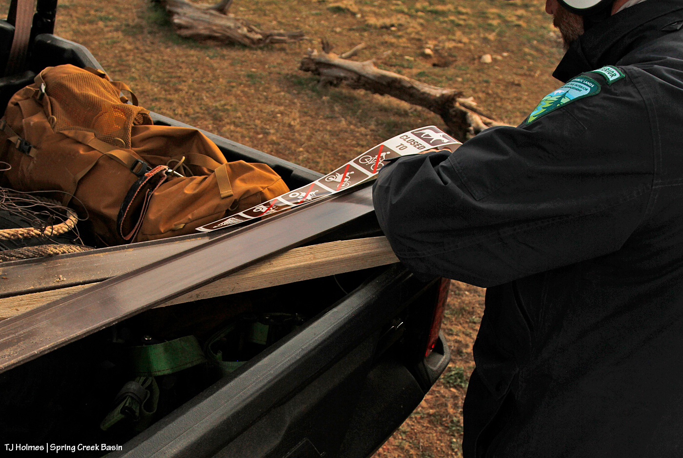
The sticker going on the carsonite for the sign you saw in yesterday’s post.
Along with:
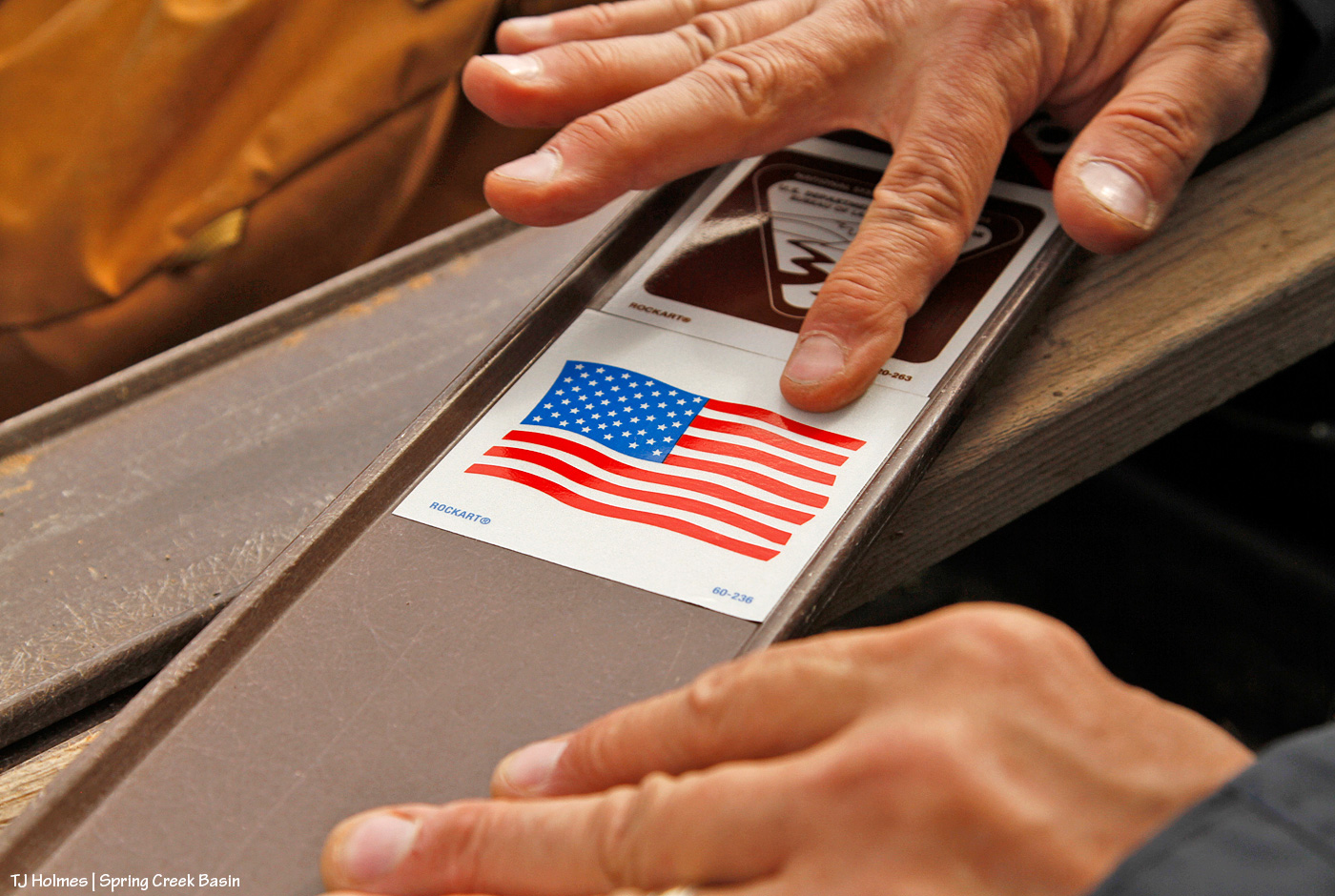
I really kinda love this pic. Those are hands that belong to someone who cares deeply about our public lands, their value and their sacredness. And though they’re the hands of only one, *I* know, and I tell you with all sincerity, that hands just like that belong to every person at Tres Rios Field Office (at least).

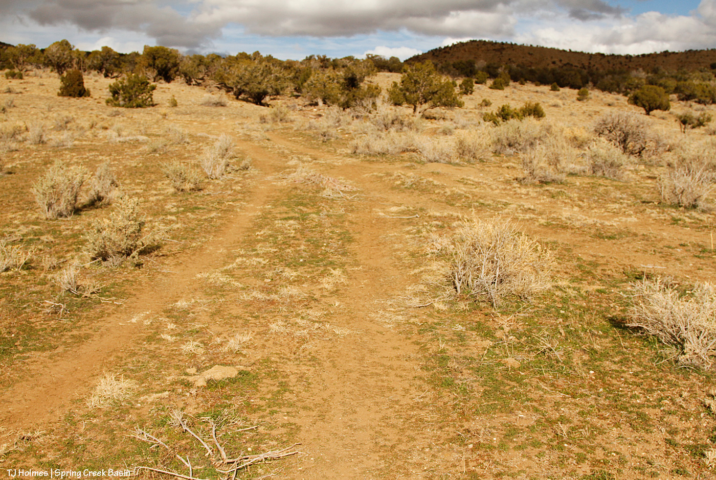
Sign inserted into pounder; check. Note the tire marks Jon and Ryan are standing on. The road is immediately behind Jon.
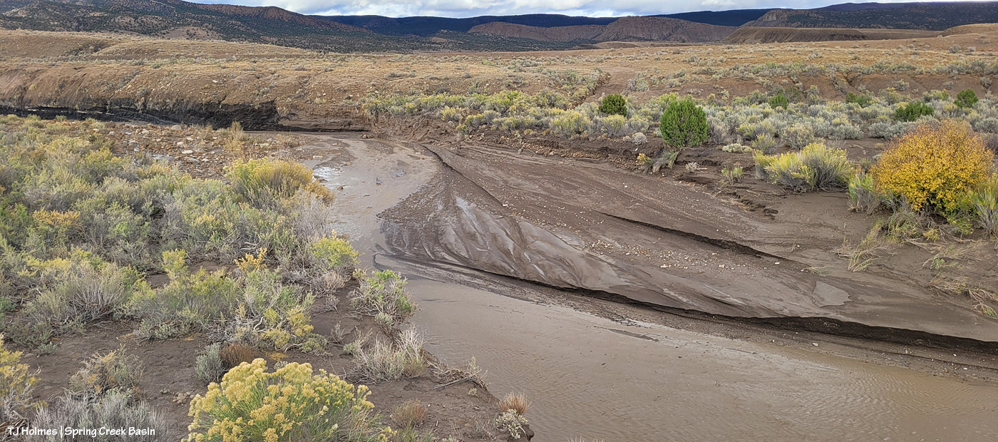
Pounding commencing; check. At right, you can see my blockade – untouched because the drivers just shifted to driving where Jon and Ryan are installing the sign – and above that, the washout. It starts at the left (literally) and runs right/south/downhill to join a bigger arroyo/drainage downhill of the catchment.
Now looking back to the road (on which the UTV is parked), my blockade along the road to try to protect the water catchment. The silver trough is just visible to the left of the leftmost tank. Yes, it’s THAT close to the road. NO need to drive down there when it’s so easily walkable to get a better/closer look! The tire tracks on the rogue route are really distinct in this image.
For a better look at the rogue route and the resource damage caused (after only two years):
The track at right is where people first started driving off the road to get around the washout. Directly ahead is where they shifted so as to ignore the blockade that plainly (!?) was meant to deter people from driving illegally over our precious and drought-limited grasses and other vegetation (cacti and four-wing saltbush are among the most destroyed).

From where they crossed the “head” of the washout, over bedrock, to return to the actual road, which is semi-visible along where this illegal route makes its last curve.
Why ELSE is this rogue route so infuriating (as if destruction of resources and the vegetation the mustangs and other wildlife depend on weren’t enough)? Within a short distance (less than a quarter-mile?) is another, bigger drainage and semi-washout (that has been hunter-filled with rocks to make it crossable). But just another quarter-or-less-mile past THAT is a washout that isn’t crossable except by walking, riding a bike or a horse or a motorbike or perhaps jigging a relatively small ATV around – and that was the last time I saw it. With the more recent rains, it’s possible that even jigging isn’t possible anymore. Either way, it’s a risky or not-possible-to-cross washout, so why destroy resources just to continue driving another half-mile??? ARGH! It has made me craaaaaaaaaaaaazy!
While out in wildcat valley a few days ago, during third rifle season, I sat with a band and literally watched a truck drive up to the washout, see the washout, back up and drive around the washout to continue on … to the washout they couldn’t pass. … Then return. Following the tracks made by others. I know these people are *just* trying to access public lands, and I am not inherently anti-hunting (though I am very against the *driving* culture that seems to be “the way to do it” out here). I believe *respect* is key, and animals are trying to survive on this fragile landscape. Please, please respect the land AND the wildlife!
I am keen to say that I’ve noticed that other signs such as those we put up Wednesday have been very much honored in the basin regarding non-designated and please-don’t-drive-on routes. I hope these signs also are honored, and I hope it indicates to visitors that we have land managers here who give a damn about the land and the herd and the way our natural resources are treated.
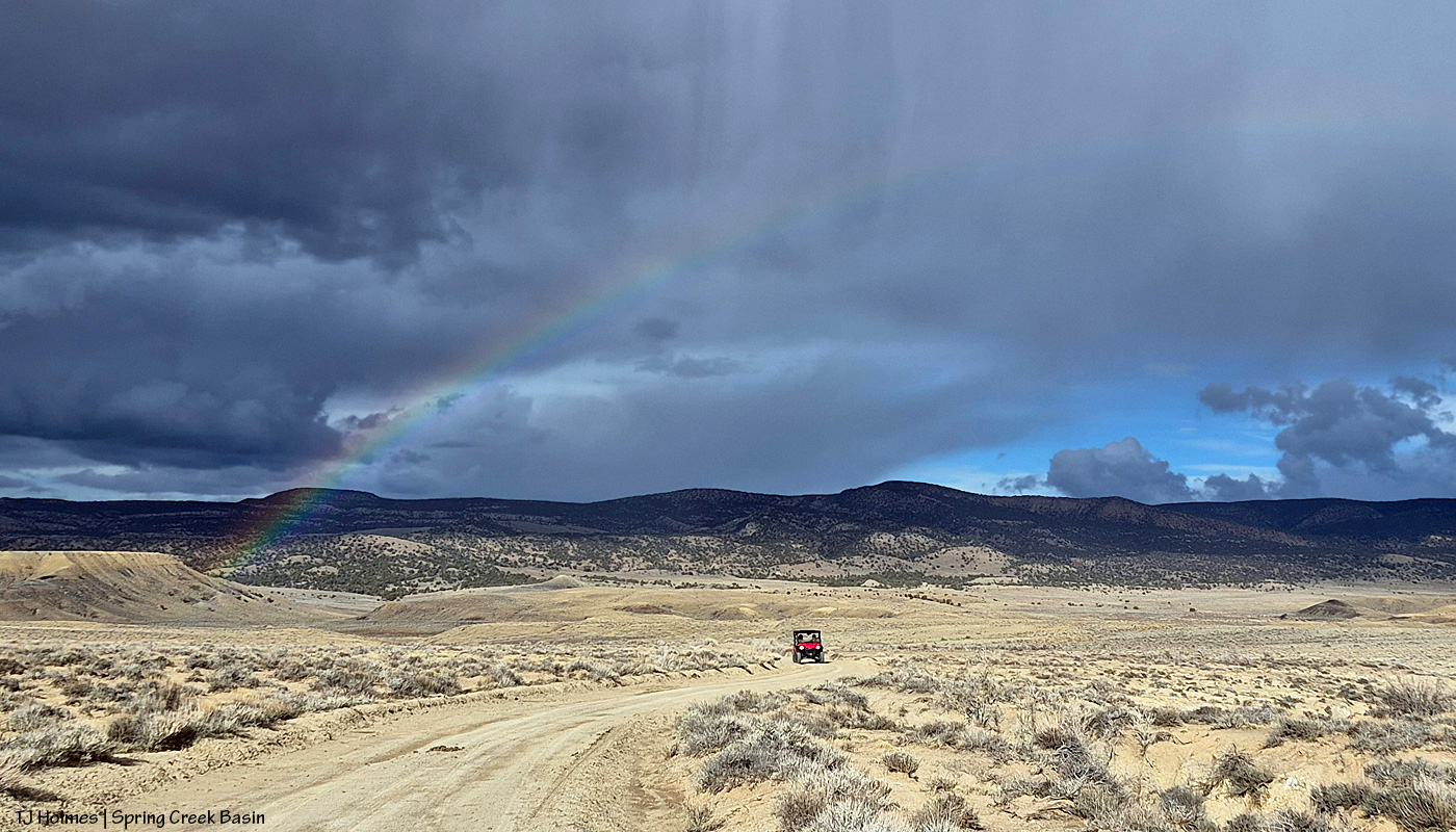
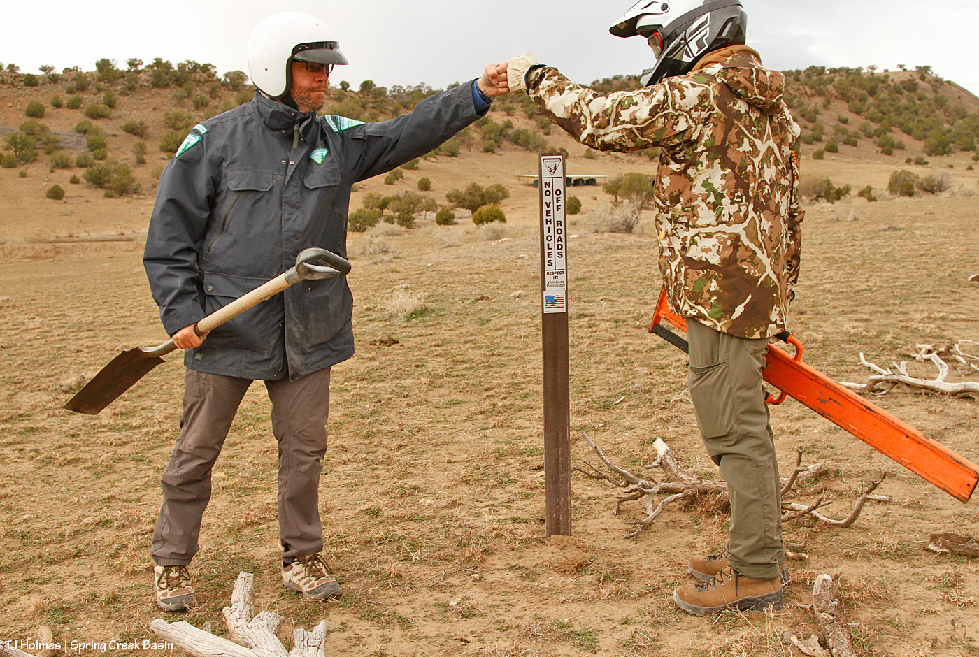
No joke: THIS happened over Jon and Ryan as we were leaving. 🙂 AND I found an old horseshoe while we were installing another sign (I didn’t think to take a pic, but it was a much better find than the rusty old wire and rusty old cable). If those aren’t *signs* that Mother Nature herself is happy with our work, I sure don’t know what are.
Absolute heartfelt gratitude to all who made this happen, including and hugely Jon and Ryan! This was a very long post about seemingly very little things, but those little signs have the potential to signal big impacts for the preservation of Spring Creek Basin and its vegetation resources for generations to come of mustangs (as well as deer, elk and pronghorns, and no, I do NOT apologize for hammering this point!), not to mention all those living their best lives right now. 🙂
Thank you, thank you, THANK YOU!!!