
It’s nice to be the band stallion when you have a lieutenant to fight your battles for you. 🙂
It’s nice to be the band stallion when you have a lieutenant to fight your battles for you. 🙂

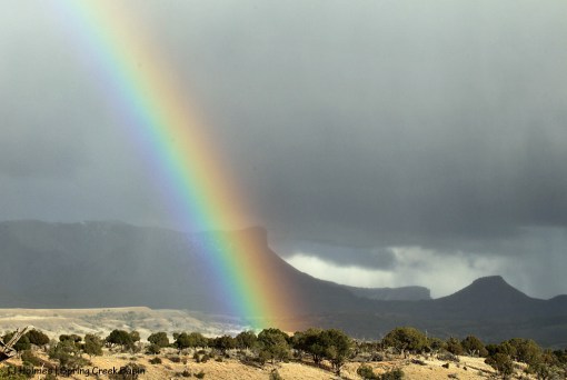
Brumley Point looks like some kind of dormant volcano in this stormy image of spotted girls Spirit and Puzzle.
We’re so grateful for the rain we’ve gotten lately in Southwest Colorado, and particularly in Spring Creek Basin and greater Disappointment Valley. This is the fuel our grasses need to feed our wildlife.
Though they’re shedding, the horses still have shaggy coats. Nature knows what it knows. We watch it unfold with great anticipation.
It did. 🙂 Rain, that is.
Love, love, love, LOVE the moisture!
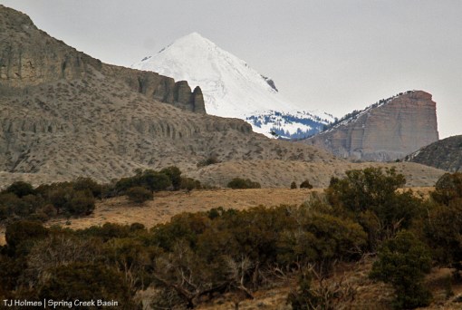
Did I mention that we got rain? Upper Disappointment Valley got some white stuff. 🙂 That’s McKenna Peak in the foreground.
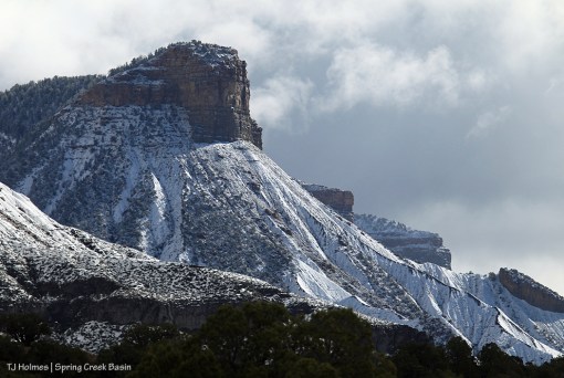
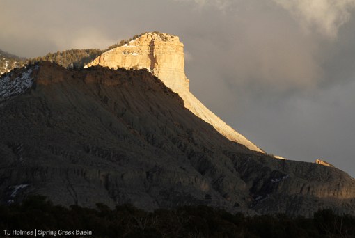
Iconic and locally relevant and important-to-us Temple Butte.

Brumley Point.

A different perspective showing Brumley Point in the foreground and Temple Butte in the background. Brumley Point is mostly within Spring Creek Basin Herd Management Area. Temple Butte is just outside the basin’s boundary.

Temple Butte and Brumley Point, along with McKenna Peak, are in McKenna Peak Wilderness Study Area, which overlaps the eastern, southeastern and southern portions of Spring Creek Basin Herd Management Area.
All three features are prominent from just about anywhere in Spring Creek Basin. The elder Mr. Brumley was a prominent member of the local community, and was a rancher and timber man; Pati and David Temple were and are prominently involved with advocating for Spring Creek Basin’s mustangs. I haven’t been able to learn anything about McKenna, but with a peak and a wilderness study area named after him, he (?) must also have made significant contributions to the region.
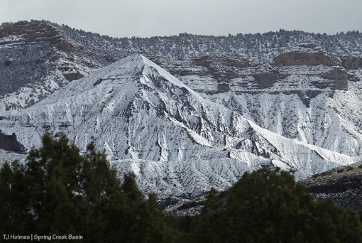
After the unseasonably warm, dry weather we’ve been having, it seems wild to see snow on the ridges, but the ground and vegetation needs it badly, and we’re immensely glad for the snow and the rain!
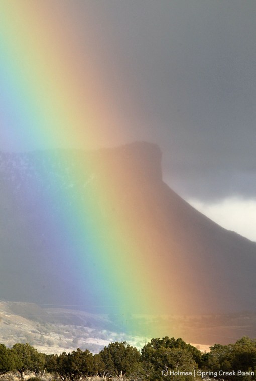
Not many words needed for these images, either. That’s a rainbow right over Temple Butte, guardian of Spring Creek Basin’s southeastern boundary … but as prominent as it is, ALL of Spring Creek Basin.
It has been four years (and a few weeks) since Pati Temple passed away. We miss her every day. And we feel her with us every single day.

Our famous Colorado sunshine has been a little lacking this winter, so we enjoy every bit of it (well, we do that anyway, but it seems particularly valuable this year). 🙂

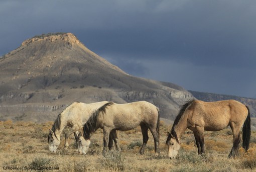
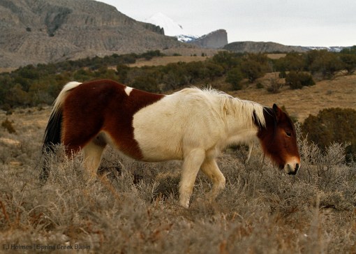
Aren’t they handsome? That’s Brumley Point at back right.
Snowmelt from Lone Cone and its drainages provides the lion’s share of water that flows into Disappointment Creek (to the Dolores River to the Colorado). That water isn’t accessible to Spring Creek Basin’s mustangs, whose herd management area is fenced away from the creek (mostly on the other side of Disappointment Road). But it gives Disappointment Valley its name, and Spring Creek Basin occupies a small, beautiful part of Disappointment Valley.
Lone Cone isn’t visible from most of Spring Creek Basin, but you can see it here, buried in snow and showing a promising water run this year for Disappointment Creek, which benefits many other species of wildlife in the area.
Meanwhile, as our snow melts at these lower elevations, the basin’s arroyos are trickling with water for mustangs. … And some of that water will find its way to Disappointment Creek to continue the flow.
Wanna see Lone Cone a little closer?
Note: That’s not Temple Butte at right. 🙂 Temple Butte is out of the frame – and much closer – to the left. Visible at left is the southeastern flank of Brumley Point (shout out to Mary Ann and Dewayne F., who were in Disappointment Valley last weekend for a “therapy drive”! Brumley Point is named after Mary Ann’s family).
Fuzzy ol’ Ty helps show off that promontory in the background.
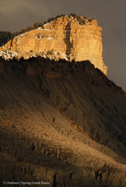
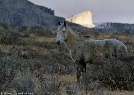
Temple Butte gleams golden in the last light of a “trying to snow” day while Brumley Peak has just a spot of light on its serrated flank.
Brumley Point is mostly within Spring Creek Basin Herd Management Area. The southeastern boundary fence climbs a lower ridge to the first wall of rimrock. Temple Butte is outside Spring Creek Basin but visible from almost anywhere in the basin (and far beyond). They’re both within McKenna Peak Wilderness Study Area, which also covers a fair bit of the southern, southeastern and eastern parts of the basin.
The mustangs showed up just a bit after I took these photos from the road. … They weren’t quite as cooperative in the last light of day as the steadfast mesas and buttes. 🙂
And the trails I ride are new
Even though I’ve made the circle many times before
For they change with every season
And with every shift of light
From the summit where the clouds fall to the sweet, valley floor.
~ from “The Circle” by Dave Stamey
