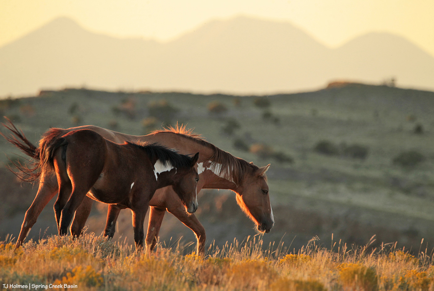
Lady Houdini is showing her age more these days, and she still warily avoids the photographer, but she seems to be doing well with young Flash. I was so happy to catch sight of the pair this gorgeous – and very cold! – autumn day at the end of October.
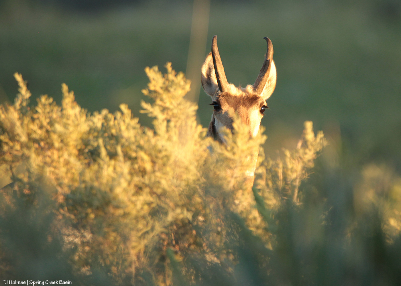
A little Spring Creek Basin potpourri for today’s post. The inspiration was this little guy/gal:
S/he was little bitty, and my first thought was the usual “chipmunk,” maybe “ground squirrel.” There were a couple of little holes, the nearest right behind the critter. While researching just what s/he IS for this blog post, I realized that I don’t give these ubiquitous little busybodies much thought, though I see them all the time. I looked up the above terms and compared those pix with my pix … nope, definitely not either. Then I spotted a pic of an “antelope squirrel,” which fit the bill. Who knew?! There are several regional kinds, and I don’t know which particular species this little one is, but s/he was awfully adorable and fairly curious about the giant (how must we seem to such tiny creatures?) with the clicking box.
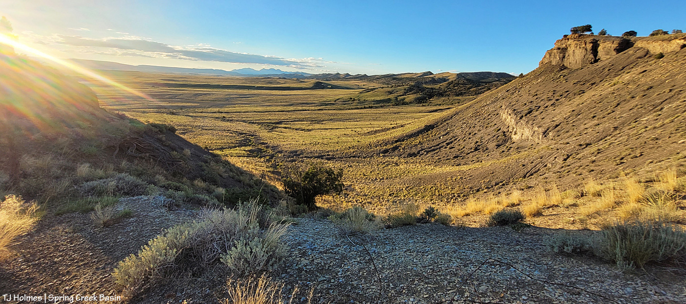
From the very top of the western boundary of Spring Creek Basin – the rimrocks you see as you approach the basin’s western boundary *from* the west – this is a view looking to the northwest out over Disappointment Valley:
Utah’s La Sal Mountains are those peaks on the horizon. This was taken right from the fence line at a little saddle. In most places, the sheer cliffs of the band of rimrocks form a natural boundary for the basin. In other places, where the horses could wander right on over, there’s fencing to keep them home and safe. In the very foreground, you can see some old wire from a previous fence; I’m standing right at the current fence (not seen). Between Spring Creek canyon (down to my left) – which is the drainage outflow of Spring Creek Basin – and what I call the northwest valley (simply the farthest little “valley” in the northwestern part of the basin, where our newest water catchment is located; up to my right), there are a series of what I call “bowls” – little “micro-valleys” between hills/ridges, for lack of a better term. The above pic was taken from the top of one of those bowls.
Now facing the exact opposite direction, looking back into Spring Creek Basin, a little lower, near where I made my little friend:
This wonderful sculpture of an old juniper just begged to be used as a frame for this view of the basin, looking southeast. Note the grey mustang at lower right; she was grazing with her band and two others just below the height of the bowl. Visible across the background are landmarks often to irregularly featured in other images posted on the blog: Temple Butte above McKenna Peak (framed right through the upper part of the old tree), submarine ridge, Brumley Point (just right of the farthest top-right branch), Round Top and Flat Top. The snaking shadow-line at mid-right, above the mustang, is a low ridge along the south bank of Spring Creek. The canyon is downstream, farther right and out of this frame.
Would you like to see a bit closer look?
Of course! A marvelous view and a marvelous old grandfather (mother?) tree – what a view it has (imagine!!)!
Have I mentioned lately the fantabulous grass in the basin? Those ponies are eating like bears in hyperphagia (I’m only partially kidding). It’s pretty glorious – and incredibly satisfying to just hang out listening to the horses snip and crop and chew.
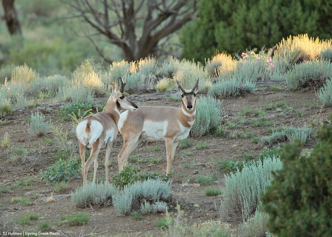
I’d been delighted by the ponies, charmed by the antelope squirrel, filled with gratitude by the bounty of grass (native grama, galleta, sand dropseed and alkali sacaton, if you want to know specifics (links may or may not be to the *specific* types that we have)), but the evening had more thrills in store. I’d noticed that the attention of a couple of horses was caught by something I couldn’t see, but as that happens quite a lot, and I was *focused* on framing the basin in the arms (branches) of the ancient juniper, it was a moment or three before another captivating face caught my eye:
One face but two somethings!
Now here’s a thing: Antelope squirrels may be called antelope squirrels (one wonders why?), but pronghorns are not actually antelope, despite the fact that they’re called antelope by most people. Kinda like the buffalo/bison thing. In any case, I didn’t know at the time about “antelope squirrels,” but I was thrilled to see these pronghorn buddies. I think they’re both young bucks, but females also have horns, which are smaller than the males’, and these weren’t super big. (I have seen females recently, with fawns.) Another interesting tidbit: Pronghorns aren’t hunted in most of Colorado. Despite being just about everywhere in states such as Wyoming (nickname: speed goats, which always tickles me), they’re not common in Colorado, especially this area of Colorado. We do have a fairly stable – and fairly small, 25-30ish animals? purely local observation – population in Disappointment Valley/Spring Creek Basin.
One …
… the other.
Thank goodness for long lenses and the quiet of inattention!
The curious stares lasted a few moments, then with a burst of speed too fast for this human to follow (with a camera …!), the boys put on a burst of their famous speed up the hill past a couple of unbothered mustangs (!).
Pronghorns could give humans lessons in sprints and interval training. As fast as they can hustle, they come to a walk or even stop just as quickly. All the better to check you out again, my dears. … Note the four o’clock blooming in the sunlight in the background. Most of the four o’clock plants/flowers are not currently blooming.
And they usually just as quickly lose interest in such slowsters as humans and mustangs. (Note the wonderfully healthy juniper trees branching over the buck and in the background. We’re losing a lot of trees to drought and teeny beetle-bugs.)
No trek above Spring Creek and the canyon would be complete without taking note of Spring Creek itself, which is trickling in places …
… and not a glimpse of water immediately downstream of the above pic. The creek makes a sharp bend to the left there and enters the canyon, just out of frame to the left.
We have an interesting phenomenon (is it a phenomenon when/where it’s normal?) here where water will run above ground (in the creek/arroyo bed), then disappear underground, then reappear (sometimes, in some places) above ground, in the creek/arroyo bed, downstream. With the geology and stone stratigraphy of Spring Creek canyon, there almost always are some little pools of water between the walls of the canyon itself. (A reminder: Spring Creek and its tributary arroyos drain Spring Creek Basin. That water then flows out of the basin, across part of lower Disappointment Valley and joins Disappointment Creek, which eventually empties into the spectacular Dolores River. Spring Creek is ephemeral; it runs only when we get a big (or sometimes not-even-so-big) rain event. This water is from the big rain(s) we got about a week ago, making its way downstream.)
And I’ll leave you all with the glorious panorama that is Spring Creek Basin, from the northwest looking east/southeast/south:
Spring Creek Basin from high atop the northwestern hills/western boundary/rimrocks of Spring Creek Basin Herd Management Area. Visible: Valentine Mesa, Temple Butte, McKenna Peak, submarine ridge, Brumley Point, Round Top, Flat Top, Filly Peak and, in the center, Spring Creek. (Click on the pic to bring it up in a separate window and enjoy it the better.)
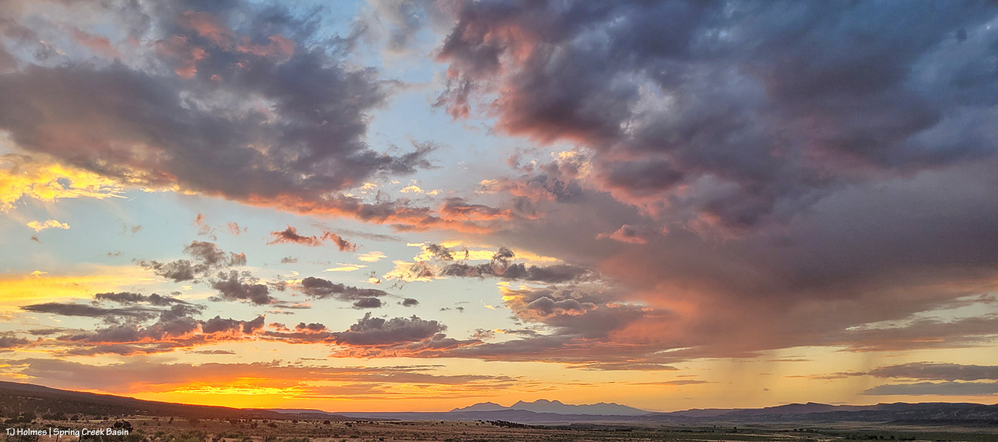
For the last very long – days and days and days and weeks and days and weeks – we’ve had solid blue skies. Every. Single. Day.
We finally got some clouds. And when Disappointment Valley does clouds, boy, does it do spectacular clouds.
In order of appearance from around 5:30 or close to 6 p.m. to after sunset:
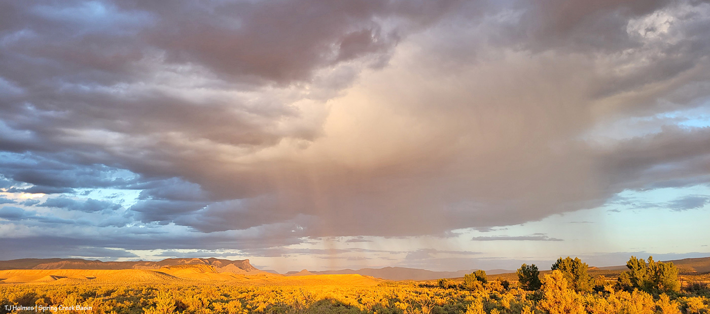
Looking west.
Mustangs grazing and napping under the relief of clouds.
Silver linings.
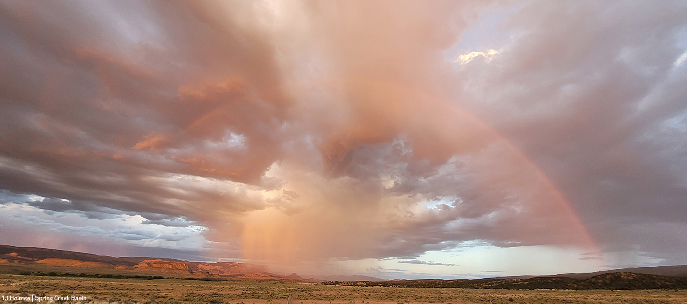
Do you see the rainbow?
Rain – or at least virga – to the west.
More mustangs. More napping.
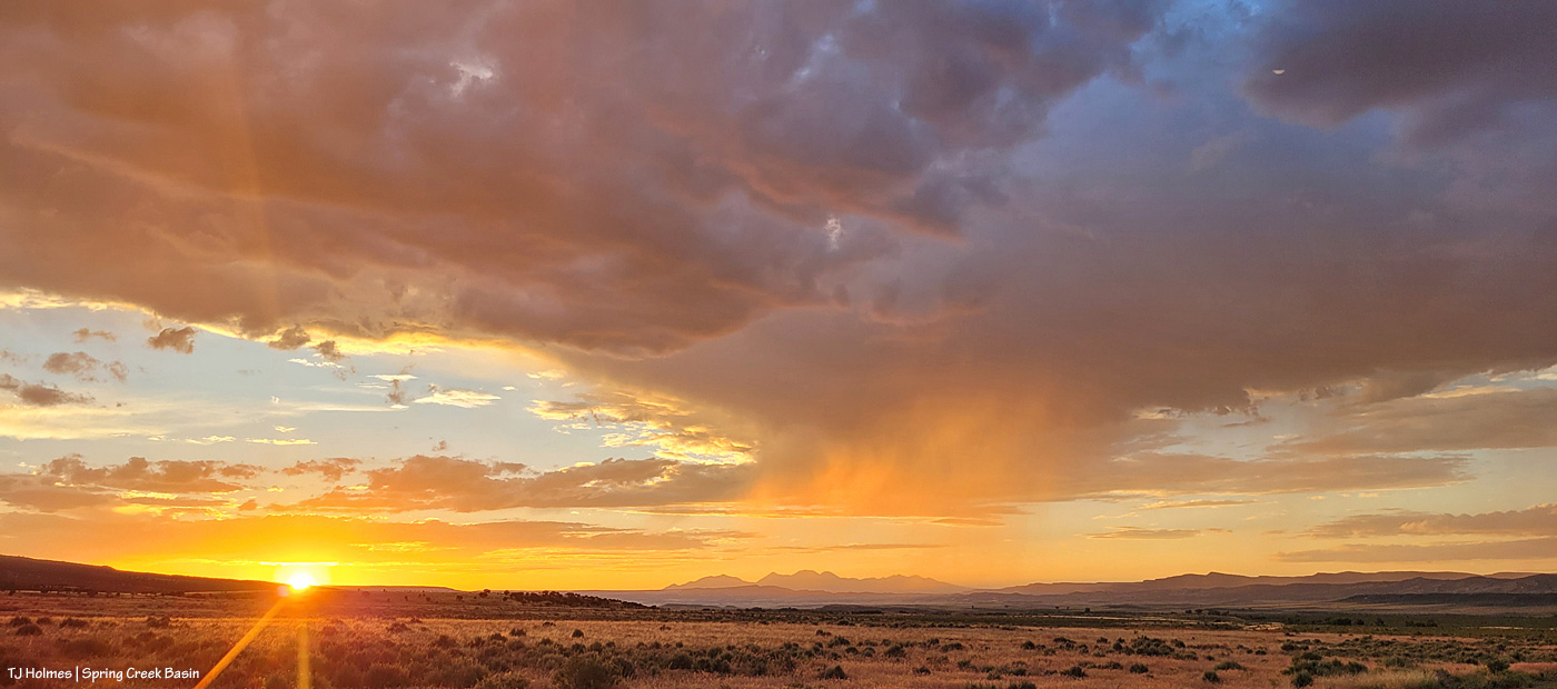
When I left the bands pictured above, I thought I might have a chance at any late surprise light with the bands pictured higher above. But they had moved quite a bit, and the clouds were heavy, and sunset was imminent. But as I left Spring Creek Basin, rain was drifting eastish along the southern ridges of Disappointment Valley. Then I dropped below the rimrocks (the basin’s western boundary), and holy rainbow! You’ll have to take my word for it that it was SUPER intense, and the photo above doesn’t do it justice.
By the time I got to the main road, that “surprise” light was glowing, and the rain had moved away from the southern ridges.
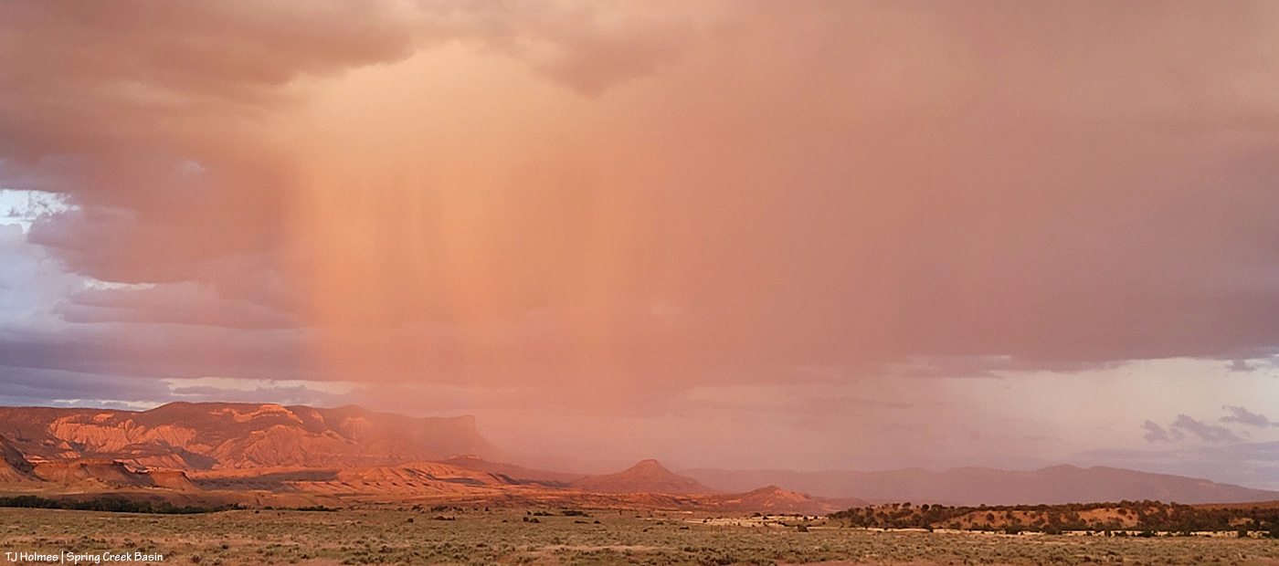
Meanwhile, to the west … this!
Bit closer view of the mountains.
Back to the southeastish, rain was actually falling over the southern/southeastern part of Spring Creek Basin.
And THIS happened. I’m not sure I’ve ever been so glad and grateful to have a cell phone that doubles as a very wide-angle camera.
We ended the day with some post-sunset magic.
And 0.01 inch of rain. 🙂 Enough to make part of the road … actually … WET!
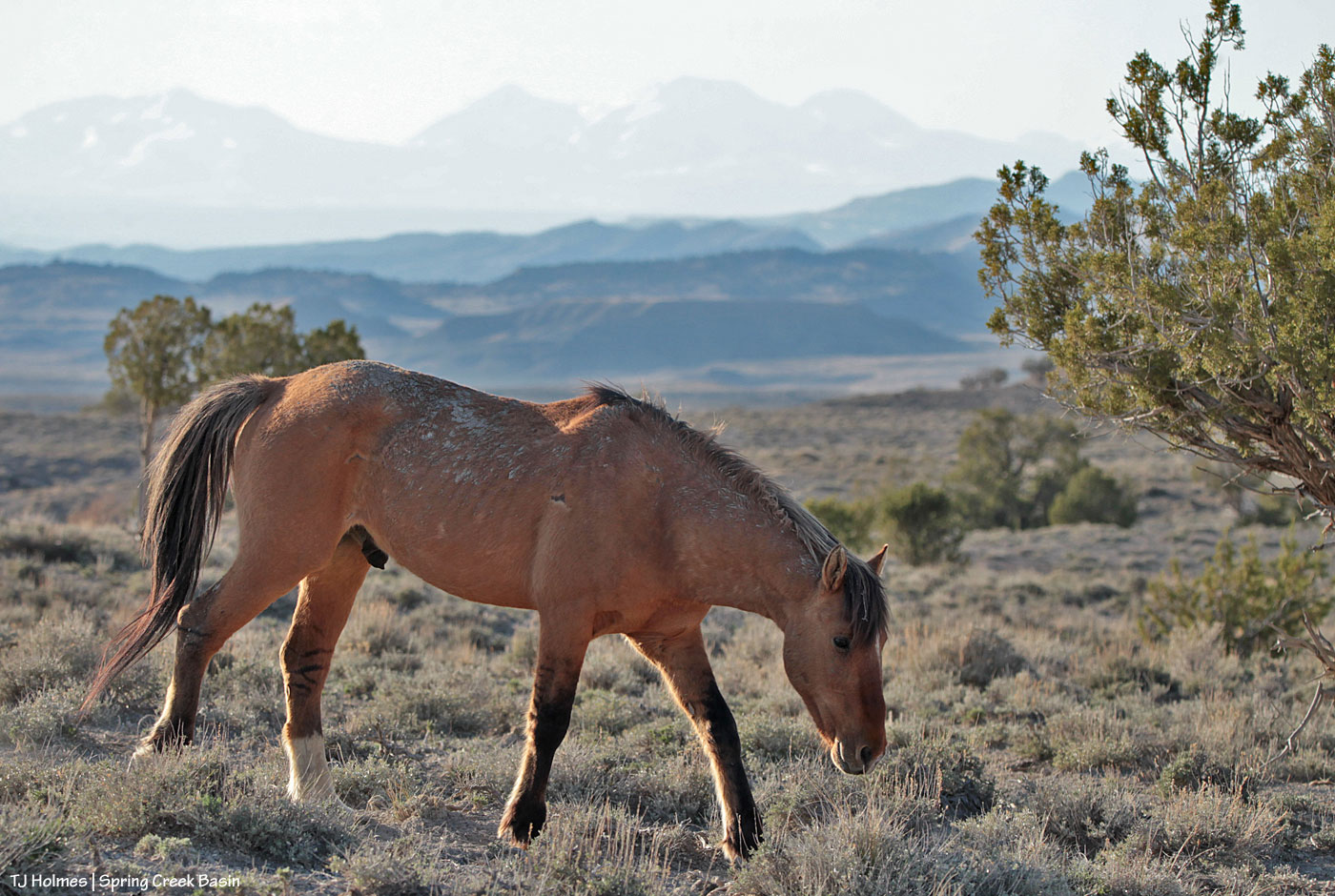
Buckeye and his band leave the main water catchment on a nice – though buggy – evening in Spring Creek Basin. I don’t think we have fire haze here … but there’s definitely a lot of dust in the air with the recent weeks of strong winds.
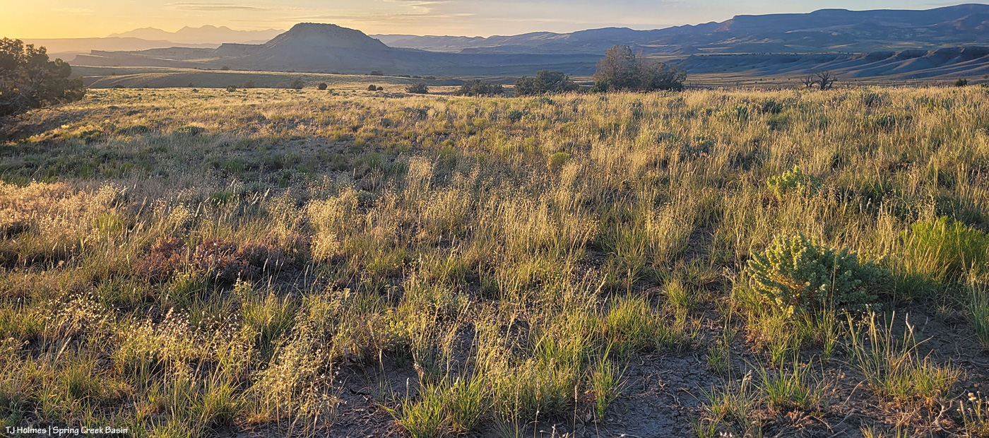
Despite a nice hike with fabulous views, I didn’t find any horses along the route I took. But I DID find fabulous grass, and I thought that might just as well make a nice subject for a post, especially during these hot, dry, windy days (did I mention hot, dry and windy!?).
Looking northwestish toward Filly Peak with Utah’s La Sal Mountains on the horizon. Grass in the foreground is a mix of Indian ricegrass and galleta.
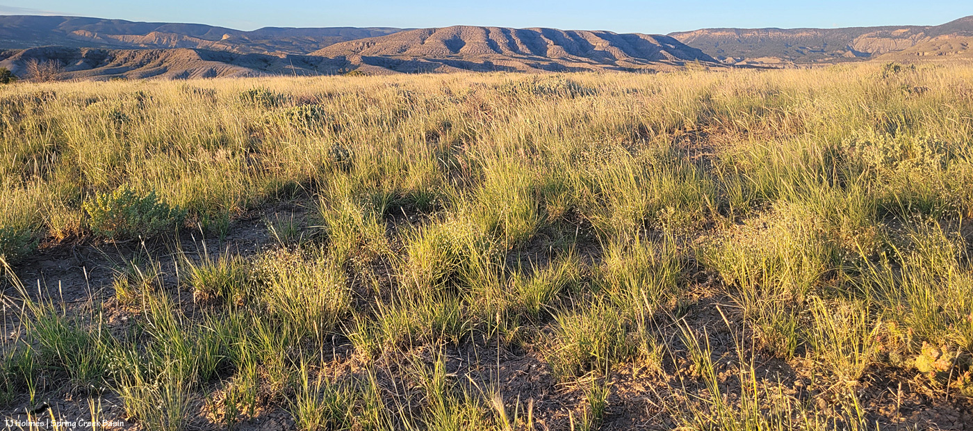
From the same spot as the above pic, this is looking eastish – more of the same Indian ricegrass and galleta. If it looks lush, it kinda is. It’s amazing, given the (hot, dry, windy!) conditions, but there ya go!
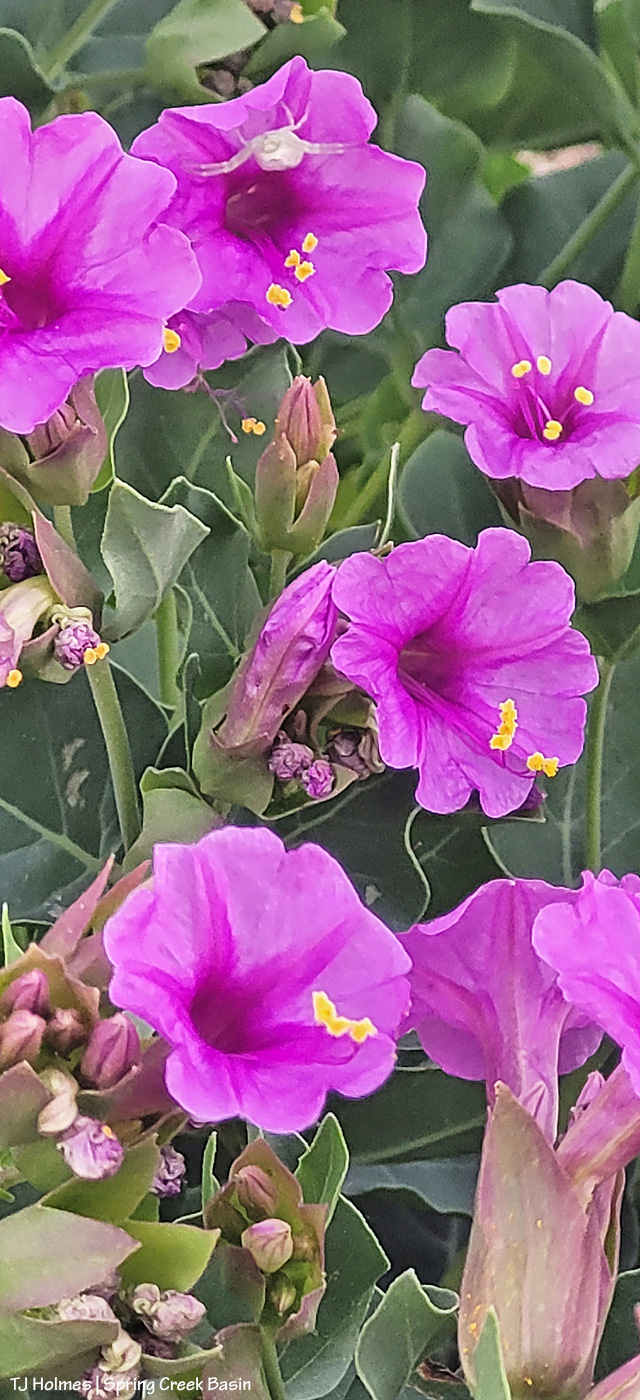
And some bonus images:
Reader Sue Story and her husband, Denny, were out to the basin last week (great to see ya’ll!), and after their visit, Sue alerted me to some luscious 4 o’clock plants in the north/northwestern part of Spring Creek Basin. The wind has scoured many of the plants growing in the open and along the roads, but a couple, growing within the protection of juniper trees, still look fabulous.
Some more photo-geekiness for you all: The horses were a LONG way away from me when I saw this scene unfolding. If the best camera is the one you have in your hand, the best composition is what you have in your viewfinder, at any distance.
Buckeye’s band watches a band led by Lieutenant Tenaz up a ridge. Buckeye’s had already been to water and had left, and Tenaz and family were on their way to water.
All the layers of canyon rimrocks and ridges of northern Disappointment Valley and all the way to Utah’s La Sal Mountains look compressed and so *right there* because of my long lens.
That’s a lotta-lotta country … the most magical, of course, the closest at hand. 🙂
As spring continues to lag and spring and lag and backslide slightly (temps below freezing and ice on water!) and green is slowly greening, the predictable spring winds are keeping dust and haze in the air. We’re looking for a renewal of moisture. Maybe that’ll be on our dusty horizon by Monday and/or Tuesday.
P.S. As Kat Wilder reminded me this morning: Happy Earth Day! Celebrate something – or many things! – wild today!