Photographers love stormy conditions. Is it any wonder?
Am I right?
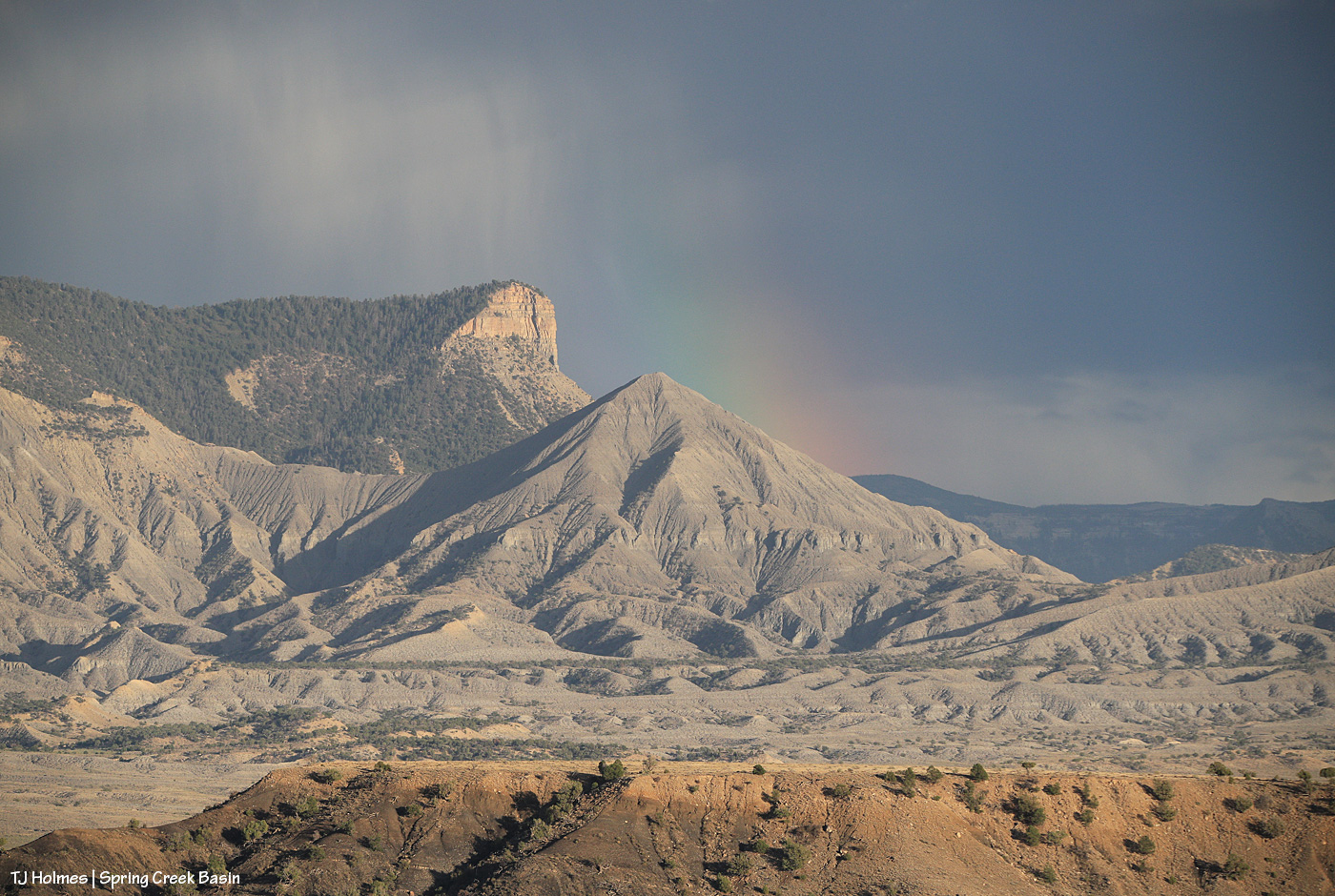
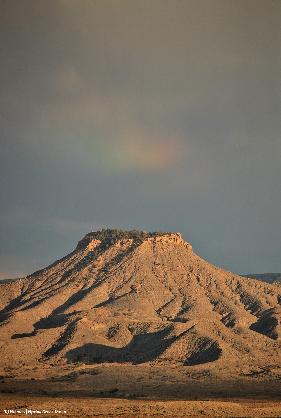
A bit wider perspective.
Mustangs were around, but they were not as cooperative as a person could wish with that amazing background ever-changing. 🙂
Flash and his band were grazing from the still-sunny side of the bowl to the already-shady side of the bowl (what I call the series of open areas between ridges in the far northwest). I was uphill of them, which made it hard to also capture the very faint rainbow in the southeastern sky. And this was quite a bit later from the first two pix.
Gaia lingered longest (thanks, girl), but she mostly gave me butt shots (thanks, girl!). 🙂 This one shows more of the rain-mist behind the rainbow.
And a last image from nearly last light … just a hint of a prism in a couple of sections in the sky at right. I mean … stunning!
We’ve gotten a few little rain waves the last couple of days. “Rain” might be overstating things a bit, as they’ve been really more like 10- to 15-minute drizzles. The ground soaks up that moisture incredibly quickly, and it’s dry very soon afterward. But we’ll take it, and the night I took the above images, I found a pond with water. Actual water. 🙂 Joy!
A hard, brief storm passed through Disappointment Valley and Spring Creek Basin (and the whole local area) Saturday, so you know what that means:
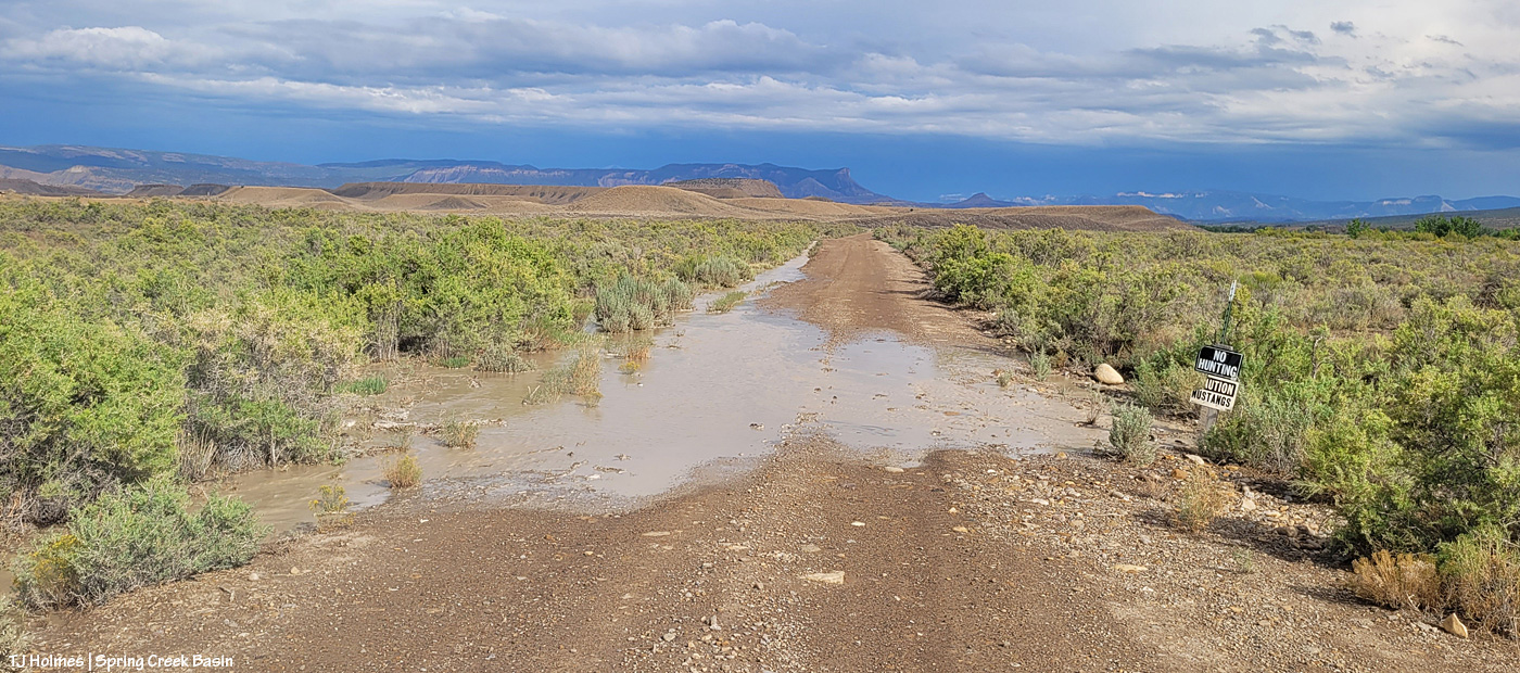
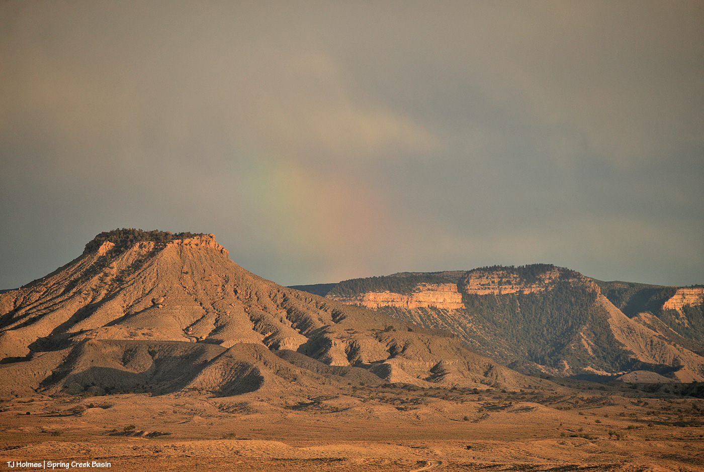
It’s hard to tell in this still image, but that water is moving. It’s flowing toward me along the ditch at left from just another 100 or so yards up the road (this is Road K20E, just east of Road 19Q). In some places, it had already stopped running, but the ditches were still soggy. There was more evidence of it having washed across the road farther along toward the basin (you can see the familiar horizon with the rimrocks, Filly Peak, McKenna Peak, Temple Butte, submarine ridge and Brumley Point rain-darkened (!) in the distance as the storm recedes to the east and southeast.
And of course, I knew what I’d find within Spring Creek Basin:
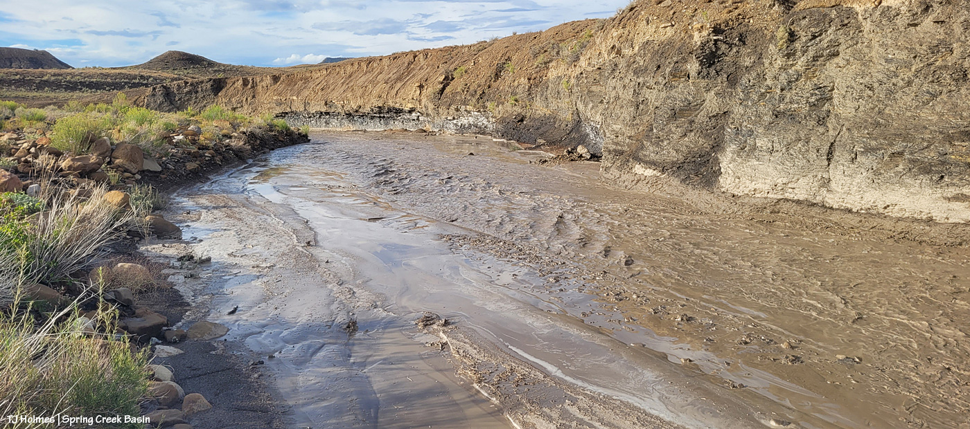
We had a number of these last year. This year, not so much. … ALWAYS fabulous to see water running across the first (as you come to it) Spring Creek crossing. It was already receding when I reached it in late afternoon, but the water (very muddy) was happily gurgling along.
From downstream a bit from the crossing (you can see it at just-left-of-top-center) looking upstream. There’s a rocky “beach” to the right that’s at least as wide as the creek bed itself, and it doesn’t look as though that flooded this time.
And from the same spot as above, now looking downstream. There’s a big curve straight ahead, and around that a bit is a seep that has water fairly consistently where the horses like to drink.
At most, floods like these last maybe 24 hours. This one probably – maybe – lasted 12? The rain came down pretty hard, but it didn’t last very long. And the rain, as hard as it was, didn’t penetrate very deep into the soil; an inch – maybe? We need a day(s)long rain that just sooooooooooooooaaaaaaaaaaaaaaaks in deeply. That’s what the fragile, drought-stressed vegetation needs.
All the mustangs I saw were on the north side of the creek, and I didn’t cross it. 🙂 Can’t wait to see the evidence elsewhere in the basin when I *can* get across the muddy arroyo!
As I was wandering the desert (seriously), hoping that tonight (which was last night) would be the night the clouds would part and I would get to see the moon rise … the clouds DID part, and a rainbow DID shine! I ask you: How does that happen!?!? 🙂 I’m not complaining, mind you, but Mother Nature is a wondrous, mysterious creature.
And then, this:
My desert wandering paid off!
If I ever get those glorious scenes with a gorgeous mustang right in my foreground, I’m going to keel right over without being able to hit the shutter even once, probably. 😉
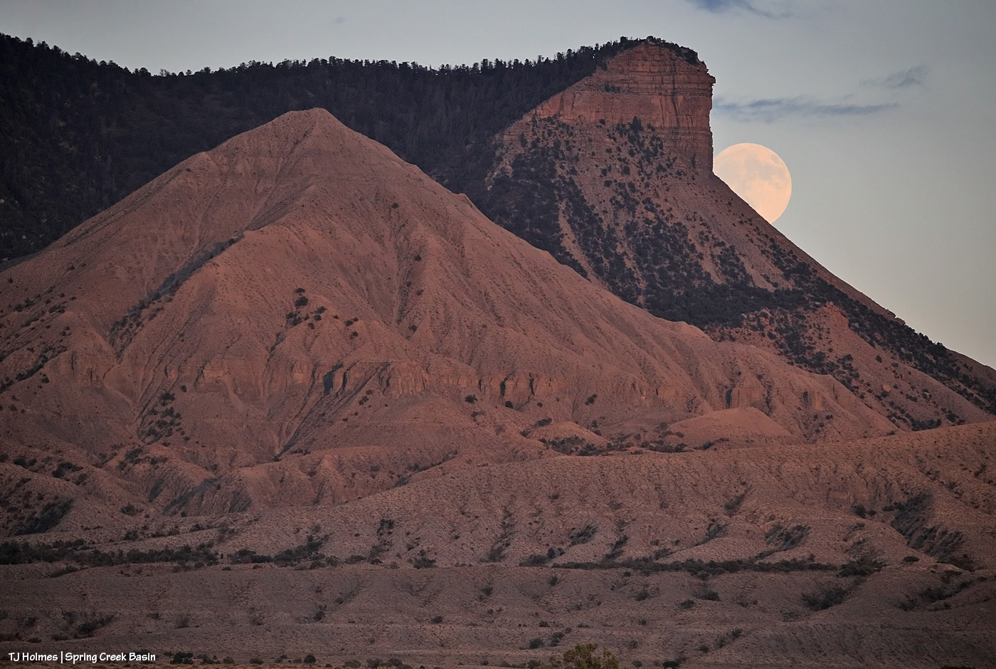
This was the last night to get the moon rising with the sun only very recently set. When the moon is actually full on Sunday (happy lunar eclipse if you’re on the other side of our world from North America!), it’ll be rising in a dark sky.
But last night, as I walked away (OK, I might have been doing as much of an Olympic race-walk as I possibly could with a camera pack on my back, binoculars in the case on my front and carrying a monopod that really is not a hiking stick), THIS was hustling me along (and yes, there was lightning):
See the moon rising above Temple Butte and McKenna Peak and submarine ridge at lower right?
Conclusion: Sometimes the rainbows come and go well before the post-sunset rain. 🙂 (And I think the valley got fairly widespread (though light) rain!)
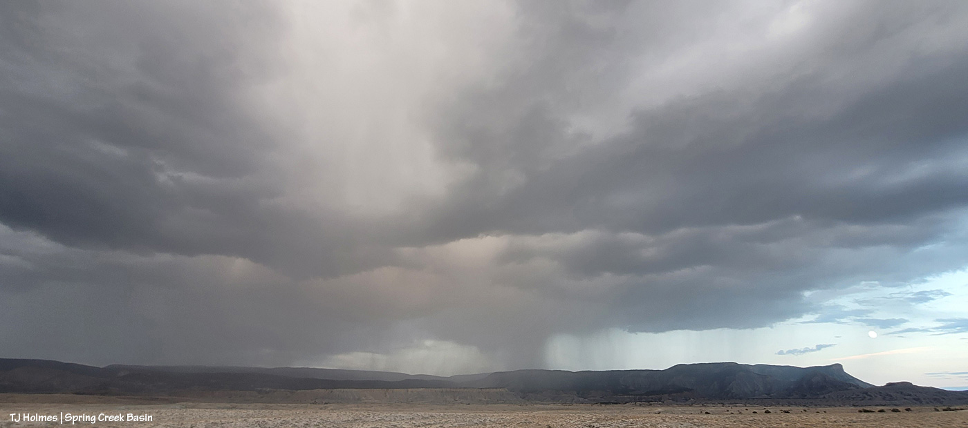
Rain – or perhaps more likely, virga – catching the western light over the southern ridge of Disappointment Valley from about mid(ish)-Spring Creek Basin. None of that for us yesterday, but we have chances today and Saturday.
How often do you get the rising moon and a rainbow (and not a moonbow!) in the same image? I actually don’t know, but both are visible in this pic … though both are extremely faint and hard to see. The rainbow is nearly impossible to see – at the right side of the pic, nearly vertical – and it was suuuuuuuper faint in reality, too. But as I was nearly stumped (again!) by clouds to see the moonrise, I shot it anyway. 🙂
But the MOST crazy pic of last night:
I’d love to say I planned the above image … but I didn’t! I was taking pix of the moon, high in the sky, between cloud layers (! can’t we have some rain, please, with those clouds??), and the plane photobombed my moon!!!! HA! The dark streak behind it is its contrail. I’m astounded that the moon is as sharp as it is because I’d only aimed and started hitting the shutter when the plane zoomed by.
The world is a wondrous place. 🙂 Especially with mustangs … not pictured, but always there.
Storms don’t last long here; rain showers don’t linger. The sky clears quickly.
Usually.
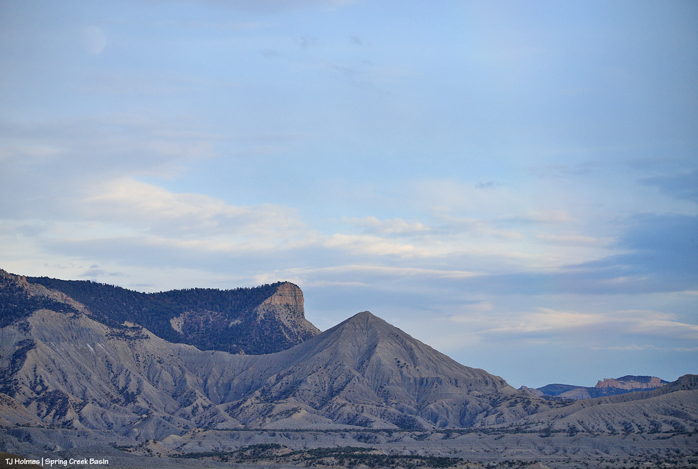
The above is the eastern horizon beyond Spring Creek Basin from not very far below the western rimrock boundary as the last storm (Tuesday morning) cleared. The rain was in the morning; the pic is from early afternoon.
Wowza.
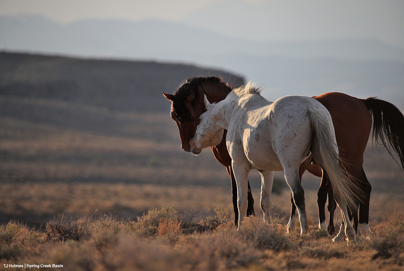
Mustangs were grazing below me, but I couldn’t get them in the view until Buckeye had a chat with Maiku.
Virga and rain (see it at lower center-ish against the far ridge?) from Spring Creek Basin looking west/southwest toward the far southwestern ridge(s) of Disappointment Valley.
Saturday:
It rained. 🙂 ACTUALLY rained. And for at least an hour (in at least some places).
OMG, the relief. … The gratitude.
It started with thunder and lightning, though, so hopefully the nearly immediate rain put out any fire(s) that may have started. …
It’s not my intention to ignore all the ills of the world on this blog, just to make it a place of peace and beauty.
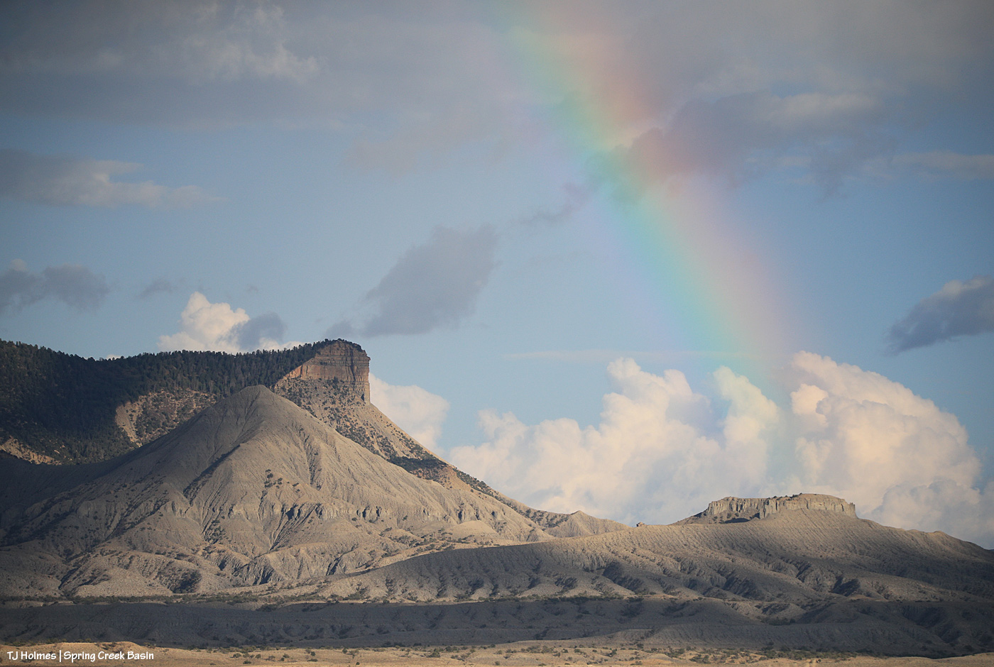
Two nights ago, clouds stymied my moonrise photography attempts, but Mother Nature put on a show, nonetheless. You can’t really call that a rainbow – a light prism? – over Brumley Point, but it was a much better sight than the image I took the day before that looked like Brumley, which looks enough like an old volcano, was actually erupting.
This was the second time it happened (and I was in a bit different location). Neither occurrence lasted more than a minute or two?
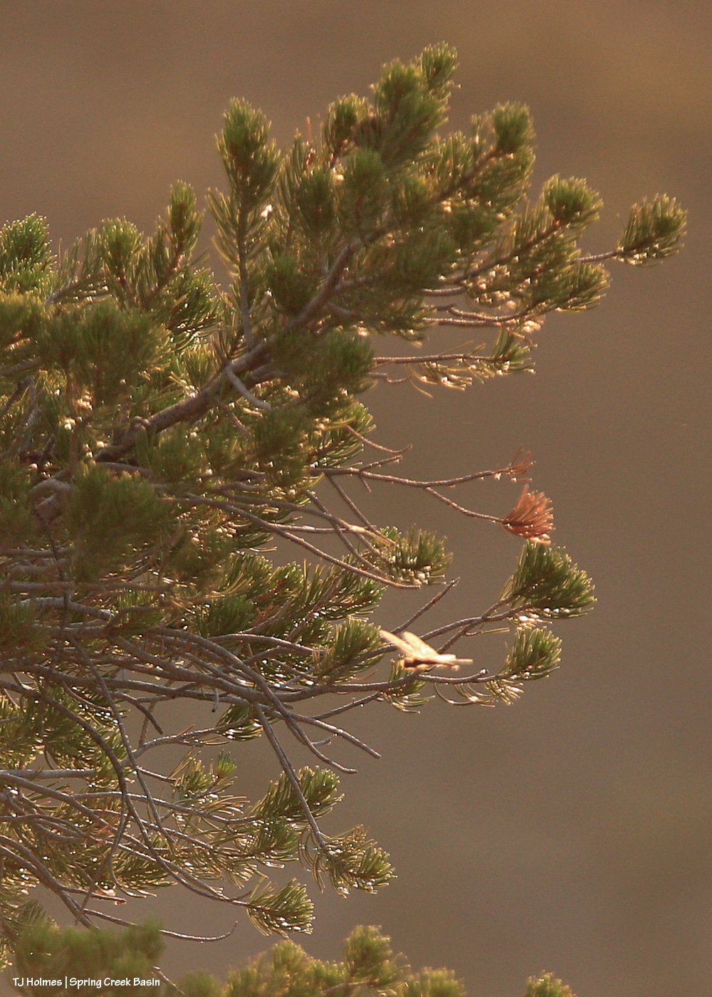
Do dragonflies bring you joy? It’s way out of focus here near the in-focus pinon tree – in my defense, I was pretty far away, and it was zipping faster than I could follow, let alone focus – but that little beam of zooming light (seeing it backlit against a far mesa is what caught my attention in the first place) brought ME joy! I realized that it was snatching flying insects out of the air, which I cheered wholeheartedly. The gnats are largely gone, but we have (still) big flies and (now) these weird little things that are bigger than gnats and almost as exasperating.
The moon did rise above the clouds eventually, of course. No matter the conditions here on Earth, it’s always, comfortingly, there – somewhere out there.
Most importantly, to paraphrase Mad-Eye Moody (apologies to non-Harry Potter fans): Stay vigilant!
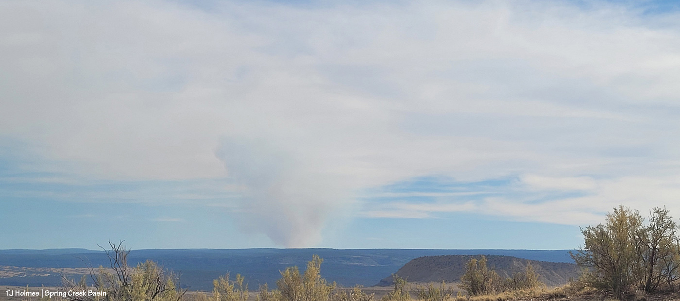
Note: Images are from Tuesday, Aug. 5. Yes, I’m in Spring Creek Basin for the below (cell-phone) images, and yes, the fire is fairly close as the eagle soars (the next county south, which is Dolores County; the basin is mostly in San Miguel County but does extend south into northern Dolores County). However, the horses are not in danger; there’s actually a lotta country between there and and the basin.
If you’ve visited Spring Creek Basin, you’ll recognize this cattle guard at the intersection of Road 19Q (Disappointment Road) and Road K20E. What you most likely and very fortunately have NOT seen as you head east toward Spring Creek Basin is a giant, nuclear-cloud-looking smoke plume. 😦 That’s the newly started Stoner Mesa Fire. (This is the Durango Herald link; you may hit a paywall, or you may get a free read of three articles (?).)
I won’t lie; I nearly had a heart attack when I saw that plume. Back in 2002, I was working at the aforementioned Durango Herald, and when I drove to work each afternoon (copy editor/page designer shift of 3 p.m. to midnight), the nuclear-plume of smoke from the Missionary Ridge Fire greeted me with heart-stopping awesomeness (and not in a good way) every time I topped Hesperus Hill to descend toward Durango.
This is from the area we call Chrome’s Point in western Spring Creek Basin, looking east-southeast. Yes, those dark-and-white spots at far left, left of the main/original water catchment aprons (looks like a tennis court) and tank are mustangs. Thankfully, they seemed completely and totally oblivious. The air was hot and smoky: Dragon Bravo Fire, Sharp Canyon Fire, Turner Gulch Fire (smoke still visible from it, too), Waters Canyon Fire … and who knows what other fires contributing to our air dis-quality (!?)) – more hazy than seems apparent from these images.
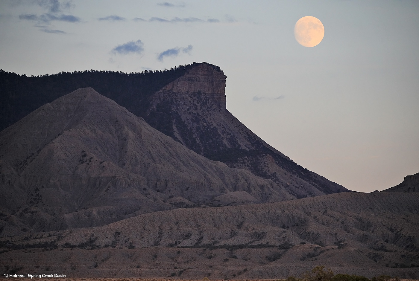
Moonrise over McKenna Peak and Temple Butte from farther north in the basin. Most of the smoke was blocked by the eastern horizon of ridges from this perspective.
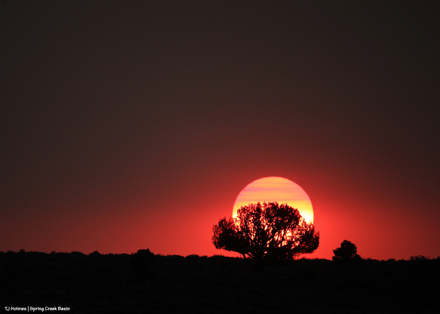
Sunset through smoke. Pretty … but it is violently, dangerously dry out there.
This is a hot, bad, dry (and very-bad-dry) summer, folks. Please be mindful of anything that could spark a flame, stay safe, and support your firefighters … local, regional, state and national. And rain dances are *ALWAYS* appreciated. 🙂
(I went with my phone pix for this post, but I may have some from my big camera in coming days. … May …)
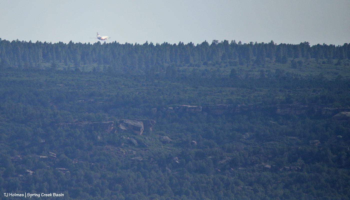
Uh oh. Another new fire (!), the Sharp Canyon Fire, started two days ago south-southwest of Disappointment Valley, north of the community of Cahone, and the plume was visible beyond the south valley ridge. I was in Spring Creek Basin when I saw the above-pictured air tanker fly over. It dropped out of sight toward the fire before I got to see it drop its load of slurry.
The Watch Duty app (which I just recently learned about and is *awesome*) alert showed the fire at 35 acres, but that was a BIG plume. Yesterday morning, it had been updated to 400 acres. As the eagle soars, it’s by far the closest current fire to Disappointment Valley and Spring Creek Basin, but it’s south of the Dolores River in its deep canyon, so the fire itself isn’t likely to endanger the mustangs. The pic is looking southish from the middle-ish (!) of Spring Creek Basin. Filly Peak at lower right is within the basin; the heavily treed ridge in the background is beyond the basin. Land goes from BLM to San Juan National Forest to private the farther south that eagle flies.
And the tanker flying back northeast over the basin to its base … possibly Montrose (?).
I looked up this handy website to identify the tanker, and it looks like it was a DC-10, or a VLAT! That’s a Very Large Air Tanker, and it was. From the website: “These airtankers, also referred to as VLATs, can deliver thousands of gallons of fire retardant at one time. Because of their size, they are less maneuverable than smaller airtankers. VLATs drop fire retardant at least 250 feet above the top of the vegetation.
“The DC-10, which can be used to support wildland firefighters on the ground, can deliver up to 9,400 gallons of fire retardant at one time. The U.S. Forest Service is responsible for managing the VLAT contracts.”
With hope, the fire will be contained soon, but it is DRY out there – which is everywhere here. We’ve been under red-flag/fire-weather warnings/watches/advisories multiple days this summer (and are in a run of such days currently).
Huge support to all those engaged in fighting these wildfires across the West (and for our neighbors in Canada, too!), from the land and from the sky.