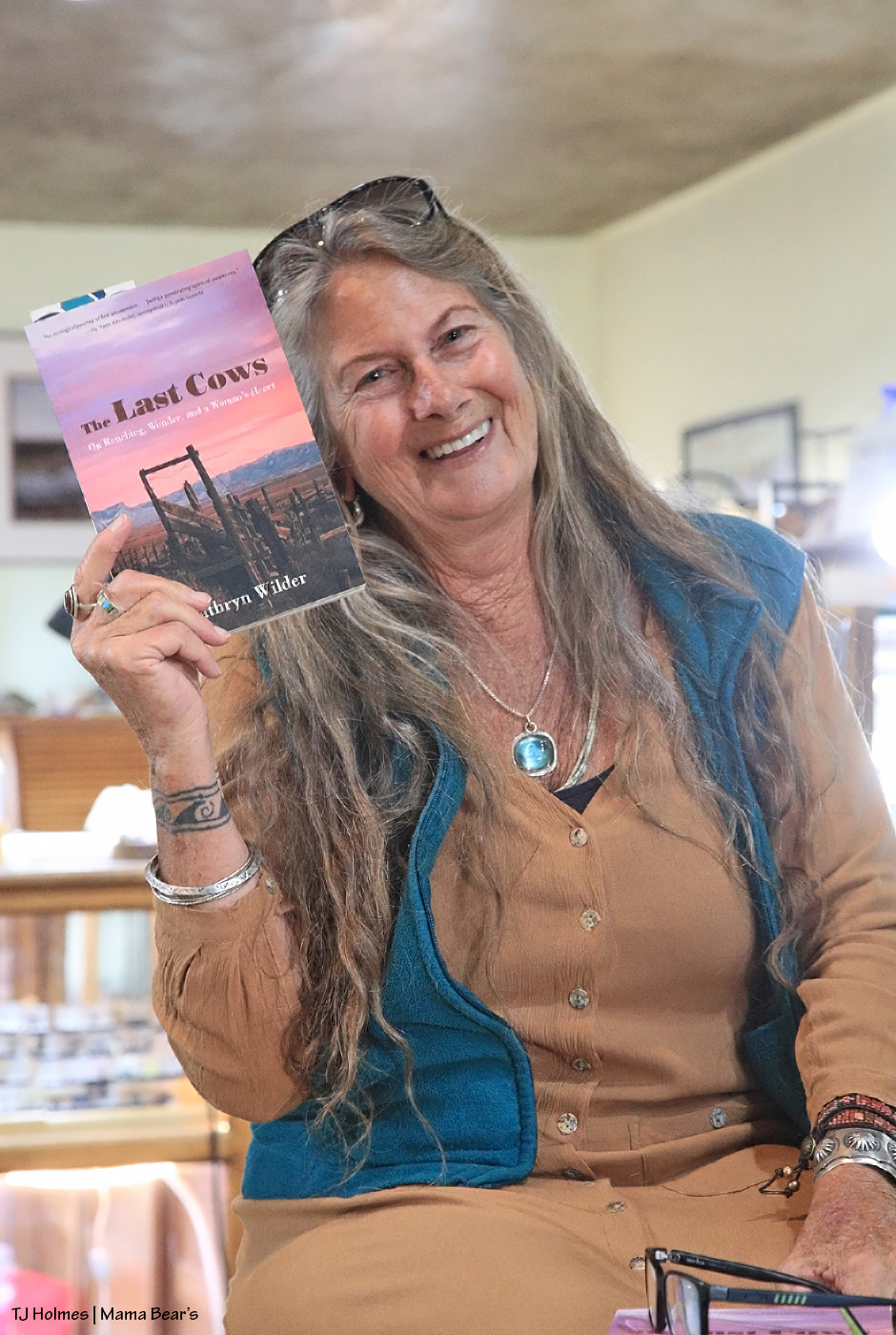
Something a little different today. My friend, writer (author!), rancher AND mustang advocate (and mom and grandma, titles she might be most proud of? :)) Kathryn Wilder has a new book on shelves right now!
They had a feast of a spread, Kat’s daughter-in-law served coffee and chai and other drinks the bakery is well known for brewing, and Kat’s sons, Ken and Tyler, and grandchildren, Lacey and Lucas, were in attendance among friends and customer-friends!
Kat read from her new book, answered questions and had folks laughing and commiserating with her narrative prose.
The Durango Herald had a fantastic review recently, and if you are local (or are passing through at the right time), Kat will be doing readings Tuesday evening at Maria’s Bookshop in Durango and Thursday evening at Back of Beyond Books in Moab.
More cows than mustangs, but if you read Desert Chrome and fell in love with Kat’s lyrical writing style and stories from the sage country (and above and below), read The Last Cows. You will NOT be disappointed (Disappointment Valley, get it? :)).
Top to bottom: Temple. Madison. Temple photobombing Madison. 🙂
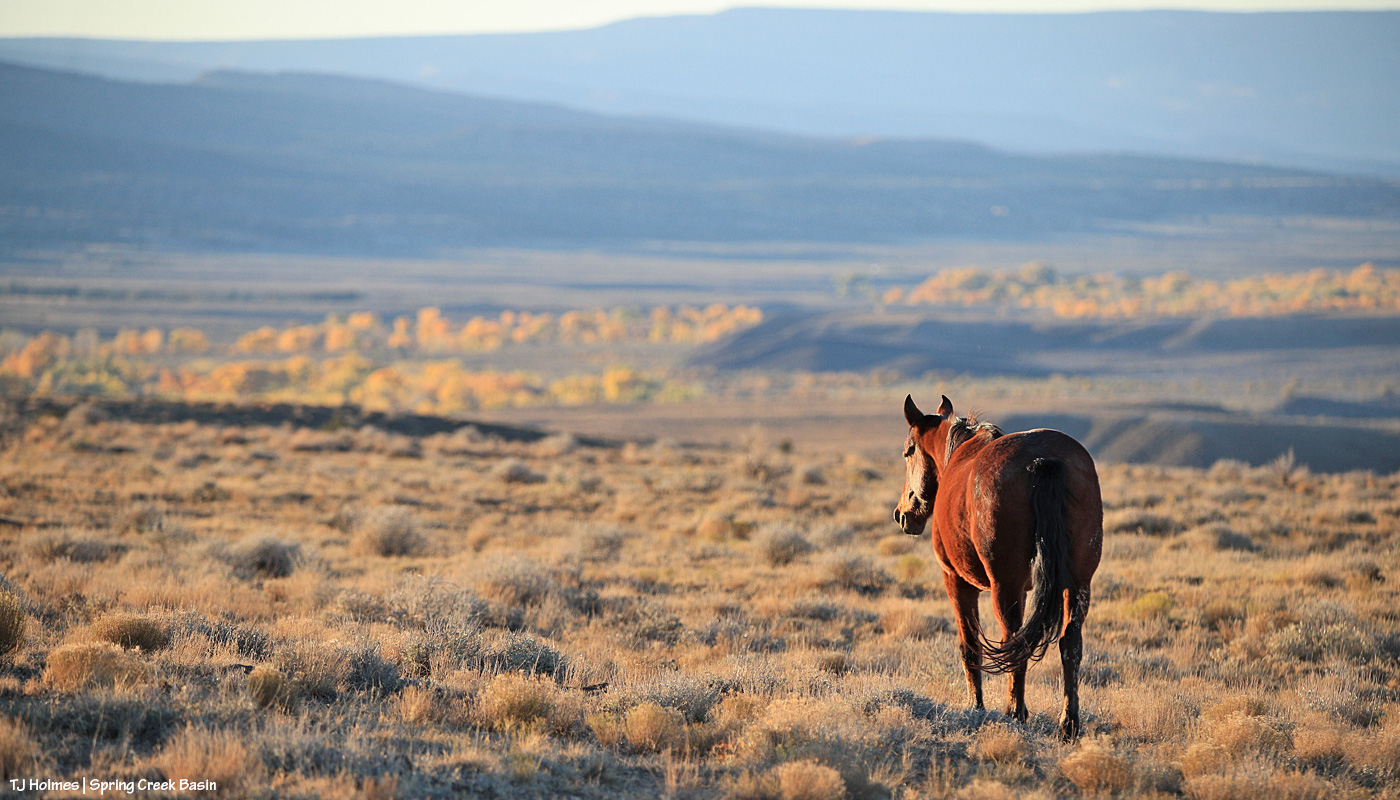
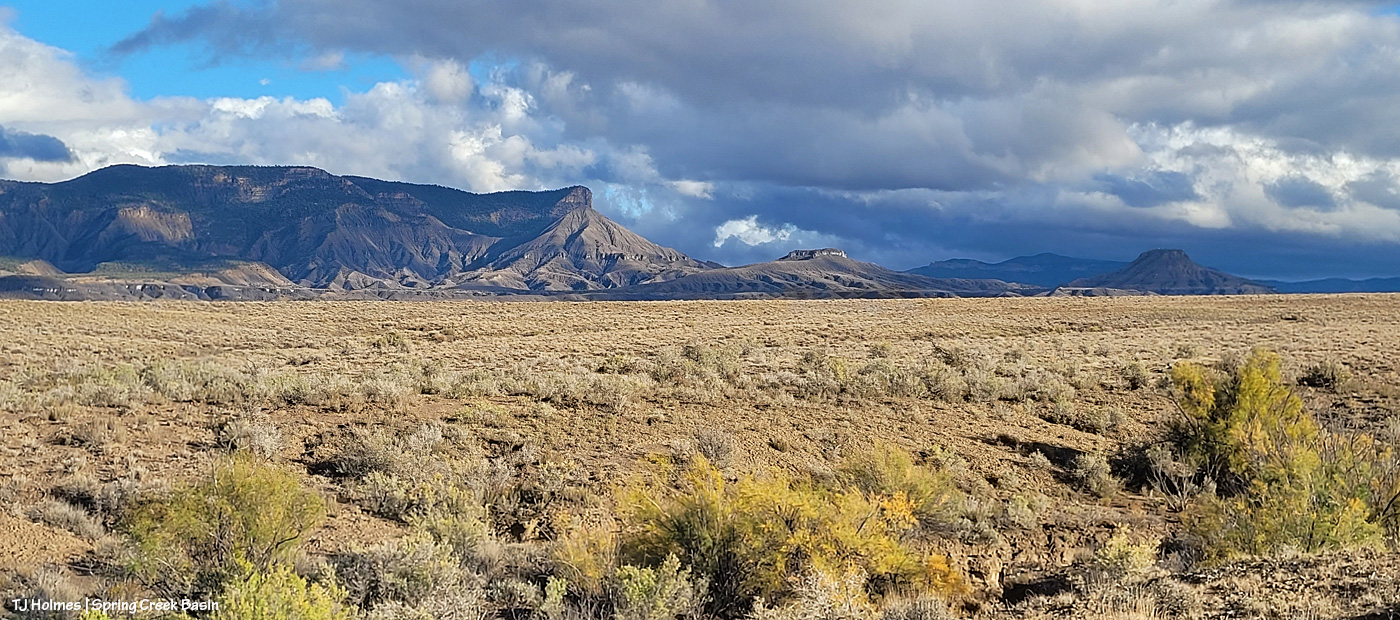
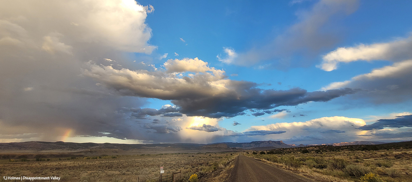
Mustangs in Spring Creek Basin, which is part of Disappointment Valley but does NOT include Disappointment Creek, along which you can see the glowing cottonwoods snaking across the distant landscape, headed west.
(Disappointment Creek currently is as dry (well, muddy, as I type this during intermittent rain waves) as Spring Creek … maybe with a few more puddles along its considerably longer length. But it generally runs from … February? Ish? Into July if we’re lucky. That’s enough water to (mostly) support the cottonwoods along most of its length. Spring Creek runs only when there’s a major rain event. We have a couple of cottonwood trees in Spring Creek Basin (I think I can count them on one hand and have fingers left over), but they’re in higher drainages that may not get more flow (?) but might get more rainfall. The cottonwoods seen in the distance in the above images are along Disappointment Creek outside/west of Spring Creek Basin.)
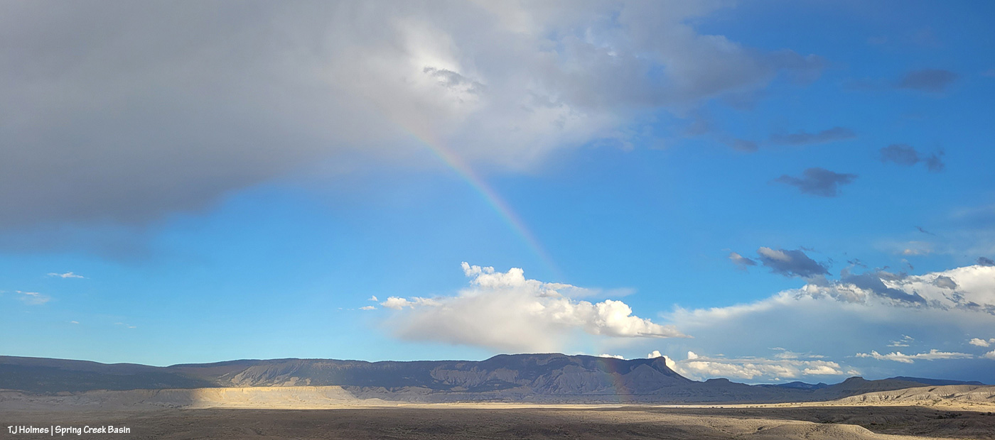
We rarely get morning rainbows; we rarely get morning rain (and even more rarely with sunshine).
Along with a lot of rain the last few days (about 2.56″), we’ve had a lot of sunshine.
This IS Colorado, after all!
Yeah, so THIS happened yesterday morning!
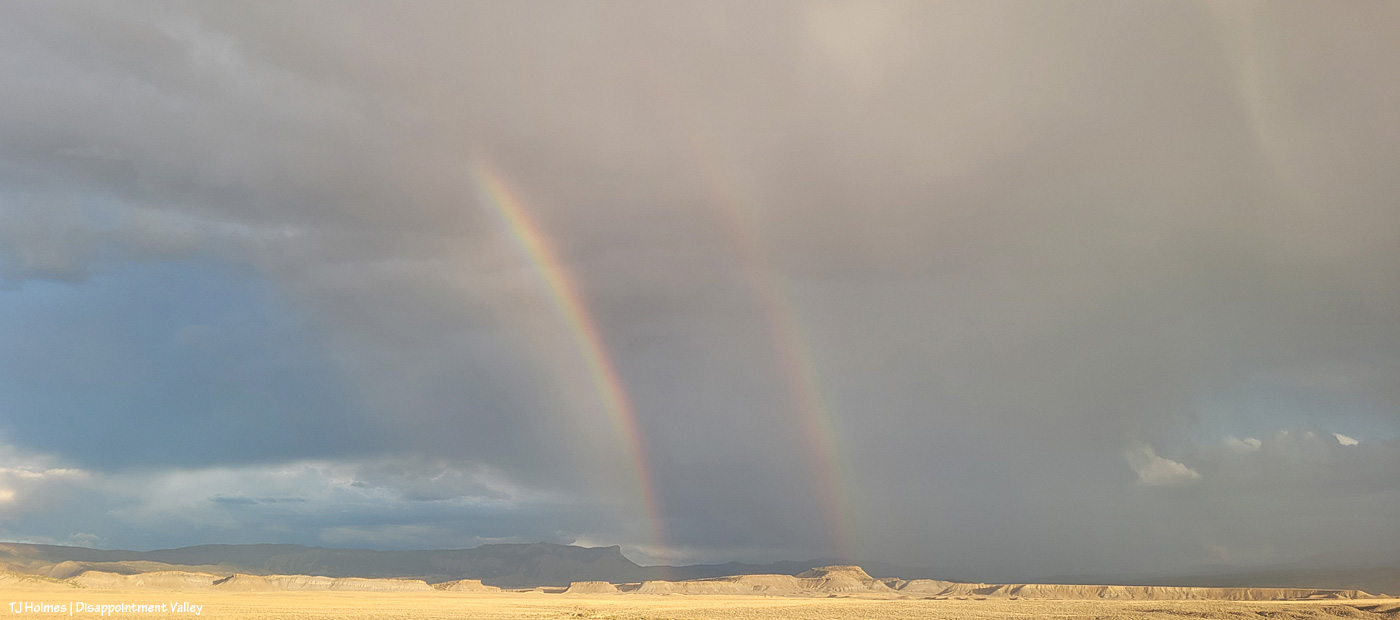
The cottonwoods along Disappointment Creek are starting to glow gold. And yes, it was sprinkling through the sunshine, which brought the magic. (The above pix are looking west; sun rising behind me above the rain clouds.)
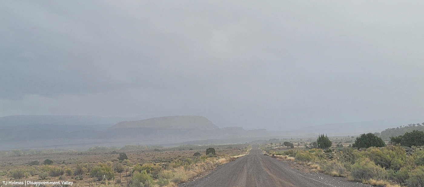
Wonder what it looked like back to the east? Here ya go! A lot different, eh? The sun was rising to upper right. This is Disappointment Road/Road 19Q looking toward Spring Creek Basin (not the road TO the basin).
Now I’m at 19Q looking west up Road K20W (not to be confused with K20E(ast) to Spring Creek Basin).
The sign struck me as funny under the rainbow. I mean, really, do you need a destination when the treasure is right in front of you??
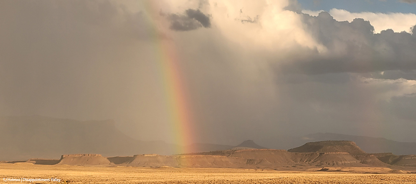
Here we are at Road K20E looking eastish/southeastish toward Spring Creek Basin as the storm was passing to the north. (Sorry about the crazy glare-arrow; my phone’s camera lens is cracked.) Don’t make the mistake of driving this road for at least a few days! The cottonwoods at right line Disappointment Creek, which, yep, was running!
The rainbow (at least the main one) lasted somewhat longer than 30 minutes?!
It.
Was.
EXCEPTIONAL!
And when it finally faded, little curtains of rain were still moving south to north across the eastern(ish) part of the valley.
A person can never have too much magic in their lives. 🙂
At least one part of Disappointment Valley got 1.35 inches of rain over about 16 hours yesterday (it started around dark Friday and ended mid-morning Saturday). Every minor ditch and arroyo to every creek bed (Disappointment, Spring and Dawson creeks) ran with water. … LOTS of water. None had been running previously; all had been dry.
While a lot of water ran off and away, there must have been a fair bit of soaking in; the rain was all fairly light and decidedly steady. The ground and the road into and in Spring Creek Basin are all SOGGY.
Come along on this virtual tour with me – yesterday late afternoon – to see what I saw:
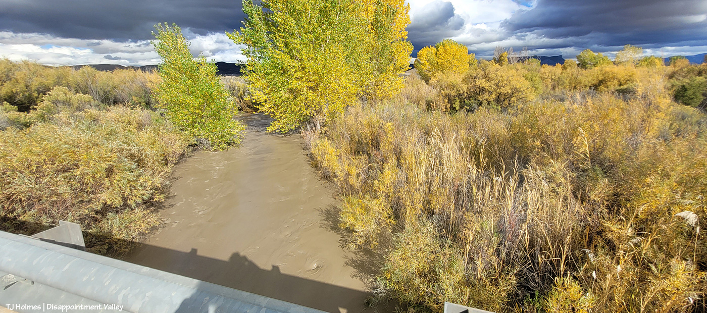
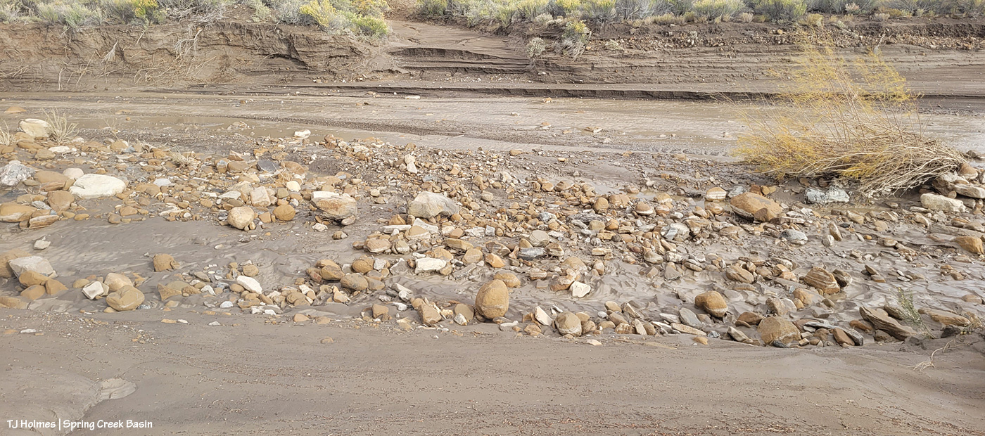
It’s hard to tell either how wide or how deep the water is here in Disappointment Creek several miles up-valley from the turn to Spring Creek Basin off Disappointment Road, but given that it was previously dry, I *hope* you can see that it’s running like a milk-chocolate river. This is looking upstream.
Another view, from several miles downstream of the above image; this is just 50 or 75 yards south of the road to Spring Creek Basin. The creek channel is much narrower here; I hope you can tell how high and wide the water is?
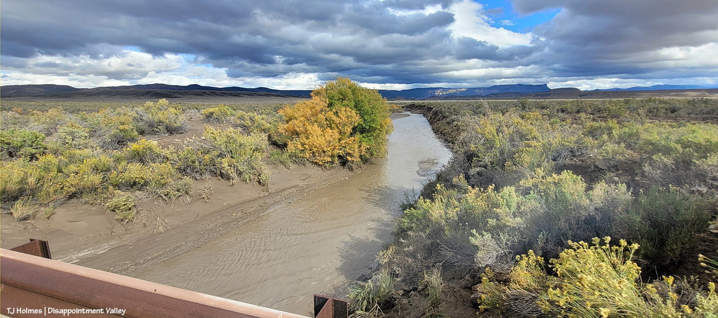
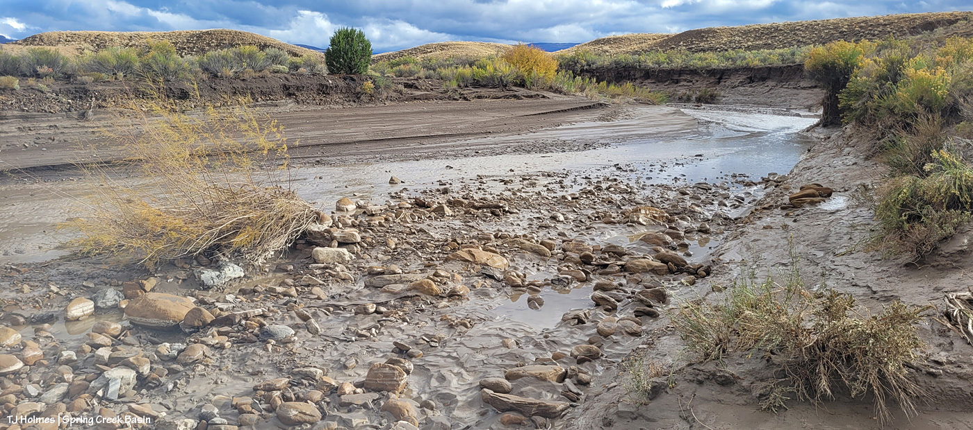
Now we’re looking upstream at Spring Creek water flowing downstream (toward us) from Spring Creek Basin, a few miles east (Temple Butte is visible against the horizon). (I’m still on Disappointment Road, a mile or so north of the above Disappointment Creek pic.)
And, from the other side of the bridge, Spring Creek flowing downstream toward its confluence with Disappointment Creek (marked by the line of barely visible golden cottonwoods in the middle distance).
I know it’s hard to tell width and depth again; the creek arroyo here isn’t terribly deep, but it’s three or four times as wide at this point as in the second pic of Disappointment Creek above. These creeks carried a LOT of water yesterday.
Then I went looking for the condition of the Spring Creek arroyo in Spring Creek Basin (in case this isn’t obvious, Spring Creek and its tributary arroyos drain Spring Creek Basin – when it rains – and the main Spring Creek arroyo carries all that gathered water west across Disappointment Valley to join the also-muddy water of Disappointment Creek, and together, they carry the watershed’s drainage to the Dolores River).
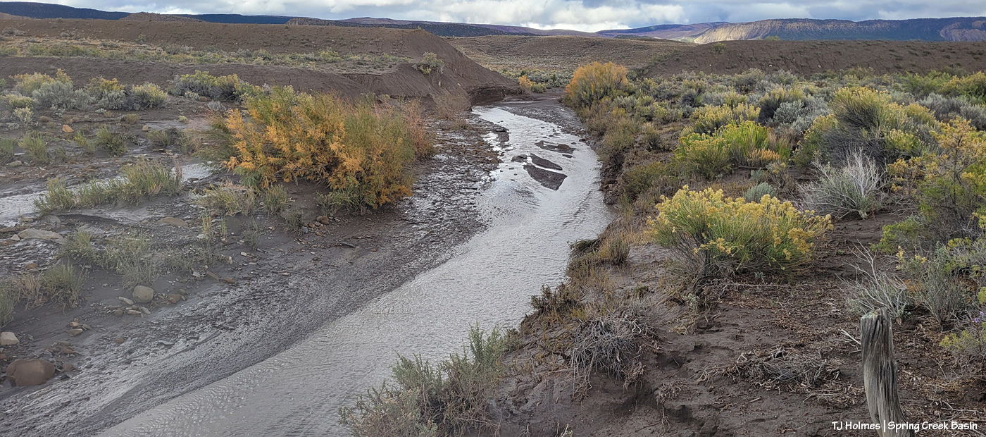
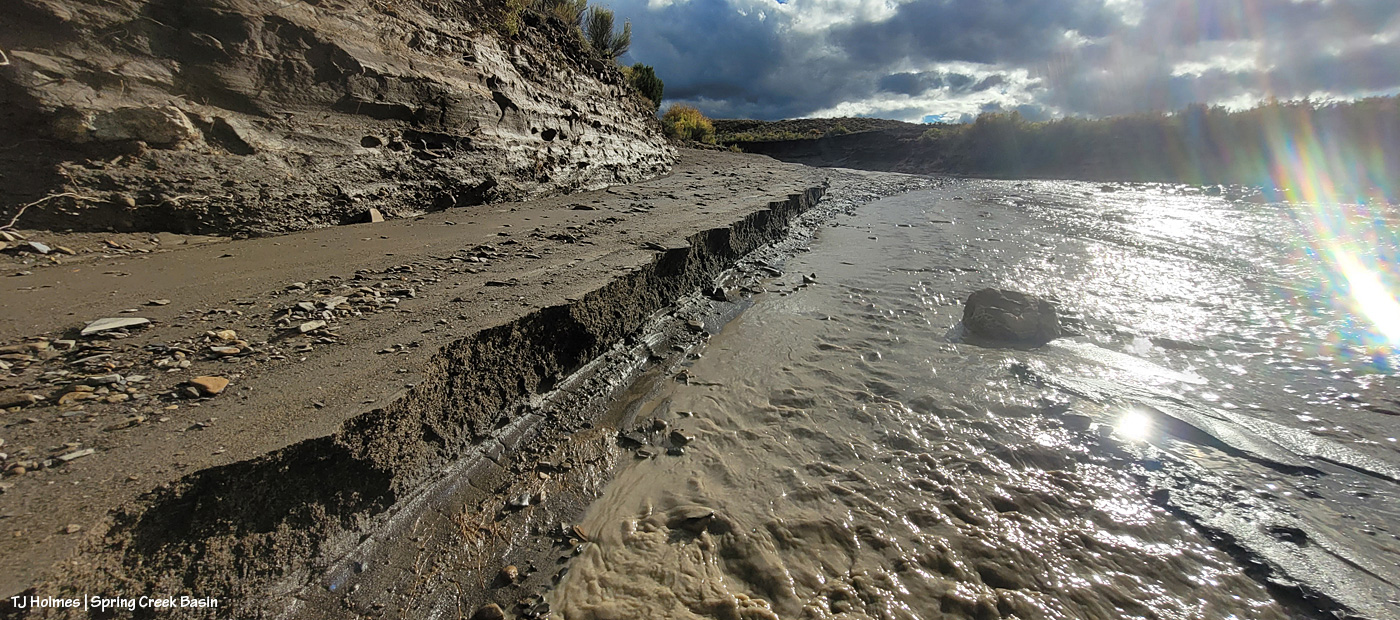
I thought you all might like to see a bit different view of Spring Creek, and I had to walk the last half-mile or so because the road was still too mucky even for my faithful little buggy, so this is just upstream and around the curve from the first crossing, where I usually take pix of rolling Spring Creek after a good rain. If you’ve ever gone into the basin with me, you’ve heard the story about Custer dam (and I even wrote a bit about it earlier this year). This image doesn’t show it well because of the background, but if you look on the left and right sides of the image above the water, you might see that the ground is abnormally straight/flat? Those sides are what remain of Custer dam (marked on maps). The brief story is that around 1900 (?), someone(s) put an enormous amount of work (and likely money) into building a dam to contain water from Spring Creek (the lowest/central arroyo in Spring Creek Basin) and the north and south *major* arroyos that feed into it (and a whole lotta other arroyos feed into all of them). The people also built at least a few miles of irrigation ditch. The story goes that the first major storm after the dam was built burst the dam. As you can (maybe?) see in the pic above, Mother Nature prevailed. (Who could possibly think this country is farmable?!)
Now I’m standing atop the south side of the dam looking downstream and westish. Just around the bend to the right is where the road crosses (when the arroyo is dry). It’s a weird perspective, and though I thought this would be a great perspective, it proved difficult to actually show. The road tops the area at the far (north) end of the dam, which is more to the right than “straight” across, but it’s only … 150 yards away, maybe? Or maybe it’s that from the far side part of the dam.
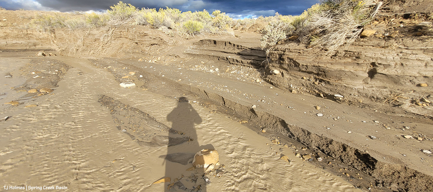
Now I’m down at the bend that you can see in the above pic, still looking downstream at the road crossing. You see it, right? Where all the rocks are at the left side of the pic. The road crosses the rocks, the arroyo and up the other side to the right.
Sorry, how about now? 🙂 Straight across. This should look familiar. … Well, except for the increase in rocks and the far side, which looks a bit like a wall. …
Looking upstream, there’s the curve where I was standing a couple of pix ago, looking to where I’m now standing.
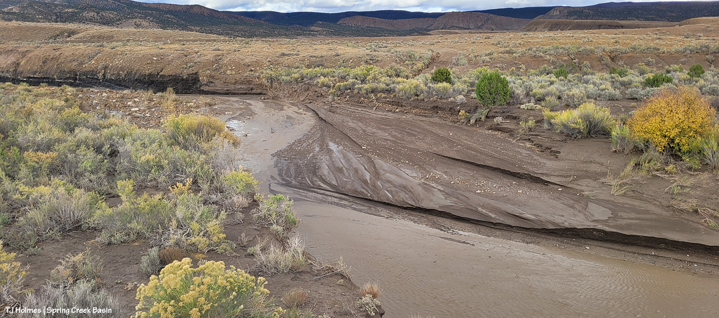
The water, I should mention, had greatly receded at this point. This is probably some five, six miles (??) upstream from the first Spring Creek pix I showed toward the top of this post. I found evidence that the water reached probably at least another 20 yards up the road where I approached, from, say, the middle of the arroyo. It would have looked most definitely like Spring RIVER at its highest/deepest point. Spring Creek runs ONLY when we have a major rain event. … And when all that water from all that rain is done, so is the “creek.”
I’m gonna need my shovel. Again. 🙂
Are you tired? We’ve been walking around, in the super-mucky mud, in calf-high mud (or muck) boots. And we still have to hoof it back to the buggy. I was whupped.
But you can never, ever, ever beat that view. 🙂 Especially rain-dampened and -darkened. 🙂
I can’t wait to get farther in and take a gander at ponds. SURELY the mustangs have multiple water sources now. What an amazing deluge of rain. Much needed.
Don’t hate me for making up spectacular words to match the gorgeousity of the magic scenery, painted by Mother Nature. … Anyone would (and should) do it. 🙂
(And yes, I did get semi-soaked!)
“It won’t rain.”
The rain came from behind-ish me (southish), and though it lasted (at a guess) less than five minutes, it soaked my right pant leg and right shoulder/arm and left water dripping down my leg inside my pants (!). These two pix (above) are looking north as the rain has mostly passed over me and is continuing north.
From the same spot as the first two pix, looking now eastish, I watched the moon rise over Temple Butte (promontory) and McKenna Peak (pyramid).
The moon was still barely visible when the light hit the passing rain and formed the prism, but while trying to decide between my phone and big camera, I think I missed it before it rose into the clouds (argh!).
With more dark clouds rising from the south and mustangs mostly far and scattered across the northern part of the basin, I decided to return another day. … (Note: It’s not a good idea to go into the basin if it’s going to rain. The road can get spectacularly bad when really, really, super wet.)
Wellllllll (a friend and a new friend will understand that heavily accented word 🙂 ) … when your gut tells you to turn around and make for the place where the rainbow will align with the pot of gold you know to be there (if you know, you know), be like Leroy Jethro Gibbs, and pay attention to your gut!
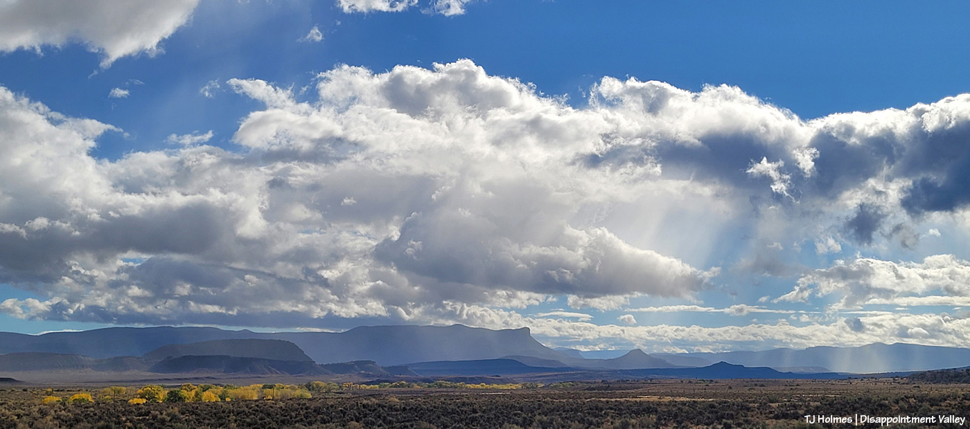
I stood in the sunshine along Disappointment Road while the second wave of rain passed from south to north across Spring Creek Basin (the rimrocks are Spring Creek Basin’s western boundary; the basin stretches away to the east in the northeasternish part of Disappointment Valley).
And the spectacularity JUST. GOT. BETTER.
End to end under the powerlines.
Temple Butte is visible again as the storm moves north.
This is NOT part of the original/above rainbows; it was a newly formed prism as the rain continued to pass and clear and the sun found space beneath the clouds above the western horizon. This stretch of Disappointment Road goes straight east.
After dark, we got yet another little wave of the good rain stuff. *Sigh of contentment*.
Maybe more overnight and in the morning. (Fingers and toes all crossed!)
I mean … RIGHT?! 🙂 Magic, folks. Pure magic. No artificial ingredients added. 🙂
The mustangs don’t *always* cooperate when spectacular things are happening on the horizon. Posing really isn’t their jam (though they sometimes do it very well, indeed). However, although there are no mustangs in these pix, I decided they showed off the gorgeousity of Spring Creek Basin to such a degree that they stand on their own (and there *were* mustangs nearby; you just have to take my word for it!).
The rainbow Sunday evening was faint … and then it was BRIGHT. Never more than that little section, but wowza. Every strand of color was bright and clear and distinct:
That extreme brightness didn’t last very long. All I did when processing was to add a touch of sharpening. (I mean, really, how can you improve on that with a mere computer?!)
Then, last night, as I was leaving the basin, this interesting light-prism phenomenon, in nearly the same area of sky:
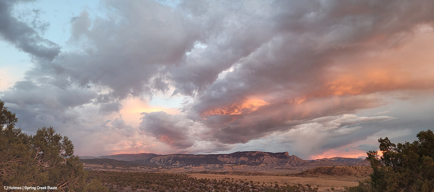
Mother Nature is booming in the high country with her annual aspen show, but she apparently didn’t want us in dry, brown Disappointment Valley to feel left out. 🙂
A dramatic background any time, but wow, did we get some dramatic light on McKenna Peak and Temple Butte to perfectly highlight Maiku and his compadres.
“We” were these fine folks from Four Corners Back Country Horsemen, who came out for a visit to Spring Creek Basin:
They didn’t bring horses to ride, but they saw a fair number of our fair mustangs. 🙂
Left to right: Marlo and Gail; Tim and Linda; yours truly; Patty Ann and her daughter, Chelsea; Larry and riding partner Jeff.
I do love showing off Spring Creek Basin and our wonderful mustangs, and a couple of bands gave us a good look!