You know how, when you’re a kid (some kids … me, for example), the edges of heights don’t bother you? You can stand there, look over, look out, and you’re so confident of your balance, your groundedness to the earth, that you can’t imagine any danger? Then, when you’re an adult (some adults … me, for example), the sight of kids or animals at the edges of great heights gives you the willies, makes the ground under your own feet seem unstable, and you really want who/whatever it is to move away from the edge RIGHT NOW?
See those rocks behind/left of Dundee? They mark the rimrock edge at Spring Creek Basin’s western boundary.
I had walked up the hill where the band was grazing, and though heights bother me a bit more as an adult than they did as a kid, when at the top of the rimrocks, the desire to look over the edge, at the view, is strong. Because … what a view!
The edge of the rimrocks, which form a natural barrier for Spring Creek Basin, is in the near foreground toward the upper right. The road below is the road from the main road in Disappointment Valley to Spring Creek Basin. This view is looking northwestish across Disappointment Valley toward Utah’s La Sal Mountains.
The view looking southwestish. The line of Disappointment Creek is in the far right distance.
And looking more northish.
As for Dundee, she obliged my nervousness so near the edge and headed back down to her friends and Buckeye. Whew. 🙂
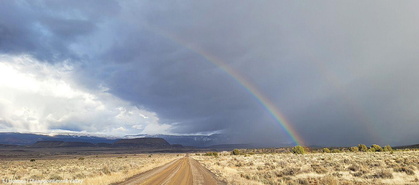
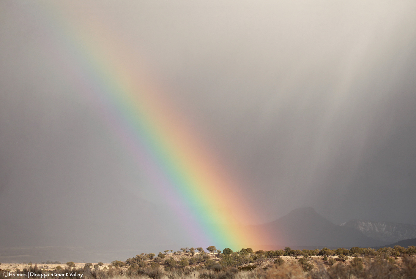
On St. Patrick’s Day in Disappointment Valley, we had a bit of gold under the rainbow (and yes, it was sprinkling when I took these pix (above with my phone; below with my camera)).
In Disappointment Valley (which includes Spring Creek Basin), WATER is the treasure! In our case, there’s a whole lotta mud under that rainbow right now, and we’re feeling pretty rich. 🙂
(And yes, these pix were taken the evening of St. Patrick’s Day – no kidding!)
Well, we kinda got skunked again on snow – the big, hyped, “inches and inches are coming!” winter-weather-warning snowfall – yesterday, but we do have snow on the ground still from Friday’s surprise event – thank goodness. We got no measurable snow from Sunday, though we did have a couple of brief waves of blowing flakes, and there was snow all around Disappointment Valley.
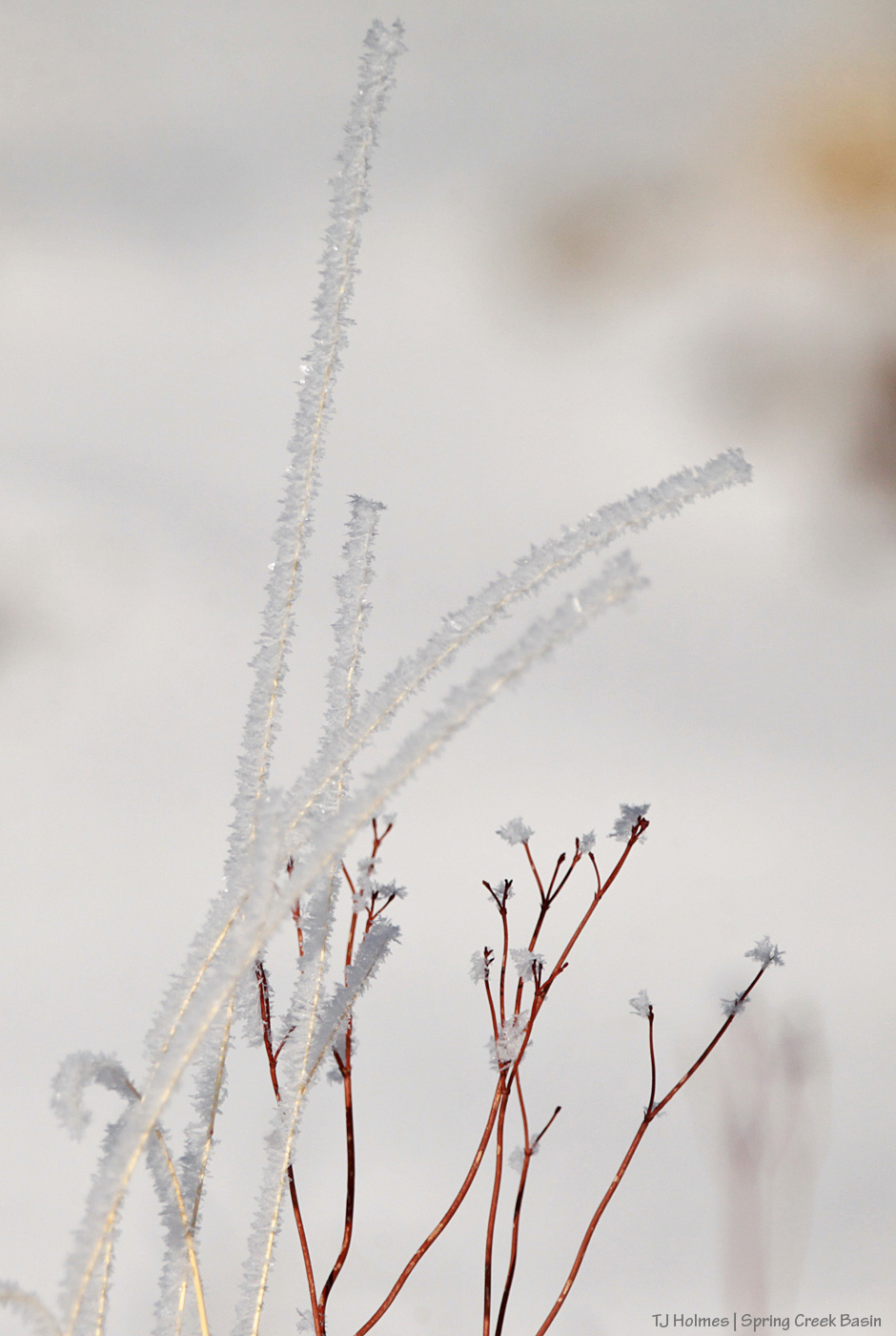
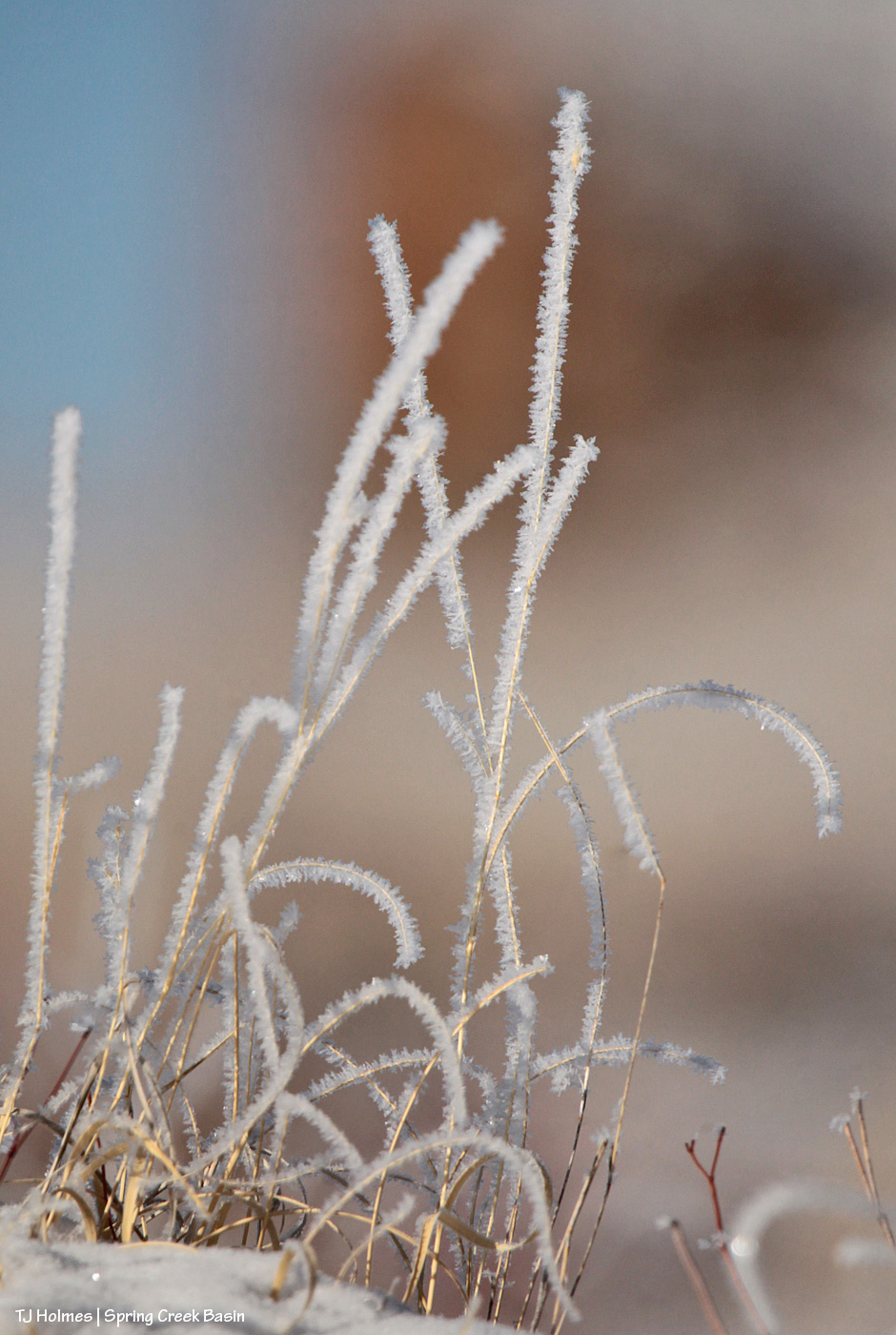
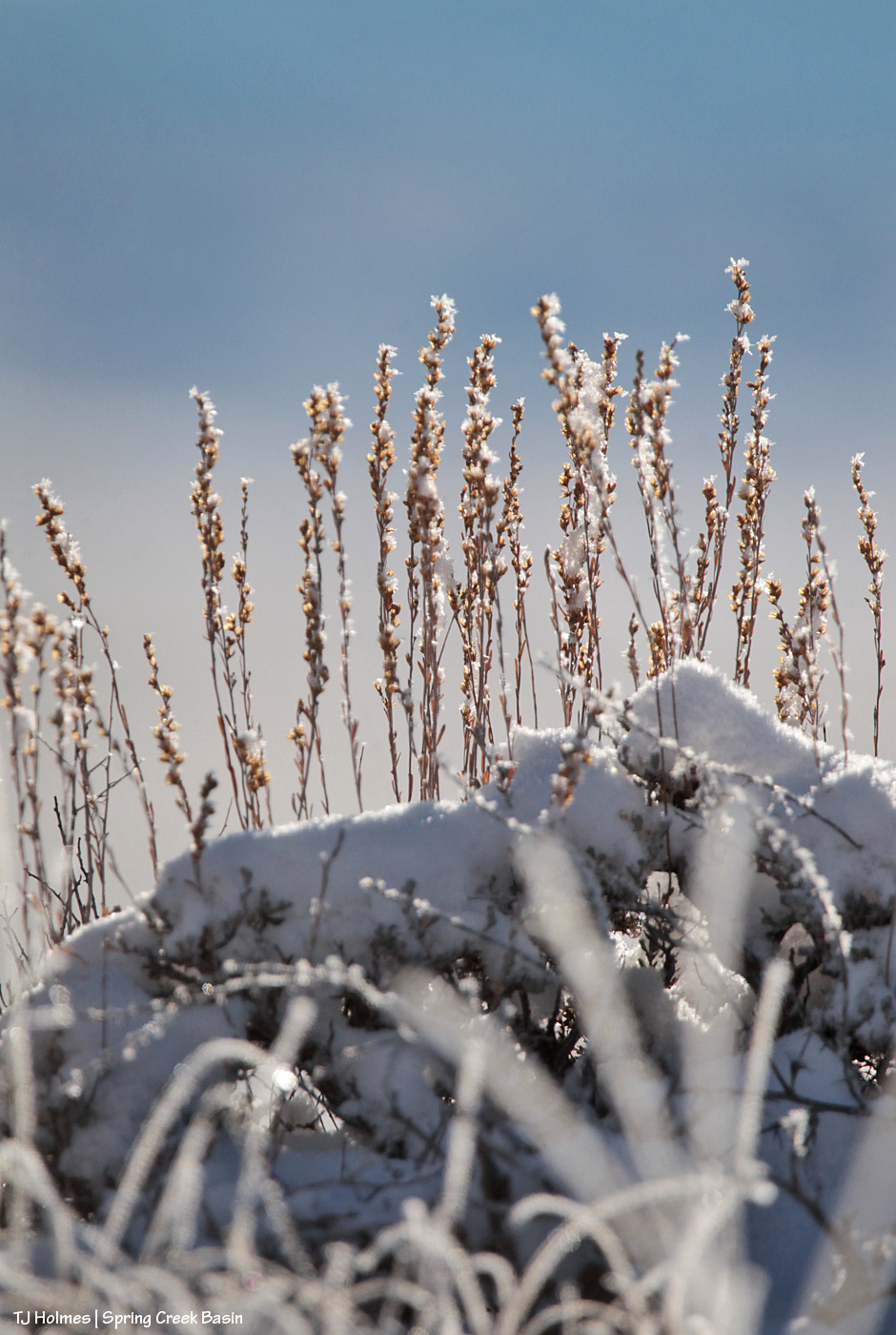
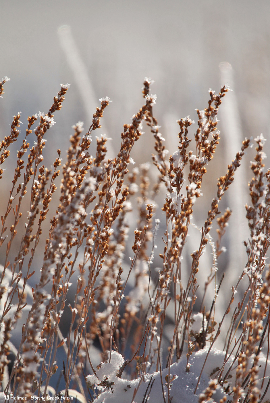
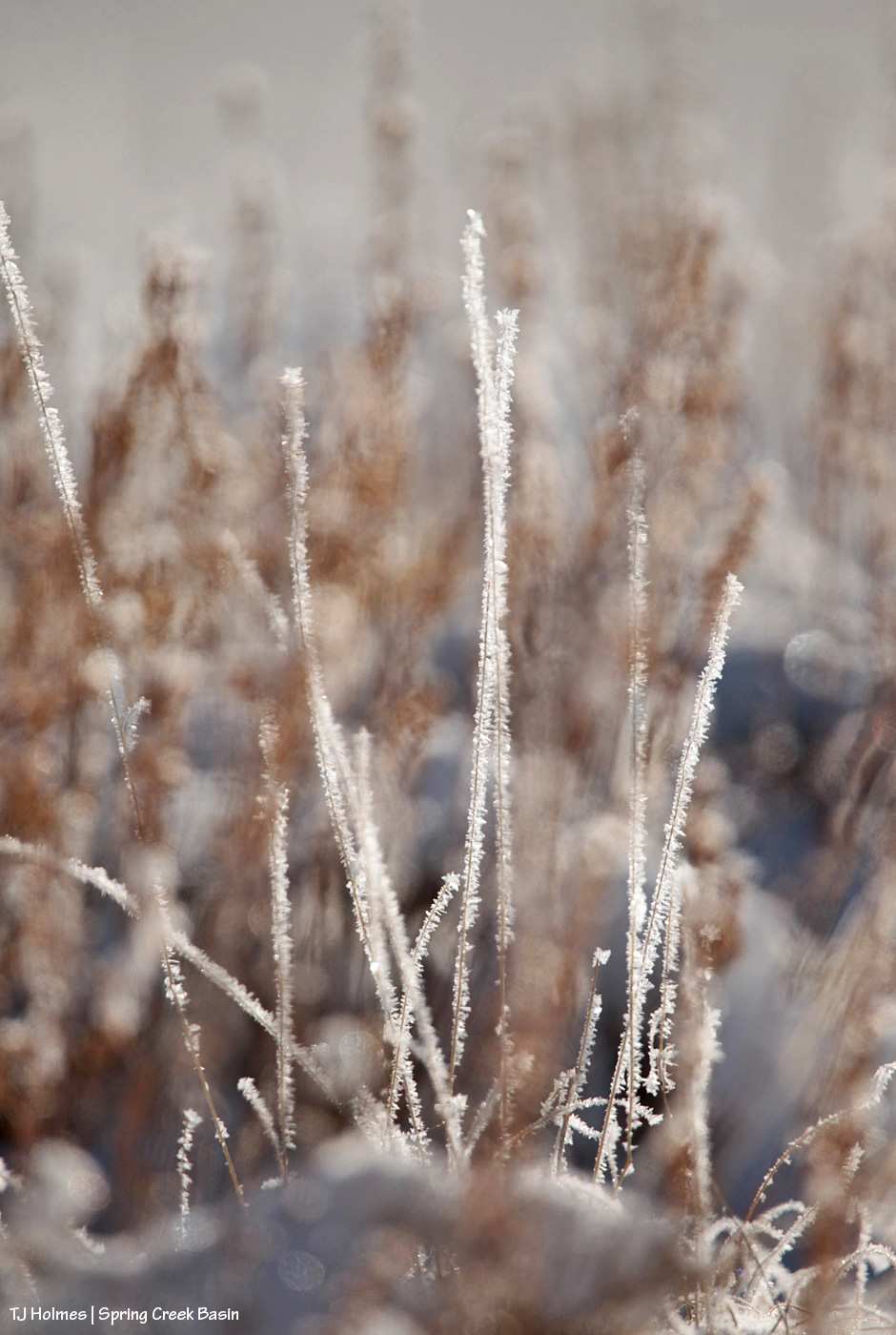
The following pix are of snow/ice crystals on grass stalks and sagebrush in Spring Creek Basin on Friday.
It was so much more beautiful and magical than I can convey in photos.
You’ve heard the phrase “doughnut hole” in weather-related conversation? How one place or another is in a “doughnut hole” of NOT getting weather the surrounding area or region is getting or has gotten?
Disappointment Valley (at least the lower part) got a skiff or less of snow Thursday morning (no measurable liquid). It was gone (melted) before you could even say “doughnut hole.” A friend west of Cortez (south of Disappointment) got 4 inches of snow. A friend right in Durango got 6 inches! Friends in Aztec, New Mexico (northern New Mexico not far south of Durango), got 3.5 inches of snow. … You see where I’m going with this?
Yeah, it’s a thing.
That’s Disappointment Road looking south. This is the afternoon of the morning it snowed – “snowed” – ha.
‘Course, at the same time, we had THIS view (to the east-southeastish). 🙂 (Note the lack of snow.) That could be a definition of “silver lining.” 😉
Yes, it really is (still) that dry in Spring Creek Basin and most of the rest of southwestern Colorado. Pooh on the U.S. Drought Monitor for thinking (erroneously in my oh-so-very-humble opinion) that we’re only “moderately dry.”
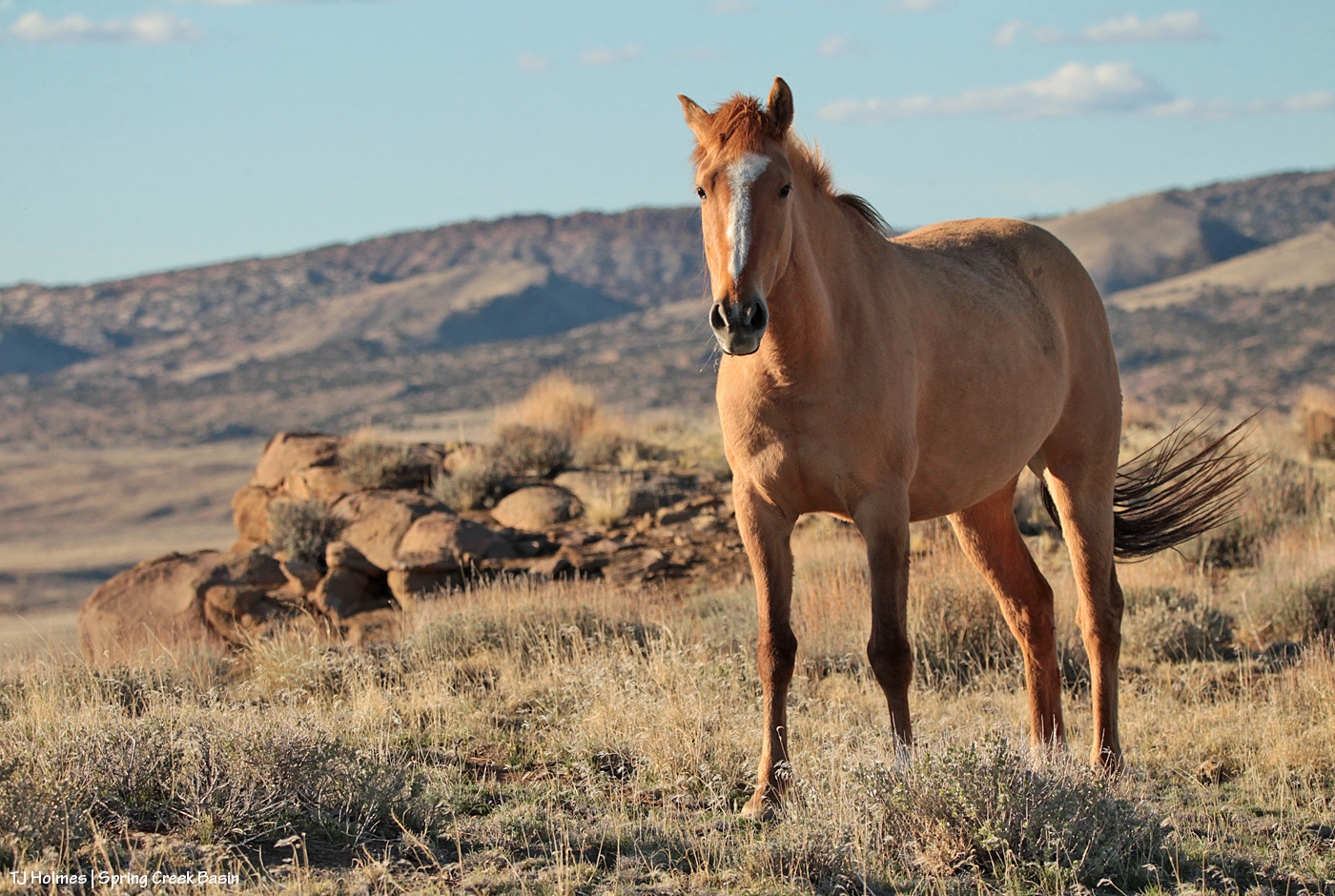
And: proof that mustangs and mountain goats have a common ancestor (!). 🙂
That’s Sundance (and one of his mares) on a finger of a ridge at the very southeastern end of what we call Knife Edge (which actually is fairly broad on top). This pic, taken with my phone as I hiked out to a series of hills to get up to the ridge that snaked down to where his band was, isn’t even wide enough to show how far to the right I had to go to get to that access area – where I could bypass the rimrocks. The other side of this ridge features a little cove, where a couple of the horses were grazing as I drove up the road to the point where I started hiking, but it’s all rimrock-locked. In other words, the only way TO that point is back up the way they got TO it in the first place.
OK, a third thing: You know I’m going to show you all some scenery from up on that ridge, don’t you? 🙂 (Here’s a crazy thing: As much hiking as I’ve done in Spring Creek Basin during the last 21 (starting to inch up on 22?!) years, I’ve never been up on that particular ridge or on the very top of Knife Edge. … The horses are very good guides at getting me to new places. :))
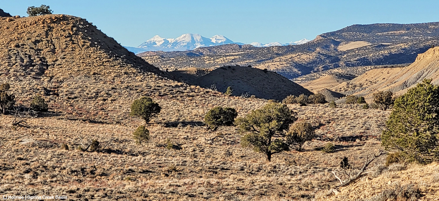
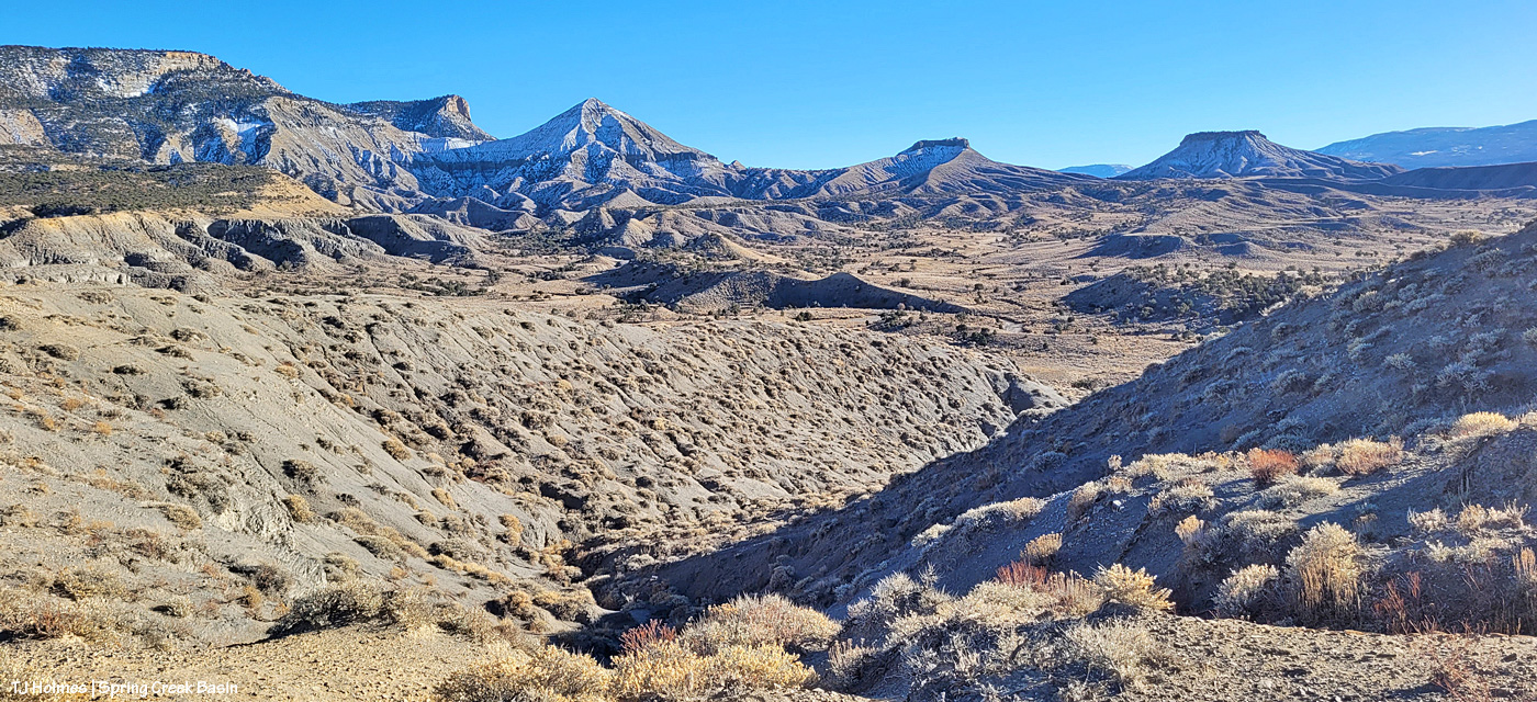
Upon leaving my buggy to start my hike (the big ridge and Sundance’s band are directly to my left), this was the first view that made me reach for my phone (aka easy-to-access camera). I’m just south of an area of Spring Creek Basin that I call the east pocket. Knife Edge is basically to about my 11 o’clock, and the sandy-colored ridges at the right of the image are what I call Valentine Mesa. The mountains are a stone’s throw away (!) in Utah; from the ridge I was later on with the horses, they’re mostly blocked by the bulk of Knife Edge.
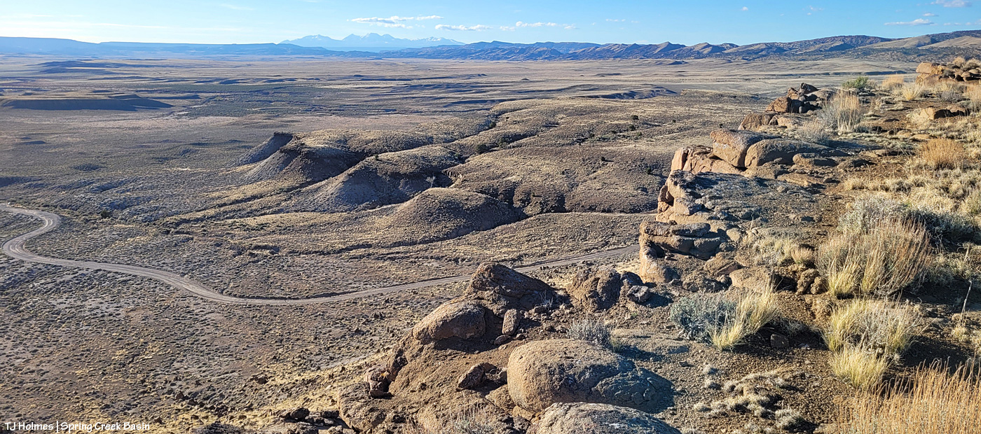
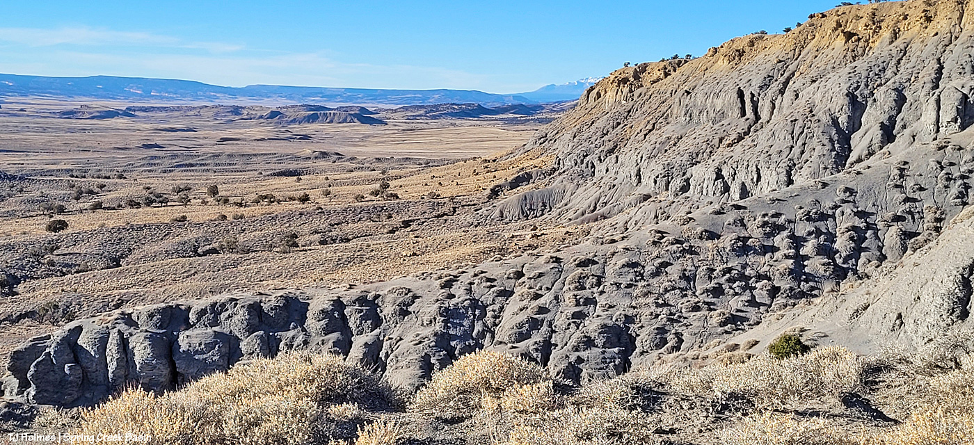
I’m up on the ridge that leads to the horses’ location farther down at the fingertip end of it. That big rise of grey Mancos shale and orangier (!) sandstone is Knife Edge. The southern peaks of the mountains are just visible way, way out against the turquoise sky. Spring Creek canyon is visible at far left. That’s the basin’s western boundary; the farthest treed ridges are the southern/southwestern boundary of Disappointment Valley above the Dolores River and its canyons.
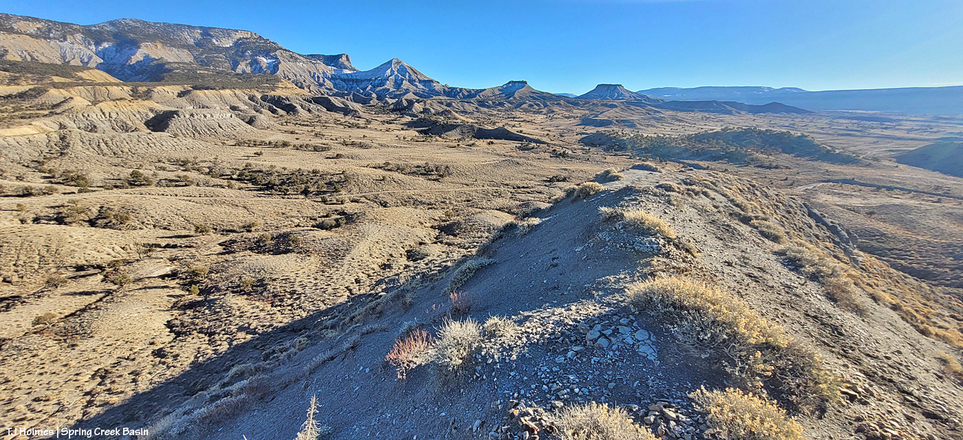
Looking left-ish from the above pic, that’s Spring Creek cutting through Spring Creek Basin in the middle ground. What I call the “weeping wall” is down there, and it provides a pretty constant source of trickling water for the mustangs. At far upper right is the eastern end of Filly Peak in the basin’s western region, and straight out is Flat Top. Round Top is barely visible at left. In about the middle ground – shadowed on its northeastish length – is the ridge I call rollercoaster (though it doesn’t look very rollercoastery from this perspective). … And see the glimmer just above/beyond it? That’s the rollercoaster ridge pond, still decently full of water (semi-frozen, depending on conditions). That’s the pond from the “Reflections” post recently. … And what do McKenna Peak and Temple Butte look like from THIS perspective?
I’m so glad you wondered! 🙂 From a little right of left: Temple Butte, McKenna Peak, what I call submarine ridge (you can see the two “arm” ridges of the actual feature from here) and Brumley Point, on Spring Creek Basin’s southeastern boundary. The Glade is in the far distance, touching the sky. A little closer – middle ground – is Spring Creek and part of the basin’s loop road (rough, and I would not recommend driving a vehicle on this section). The ridge down to the horses starts to the left and runs through the nearer middle of the pic. Sundance was actually partially visible (his back), but I don’t think he shows up very well in this pic.
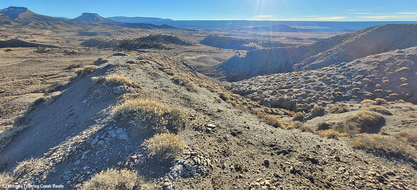
This pic (left) and the next (right) were taken from the same vantage point, but when I tried to stitch them together into a bit of a panorama in Photoshop, it didn’t work out so well. So, using the ridge in front of me as your guide, you’ll have to use your imagination a bit as you scroll up and down to look left and right (!).
If you can find the ribbon of road, out there in sort of the middle, heading uphill (to the left from this perspective), is where I was when I looked up and horses appeared, much to my wondering eyes! (Magic isn’t just the domain of Santa, folks.) If I’d been going the other way around the loop, downhill, which is my usual direction and preference given some fairly challenging road issues (!), I don’t think I’d have seen them because I’d have had to look back over my shoulder and up. I try to look in that area because I’ve seen Sundance’s band in that relative vicinity before, but see the little “cove” down to the right in the second pic (the one right above)? That’s where a couple of the horses were when I first spotted them from below, and if I’d been in a different place, I wouldn’t – couldn’t – have seen them there from the road.
Another lesson: Perspective often is everything. 🙂
Pretty dry out there. The forecast is starting to show us some glimmers of hope for coming snow. We got kind of skunked over Christmas, but fingers and hooves are crossed that our winter will start picking up in this newest part of the new year.
As usual, it’s hard to believe that another year has come to an end and another is starting.
As usual, there’s been good news and bad. … Much of the time, it seems like bad news is all the news that is news.
We need to know what’s going on in the world – from our local communities to the wider global community – but the constant onslaught very often has the effect of hurting the heart (as an understatement). Wouldn’t it be crazy if good news so dominated the headlines that bad news was relegated to the “inside pages” – or not at all? A good kinda crazy, for sure.
With this blog, I strive (in part) to provide a positive counter to the negativity that’s so easily found. If you’re here, reading, you’re looking for that positivity, and I’m so glad you’ve found it with our Spring Creek Basin mustangs. 🙂 If you get to visit the basin for yourself, so much the better. There’s truth in the phrase that the outside of a horse is good for the inside of a … let’s say human.
What follows is one photo for each month of the past year. Some have been on the blog previously; others have not. All pix were taken in the month they represent. Onward.
January
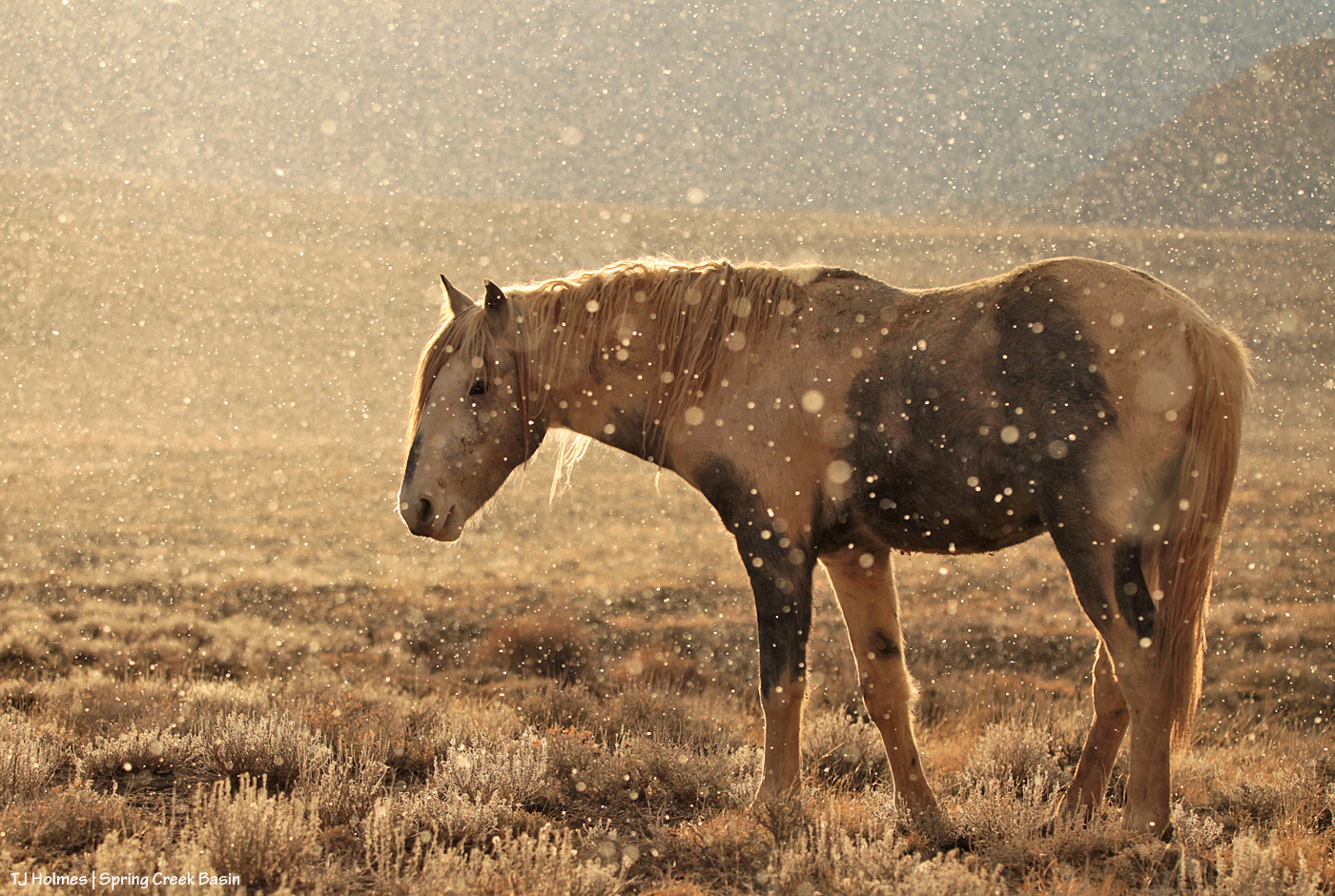
While photographing Flash and some bachelor pals, snow started floating through the air while the sunshine illuminated every single flake. I mean, GORGEOUS! The bachelor boys are famous for mostly ignoring me, but that light and those flakes demanded photographic proof. Fortunately, Flash paused his grazing – and chewing – just long enough to look at his pals, and I snapped the shutter on a magical moment. The snow ended very soon after I did so – or maybe it was the light on the snow.
*****
February
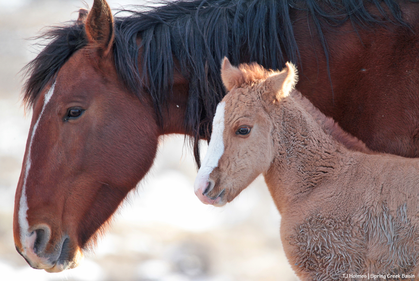
In February, we welcomed a long-awaited addition: Hollywood’s and Shane’s son, Odin. He was at least a week old when I found him and just as cute and fuzzy and stout as I could have hoped. He is growing so well and is as cute and stout – and fuzzy, again! – as can be! Hollywood no longer has his band, but his legacy continues in his son. This is still one of my very favorite pix of Odin and Shane.
*****
March
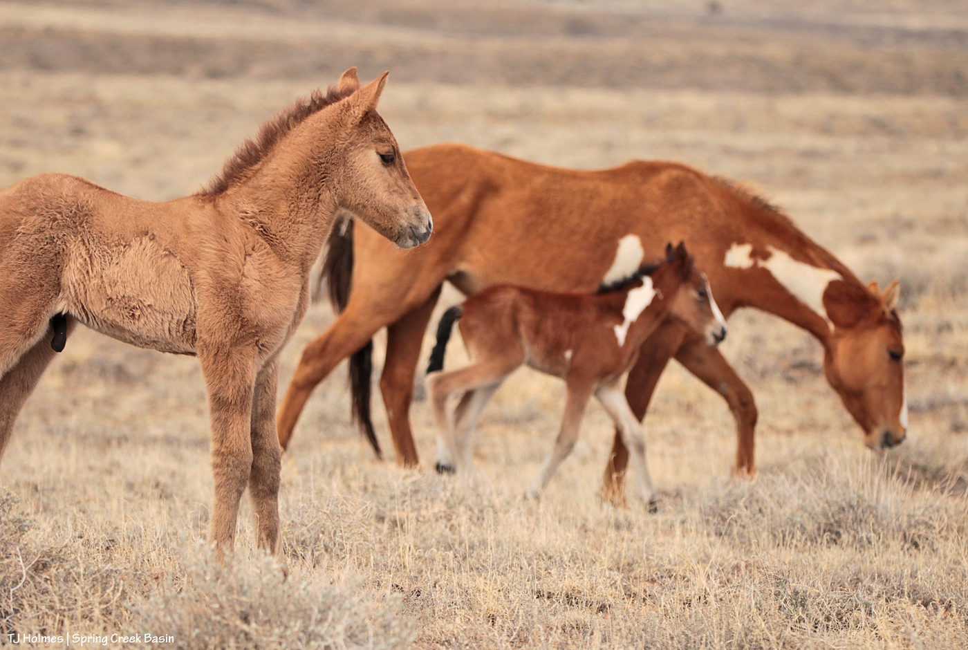
I couldn’t have been more thrilled when Dundee, one of the three introduced mares from Sand Wash Basin, had her very big first colt by Buckeye: Ranger. A couple of weeks later, Aiyanna delivered her delicate little filly – also by Buckeye – Bia. Unfortunately, we lost Ranger at about a month and a half old to unknown circumstances. Bia continues to do very well and is growing into a very lovely filly. She’s the spitting image of her mama – though she’s bay and mama is dun. She is adored by her entire band.
*****
April
As I remember, we had a nice, lingering spring. As spring was springing, love was in the air. Above, one of our young(ish) stallions, Zeb, was flirting with one of his mares. Really, who can resist his handsomeness or the flirty swish of his tail?!
*****
May
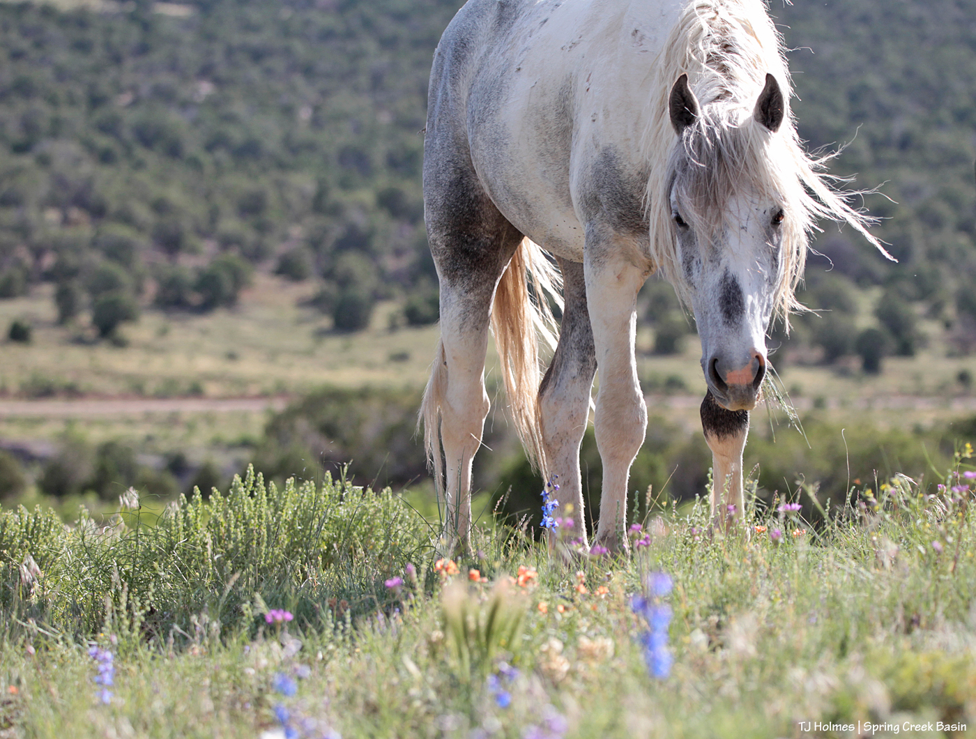
With the decent winter, we had a nice wildflower season, but it sure took its sweet time in arriving (or so I thought at the time, being, as usual, impatient). I visited my parents for Mother’s Day and left Disappointment Valley still brown and drab. When I returned, holy green! And then came the wildflowers. And once again, Flash proved a fabulous model among the larkspur (it was a bad larkspur year for the cattle folk), globemallow, wild onion and other lovelies. And the grass, of course. Green is my favorite color. 🙂
*****
June
That light! That grass! Those pinto girls! I saw Reya’s band only rarely this year, but they make every visit worthwhile. Mama and daughter Chuska: lookalike girls!
*****
July
That. LIGHT! Terra and her stallion, Venture, enjoyed a quiet moment during the height of summer. I think he adores her, and I think this moment in time illustrates that perfectly.
*****
August
Oh, this was another of those beautiful evenings in Spring Creek Basin. Buckeye’s band was napping on a hillside in an area that wasn’t usual for them. Another band was grazing down in a little cove among the hills. I walked up to take advantage of the view, then waited. Baby Bia had been napping between her auntie Rowan and mama Aiyanna. My waiting paid off when Bia ducked under mama’s neck on her way to nurse, and Aiyanna gave her a quick little casual “hug” as she did. Click went the shutter on one of those moments you never forget.
*****
September
On a stormy evening that didn’t bring rain (to us), Buckeye was guarding his band from a nearby band on the flanks of Filly Peak. (He appears to be napping, but he was alert, I assure you.) His band is to my left – and they really were napping, secure in his watchfulness. Beyond him is his mother, Winona. Her band was mostly out of sight in a little low place between here and there. The photo for this month was a tossup between this one and another photo from that same evening. Quiet, peaceful, lovely.
*****
October
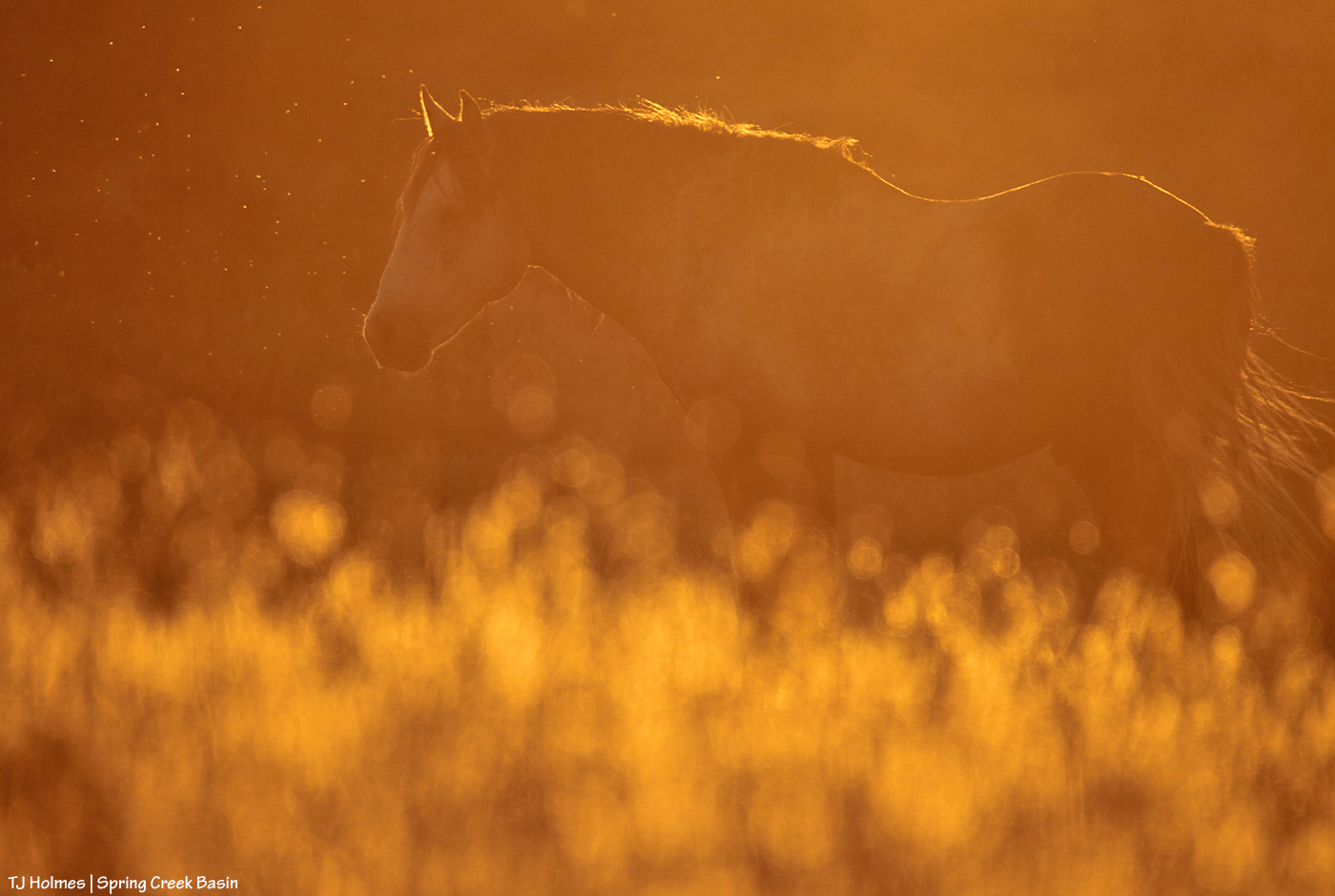
Young stallion Cheveyo was in just the right place at just the right time for the very low sun to highlight him against the far, shadowed, hill and turn the foreground grasses to dancing flames of light. I’ve said it before, but it bears repeating: I adore backlighting!
*****
November
This was the first snowfall of the season, and I was happy to find Remy’s band grazing in the western part of the basin. The sun was flirting with the clouds. A great wave of light would sweep across Disappointment Valley, followed quickly by the greyer light – the kind of light that keeps photographers hopping (and hoping). Light snow also was falling and stopping and drifting and stopping and floating and stopping. A small band of young bachelors was nearby, but they weren’t too interested in Remy’s girls. Remy took his band to water in Spring Creek canyon (the rimrocks are seen in the background), and I called it a (beautiful) day.
*****
December
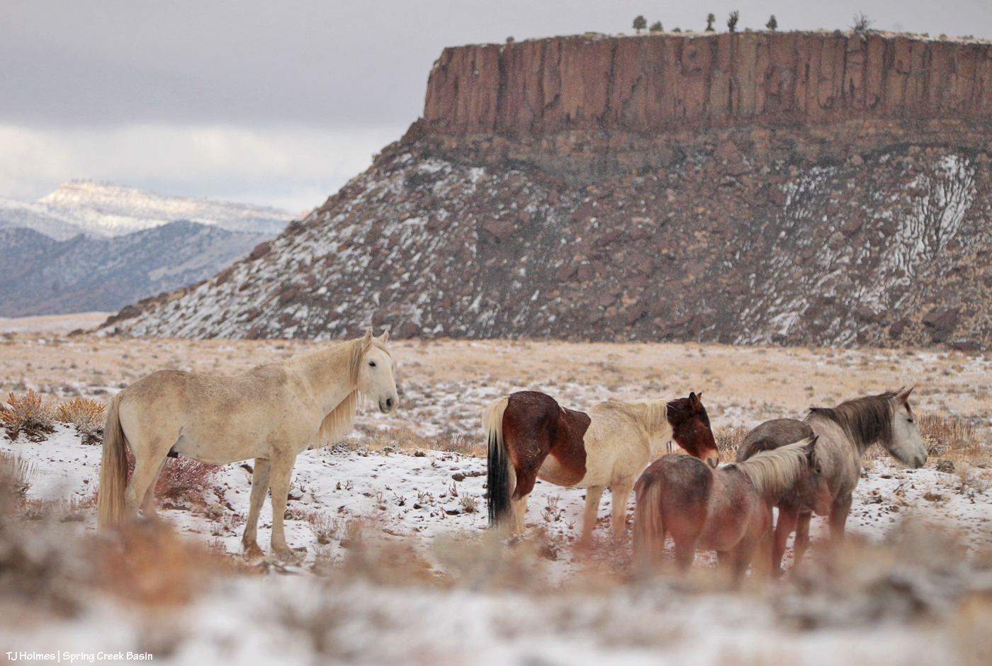
Our Hollywood, beloved and storied elder stallion, rounds out the year. This was the second snowfall of the season (and our last to date, as it happens). The snow was a little deeper, and it stayed pristine a little longer, than the first. The day was glorious for a hike, and that’s how I found Hollywood – originally drinking at a nearby pond. Here, he’d walked away from the pond before he stopped for a nap. As hard as it is to see the aging process at work on him, and missing his loyal mares, it’s always good to see this wonderful wild stallion.
*****
Bonus
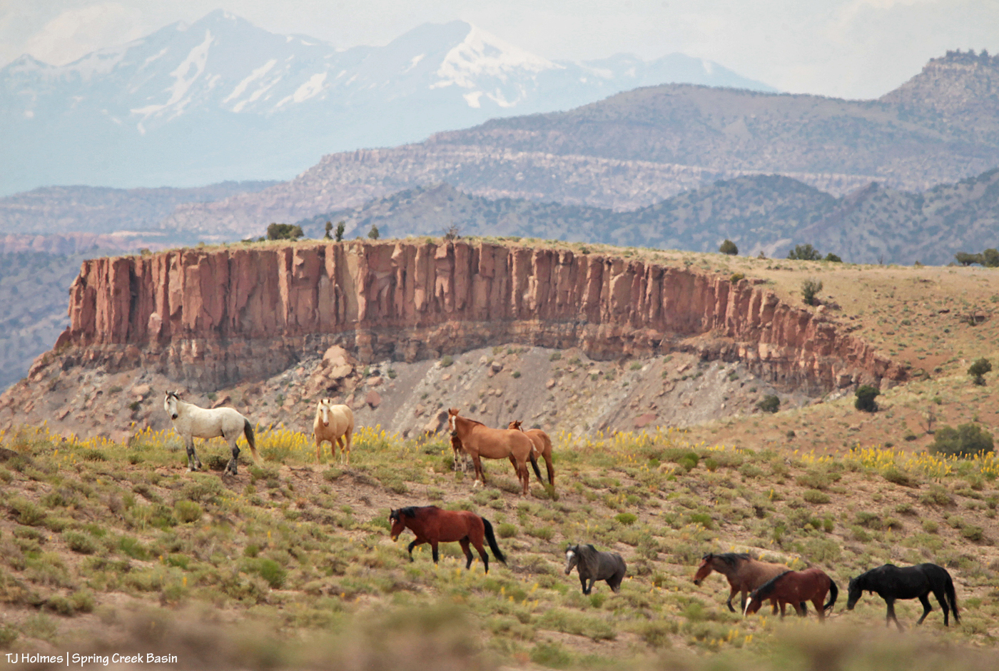
Taken from very far away, I love all the layers in this image of Buckeye’s band – with prince’s plume! – and Tenaz and the band he escorts. A dear friend was with me at the time, and the enjoyment was doubled to have her along for the visit.
*****
Happy New Year’s Eve, everyone! Best wishes to you all for a happy, healthy and positive 2024!
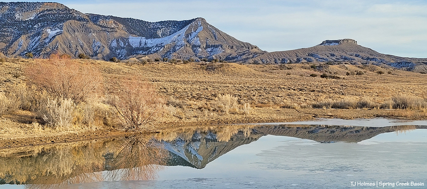
This is a pond in the eastern-ish part of Spring Creek Basin, and on this lovely winter day, there was some skim ice on the surface. The reflection of McKenna Peak and Temple Butte (see it, just barely, behind McKenna?) and submarine ridge was perfect on a day without breeze.
At the end of the year, of course, we like to *reflect* on the past year before we look ahead to the coming year.
We had no big projects (or any projects) for the mustangs in Spring Creek Basin this year. The new catchments were a huge relief to yours truly, especially as last winter wasn’t too snowy for us in mid-to-lower Disappointment Valley, and the rest of the year was pretty warm and fairly dry. We did start the year with good ponds, and though they all went dry as summer dragged on, later rain filled the ponds and kept the catchment troughs filling with water for the mustangs.
Our foals are growing and thriving; they’re the light of their mamas’ and daddy’s and aunties’ eyes – and this human’s, too.
We potentially have some projects coming up, and I’ll let ya’ll know about those as they come to fruition. Otherwise, it looks like another quiet year for the mustangs. As always, we’ll need snow and rain – as much as Mother Nature wants to pour out (and then some, but when asking, we don’t like to seem greedy!).
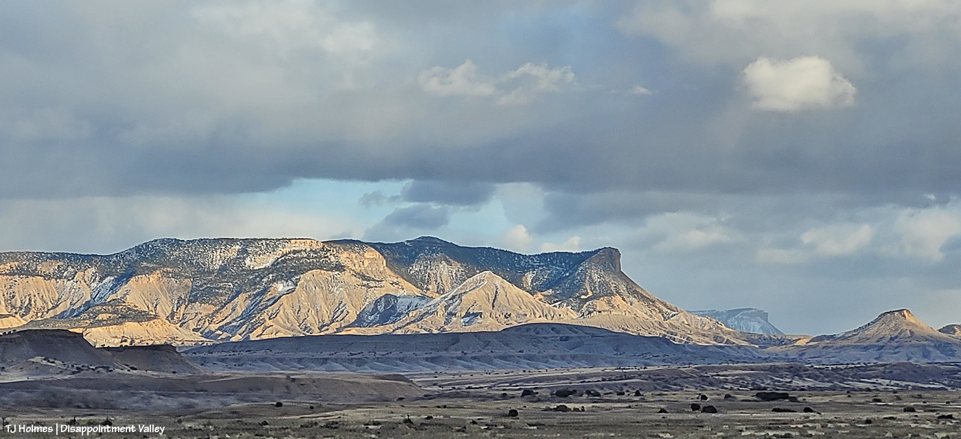
From about mid-Spring Creek Basin looking northwest not long before sunset Friday evening. You know, the day we were supposed to get snow.
The passing snow squalls were “this side” (eastish) of Utah’s La Sal Mountains.
Later, very just most immediately before sunset shuttered the light on the rimrocks above Spring Creek canyon, the snow had passed, but the light was still gorgeous.
I was hoping sunset would light up those clouds like it did the previous night, when I was driving and had no camera to hand but my phone.
The cloud/sunset light show never really materialized (some subtle color), but THIS color is always gorgeous and rewarding! (Some snow ON us would have been greatly appreciated.)
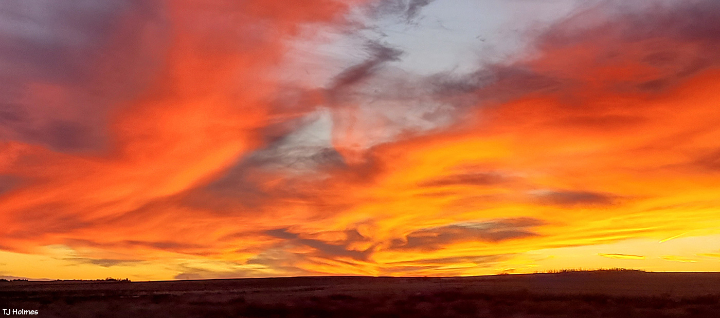
Because I’ve referenced it, and because it deserves to be seen, this was the light show Thursday night from U.S. Highway 491 heading north from Cortez, Colorado:
The best camera is the one in your hand. The best light is that in front of you, wherever you are. 🙂
This handsome fellow was spotted a couple of days after the end of fourth rifle season. Some does were nearby. He wasn’t too interested in posing for pix. … I’m just glad he hid himself away the last couple of months.