
Late, late, golden light on beautiful Alegre.
Late, late, golden light on beautiful Alegre.
Beautiful Temple at glorious sunset.

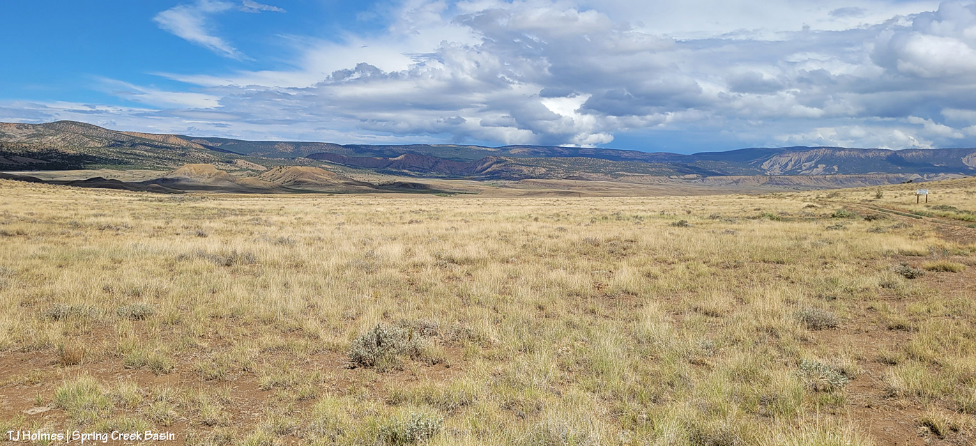
Just another beautiful day in Spring Creek Basin.

And another beautiful night.

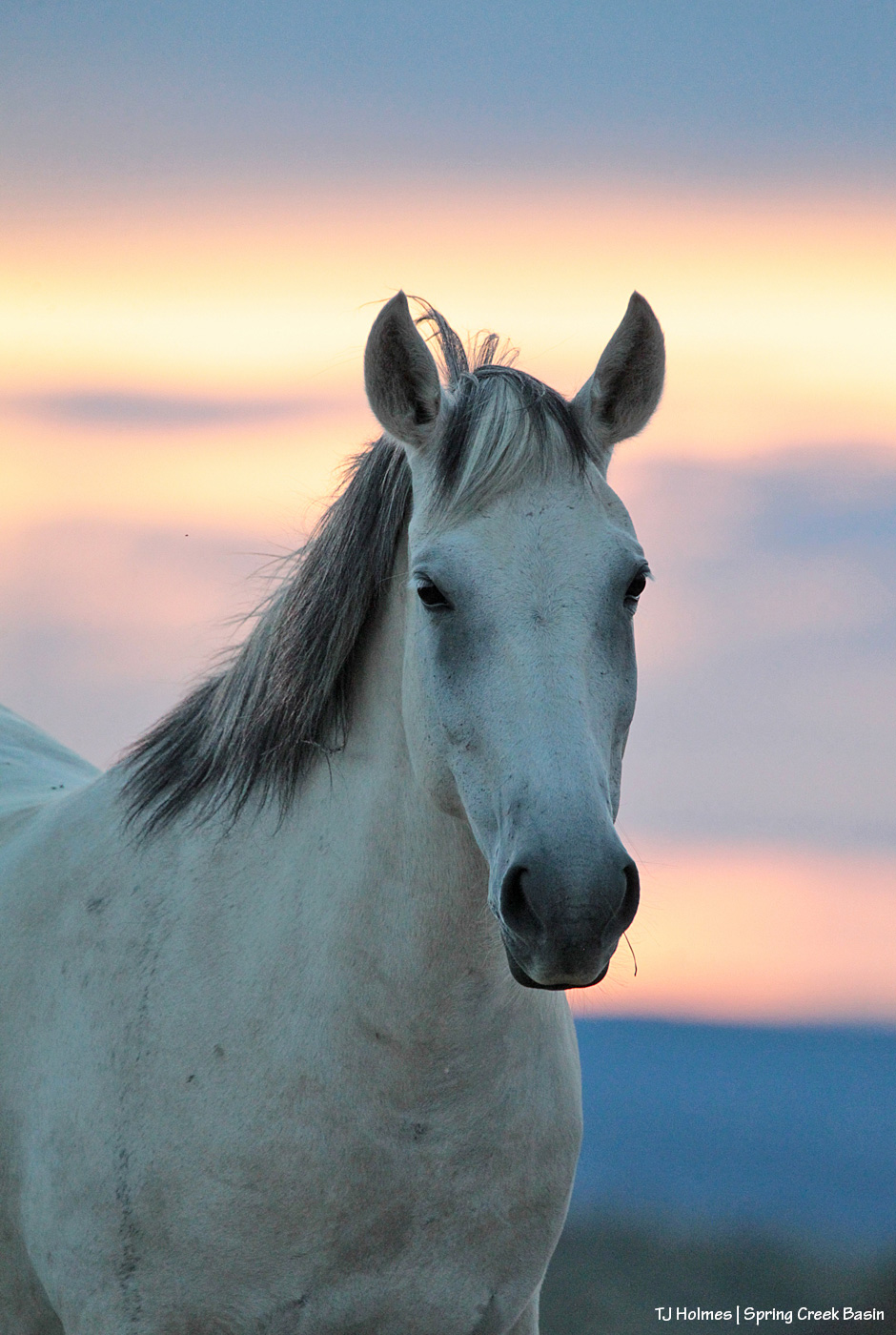
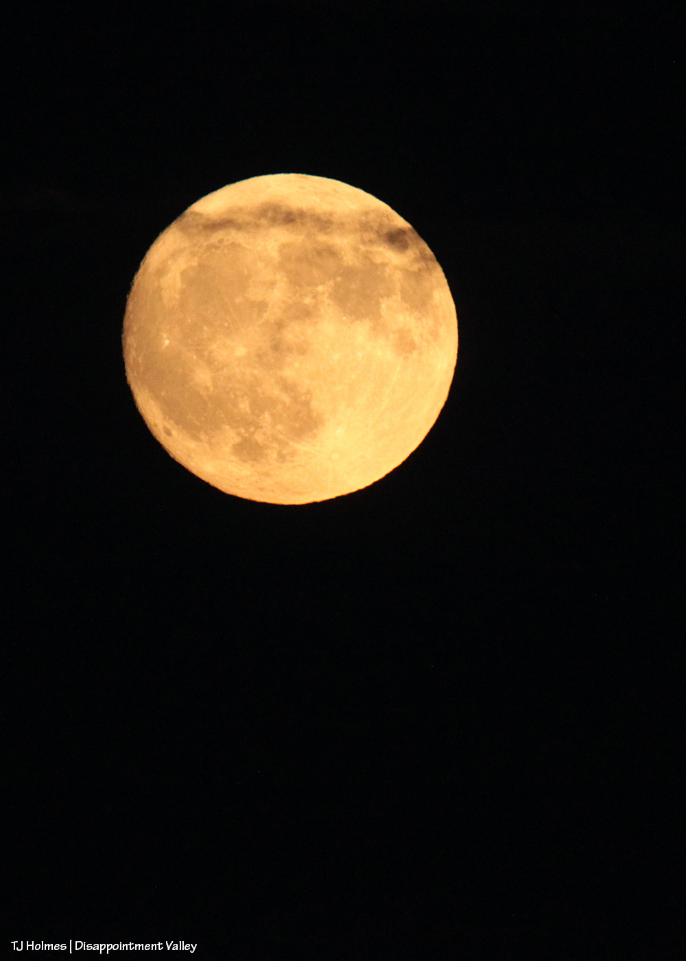
While you marvel at the gorgeous grey beauty of Alegre and Maia, allow me to point out a couple of things: the nearly full August super blue moon (!) rising over submarine ridge on the far horizon … and ALL. THAT. AMAZING. GRASS!!!!!!!!!
Unexpected clouds prevented more than a brief sliver of a glance at the moon – already risen – last night (with also-unexpected rain after dark!), so I’m glad I made it out the night before last to see it rising pale and a bit lopsided over a most lovely band.

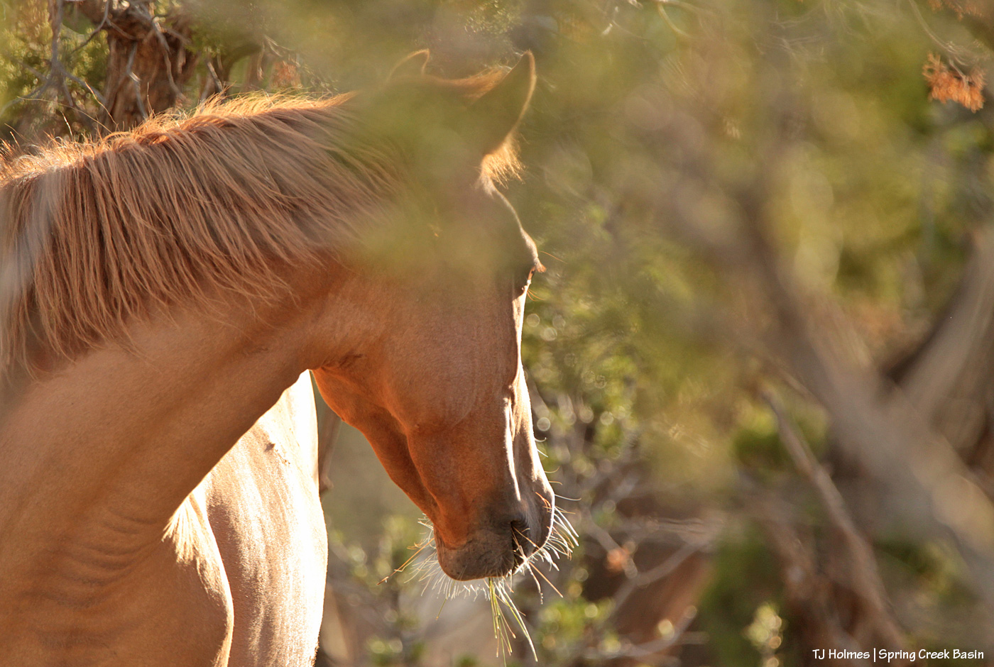
In many places, the horses are literally up to their eyeballs in fantastic, fabulous grass (equines, as you might know, evolved on the North American continent as widespread marshes became vast grasslands, and part of that evolution was eyes placed high on their heads particularly TO see over the sea of grass to spot predators). As our summer slides toward fall, it’s an enormous relief to see such bounty in Spring Creek Basin for our mustangs. (As rain drips outside, it’s easy to forget the long, hot, dry days and feel only gratitude for current conditions!)

Not a usual pose, but I love the light shining through Dundee’s eye as she looks back at another band moving through the pinon and juniper trees in Spring Creek Basin’s north hills. And also the bit of dead juniper at upper right that looks like a monarch butterfly. 🙂

Sundance and his long-time mare, Arrow, share some closeness on a recent warm evening while rain curtained the horizons around us.
*****
Happy FIFTY-FIFTH anniversary to my wonderful mom and dad – Nancy & Dave! As long-time readers know, they gave me my love of horses. Truly, I couldn’t have escaped it I’d tried (and I certainly never tried). From horse-loving teenagers in Ohio to Texas ranchers (lotta time and other states and countries between those years!), horses have always been part of their – our – lives. I really can’t thank you enough for the lifetime you’ve given me (and Jeff) of love and support – and horses. 🙂 You both are my anchors and rocks of support in crazy times (and always, appreciators of rain :)).
Here’s to love and commitment – and many more years to come! 🙂 I love you, Mom and Dad!

Sundance is starting to show his age this year (19, I think), but the light – and we – love him.
Hold onto your paddles, folks, have I got some rainwater for you. 🙂
Brought to you courtesy of Mother Nature –> Southwest Colorado –> Disappointment Valley –> Spring Creek Basin:

A full water-catchment trough is always a good sign. Fortunately, though low (in the tank, uphill behind me), we’ve had enough rain lately to keep this trough full – and there have been a fair number of horses drinking here with the amazing grass around (don’t let the pic fool you; the galleta, in particular, is bonkers this year, along with the alkali sacaton). I may have explained this in the past, but it bears repeating: The triangular sheet of metal over the trough is an evaporation cover, designed to help slow evaporation of precious water in our (usually) dry climate. The shape of the cover is triangular so the horses have plenty of room to drink at the sides of the round trough.

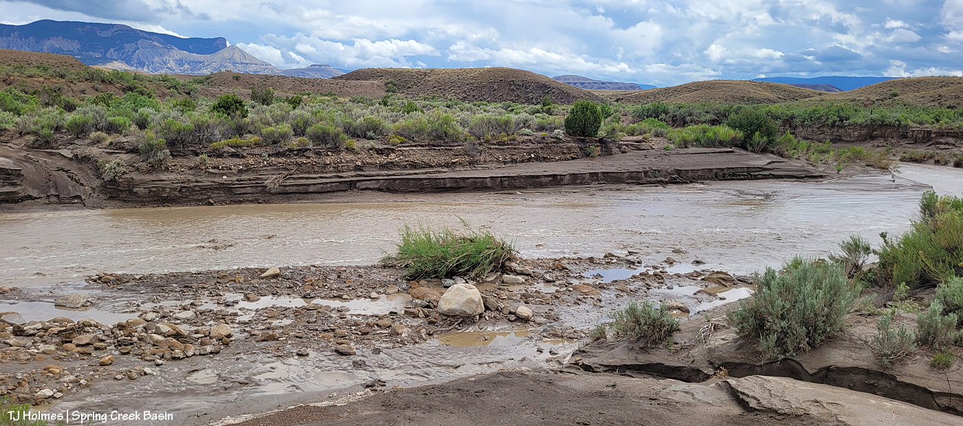
The Flat Top pond looks small in this wide-angle view looking eastish across Spring Creek Basin, but although it has gotten pretty shallow in recent years, it’s a pretty good size.

Good thing I scouted the V-arroyo before I tried to cross it. Those are my tentative footprints in the pillowy, shoe-grabbing – and tire-stopping – mud in the center bottom of the pic. You might not think it’s too bad, but there’s a lot of water in/under that surface mud still, and it is NOT friendly to tires or shoes until it has a chance to seep deeper into the soil and dry out from the bottom up. Along the left side of the pic is the arroyo – we’re looking upstream. The bottom of the arroyo, where I’m standing on relatively firm ground, isn’t very wide (hence my name of the “V”-arroyo), and the road rises to my left – up a little water-carved bank that’s nothing like the wall still in place on the other side of the first Spring Creek crossing.

Holy Spring, err, RIVER! I know it’s hard to tell, but this is the first crossing of the usually-dry arroyo that is Spring Creek (when it’s not masquerading as a rainwater-swollen river). Yes, the other side is a road. 🙂 Well, it’s mostly a two-tiered wall; the right side of it is where I dug a channel in the wall the last time the creek ran (back in June) so I could get my ATV across and up and over. It has been widened by crazy people in a truck (I don’t know who … I don’t know anyone that silly/stupid/nutso), but it’s greatly eroded again and is going to need some custom shovel work. (And lowering of the water level. :)) The width here is probably about 25 yards? (Good darting distance.) And this water level is at least 4-5 feet below where it was at its highest/widest mark, behind me, so it’s already running with less volume than at its peak. (WoW!)
I took a lot of pix from here, and I wish I knew how to embed video; I’m still on a super-high from seeing all that water. Bear with me as I show you some upstream and downstream and high-vantage pix. (If you don’t think water in the desert is A BIG DEAL, you don’t live in a desert.)

Looking downstream. Note the two-tiered wall across the creek where the road is (should be). Most of the rocks at left are from previous flooding. But I will tell you, that kind of water can move BIG rocks. I have seen it, and I have moved big (enough) rocks out of the way of crossing in a vehicle or ATV. This is why the powers that be warn people against crossing flooded roads; that water literally grooves arroyos into our salt-desert landscape (milennia ago, this was under a giant ocean!).
Arroyo as defined by Merriam Webster: plural arroyos. 1. : a waterway (as a creek) in a dry region. 2. : an often dry gully or channel carved by water.). … Arroyos are a desert’s proof of water movement – that far bank/wall is much taller than I am. The wall where the road used to be is proof that they’re always changing – with more water.

Looking upstream. Note the water at far right; it was still finding ways to trickle along downstream.

A bit wider view from back up the road a bit. I mean … ?! 🙂 I knew, before ever I got there, that I wouldn’t be able to cross, but I did NOT know how river-esque Spring Creek would be. I love, love, love this place.
Similar view, but this shows the bend in the creek at right. … Try to follow me upstream: See McKenna Peak (the pyramid-shaped pointy peak)? Way back there is the source/start of Spring Creek, which – as you all know, being loyal, wonderful readers of this blog – drains Spring Creek BASIN (along with all its multitude of widely (and narrowly) and wildly variable tributary arroyos). As you may or may not know, the creek doesn’t roll in a straight line from there to here (or beyond/behind/downstream of me). So that bend goes around to the left – upstream of the southernmost *major* drainage/arroyo in the basin – and past another creek/arroyo crossing (below the dugout, if you’ve visited). It comes from the eastish side of the basin – with the northernmost *major* drainage/arroyo entering from the northish to also run back to (really from) the northeast. Are you still with me? There are three *major* drainages in Spring Creek Basin with Spring Creek being the lowest, middle drainage – named as the very-most-major drainage and namesake of the basin it drains.
Water is important here. Knowing how it flows is part of the importance. Back in the very-long-ago day, some other silly people – who apparently didn’t know about arroyos and the highly-erodable quality of the salt-desert soil – tried to dam Spring Creek just below the confluence of the third major arroyo. Thinking they would create a reservoir out of which to irrigate land for farming (what WERE they thinking?), they built a dam and dredged miles of irrigation ditch; the remains of both can still be seen. As the story goes, the first major rain of the (likely monsoon?) season brought water rolling like a river down every tiny arroyo, down to and through the big drainages, blasted a hole in the dam that likely had cost boatloads of blood and sweat and resulted in tears (!) … and they went away *disappointed* (har har). … Mother Nature always wins, folks.
Well, I knew better than to attempt the crossing of Spring Creek Basin’s *river* (without more rain … which we’re getting again as I type … the creek would likely be done flowing within 24 hours … though the water will last in pockets and seeps for a good long while), so despite the big group of a couple of bands of mustangs not far away, I headed out, already on a great big, marvelous high.

What you’re looking at in the pic above is our crazy-good grass, which amazes me because of the little – but always valuable – rain we’ve gotten this summer (this year, really; it’s been pretty darn dry since *last* year). The galleta grass is particularly bonkers this year, along with the sand dropseed and/or alkali sacaton (very similar in appearance). This is from right inside the basin’s main/western boundary entrance looking eastish.
From here, my next destination was the south rim of Spring Creek canyon, through which water runs out of Spring Creek Basin, out across lower Disappointment Valley and into Disappointment Creek, which delivers water – along with a “healthy” (aka large) dose of salt and sediment (apologies) – to the grand and spectacular Dolores River.

Spring Creek, draining Spring Creek Basin. 🙂 Around the near (left) bend, before the far bend, there’s a fence across the wide-open low ground and a water gap across the creek; that’s the basin’s western boundary. Way yonder, on the horizon, on the far side of the farthest rimrock and even beyond that blue-grey tide of rain, is the south shoulder of eastern Utah’s La Sal Mountains.

Not even my phone’s widest angle is wide enough to take in all the gorgeousity of Spring Creek through its canyon, so here’s another bit of view that takes in more of the upstream canyon area. Spring Creek Basin stretches north (straight ahead of me) and east (to my right) and south (behind me) from this perspective on the canyon’s south rim.

Those layers. The canyon is neither super deep nor particularly long. But it is so gorgeous.

In just the short time I walked out and spent along the rim, the storm to the west was already passing.

Looking upstream across the heart of Spring Creek Basin, where another storm loomed on the northeastern/eastern/southeastern horizon.

And because this is a blog about the wild horses of Spring Creek Basin, there IS a mustang out there, though I’m not sure he’s visible. As far as I know, the young mister is the only one to have crossed the creek (within view, anyway). 🙂
Grow, grass, grow!
Better late than never (this was the last day of specific rain in the forecast). I think we can be said to have gotten some monsoon rains this summer. Despite all the worry leading to this day (yesterday), soooo amazingly grateful. 🙂
* Thanks to Charley Pride for the inspiration behind this post’s title – “(High on a) Mountain of Love.”
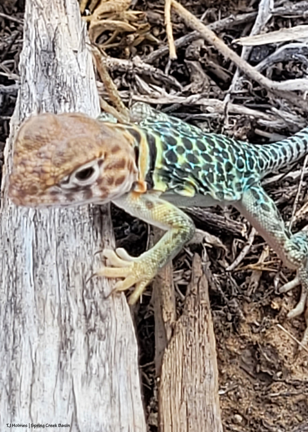
Warning: Extreme cuteness ahead (and no, it’s not any kind of equine).
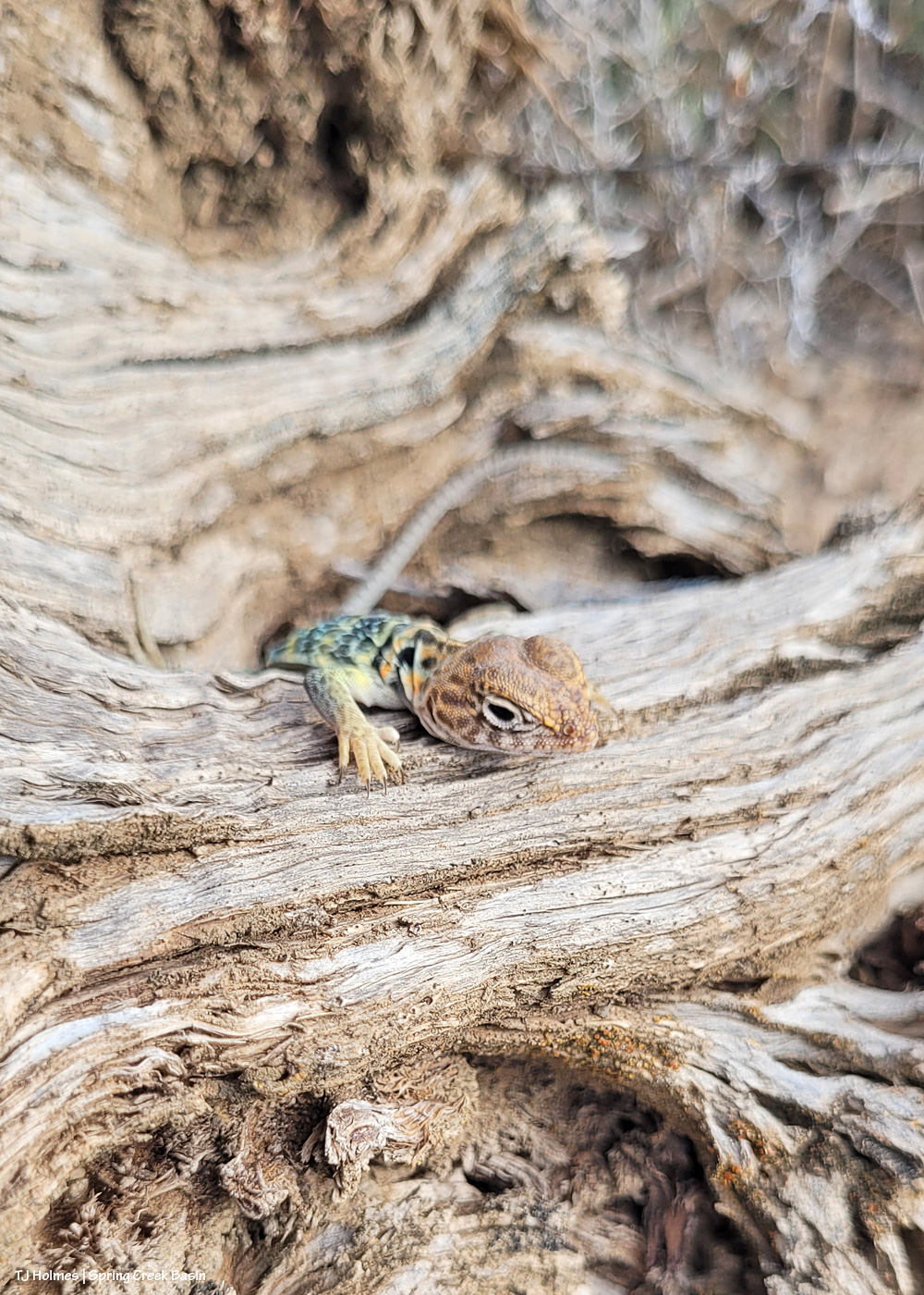
In Spring Creek Basin the other day, I got some unexpected – and adorable – help when I found and dug up some old, buried beer/liquor bottles (past hunter camp, and yes, they actually *buried* their trash instead of hauling it out!? I’m not sure whether that’s better or worse than the glass bottles they tried to melt away in their stone-ringed fire pit?!).
Forgive the painterly (read: out-of-focus) quality. I was focused on trash pickup, not ponies, so I didn’t have my big gun, just my phone. And this little guy/gal was TINY (how often do you get to capitalize a – literal – tiny word?) – and fast in his/her quest for ever-newer places from which to check me out.

Two brown-glass beer bottles, an old beer can (Budweiser) and a bigger liquor (?) bottle of some kind (being a non-drinker, I don’t know all the lingo). Does it give you an idea how teeny this little baby is? Not counting its very long tail, from snout to back legs, it wasn’t any longer than my pinkie finger – and probably about the same “roundness”!
S/he had me at hello, but I’m completely in love with those dorsal – not stripe(s) – but spots! Stripes are reserved for the very long tail.
And like every other baby: curious, curious, curious!
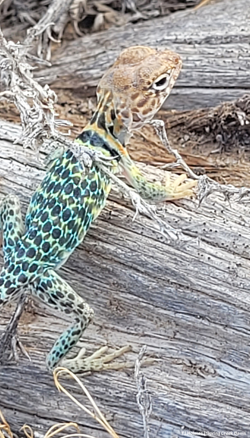
Are you going crazy over those spots?!
I asked him/her to wait while I schlepped the bottles (and some old cans) down the hill to the road, but it took a while, and on my way back (schlepping my camera and another bag), I spotted – and spent a fair amount of time digging out – an old tent spike, and the critter had moved on to other (more) interesting lizard things.
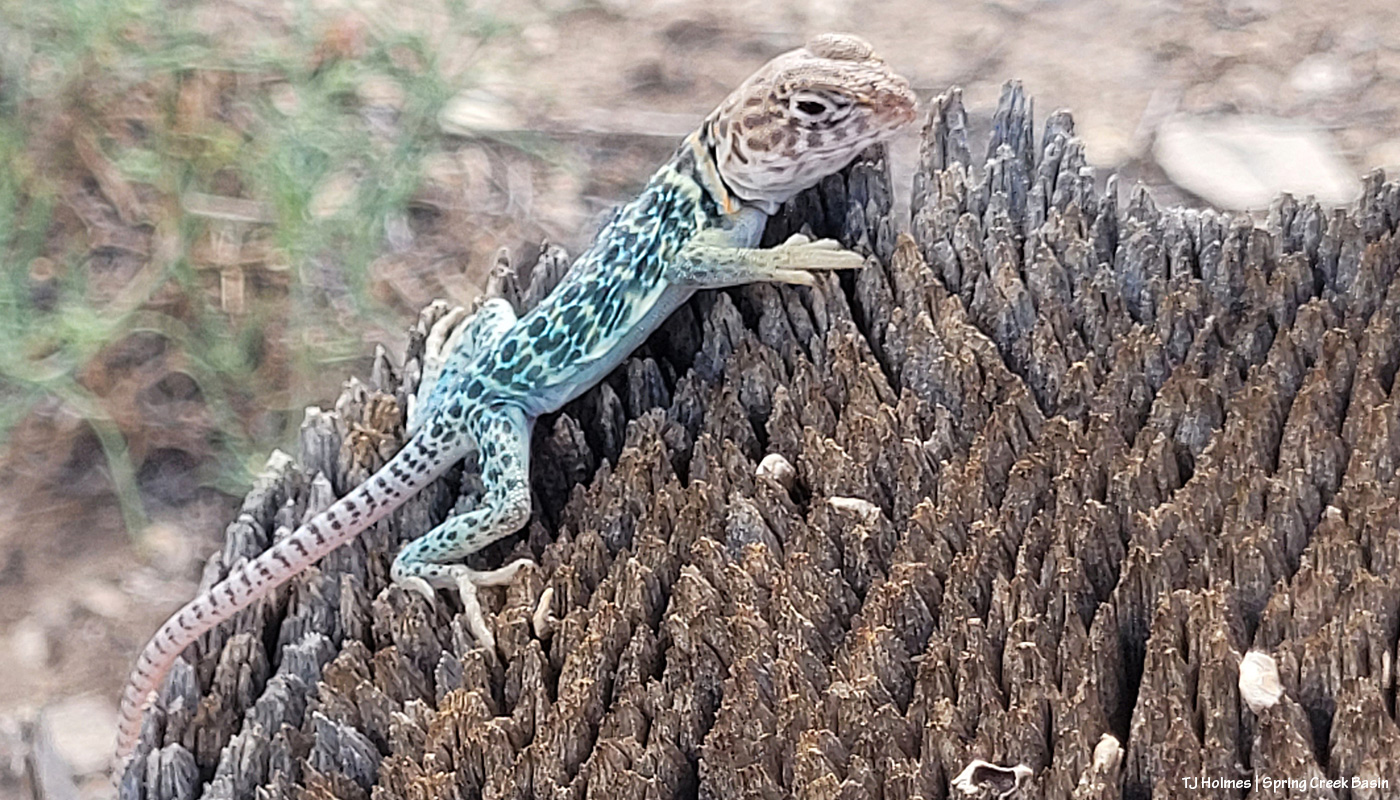
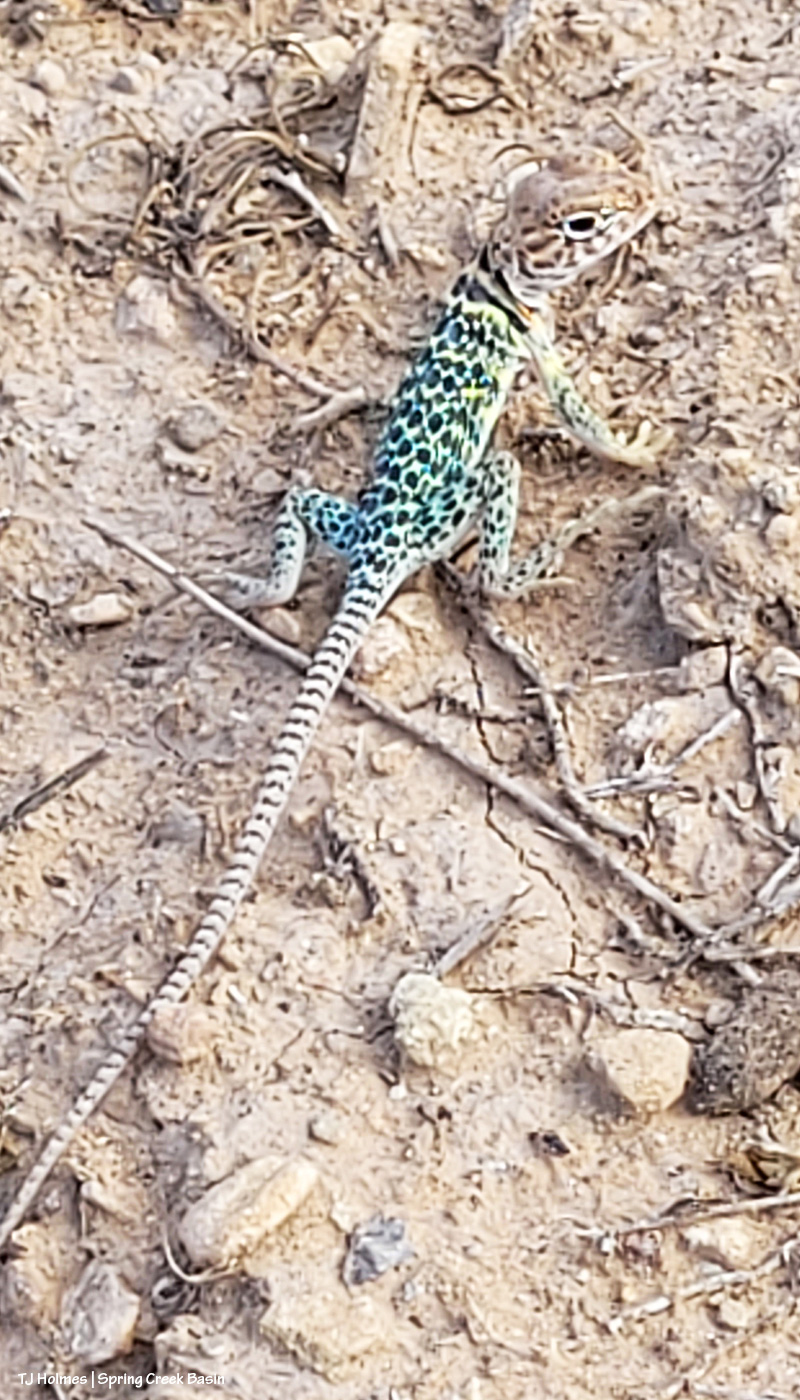
I’ve shared some pix on the blog before of collared lizards, which I adore in general, but this little baby was my absolute very most bestest favorite!
And because the light was so scrumptious, a bonus pic:

Heavenly angel light over Storm’s band. Storms did rumble across the north that night but didn’t really reach the basin – until the next day. 🙂
On the rain front, let me illustrate the craziness: The past four to six days, we’ve had rain in our forecast, ranging from 30ish percent chances to a whopping (for us) 60 percent. We’ve heard the rumbles and seen the flashes. We’ve enjoyed the cooler weather (80s from 90s-near-100). We’ve marveled at the rain curtains around and beyond the valley.
The day we had the 60 percent chance? We got nada. The day we had zilch to 15 percent? Yeah, it rained. OK, for maybe 20 minutes tops (graupel, too!), but I’m expecting to see more in the rain gauge than the 0.03- to 0.12-inch (no more than a quarter of an inch total) drizzles we’ve gotten out of those “big” rain chances. It actually left puddles instead of a ground that wasn’t even left wet.
I AM GRATEFUL!
How crazy is rain in the (high) desert?
Napping never looked so beautiful. 🙂
