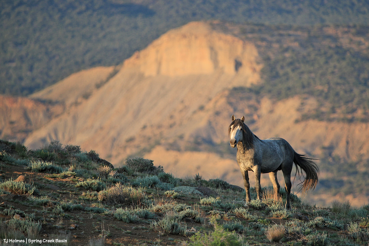
Catchup

5 07 2026

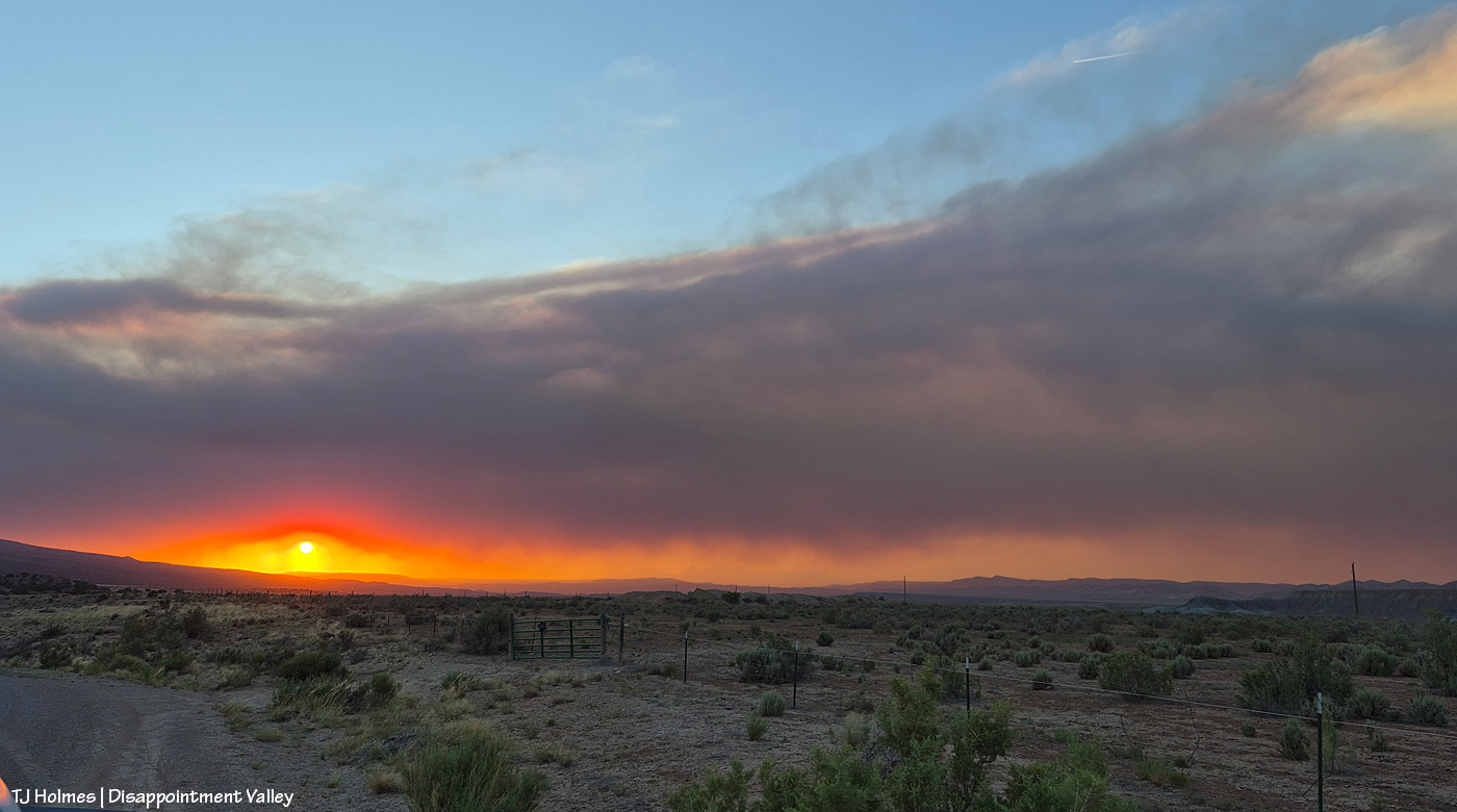
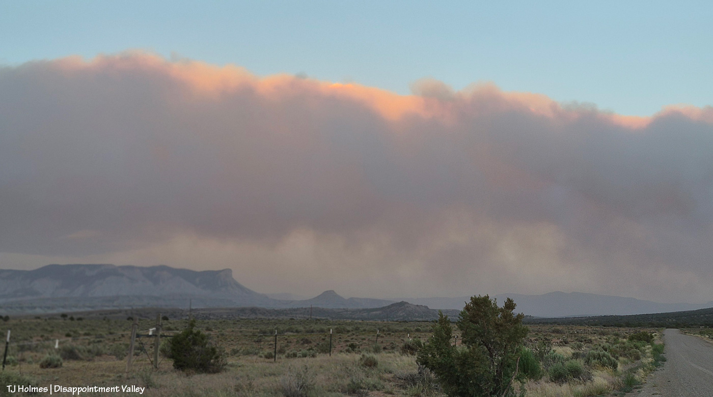
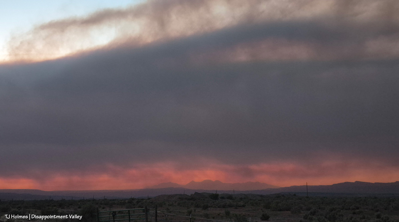
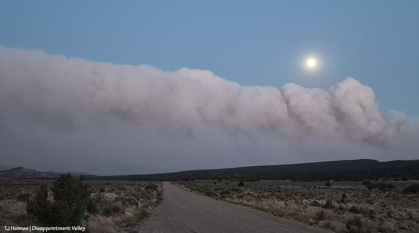
These pix were taken the evening of Friday, July 3:
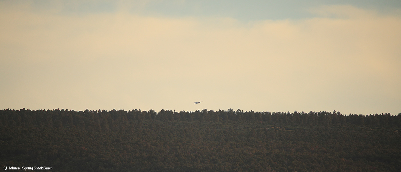
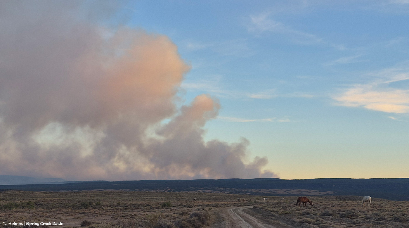
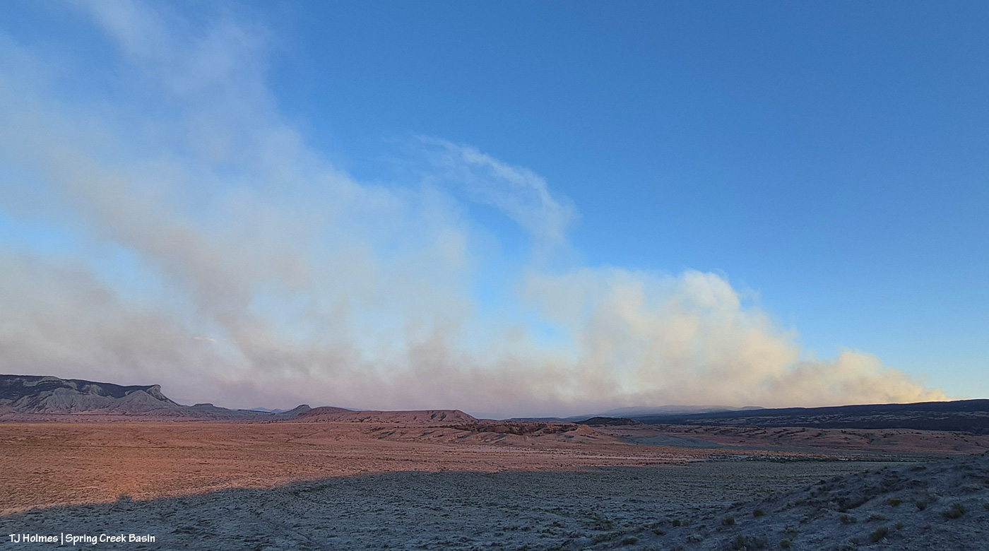
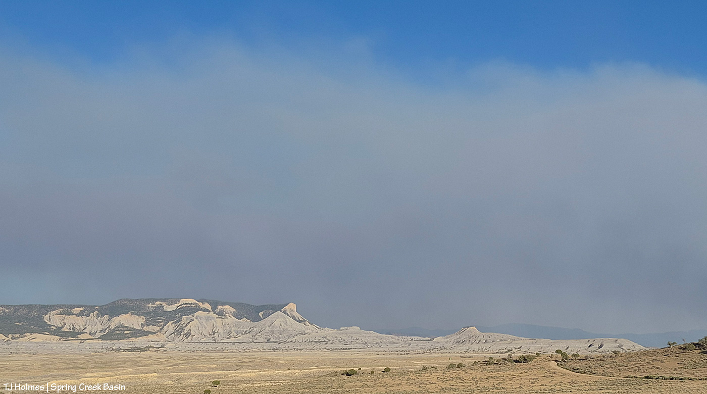
I wasn’t going to go to Spring Creek Basin on Friday. Just watching the smoke from a relatively safe vantage, I *cannot* even begin to fathom the strength and accompanying exhaustion of the firefighters, the law-enforcement rangers, officers, deputies, residents evacuating the Ferris Fire (and others around the region; we’re all in our own communities of what-ifs and fears and plannings). Then, in the evening, the smoke did one of those giant plumes on the west/southwestern side (where it crossed the Dolores River), and my journalist brain kicked in (journalist brain = aka nosy-nellie = aka curiosity-never-hurt-anybody, eh?), and out I went. Above: From Chrome’s Point at the western side of Spring Creek Basin, looking nearly straight south, see the plane above the treed ridge (that’s the south ridgeline of Disappointment Valley at the lower-ish southwestish end/side of the valley)? I regularly use Chrome’s Point to glass a big swath of the big basin that IS Spring Creek Basin, and from there, I heard the drone of a big plane (air tanker), and to my surprise, I actually saw it. It was much higher when I first spotted it, flying from right (west) to left (east) … then it banked to go south, and as you see it above, it’s turning east/southeast again and just about to drop out of sight. Again, there’s a fair (!) amount of distance between the fire and the basin, so there was no way I’d see it drop its load of retardant slurry … but I’m sure you can find impressive videos online of those pilots doing that amazing work.
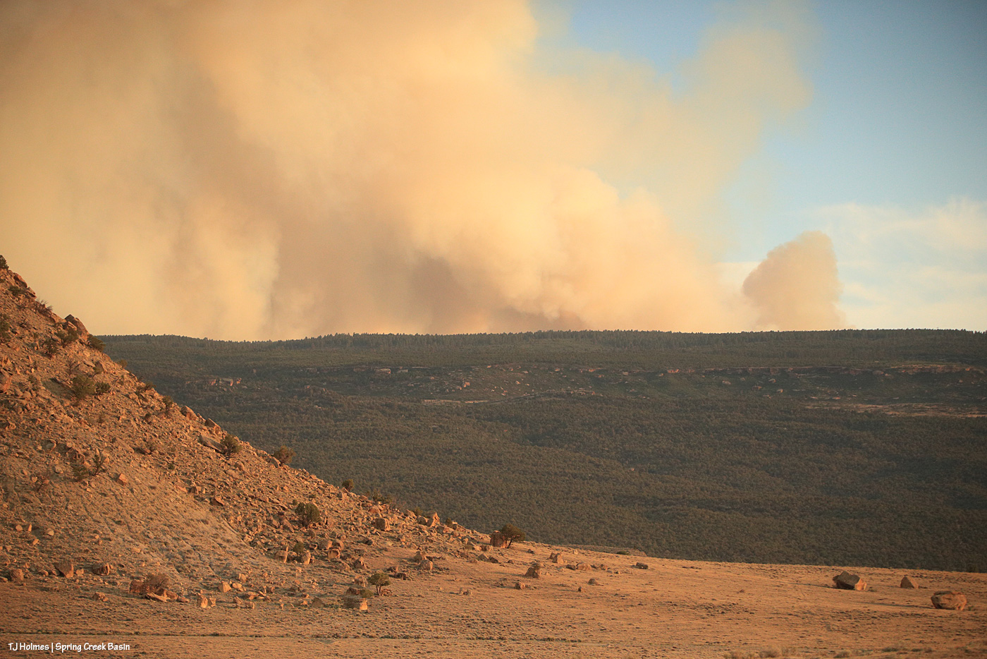
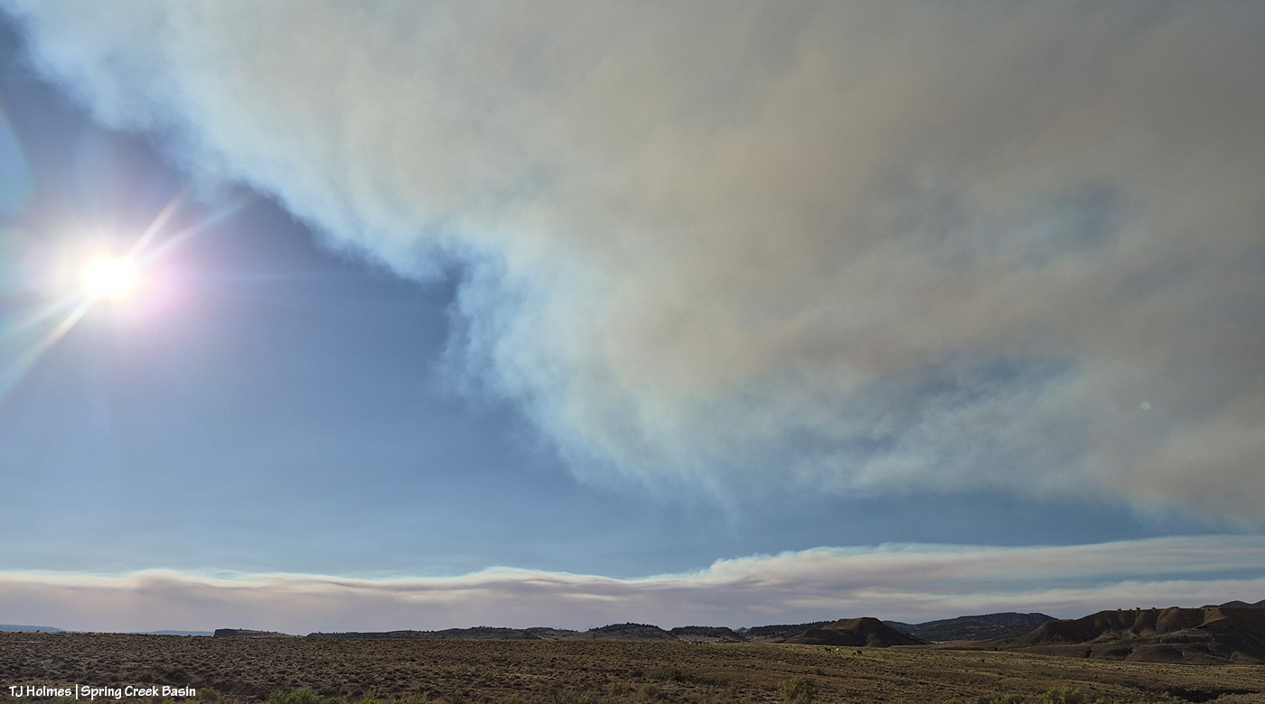
This was as backed out as my big lens could go to give you a view – and context – of the western end of Filly Peak at left, the straight-south, far southern ridge(s) of Disappointment Valley and Friday evening’s blowup of the west/southwest side of the Ferris Fire, burning south of Disappointment and Spring Creek Basin in northern Montezuma County (where it started) and right up the westish-middle of Dolores County. San Miguel County is the next county north, and that’s where this part (and most of) Spring Creek Basin is located. … Interestingly, though I thought I hadn’t caught the plane in this image, when I was way zoomed in on the computer to clone out (dratted) dust spots, I’m pretty sure I actually spotted it, juuuuuust above the tree line at far right. Again, the pix above are from Friday evening.
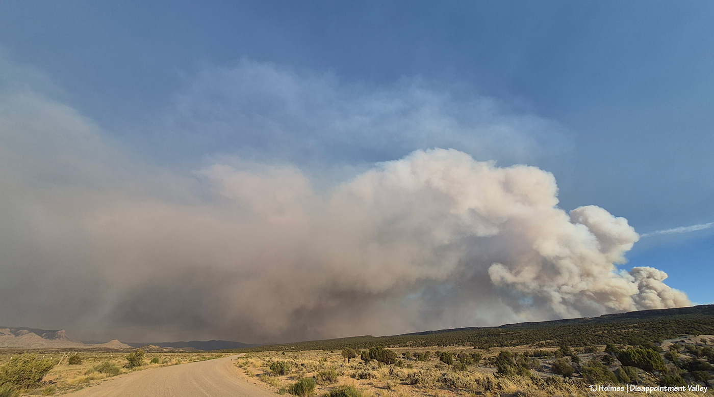
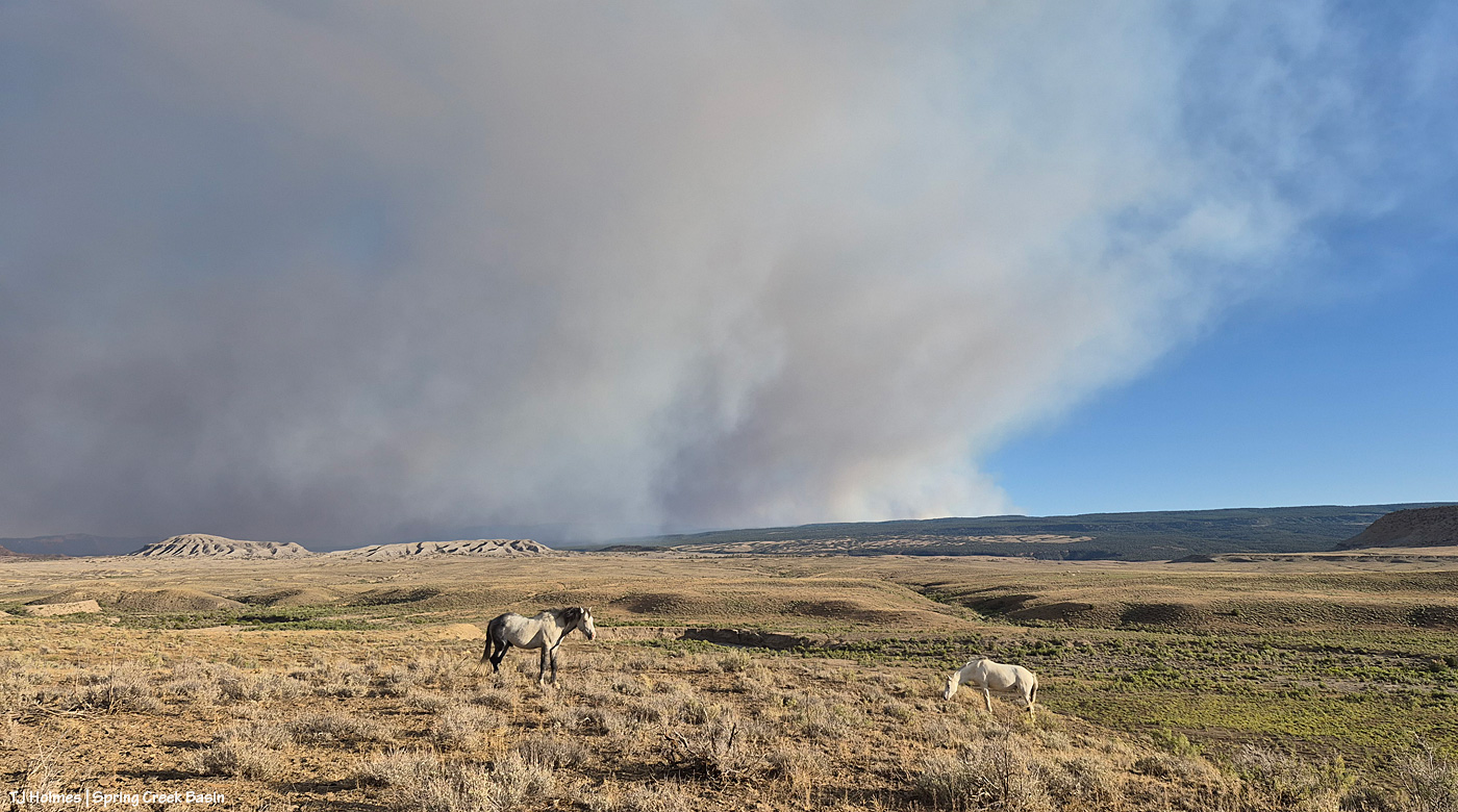
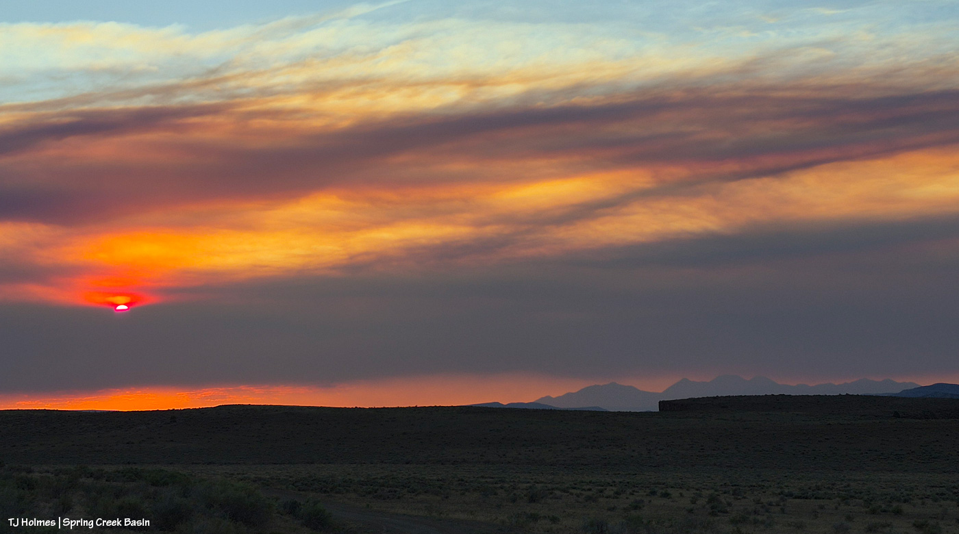
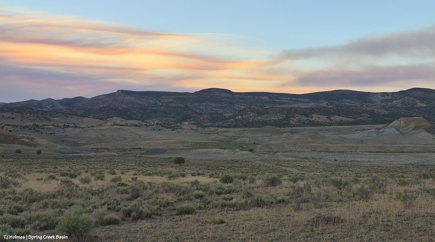
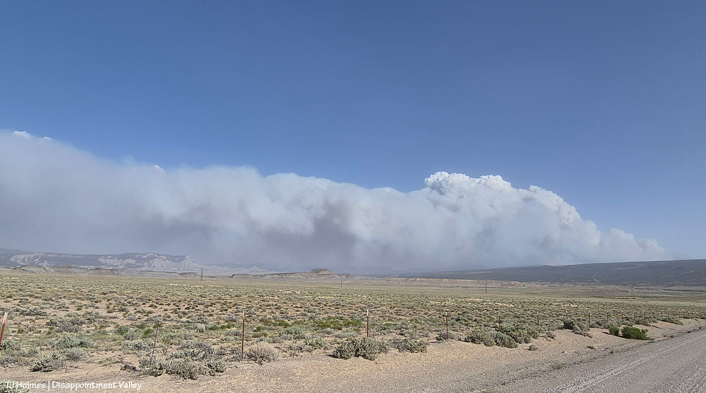
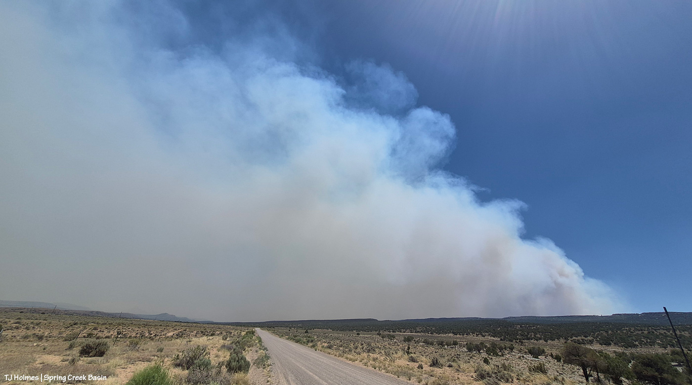
This is a very wide-angle phone shot from Disappointment Road looking south/southeast/eastish, earlier in the evening than I took the pix above from inside the basin. The familiar landmarks of Brumley Point, Temple Butte and McKenna Peak are at far left. That is really not something you want to see – that kind of super-active fire activity! – but flames on the hillside south of your home has to be about a billion times worse (see below).

The Ferris Fire now is up to 41,337 acres, and containment has dropped to 7 percent as the fire has grown (as of Saturday night). A staggering “500 personnel are now working the fire. A Complex Incident Management Team has been ordered to provide additional management and logistical support.” That information is from a 7:30 p.m. July 4 report on Watch Duty (if you live in the West, or know people who do, for goodness sake, download it to your phone if you can; it’s massively informative, and the network they have to report on so many fires is nothing short of amazing).

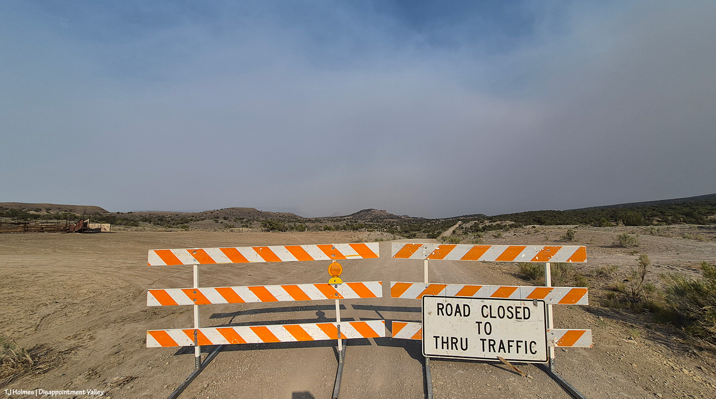
As of Saturday, July 4 (hope you all celebrated Independence Day safely!), maybe Friday (?), Disappointment Road is closed to through traffic. From the west, heading up-valley-southeast, the closure is at the old Perkins corrals; coming down-valley, northwest from the Dolores-Norwood Road, the closure is just above/southeast of Ryman Creek Road. Ryman Creek and Black Snag roads already are closed. In its run north, the fire bypassed Benchmark Lookout (thankfully being aggressively protected by firefighters; if you’re on Instagram, follow @benchmark_rick; Rick and his wife, Linda, staff the tower during fire season … it’s so crazy that they’re not actually there during this fire, but thank goodness they’re safe! they’re helping with supplies at the Salter Y Spike Camp) and started down/north toward Disappointment Valley on Friday night. Up-valley neighbors watched actual flames, as did (at least) San Miguel County deputies, who were stationed up there until around midnight. Smoke is bad enough … seeing flames on the hillside south of your home … I can’t imagine. 😦
Today’s big shoutout goes to San Miguel County Undersheriff Nick Xavier, who, along with deputies Todd Rector, Derek Kibel and Jeremy Platt, and Dolores County deputy Branson Smith, has been keeping me updated about the fire in this neck of the Disappointment Valley piΓ±on-juniper woods. Along with above-and-beyond information-sharing by my BLM range guy Ryan Schroeder (Anton Rambur and Laura Heaton are on the fire), my gratitude is high to all of these folks for keeping calm and keeping eyes and ears on the situation.

From Undersheriff Xavier’s mention of pix he saw, three links to – get this – images of the Ferris Fire with the aurora above flames:

Link to a reddit post by someone in Lewis, Colorado (north of Cortez), looking north. Click the little arrow on the right side of the pic to see the second image.

Link to a post by “Meteorologist Chris Nunley from Cortez, Colorado. This is Facebook, but I could see the post, and I’m not on FB, so hopefully you’ll be able to follow the link, even if you’re also not on FB.

Link to a post by “Meteorologist Joe Ruch CBS Colorado” of the Ferris Fire and northern lights. Also a FB post.

Did I see the northern lights? No, no, I did not. Once again, I slept right through the show. One of these days (err, nights …) … !

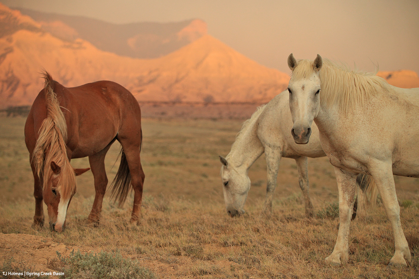
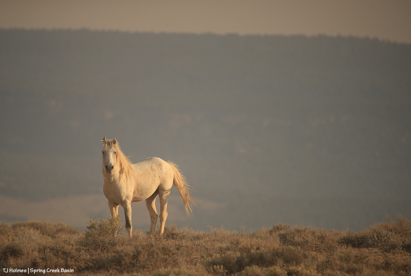
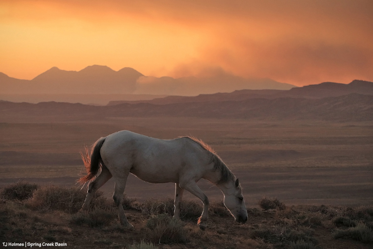
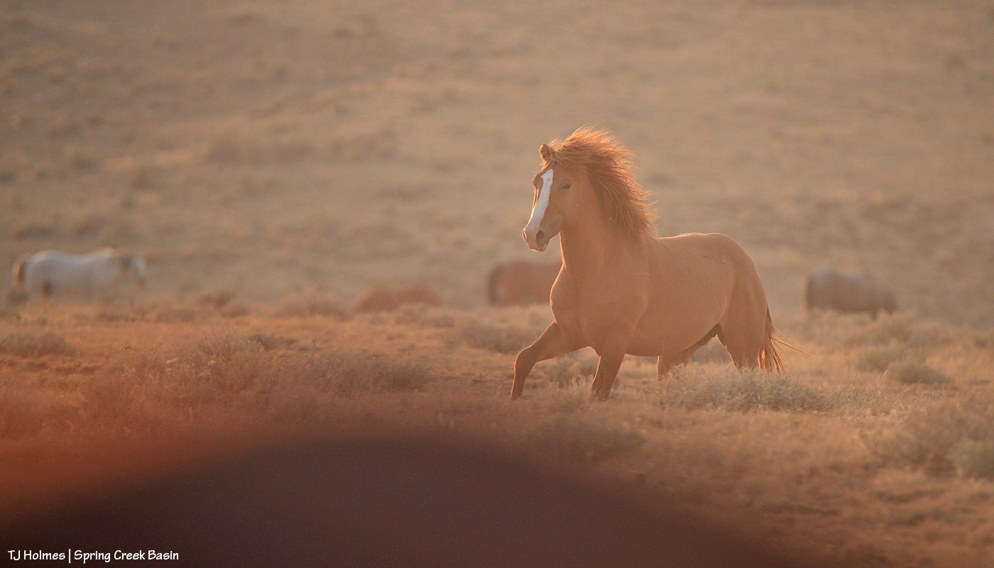
And your pony pic from Friday night:
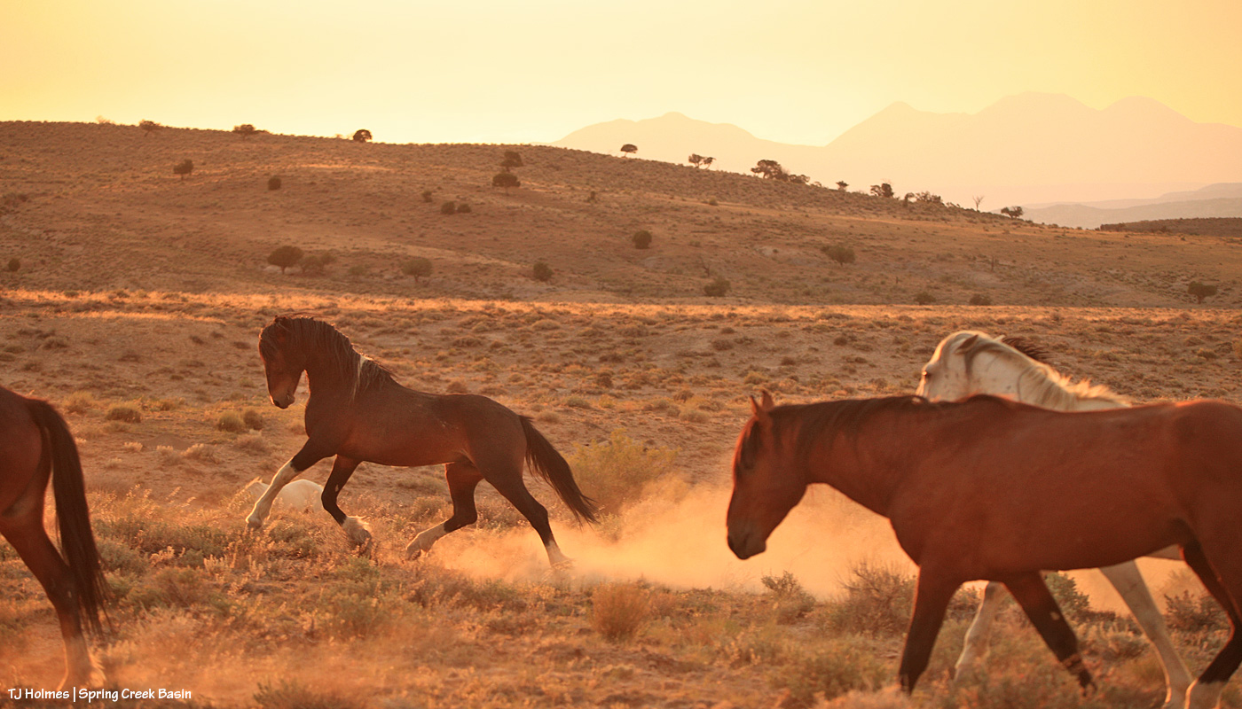
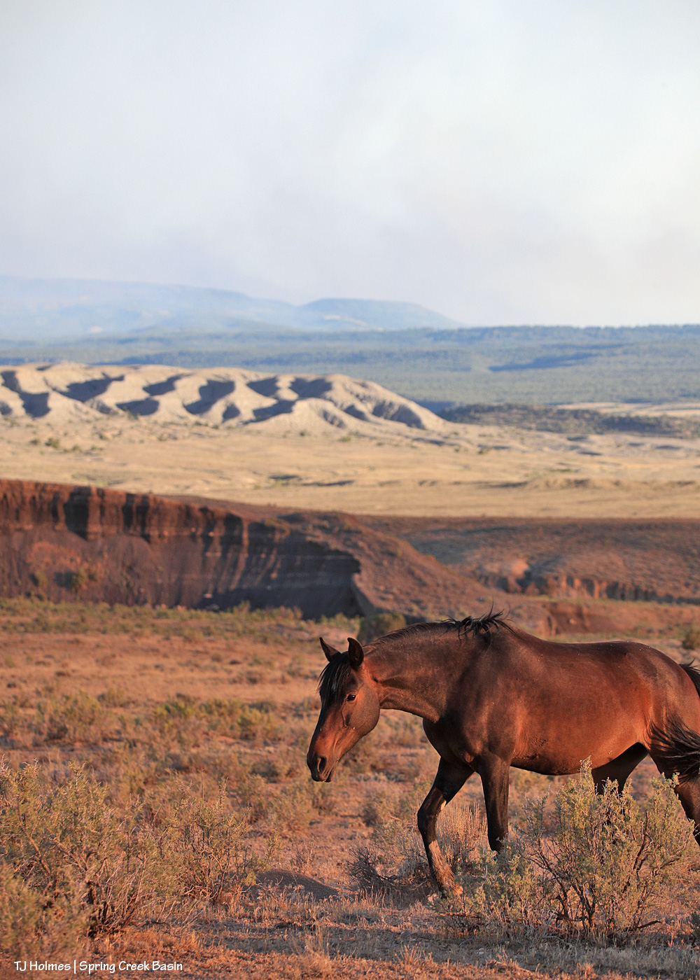
Maiku kicking up dust (we don’t need any more smoke OR dust!) while smoke from the Ferris Fire (coming from the south/left) and Babylon Fire (across our whole western horizon) casts a golden glow over our ponies that isn’t nearly as lovely as simple golden sunset light.
Happy 250th, America

4 07 2026

From the Library of Congress:

“The American republic was founded on a set of beliefs that were tested during the Revolutionary War. Among them was the idea that all people are created equal, whether European, Native American, or African American, and that these people have fundamental rights, such as liberty, free speech, freedom of religion, due process of law, and freedom of assembly. America’s revolutionaries openly discussed these concepts. Many Americans agreed with them but some found that the ideology was far more acceptable in the abstract than in practice.”

Two hundred fifty years on, the “ideology” must be acceptable in *practice* for the United States of America to succeed.

Celebrate safely, my friends.

**********

In fire news, the Ferris Fire now exceeds 33,000 acres and is 9 percent contained. Lots of growth has occurred on the southwest/west side, where it has crossed the Dolores River. A northeastern finger of the fire is pointing northeastish and has passed Benchmark Lookout. Friends in the upper part of Disappointment Valley are at “set” status to evacuate should the need arise. Spring Creek Basin’s mustangs continue to be safe and doing well. Smoke is at times dense as it settles overnight and greets us in the morning. The forecast continues to deny the region much-needed rain.

Holding firefighters, evacuees and residents close to the fire’s perimeters in prayers. (I looked for donation opportunities but found just a generic reference to Red Cross. If I find better options in the future, I’ll list those.)


A tale of two skies

3 07 2026

It should go without saying: Every day, the fire – and the smoke – is different. The Ferris Fire is up to 28,801 acres and 10 percent contained. As Watch Duty says, “That still leaves a lot of uncontained perimeter, but fire crews are still on the line this hour [6:42 p.m.] working to increase that number and there will be personnel working overnight again tonight [Thursday, July 2].”

Yesterday morning, Disappointment Valley was pretty socked in with dense smoke again, but it cleared faster than the day before (which is still relative, as smoke still lingered closer to the ground into early afternoon). Fortunately, it’s lifting by late afternoon and evening.

Yesterday afternoon, it became, as noted, a tale of two skies: smoke across the entire east, from south to north from the Ferris Fire; low smoke across the western horizon from the Babylon Fire in southeastern Utah (81,494 acres!) and clear blue sky above, south/southwest across the west to the north.

These next three pix are the Ferris Fire smoke:

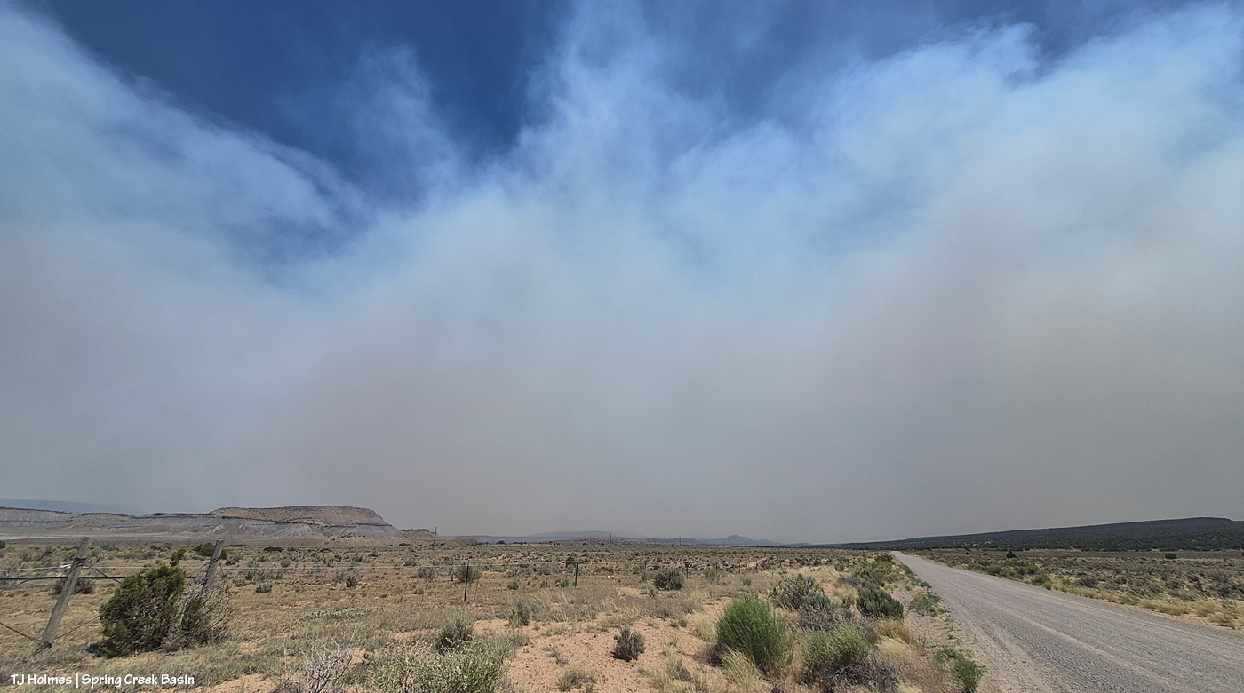
That’s the southern – probably southwestern – edge of the Ferris fire, south of Disappointment Valley (more the upper valley than the lower valley, which is behind me). The smoke is drifting to the left, which is north.

Looking southeast/eastish straight up-valley and up Disappointment Road from southwest of Spring Creek Basin. (I know, it’s weird; up-valley in Disappointment Valley is up/higher elevation, and it’s southeast, which people usually refer to as “down”!) The rimrocks at lower left form the western boundary of Spring Creek Basin, and that’s Filly Peak, within the basin, just above them. On a clear day, you could see Temple Butte and McKenna Peak and Brumley Point from this vantage point.

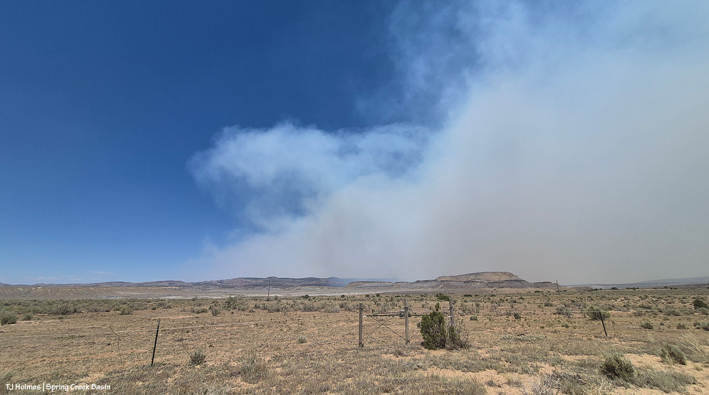
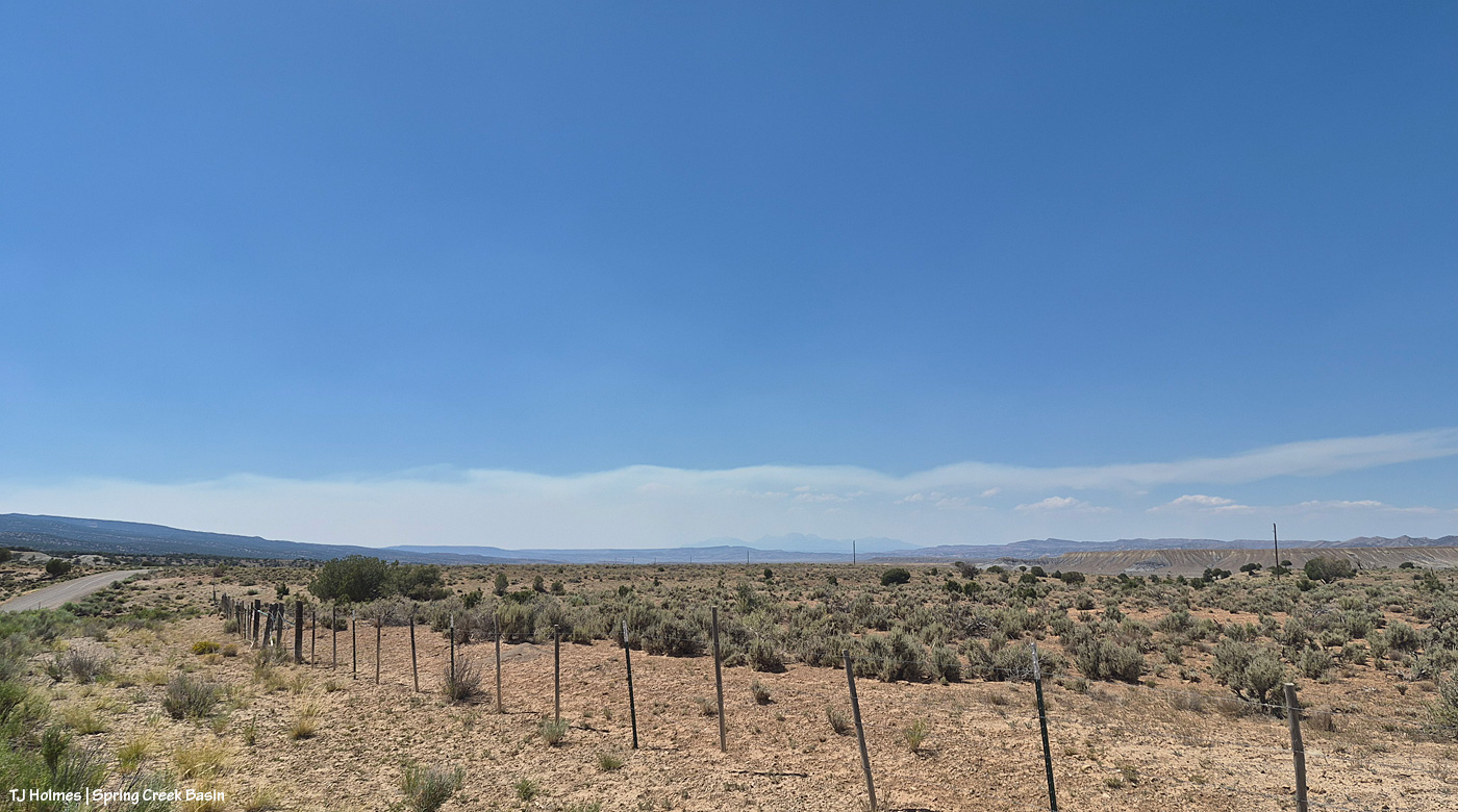
This is looking east/northeast/north. Even with my phone’s widest angle, I can’t get the entire smoke-drift in one image, south to north, basically. See that blue sky at left in the photo above and to the right in the first pic?

Now let’s turn directly around and look west/northwest, and this was the view: mostly blue sky above the low smoke layer, mingling with some low clouds, from the Babylon Fire, drifting again from south to north across our western horizon. Quite a difference in the two halves of the sky, eh?

Now a couple of evening pix, looking at the changed smoke from the fires:

Seneca and Chipeta, looking west toward Spring Creek canyon, sunset and the Babylon Fire smoke.

Flash’s band, looking south to the sunset-colored smoke from the Ferris Fire.


Glow-up

2 07 2026

Yesterday was not the prettiest day under the smoke layers. … In fact, until late afternoon/early evening, it was pretty downright ugly (!). The fire moved toward the Dolores River canyon on its west side, and those delicious new fuels sent up a great deal of smoke. Morning found us super socked in … and it just didn’t lift or drift until much later in the day, which was – you guessed it –another red-flag-warning day. Today, the same.

The mustangs continue to fare well through it all. They have forage, they have water, they have each other. When it comes right down to it, they have the important things kinda nailed. Mysterium, Gaia and Maple above.

If you’re using the Watch Duty app, you can find the below information there. I thought the updates Wednesday night for earlier in the day were informative, so I’m going to post them here (and huge thanks to those folks doing the updating?!). There has been a massive amount of work done by firefighting ground crews as well as air attack. It’s humbling to know those folks are out there giving every ounce of their strength to fighting this fire. The Ferris Fire apparently has its own Facebook page, but that’s beyond my knowledge.

Michael Silvester β€’ Senior Manager of Operations & Standards

22 minutes ago β€’ Jul 1 at 9:58 PM

The Ferris Fire is expected to reach the Dolores River Canyon tonight as it backs down Doe Canyon. Fire crews will continue monitor this area closely tonight and will be in close communication with Dolores County out of an abundance of caution.

Tomorrow [today, July 2], a number of engines will staff the west side of the canyon. The Incident Management Team is also coordinating closely with the local fire protection.

Michael Silvester β€’ Senior Manager of Operations & Standards

3 minutes ago β€’ Jul 1 at 9:32 PM

Zone 8 [I believe this is directly west of the fire] is now on “Set” status & the parameters for that zone can be seen above, per the update from Dolores County Office of Emergency Management on Facebook. SET Means Be Ready to Leave & means there’s a wildfire in the area, and conditions could change quickly. It’s time to be alert, stay informed, and be ready to leave at a moment’s notice.

When you’re SET:

– Load your go-kit into your vehicle.

– Park facing out for a quicker departure.

– Follow updates from official fire and emergency channels.

– Review your evacuation routes and know where you’ll go.

– Get pets and livestock ready to leave with you.

Being SET doesn’t mean you need to leave yet.

Total acreage: 25,814 Total personnel: 282

Today [yesterday, July 1], the Arroyo Grande Hotshots continued to dig containment line on the northeast corner of the fire nearest to private lands. An additional dozer and hotshot crew will be in place tomorrow to continue this mission. Favorable weather conditions will allow overnight burnout operations to continue this evening.

Dozer work on the southwest corner of the fire was completed. Firefighters will continue improving and developing containment line in this area.

The west side of the fire, closest to the Dolores River Canyon, continues to present challenges for direct engagement. Additional divisions were added to respond to this expected growth.

Susan Perney β€’ Coverage Reporter

About 4 hours ago β€’ Jul 1 at 5:42 PM

Three Type 1’s and one smaller helicopter are working the various hotspots around the fire. Air tankers have also been dropping retardant to slow the fire’s growth on the southern end where Doe Canyon meets the Dolores River Canyon.

A second interagency Hotshot Crew (IHC) will be arriving later today. Current plans call for them to assist with creating fire line in rugged terrain on the fire’s northeast corner near the lookout. The goal is to prevent the fire from reaching and threatening homes and private property in the Glade Ranch Subdivision and to protect the lookout itself. Despite several large fires in Colorado and surrounding states we are continuing to get more resources to support the crews on the ground and in the air. 280 firefighters and support personnel are now assigned to the fire.

**********

That Montana-shaped smoke is from the Ferris Fire, which has moved north and northwest and is overlapping the western-horizon smoke from Southwest Colorado and Utah fires.

Smoke in the pic is NOT as close as it seems, nor as awful as it looks. I mean, it IS awful where it is, but it is not super close to Spring Creek Basin. I actually debated showing this pic, and I decided to do it, not for drama factor, which I’m aware that it has, but because that was the scene toward sunset looking south/southeast, and I think it helps tell the story. A recovering journalist, still, I am.

We remain incredibly grateful to all the firefighters and folks supporting the crews working on the Ferris Fire *AND* all the other fires burning near and not-so-near. I particularly value my partnership with my local BLM folks, which includes this challenging time, during which they are, as you might guess, super busy. Thanks (again!) to Ryan for taking the time to keep me updated about goings-on; you can’t imagine how grateful I am.

And thank you also to everyone who has messaged me asking about the safety of the mustangs; I appreciate that immensely.

They’re OK. We’re OK. πŸ™‚


Windy again; more and less smoke

1 07 2026

After a pretty smoky early morning, the wind blew it east and away again most of the rest of the day. The wind still is switching between southwest and southeast and south. Cassidy Rain and her band were just leaving water; you can see the mud on her right front leg.

This is a very wide view (cell phone) from the main/original water catchment looking south/southeast. The source (ish?) of the Ferris Fire is at far right. I think it might have been the wind that had the smoke so ragged; clouds were actually visible low to the horizon, through the smoke. (Is that weird? It seems weird; the smoke on the horizon(s) has been so dense that it seems unusual to see anything beyond it, whether that’s the far ridges or even clouds.) You can see how clear it is between here and there. Fortunately for the mustangs, they’re not dealing with a lot of smoke.

From near the western boundary of Spring Creek Basin, looking west/northwest as the sun drops into a bank of smoke drifting from the Utah fires and maybe some farther southwest of Disappointment Valley in Colorado. Earlier in the day, the mountains were fully visible and the smoke was behind (west) of them. Then there was a period during the day when the mountains were fully obscured by smoke again. And here, at the end of the day, they were visible below the band of smoke. I think that great band of smoke was from the southern fires and joining smoke from the northern fires (like the Snyder Mesa Fire).

This last image is from about the same place as the one above, but now we’re looking nearly directly north. See the painterly smoke from left that fingers to the right, right of center? That’s from the western fires. See the greyer smoke at right? That’s from the Ferris Fire. Straight south and to the southwest, we’ve had a clear sky, and straight-ish north, we’ve had a clear sky. Tonight, the smokes from west and east have joined in the north. Wild, right? (If you look closely, those white dots at center left, on the sloping edge of the northern Spring Creek canyon side, are mustangs. :))

We continue to be very lucky in location, and the mustangs are doing very well.


Between the smokes

30 06 2026

Gratefully, while the Ferris Fire burns 20,560 acres to the southeast and the McCloud Fire and Horse Head Fire burn 113 and 530 acres, respectively, to the southwest (and that smoke is joined from the Snyder Mesa Fire (30,163 acres) to our north/northwest, drifting southish), Spring Creek Basin and lower Disappointment Valley were mostly smoke-free yesterday.

In the pic above, Tenaz and Skywalker, grazing with their band almost at the western boundary of the basin, are highlighted by that drifting smoke to the west. It’s fairly far away, but I haven’t seen Utah’s La Sal Mountains for at least a few days now as the smoke obscures any sight of them.

Now looking east/southeast, that’s the smoke from the Ferris Fire (the Doe Canyon, Far Draw and Ferris fires all have merged and are now being collectively called the Ferris Fire). But see how clear it is between here and there? Not great for folks and critters in that direction … but (again, gratefully), a huge relief for my beloved center-of-the-world Spring Creek Basin.

Huge thanks to sheriff’s deputies from both Dolores and San Miguel counties (Disappointment Valley spans both counties, and Disappointment Road runs from Colorado Highway 141 at the lower north end to the Dolores-Norwood Road at the upper southeast end) who have been diligent in keeping an eye on the fire’s approach: Branson, Todd, Derek, Jeremy and Nick. Also to my BLM folks, especially Ryan and Laura, for keeping an eye on the situation and updating me with information. Anton was on one of the fire crews pulled back Saturday for safety on the Doe Canyon Fire, and he might still be on a fire crew on the merged fire.

To all the firefighters out there, heartfelt thanks and prayers for your hard work and continued safety. The firefighters killed while fighting the Snyder Mesa Fire have been identified. There are really no words to describe the heartbreaking loss of those young lives.


Smoky but OK

29 06 2026

Flash with a smoky background, looking close to straight south from Spring Creek Basin to the southern ridges of Disappointment Valley.

The Ferris Fire merged with the Far Draw Fire on Sunday morning … and by Sunday evening, the nearby Doe Canyon Fire had merged with the others, so now it’s all one big fire (being called, collectively, the Ferris Fire), and it was at almost 14,500 acres by last night. Awful south/southwest/southeast (yep; it keeps switching) winds are driving this fire and probably every other fire at least in western Colorado and eastern Utah right now.

The fire(s) and smoke continue to move in a northeasterly direction, and mid-lower Disappointment Valley and Spring Creek Basin actually are not nearly as smoky as upper Disappointment Valley.

The mustangs are OK. Really, they’re pretty unphased, as far as I can tell. I spent time last evening with Flash’s band, and I saw several other bands going about their business of grazing and moving to and away from water sources.

The Gold Mountain Fire also started Saturday in Ouray County, near the town of Ouray, and a stretch of U.S. Highway 550 is closed in that area. Friends we visited in Ridgway on Saturday could see flames from that fire from their respective homes after we left.

Tragically, three firefighters died and two more are hospitalized from injuries suffered fighting the Snyder Mesa Fire on the Utah-Colorado border almost directly west of Grand Junction. Heartbreaking.

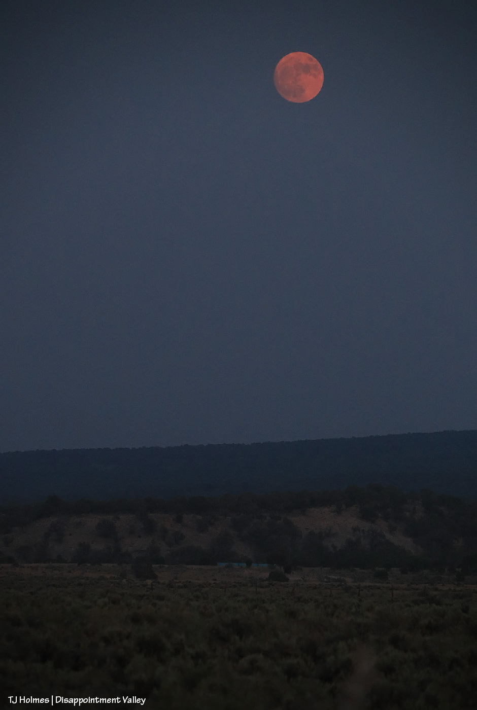
The smoke isn’t really discernible in this pic post-sunset (hard to tell as the sun sank again into a smokebank), but that rising moon, nearly full, is red through a layer of smoke. Noooooootttt the moonrise pic I had pictured for this month.

The mustangs are OK, and we’re watching the progress of the fires and keeping an eye on that smoke. Firefighters should make some progress when the horriblebadawful wind dies down. Think safety for all involved.


Close to home

28 06 2026

This won’t be an easy post to either read or view.

*THE MUSTANGS ARE SAFE*

That’s the important thing (as far as the main topic of this blog, anyway).

Yesterday, Saturday, June 27, at least three wildfires of significance roared to life directly south of Disappointment Valley: Ferris Fire (4,777 acres as of Saturday evening), Far Draw Fire (651 acres) and Doe Canyon Fire (385 acres). There’s also the Horse Head Fire (200 acres) burning to the southwest, in Utah, and the Snyder Fire (28,264 acres) burning north-northwest of here, almost directly west of Grand Junction and just inside Utah.

Red-flag warnings; check.

Wind advisories; check.

Bad air quality; check.

Critical fire weather; check.

Stage 2 fire restrictions in San Miguel and Montrose counties; check (these might extend to other nearby counties, but these are the ones I know about, and most of Spring Creek Basin is in San Miguel County, with the southern/southeastern portion in Dolores County).

Kentucky is flooded, and the West is on fire. Friday night, we had a swift little storm pass through Disappointment Valley – 0.04 inch from four minutes of rain. My guess (guess only; I don’t know yet the cause of these fires) is that they started from lightning strikes. It is one giant tinder box out there. Until the little bit of rain Wednesday, it hadn’t rained here for more than a month.

If images of wildfire smoke bother you (it bothers me), the rest of this post isn’t for you … and the pictures, as usual, don’t convey the bad-ness of the beast. … Again, please know that the mustangs are SAFE. I can’t say what the fires will or will not do, but for now, the horses are OK and not in danger.

I spent most of Saturday in Ridgway with mustang friends, and this is what greeted me and Kat Wilder upon our return to Disappointment Valley. This is from the northern part of the valley, a few miles south of Colorado Highway 141, looking southeast.

Looking west at sunset; this smoke is from the Utah fires.

The majority of the smoke seems to be passing east of the eastern side of Spring Creek Basin; McKenna Peak, Temple Butte and Brumley Point are all visible. … The smoke ain’t great up-valley; it smells like you’re in the middle of a campfire (and by the way, campfires and any other kind of fires are strictly verboten (that means forbidden!), not to mention dumb as hell).

Stage 2 fire restrictions in San Miguel County, Colorado:

Stage II Restrictions

The following are prohibited under Stage II restrictions:

  1. Open Fires
    1. No campfires, charcoal grills, wood-burning stoves, chimineas, tiki torches, or any open flames, even at private homes or campgrounds.
    2. Gas grills or propane stoves are allowed if they can be turned on and off, and only in areas cleared of flammable materials.
  2. Smoking except within an enclosed vehicle or building
  3. Chainsaws or other equipment powered by an internal combustion engine, unless it has a working spark arresting device
  4. Outdoor welding or acetylene torches unless in a cleared area at least 10 feet wide and a pressurized fire extinguisher must be on hand
  5. Off-road driving or parking: vehicles must stay on established roads, trails, or parking areas. No parking over dry grass.
  6. Explosives and fireworks

Post-sunset looking west again. … This is NOT the “red glare” we like to see. 😦

Please, please be careful out there.


Recap of 2025

31 12 2025

To remember how I did this post last year, I had to go all the way back to Valentine’s Day to find the post recapping the previous year (2024, then) in images. This year (for 2025), I’m happy to announce that for once, though I procrastinated, it wasn’t THAT long, and it was in plenty of time (OK, one day to spare) to make the Dec. 31 deadline.

Deep breath: This was a hard year. Last winter was rough (read: bad dry), which meant the rest of the year was rough (read: really bad horrible awful dry) in terms of drought. Monsoons didn’t hit their stride over Southwest Colorado, so we didn’t get much rain, either. Federal employees were hard hit, too, and one of our young BLM’ers was illegally fired from the new job he loved.

But we also had some good-news happenings: Thankfully, he was reinstated, and we have a strong range team in Ryan, Anton and Laura. We got some new signs installed, including the replacement of the old, sun-bleached, weather-beaten interpretive sign for the new information “kiosk” that greets visitors upon entering Spring Creek Basin. Fertility control (native PZP) continues to be an extraordinary benefit to our herd in terms of management and keeping roundups and removals at bay.

In wider Colorado mustang news, the BLM short-term holding facility at the CaΓ±on City prison complex closed in November, BLM and Colorado Department of Corrections being unable to reach a contract agreement. That’s not-great news in terms of uncertainty for rounded up and removed Colorado mustangs. Where will they go? In semi-balanced decent news (?), all of the Colorado mustangs that were in holding there (about 100 at the time) were adopted or went to private sanctuary or are currently in foster situations for a planned adoption in March (and that all happened despite federal employees, including BLM’ers, being out of work (or working without pay) because of the government shutdown).

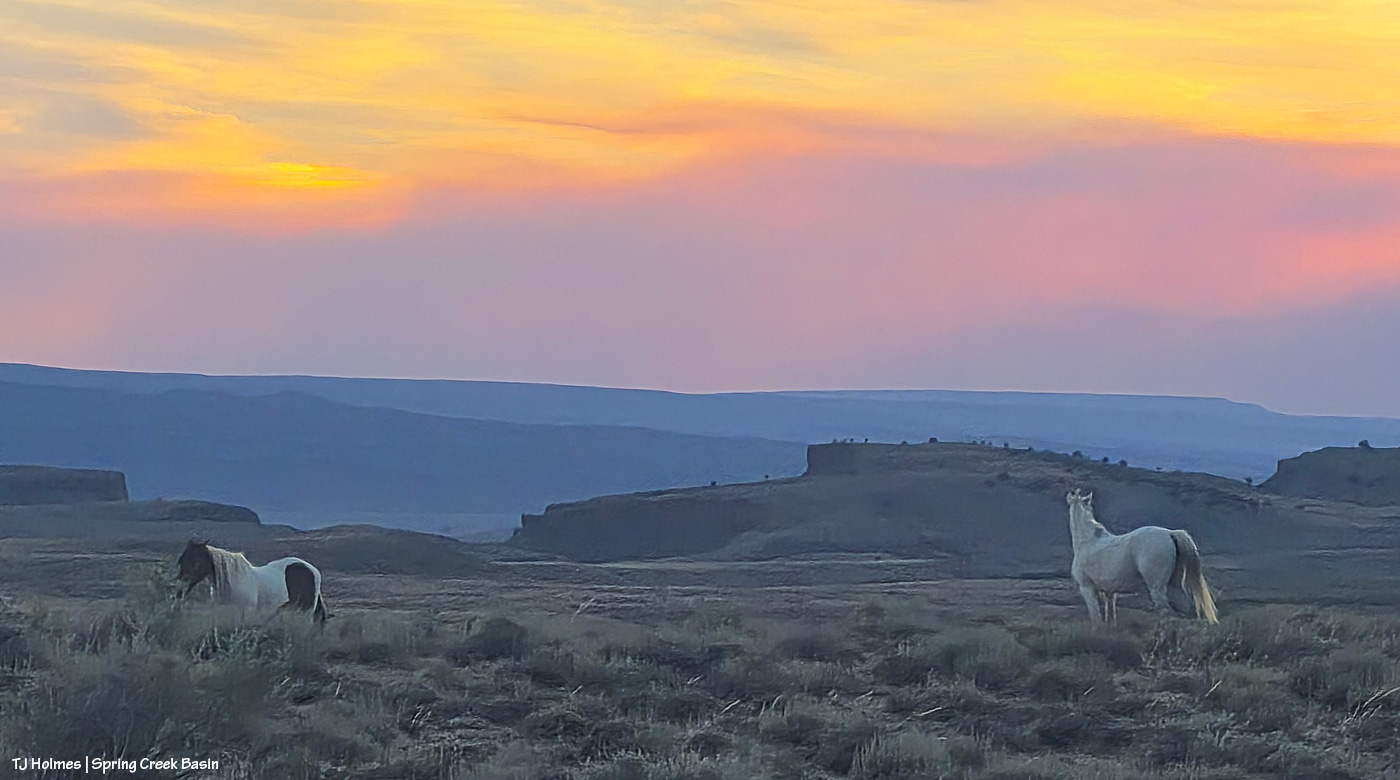
What follows is a pic from each month of the past year and a bit of reminiscence of what was happening when I captured the image of a mustang or mustangs. Many of these pix have been featured previously on the blog; some haven’t. If you make it to the end, there’s a bonus pic … one of my favorite of the past year.

This is one of my very most favorite pix of the entire year. I love it so much, it’s the background image on my computer. I’m aware that I likely post a lot of images of Buckeye’s family; you won’t be surprised to know that they’re among my most favorite mustangs. I considered this image as the *bonus* image … but it was one wildly beautiful day of snow (well, I was out with the horses, watching the snow coming for at least two hours before it finally reached us), and it didn’t match the otherwise very dry *year*. … So it gets the January title.

Did I say that I love Buckeye’s family? You can forgive me for singling them out, right? The three mares weren’t born here, but gosh, they are treasures from our sister herd in Sand Wash Basin, and I’m so grateful that we have them. And yes, that was February. Utah’s La Sal Mountains may not have been the *closest* snow, but we sure didn’t have much.

March is still fuzzy-coat weather with signs of approaching spring, especially in the high desert of Southwest Colorado. Fortunately, we had ponds early in the year. They’d all go dry before some rain this past fall put water back in a couple of them, including the one pictured above with Chipeta. This pond is nicely full currently – and has mustangs taking advantage of its water.

April found Sundance not far from the pond pictured above, and he still had his band at that time. Later in the year, he lost them, and he’s been by himself since then. He has wandered a bit, following vegetation and available water. The stately ol’ guy is still around … I see him now and then, napping in the sunshine or grazing on the side of a ridge.

This wasn’t especially the best pic I took in May, but I love both the perspective and the sort of inside joke that Cassidy Rain always likes to be the farthest away from the two-legged. That day was a pretty warm one, and the band was in an area of basin where I rarely find them. It’s not a place with a lot of trees (in fact, there are very few), but they had found a couple, and were comfortable together in the shade near sunset.

My best boy Storm made a brief appearance in the northern part of the basin in June … one of the first times I’d seen him since he’d lost his band the previous autumn. Bittersweet. I haven’t seen him since about July, when he was at a water source with another band as I was trying to shoot the rising moon.

Ah, July, the month the Deer Creek Fire at the base of Utah’s La Sal Mountains sparked. It wasn’t the biggest wildfire of the season, and it wasn’t even the biggest with smoke visible from Spring Creek Basin and Disappointment Valley, but it was uncomfortably close to home. It was a reminder (as if we need any more) that it’s hotter and dryer out there, and we all need to be super aware and careful.

Fortunately, the mustangs live in the moment (while the humans obsess over the wildfire updates), and they still enjoyed peaceful days such as this: Three mares content with their world and each other.

Finally, as summer gave way to fall, Mother Nature cried her best tears and filled some ponds for the mustangs. THAT brought huge relief to us all (if I may speak for my four-legged friends as well as myself). Interestingly, visible at upper left in this image is Benchmark Lookout, a U.S. Forest Service wildfire-watch tower staffed during the critical seasons of the year (which includes September). In this backcountry, we are massively grateful for those who watch for and provide critical information about wildfires, as well as those who work to contain them, allowing them to provide some benefit in some cases while trying to keep property and lives intact.

It might be about now in the list that you’re thinking, “for talking about dry it was, she sure included a lot of pix of ponds.” It’s not because we had so much water; it’s because we’re massively grateful for the water we had.

There’s no water in this image – and it was November, before snow graced the peaks on our northwestern horizon – but the ponies are lined out on their way out to graze after drinking at a little place I call the marsh. This is post-sunset, but wow was it gorgeous under the autumn light. … And it’s not UNgorgeous at blue hour.
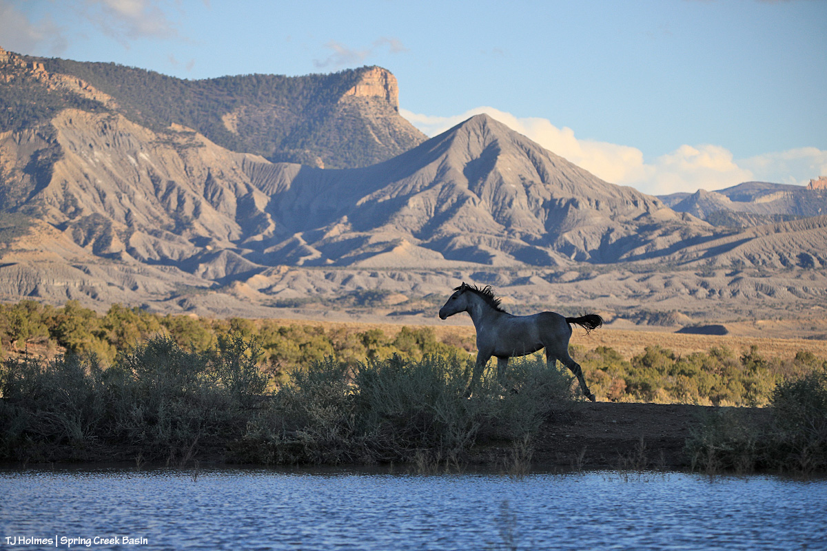
You’ve just seen this image of Temple with Temple (yes, the same) Butte and McKenna Peak in the background under a stream of stormy-looking (they didn’t produce a drop over us) clouds. I decided not to choose a pic from the bit of snow we got at the very beginning of December because the above is what we saw the whole rest of the month. The weather has been warm and dry … and that’s awfully nice for getting around and playing outdoors (60s! in Colorado!! in December!!?!) … but if things don’t change in the next few months, I’m going to be singing the same ol’ why-won’t-it-snow song that seems to be stuck on repeat.

And your bonus:

This was an evening in June. Nobody wanted to pose much, and I was going bananas, trying to get somebody – anybody – in front of that background in that subtle, delicious light. Finally, this young stallion obliged. And it seems to sum things up a bit: Hot this year? Yes. Dry? Gosh, yeah. Anxiety-inducing? Pretty much like always … with an extra edge. But! Beautiful, peaceful, a place of escape from the world’s ills (at least the headline type). Kind of a promise that it’s there … out there … and sometimes we don’t have to search all that far for it.
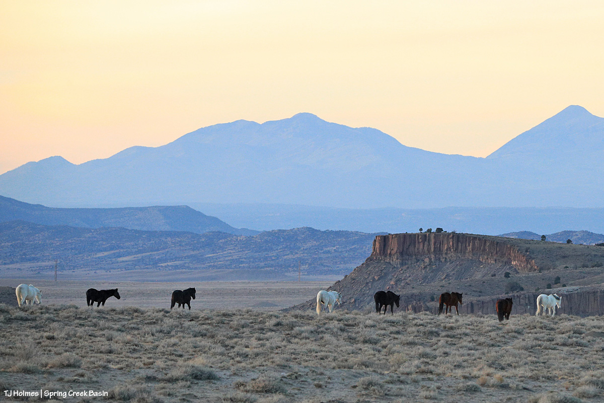
And there you (kinda) have it: 2025 in the rearview. It’s always hard to select just one pic for each month (plus a bonus!), but I hope you enjoyed this little recap.

In best-of-all news, I spent a lot of time (again) with my beloved mustangs in the best place on Earth (in my ever-so-humble opinion). πŸ™‚

And close to that is my gratitude for all of you readers who follow the mustangs and our pictorial journal of peaceful, wild, beautiful life here in Spring Creek Basin. Thank you so much, and I hope you all have a peaceful, wild, beautiful 2026 (with lots more moisture!!!!!!!!!!!!!)!

Be kind to each other! πŸ™‚


Dun days

16 08 2025

That haze is *smoke*. Odin was probably no farther away than about 150 yards (?), and it was SO smoky.

He had gone visiting a bit with another young bachelor between his family and another, and here he looks like he’s returning to his mama and aunties … but he stopped about halfway to graze … just in case there was another chance to visit. πŸ™‚

Little mister is a big boy. He’s 2.5 now, but he’s stout – and still loves his mama Shane.

*****

I can’t believe time – and dates – got away from me; when I scheduled this post several days ago, I didn’t note the date!

HAPPY 56th ANNIVERSARY TO MY MOM AND DAD!!!!!!!!!!!!!!!! πŸ™‚ Thank you SO much for giving me the gift of horses, from your own love of horses that led to your fortuitous meeting … 60-PLUS years ago! I love ya’ll and hope you have a wonderful anniversary day. πŸ™‚