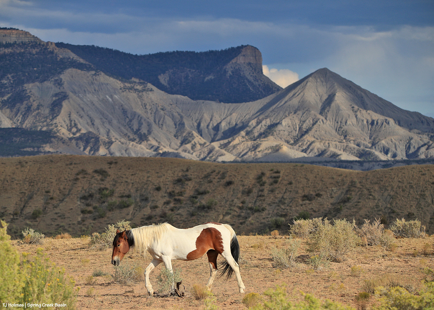
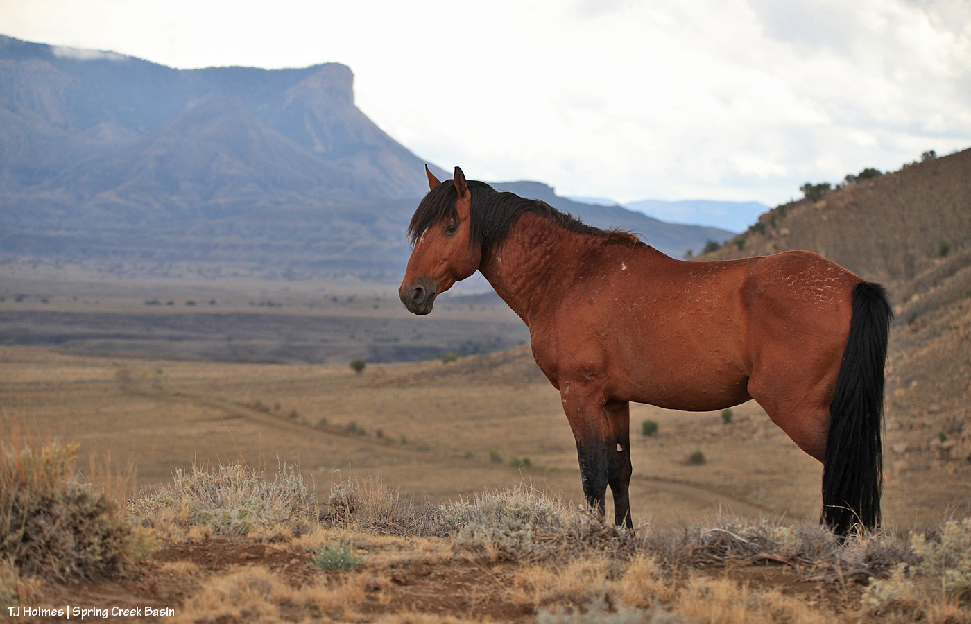
Heading to water. Chipeta is showing her age (she’s at least 20 now), but she still looks beautiful, especially under that dramatic sky. 🙂
Heading to water. Chipeta is showing her age (she’s at least 20 now), but she still looks beautiful, especially under that dramatic sky. 🙂
Cue the angels:
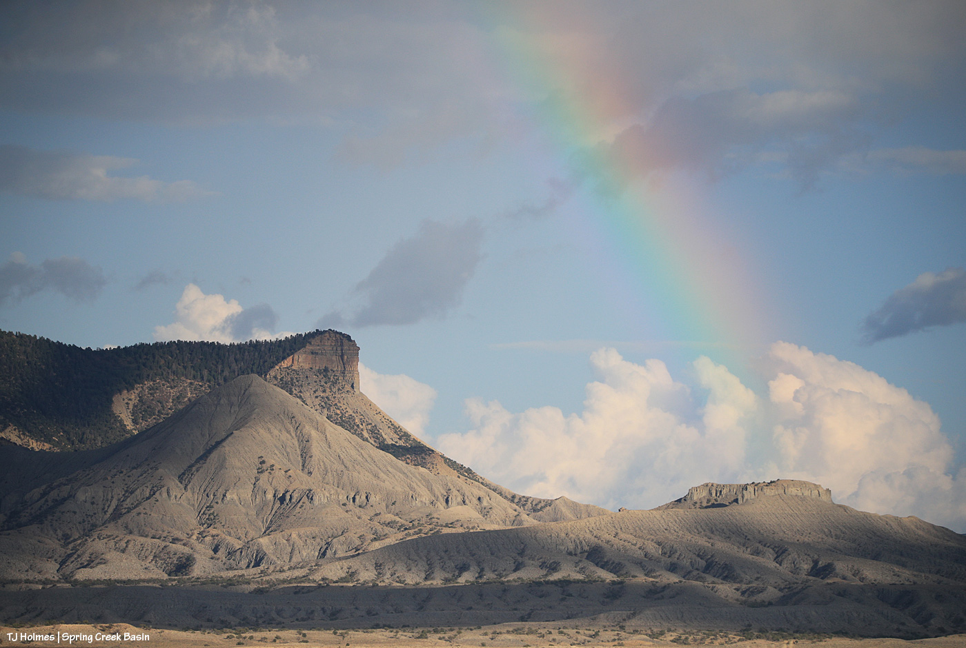
As I was wandering the desert (seriously), hoping that tonight (which was last night) would be the night the clouds would part and I would get to see the moon rise … the clouds DID part, and a rainbow DID shine! I ask you: How does that happen!?!? 🙂 I’m not complaining, mind you, but Mother Nature is a wondrous, mysterious creature.
And then, this:
My desert wandering paid off!
If I ever get those glorious scenes with a gorgeous mustang right in my foreground, I’m going to keel right over without being able to hit the shutter even once, probably. 😉
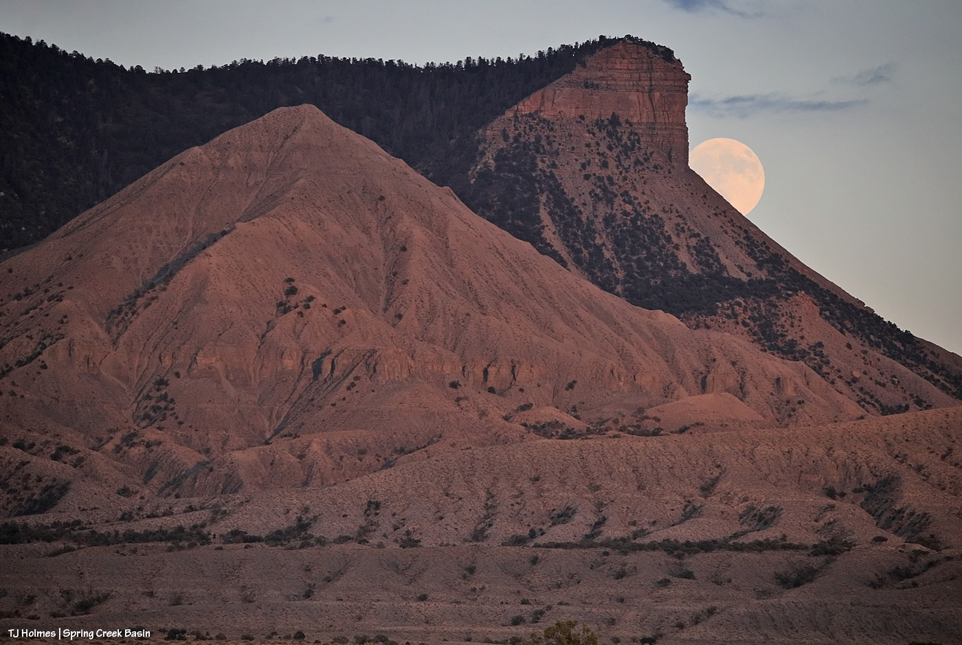
This was the last night to get the moon rising with the sun only very recently set. When the moon is actually full on Sunday (happy lunar eclipse if you’re on the other side of our world from North America!), it’ll be rising in a dark sky.
But last night, as I walked away (OK, I might have been doing as much of an Olympic race-walk as I possibly could with a camera pack on my back, binoculars in the case on my front and carrying a monopod that really is not a hiking stick), THIS was hustling me along (and yes, there was lightning):
See the moon rising above Temple Butte and McKenna Peak and submarine ridge at lower right?
Conclusion: Sometimes the rainbows come and go well before the post-sunset rain. 🙂 (And I think the valley got fairly widespread (though light) rain!)
Happy, happy!

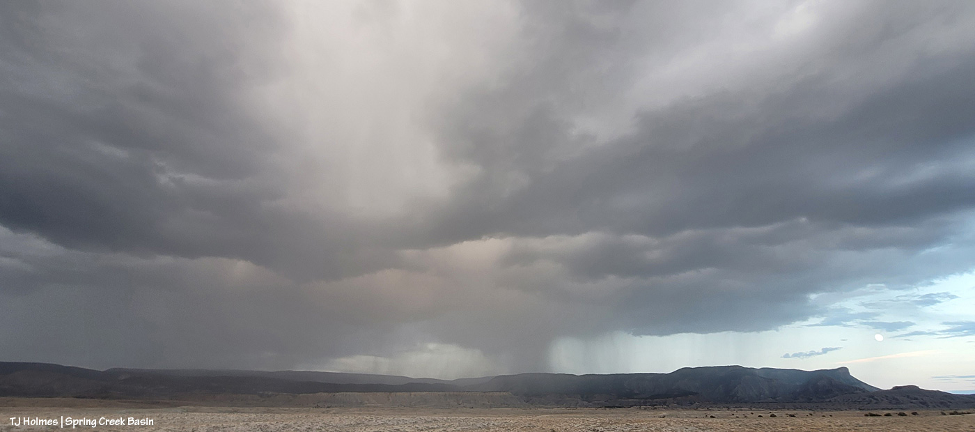
Rain – or perhaps more likely, virga – catching the western light over the southern ridge of Disappointment Valley from about mid(ish)-Spring Creek Basin. None of that for us yesterday, but we have chances today and Saturday.
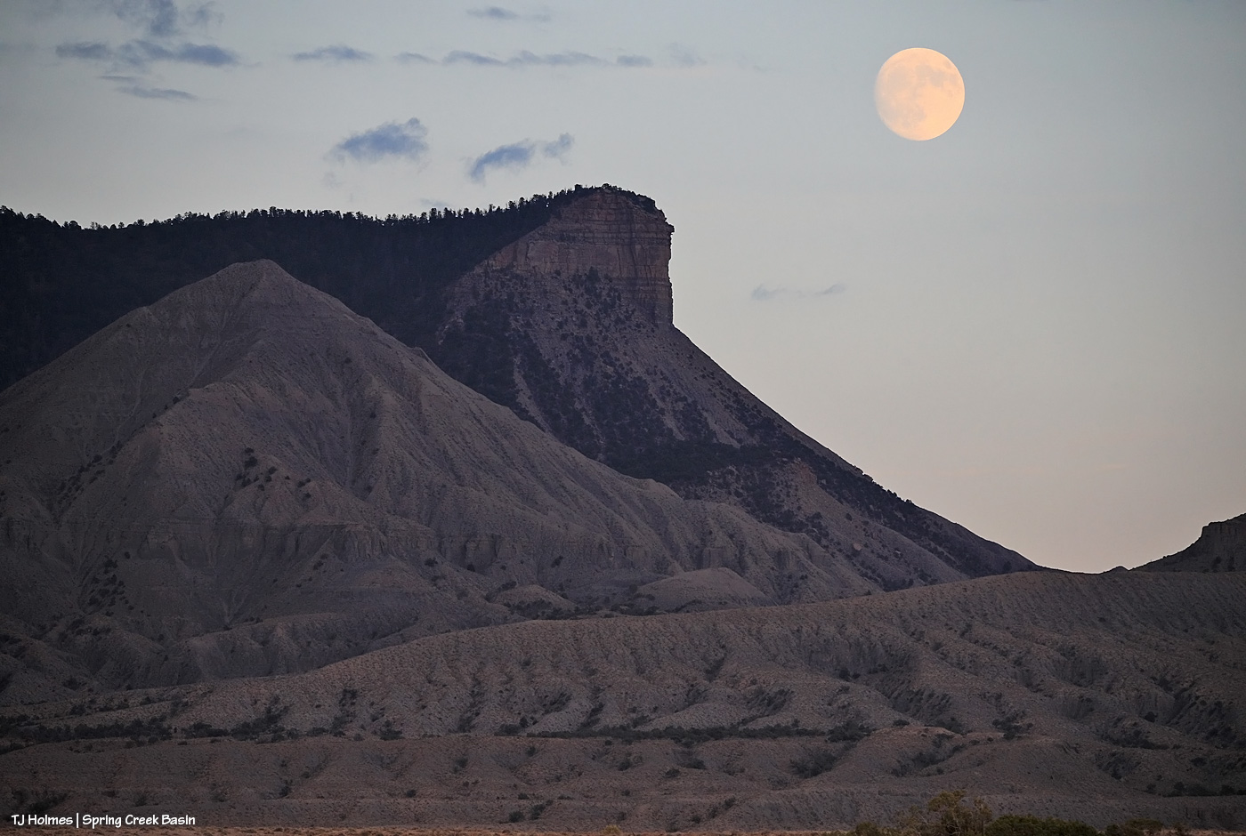
How often do you get the rising moon and a rainbow (and not a moonbow!) in the same image? I actually don’t know, but both are visible in this pic … though both are extremely faint and hard to see. The rainbow is nearly impossible to see – at the right side of the pic, nearly vertical – and it was suuuuuuuper faint in reality, too. But as I was nearly stumped (again!) by clouds to see the moonrise, I shot it anyway. 🙂
But the MOST crazy pic of last night:

I’d love to say I planned the above image … but I didn’t! I was taking pix of the moon, high in the sky, between cloud layers (! can’t we have some rain, please, with those clouds??), and the plane photobombed my moon!!!! HA! The dark streak behind it is its contrail. I’m astounded that the moon is as sharp as it is because I’d only aimed and started hitting the shutter when the plane zoomed by.
The world is a wondrous place. 🙂 Especially with mustangs … not pictured, but always there.

That’s rain beyond Tenaz. 🙂
It wasn’t in the forecast. Of the previous six days that had rain chances, we got rain only one of those days. The rain yesterday was *wildly* variable, even just over Spring Creek Basin. Some places didn’t anything; some got something.
We’ll take anything, anytime. 🙂

Storms don’t last long here; rain showers don’t linger. The sky clears quickly.
Usually.
The above is the eastern horizon beyond Spring Creek Basin from not very far below the western rimrock boundary as the last storm (Tuesday morning) cleared. The rain was in the morning; the pic is from early afternoon.
Wowza.
Mustangs were grazing below me, but I couldn’t get them in the view until Buckeye had a chat with Maiku.

It may not look very damp, but it was – after a quarter of an inch of rain that morning! McKenna Peak and Temple Butte were wreathed in clouds (very unusually) until early afternoon, and this doesn’t capture that, but Tenaz is the star of the show anyway. 🙂
That gives us 0.35 inch of rain (Friday afternoon and Tuesday morning), which is more than we’ve gotten in about three months? At least. The ground still is pretty dry under the top layer of dampened soil, but it has to help the vegetation (and the water catchments, too).

There are places where the horses drink where they also can roll and get muddy, but I like to hope that Cassidy Rain’s “adobe coat” (thank you, Sue!) is from anywhere in the whole wide basin that got rain on Friday. The damp ground didn’t last long, but it was a relief, nonetheless.
(Thanks to Luke Bryan for the title of today’s post: “Rain IS a good thing“!)

Earlier, the smoke plume from the Stoner Mesa Fire (now more than 3,500 acres in very rough country), had been rising high into the sky on our southeastern horizon, but by the time I got out to see the ponies, it was settling again for the night. There’s still a haze, but it’s nice to see more of our blue sky again.
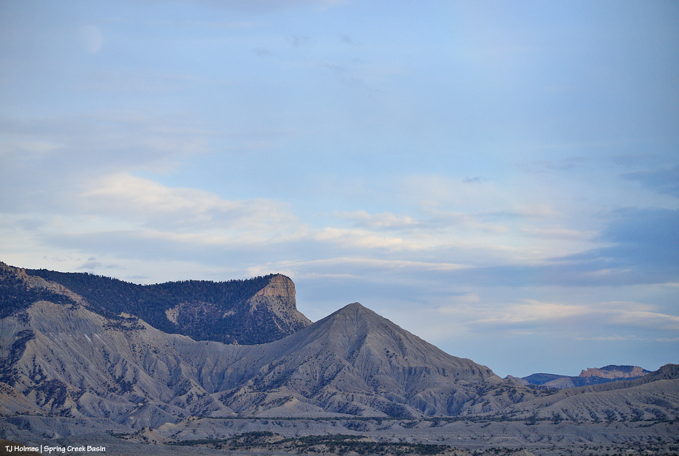
Temple looks as beautiful as always, especially with McKenna Peak and Temple (yes, named for her namesake(s)) Butte in the background.
I heard a rumor that some wet weather might be coming into our region toward the end of the week or weekend, but the forecast is either behind the times, or it doesn’t want to give us a (false?) sense of hope. Ha. Any hope is great hope at this point!
Who DOESN’T like to take in that view every now and then?!
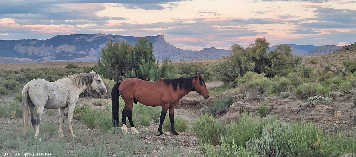
Skywalker might be considered Tenaz’s lieutenant, though I don’t think he would mind my translation that it’s not a title he likes or plans to use for long (!). Tenaz has two young mares, and Skywalker does keep Tenaz on his toes. They’re part of a bigger group of horses that’s basically two separate bands – one mostly happy family. 🙂
Above, the mares have gone ahead (to the right), and they’re waiting for their turn at the water cooler … err, pools of water that gather in the creek bed just above/upstream of Spring Creek canyon. A couple of other bands beat them to it, so they were politely waiting their turn.
The arroyo actually comes from beyond/above where Skywalker and Tenaz are standing, passes by us on the left, makes a big curve behind me as I’m facing them, runs a short distance, then makes another big curve to enter the canyon. Another few curves later, it empties below the rimrock cliff band that forms the basin’s western boundary into lower, wide-open Disappointment Valley on its way to join Disappointment Creek (which also is dry but for pockets of water) … and on to the Dolores River.
The mustangs definitely rely on these seeps in Spring Creek and its tributary arroyos as the summer gets drier and drier before the hoped-and-prayed-for monsoon rains. The forecast is showing an uptick of chances next week, and we’re crossing fingers, toes and hooves (!) that some rain actually pans out for us from those chances!
