Mules helping mustangs, part 2

14 03 2017

031317katytb1

And who wouldn’t smile, to be on a good horse, packing good mules in Spring Creek Basin, Southwest Colorado, on a gorgeous spring day?!

Katy Bartzokis (above) and Glenn Ryan and their horses and mules were back to haul more fencing supplies into the basin for future work, and we had more help in the form of Mike Schmidt and Keith Fox, who came to help Kathe Hayes and Kat Wilder.

So many photo opportunities … so little time to actually peruse the images and select ones for publication! And we welcome Glenn and Katy, Sly and Karmel, and Joey, Karla, Lena, Roz and Skid back tomorrow for another few trips into the wilderness (McKenna Peak Wilderness Study Area, that is). (So someone has to get to bed!)

Locals: Glenn (and Katy?) will be at the Ag Expo at the Montezuma County Fairgrounds this weekend with the mules and horses that made this project happen. If you go, please stop by and heap thanks upon them for helping our beloved Spring Creek Basin mustangs. Their work will enable us to rebuild fence sections without having to carry in hundreds of pounds (1,000 or more? we should add it all up!) of materials. Just one wooden post for an H-brace weighs 50-some pounds.

Many, many thanks!!

031317glenn1

031317katy1

031317katyglenn1


Mules helping mustangs

13 03 2017

031217mikekatyglenn1

Spring Creek Basin herd manager Mike Jensen leads Katy Bartzokis (BLM) and Glenn Ryan (Forest Service) and their mules to a drop site with fence materials for some upcoming projects – including alternative spring break!

We are so stoked to work with the Rocky Mountain Regional Specialty Packstring to get these supplies hauled into the basin by mule power!

This project is completely possible because of some big “horse” power, so BIG thanks to awesome mules Joey, Karla, Lena, Roz and Skid, and saddle horses Karmel and Sly. 🙂

And extended thanks to San Juan Mountains Association’s volunteer coordinator Kathe Hayes, who heads alternative spring break each year; Justin Hunt, BLM range tech; and tireless advocate Kat Wilder.

031217glennkatymulestring1

031217katy2

031217glenn1

031217katy1

031217katyglenn3

031217katyglennmike1


A little (lotta) magic

25 02 2017

Rainbow over Temple Butte

Rainbow over Temple Butte

Not many words needed for these images, either. That’s a rainbow right over Temple Butte, guardian of Spring Creek Basin’s southeastern boundary … but as prominent as it is, ALL of Spring Creek Basin.

It has been four years (and a few weeks) since Pati Temple passed away. We miss her every day. And we feel her with us every single day.


Atmospheric

28 01 2017

Temple Butte in lifting snow-mist.

Temple Butte in lifting snow-mist.

Temple Butte in lifting snow-mist.

I couldn’t choose. 🙂

There’s magic in them thar hills.

Temple Butte itself isn’t in Spring Creek Basin; it’s just outside our southeastern boundary. The foreground in these photos IS Spring Creek Basin. The southeastern and eastern parts of Spring Creek Basin Herd Management Area also are part of McKenna Peak Wilderness Study Area – which also extends to the east beyond Spring Creek Basin. (Note: McKenna Peak also is just outside the basin, and it’s visible from this vantage, to the left. With my long lens, I couldn’t fit them both in the confines of one photo – and it was more wreathed in snow-mist. :))


Subdued

6 01 2017

Ty

Fuzzy ol’ Ty helps show off that promontory in the background.


Spotlight-worthy

5 01 2017

Tesora

Tesora helps show off another unnamed promontory, farther up the valley. Behind her is the shadowed ridge of Brumley Point, and above and beyond that is our previously unnamed promontory, now called Temple Butte in honor of Pati and David Temple, who advocated tirelessly for Spring Creek Basin’s mustangs (David still does, and Pati spreads her angel’s wings over our blessed basin).

The very last light lit up that promontory, and it was hard to balance its brightness with the already shadowed foreground – and mustangs. So that’s not snow; it’s very-bright sunshine spotlighting the golden rock of the promontory.


‘Every shift of light’

4 01 2017

010117templebuttebrumleypoint3

Temple Butte gleams golden in the last light of a “trying to snow” day while Brumley Peak has just a spot of light on its serrated flank.

010117templebuttebrumleypoint1

Brumley Point is mostly within Spring Creek Basin Herd Management Area. The southeastern boundary fence climbs a lower ridge to the first wall of rimrock. Temple Butte is outside Spring Creek Basin but visible from almost anywhere in the basin (and far beyond). They’re both within McKenna Peak Wilderness Study Area, which also covers a fair bit of the southern, southeastern and eastern parts of the basin.

The mustangs showed up just a bit after I took these photos from the road. … They weren’t quite as cooperative in the last light of day as the steadfast mesas and buttes. 🙂

And the trails I ride are new
Even though I’ve made the circle many times before
For they change with every season
And with every shift of light
From the summit where the clouds fall to the sweet, valley floor.

~ from “The Circle” by Dave Stamey


The light that shines

3 01 2017

Chipeta at the end of a day of "trying to snow" in Spring Creek Basin.

Grey and brown are our colors of late. We’ve been waiting for this big snowstorm that has been in the forecast for days, but it hasn’t hit us yet. Meanwhile, we have plenty of moisture (aka mud). 🙂

And every now and then, a ray of light.


Alternatively …

31 03 2016

Once upon a time in a place far, far away from civilization – better known as Spring Creek Basin – it snowed during alternative spring break. And then we had many, many years of pretty excellent weather, during which we completed many projects for the benefit of our mustangs that call this faraway place their home on the range.

Brumley Point forms part of Spring Creek Basin's southeastern boundary.

Tuesday would have been the first day of the annual two-day work project for alternative-spring-break partiers in Spring Creek Basin. However, Ma Nature had other plans, and she sent howling winds and blowing snow to this southwestern corner of Colorado.

033016brumleytemplebsnow

Yesterday was the second day of our Spring Creek Basin project. Despite a light skiff of snow on the ground in the morning, we got a fairly decent start, and students carried several loads of materials and tools to the work site – which now is about mile from the road up the southeastern fence line.

033016safetytalk

BLM range tech Justin Hunt gives a safety talk before Mizzou students carry tools and supplies to the work site.

033016supplypickup

University of Missouri students pick up materials to carry to the work site from BLM range specialist Garth Nelson.

033016libbynina

Libby and Nina carry staves up the big hill.

033016ninakathelead

Nina (left) walks back to the truck for more supplies while SJMA’s Kathe Hayes leads Jenna and Bailey to the work site  with a second load of tools. SJMA’s MK Gunn is at far right.

And then it snowed again.

At first, they were lovely little flakes floating on the breeze.

Then those flakes got bigger and heavier, and they started sticking to the ground, and the dirt started getting damp and started sticking to the bottoms of our hiking boots.

033016chalenjoshsean

Mizzou’s Chalen helps Southwest Conservation Corps-BLM GIS intern Josh Ryan carry wire to the work site along Spring Creek Basin’s southeastern boundary during alternative spring break. BLM’s Sean Waggoner follows with the chainsaw and T-posts.

033016lukejessicastaves1

University of Missouri students Luke and Jessica carry staves about a mile to the work site while snowflakes start to fall.

About noon, we made the decision to call it a day. By the time we got back to the road, the snow had stopped … but the next wave was on its way.

Between the waves of snow, students carried armloads of T-posts and staves, buckets of tools and handfuls of tools, stretched a string to straighten the next section of fence, built an H-brace, pounded T-posts and cut wood away from the path of the new fence line (actually done by our BLM range tech). A couple of them even got as far as dropping posts and staves along the line. But we didn’t have time to take down old wire and string and stretch new wire.

033016garthchalenbrace1

Garth pounds a spike into a cross brace held by Chalen in the H-brace built before the snow really came down.

033016garthchalenlukebrace1

Garth helps Chalen and Luke tighten the wire holding an H-brace together.

033016justinsaw1

Justin cuts a tree away from the fence. Sean and Mizzou’s Megan serve as safety spotters. We learned that while we can’t cut even dead trees to use as posts in McKenna Peak Wilderness Study Area, we can use chainsaws to clear such trees from a fence line.

033016ninameganseanwire

Sean holds wire while Nina and Megan attach strands to a T-post when the snowfall got heavy.

We’ll continue this project on other (sunny) days. 🙂

We sincerely thank this year’s Mizzou crew for being hearty and willing to brave the elements to tackle this ongoing project! It was great to meet you all … and there’s always next year! We also thank SJMA’s Kathe Hayes for her ever-cheerful organizational skills and taking care of the students, as well as members of the Colorado chapter of the National Mustang Association and Disappointment Wild Bunch Partners (who represent NMA/CO, Four Corners Back Country Horsemen and Mesa Verde Back Country Horsemen) for helping with funding.

033016asbgroup1

University of Missouri students gather with BLM and SJMA employees in front of Temple Butte, just outside Spring Creek Basin in McKenna Peak Wilderness Study Area, during alternative spring break. From left to right: Justin Hunt, Bailey, MK Gunn, Josh Ryan, Jenna, Nina, Jessica, Megan, Luke, Libby, Kathe Hayes, Garth Nelson, Chalen and Sean Waggoner.


Steep work, great views

31 10 2015

Caution: Scenery- and work-project-heavy post ahead.

Thursday was the last day of work for the SCC crew – a short amount of time for a big – steep – job.

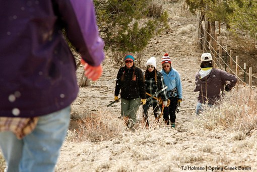
The day started with some clouds, cleared to sunshine, then returned to clouds. (More) Rain started Thursday night. (Have we been blessed by rain the last couple of weeks or what?!) So the crew had good conditions for their final day of work on Spring Creek Basin’s southeastern boundary fence.

Southwest Conservation Corps crew members build H-braces on a steep hill along Spring Creek Basin's southeastern boundary. From this vantage, one looks across the last drainage in the basin toward Disappointment Road.

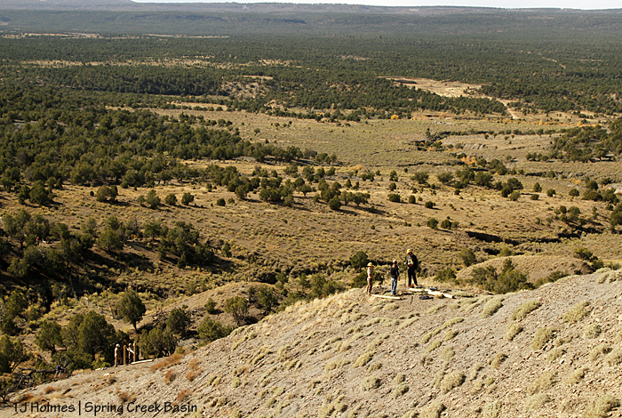
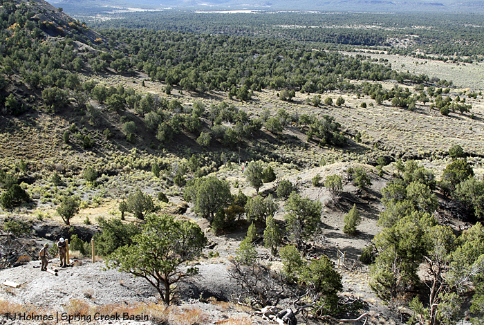
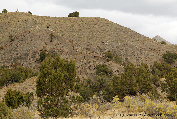
Let’s start with a scenic overview. There we were, on the basin’s far southeastern boundary looking southwestish over the basin’s “last” drainage toward Disappointment Road, the cottonwoods along Disappointment Creek and to more pinon-juniper covered BLM land beyond the basin to San Juan National Forest Service land to the horizon. Note the two groups, both working on H-braces on the near ridge – aka “the steep hill.” If you click to make the photo larger, you may be able to see the silver fence at the left; that’s the part of the fence that the crew already had rebuilt. It runs into the fence rebuilt by Mizzou students (we left a section for the students to work on in the spring).

Southwest Conservation Corps members are replacing this fence along Spring Creek Basin's southeastern boundary.

Next, let’s take a look at the sad old fence that serves as an example of what the Mizzou students and the SCC crew have rebuilt and are rebuilding. We figure that fence has been around for 40 or more years.

Southwest Conservation Corps crew members Toby and Zoe finish an H-brace at the base of the steep hill to along Spring Creek Basin's southeastern boundary.

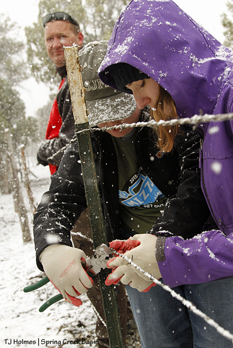
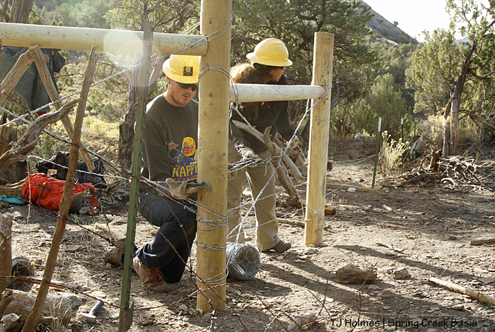
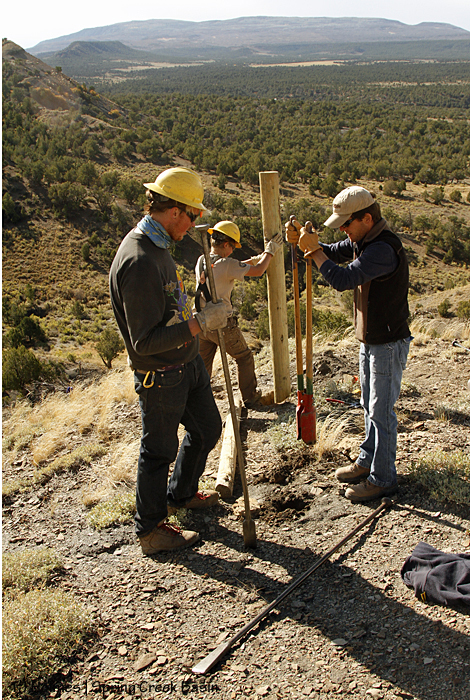
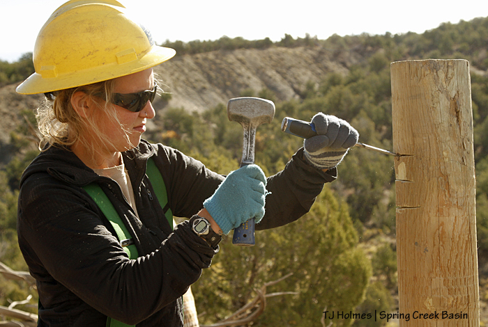
Toby and Zoe tighten another wire strand to a corner H-brace. Their rebuilt fence comes in from straight ahead, up from the arroyo shown in the previous post; the steep hill starts steps to the left.

Southwest Conservation Corps members Eric and Aaron dig a hole while building an H-brace on the steep hill on Spring Creek Basin's southeastern boundary.

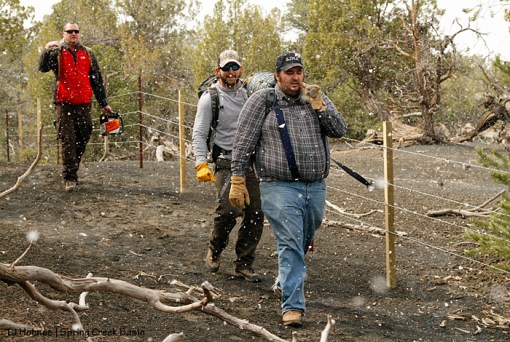
Meanwhile, up the steep hill (hey, it really IS steep), Aaron and Eric dug holes for another H-brace. If you look closely, you can see the H-brace Toby and Zoe were working on below the hill at right.

Southwest Conservation Corps member Aaron watches Sarah carry an H-brace post up the steep hill on Spring Creek Basin's southeastern boundary.

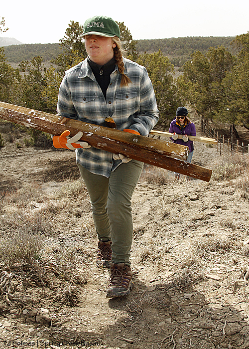
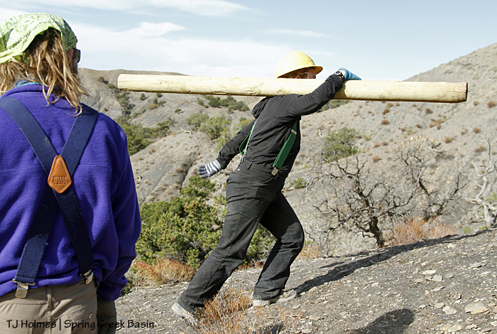
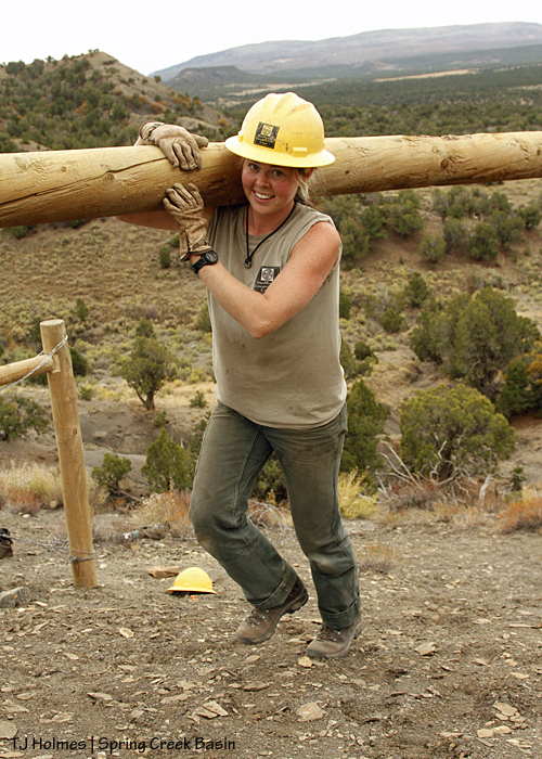
Photographic proof of the steepness (in a two-dimensional photo, it’s hard to convey just how steep this hill is): Sarah carries a post up the hill to the site of the next H-brace.

Southwest Conservation Corps members Eric and Aaron check the cross post while building an H-brace on the steep hill on Spring Creek Basin's southeastern boundary.

This photo does double duty: Partners Eric and Aaron measure the setting of an H-brace post with the cross post, AND you get another dose of scenery.

Southwest Conservation Corps members Toby, Sarah and Abby take turns digging a hole for an H-brace post on the steep hill on Spring Creek Basin's southeastern boundary.

Toby and Sarah stand ready as Abby uses the post-hole digger to dig yet another hole for yet another H-brace on their journey to the top of the steep hill. Eric and Aaron in the photos above are below on the hill. The scenery here is part of McKenna Peak Wilderness Study Area – which overlaps into Spring Creek Basin Herd Management Area; in this view, it’s all wilderness study area.

BLM range tech Justin Hunt helps dig a post hole for an H-brace on the steep hill with SCC crew members Toby and Abby on Spring Creek Basin's southeastern boundary.

Another view of the same H-brace site, this time with BLM range tech Justin Hunt helping to dig the second post hole. How steep is the hill? The H-brace Eric and Aaron are working on is 100 yards or less below this site – and completely out of view of this little knob in the hill.

The fence the Southwest Conservation Corps built. Up the hill in the foreground and across the small drainage in the lower background, beyond the photo, the crew left a section for the Mizzou students on alternative spring break next year.

From the side, here’s a view of Eric’s and Aaron’s H-brace. Abby and group are up the hill to the right. In the very first photo in this post, you can see both groups. Their rebuilt fence as it crosses the arroyo is very visible in this photo.

Southwest Conservation Corps members rebuild the fence up a steep hill on Spring Creek Basin's southeastern boundary.

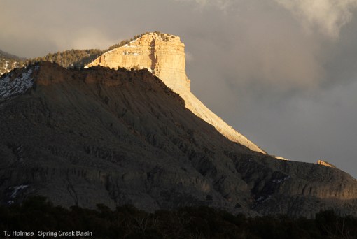
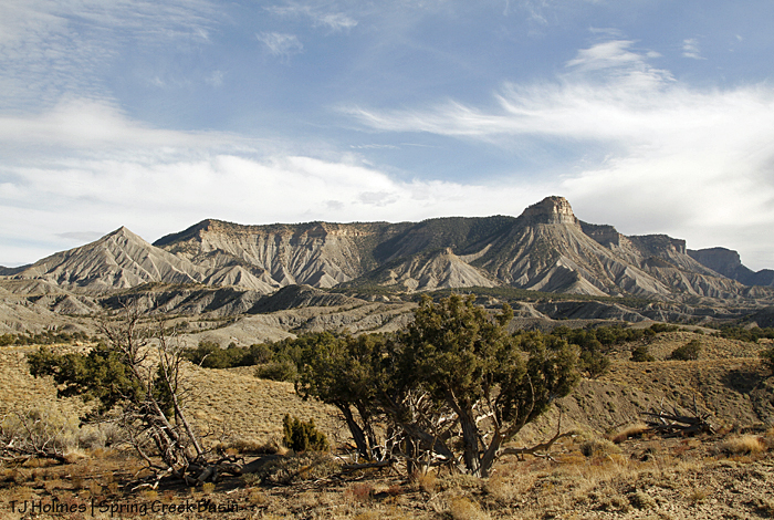
Another gratuitous scenery shot – ain’t it grand?

Southwest Conservation Corps crew members Sarah, Aaron and Eric help co-crew leader Dillon complete an H-brace they built on a steep hill on Spring Creek Basin's southeastern boundary.

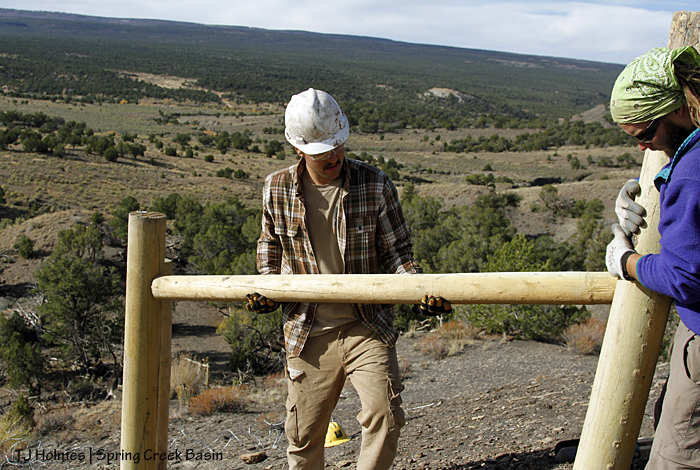
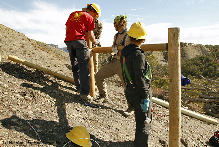
Returning to Eric’s and Aaron’s H-brace, now they have help from Sarah and co-crew leader Dillon to mark the first cross post. We had some debate about the levelness of these cross posts because the ground is so steep. Keeping the cross pieces strictly level would have had the post normal height on the downhill side of the brace but only about mid-thigh high on the uphill side! So crew members mirrored the slope a bit and cut their notches to reflect the angles of the posts’ ends.

Southwest Conservation Corps co-crew leader Dillon lends weight to the manual drill wielded by Eric as he drills a hole for a spike in the H-brace pictured. Aaron and Sarah, who dug the post holes, thread wire to anchor the braces on Spring Creek Basin's southeastern fence line.

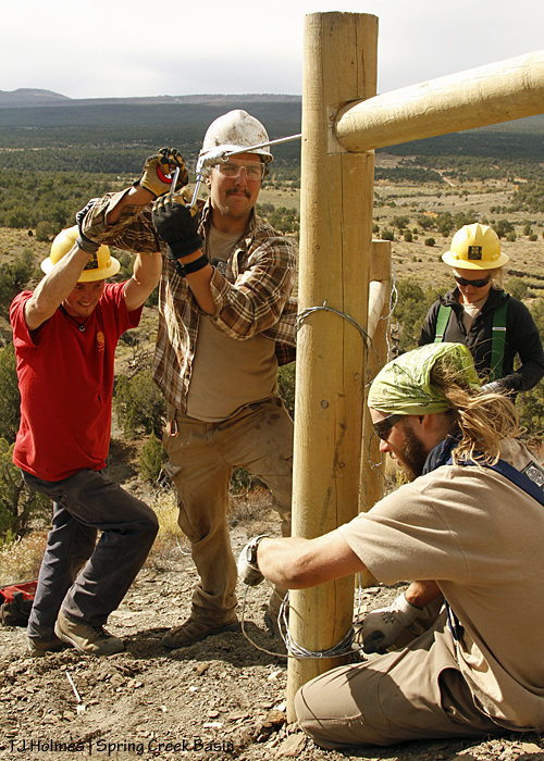
It’s easy to ramble on about the partnerships we enjoy for the benefit of the basin’s mustangs, but here it is in living color: Dillon lends weight to Eric’s drill while he drills a hole in the H-brace into which he’ll later pound a spike. Ain’t it grand?! 🙂 Wrapping wires to create the “X” to further bind the brace posts together are Aaron and Sarah.

Southwest Conservation Corps crew member Sarah uses a chisel to create a notch for a cross bar in an H-brace in Spring Creek Basin's southeastern fence line.

Sarah chips out the notch that will hold the cross posts even steadier in the vertical H-brace posts.

In case the steepness of “the steep hill” hasn’t been mentioned or illustrated clearly, these next photos should do the trick:

Southwest Conservation Corps co-crew leader Sarah carries a post up the steep hill to build an H-brace in Spring Creek Basin's southeastern fence line. All smiles on Day 4!

Co-crew leader Sarah carries an H-brace post up the steep hill. She’s passing the first H-brace, and she’ll pass the next H-brace before getting to her destination – and they had at least one more H-brace to build after that. Still all-smiles on Day 4!

BLM range tech Justin Hunt carries a post up the steep hill behind SCC co-crew leader Sarah on the way to build a new H-brace above the one pictured, with co-crew leader Dillon, on Spring Creek Basin's southeastern boundary.

Justin follows Sarah on the way to the second H-brace up the steep hill, where Dillon is making cuts to start the notching process.

Southwest Conservation Corps crew member Zoe carries a post up the steep hill to use as part of an H-brace along Spring Creek Basin's southeastern fence line.

And here’s Zoe carrying another post from basically the base of the steep hill (scroll back up to the beginning of this post and the H-brace where she and Toby were tightening a strand of wire).

Southwest Conservation Corps crew members construct H-braces in the new fence along Spring Creek Basin's southeastern boundary. That steep hill is why they were hired!

From the bottom looking up.

Southwest Conservation Corps crew members construct a new fence along Spring Creek Basin's southeastern boundary. That steep hill is why they were hired!

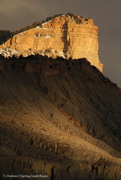
And from down toward the arroyo looking up at the steep hill. Um, wowowow?! The wilderness study area’s namesake McKenna Peak shows its point at far right.

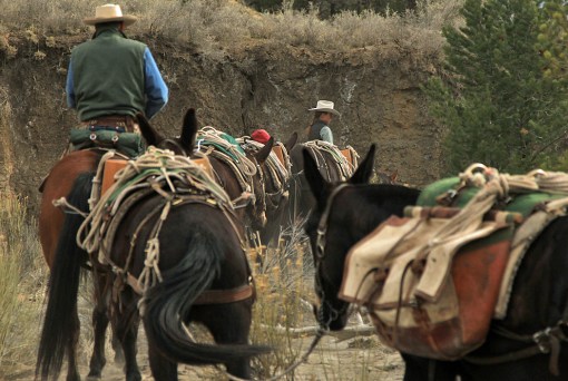
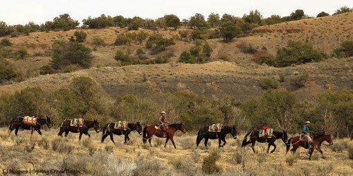
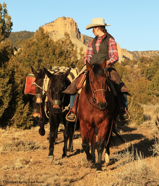
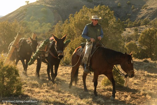
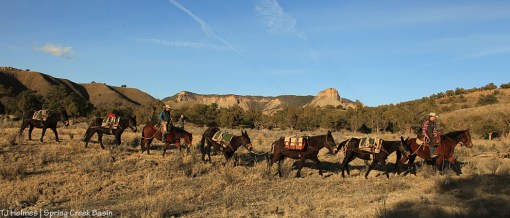
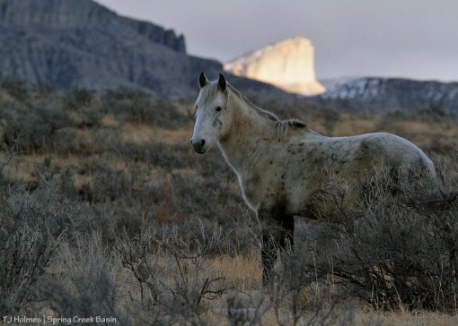
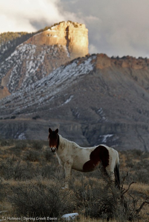
Sarah, Dillon, Eric, Aaron, Sarah, Zoe, Abby and Toby, we thank you, thank you, thank you for your service on behalf of our mustangs! We hope your last hitch of the season was your best. Thankfully, you saw some mustangs along the way between camp site and work site, and if you can, please come back soon to see more of the mustangs protected and kept safe by your work!

Beyond Spring Creek Basin in McKenna Peak Wilderness Study Area: McKenna Peak at far left and Temple Butte toward the right. Outside Spring Creek Basin, they are two of the basin's most recognizable landmarks.

View from the top. 🙂