The water trough at the main/original water catchment is full again. The tank has about 3 feet of water. It has been mostly dry with a poor winter and without much rain.
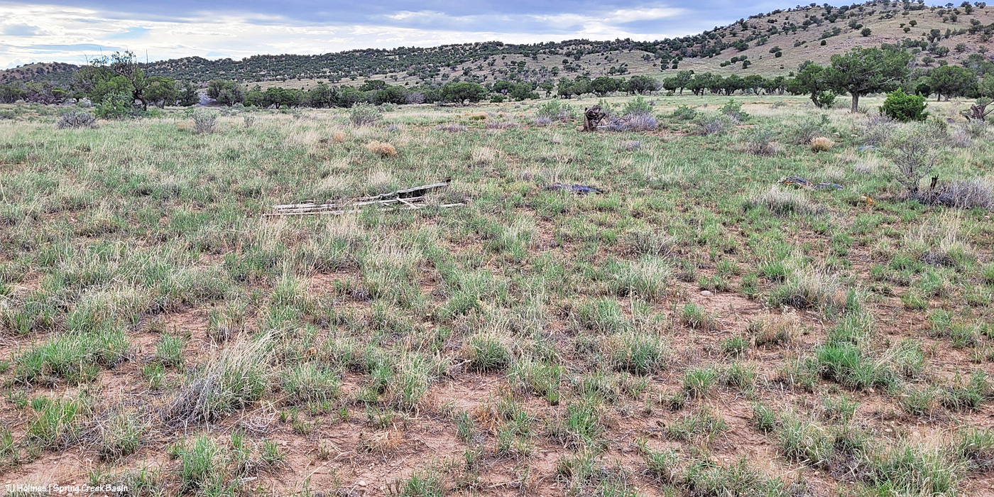
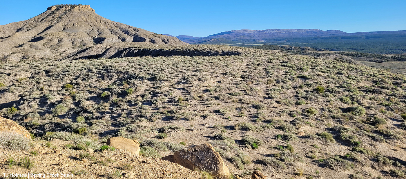
Post-rain grass growth! If you live east of the Rockies and in places where it, you know, rains, this might look sparse. … To us, it looks lush and divine! And I will tell you, the mustangs are going after it with gusto!
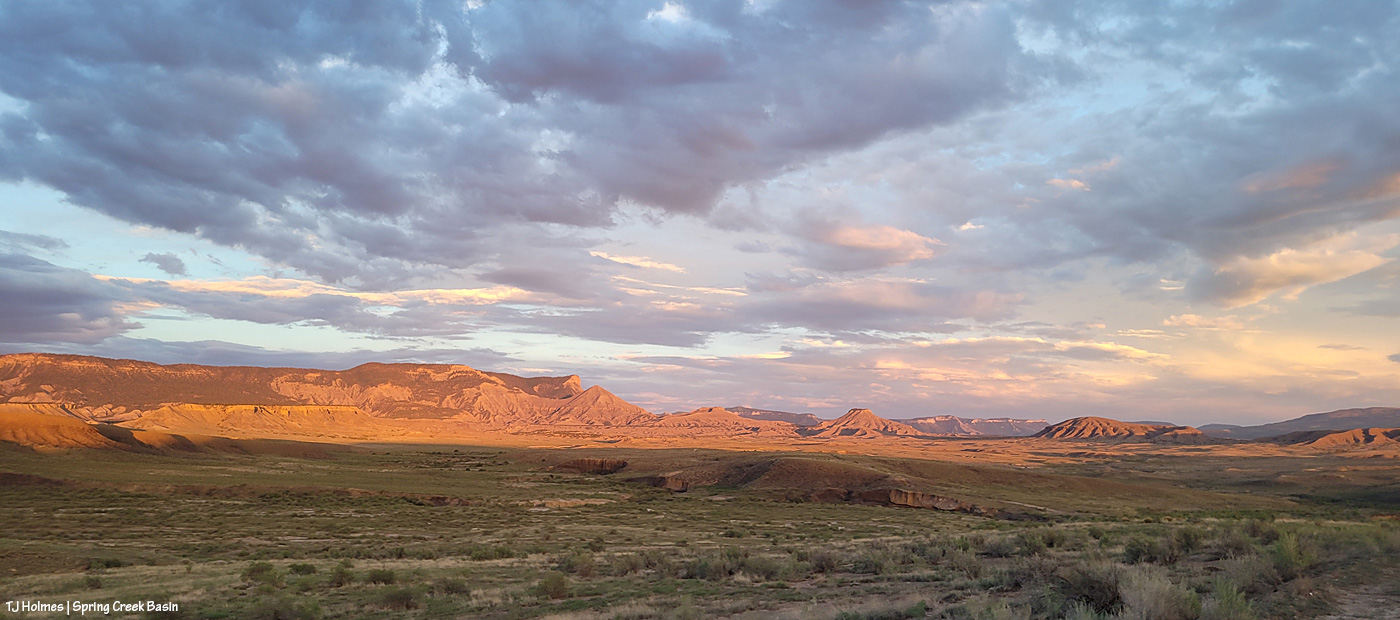
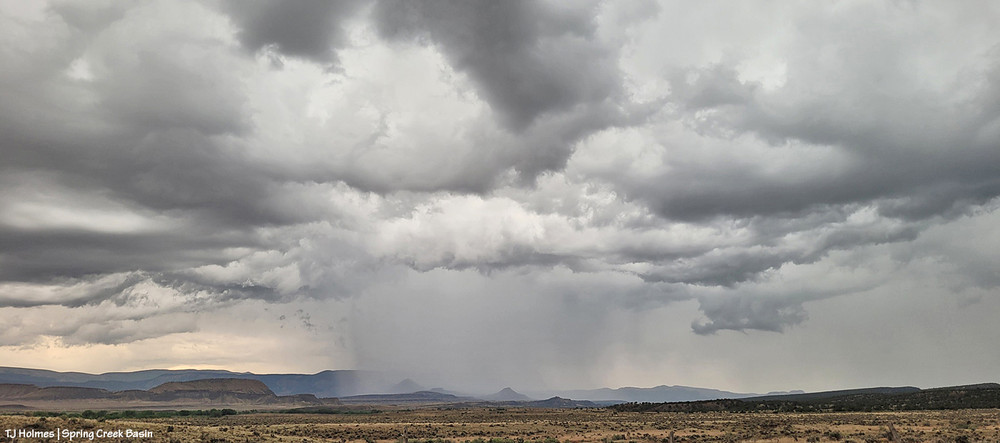
Do you see the pillar of light? The clouds were heavy the last part of the day (and they and the breeze dropped the mercury comfortably), but then, at THE very end of the day, the sun found a window, and it lit up the basin.
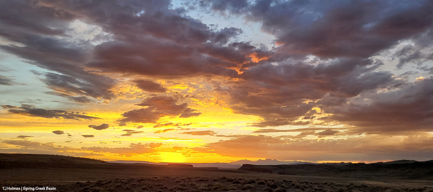
Did you think I was exaggerating? 🙂 As usual, the pic doesn’t do justice to the colors of reality.
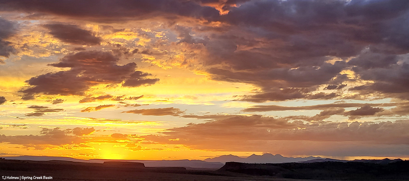
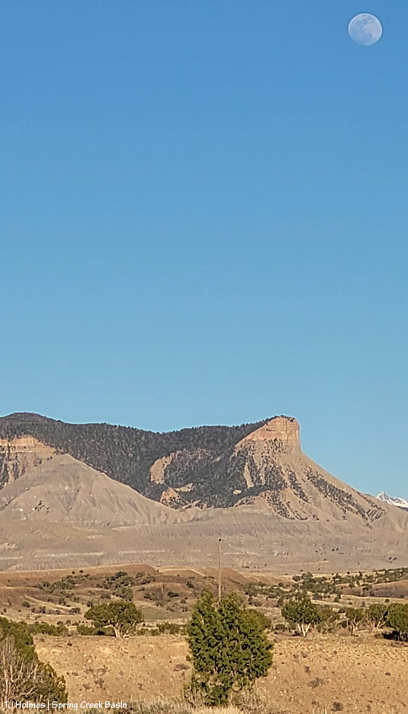
I couldn’t decide between the really long, wide view or the slightly zoomed-in view, so you get both. 🙂
Just another glorious day in Spring Creek Basin. I promise, pix of ponies are on the way.
This targeted downpour over southeastern Spring Creek Basin and upper-ish Disappointment Valley was by no means the only rain we got in the last couple of days. And it probably wasn’t even the most dramatic. But it sure was cool. 🙂
Depending on the part of the valley, we got anywhere from half an inch to probably at least an inch of rain between Thursday afternoon and Friday evening. Every drop is so very welcome.
According to the Old Farmer’s Almanac (linked above), “In the Northern Hemisphere, the June solstice (aka summer solstice) occurs when the Sun travels along its northernmost path in the sky. This marks the astronomical start of summer in the northern half of the globe. (In the Southern Hemisphere, it’s the opposite: the June solstice marks the astronomical start of winter when the Sun is at its lowest point in the sky.)
“This solstice marks the official beginning of summer in the Northern Hemisphere, occurring when Earth arrives at the point in its orbit where the North Pole is at its maximum tilt (about 23.5 degrees) toward the Sun, resulting in the longest day and shortest night of the calendar year. (By longest “day,” we mean the longest period of sunlight hours.) On the day of the June solstice, the Northern Hemisphere receives sunlight at the most direct angle of the year.”
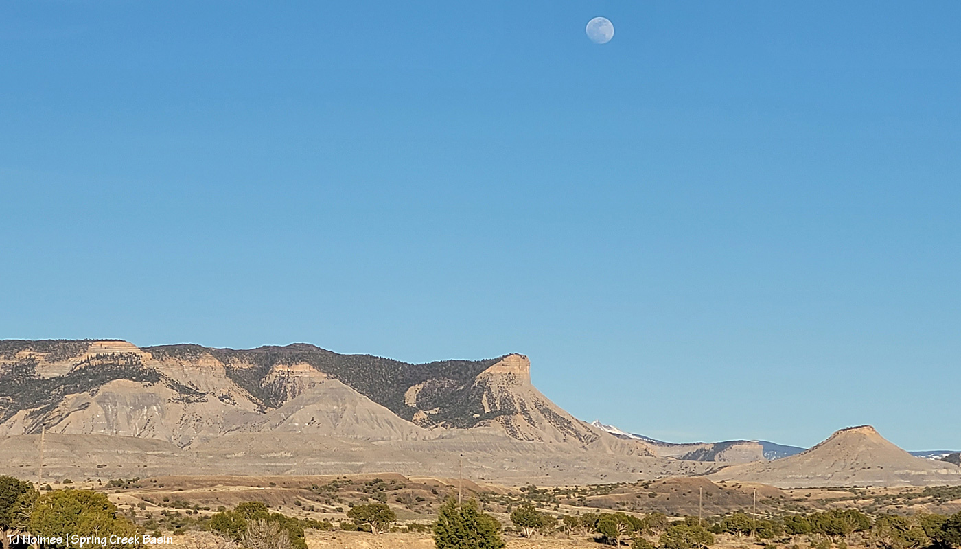
The pic of the nearly-full moon rising over Spring Creek Basin landmarks McKenna Peak, Temple Butte, submarine ridge and Brumley Point was taken last night.
What is THAT crazy little alien-looking bee on these prickly pear cacti? There were two of them, and they were busily busy in the depths of these lovely blooms along a road in the basin.
To give a little more range to the views on (of? from?) my route to the top of (and back down off of) a remote ridge in Spring Creek Basin the other day, here are a few more pix (because you don’t mind the views, do you?!):
This was taken on my way back to where I’d left my vehicle at the end of the day (note the very warm, golden light and hefty shadows). On my way out (I took a different route to get there than I did coming back), I could see the horses almost the entire time (except Hollywood; I didn’t see him until I got to the top), but I didn’t take any pix because I didn’t want to take the time to get my camera out of the pack, take pix, put it back in the pack and continue on. I thought the horses might wait for me (grazing) to get closer so I could show them in their awesome related-to-mountain-goats locations. They didn’t. 🙂
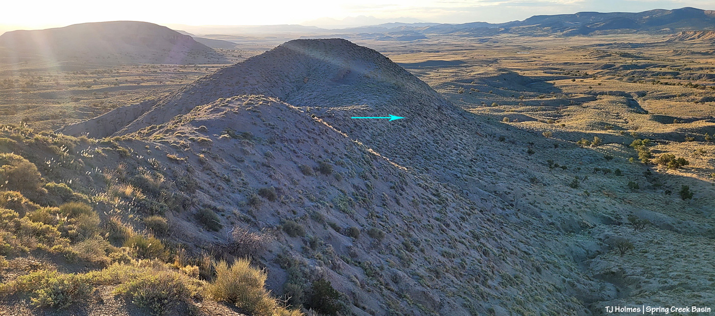
In the above pic, the pinkish arrows show where Storm’s band went up (left) and where Sundance’s band went up (right). Those look steep enough, eh?! The yellow arrow at left shows the shale-y little “rimrock” I climbed up and then crawled along for several yards (it doesn’t show how narrow it is, even if you zoom in). The blue arrow at left is the general location of a diagonal trail the horses and deer have that goes up and over – or over and down, depending on their direction of travel. By the time I got to the top of the ridge on my way up, the horses were at the far end – closest to Brumley Point. There’s a little seep over the other (south – right from this view) side of that ridge, there’s a seep kind of at the base of that little “cove,” and from my location taking this pic, there’s a seep in the arroyo right below me.
I’ve been up there before, but I can’t quite remember how I went up (or which band I was visiting then), and I’m still not entirely sure how I went down then. Instead of going down the horses’ trail from that little saddle (blue arrow), I think I went on up that hump of a hill (steeper than it looks from here) and then down onto the ridge just visible at the far right side of the pic, which descends to a lower and slightly rounded-top ridge along and above part of the arroyo.
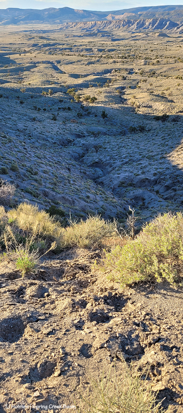
In the above pic, I’m back on my narrow finger ridge looking back down as I was on my way up; this gives a better view of the broad arroyo that has the couple of seeps. The yellow arrow at far left shows my starting point at rollercoaster ridge.
Now I’m on my way back down after my visit with the horses. I’m at the top of the ridge above that little “cove” – above and to the right of the left pink arrow in the first pic at the top of this post – looking back at the way I came up (yellow arrow) and the way Storm’s band came up (pink arrow). It’s hard to tell here, but those are different ridgelines; they’re more easily seen in the first pic.
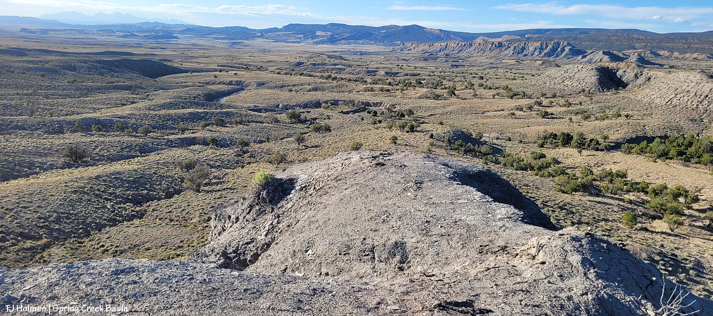
This shows the other side of the “cove” (I’m taking the pic from the same spot as the pic just above but now slightly to my left) with the blue arrow indicating the general location of the trail I took back down. (For those of you who’ve been to the basin, that’s Round Top at far left.)
The trail at the far west end finger ridge down to the saddle and the bigger hump hill (which is slightly to my right); I’m taking this pic from the same place as the previous two pix. Perfectly wide enough for upright two- and four-legged travel. 🙂
And the “trail” where Sundance’s band came up from their grazing on the steep side of the “cove.” When I say that mustangs are relatives of mountain goats, I’m not even kidding!
I’m nearly back to the beginning of my “trail” on rollercoaster ridge, looking northwest to Utah’s La Sal Mountains across the lovely shadowed expanse of Spring Creek Basin and lower Disappointment Valley beyond. If I could bottle the peace in this magical, extraordinary place, there’d be no more war or strife or violence anywhere ever.
The very last light over Spring Creek Basin and my epic adventure. That’s the pond below rollercoaster ridge shining like a mirror in the middle ground.
Epic? … Really, just another day in mustang paradise. 🙂 (I do promise to feature mustangs again tomorrow. They are the very foundation of the magic of this wondrous place.)
If you’re afraid of heights, you’d have had a hard time hiking with me to this spot … because I had to crawl, on hands and knees, hoping the wind wasn’t stronger than my body weight (no chance of that –ha!) because the width of the finger of shale I crawled up on to get to where I’m sitting on the ground to take this pic (below what you can see) was not much wider than my four-square hands and knees. Let’s just say that I didn’t take in the view – or the drop to either side – until I got to this point and shimmied around onto my derrière!
What. A. VIEW!
If I say that frequently about Spring Creek Basin, who could blame me – or argue? 🙂
Bonus: It’s starting to look a little green, eh? … Just a little?!
Bonus No. 2:
I knew I was going to find Sundance’s and Storm’s band up top (you think I did a death-defying hands-and-knees crawl for my health!?), but I also found Mr. Hollywood! This pic can’t begin to do justice to this view: It’s still a ridge, though it’s (much) wider than where I crawled up. The horses had already moseyed to the far end by the time I crawled and walked up to this point, which is just above and behind my spot in the first pic. You might have to zoom in to see them.
The horses take me to all the very BEST places! 🙂 There will be pix of them to come in future posts.
Oh, and I forgot to mention that although the horses didn’t follow my route UP (!!!!), they had been DOWN that little ridge – at least to the end – by the existence of desiccated manure. (Really, you find it in the craziest places!)
The mustangs weren’t in cooperative locations for catching the rising moon, so I tried a bit different place. I still caught it a bit later than I’d hoped, but with Temple Butte on the left and Brumley Point on the right, Groundhog Mountain in the background and part of Spring Creek Basin in the middle ground … it worked out all right. 🙂
That’s part of Disappointment Road at lower right.
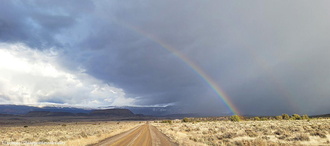
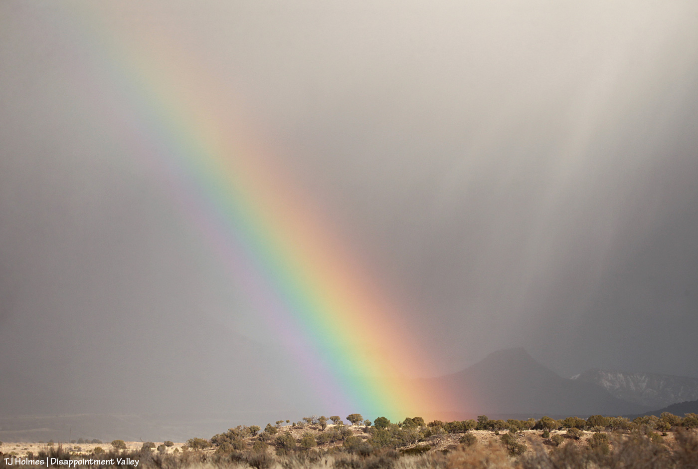
On St. Patrick’s Day in Disappointment Valley, we had a bit of gold under the rainbow (and yes, it was sprinkling when I took these pix (above with my phone; below with my camera)).
In Disappointment Valley (which includes Spring Creek Basin), WATER is the treasure! In our case, there’s a whole lotta mud under that rainbow right now, and we’re feeling pretty rich. 🙂
(And yes, these pix were taken the evening of St. Patrick’s Day – no kidding!)
Sometimes the mares (Piedra in this case) get a wild hair and try to outrun their stallion. In this case, her band and the band that moseys with her band had gotten a little separated when they chose different sections of an arroyo to drink in.
Her stallion followed along, and maybe she just needed a little gallop because he fairly easily and quickly collected her – and she let herself be collected.