Do you ever get that feeling like you’re being watched?
In the best possible way, of course! 🙂
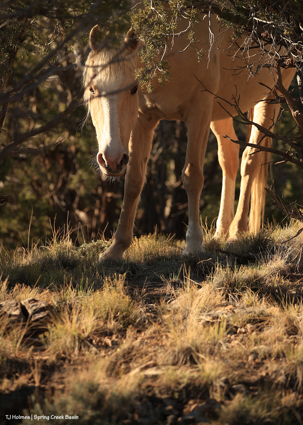
I was sitting way up high on a hill in the northwestern part of the basin, after a huffin’-and-puffin’ kind of climb, and I was looking out at the view when I happened to look straight to my right to see a pretty little face looking at me from under the cover (or so she thought) of trees. Ha!
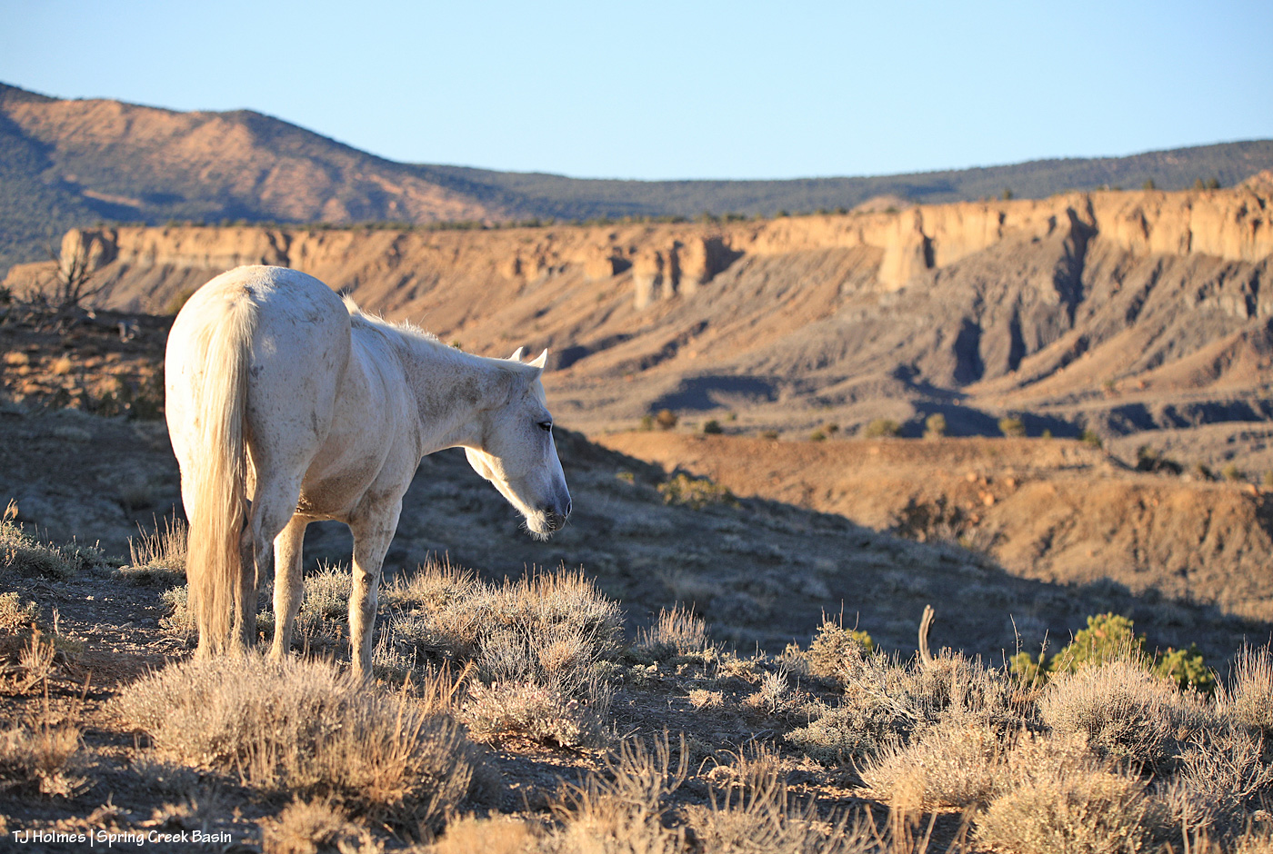
Pretty Rowan in Buckeye’s band is a curious girl!
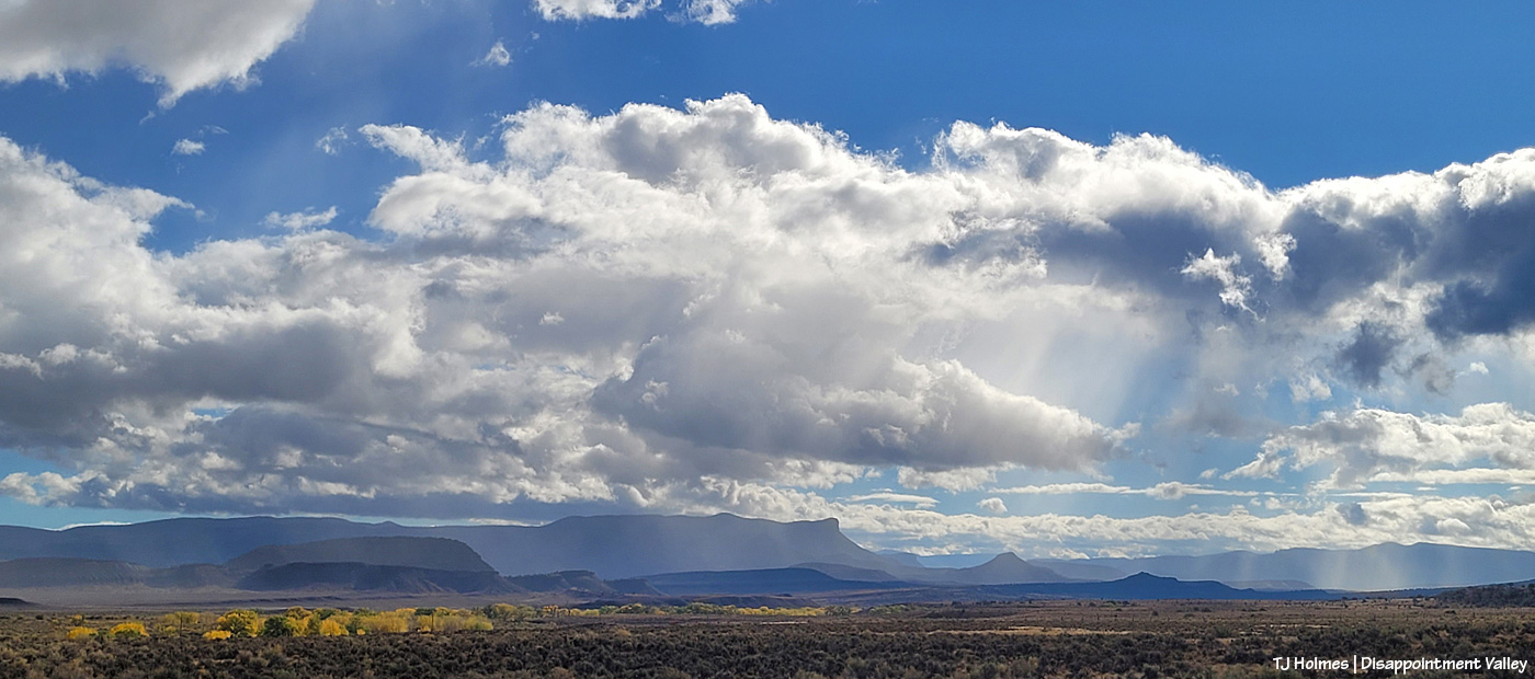
We are having some absolutely gorgeous weather. It’s mostly dry again, though I keep finding little pools in arroyos and canyons and other little places of still-damp ground. The mustangs are growing their winter coats and starting to look fuzzy. My favorite time of year.
Cassidy Rain remains morally opposed to posing for marvelous mustang portraits … but now and then, I “catch” her looking gorgeous (as she always does, willingly or not)!
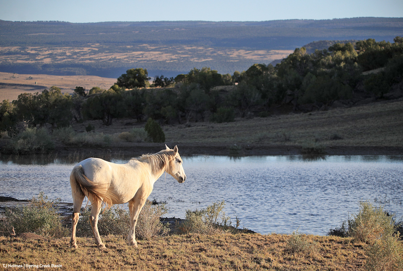
That’s Winona, and this is the same pond from a few posts ago featuring Temple. The rain FILLED this pond, which was looking a little weak (but better than dry).
Same Winona, same pond, same almost-overtaken-by-setting-sun-shade time of day after she’d walked around it.
It was like taking pix of a mustang at a LAKE with all that water in the background. 🙂 It was a weird and wild and most wonderful situation, and I hope to see a lot more scenes like it.
Mariah was not impressed about being disturbed from her nap in the shade. I didn’t bother them long as I investigated the sound of water trickling and discovered it to be rain-remnant water trickling over rock down an arroyo just behind her band. Amazing!
By tomorrow morning (?), she might want more sunshine than shade as temps are predicted to drop to freezing for the first time this season!
We rarely get morning rainbows; we rarely get morning rain (and even more rarely with sunshine).
Along with a lot of rain the last few days (about 2.56″), we’ve had a lot of sunshine.
This IS Colorado, after all!
Yeah, so THIS happened yesterday morning!
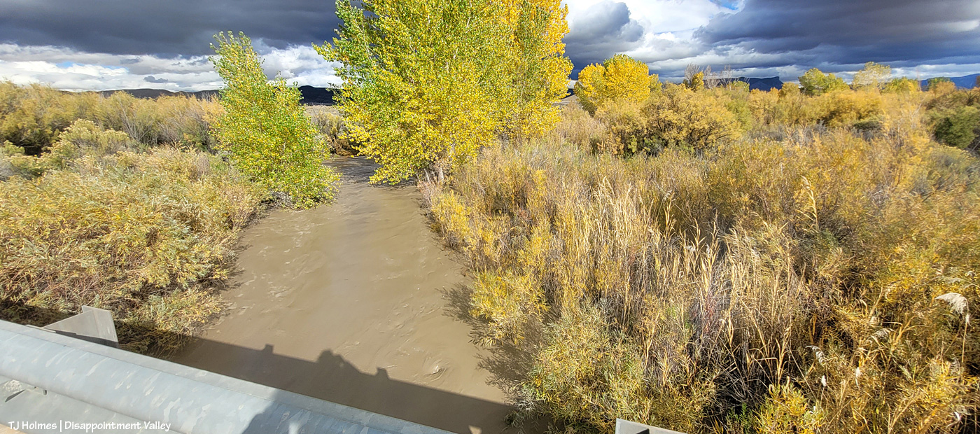
The cottonwoods along Disappointment Creek are starting to glow gold. And yes, it was sprinkling through the sunshine, which brought the magic. (The above pix are looking west; sun rising behind me above the rain clouds.)
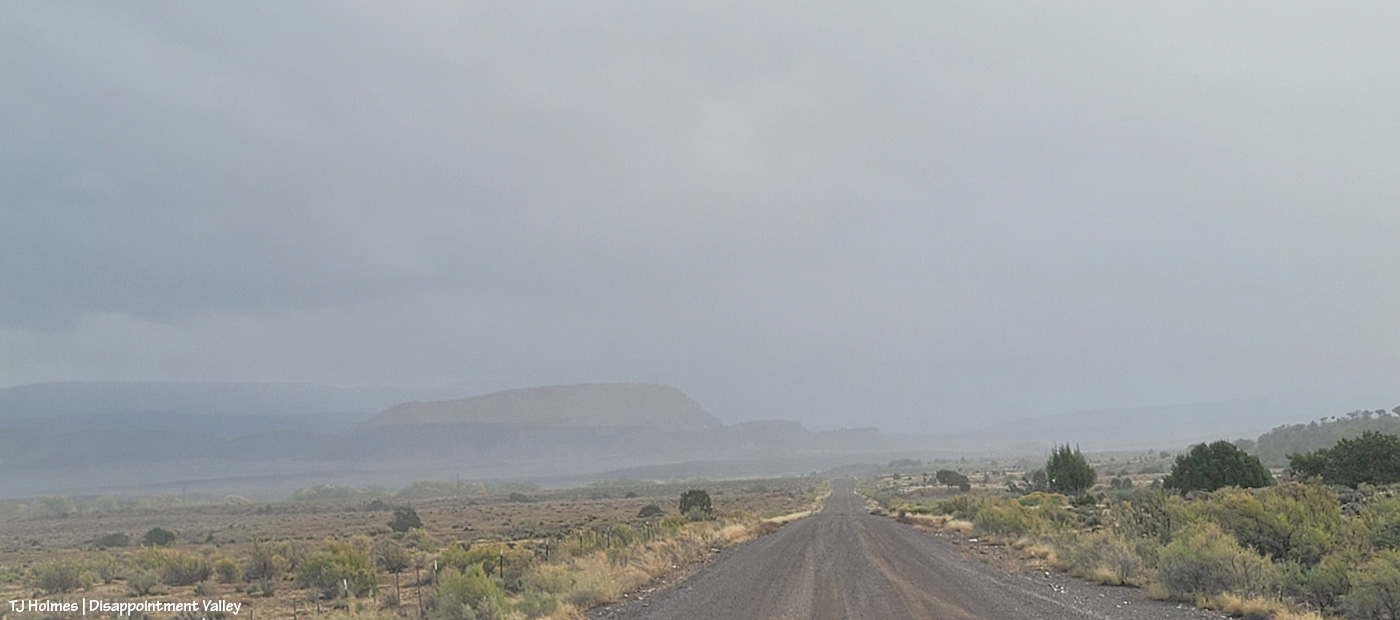
Wonder what it looked like back to the east? Here ya go! A lot different, eh? The sun was rising to upper right. This is Disappointment Road/Road 19Q looking toward Spring Creek Basin (not the road TO the basin).
Now I’m at 19Q looking west up Road K20W (not to be confused with K20E(ast) to Spring Creek Basin).
The sign struck me as funny under the rainbow. I mean, really, do you need a destination when the treasure is right in front of you??
Here we are at Road K20E looking eastish/southeastish toward Spring Creek Basin as the storm was passing to the north. (Sorry about the crazy glare-arrow; my phone’s camera lens is cracked.) Don’t make the mistake of driving this road for at least a few days! The cottonwoods at right line Disappointment Creek, which, yep, was running!
The rainbow (at least the main one) lasted somewhat longer than 30 minutes?!
It.
Was.
EXCEPTIONAL!
And when it finally faded, little curtains of rain were still moving south to north across the eastern(ish) part of the valley.
A person can never have too much magic in their lives. 🙂
Mysterium contemplates … something? … while grazing with her band in the still-muddy eastern part of Spring Creek Basin. Spring Creek is still trickling, and the horses had been drinking there before making their way up this ridge.
I’d have loved to catch the ponies there, at the pond, drinking that glorious rainwater. … But I can’t begin to tell you how much I LOVED to see that glorious rainwater, its still surface mirroring the sky like glass.
I may have shouted and screamed and whooped and hollered with pretty massive, uncontainable joy. 🙂
… amid a bigger group! And these weren’t all of them. After the rains, they have plenty of roadside puddles (some of them decently large!) to drink from without ranging too far!
At least one part of Disappointment Valley got 1.35 inches of rain over about 16 hours yesterday (it started around dark Friday and ended mid-morning Saturday). Every minor ditch and arroyo to every creek bed (Disappointment, Spring and Dawson creeks) ran with water. … LOTS of water. None had been running previously; all had been dry.
While a lot of water ran off and away, there must have been a fair bit of soaking in; the rain was all fairly light and decidedly steady. The ground and the road into and in Spring Creek Basin are all SOGGY.
Come along on this virtual tour with me – yesterday late afternoon – to see what I saw:
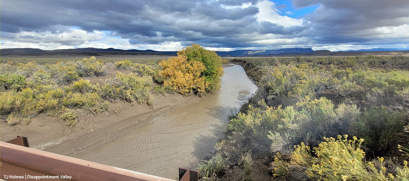
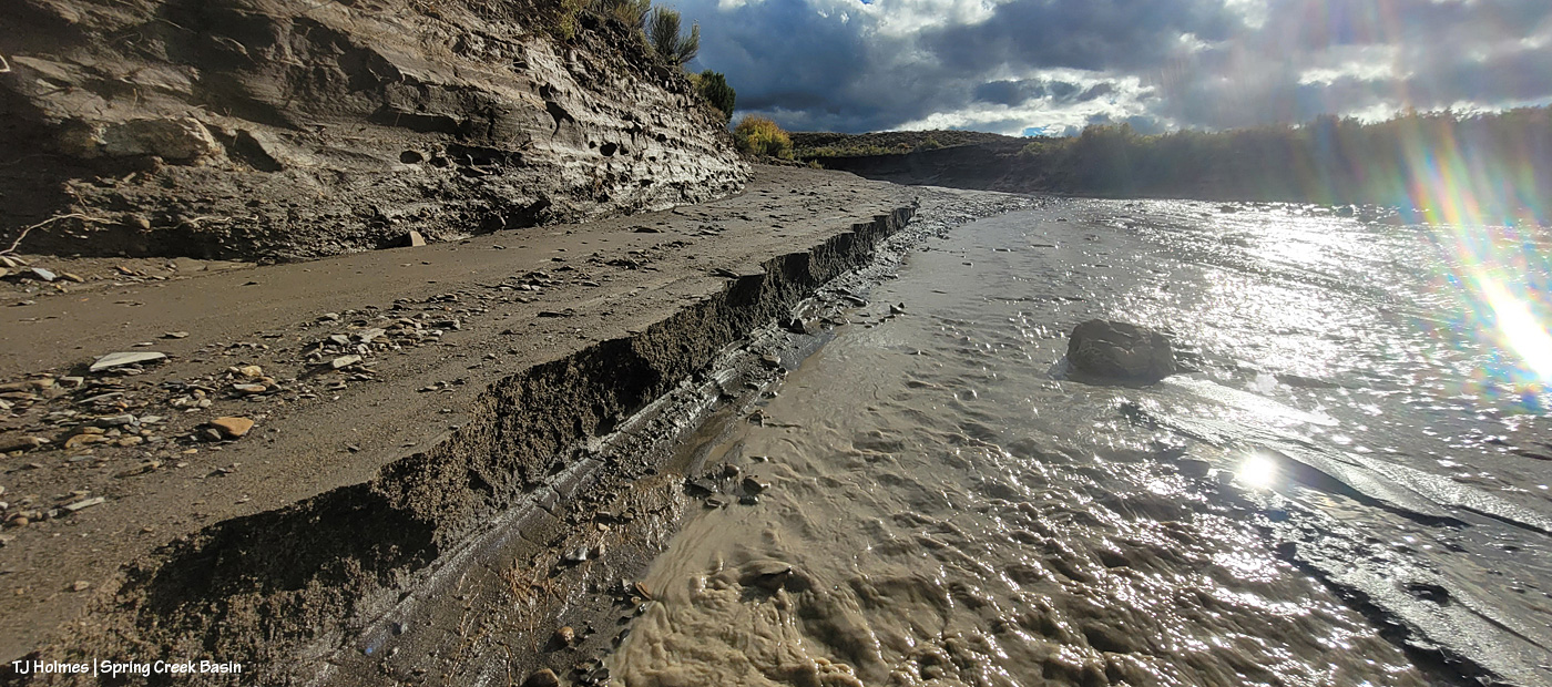
It’s hard to tell either how wide or how deep the water is here in Disappointment Creek several miles up-valley from the turn to Spring Creek Basin off Disappointment Road, but given that it was previously dry, I *hope* you can see that it’s running like a milk-chocolate river. This is looking upstream.
Another view, from several miles downstream of the above image; this is just 50 or 75 yards south of the road to Spring Creek Basin. The creek channel is much narrower here; I hope you can tell how high and wide the water is?
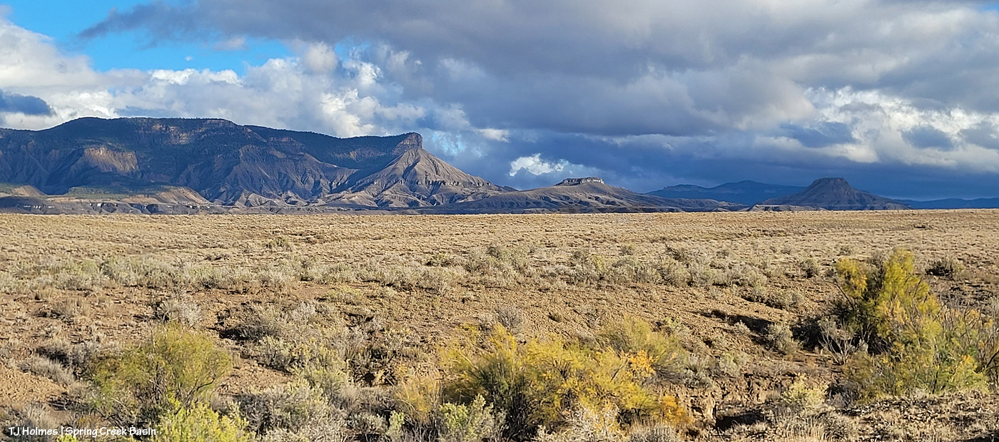
Now we’re looking upstream at Spring Creek water flowing downstream (toward us) from Spring Creek Basin, a few miles east (Temple Butte is visible against the horizon). (I’m still on Disappointment Road, a mile or so north of the above Disappointment Creek pic.)
And, from the other side of the bridge, Spring Creek flowing downstream toward its confluence with Disappointment Creek (marked by the line of barely visible golden cottonwoods in the middle distance).
I know it’s hard to tell width and depth again; the creek arroyo here isn’t terribly deep, but it’s three or four times as wide at this point as in the second pic of Disappointment Creek above. These creeks carried a LOT of water yesterday.
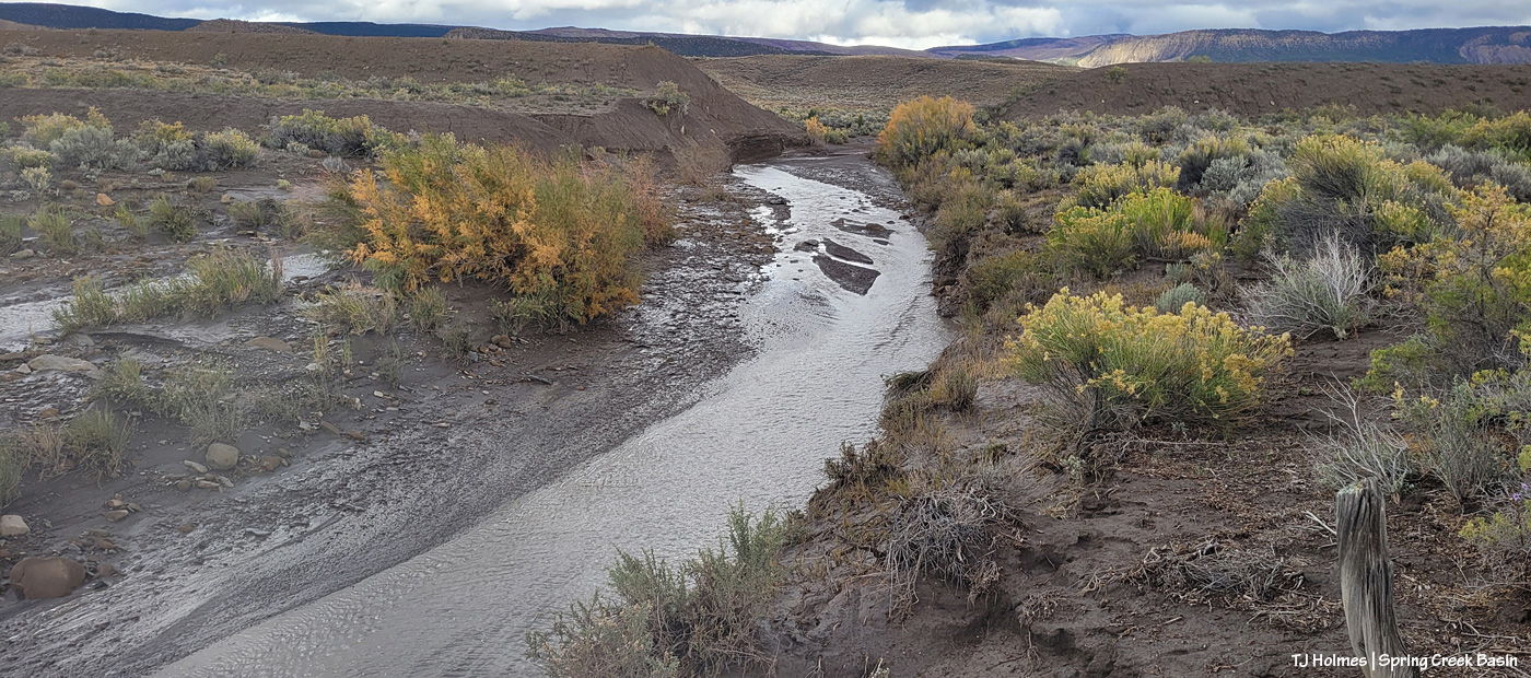
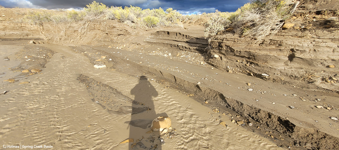
Then I went looking for the condition of the Spring Creek arroyo in Spring Creek Basin (in case this isn’t obvious, Spring Creek and its tributary arroyos drain Spring Creek Basin – when it rains – and the main Spring Creek arroyo carries all that gathered water west across Disappointment Valley to join the also-muddy water of Disappointment Creek, and together, they carry the watershed’s drainage to the Dolores River).
I thought you all might like to see a bit different view of Spring Creek, and I had to walk the last half-mile or so because the road was still too mucky even for my faithful little buggy, so this is just upstream and around the curve from the first crossing, where I usually take pix of rolling Spring Creek after a good rain. If you’ve ever gone into the basin with me, you’ve heard the story about Custer dam (and I even wrote a bit about it earlier this year). This image doesn’t show it well because of the background, but if you look on the left and right sides of the image above the water, you might see that the ground is abnormally straight/flat? Those sides are what remain of Custer dam (marked on maps). The brief story is that around 1900 (?), someone(s) put an enormous amount of work (and likely money) into building a dam to contain water from Spring Creek (the lowest/central arroyo in Spring Creek Basin) and the north and south *major* arroyos that feed into it (and a whole lotta other arroyos feed into all of them). The people also built at least a few miles of irrigation ditch. The story goes that the first major storm after the dam was built burst the dam. As you can (maybe?) see in the pic above, Mother Nature prevailed. (Who could possibly think this country is farmable?!)
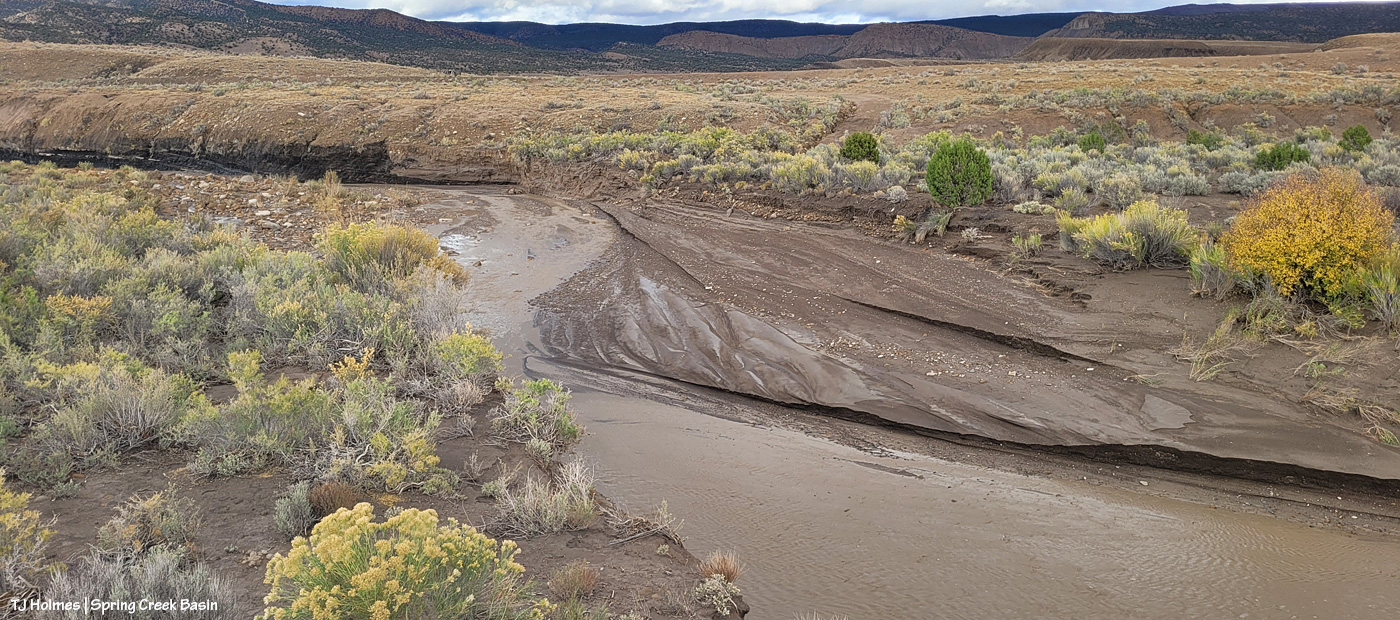
Now I’m standing atop the south side of the dam looking downstream and westish. Just around the bend to the right is where the road crosses (when the arroyo is dry). It’s a weird perspective, and though I thought this would be a great perspective, it proved difficult to actually show. The road tops the area at the far (north) end of the dam, which is more to the right than “straight” across, but it’s only … 150 yards away, maybe? Or maybe it’s that from the far side part of the dam.
Now I’m down at the bend that you can see in the above pic, still looking downstream at the road crossing. You see it, right? Where all the rocks are at the left side of the pic. The road crosses the rocks, the arroyo and up the other side to the right.
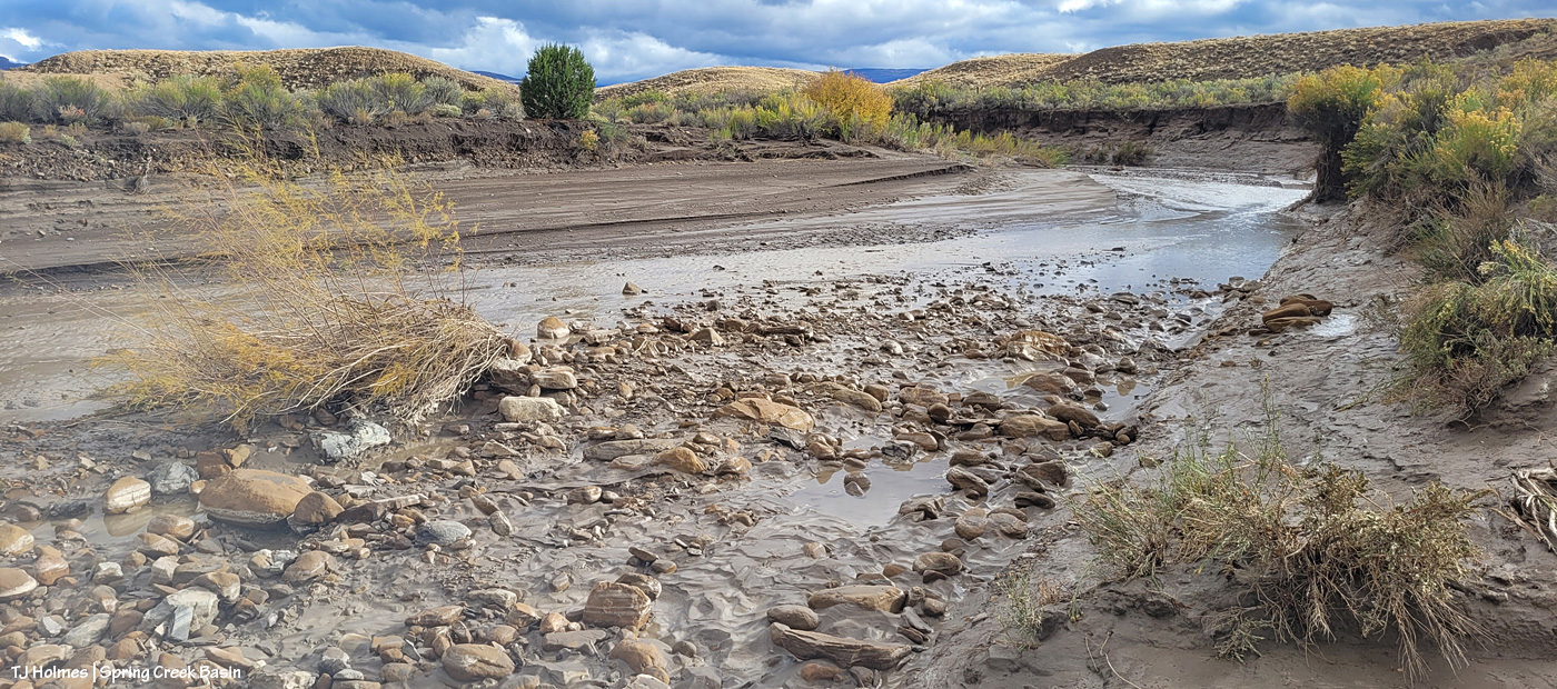
Sorry, how about now? 🙂 Straight across. This should look familiar. … Well, except for the increase in rocks and the far side, which looks a bit like a wall. …
Looking upstream, there’s the curve where I was standing a couple of pix ago, looking to where I’m now standing.
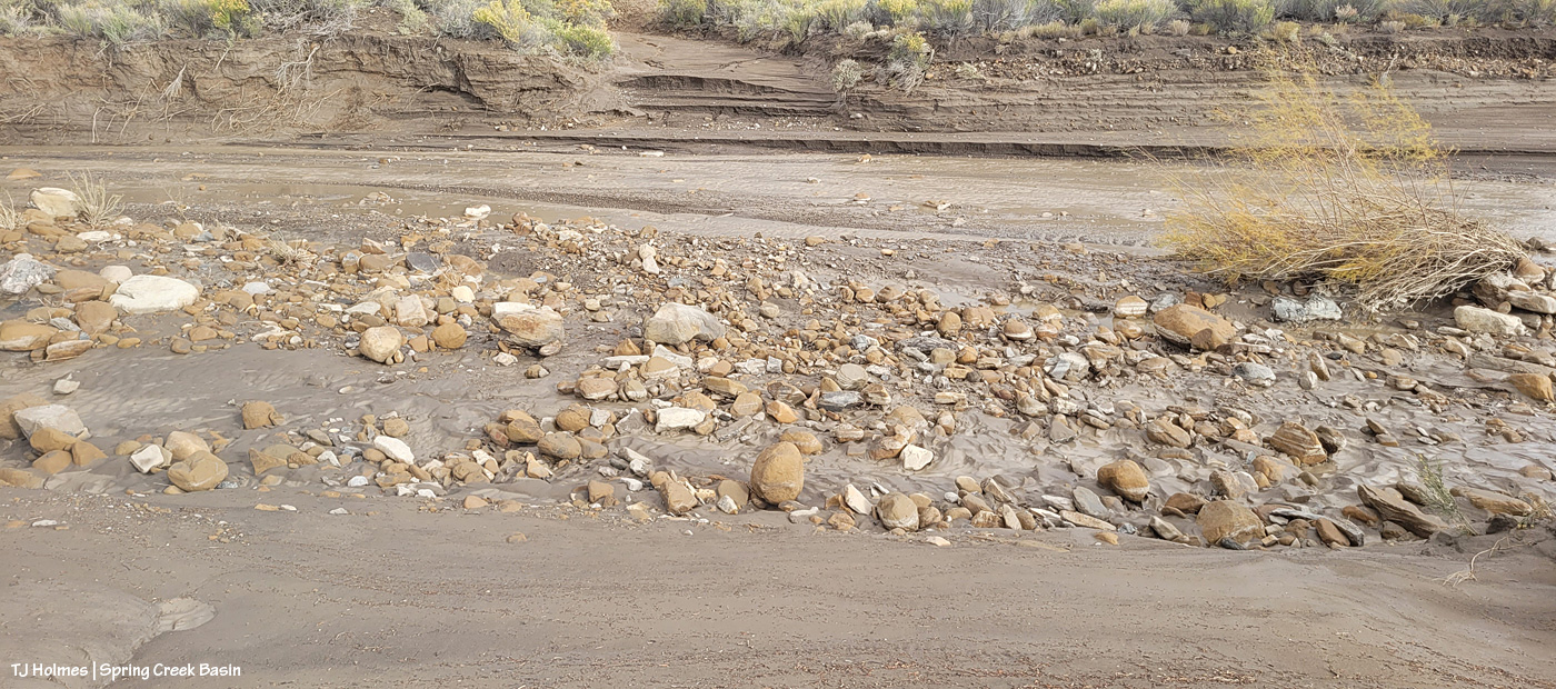
The water, I should mention, had greatly receded at this point. This is probably some five, six miles (??) upstream from the first Spring Creek pix I showed toward the top of this post. I found evidence that the water reached probably at least another 20 yards up the road where I approached, from, say, the middle of the arroyo. It would have looked most definitely like Spring RIVER at its highest/deepest point. Spring Creek runs ONLY when we have a major rain event. … And when all that water from all that rain is done, so is the “creek.”
I’m gonna need my shovel. Again. 🙂
Are you tired? We’ve been walking around, in the super-mucky mud, in calf-high mud (or muck) boots. And we still have to hoof it back to the buggy. I was whupped.
But you can never, ever, ever beat that view. 🙂 Especially rain-dampened and -darkened. 🙂
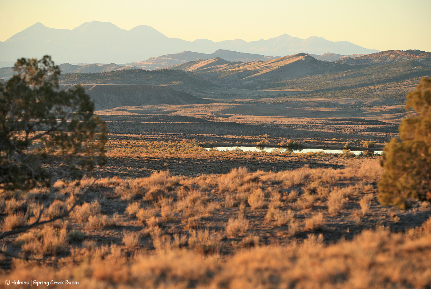
I can’t wait to get farther in and take a gander at ponds. SURELY the mustangs have multiple water sources now. What an amazing deluge of rain. Much needed.