
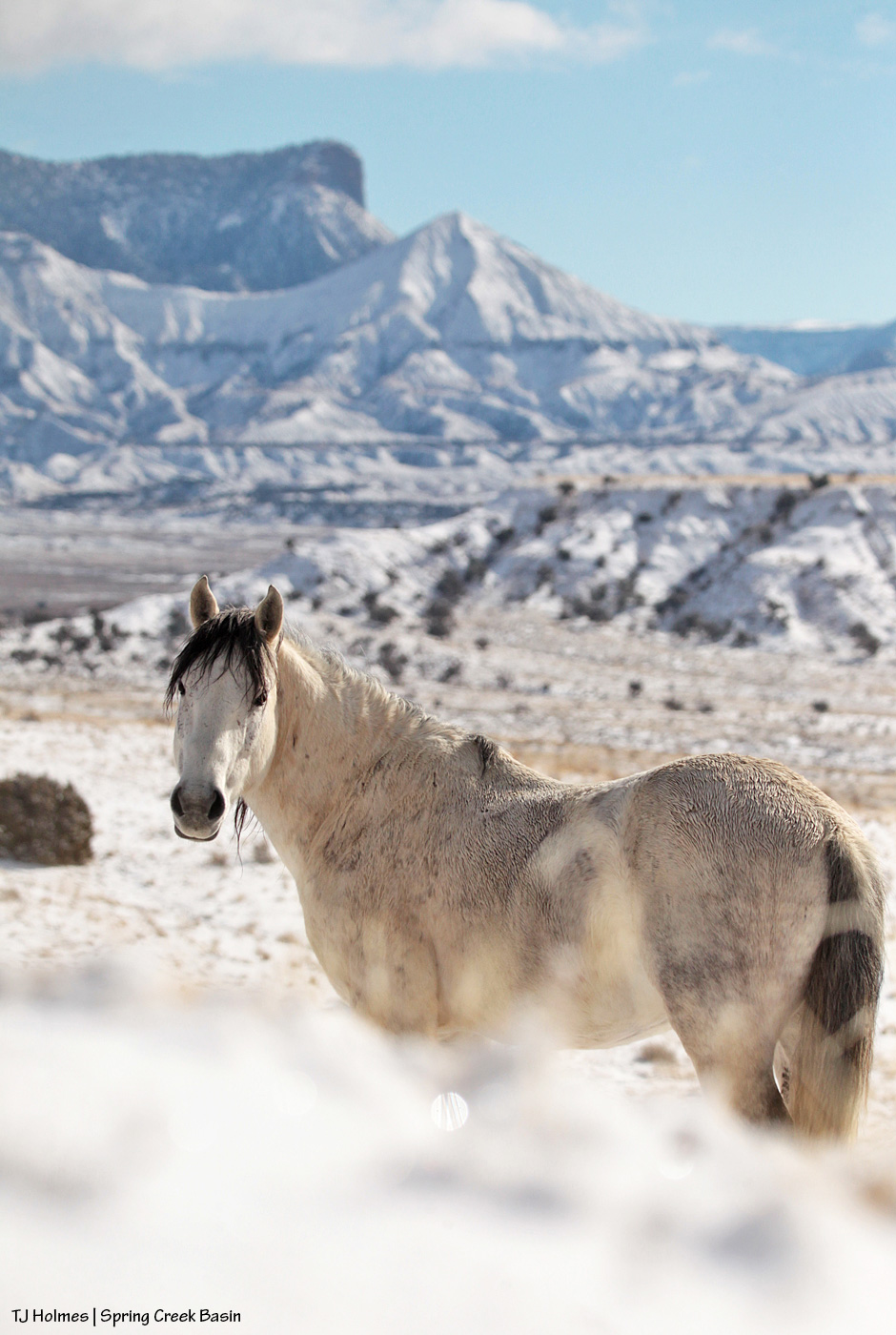
While the band napped, Skywalker foraged in the snow, lookin’ all handsome-like as he moseyed. 🙂
While the band napped, Skywalker foraged in the snow, lookin’ all handsome-like as he moseyed. 🙂

All those rich hues of brown and gold in a “simple” bay coat! Love.
And yummy snow-coated grasses!

Fresh frosty ice lacing on Chipeta.
Well, we kinda got skunked again on snow – the big, hyped, “inches and inches are coming!” winter-weather-warning snowfall – yesterday, but we do have snow on the ground still from Friday’s surprise event – thank goodness. We got no measurable snow from Sunday, though we did have a couple of brief waves of blowing flakes, and there was snow all around Disappointment Valley.
The following pix are of snow/ice crystals on grass stalks and sagebrush in Spring Creek Basin on Friday.

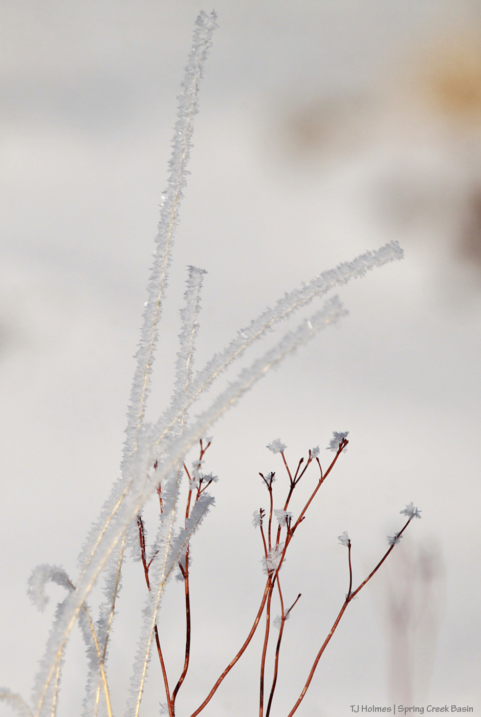
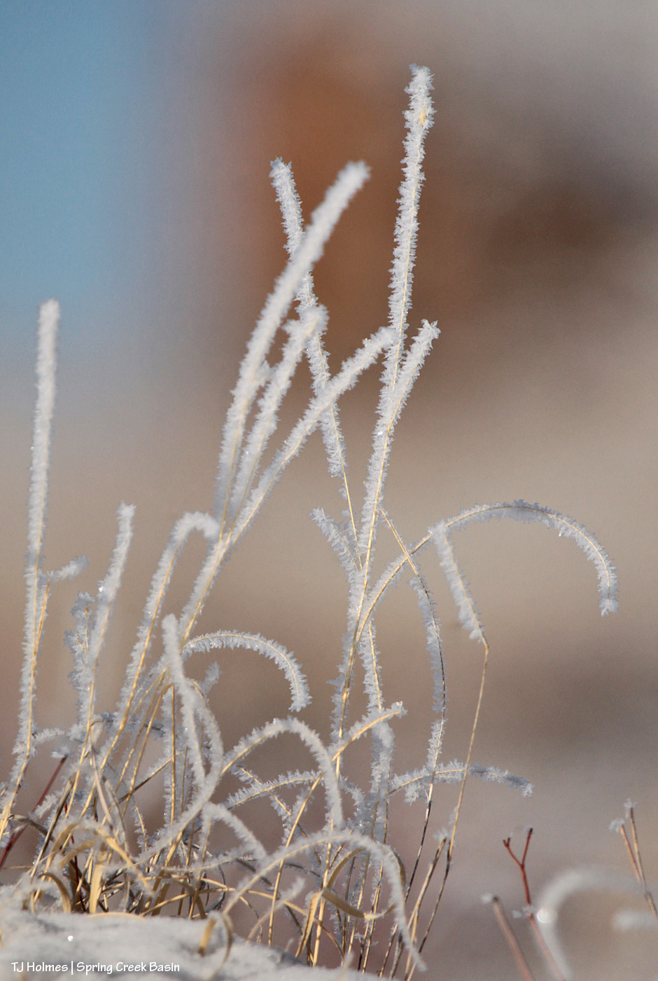


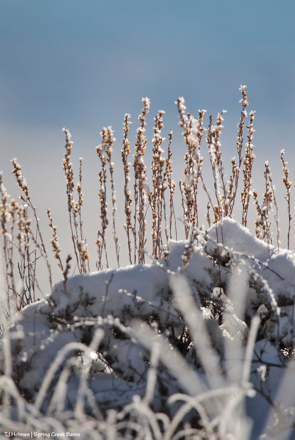
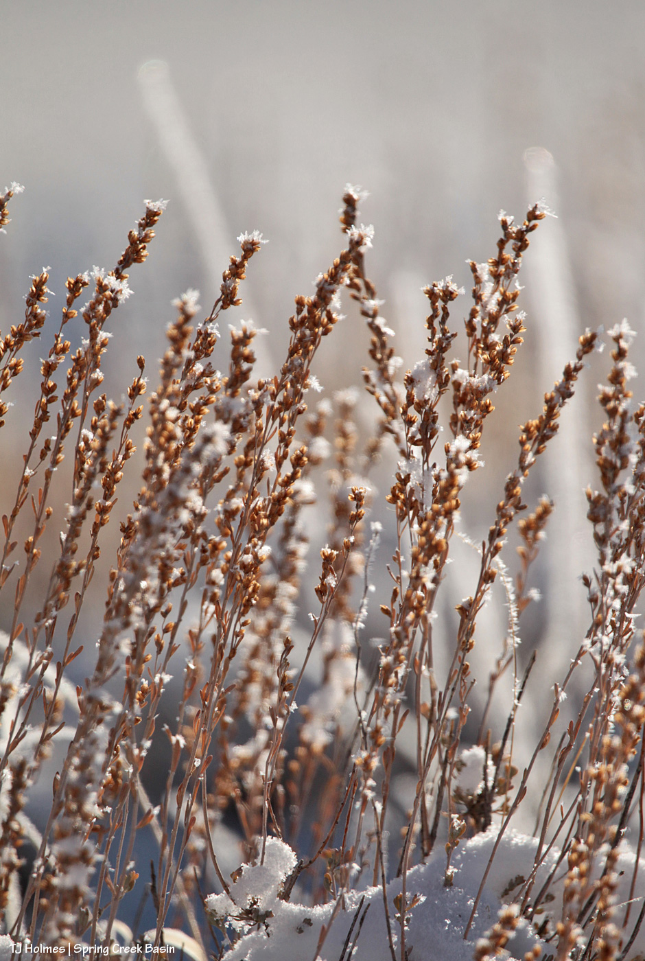
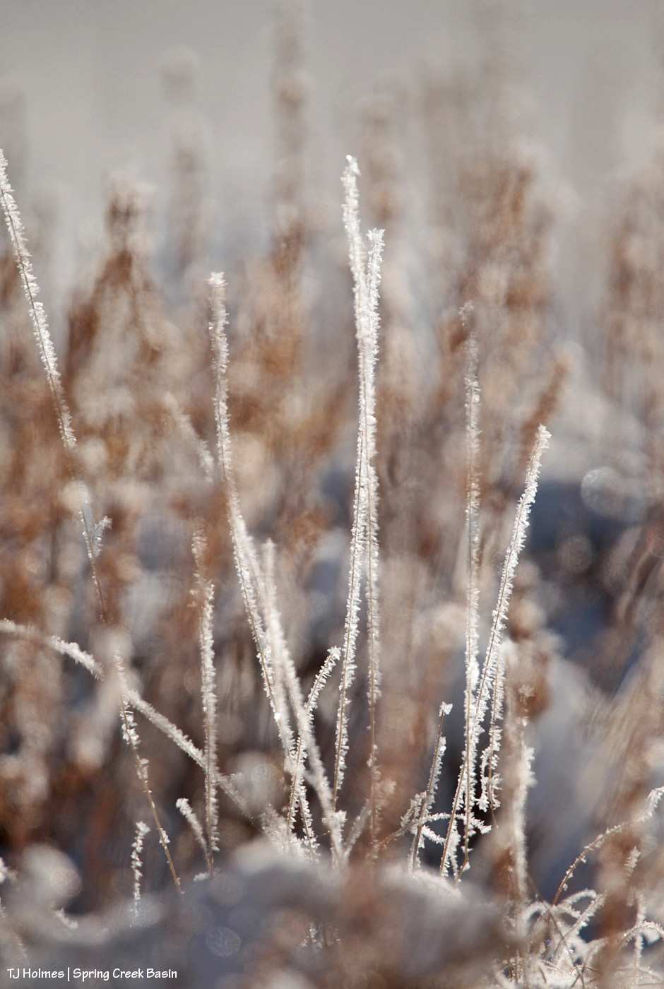
It was so much more beautiful and magical than I can convey in photos.
If complaining about lack of snow leads to more unforecast snow in the future, I’ll do it!
After Thursday’s bomb, snow-wise, our next big snowfall was supposed to be Sunday (today). Snow Friday night/Saturday morning was NOT in the forecast – until late Friday night. But with no tell-tale blue blobs in the vicinity Friday night, I went to bed thinking it was wrong or wouldn’t amount to anything.
Saturday morning, I woke up to 2 inches of glorious snow! Please, chuckle along with me at the forecasters. As high-tech as weather forecasting is these days, even they don’t always get it right. 🙂
Mother Nature still rules, and as surprises go, this was an awesome one!
I schedule all my posts at least the evening ahead of their publication time, so I don’t always see into the future, either. With any luck – and good forecasting – we’ll be waking up to (more) snow, as has been in the forecast for the past week!
You’ve heard the phrase “doughnut hole” in weather-related conversation? How one place or another is in a “doughnut hole” of NOT getting weather the surrounding area or region is getting or has gotten?

Disappointment Valley (at least the lower part) got a skiff or less of snow Thursday morning (no measurable liquid). It was gone (melted) before you could even say “doughnut hole.” A friend west of Cortez (south of Disappointment) got 4 inches of snow. A friend right in Durango got 6 inches! Friends in Aztec, New Mexico (northern New Mexico not far south of Durango), got 3.5 inches of snow. … You see where I’m going with this?

Yeah, it’s a thing.
That’s Disappointment Road looking south. This is the afternoon of the morning it snowed – “snowed” – ha.
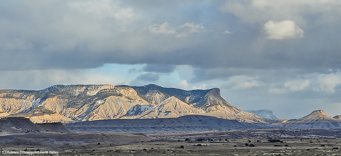
‘Course, at the same time, we had THIS view (to the east-southeastish). 🙂 (Note the lack of snow.) That could be a definition of “silver lining.” 😉
(Next forecast snowfall: tomorrow!)
From the first evening of the first day of the brand-new year.
The last evening of the last day of last year. So peaceful.
(Snow expected today?! We’re so ready!)

Because of course I had to show ya’ll the very BEST view from the top of the ridge. 🙂

Couple of things:
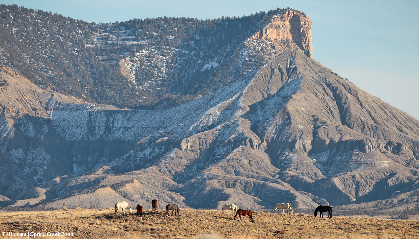
Yes, it really is (still) that dry in Spring Creek Basin and most of the rest of southwestern Colorado. Pooh on the U.S. Drought Monitor for thinking (erroneously in my oh-so-very-humble opinion) that we’re only “moderately dry.”
And: proof that mustangs and mountain goats have a common ancestor (!). 🙂
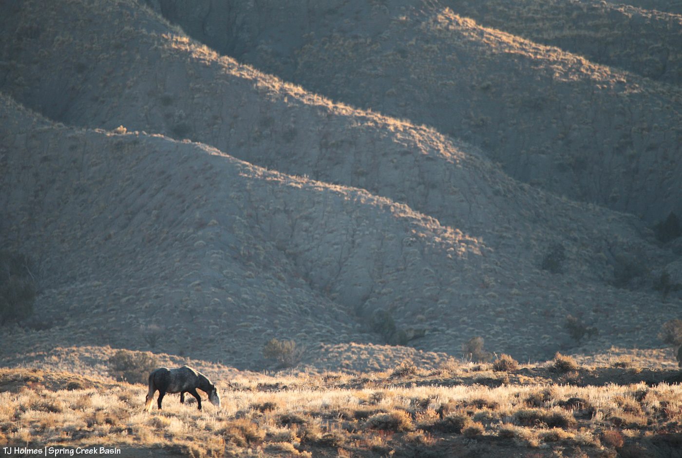
That’s Sundance (and one of his mares) on a finger of a ridge at the very southeastern end of what we call Knife Edge (which actually is fairly broad on top). This pic, taken with my phone as I hiked out to a series of hills to get up to the ridge that snaked down to where his band was, isn’t even wide enough to show how far to the right I had to go to get to that access area – where I could bypass the rimrocks. The other side of this ridge features a little cove, where a couple of the horses were grazing as I drove up the road to the point where I started hiking, but it’s all rimrock-locked. In other words, the only way TO that point is back up the way they got TO it in the first place.
OK, a third thing: You know I’m going to show you all some scenery from up on that ridge, don’t you? 🙂 (Here’s a crazy thing: As much hiking as I’ve done in Spring Creek Basin during the last 21 (starting to inch up on 22?!) years, I’ve never been up on that particular ridge or on the very top of Knife Edge. … The horses are very good guides at getting me to new places. :))
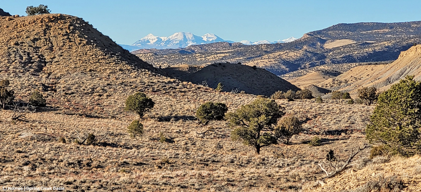
Upon leaving my buggy to start my hike (the big ridge and Sundance’s band are directly to my left), this was the first view that made me reach for my phone (aka easy-to-access camera). I’m just south of an area of Spring Creek Basin that I call the east pocket. Knife Edge is basically to about my 11 o’clock, and the sandy-colored ridges at the right of the image are what I call Valentine Mesa. The mountains are a stone’s throw away (!) in Utah; from the ridge I was later on with the horses, they’re mostly blocked by the bulk of Knife Edge.
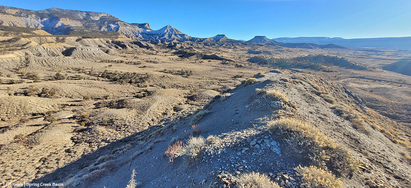
I’m up on the ridge that leads to the horses’ location farther down at the fingertip end of it. That big rise of grey Mancos shale and orangier (!) sandstone is Knife Edge. The southern peaks of the mountains are just visible way, way out against the turquoise sky. Spring Creek canyon is visible at far left. That’s the basin’s western boundary; the farthest treed ridges are the southern/southwestern boundary of Disappointment Valley above the Dolores River and its canyons.

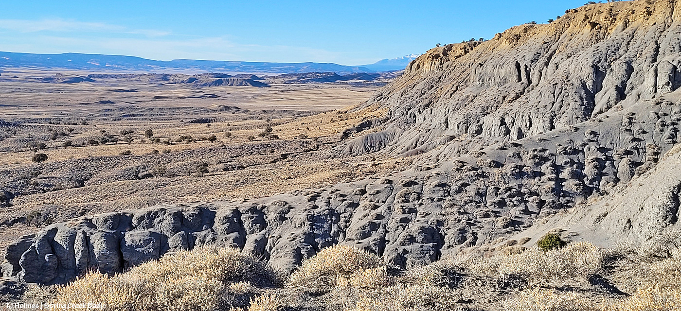
Looking left-ish from the above pic, that’s Spring Creek cutting through Spring Creek Basin in the middle ground. What I call the “weeping wall” is down there, and it provides a pretty constant source of trickling water for the mustangs. At far upper right is the eastern end of Filly Peak in the basin’s western region, and straight out is Flat Top. Round Top is barely visible at left. In about the middle ground – shadowed on its northeastish length – is the ridge I call rollercoaster (though it doesn’t look very rollercoastery from this perspective). … And see the glimmer just above/beyond it? That’s the rollercoaster ridge pond, still decently full of water (semi-frozen, depending on conditions). That’s the pond from the “Reflections” post recently. … And what do McKenna Peak and Temple Butte look like from THIS perspective?
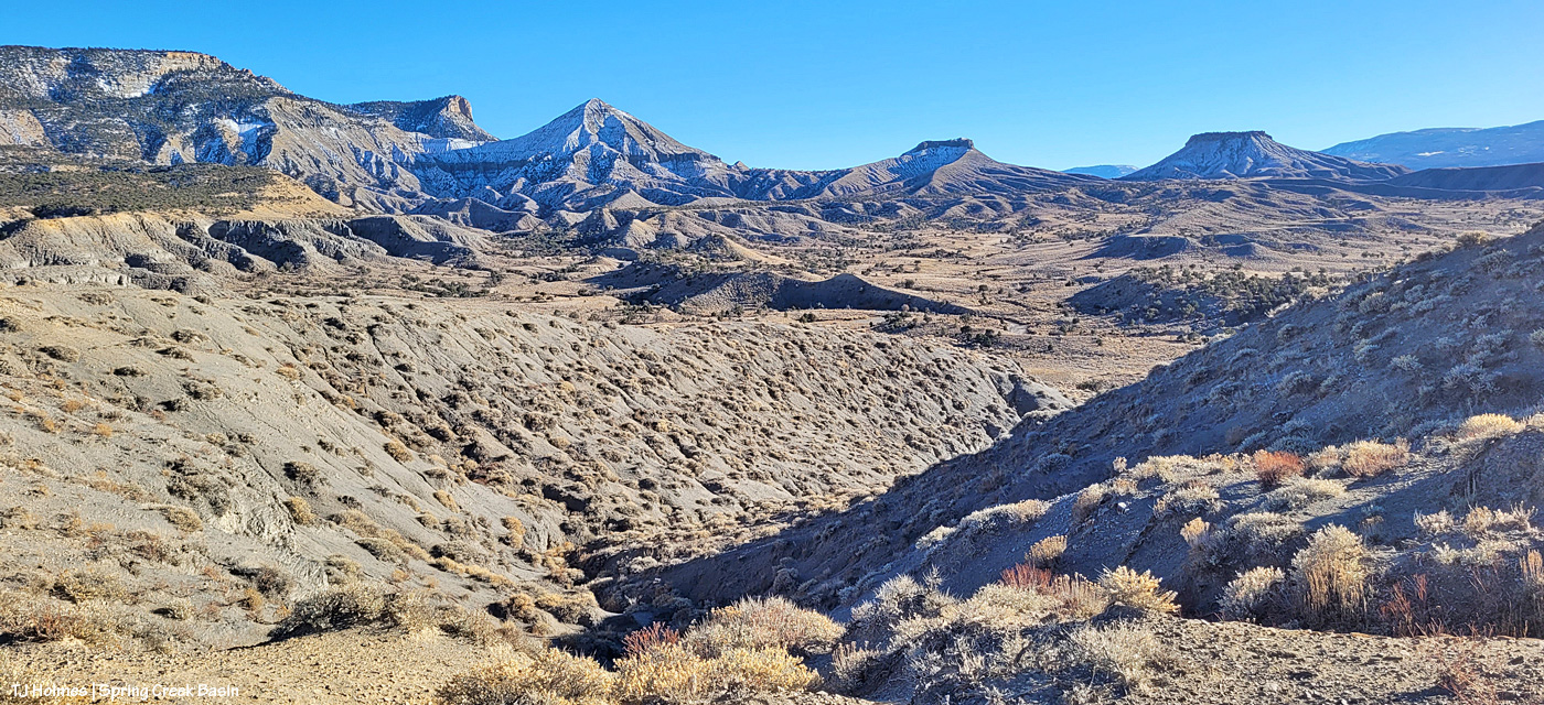
I’m so glad you wondered! 🙂 From a little right of left: Temple Butte, McKenna Peak, what I call submarine ridge (you can see the two “arm” ridges of the actual feature from here) and Brumley Point, on Spring Creek Basin’s southeastern boundary. The Glade is in the far distance, touching the sky. A little closer – middle ground – is Spring Creek and part of the basin’s loop road (rough, and I would not recommend driving a vehicle on this section). The ridge down to the horses starts to the left and runs through the nearer middle of the pic. Sundance was actually partially visible (his back), but I don’t think he shows up very well in this pic.
This pic (left) and the next (right) were taken from the same vantage point, but when I tried to stitch them together into a bit of a panorama in Photoshop, it didn’t work out so well. So, using the ridge in front of me as your guide, you’ll have to use your imagination a bit as you scroll up and down to look left and right (!).
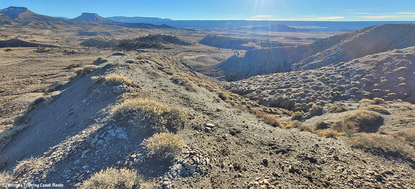
If you can find the ribbon of road, out there in sort of the middle, heading uphill (to the left from this perspective), is where I was when I looked up and horses appeared, much to my wondering eyes! (Magic isn’t just the domain of Santa, folks.) If I’d been going the other way around the loop, downhill, which is my usual direction and preference given some fairly challenging road issues (!), I don’t think I’d have seen them because I’d have had to look back over my shoulder and up. I try to look in that area because I’ve seen Sundance’s band in that relative vicinity before, but see the little “cove” down to the right in the second pic (the one right above)? That’s where a couple of the horses were when I first spotted them from below, and if I’d been in a different place, I wouldn’t – couldn’t – have seen them there from the road.
Another lesson: Perspective often is everything. 🙂
Pretty dry out there. The forecast is starting to show us some glimmers of hope for coming snow. We got kind of skunked over Christmas, but fingers and hooves are crossed that our winter will start picking up in this newest part of the new year.
