
Wowza.
Storm clearing over southeastern Utah’s La Sal Mountains from Spring Creek Basin looking over/past/beyond the north wall of Spring Creek canyon.
Pretty gorgeous!
Wowza.
Storm clearing over southeastern Utah’s La Sal Mountains from Spring Creek Basin looking over/past/beyond the north wall of Spring Creek canyon.
Pretty gorgeous!

A nap, a drink, an evening mosey.
Ah, the life. 🙂
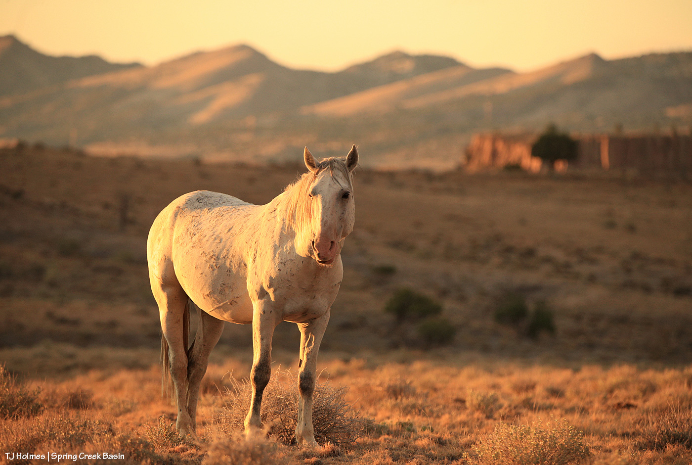
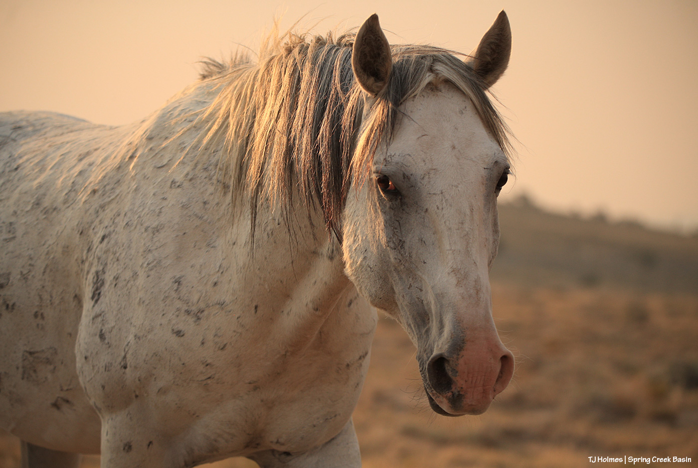
The golden tones of sunset suit Skywalker very well in a quiet moment.
We’ve been warm again, but signs of approaching fall are becoming more numerous. Hopefully some good rains are part of the plan.
This pic of Dundee was taken before the rain. She was very calm, almost napping, watching some drama below between a couple of stallions. It makes you wonder what the mares are actually thinking when they watch the boys. … And most boys think *girls* are dramatic. 😉
These pix are from sunset Friday:


Virga and rain (see it at lower center-ish against the far ridge?) from Spring Creek Basin looking west/southwest toward the far southwestern ridge(s) of Disappointment Valley.
Saturday:
It rained. 🙂 ACTUALLY rained. And for at least an hour (in at least some places).
OMG, the relief. … The gratitude.
It started with thunder and lightning, though, so hopefully the nearly immediate rain put out any fire(s) that may have started. …

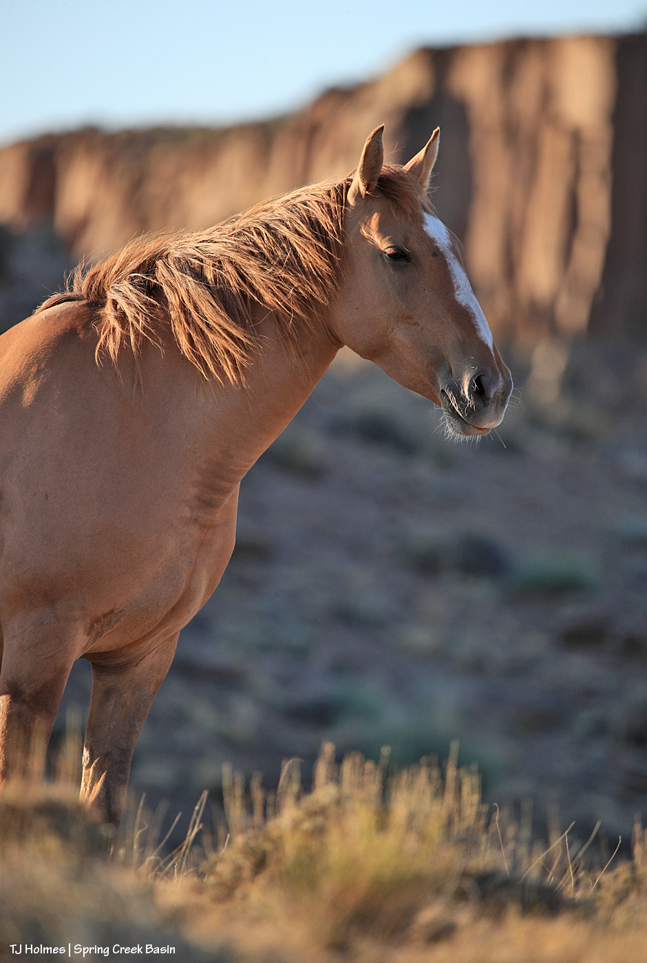
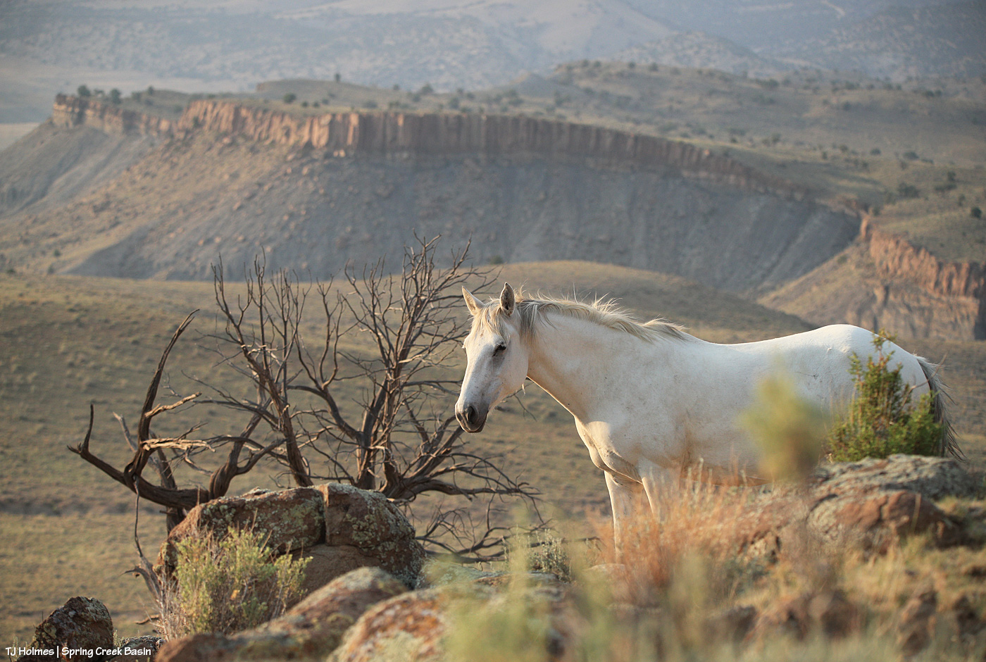
The rimrock-topped Spring Creek canyon is always such a great background for handsome little Maiku.
Here, he gives me some attention, but most of his focus was on a young stallion with a nearby band.
This was (fortunately) several days ago now.
That was yucky.
I thought it was wildfire smoke from (at least) the Deer Creek (western Colorado and eastern Utah; northwest of Disappointment Valley at the base of Utah’s La Sal Mountains and above Colorado’s Paradox Valley) and Turner Gulch (northeast of Gateway, Colorado) fires because the wind was out of the north/northwest/west, but I read that it was from the Arizona fires (Dragon Bravo and White Sage). Look at a fire map of the western United States, and you’ll see that we’re likely getting smoke from … any/everywhere. 😦
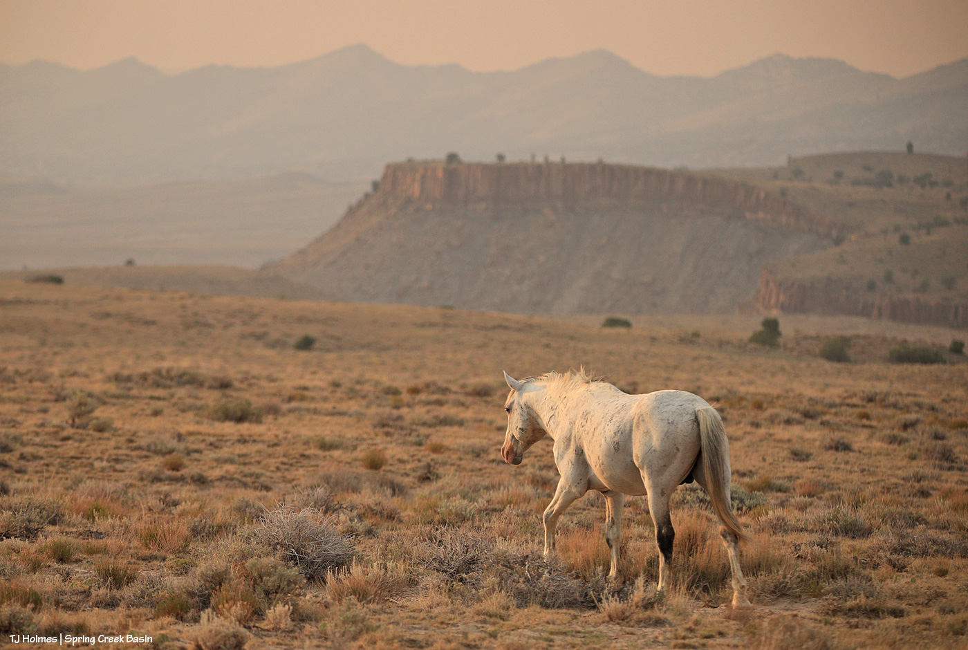
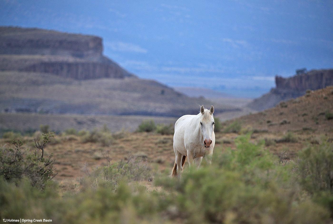
Skywalker on the flyby to give me a bit of a checkout as he moseyed with the band.
Several days now after the above images (I really couldn’t bear to post them at the time), our sky has returned to glorious Colorado-turquoise. The unfortunate part there is that we’d like to have some clouds. 🙂 For shade relief, let alone rain. … Never quite happy, are we? 🙂 (Please, please, please rain!!!!)
Winona paused for a brief little catnap on a ridge above Spring Creek canyon while moseying/grazing with the band. I just happened to be moseying along with them – happily, gratefully! – and caught her looking beautiful as always.
Skywalker might be considered Tenaz’s lieutenant, though I don’t think he would mind my translation that it’s not a title he likes or plans to use for long (!). Tenaz has two young mares, and Skywalker does keep Tenaz on his toes. They’re part of a bigger group of horses that’s basically two separate bands – one mostly happy family. 🙂
Above, the mares have gone ahead (to the right), and they’re waiting for their turn at the water cooler … err, pools of water that gather in the creek bed just above/upstream of Spring Creek canyon. A couple of other bands beat them to it, so they were politely waiting their turn.
The arroyo actually comes from beyond/above where Skywalker and Tenaz are standing, passes by us on the left, makes a big curve behind me as I’m facing them, runs a short distance, then makes another big curve to enter the canyon. Another few curves later, it empties below the rimrock cliff band that forms the basin’s western boundary into lower, wide-open Disappointment Valley on its way to join Disappointment Creek (which also is dry but for pockets of water) … and on to the Dolores River.
The mustangs definitely rely on these seeps in Spring Creek and its tributary arroyos as the summer gets drier and drier before the hoped-and-prayed-for monsoon rains. The forecast is showing an uptick of chances next week, and we’re crossing fingers, toes and hooves (!) that some rain actually pans out for us from those chances!
The Deer Creek and Turner Gulch fires both now have burned through more than 15,000 acres. Smoke wasn’t nearly as visible yesterday as previously, and it has been weirdly (eerily?) not very windy. Rain has been in and out of the forecast (mostly out … and it hasn’t rained), but we could sure use some actual “wetting rain” that actually makes landfall and drenches the land and its vegetation AND its fires.
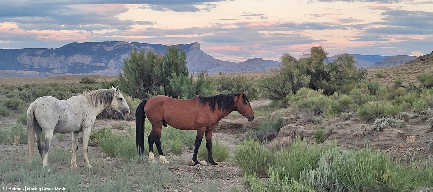
Terra, above, and her band had just come up from a water seep in the Spring Creek arroyo and were grazing their way peacefully toward (potentially) another little water source. They know where to find water, and fortunately the water sources in the basin are holding steady. Any little (or lotta) bit helps.
