What follows is a random selection of cellphone pix from a couple of evenings ago in wild, woolly and very windy Spring Creek Basin.
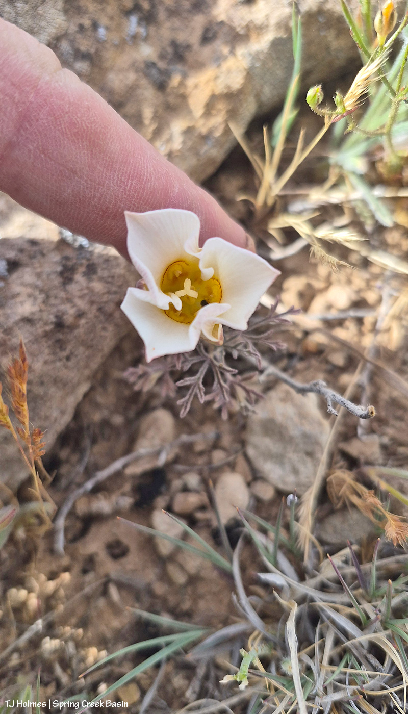
First sego lily of the season! That I’ve seen, anyway. It was SO windy, the flower was whipping around like crazy, so I tried to hold it still for my phone. It’s always a bit of a crap shoot to try to take pix of small things with my phone because I can’t see at all whether the *thing* is in focus or whether it’s the background.
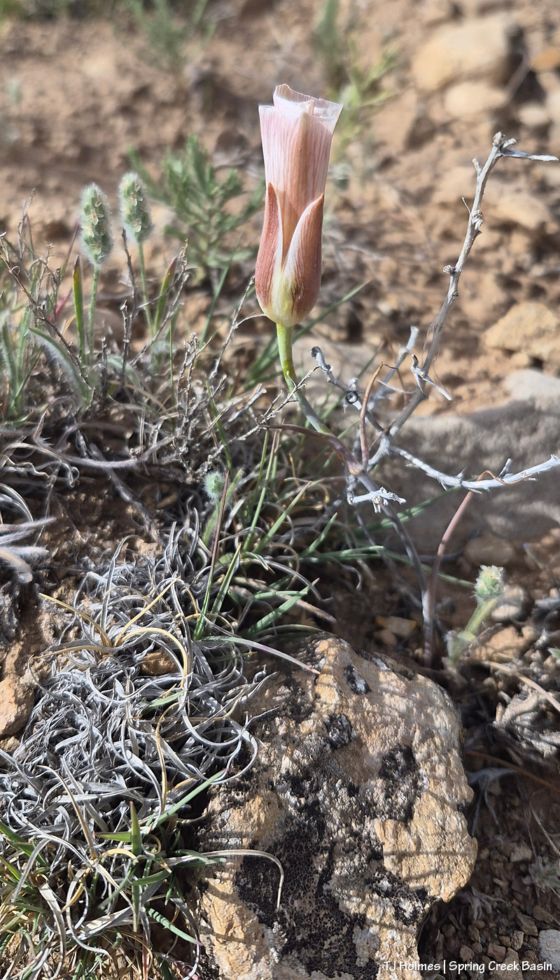
Case in point: I took several pix of this beauty, within a couple of feet of the first one, and only the last one was in focus (that could have been the wind). I adore these lilies – in the desert! These seemed smaller than usual, but I’m glad to see them.
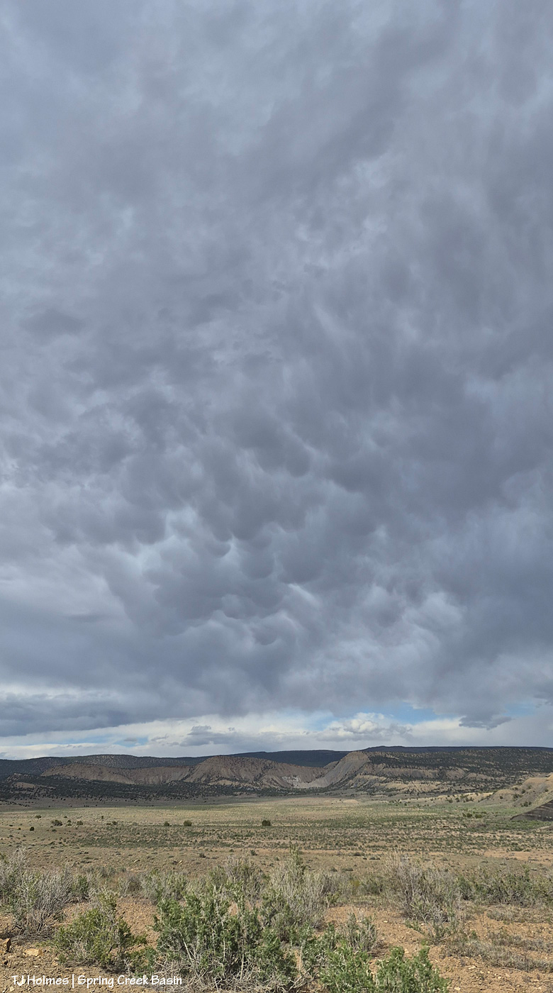
While the pix of the sego lilies seem to suggest that it was sunny, mostly we had these crazy, wildly dramatic clouds looming over the basin. These are mammatus clouds. Looking eastish-northeastish.
Google AI says:
Mammatus clouds are distinct, pouch-like cloud protrusions that hang downward from the base of a larger cloud, usually a towering cumulonimbus. Named after the Latin word for “udder” or “breast”, these stunning formations are fascinating for their unique shape and the rare meteorological process that creates them.
How They Form
Unlike most clouds, which are created by rising air (updrafts), mammatus clouds are formed by sinking air (downdrafts). [1]
- The Process: Pockets of cold, dense air saturated with heavy ice crystals and precipitation sink downward from the parent cloud (usually the “anvil” of a thunderstorm).
- The Shape: As these dense, cool pockets of air descend into warmer, drier air beneath the cloud, the ice and water begin to evaporate. This evaporation cools the air even more, causing the pockets to sink further, creating the characteristic rounded, bubble-like pouches. [1, 2, 3]
What They Indicate
While their ominous, alien-like appearance might make them look like the beginning of a severe storm or tornado, mammatus clouds are generally a sign that the worst part of the storm has already passed or is off in the distance.
- Severe Weather Link: They are most commonly spotted in the vicinity of strong thunderstorms. If you spot them during the summer months, it usually means there are powerful storm cells nearby.
- Safe or Not: Mammatus clouds themselves do not produce severe weather and are not dangerous to anyone on the ground. However, pilots are warned to avoid them because the sinking air can cause intense turbulence.
Key Characteristics
- Composition: Because they hang high in the atmosphere, they are primarily composed of ice crystals rather than liquid water droplets.
- Lifespan: They are relatively short-lived, typically appearing and dissipating within 10 to 30 minutes.
- The Best Time to See Them: They are particularly striking at sunset or sunrise, when the low angle of the sun illuminates the underside of the pouches, turning them brilliant shades of gold, orange, pink, or deep blue.
In our case, they appeared around three hours before sunset, so we didn’t get the color, but they’re still pretty amazing to see, even if they also did NOT bring us any rain.
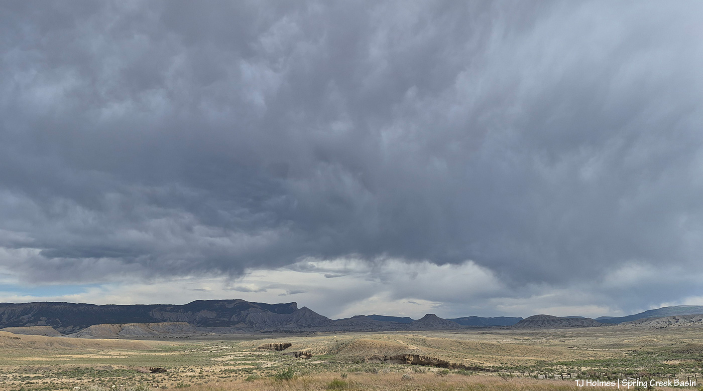
This was taken at about the same time, now looking eastish to southeastish. And quite a bit later, it looked REALLY rainy out beyond our local horizon. So hopefully somebody somewhere got some wet stuff.
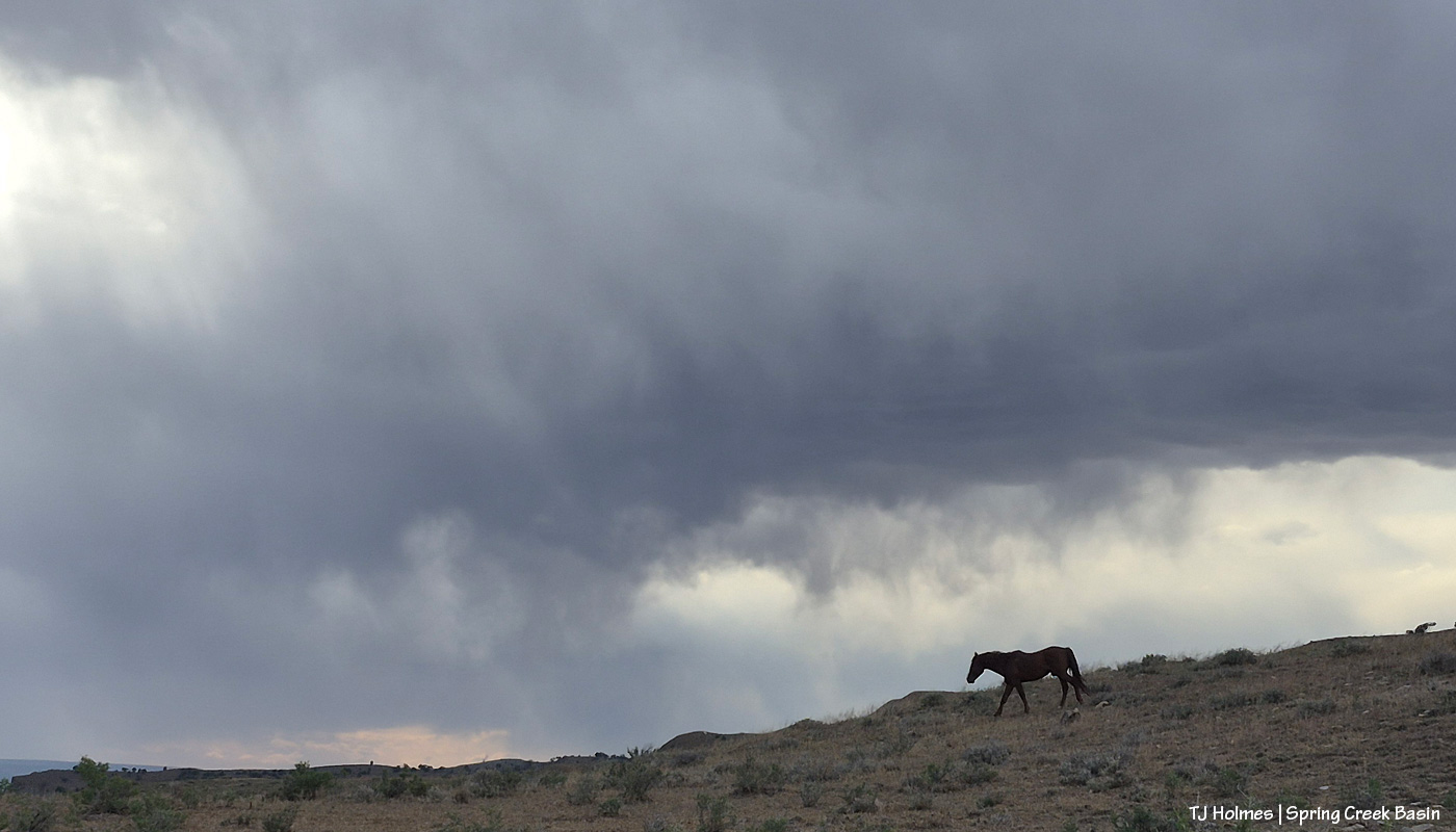
Have to have a pony walking the skyline. 🙂 He was heading to the Spring Creek arroyo (down to the left), and pretty soon, his band followed. Looked like it was raining somewhere out in that direction, too (westish-southwestish).
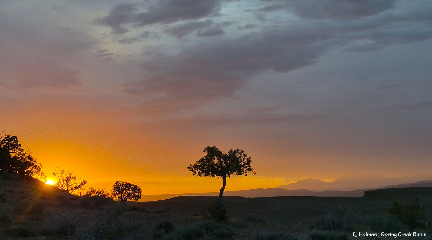
And at the very end of the day (an hour or more later than the last pic), a pretty glorious and somewhat unexpected (and *very* brief) shot of sunset brilliance from the west end of the basin looking westish-northwestish. There were horses immediately behind me, but they were already in the shade of the hill, and that side was already fairly darkrainydusty (? did I mention the howling wind?).
Even under the “worst” conditions, there’s always such beauty. 🙂
