Day of giving thanks

26 11 2020

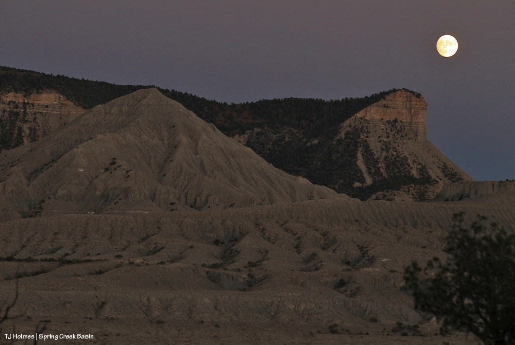
On this day of thanksgiving, I thought I’d share some images from the other day when I hiked to the top of Flat Top in Spring Creek Basin. Among the many objects of my gratitude: moisture. And these pix show it in most obvious form. 🙂

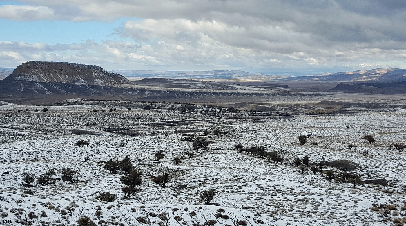
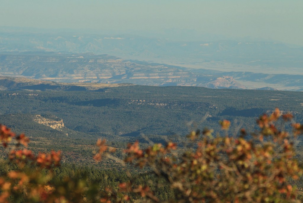
Starting about halfway up one of the western fins, this is looking west-northwestish across part of the western part of the basin. Filly Peak is the prominent hill at left. Part of Spring Creek canyon is visible on the right side of the image. Lingering clouds obscure most of Utah’s La Sal Mountains in the far distance. Note how much snow has already melted in the lower regions of Spring Creek Basin and far lower Disappointment Valley.

This is looking to the north-northwest.

And looking to the west-southwest. That’s Filly Peak again at far right. The already-meltedness is obvious in this image.

From the top, southern edge of Flat Top, this is the view looking across a small part of the southern part of Spring Creek Basin and across Disappointment Road (not visible), where the land rises to the south, encompassing more BLM land (outside the herd management area) before the invisible border where it meets San Juan National Forest.

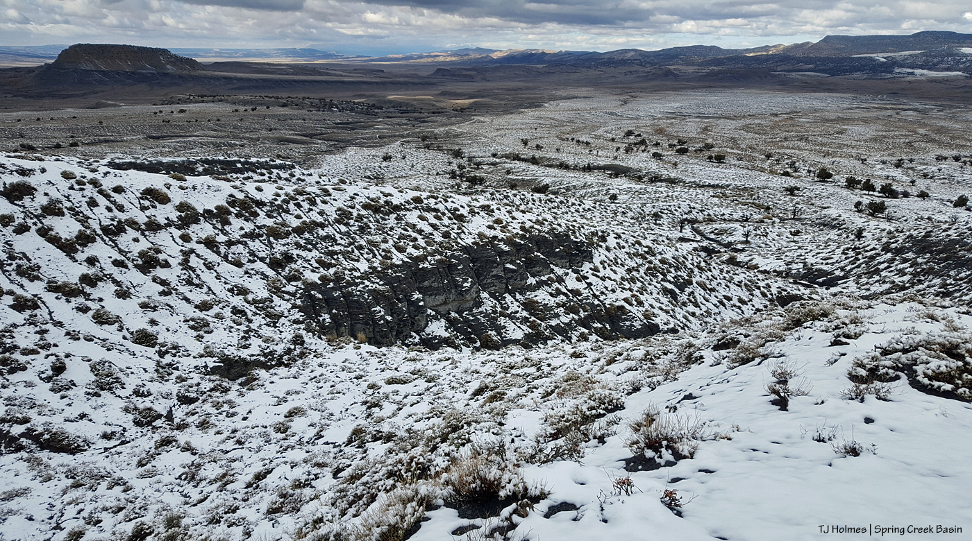
From the east side of Flat Top, looking east: Round Top across most of the image, McKenna Peak at mid-left and Temple Butte at center-back.

The top of Flat Top isn’t really that big – and it’s also really not that flat, despite its appearance from below-the-top ground level. It’s made up of fins of ridges that stretch out and down, mostly to the northwestish and north on the north and west sides. In one little drainage, there’s a random little cluster of pinon-juniper trees – evidence of the collection, at least at one time, of moisture needed to grow trees.

The top of Round Top also really isn’t that big. I’ve been on top of that hill many, many times; the top of Flat Top, not so many times.

And here I am, back on the west side of Flat Top, stopping for one more soaking in of the view, even as the snow was soaking into the ground. Even more had melted in the time I was on top.

Those are my tracks from my hike up the ridge-fin. Melty-melty. I followed them back down …

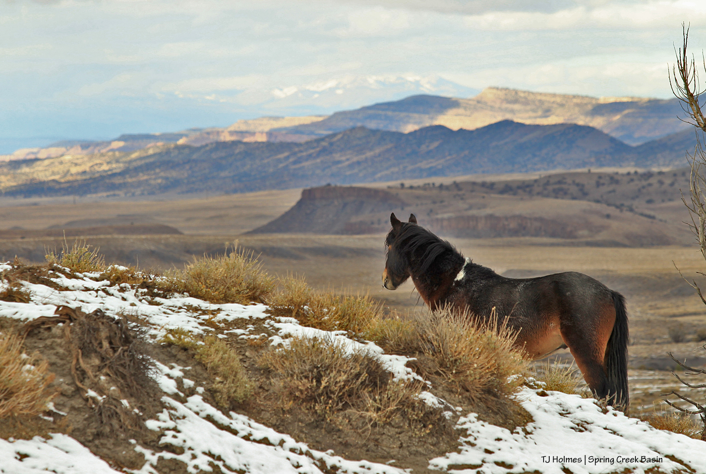
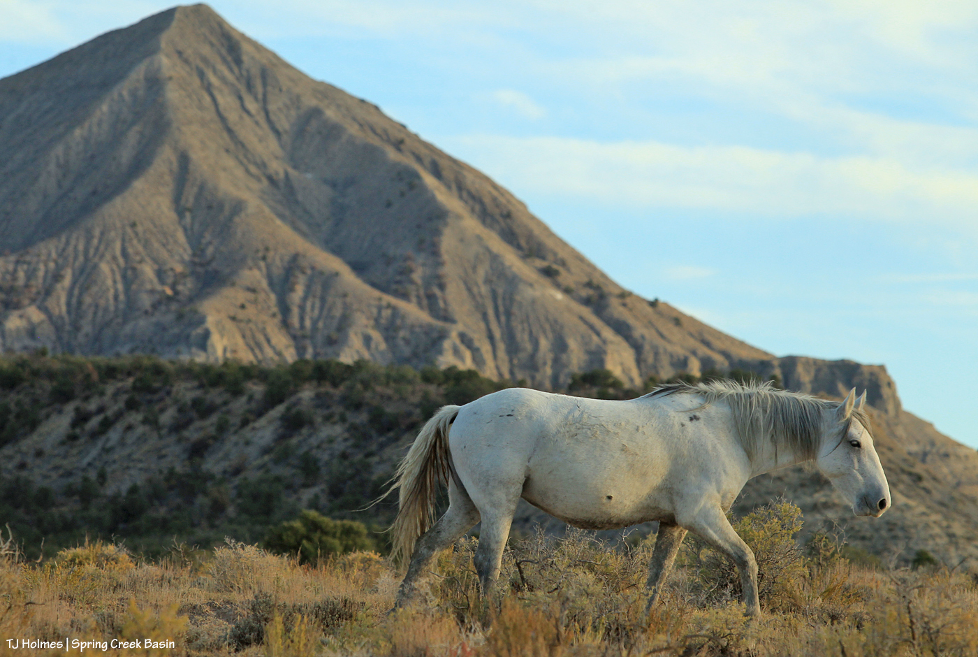
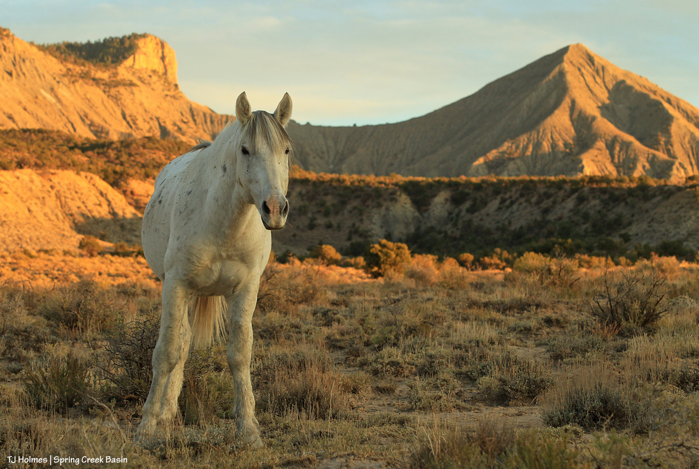
… for one more visit with some of the wild horses for which I am so grateful. Look how the ground around the shadscale and sage already has been slurped by the plants. Yes, it was extraordinarily, sloppily, marvelously muddy. 🙂

Happy Thanksgiving to you all, for whom I’m also grateful! My family, of course, tops my list this day, and though I can’t be with them, we’re together in spirit, as I hope so many of you are with your own families if you’re avoiding travel.

Peaceful wishes and gratitude to you all!


He belongs

18 11 2020

The *rightness* of wild is reflected in those gorgeous eyes, eh?


No trails, no problem

2 11 2020

On Halloween, I had great fun hiking with a group from Telluride’s Sheep Mountain Alliance into a part of Spring Creek Basin that is overlapped by McKenna Peak Wilderness Study Area.

Lexi and Mason from SMA brought five interested – and interesting – people to see this area that’s in the same county as Telluride (San Miguel) … and a world away climate- and geology- and geography-wise.

Disclaimer: The pic above of Juniper walking past McKenna Peak was NOT taken during our hike. 🙂

We didn’t see any of our fabulous mustangs during our hike in the far southeastern part of the basin, but we did see a couple of tarantulas and lots of cool fossils (including a couple of faint but awesome nautilus impressions!). I got to talk about my favorite subject ever (I bet none of you can guess what that is … ;)), and Lexi talked to us about McKenna Peak and the CORE Act – the Colorado Recreation and Economy Act.

From the website:

“The CORE Act is the most significant and broadly-supported effort to protect Colorado’s most cherished lands, waters, and forests in a generation. The legislation would protect roughly 400,000 acres of public lands in Colorado, ensuring that future generations can always enjoy our state’s mountains, rivers and wildlife.”

McKenna Peak Wilderness Study Area is proposed for inclusion in the San Juan Mountains area. This link shows the locations of the areas; scroll down to read a little more about McKenna Peak and see where it’s located. The entire WSA isn’t included, just the part in San Miguel County. As with anything else, politics plays a part. Our San Miguel County commissioners are fully supportive of this inclusion, just as they were of the naming of Temple Butte, which is in San Miguel County.

Regular readers know the shape of both McKenna Peak and Temple Butte as icons of our Spring Creek Basin horizon. Given our location and lack of specific trails, I don’t think we’ll be overrun with visitors. But how cool would it be to see the status of even part of this amazing landscape go from wilderness study area to full wilderness area? It’s protected from motorized/mechanized-vehicle use currently, which enables it to feel secluded and protected to the wild horses and other lives that know its wildness (even us humans).

Being able to share it with another few like-minded humans gave me great enjoyment. To see their wonder and appreciation of this landscape I love … well, to be perfectly honest, it made me happy. 🙂


Fleeting

30 10 2020

Not much is left of the snow that blanketed Disappointment Valley early in the week. Here’s to the fervent hope that we’ll have more as winter arrives!

This was taken from Disappointment Road. Visible are corral hill, the south edge of Flat Top, Round Top, McKenna Peak, submarine ridge and Temple Butte.


Oomph

22 10 2020

Sometimes, we need a little gumption to get going up and out of the arroyo.


Color brilliant

21 10 2020

Glorious cottonwoods and blooming rabbitbrush along (dry) Disappointment Creek in Disappointment Valley draw admirers’ eyes toward McKenna Peak and Temple Butte above and beyond Spring Creek Basin. The sky isn’t blue-blue because we’ve had some gauzy, hazy, high “clouds.”


When evening shadows …

18 10 2020

Skywalker saunters after bands as another days slides toward night in Spring Creek Basin.


Just like that

15 10 2020

Storm and his band prefer the quiet places beyond the back of beyond. In the course of looking for them (and finding them, sometimes) in those places this year, they’ve shown me a number of seeps. Even after all these years and lots and lots (LOTS!) of wandering, they teach me how much I have to learn about this wonderful place they call home.

🙂 Who doesn’t love to learn new things? 🙂


Other views

1 10 2020

Readers have seen a lot of pix of La Sal Mountains in my photos of mustangs in Spring Creek Basin. They form a pretty dramatic range on our northwestern horizon.

During a couple of recent aspen-leaf-peeping drives, I had the opportunity to see our landmarks from different perspectives, including from those not-so-far-away La Sals.

Spring Creek Basin, in Disappointment Valley, is a little hazy with smoke in this view southeast from below Mount Peale (the highest La Sal peak), and in this smallish view, maybe hard to pick out. But visible – in the upper, farthest area of the pic – are McKenna Peak, Temple Butte, submarine ridge (my name for it), Brumley Point, Round Top, Flat Top, Filly Peak and the rimrocks on the western edge of the basin.

Autumn-tinged Gambel oak is in the foreground.

This may be the most colorful image I’ll ever get to take of Temple Butte.

It’s taken from a couple of miles east of Groundhog Reservoir, looking northwestish. Spring Creek Basin is on the *other* side of Temple Butte from this perspective.

Happy autumn. I hope you’re all enjoying the colors of the changing season and the cooler temps!


Only minutes

30 09 2020

At 6:50:28 p.m., Killian was waiting for his band to graze their way to the top of the ridge.

At 6:51:27 p.m., this was happening:

Killian was already gone, moseying on in the shade of sunset.

By 7:09:38 pm., the ponies were browsing over the ridge, I was on my way back to the Jeep, and the moon was still rising.

Another beautiful day – and night – in the basin.