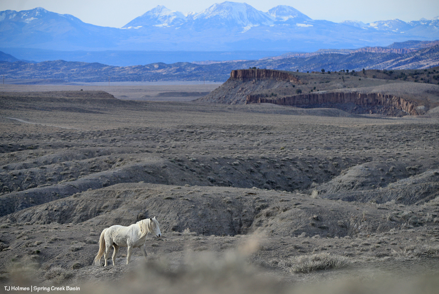
Going back a couple of days, to the time before the wind when the mountains were still clear on the northwestern horizon.
I read an article recently about how lack of dust on the snow of the mountains is a good thing. … And it is (dust causes the snow to melt more rapidly). … But I imagine that those same researchers will find a pretty “good” layer of dust after this weekend, and that just joins the bad news of “skimpy snow” (according to the article) to begin with.
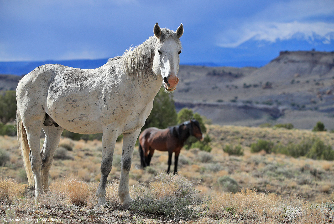
Still, we have to admire the positive, and that’s Flash and all our other wild ones in that magnificent landscape. … And pray for a wet(ter???) spring.
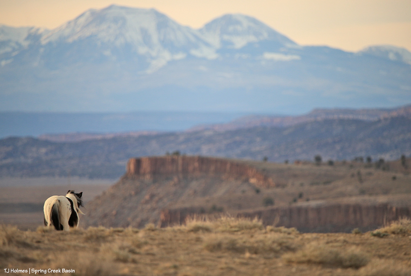
Corazon’s band was in the same area that evening, and even though you can’t see his face and eyes, I liked this pic as he led his band away toward water.
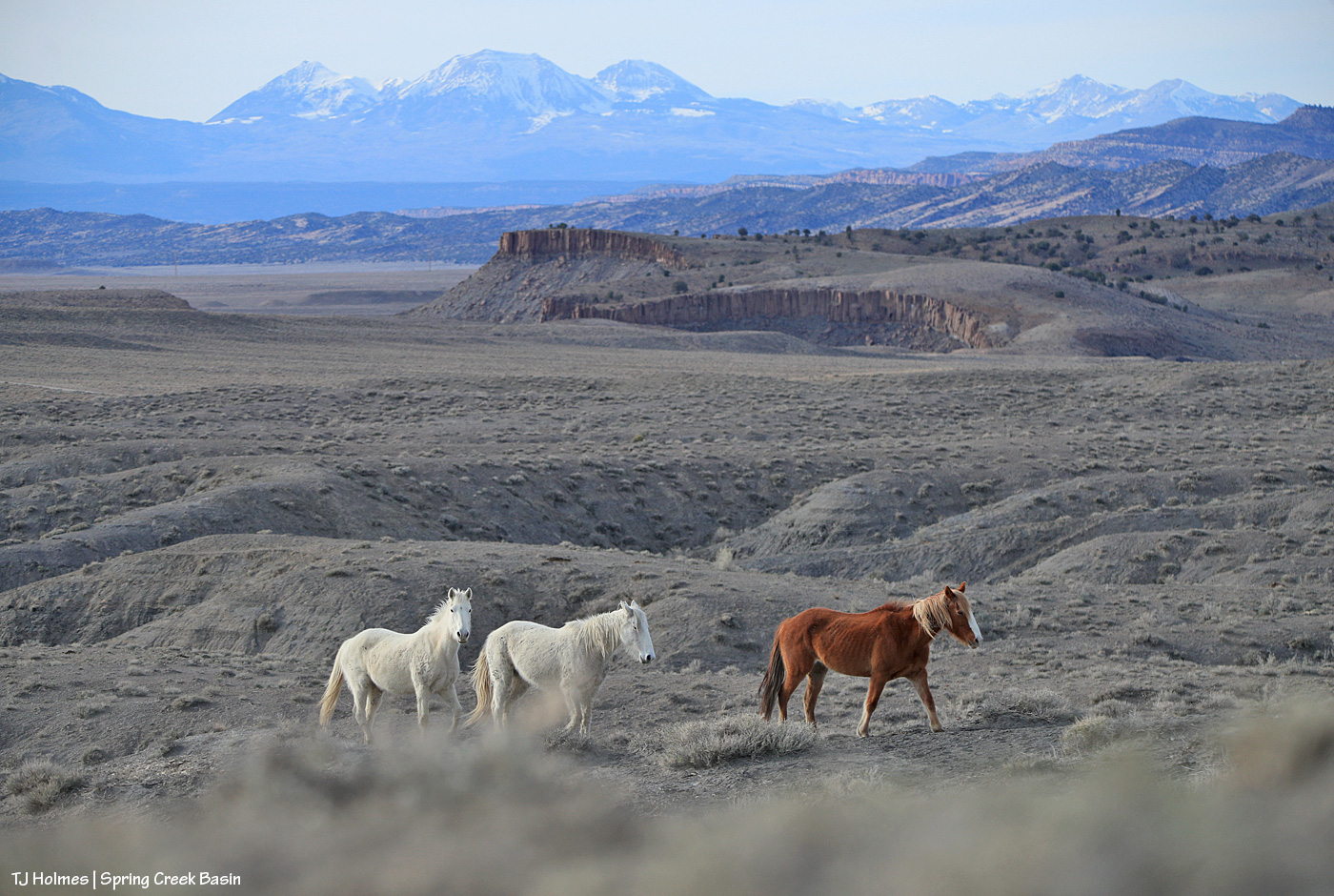
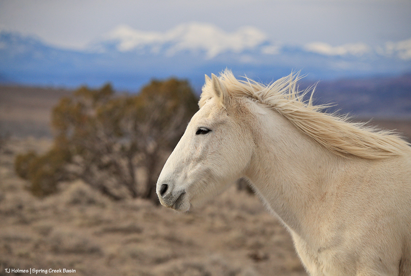
Back to current conditions, though this pic of Winona was taken the day before the snow-that-stuck-day (as opposed to the blowing-snow-didn’t-stick-at-all-days).
So peaceful … but we need a lot more of those snow-sticking days for the good of the rest of our year!
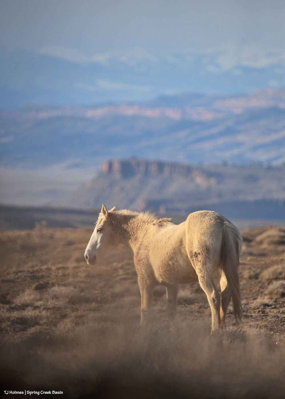
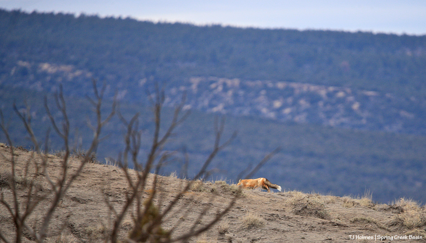
Question: Is Mysterium posing, or is she alert to something?
Hint: She does love her naps, when it might look like she’s “posing,” but she really doesn’t do posing. 🙂
Whaaaaaaaaaaaaaaaaaaaaaaaat?!?!?!!!!
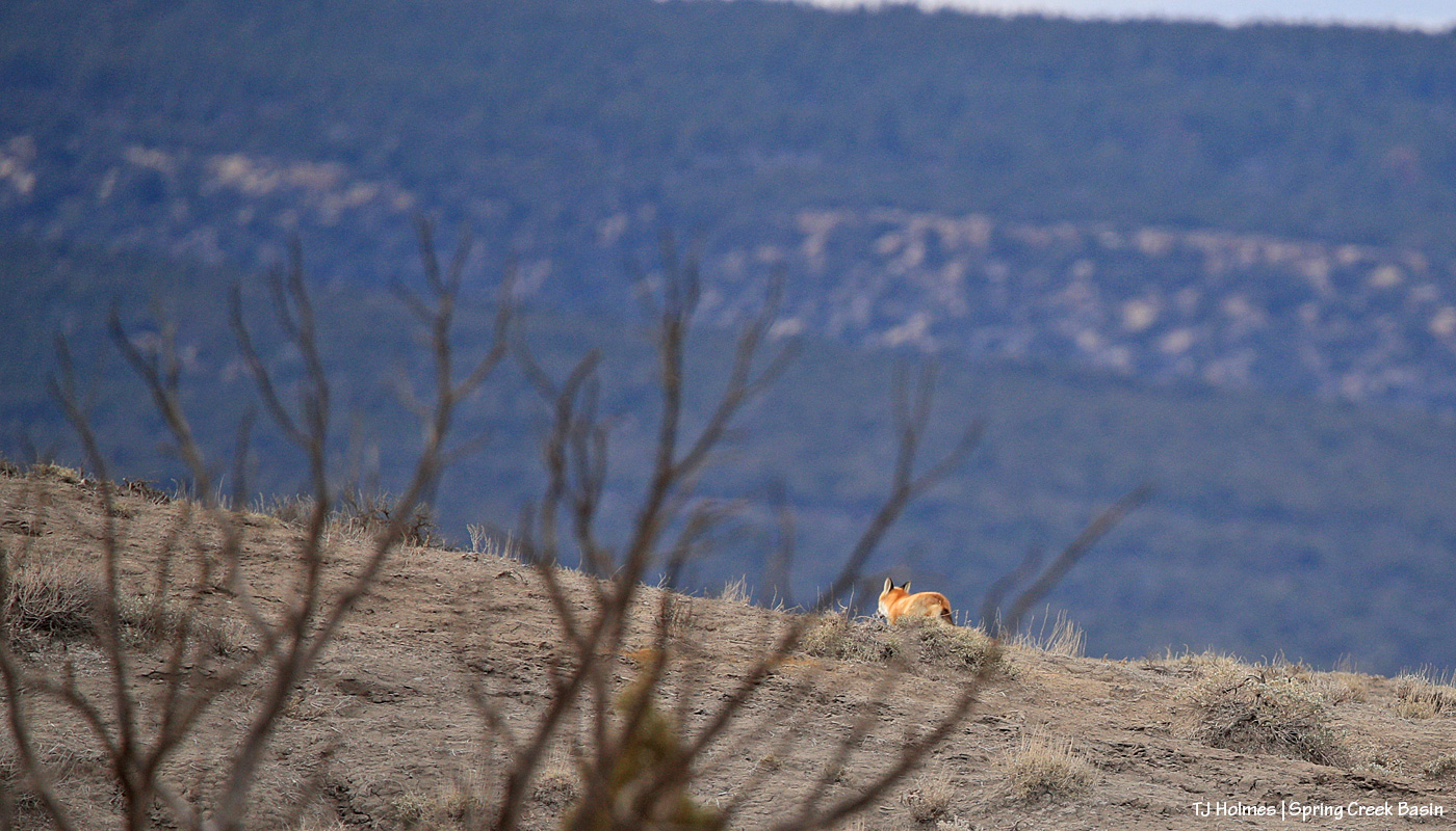
I was sitting on the ground, lens trained on some horses, when I heard them spook and looked up to see that something had caught their attention. THEY didn’t go far at all (more a spook-in-place kind of thing), and then I saw a flash of moving-red … FOX! Wow. It must have been in one of the little/shallow curvy arroyos nearby, and I’m not sure what spooked IT. I must have walked semi-past it earlier to go uphill of where the horses were (note the view beyond Mysterium!).
Unfortunately, there was a tree between us, and then it disappeared into one of the drainage folds … and when I caught sight of it next, it was nearly over the ridge. I wish it had stopped to give us a quick look, but nope.
Wowowowowow! I think the mustangs were just as thrilled (OK, interested) as I was. I doubt they see many flashy red foxes around. (We weren’t super far from where I found the fox last year, but we weren’t close, either. I don’t know what kind of territory a fox covers?)
The Deer Creek Fire, burning at the southeastern base of Utah’s La Sal Mountains, just west of the state line with Colorado, is now at 10,000-plus acres with 0% containment. (Note: As of 10 p.m. Monday, it had grown to more than 11,000 acres.)
That’s the fire closest to us, and fires at Grand Canyon and Black Canyon of the Gunnison national parks have resulted in the destruction of the historic Grand Canyon Lodge (and other structures) and evacuations of visitors and National Park Service employees, not to mention people who live in affected areas nearby.
Many other fires are burning across the West’s drought-dry landscapes, as well as in Canada, while floods devastate other regions. My heart has a hard time taking it all in.
*****
I drafted the above post (showing Sancho in a very smoky Spring Creek Basin a few days ago) and scheduled it … and then I went out to Spring Creek Basin last night and saw that smoke from two more fires – Wright Draw and Turner Gulch fires near Gateway (about halfway-ish between Disappointment Valley and Grand Junction or about an hour and a half away as the vehicle motors) – is visible on our northern horizon. Argh.
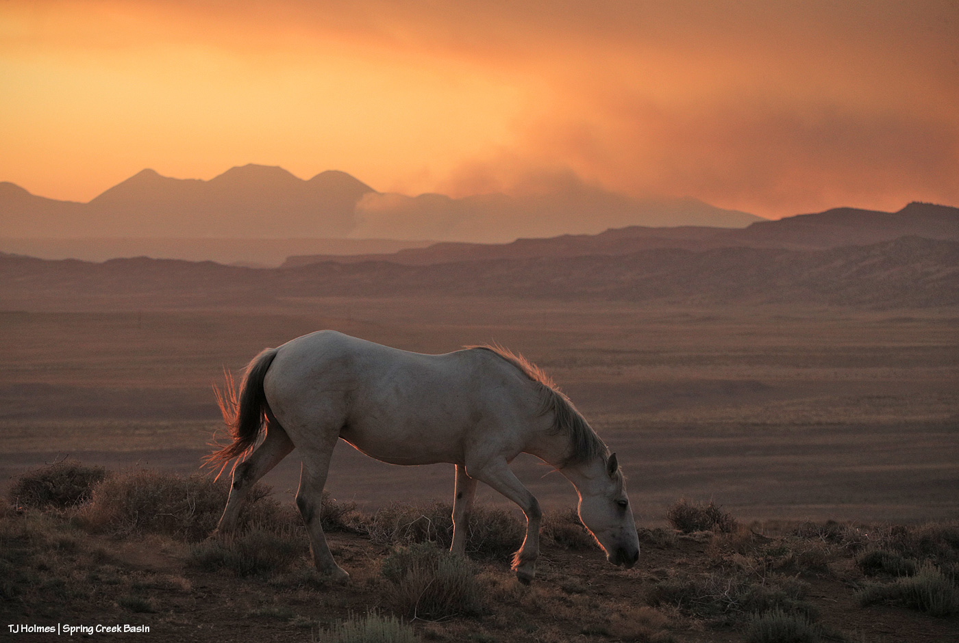
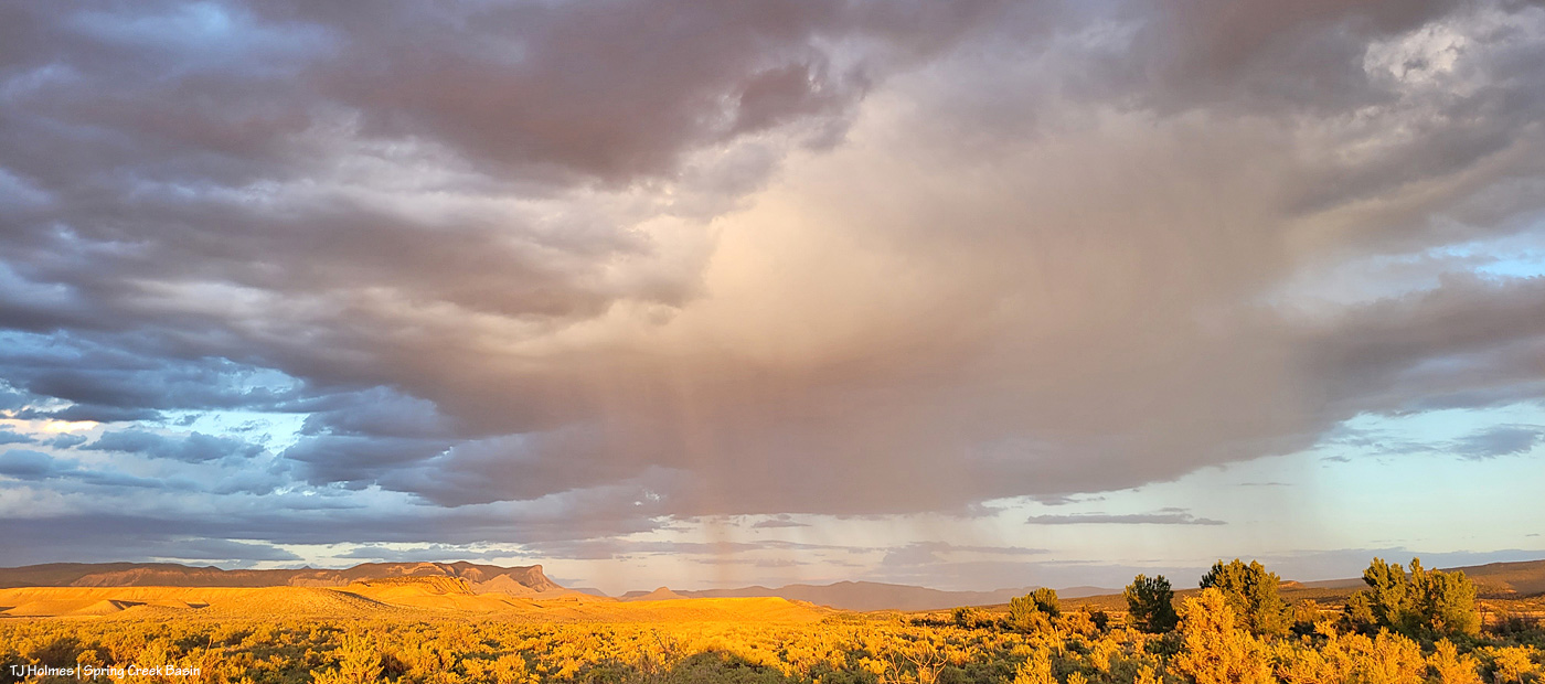
Vantage point: above Spring Creek (mostly dry but with pockets of water from which at least a few bands of mustangs are drinking) in Spring Creek Basin looking north/northwest. The canyon is not far to my left. The obvious smoke starting at the left side of the image is from Utah’s Deer Creek Fire. Smoke from the Wright Draw and Turner Gulch fires shows as a yellowish line of smoke immediately above the bumpy-hills horizon just right of center.
Post-sunset from outside Spring Creek Basin. Utah’s La Sal Mountains are visible at left, and smoke from the Deer Creek Fire stretches across the entire horizon. … It looked like virga, which was completely wild and surreal.
We need “wetting rain” as I read recently. Hopefully it’s coming Friday/Saturday … along with thunderstorm chances (we do NOT need the lightning!!!). Please keep all those in the paths of the wildfires (everywhere), as well as those battling the blazes, in your prayers. And please, please, please, stay safe.
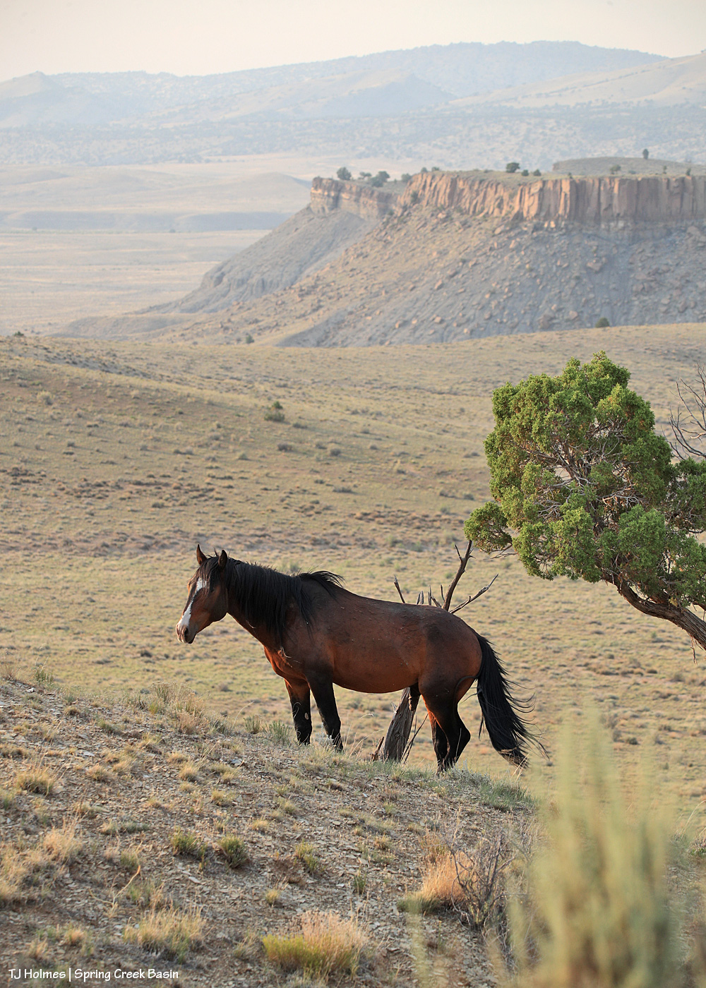
Skywalker, who has been wandering mostly on his own, sometimes with a couple of bachelor pals, most recently has been back with his former band (still as a bachelor) and buddy (maybe not quite anymore) Sancho.
He seemed fairly grumpy, but I finally caught him looking mildly interested as he looked up from snoozing, saw me sitting nearby … and went back to sleep. Nothing to see here!
But everything to see *there*!
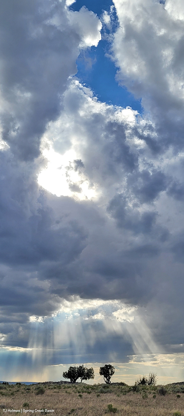
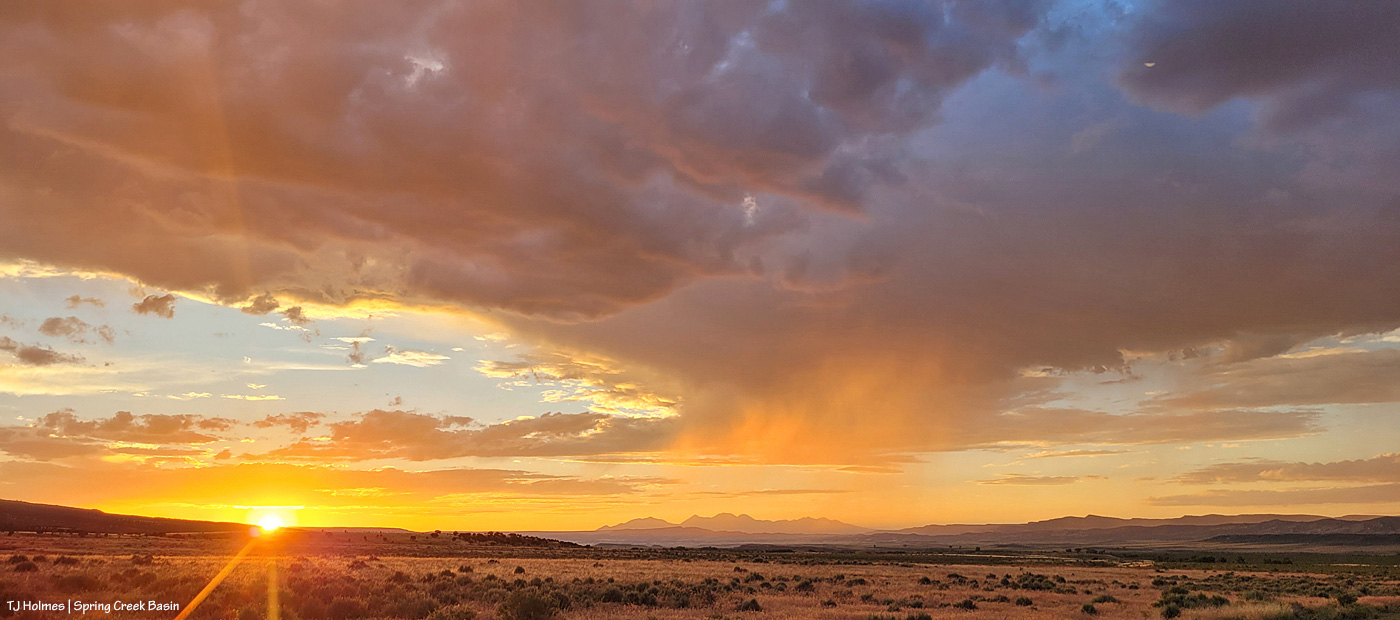
We had rain Sunday and Monday, and we had great storm clouds Tuesday and Wednesday. Unfortunately, we got only a trickle-drip of “rain” from those clouds those days, but the light has been incredible.
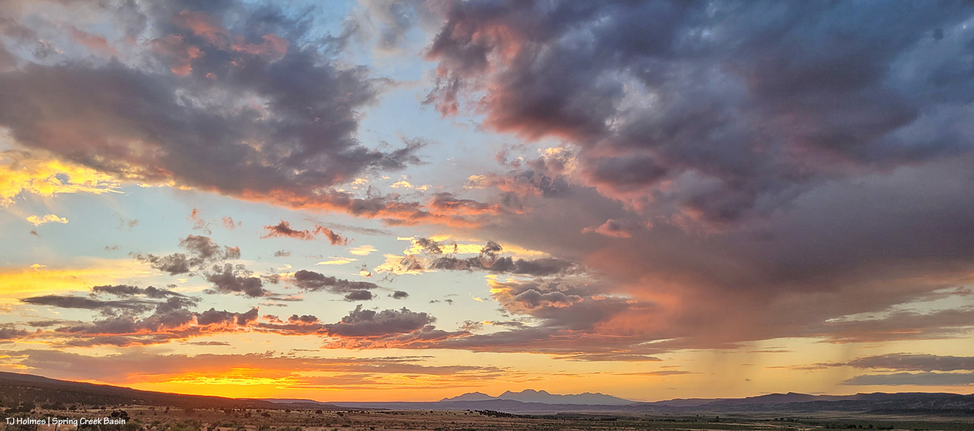
Most unfortunately, I had already hiked down from the hill and the band by the time sunset and THIS happened (a couple of hours later):
Those mountains, in all three pix, are southeastern Utah’s La Sal Mountains.
Absolutely, breathtakingly spectacular. Scenery and mustangs brought to you by Mother Nature’s magic. 🙂
For the last very long – days and days and days and weeks and days and weeks – we’ve had solid blue skies. Every. Single. Day.
We finally got some clouds. And when Disappointment Valley does clouds, boy, does it do spectacular clouds.
In order of appearance from around 5:30 or close to 6 p.m. to after sunset:
Looking west.
Mustangs grazing and napping under the relief of clouds.
Silver linings.
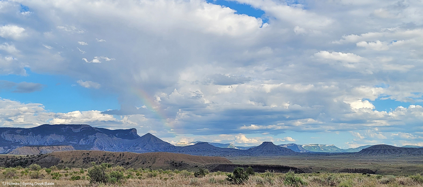
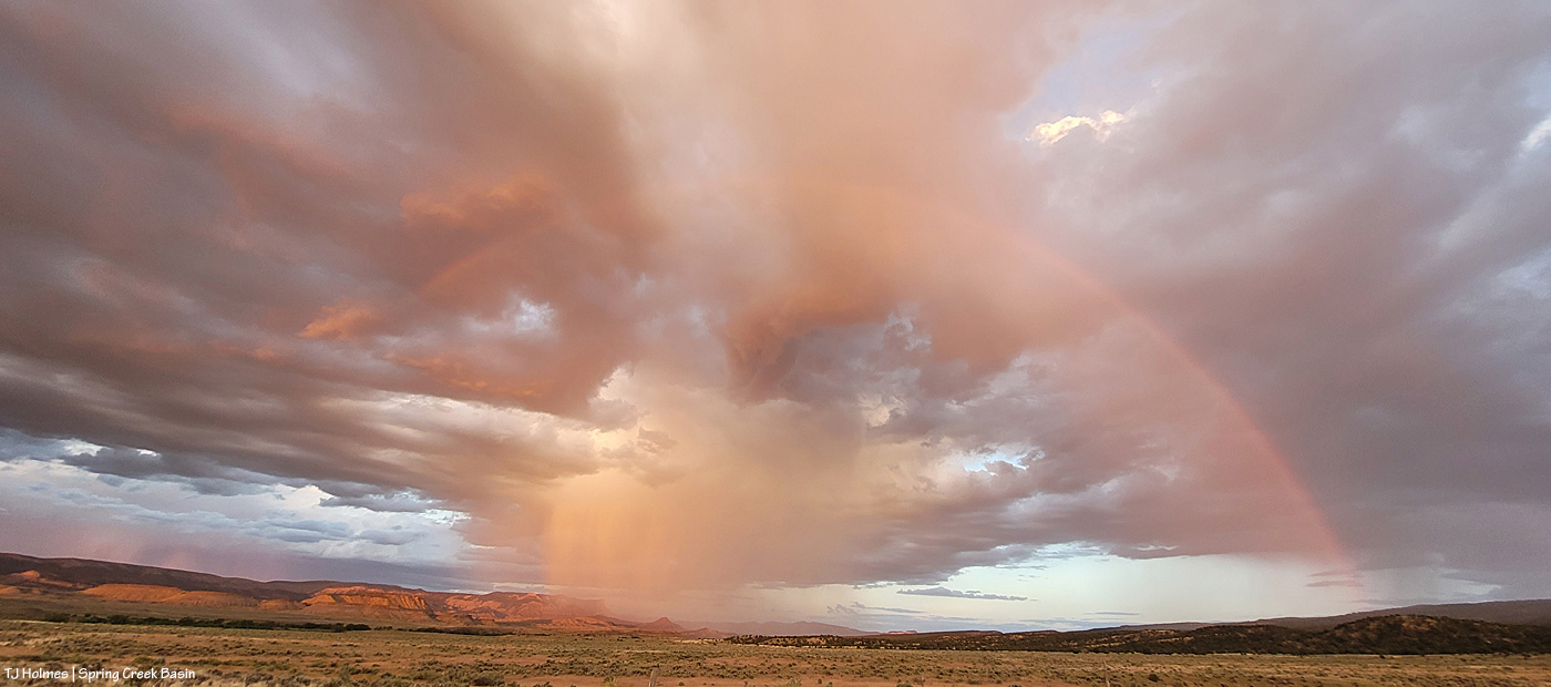
Do you see the rainbow?
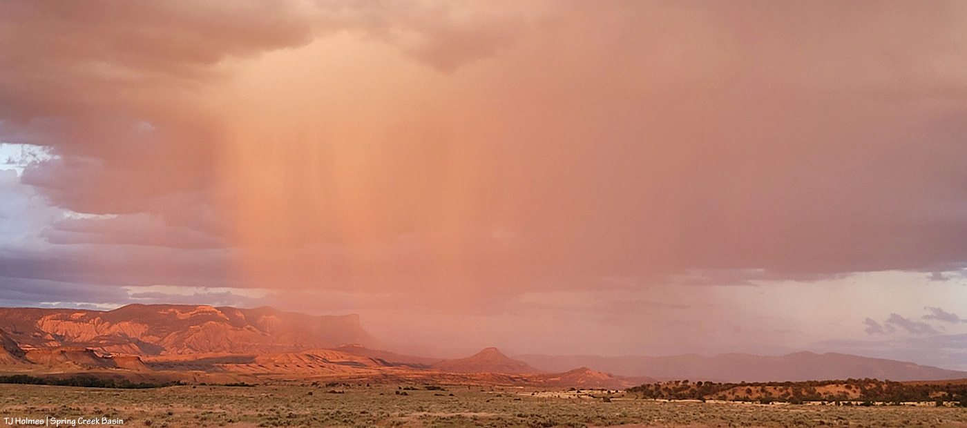
Rain – or at least virga – to the west.
More mustangs. More napping.
When I left the bands pictured above, I thought I might have a chance at any late surprise light with the bands pictured higher above. But they had moved quite a bit, and the clouds were heavy, and sunset was imminent. But as I left Spring Creek Basin, rain was drifting eastish along the southern ridges of Disappointment Valley. Then I dropped below the rimrocks (the basin’s western boundary), and holy rainbow! You’ll have to take my word for it that it was SUPER intense, and the photo above doesn’t do it justice.
By the time I got to the main road, that “surprise” light was glowing, and the rain had moved away from the southern ridges.
Meanwhile, to the west … this!
Bit closer view of the mountains.
Back to the southeastish, rain was actually falling over the southern/southeastern part of Spring Creek Basin.
And THIS happened. I’m not sure I’ve ever been so glad and grateful to have a cell phone that doubles as a very wide-angle camera.
We ended the day with some post-sunset magic.
And 0.01 inch of rain. 🙂 Enough to make part of the road … actually … WET!