‘Every shift of light’

4 01 2017

010117templebuttebrumleypoint3

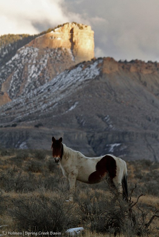
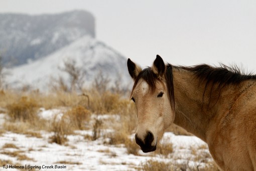
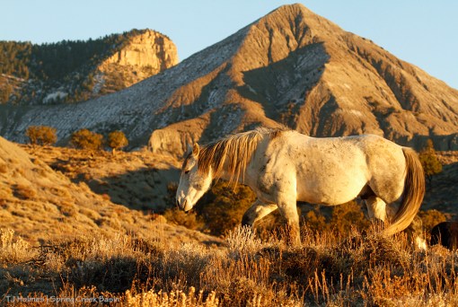
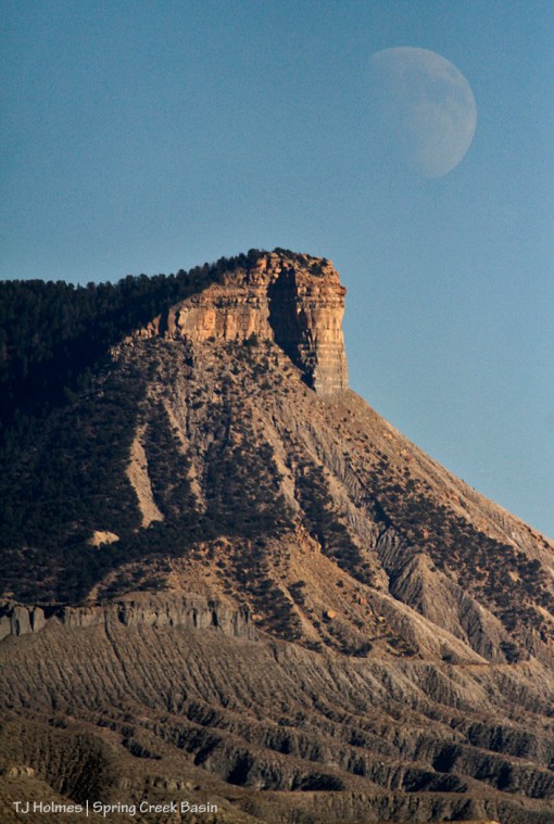
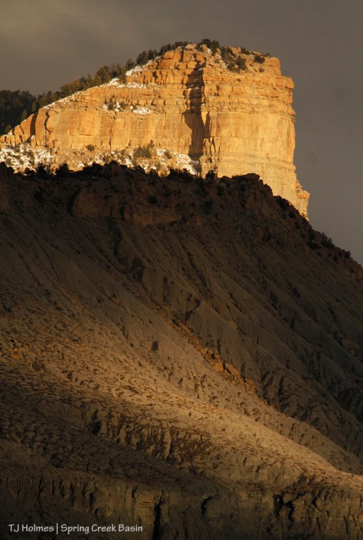
Temple Butte gleams golden in the last light of a “trying to snow” day while Brumley Peak has just a spot of light on its serrated flank.

010117templebuttebrumleypoint1

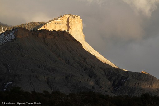
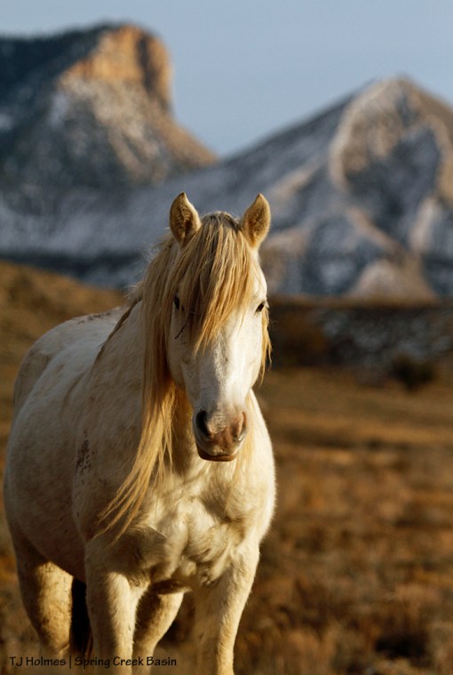
Brumley Point is mostly within Spring Creek Basin Herd Management Area. The southeastern boundary fence climbs a lower ridge to the first wall of rimrock. Temple Butte is outside Spring Creek Basin but visible from almost anywhere in the basin (and far beyond). They’re both within McKenna Peak Wilderness Study Area, which also covers a fair bit of the southern, southeastern and eastern parts of the basin.

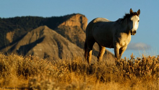
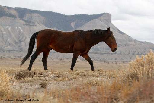
The mustangs showed up just a bit after I took these photos from the road. … They weren’t quite as cooperative in the last light of day as the steadfast mesas and buttes. 🙂

And the trails I ride are new
Even though I’ve made the circle many times before
For they change with every season
And with every shift of light
From the summit where the clouds fall to the sweet, valley floor.

~ from “The Circle” by Dave Stamey


The light that shines

3 01 2017

Chipeta at the end of a day of "trying to snow" in Spring Creek Basin.

Grey and brown are our colors of late. We’ve been waiting for this big snowstorm that has been in the forecast for days, but it hasn’t hit us yet. Meanwhile, we have plenty of moisture (aka mud). 🙂

And every now and then, a ray of light.


Everything needed

13 12 2016

Sundance, McKenna Peak and Temple Butte

Be still my Spring-Creek-Basin-devoted heart.

Mustang (Sundance). Check.

McKenna Peak. Check.

Temple Butte. Check.

Perfection. CHECK!


The way out there

8 12 2016

Kestrel, Temple Butte and McKenna Peak

Kestrel seems to be pointing the way to McKenna Peak and Temple Butte, foggy with light snow in the background of Spring Creek Basin.

Yes, we see you, beautiful girl. 🙂


Home, sweet home

29 11 2016

Temple Butte, Round Top, Flat Top and Brumley Point from Filly Peak.

From this vantage point on the “back side” of Filly Peak, you can see Temple Butte, Round Top, Flat Top and Brumley Point. There be mustangs among those weathered folds of hills and arroyos.


Holiday of gratitude

24 11 2016

Storm, McKenna Peak and Temple Butte

Happy Thanksgiving to all those whose gratitude for wild places and the wild lives that inhabit these places helps keep those beautiful lives wild and free. With your voices, you speak for the wildness that we love.

Endless thanks!


Shades of gold

21 11 2016

Winona

Pretty girl Winona on a pretty fall day.


Super close to a supermoon

11 11 2016

Moon rises over Temple Butte and Spring Creek Basin.

On Monday, November’s “beaver moon” – also a supermoon – will rise. The moon will be closer than any other lately (70 years, it says below) … and it won’t be this close to Earth again until 2034.

Here’s more information – “Why November’s Super-Close Supermoon is a Full Beaver Moon” (isn’t that an awesome headline?):

“November’s supermoon — the name given to a full moon that occurs when the satellite is at its closest point to Earth during the lunar orbit — will be the biggest supermoon in about 70 years.

“Algonquin Native American tribes as well as American colonists called the November full moon the Beaver Moon because ‘this was the time to set beaver traps before the swamps froze, to ensure a supply of warm winter furs,’ according to the Old Farmer’s Almanac.

“An alternative name for November’s full moon is the Frost Moon, which was also coined by Native Americans, according to the Almanac. [Supermoon November 2016: When, Where & How to See It]”

*************************************************************************

Deep gratitude to active-duty service members and veterans of America’s military. We cannot repay our debt to your service and sacrifice, and that of your families as you spend time away from them to ensure the protection of ours – of all of us.


The gold

7 11 2016

Rainbow over Spring Creek Basin.

This was the brighter arch of a full double rainbow over Disappointment Valley. And this photo was taken from outside Spring Creek Basin looking in. Filly Peak is visible at far left (in shade), McKenna Peak and Temple Butte are visible to the right of center, and the rainbow is crowning Brumley Point.

Neither the widest-angle camera lens I own nor my cell phone could capture the full arch of the rainbow – let alone its double. Please believe me when I say (type) how stunningly, awesomely, amazingly, phenomenally, magnificently, marvelously SPECTACULAR it was!

This photo also clearly shows that there be magic in Disappointment Valley. 🙂

(The road into the basin was too wet to drive on – or so advocate Pat Amthor and I thought. The next day was the first day of third rifle season, and slippery mud does not overeager hunters deter – nor the fact that such driving will leave terrible ruts when the now-wet road dries. It’s orange country out here right now, and I ain’t referring to the Denver Broncos.)


Elder Duke

6 11 2016

Duke, McKenna Peak and Temple Butte

Duke is a mustang classic. He has lived his entire wild life in Spring Creek Basin, with that familiar horizon. These days, he hangs out alone or with the younger bachelors. His presence is a gift for them and for us.