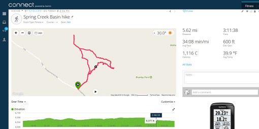
This is why I mountain bike (well, and because I love to mountain bike) – to stay in shape to track mustangs. 🙂
Add a couple to a few inches of snow to that 5.62 miles, and 1,116 calories burned seems pretty measly. The temperature is a bit skewed because I carried the GPS in an inner jacket pocket; I don’t think the temp rose out of the 20s.
The green tag shows where I started: on Spring Creek Basin’s boundary along Disappointment Road. From there, I hiked north, then to the northwest. The farthest northwest point is the point at which I realized horses were waaaay over at that easternmost point. (Of course!) So I backtracked my tracks, then followed horse trails and avoided arroyos, heading southeastish, to the little flat loop – which is where the horses were.
The ziggy-zaggy line is where I walked (this was all on snowshoes) the bottom of an arroyo until I cut my original trail and followed it back to the Jeep.

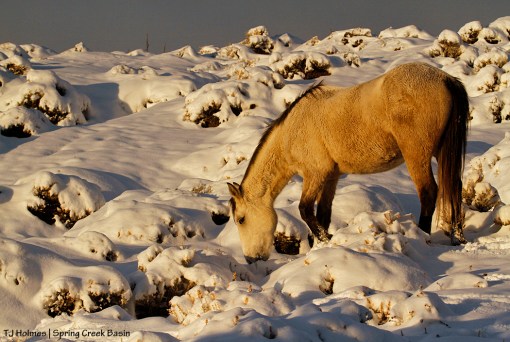
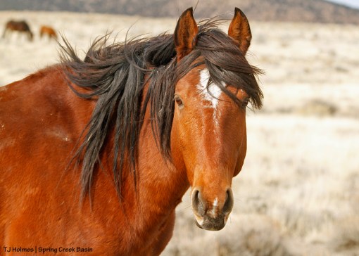
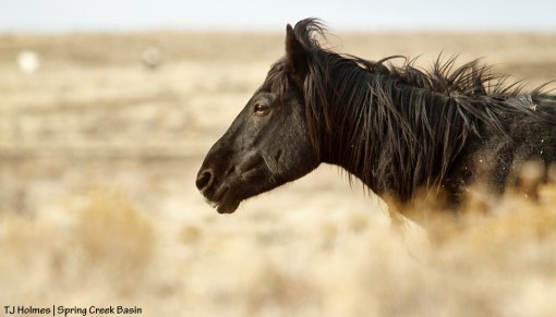
Seeing this handsome youngster (Killian) makes it alllllllll worth it!